
On September 14, 1919, a powerful hurricane made landfall near Corpus Christi, Texas, leaving a trail of destruction that stunned the entire Gulf Coast. The storm had already torn through the Florida Keys before entering the Gulf of Mexico and tracking toward the Texas Coastal Bend. What followed its arrival in Corpus Christi was one of the deadliest and most destructive weather events in Texas history.
The hurricane struck Corpus Christi in its right-front quadrant — the section of a storm that carries the strongest winds and the most powerful storm surges. Winds ranged between 70 and 110 mph, and the surge reached 16 feet along the waterfront. The water rose fast, trapping residents inside homes and businesses as waves pounded the walls from the outside.
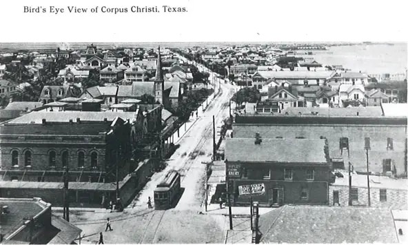
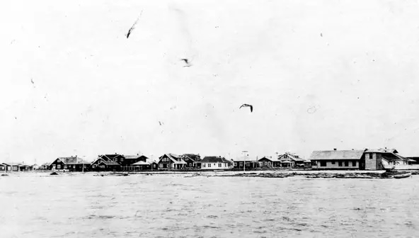
Before looking at what the storm left behind, these pre-hurricane photographs of downtown Corpus Christi show the city as it stood before the disaster. Water Street, the Chaparral corridor, and the North Beach area were all developed and occupied. Within hours, most of it would be gone.
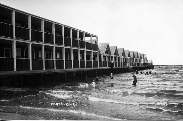
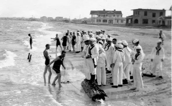
Of the 284 confirmed deaths attributed to the storm, all were Corpus Christi residents and those from its immediate surroundings. Fifty-seven bodies were recovered in the city proper. Another 121 were found at White Point, a nearby area where the storm surge carried victims across Nueces Bay. Those numbers made the 1919 hurricane among the deadliest storms ever to strike the Texas Gulf Coast.
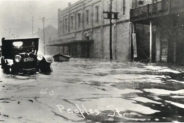
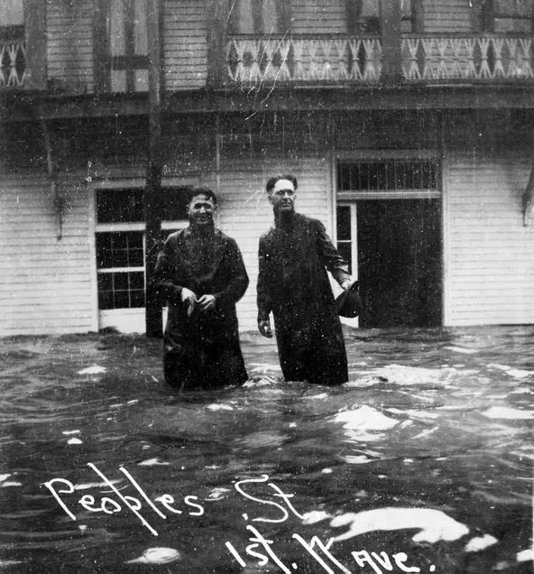
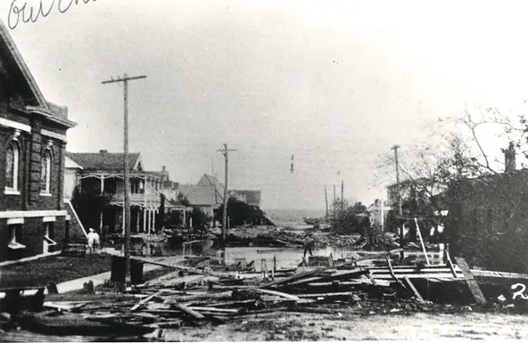
These photographs capture the early hours of the storm’s arrival as floodwaters began filling the downtown streets. The surge reached 12 feet in the downtown core, with high-water marks recorded as high as 16 feet in some areas. Residents who ventured outside waded through chest-deep water in the middle of city streets.
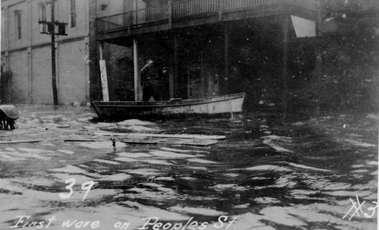
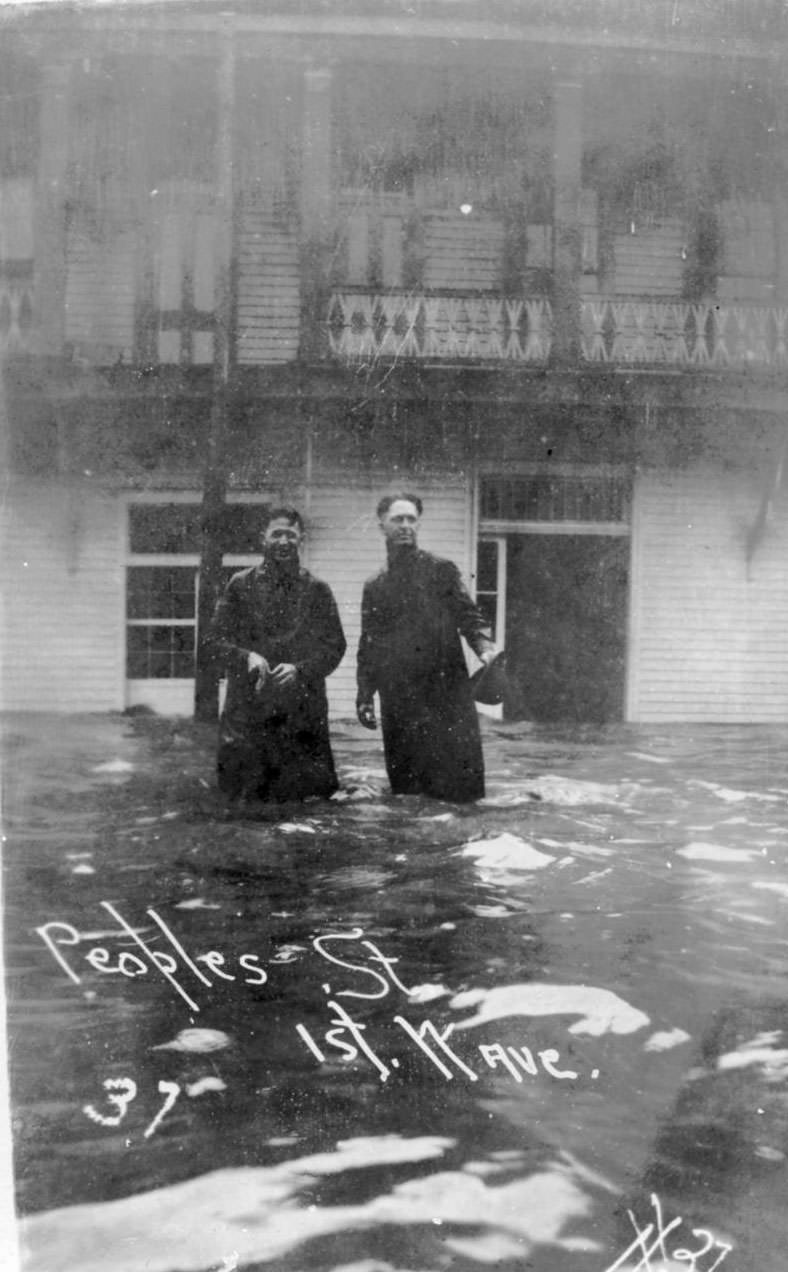
Peoples Street became one of the most photographed locations in the storm’s aftermath. The floodwaters lingered well after the storm passed, leaving men wading through the streets to assess the damage. Floating in the water alongside homes and telephone poles were ruptured oil tanks and water-soaked cotton bales that had been swept from the municipal wharf.
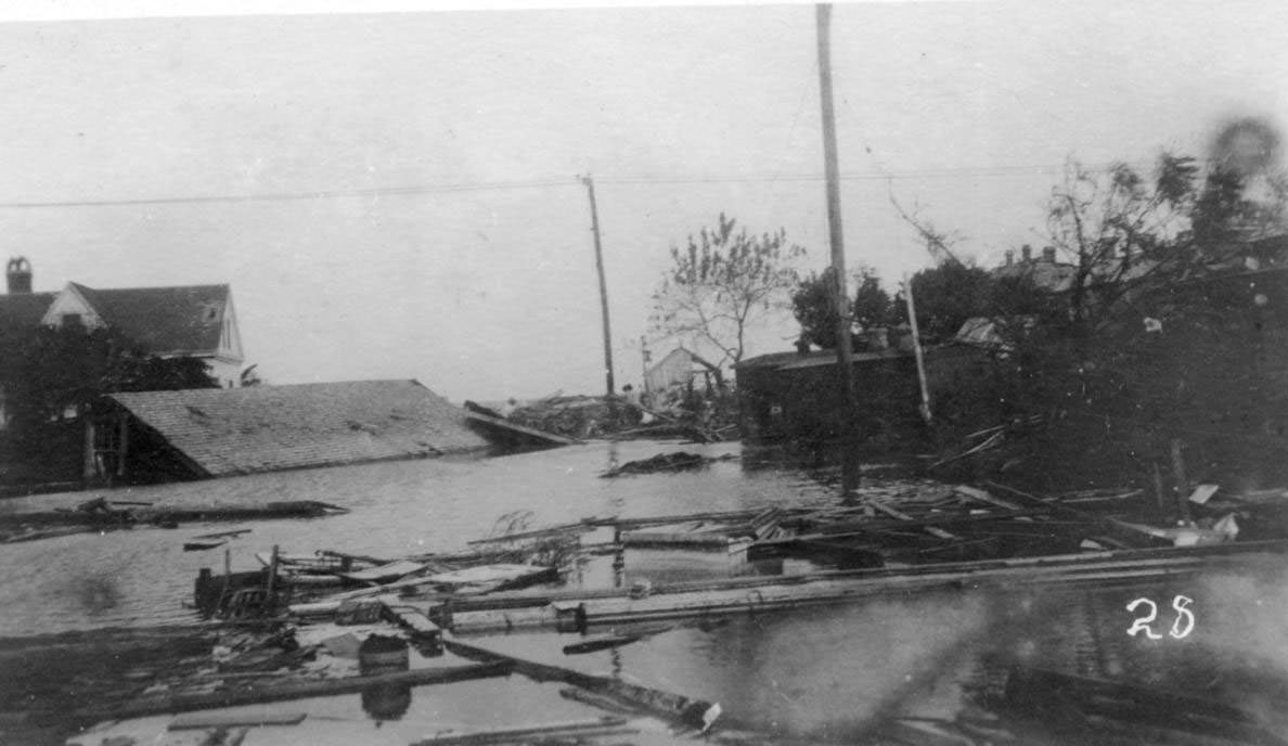
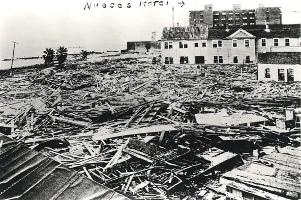
Downtown Corpus Christi was submerged. The intersection of Chaparral and Taylor Streets was completely underwater. The Nueces Hotel, visible in the background of photographs from the waterfront, served as one of the few refuges during the storm. Former mayor Roy Miller — whose own home was destroyed during the hurricane — sheltered his family there. Current mayor Gordon Boone appointed Miller to head the city’s relief committee in the storm’s aftermath.
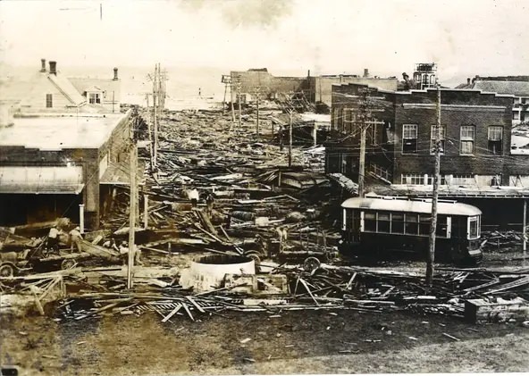
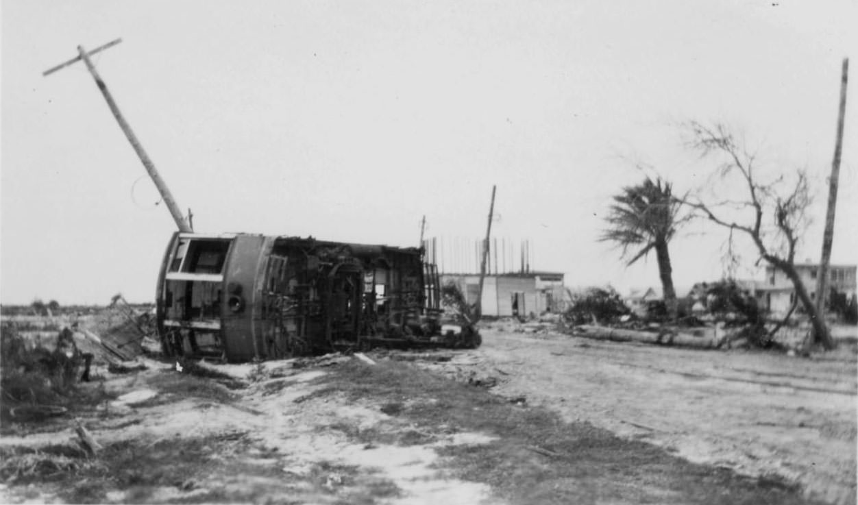
The storm surge overturned streetcars and scattered them into the middle of city roads. These photographs show the raw force of the water that swept through downtown. Infrastructure across the city was knocked out, and the streets themselves were buried under feet of debris, timber, and sediment.
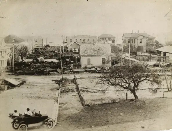
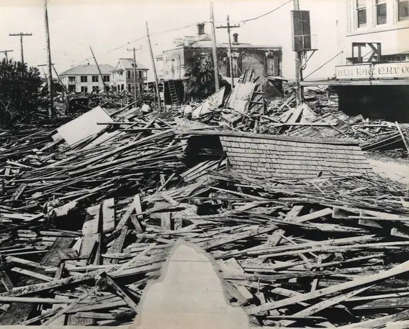
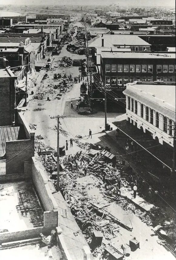
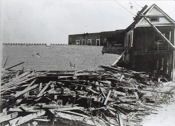
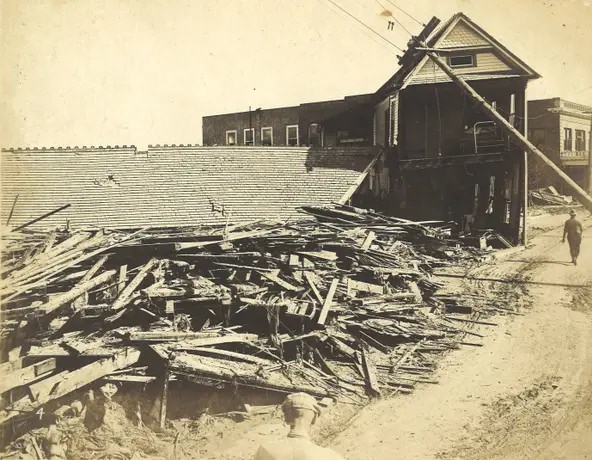
Looking down Chaparral Street from the roof of the Nueces Hotel, the extent of the downtown destruction becomes clear. Entire blocks were buried under splintered wood, broken bricks, and tangled wreckage. Cleanup crews began working immediately, but the scale of the damage stretched their efforts for weeks.
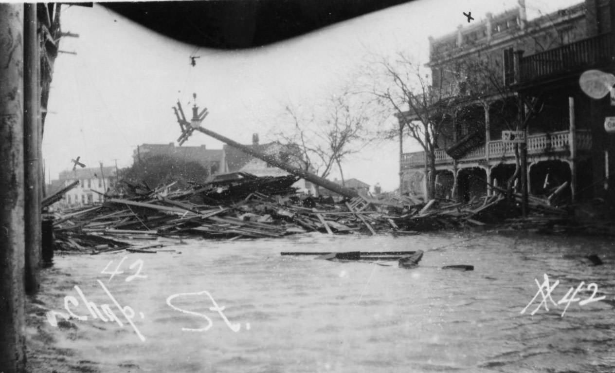
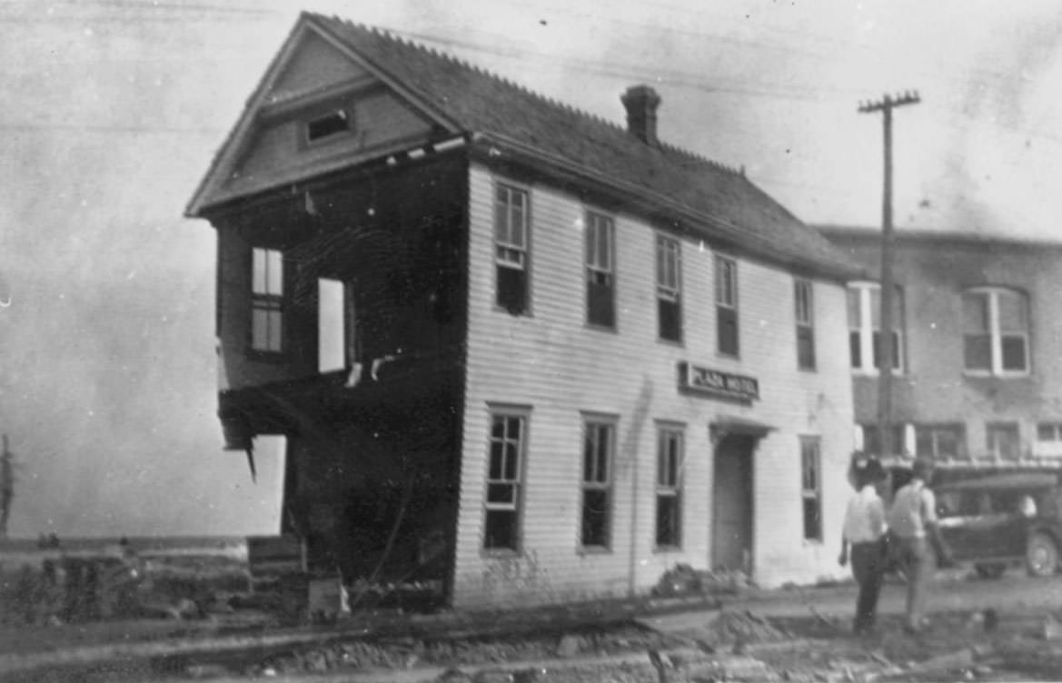
The Plaza Hotel near Artesian Park was physically pushed into Chaparral Street by the force of the storm surge and the debris it carried. Large sections of the lower level were stripped away entirely. Two men are photographed walking past the exposed structure, giving a sense of the building’s scale and the degree of its damage.
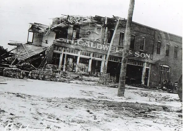
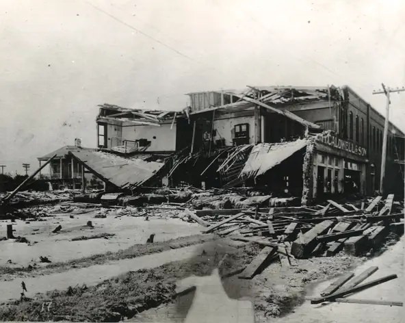
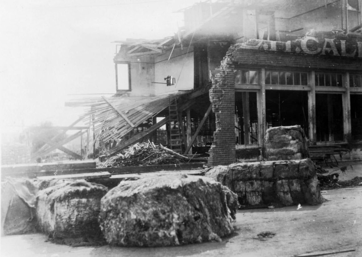
At the corner of William and Chaparral streets, the E.H. Caldwell & Son hardware and machinery business was inundated by cotton bales pushed from the municipal wharf by storm waters. Those bales acted as battering rams against storefronts, caving in walls and shattering windows across the downtown business district.
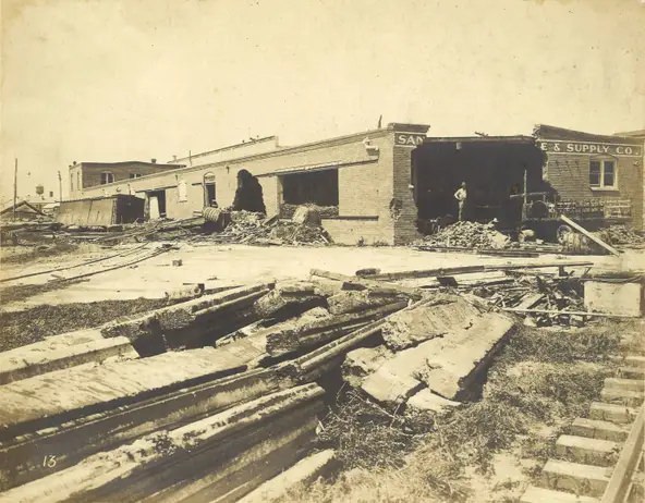
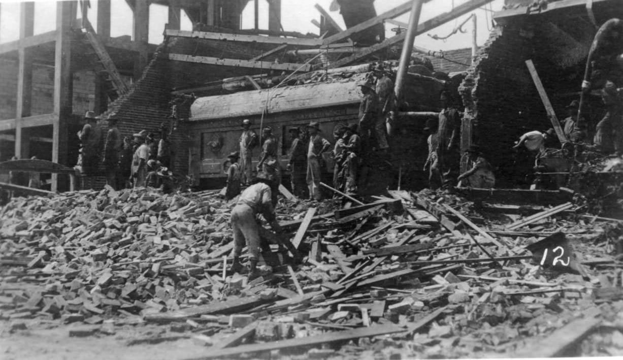
Even reinforced brick buildings along the commercial waterfront could not withstand the combination of surge, wind, and flying debris. The San Antonio Machine & Supply Co. warehouse near Coopers Alley sat directly across from the Municipal Wharf. When the hurricane hit, cotton bales and structural debris from the wharf were hurled directly into it.
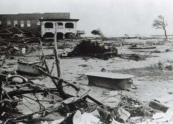
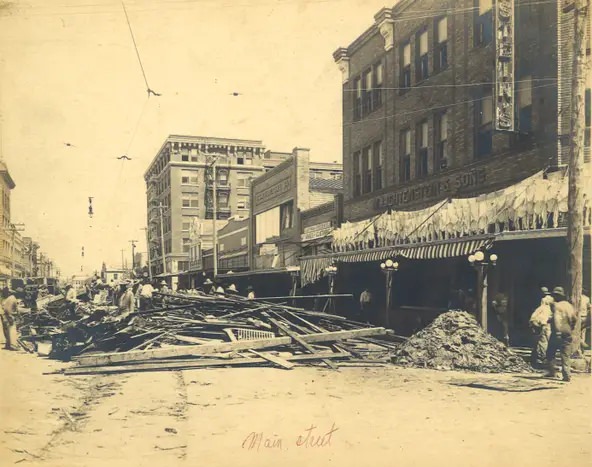
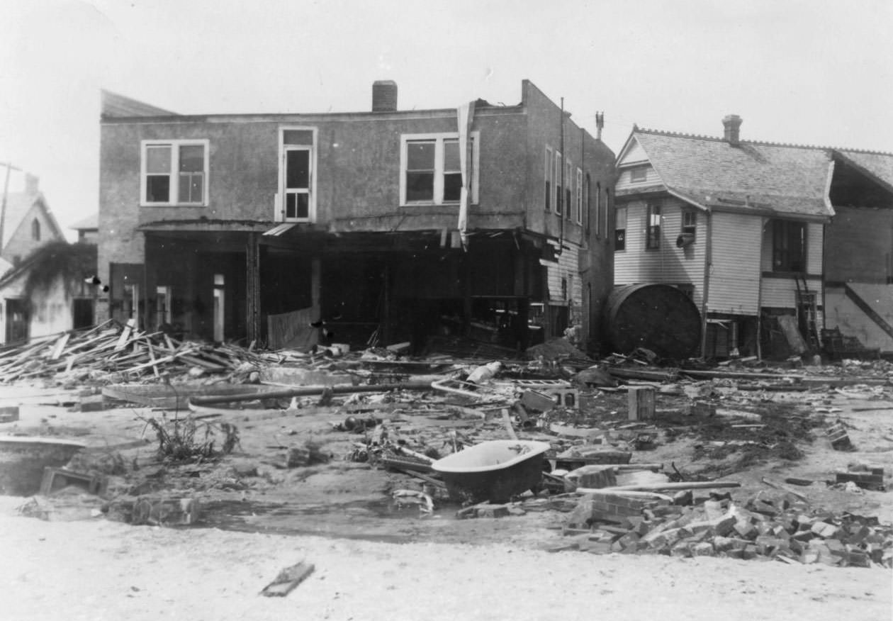
In the days that followed, small details emerged from the wreckage that illustrated how completely the storm had torn apart ordinary life. Bathtubs and sinks, swept out of homes, ended up scattered across open lots. Outside Lichtenstein’s department store on Chaparral Street, shirts were hung out to dry — one of the earliest signs of residents trying to restore some sense of normalcy.
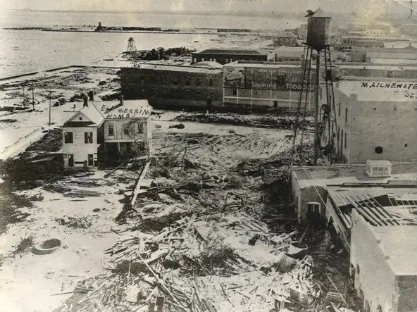
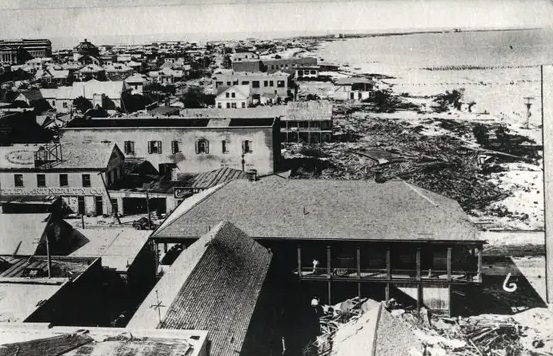
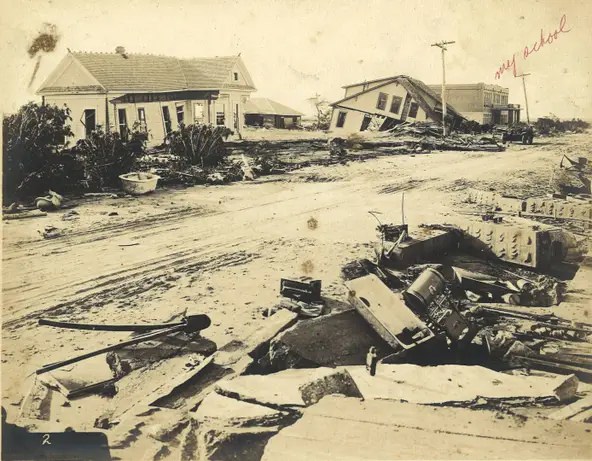
Water Street, running along the bay, took an especially severe hit. Photographs taken from the roof of the Nueces Hotel show the length of the damage stretching in both directions. The home of Eli Merriman, one of the founders of the Corpus Christi Caller, stood at 505 Water Street at the corner of Schatzell Street — one of many private residences that was heavily damaged. The David Hirsch School, visible in one image from Brewster and Carroll streets, sustained serious damage but was eventually repaired and reopened.
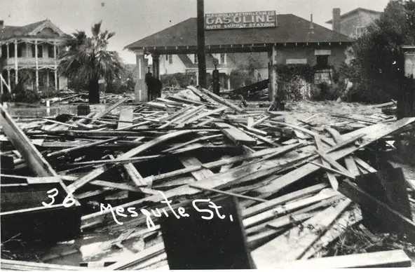
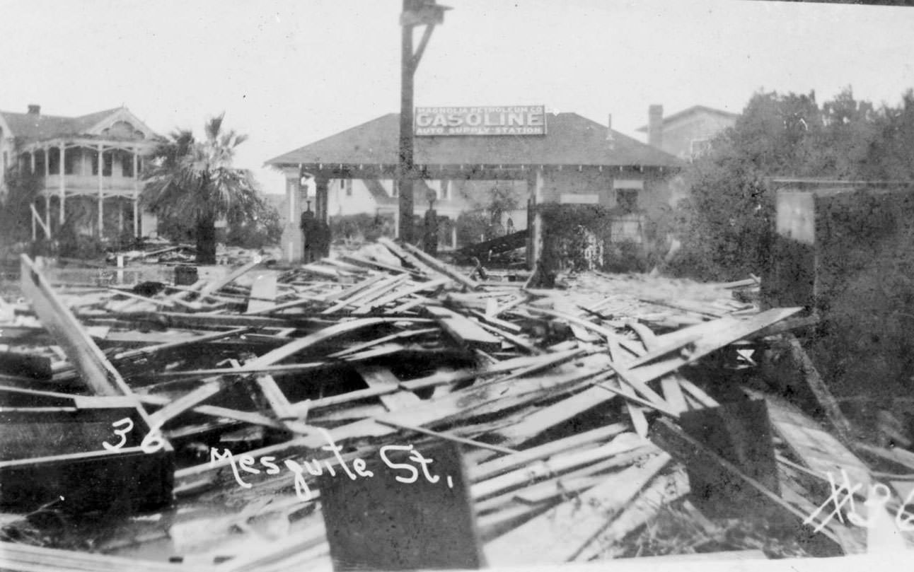
Looking down Taylor Street toward the bay, the scale of the waterfront destruction comes into full view. The Magnolia Petroleum Company filling station at the corner of Mesquite and Taylor was gutted, its structure reduced to a shell. The First Baptist Church, annotated in photographs by survivor Inez Hendrix Stairs, was among the landmark buildings that took direct hits.
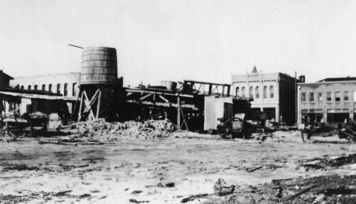
Not every building in Corpus Christi was destroyed. Some structures — particularly those built of reinforced concrete or set back from the most vulnerable shoreline positions — survived. A row of businesses along one section of the city remained standing, offering a visual contrast to the total obliteration just blocks away. The Nueces County Courthouse, built in 1914, was one of the most significant survivors.
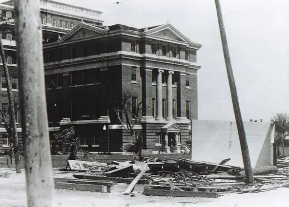
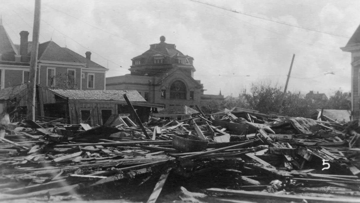
The Nueces County Courthouse sheltered residents whose homes had been destroyed. The Methodist Church also stood after the storm, one of only a handful of buildings in its vicinity left upright. These structures became gathering points for survivors in the storm’s immediate aftermath.
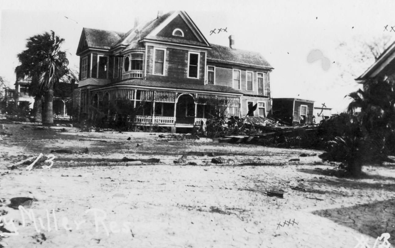
Among the homes that did not fare as well was the Miller residence — the home of former mayor Roy Miller, which was destroyed during the storm. The damage to prominent residences like Miller’s illustrated that the hurricane showed no preference. Wealthy households and modest ones alike were reduced to rubble. The Tatum home on North Chaparral Street survived, one of the rare exceptions in a neighborhood of losses.
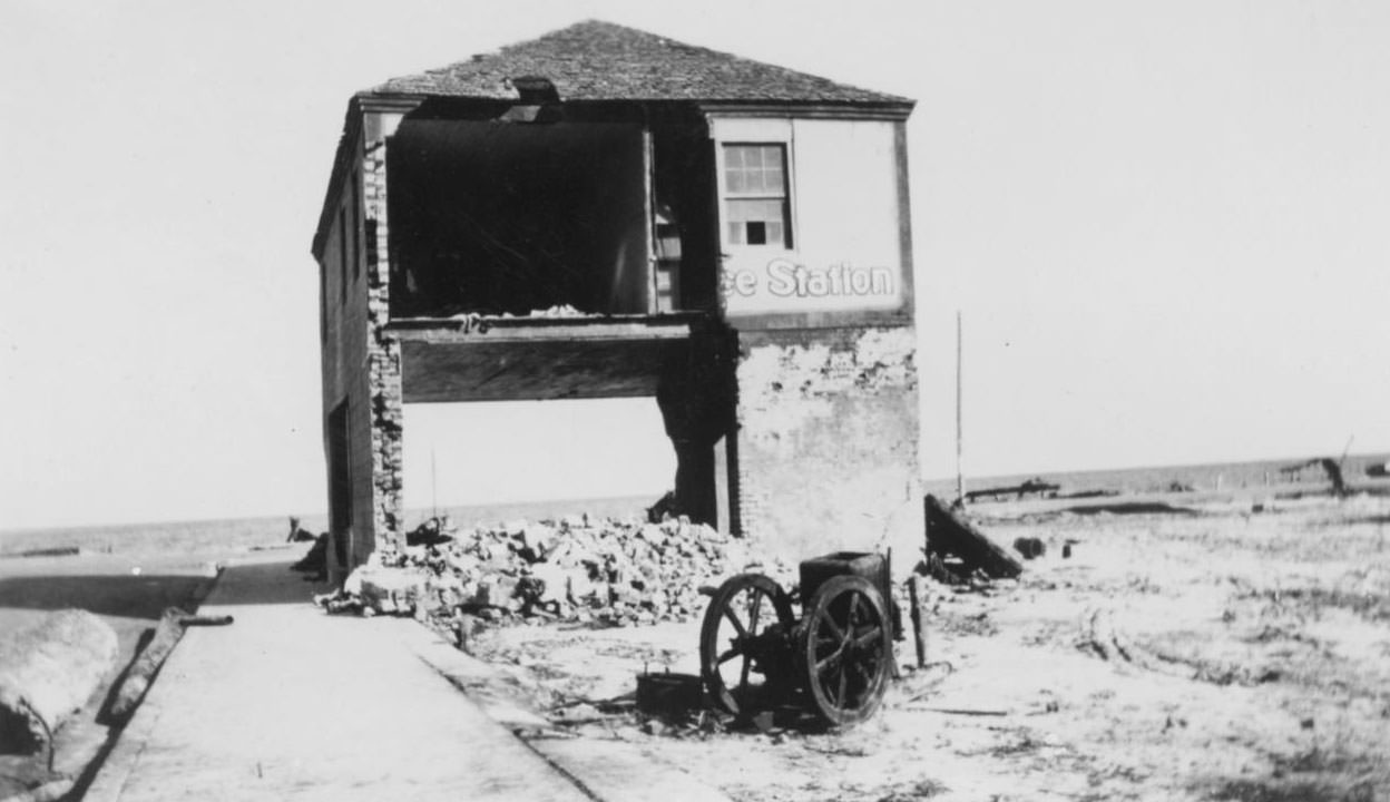
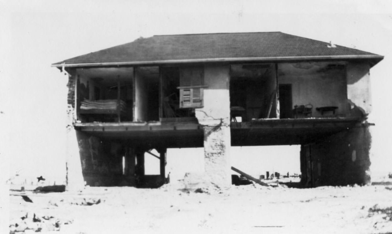
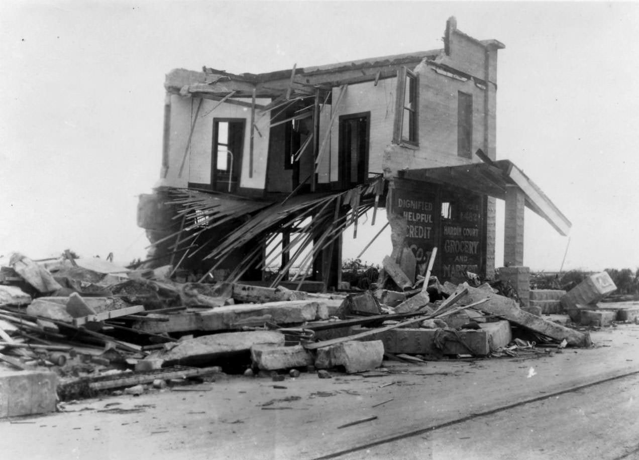
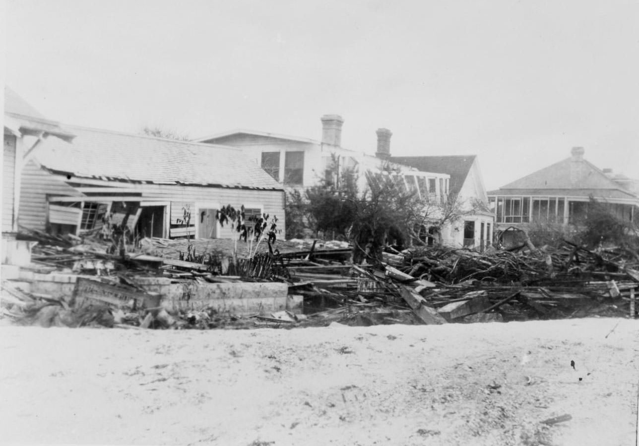
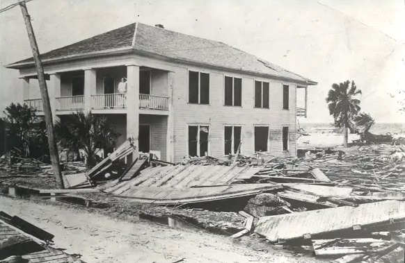
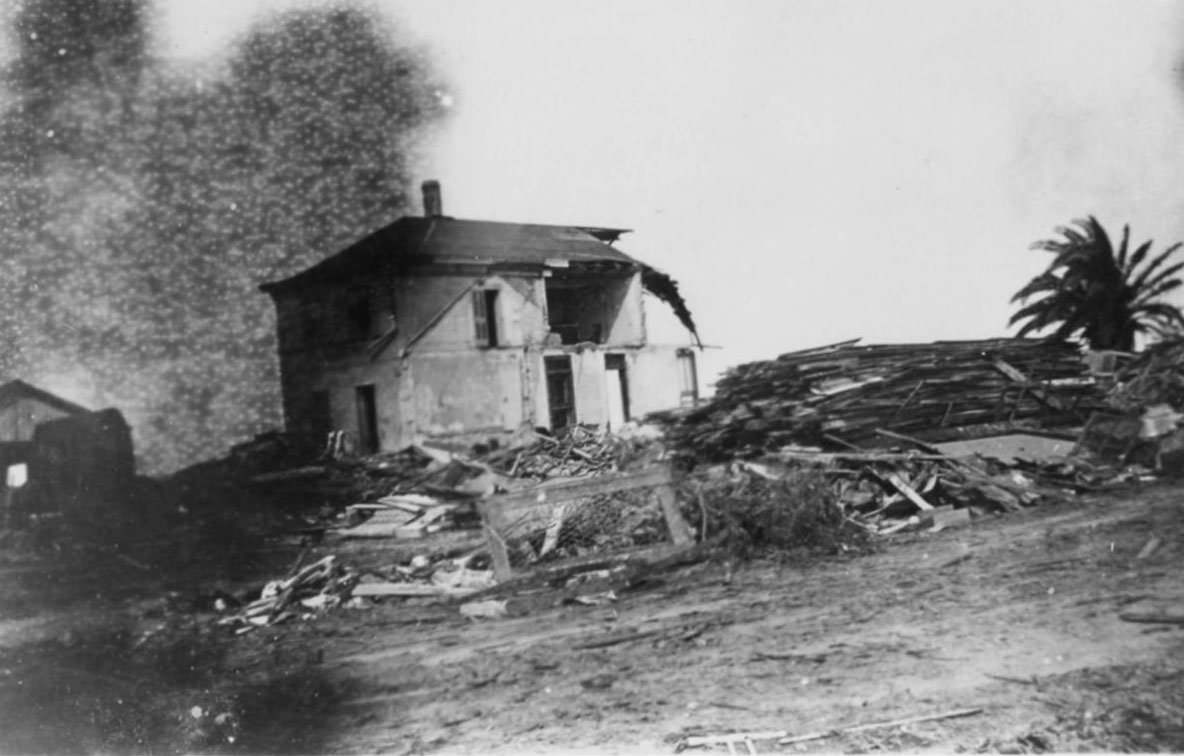
Buildings constructed of brick covered with thick concrete layers were stripped down to their frames or left as hollow shells. Photographs document two-story homes with their entire front walls missing, the interiors exposed to open air. Proximity to the bay was a determining factor — structures on the water-facing side of streets were nearly always more heavily damaged than those a block further inland.
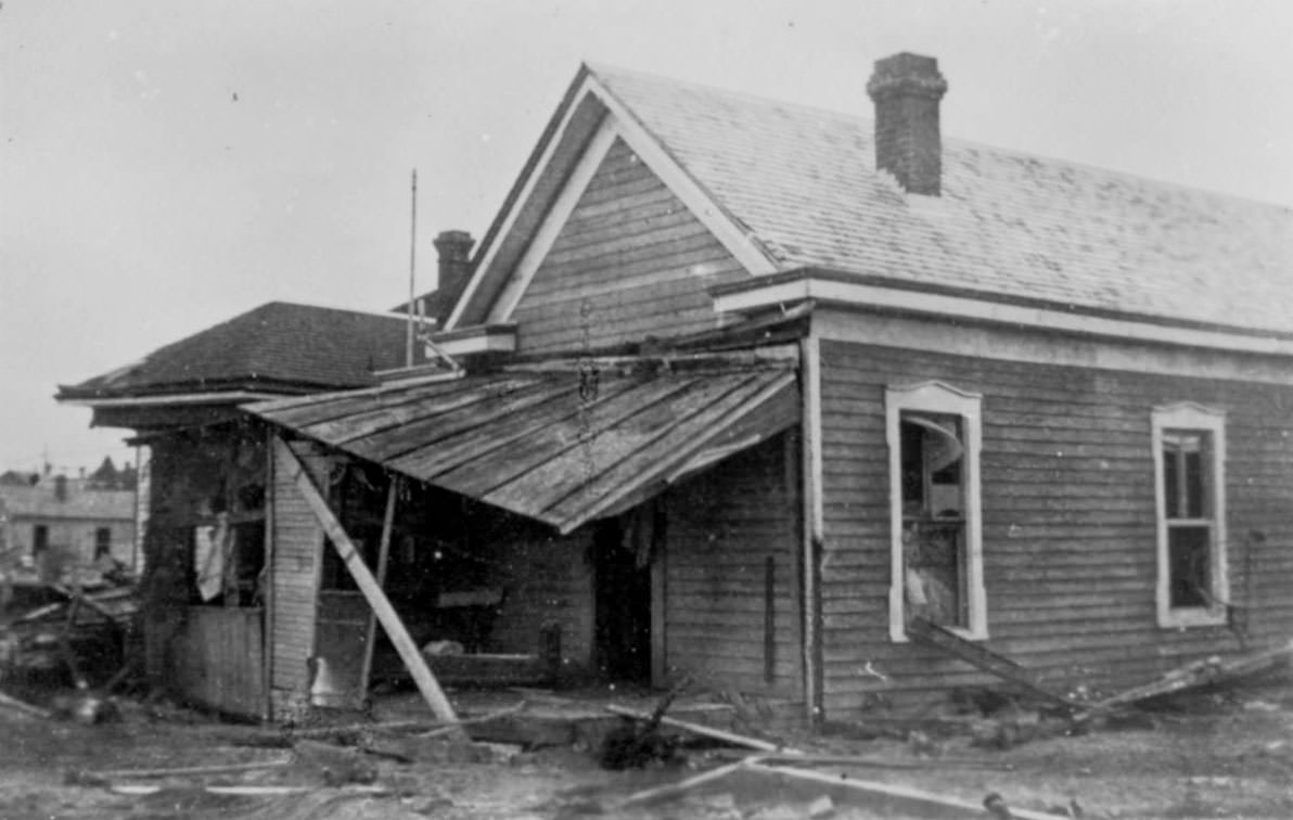
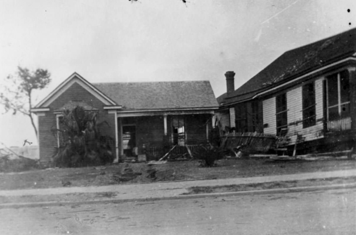
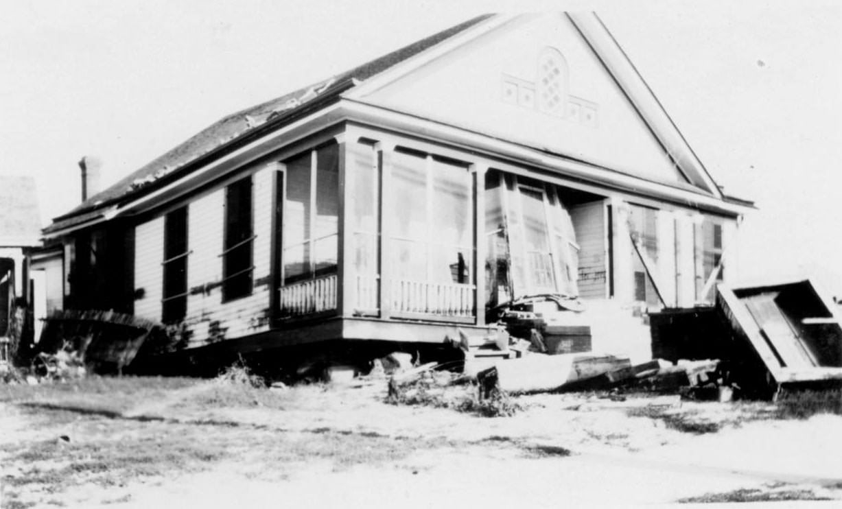
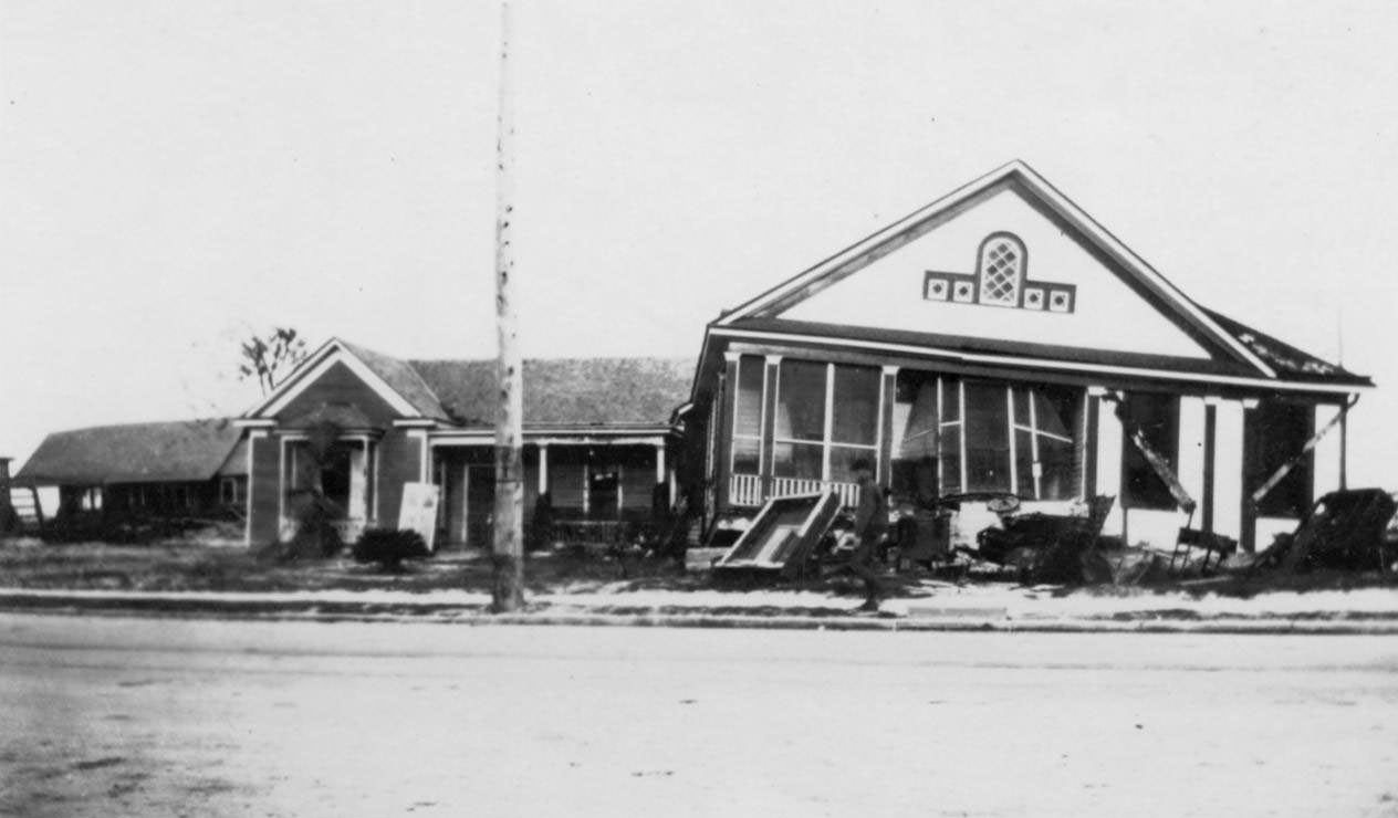
Residential neighborhoods throughout the city were devastated. Over 23 blocks of city beach between Star Street and Dan Reid Street saw 900 homes disintegrate entirely, leaving little more than scattered debris to mark where they had stood. These photographs of damaged houses are among hundreds taken in the days following the storm.
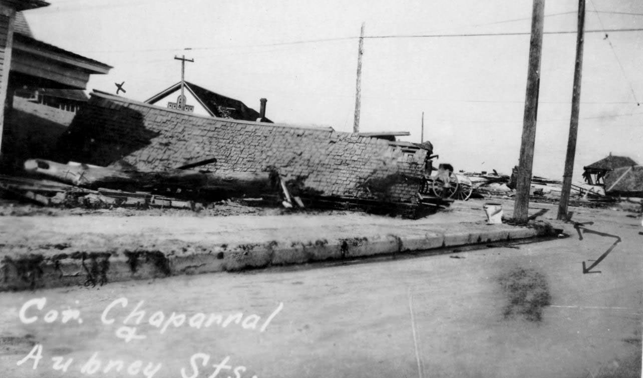
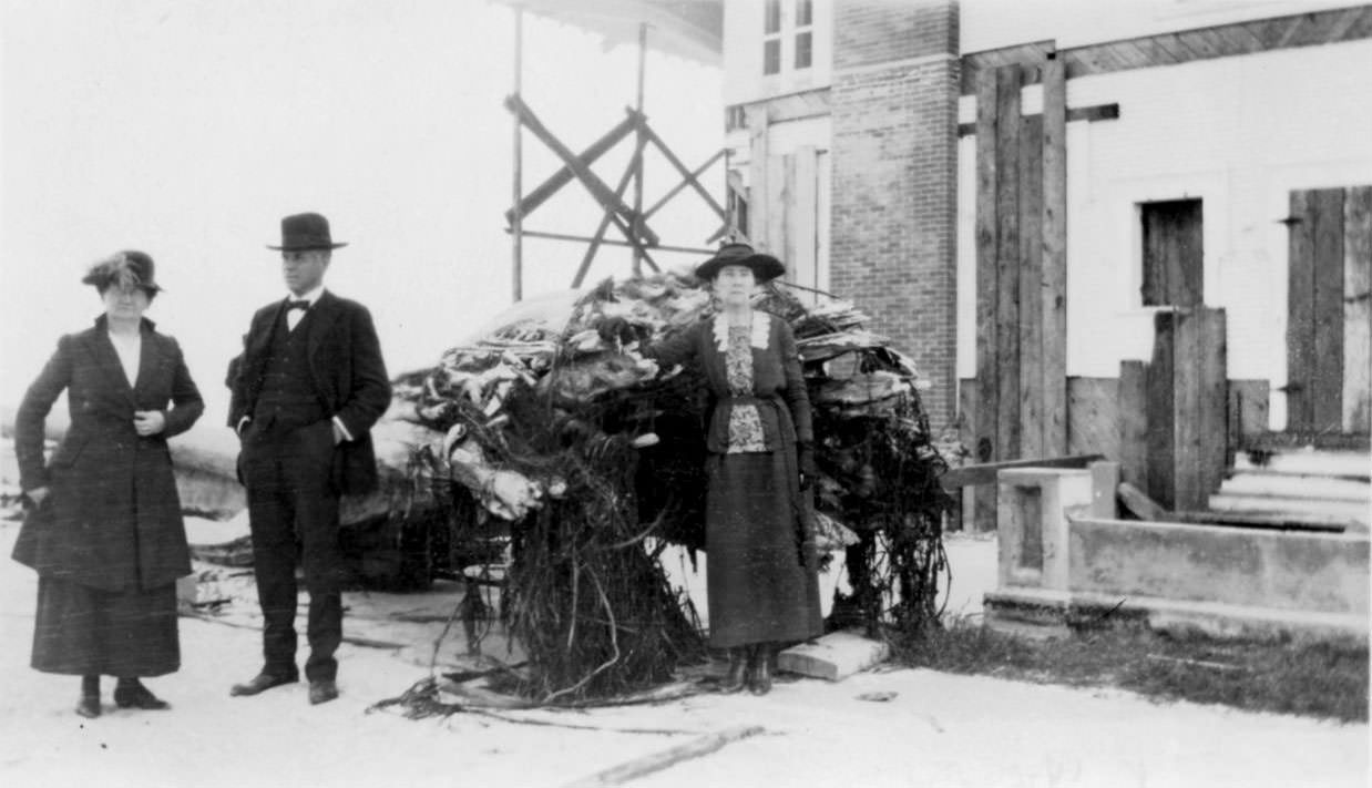
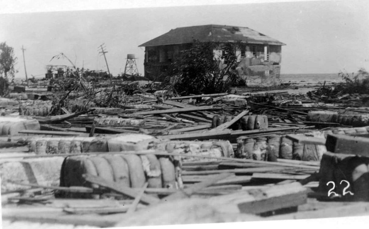
Survivors are photographed standing among the ruins of houses they likely knew — or in some cases, had lived in. A two-story home is surrounded by shingles, loose boards, and cotton bales pushed inland from the wharf district. One personal note written on the back of a photograph describes the scene at a street corner south of a family’s home, noting it was what they found upon returning from Missouri after cleanup had already been underway.
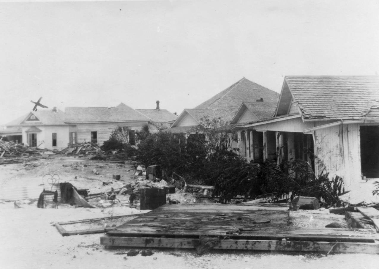
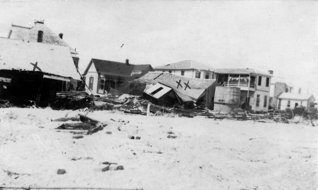
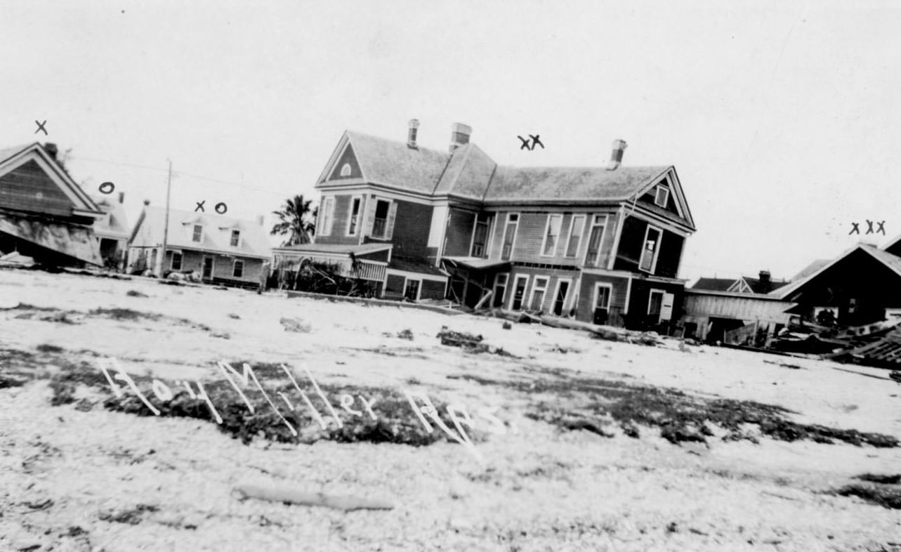
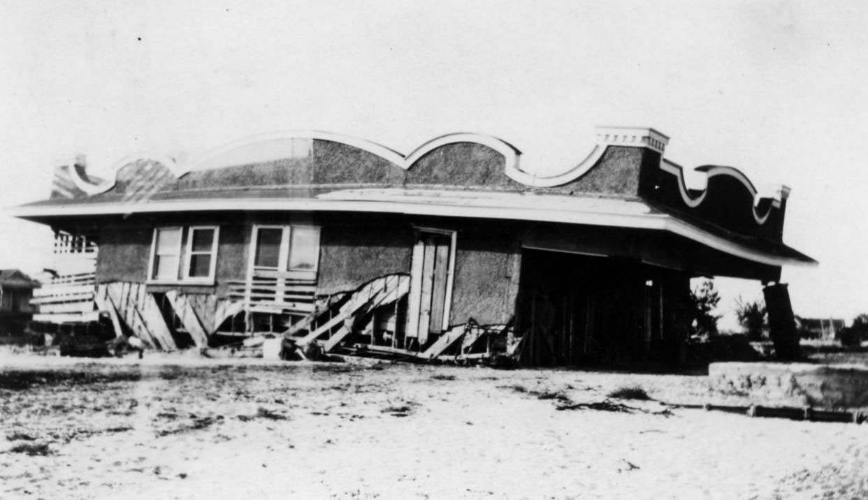
Entire rows of cottages and single-family homes were knocked off their foundations. Some were relocated hundreds of feet from where they originally stood. Others were reduced to piles of lumber. The photographs show neighborhood after neighborhood in the same state of total ruin.
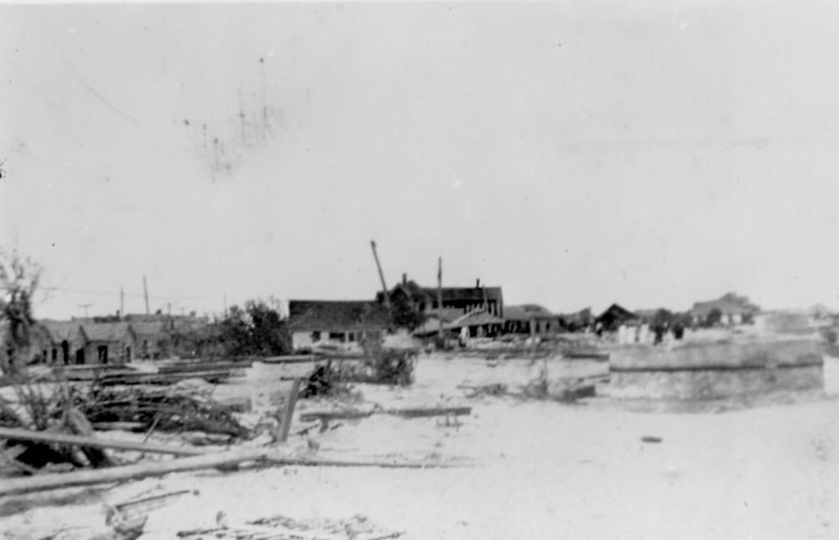
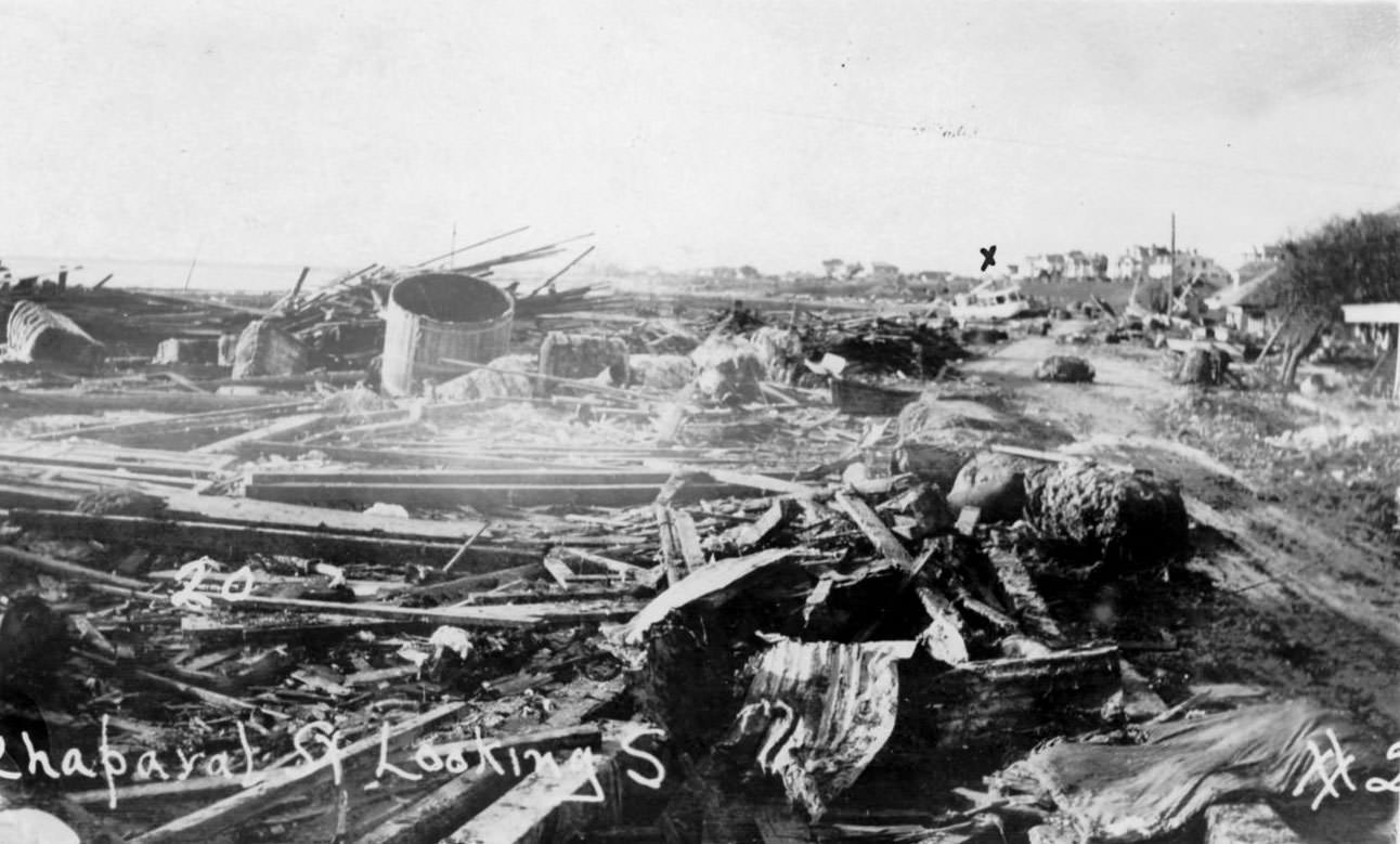
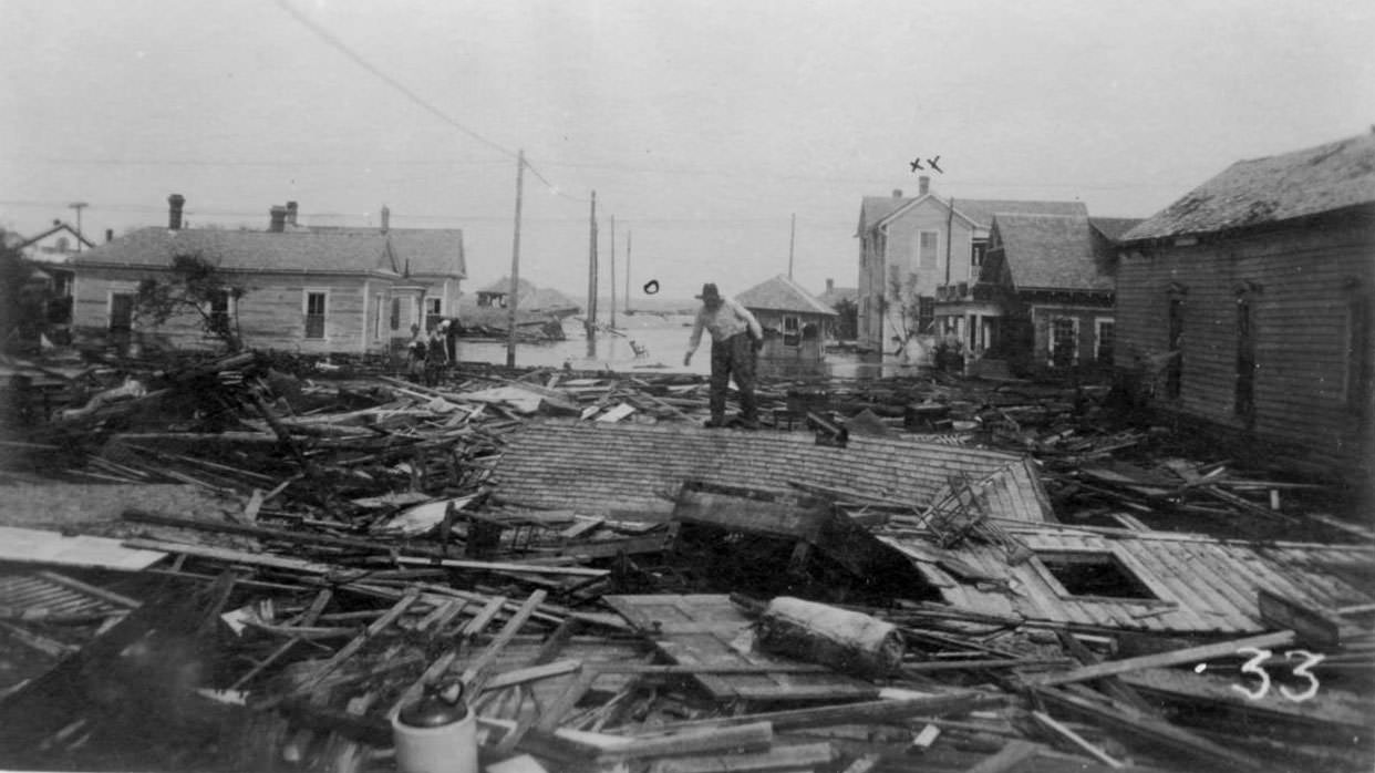
One photograph shows a man standing on a roof that now lies flat on the ground — torn entirely from the structure it once covered and dropped in the open. Piles of wreckage stretched across open ground where entire blocks of buildings had once stood. The storm left some areas so bare that even locating where streets had been required careful examination.
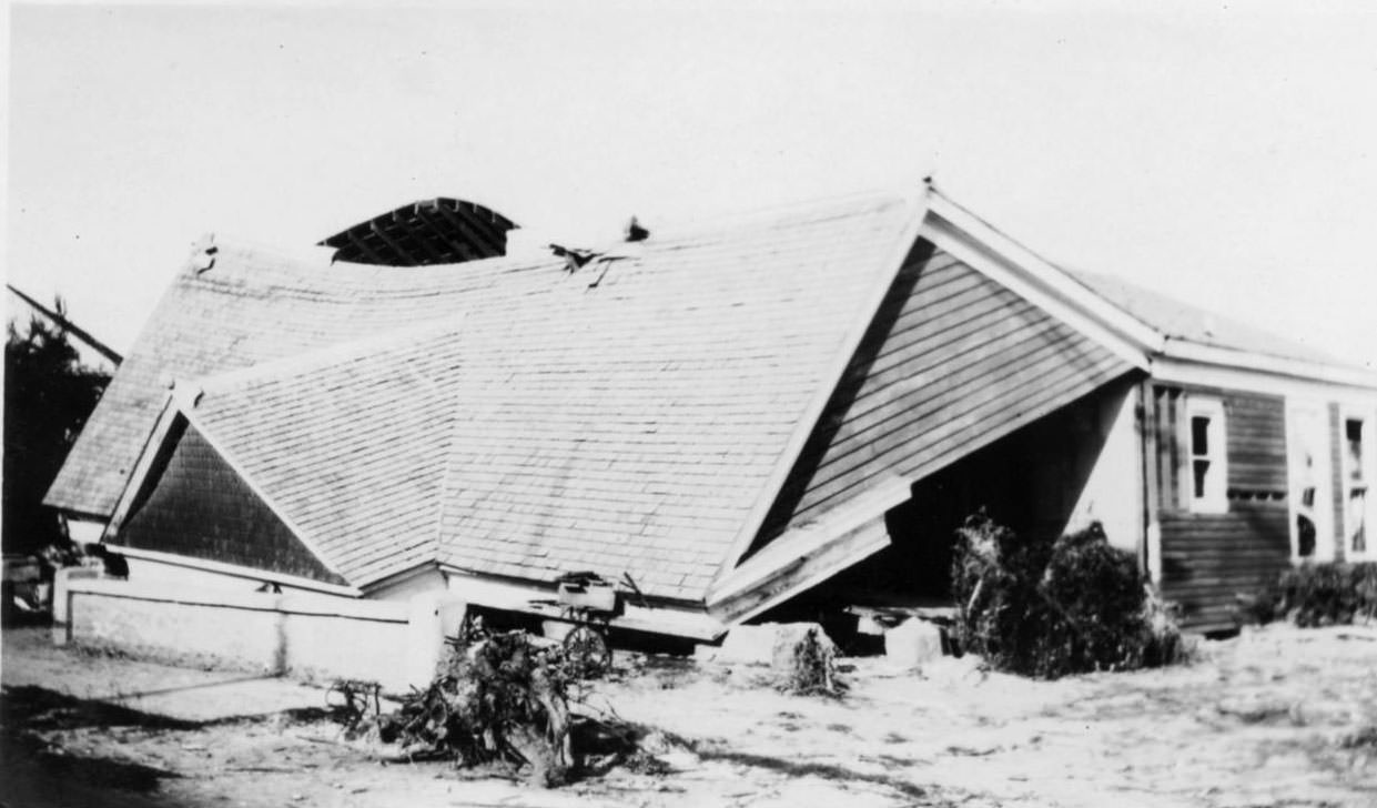
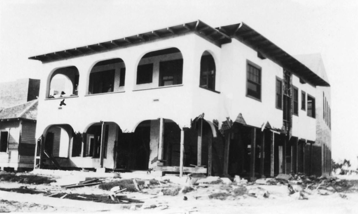
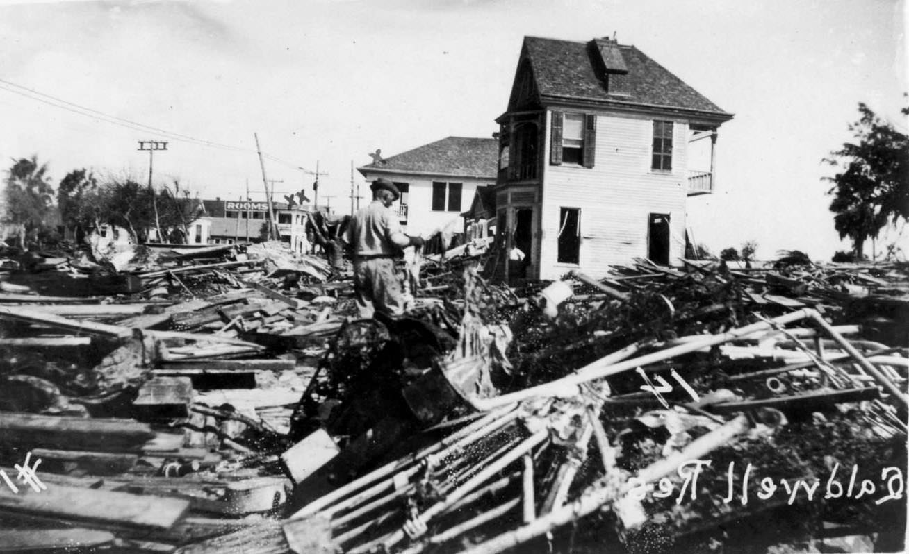
Hotels and apartment buildings along the beach corridors fared no better than private homes. The North Beach area bore some of the worst damage. North Beach sat just five feet above sea level and was completely submerged during the storm surge. Of approximately 200 residences originally on North Beach, only three structures survived.
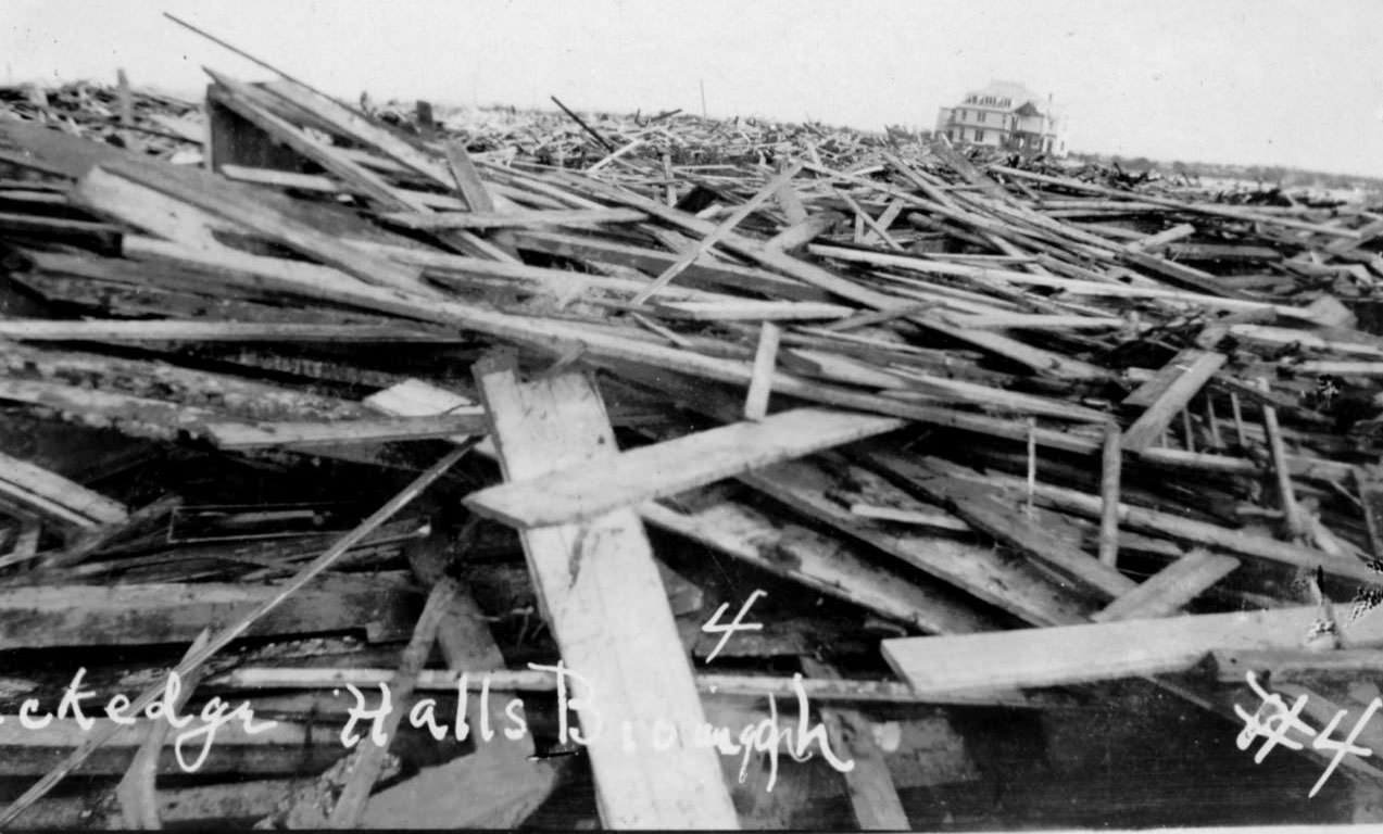
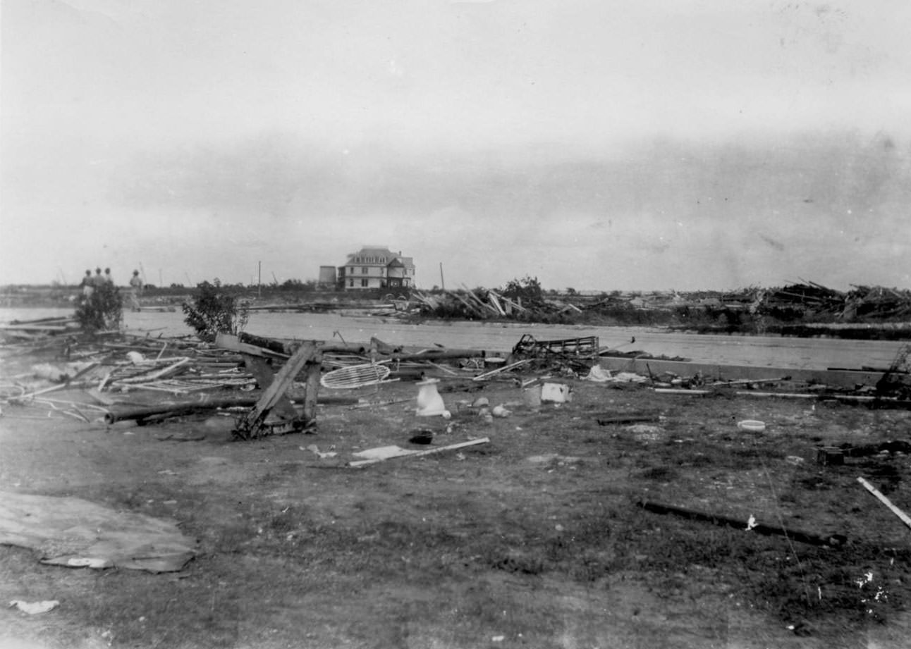
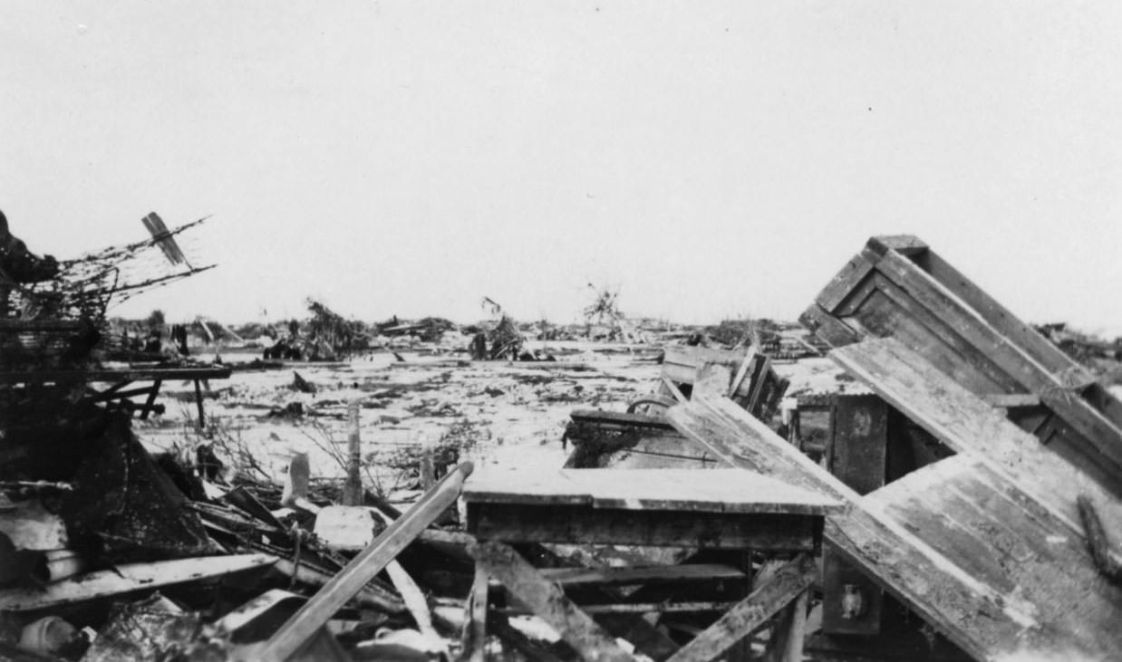
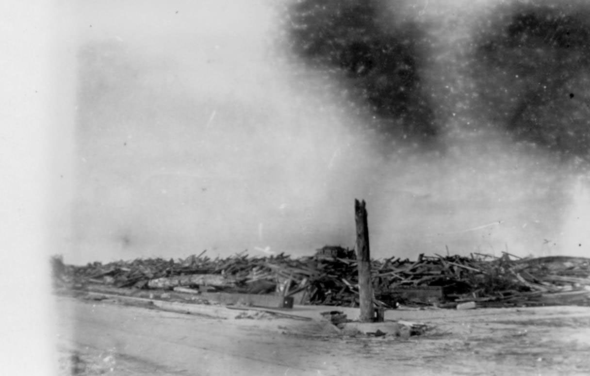
North Beach after the storm was almost unrecognizable. The photographs show nothing but boards, broken timber, and open, bare ground where a dense residential and hotel district had existed just days before. The area had been a popular destination, with hotels, cottages, and recreational facilities lining the beach.
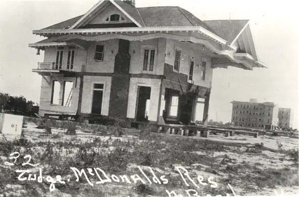
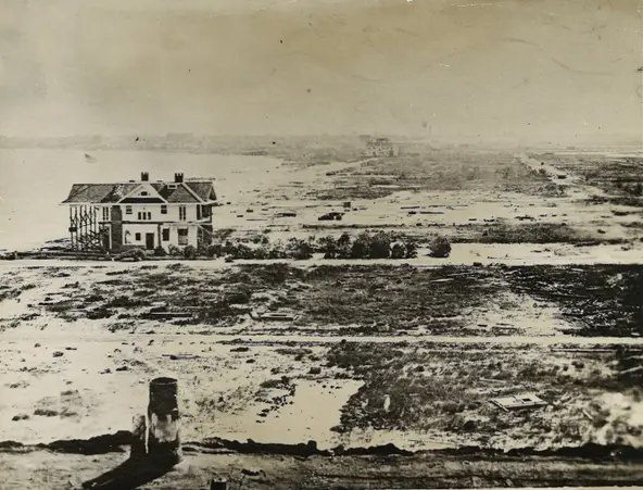
Judge Henry McDonald’s house at 3312 Rincon was one of those three surviving structures. It stands in photographs surrounded by total devastation — a single intact building amid the ruins of what was once a full neighborhood. Spohn Sanitarium and the U.S. General Hospital No. 15 were the other two survivors.
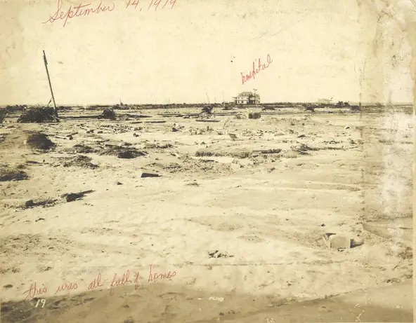
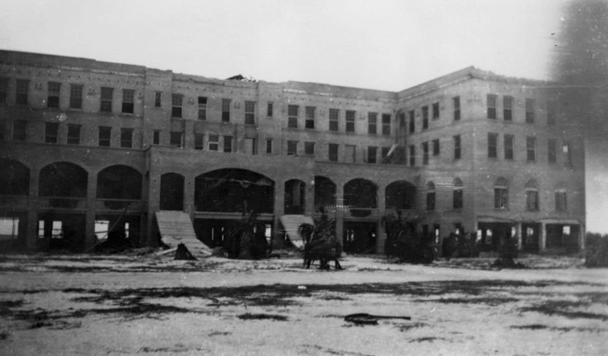
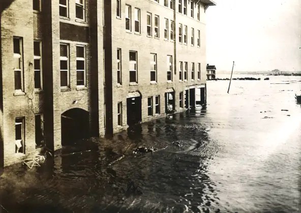
Spohn Sanitarium, where four people died during the storm, remained standing and is now the site of the Texas State Aquarium. U.S. General Hospital No. 15 — formerly the Beach Hotel — also survived. The day after the storm, water was still flowing across the land as the surge in Nueces Bay drained back into Corpus Christi Bay.
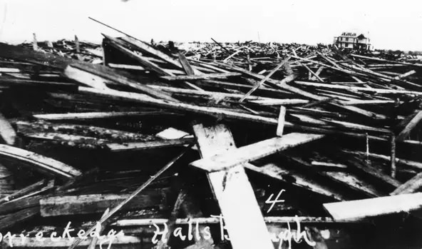
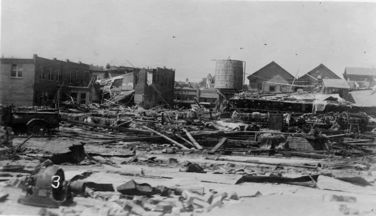
At Hall’s Bayou, wreckage piled up along the water’s edge. That bayou was eventually dredged decades later to create the entrance to the Port of Corpus Christi. Looking toward the town from the bay, the waterfront presented a jagged skyline of broken buildings and bare lots where structures had been swept entirely away.
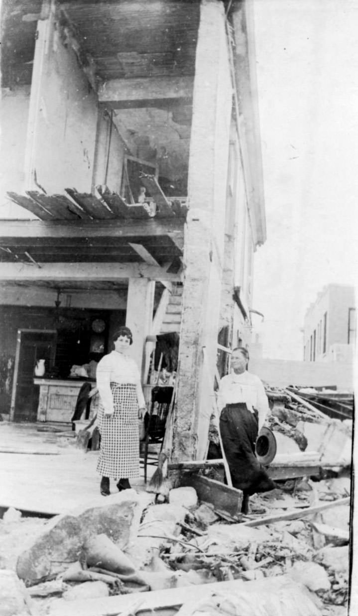
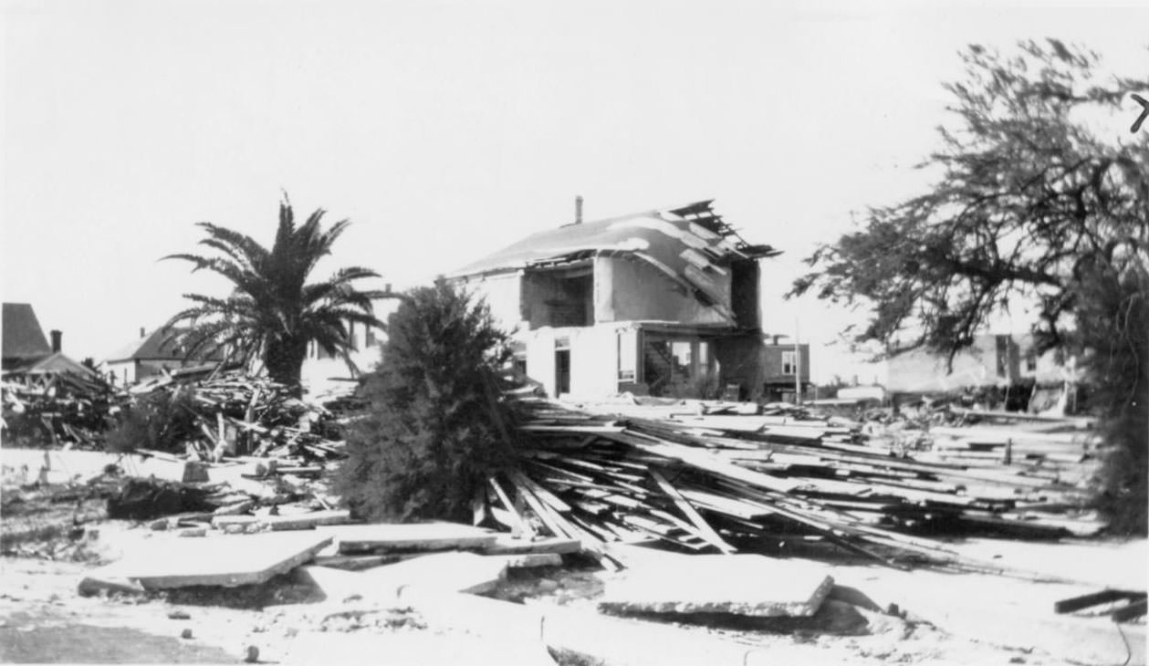
The Seaside Hotel, which had stood along the beach near the salt cedar arbor of the Seashore Club, was reduced to ruin. Its pavilion hotel counterpart — the Seaside Pavilion Hotel — was stripped entirely, leaving only its pilings standing in the bay. Photographs taken at the site show two women standing beside the damaged structure, the debris field stretching out around them in every direction.
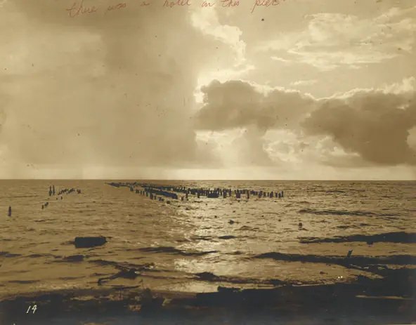
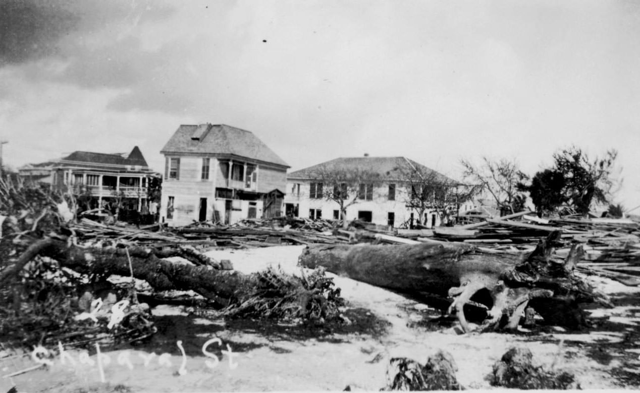
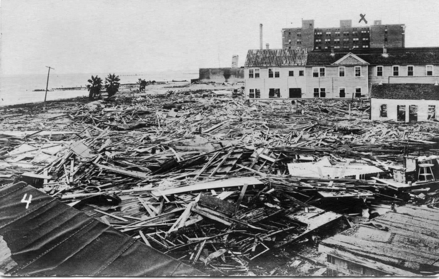
Along the shoreline near the Seashore Club, paved streets were buried so deeply under debris that locating them required close examination. One written description from the period notes that somewhere under the wreckage ran the street that had passed by the Seaside Hotel and back toward the Pavilion Hotel over the bay.
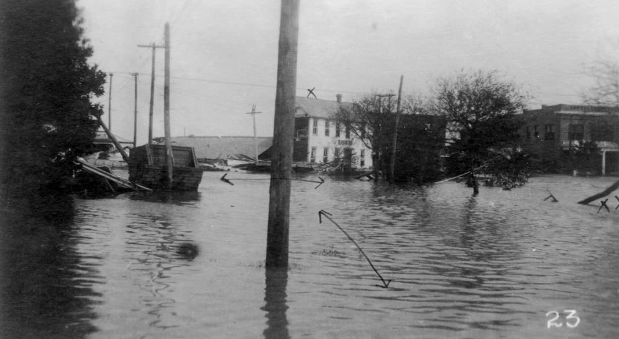
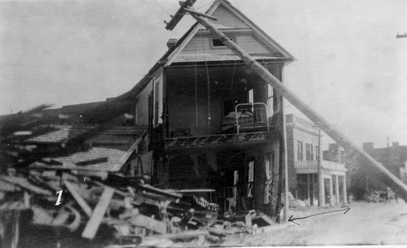
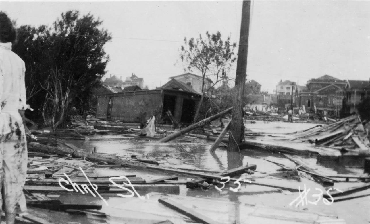
The Winona Hotel was left with only four of its rooms standing — displaced into the middle of the street, surrounded by standing water. A leaning utility pole in the foreground of one photograph emphasizes how thoroughly the entire infrastructure of the area had been destabilized.
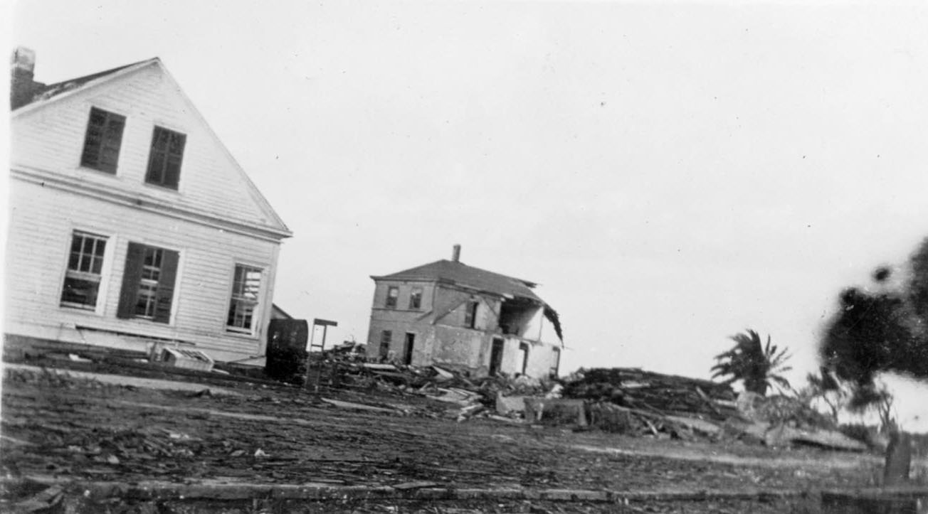
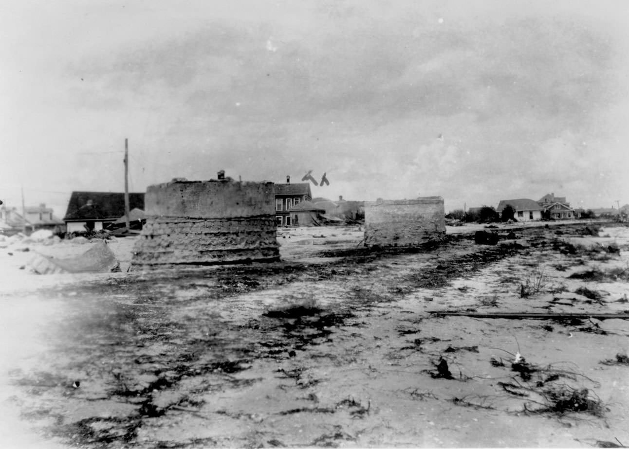
Across the beach communities and downtown districts, homes and hotels that sustained damage were photographed repeatedly by survivors and official recorders alike. The photographs show how randomly destruction was distributed — a house stripped to its frame standing next to one with only minor damage, while everything around both had vanished completely.
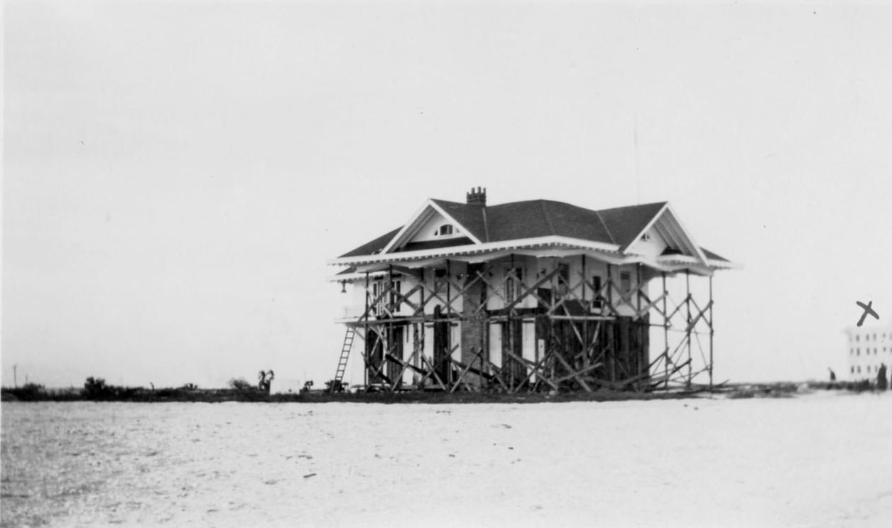
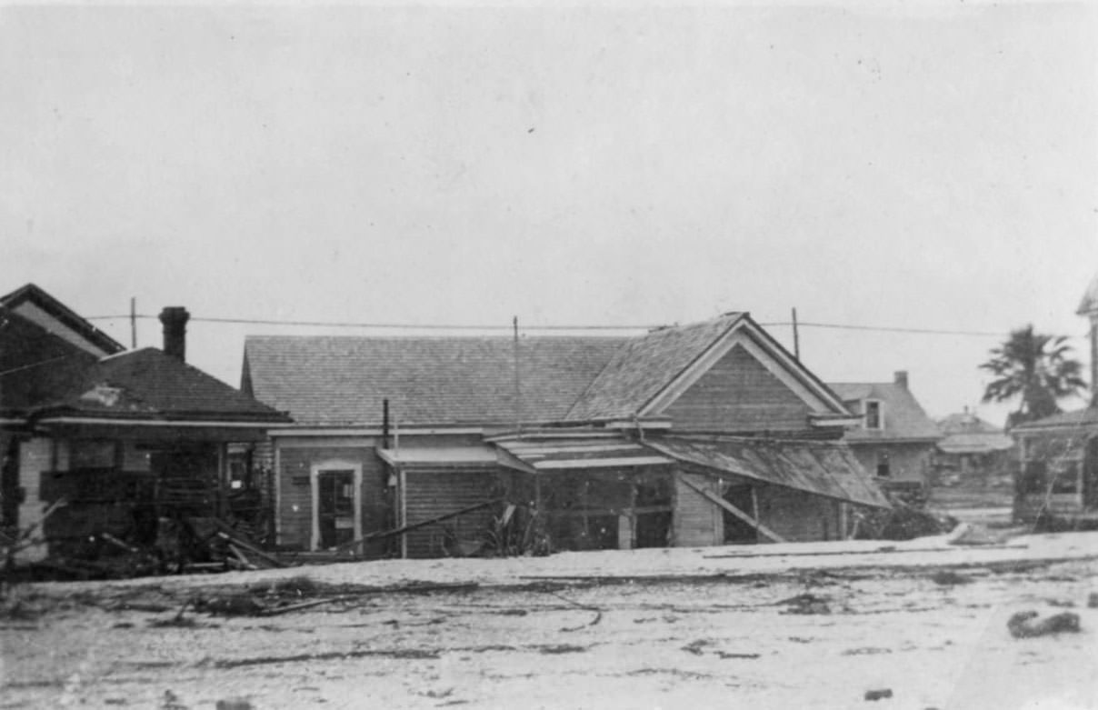
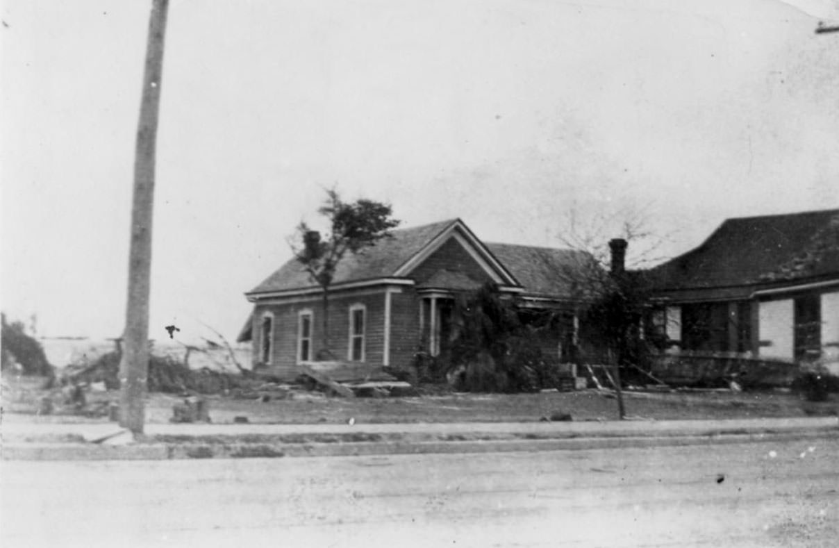
The storm surge deposited enormous quantities of sand, pushing it up behind and around surviving structures. Photographs show large sand banks piled directly against the rear walls of houses that had managed to stay standing. The sand itself became a marker of the water’s reach and force.
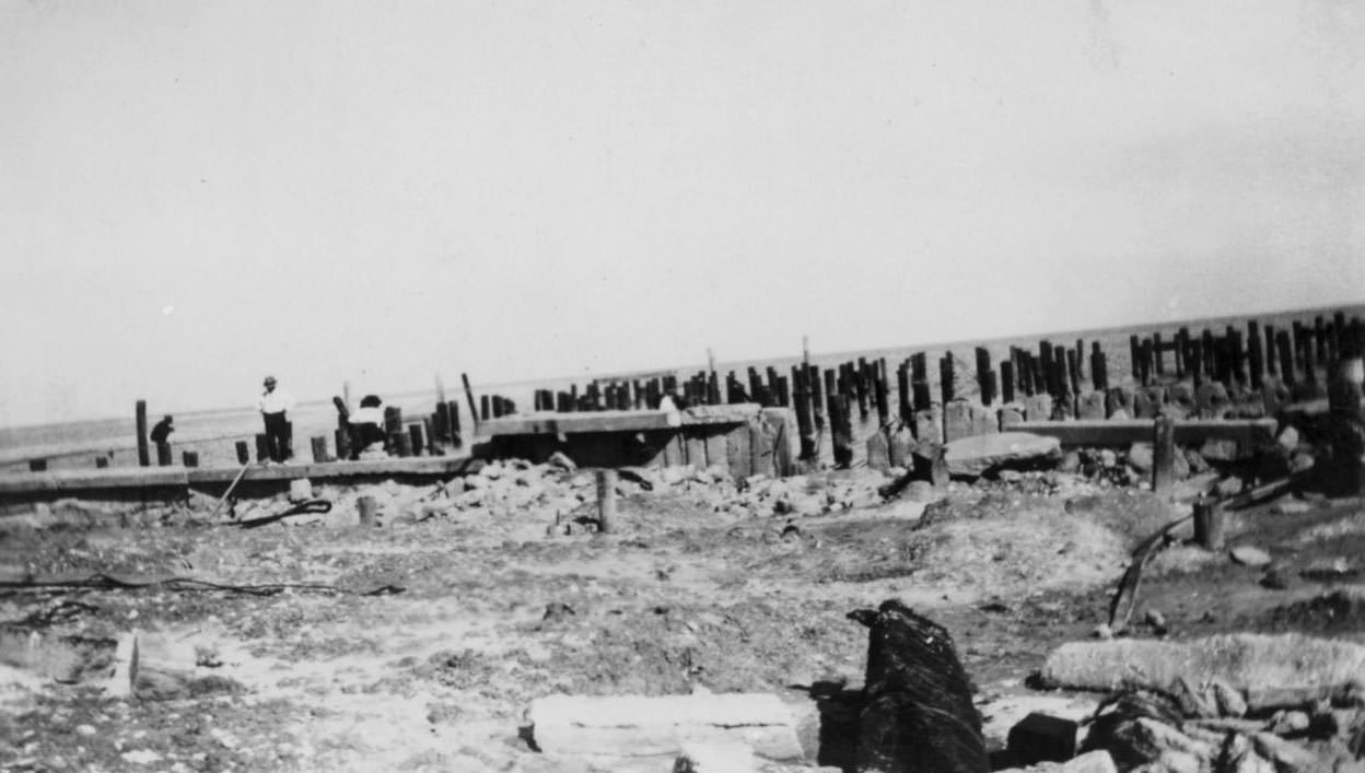
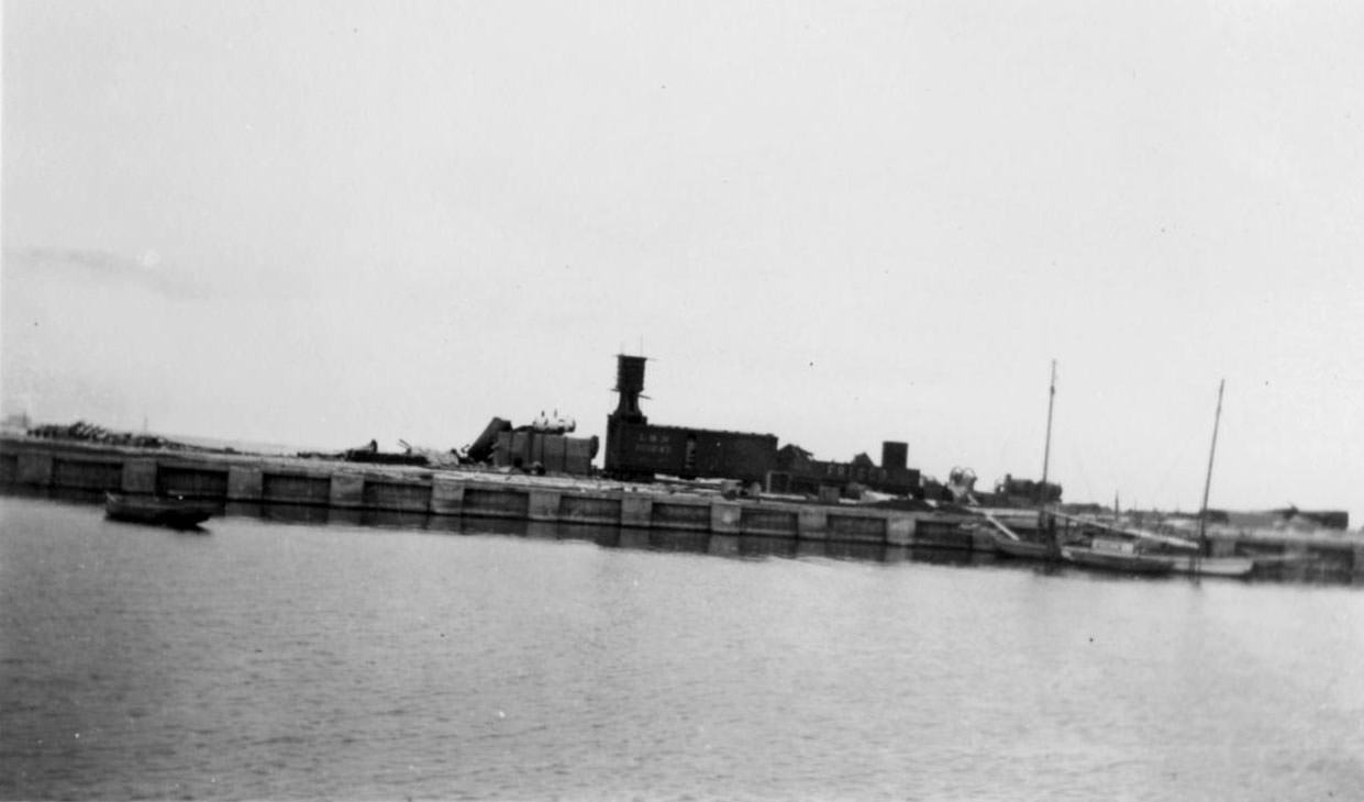
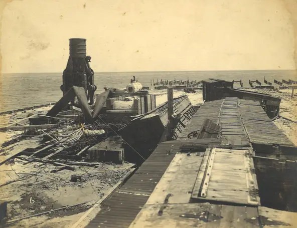
The Municipal Pier was demolished down to concrete rubble and bare pilings. The cotton compress at the Municipal Wharf — a major commercial facility — was destroyed entirely. Cotton bales from the wharf were driven by the surge through the streets and into buildings throughout the surrounding blocks, acting as heavy projectiles against anything standing in their path.
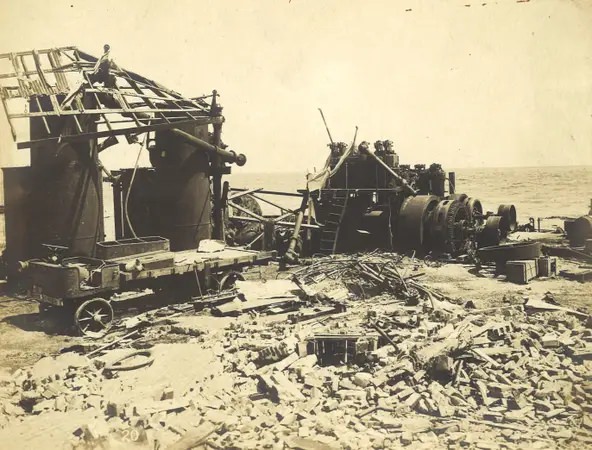
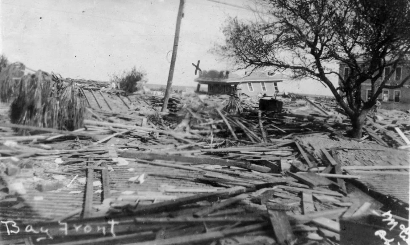
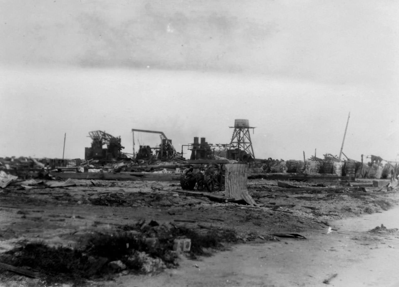
Industrial facilities along the bay front were also wiped out. The ice factories, which were essential to keeping food and medical supplies cold in the days before widespread refrigeration, were destroyed. The electric power plant was reduced to rubble. With both water and power infrastructure gone, recovery efforts in the immediate aftermath were severely hampered.
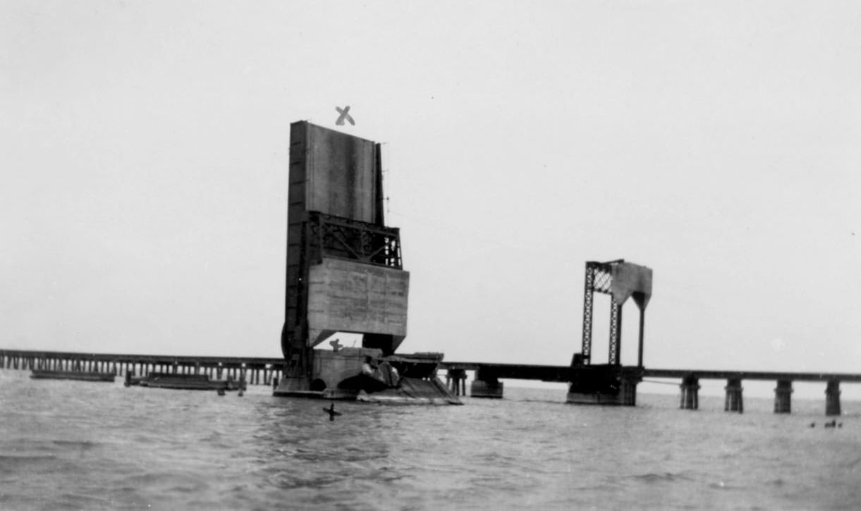
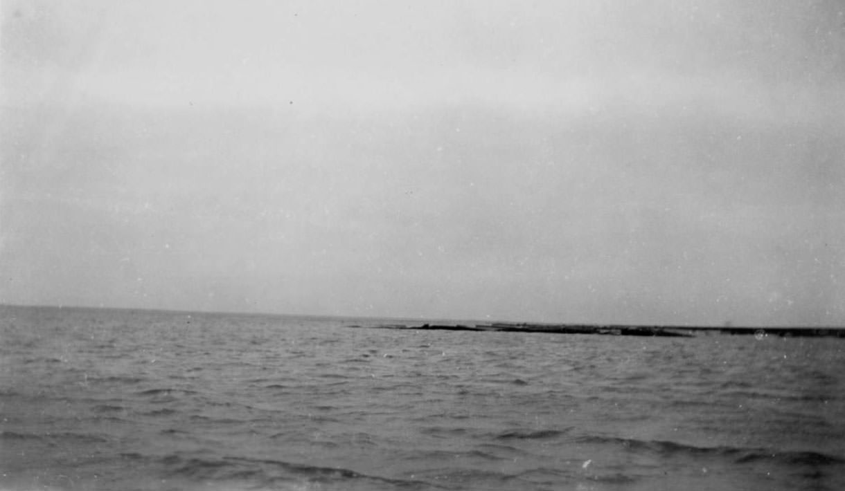
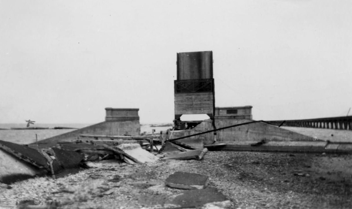
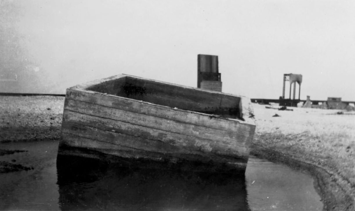
The causeway crossing the bay was destroyed, cutting off one of the main routes in and out of Corpus Christi. Photographs show its remains as broken concrete and twisted structural material scattered across the water. The railroad bridge near the causeway was similarly wrecked, severing rail connections to the city.
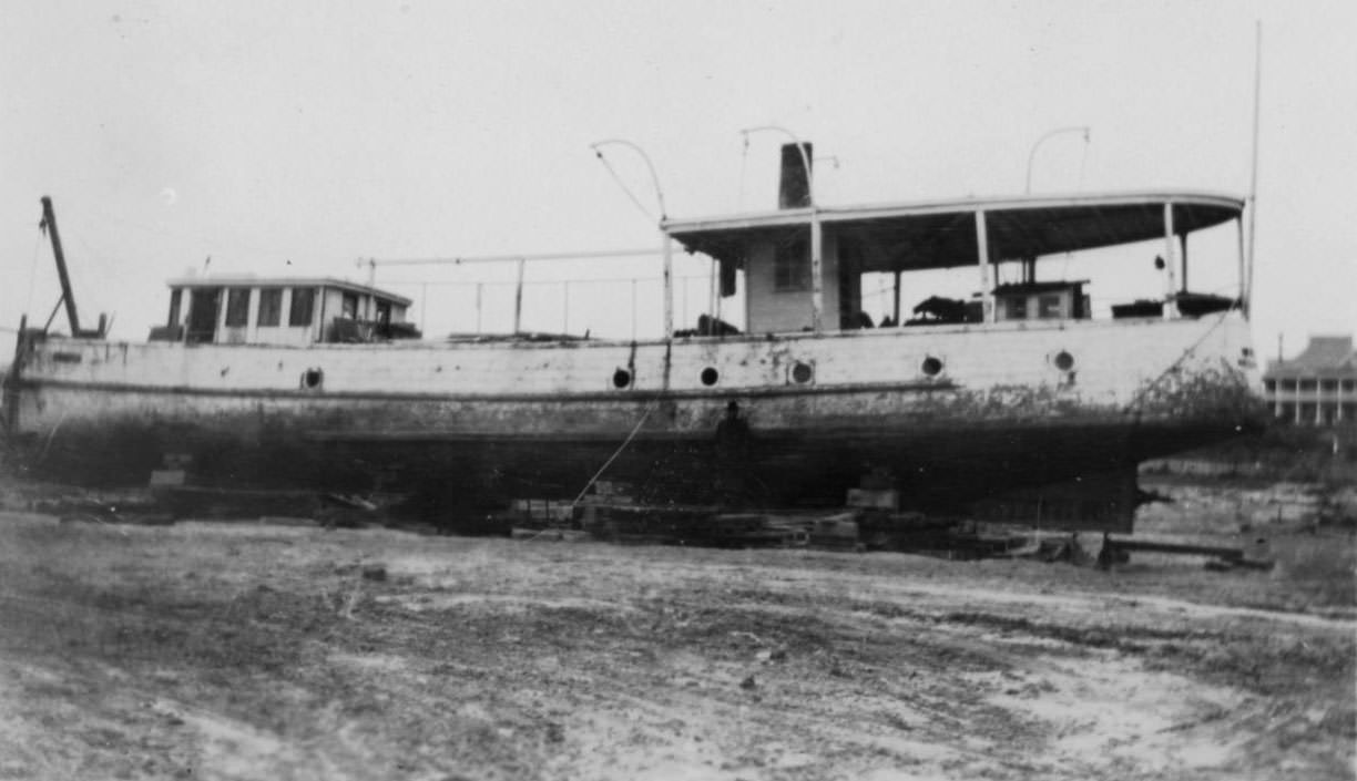
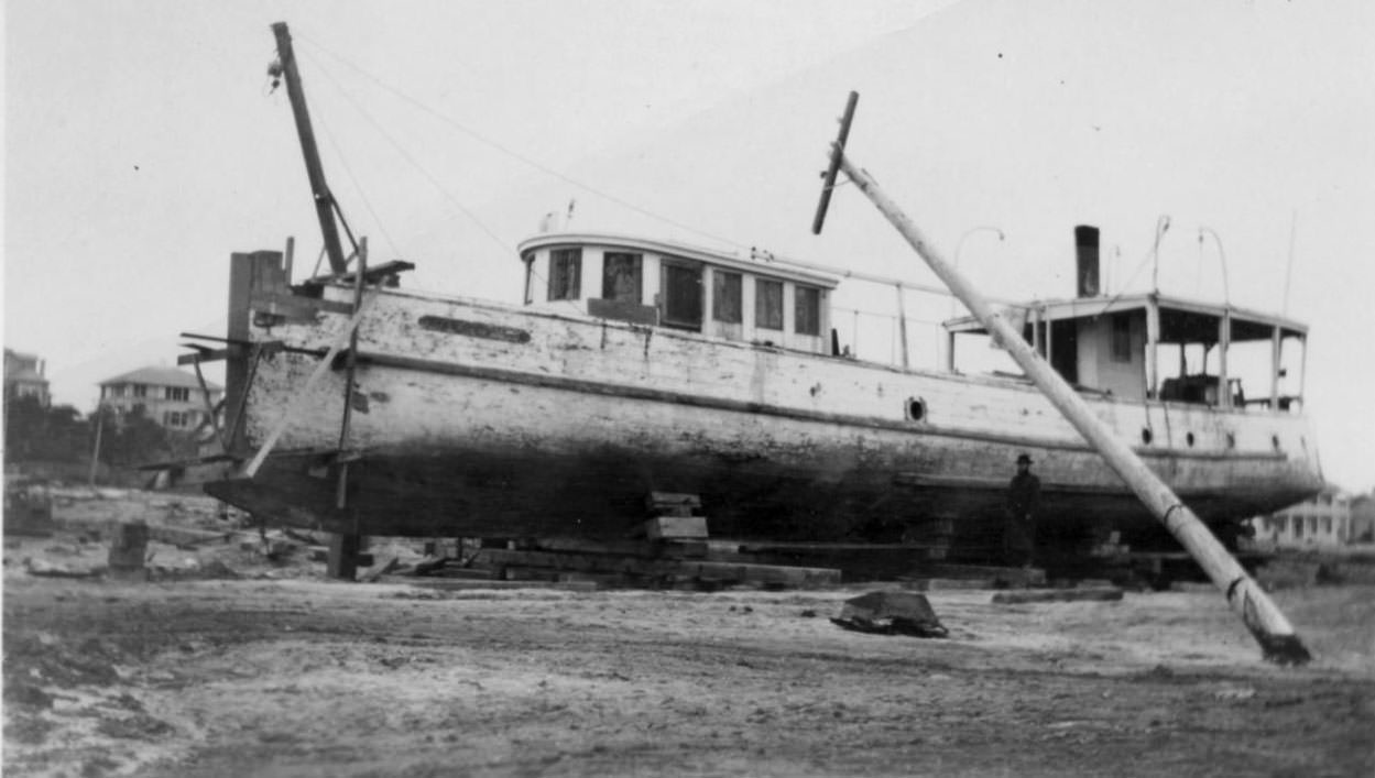
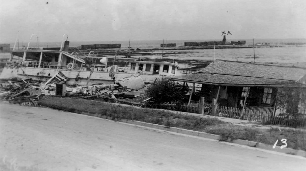
The storm also drove vessels ashore. The Japonica was photographed sitting directly on the beach, driven there by the surge. Multiple photographs document the vessel from different angles — the ship high and dry on land, with a small building still precariously standing nearby. It became one of the most striking visual symbols of the storm’s power captured on film.
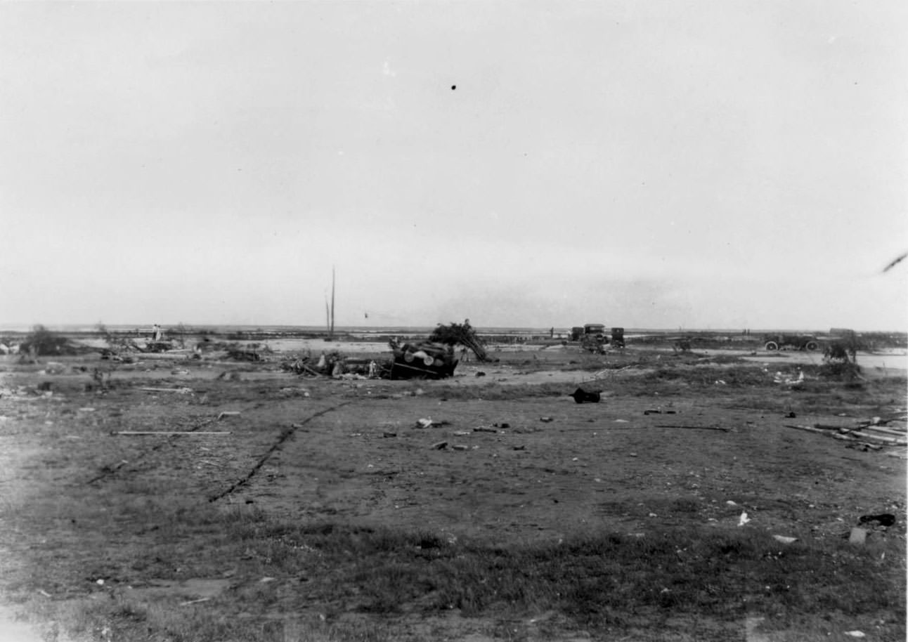
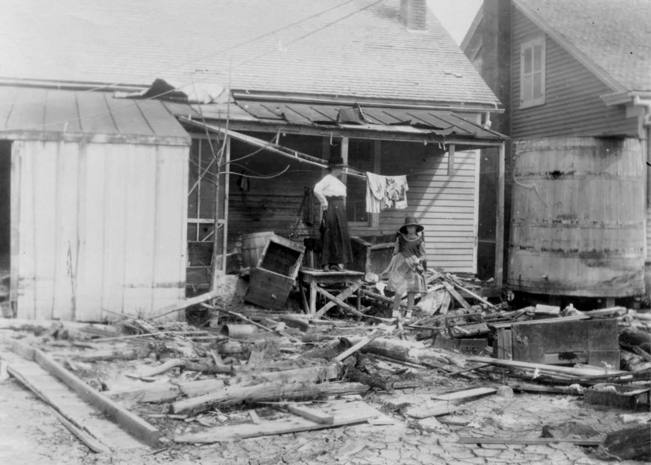
Cars were overturned on the beach. A woman stands on what remains of her back porch, looking out over the debris field that had replaced her neighborhood. These human moments in the photographs are a reminder that behind every pile of lumber and shattered wall was someone’s home, business, or livelihood.
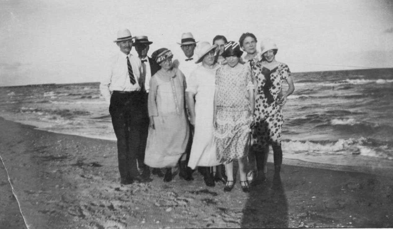
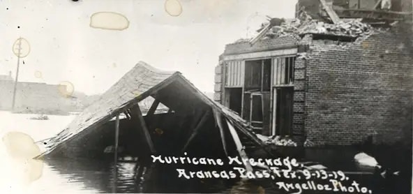
The destruction was not confined to Corpus Christi. Aransas Pass, located northeast of the city, also sustained significant damage from the same storm. Groups of survivors gathered on the beach in the aftermath, taking in the scale of what had happened around them.
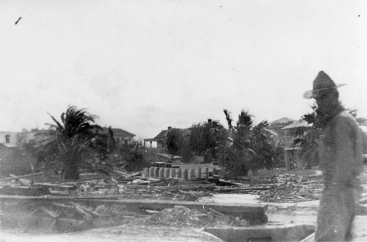
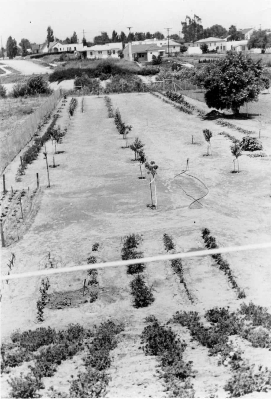
Even parks and gardens throughout the city were damaged. One photograph documents an orchard and garden — with visible flowers, strawberries, and about ten different varieties of trees including pepper and acacia — that had survived the flooding intact at the time the photo was taken. It represents one of the rare intact patches of pre-storm Corpus Christi amid widespread ruin.
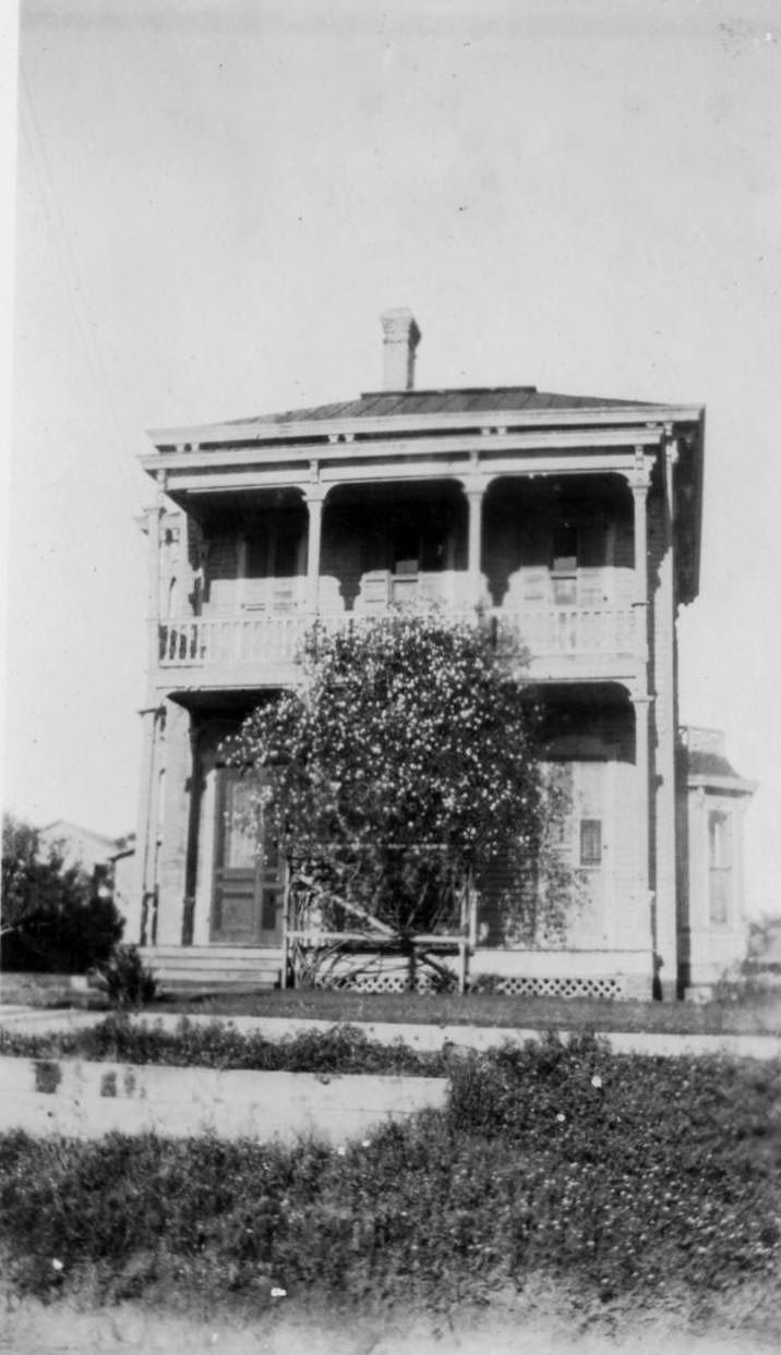
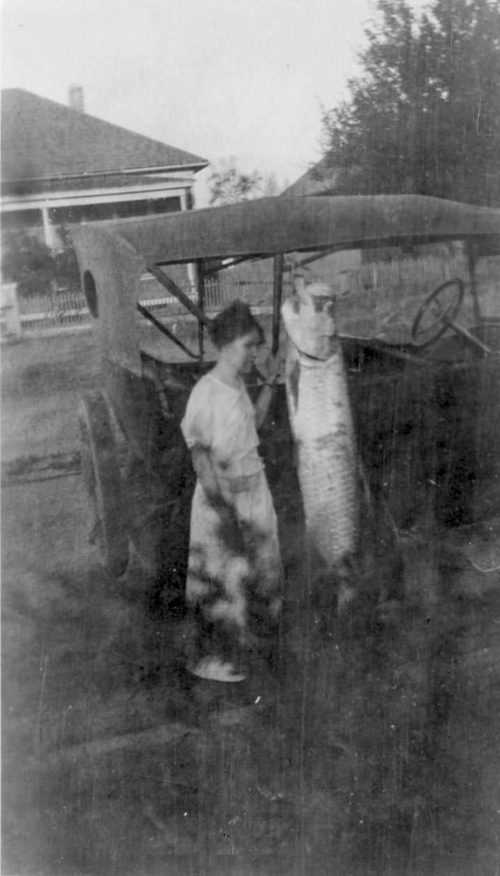
Not all photographs from the period show destruction. Some document the community in quieter moments — a woman standing next to a car with a large fish hung from its roof, Loyd’s House still standing, a two-story home with its wide porch and balcony intact. These images provide contrast against the devastation and show what the city had been — and what residents were determined to rebuild.
After the storm, Corpus Christi asked Congress for federal disaster relief. Congress refused. The Texas Legislature stepped in instead, approving an ad valorem tax across seven South Texas counties to fund storm protection. Roy Miller, working through his relief committee role, began pushing for a deepwater port for Corpus Christi as soon as recovery efforts got underway — a goal that would eventually reshape the city’s future.




