
Trondheim holds a unique place in Norwegian history. Viking King Olav Tryggvason founded the city in AD 997, and it quickly became one of the most important centers in the Norse world. For centuries, it served as a royal seat and a major hub for the Norwegian church. The city’s streets carry names tied directly to that long past — Olav Tryggvasons street, Kongens gate, Munkegata — each one a thread connecting the modern city to its medieval roots.
The city was not without its share of violent history. In 1179, King Sverre clashed with Erling Skakke in a battle fought on Trondheim’s own ground. That struggle for power was one of many that shaped the city’s political identity over the centuries. A street named after Erling Skakke still runs through the city today, a quiet reminder of that medieval conflict.
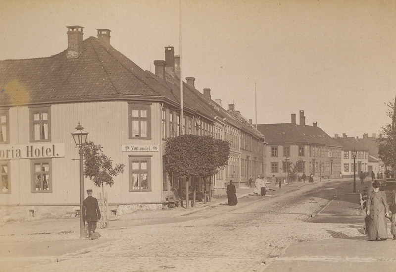
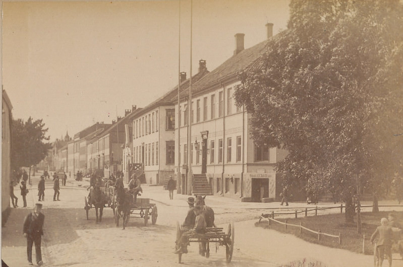
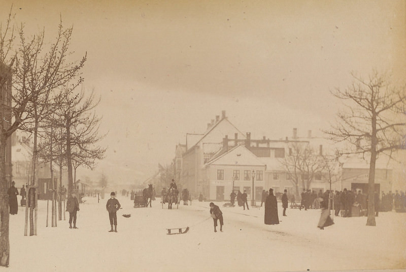
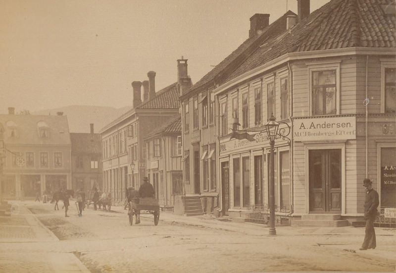
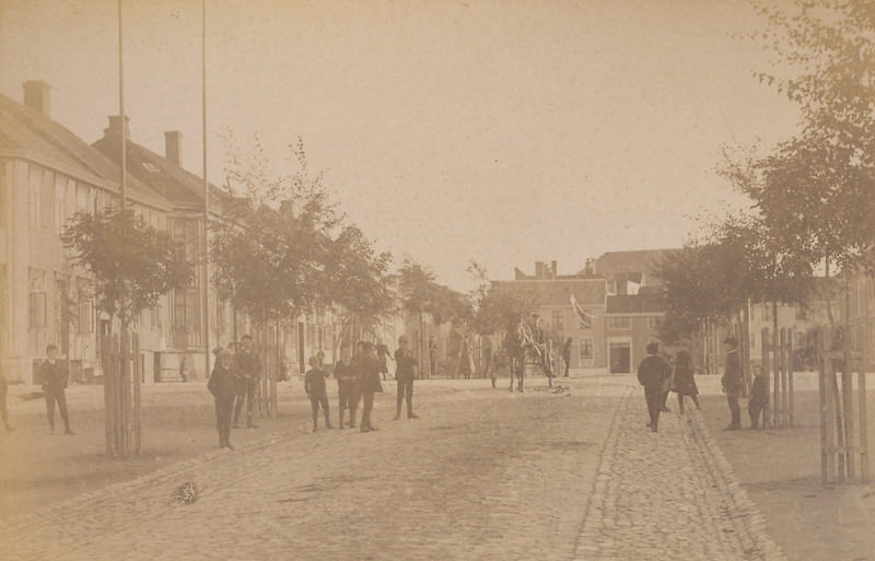
Fire was perhaps the most destructive force in Trondheim’s history. The 1651 fire wiped out 90% of the city’s buildings in a single catastrophe. Just three decades later, in 1681, another major fire tore through what had been rebuilt — this time so completely that the city underwent total reconstruction. The grid-like street plan that appears in these 1893 photographs is largely a product of that post-fire redesign.
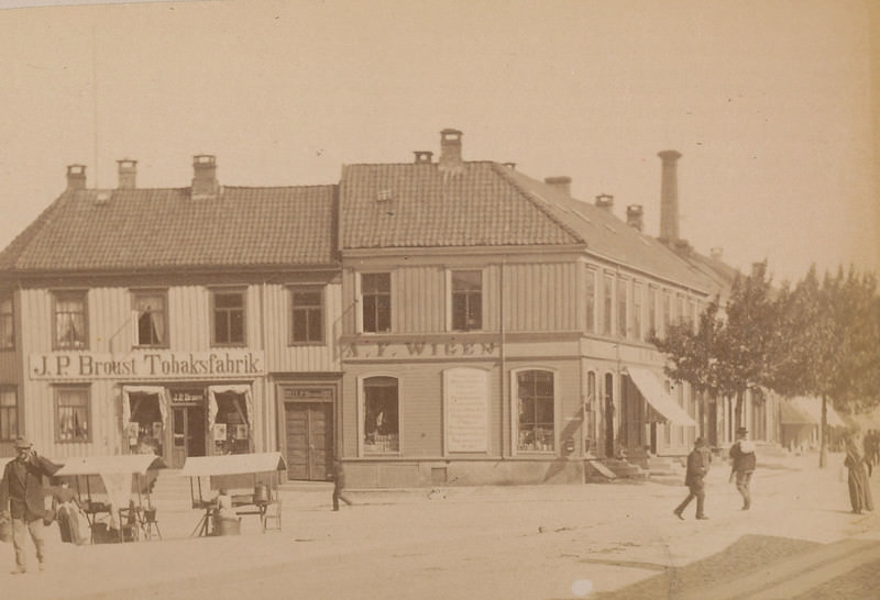
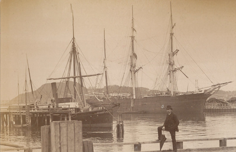
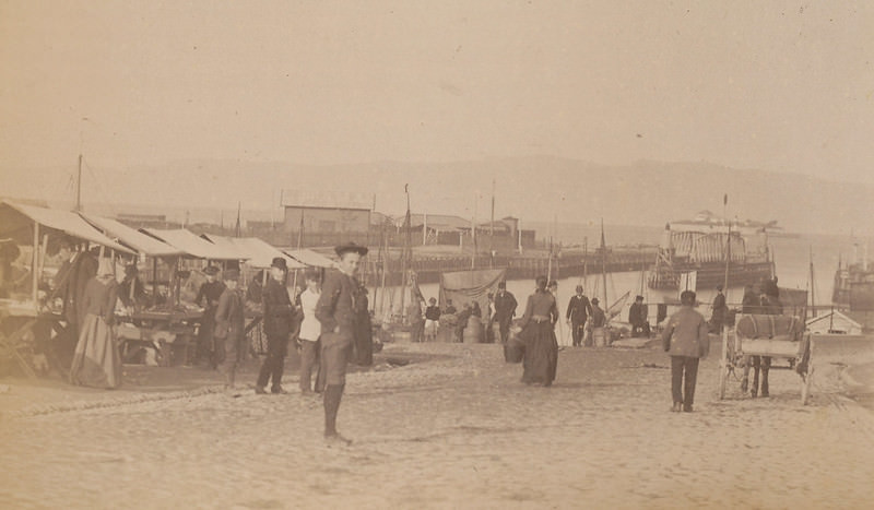
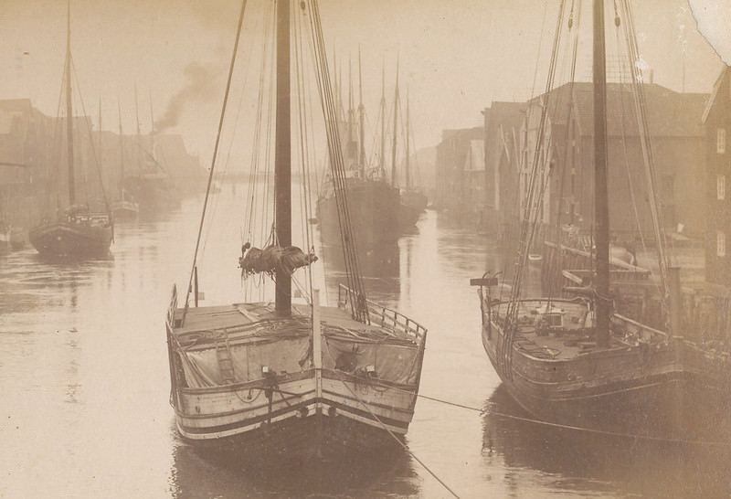
By 1893, Trondheim was a functioning commercial city with a busy waterfront, established financial institutions, and a growing working class. The Nidelva river was central to trade, with barks and vessels docking along its banks. Kjøpmannsgata — literally “Merchant Street” — ran close to Norges Bank and hosted the offices of major trading operations, including the Nordenfjeldske Steamship Company.
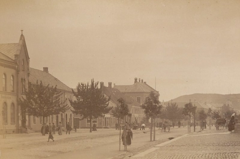
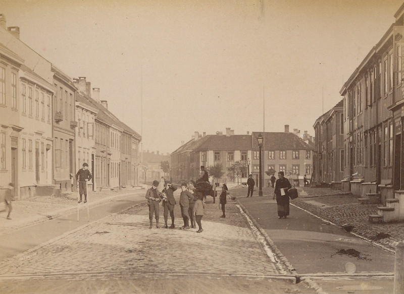
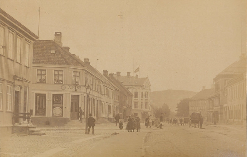
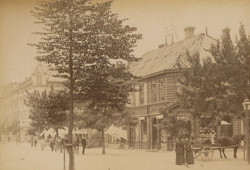
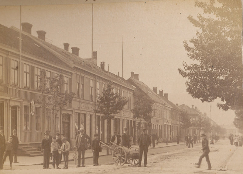
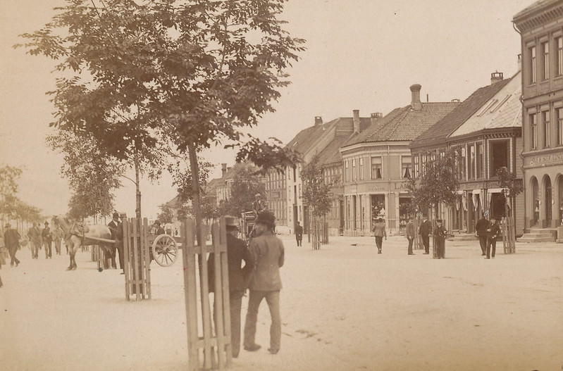
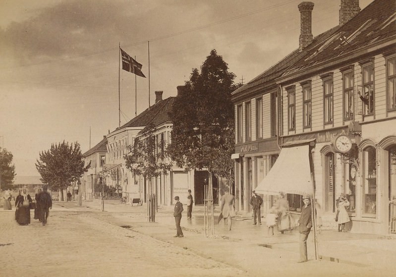
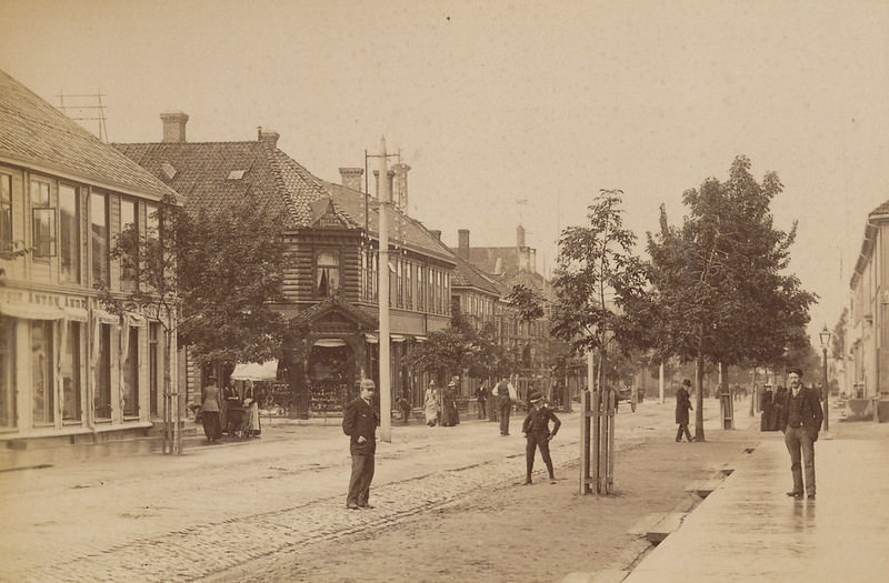
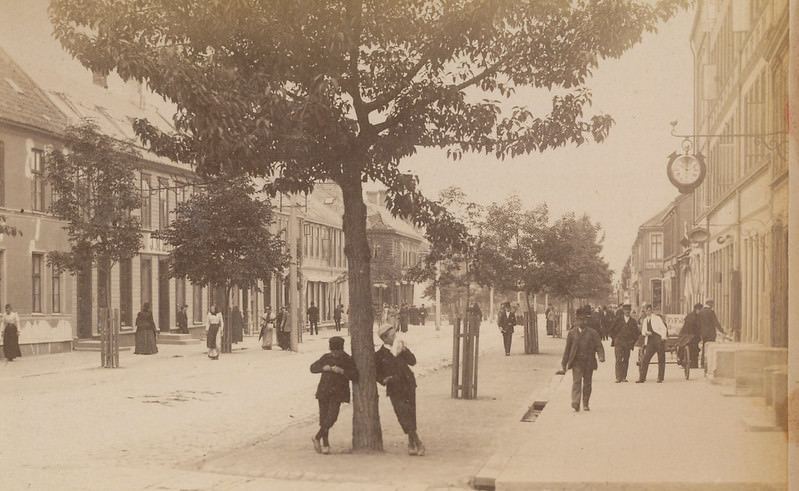
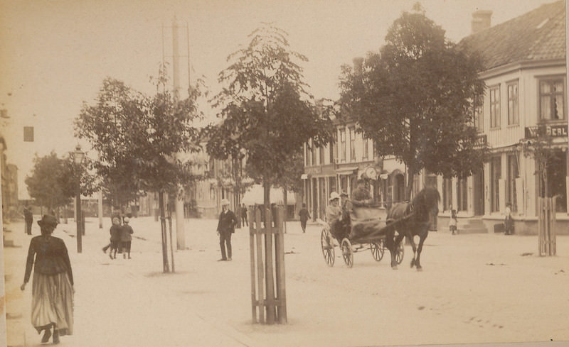
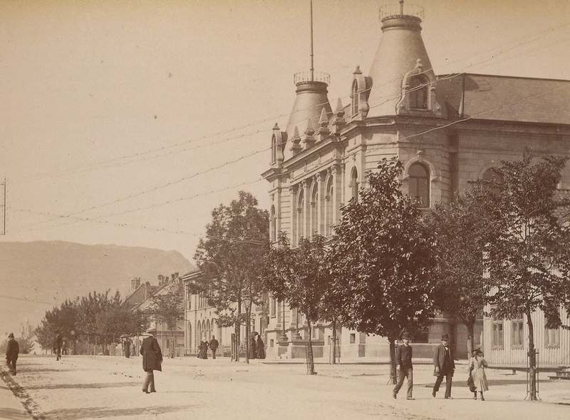
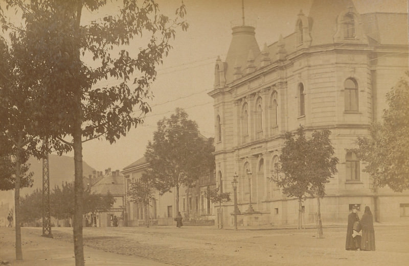
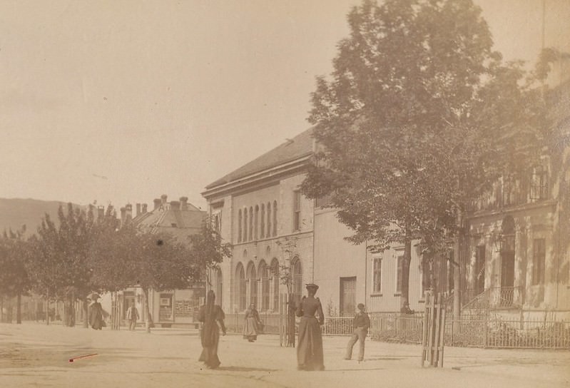
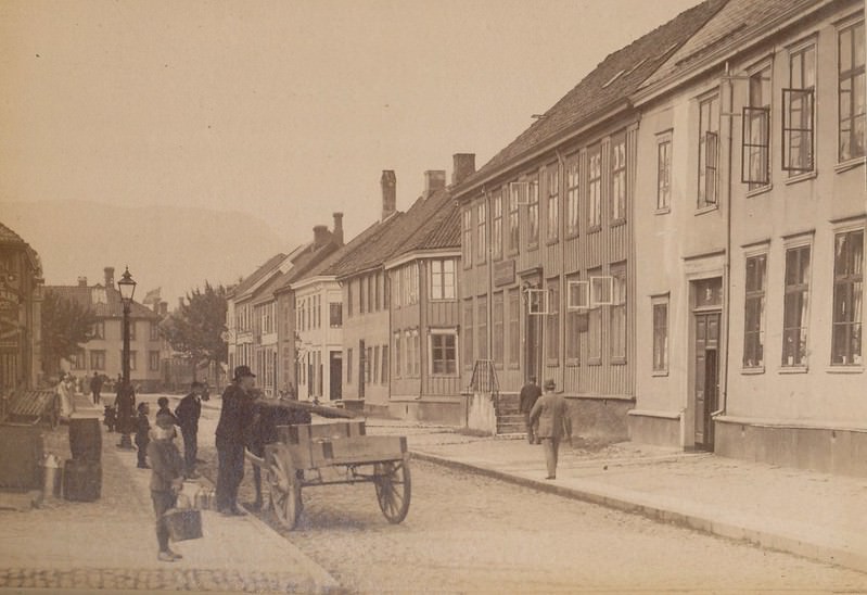
Dronningens street — Queen’s Street — was one of the main arteries running through the city center. These photographs capture it from multiple angles, showing wooden and stone-faced buildings lining either side, with horse-drawn traffic and pedestrians going about their daily routines.
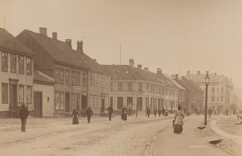
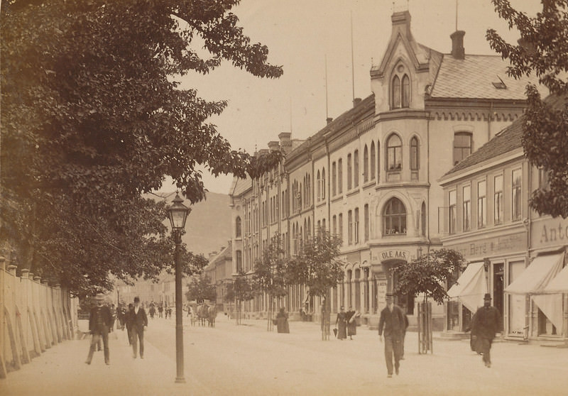
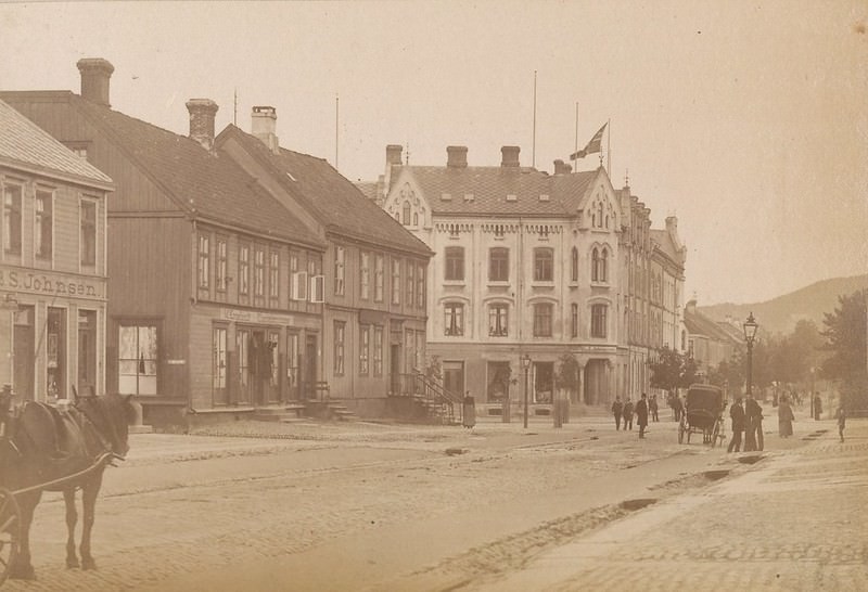
Fjordgata ran along the waterfront, where the jetties between Jomfrugata and Ravnkloa served the city’s shipping trade. Vessels anchored here regularly, and the area around Ravnkloa was a well-known gathering point at the edge of the city’s commercial district.
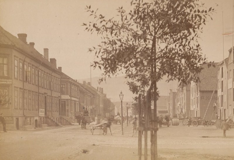
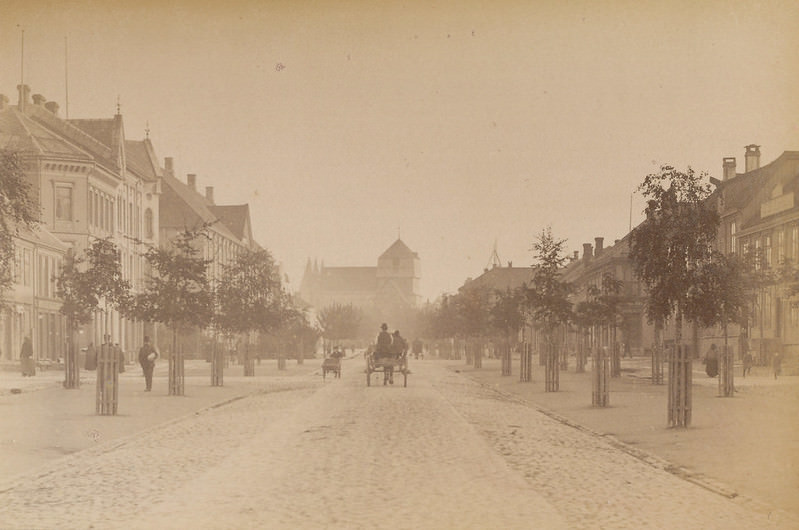
Munkegata was the city’s central spine, running from Torvet — the main square — straight toward Ravnkloa and the waterfront. Looking down Munkegata toward the Nidaros Cathedral, one of the great landmarks of medieval Scandinavia, the street presented a clear axis between commerce and religion that defined the city’s layout for centuries.
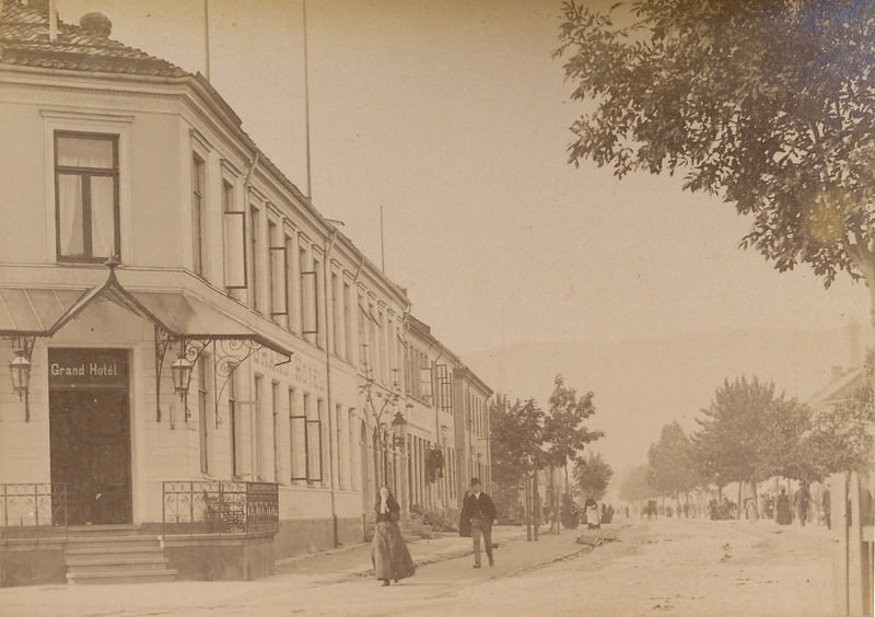
The Grand Hotel stood in Strandgaten, one of the more prominent buildings in the city’s commercial zone. Nearby, the Nordenfjeldske Kreditbank and the Britannia Hotel represented the financial and hospitality establishments that served Trondheim’s growing business community.
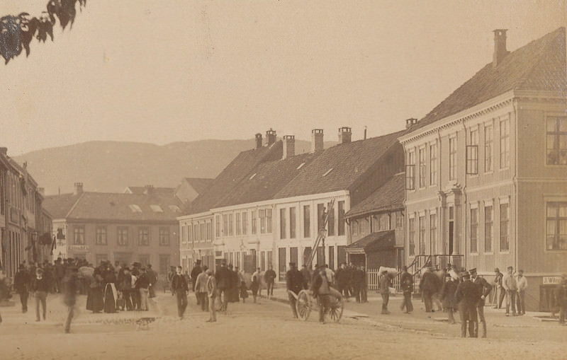
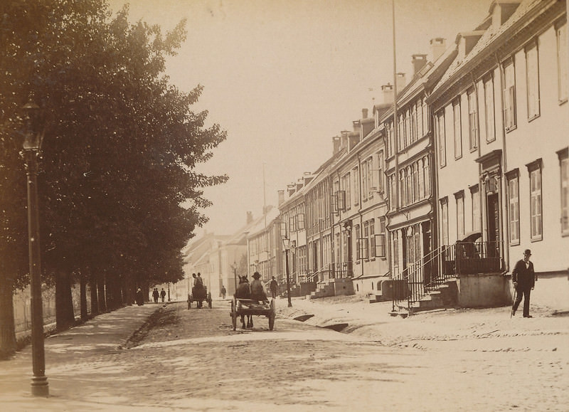
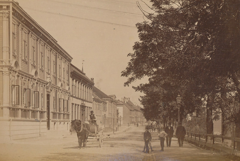
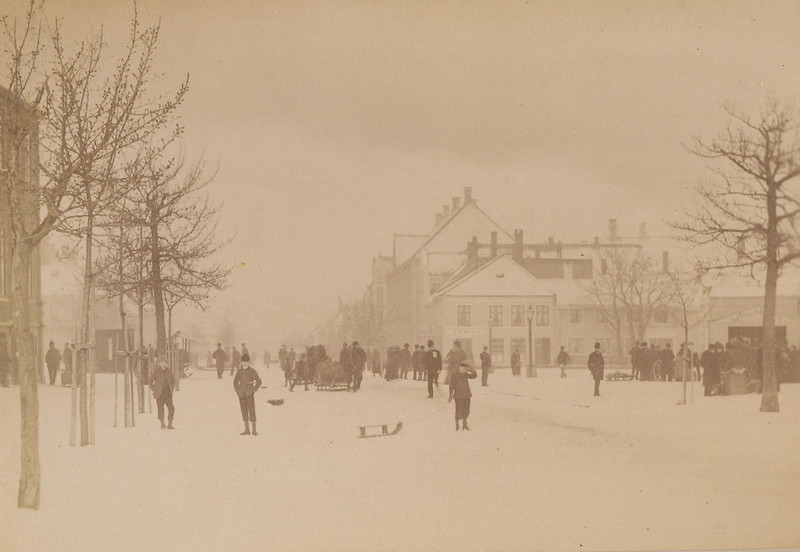
Kongens gate — King’s Street — stretched through the city in several directions, photographed here toward Ila Church, the Hospital Church, Munkegata, and Prinsens street. These images show a street with mixed-use buildings: ground-floor shops, upper-floor residences, and the steady movement of city life in between.
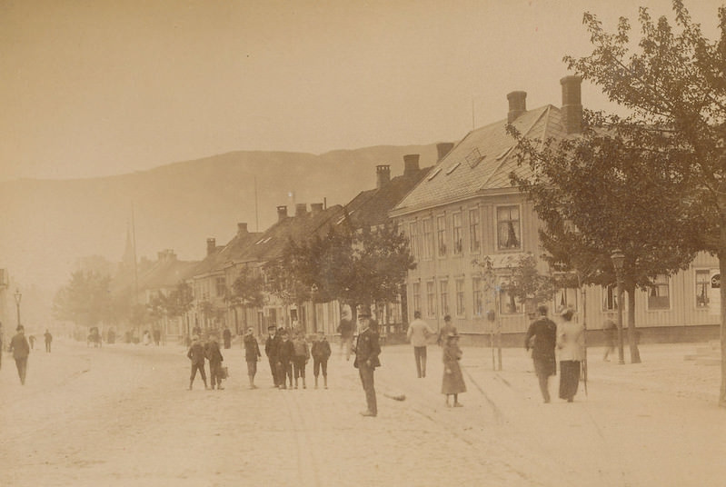
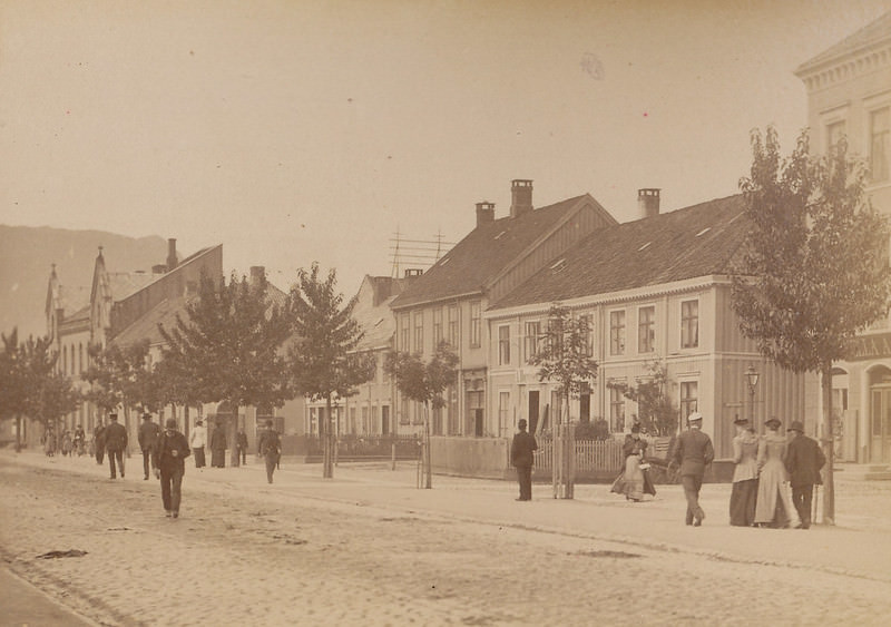
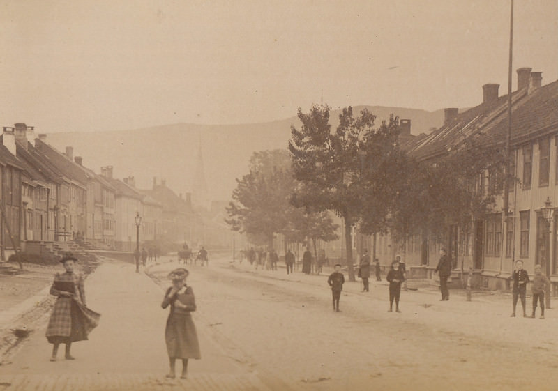
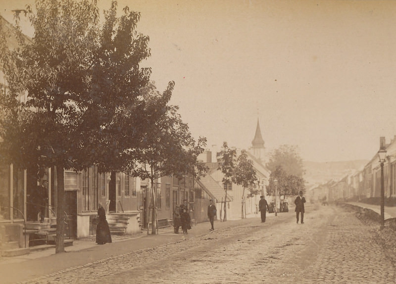
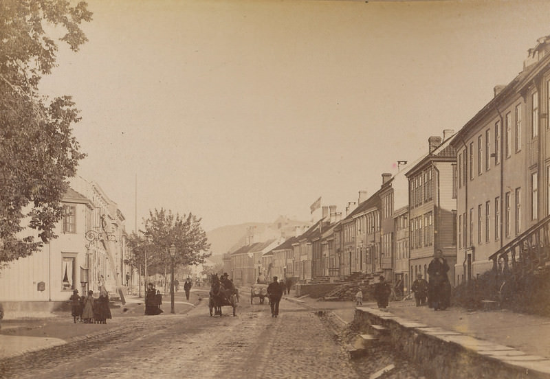
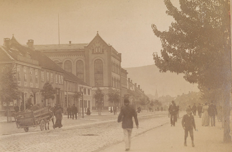
Munkegata appears throughout this collection from many vantage points — toward Ravnkloa, alongside Torvet, and at its various intersections. The street was wide and well-traveled, lined with substantial buildings that reflected the city’s economic standing by the late 19th century.
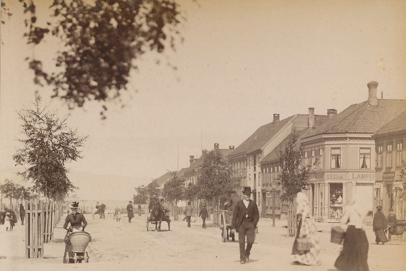
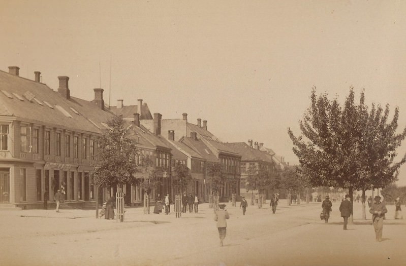
Banking and finance had a visible presence in 1893 Trondheim. The Nordenfjeldske Kreditbank operated alongside the Britannia Hotel, and Trondhjems Sparebank — the city’s savings bank — occupied a prominent building captured here in two separate photographs. These institutions served a city that was actively growing its trade networks both regionally and internationally.
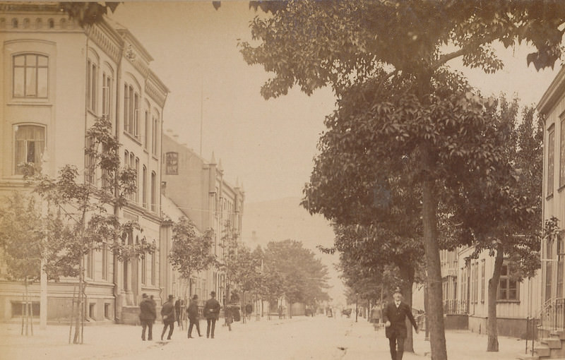
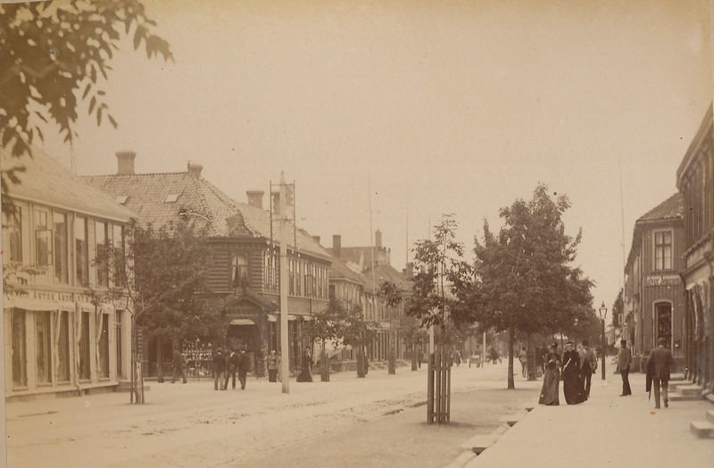
Our Lady Church and Hornemannsgården appear in two photographs from the collection. The church was one of the older religious structures in the city, and its surrounding neighborhood carried an older architectural character compared to the more recently rebuilt commercial districts.
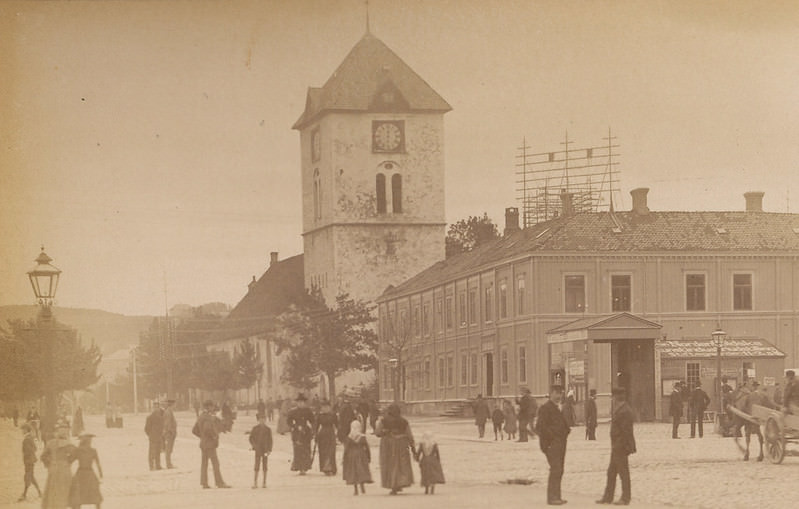
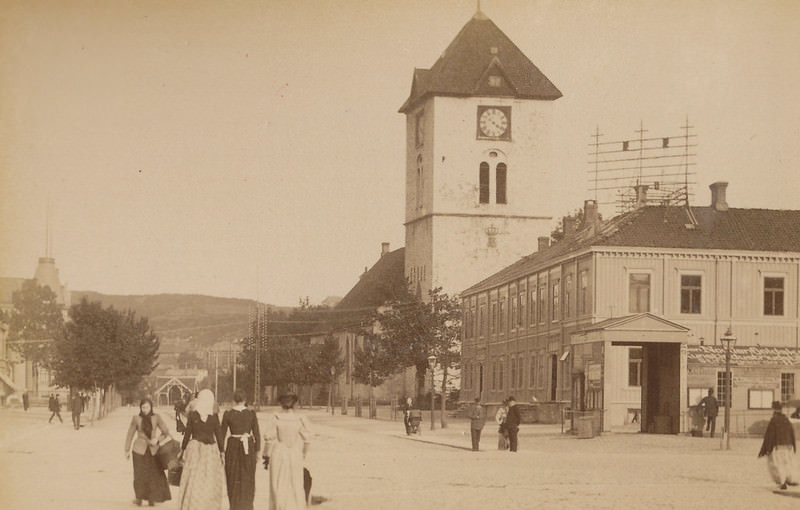
One photograph shows a police constable standing in Munkegata — a rare human-centered image among these largely architectural street scenes. The presence of uniformed officers on the street reflects the city’s organized civic structure by 1893. Nearby, soldiers were photographed in Erling Skakkes street, adding a military dimension to this visual record of the city.
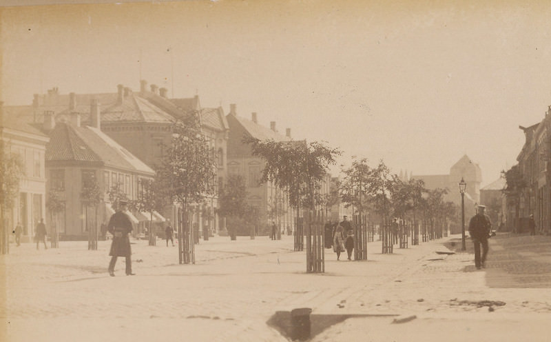
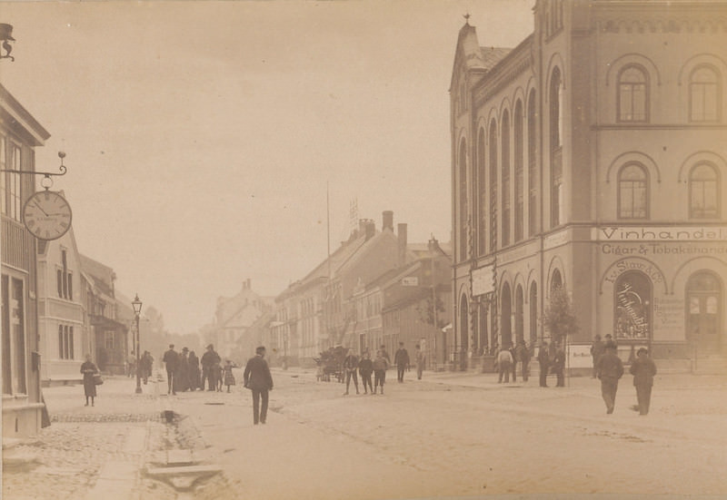
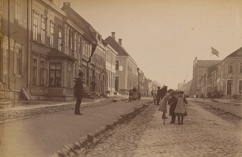
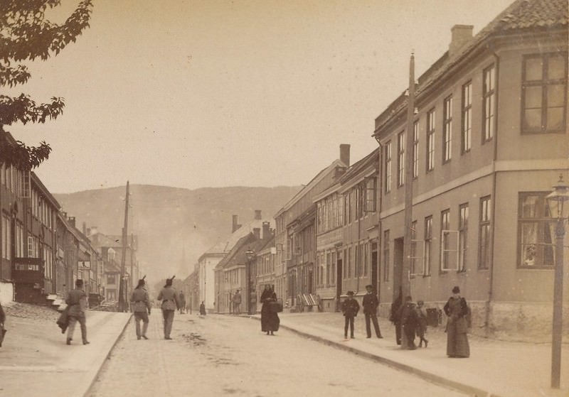
Trondhjems Arbeiderforening — the Workers’ Association — appears in photographs on both Prinsens street and Kongens street. The organization represented the city’s labor movement at a time when industrial and working-class organizing was gaining momentum across Norway. Its dual presence in these street photographs speaks to its active role in city life.
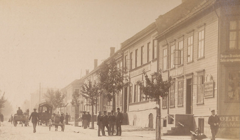
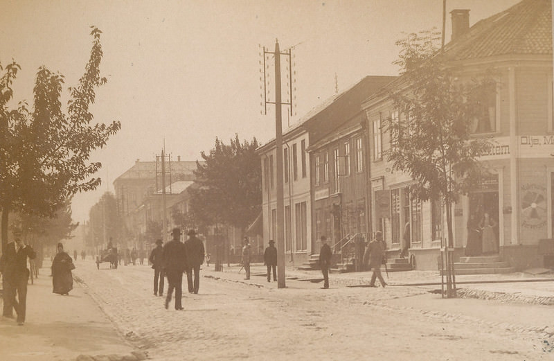
Stiftsgården — the royal residence in Trondheim and one of the largest wooden buildings in Scandinavia — stands captured in its own photograph here. Built in the 18th century after the great fires, it served as the official royal residence in the city, and its scale set it apart from the commercial and civic buildings that surrounded it.
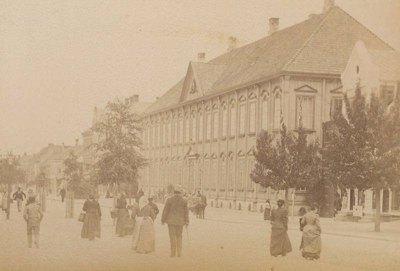
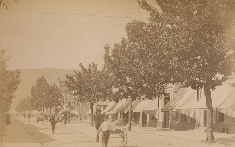
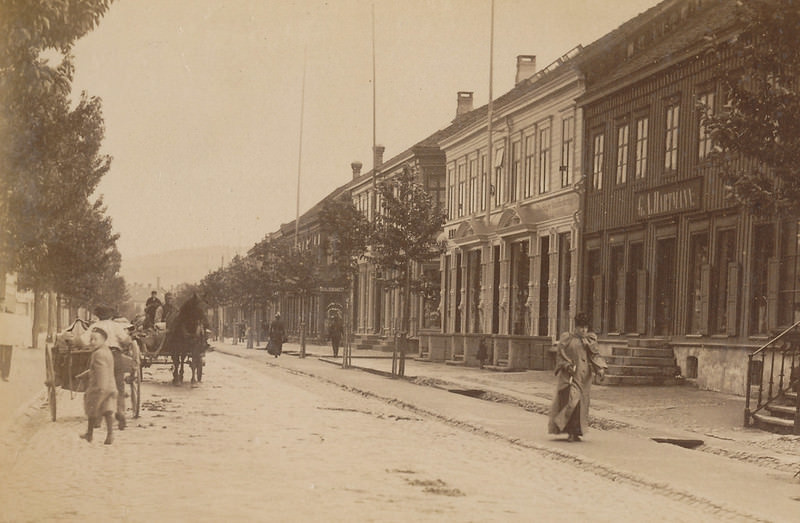
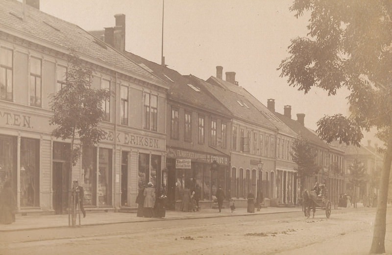
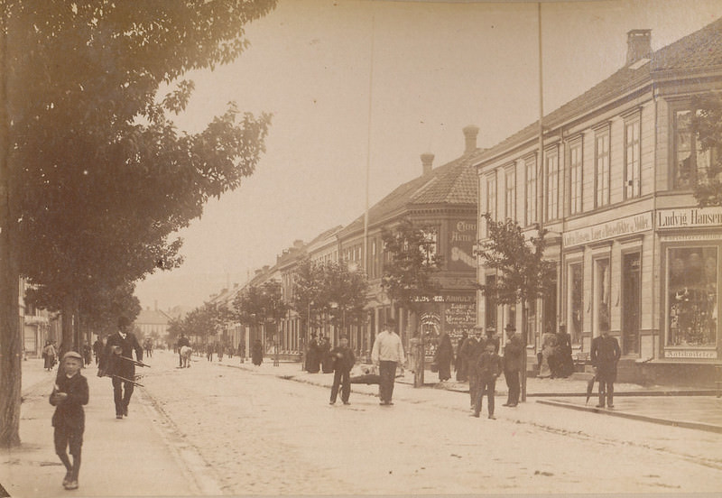
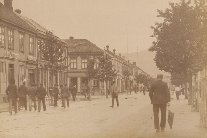
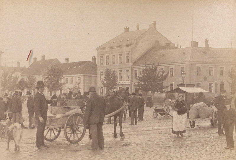
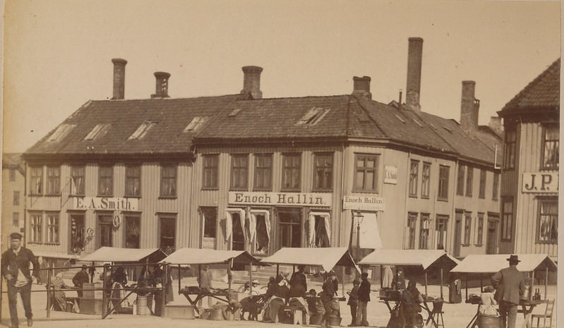
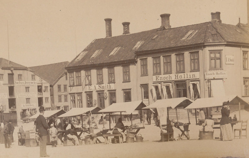
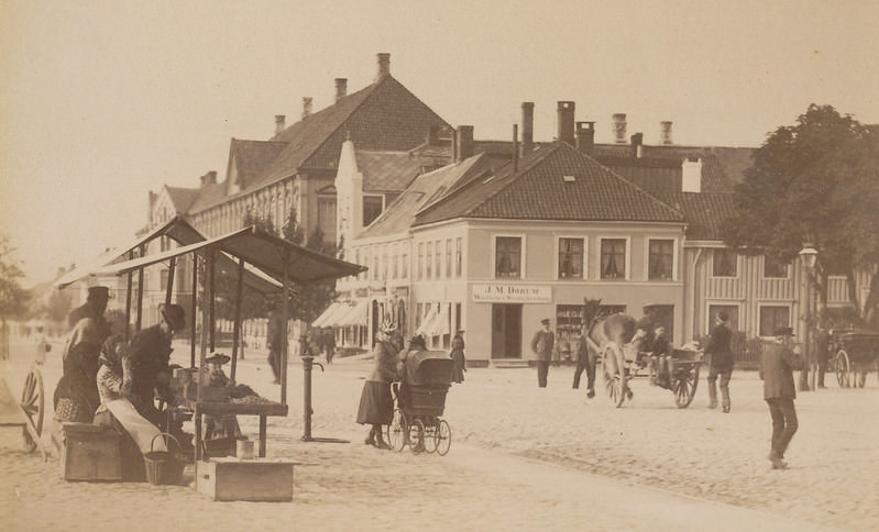
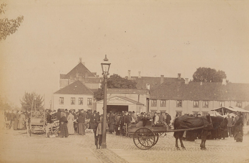
Torvet, the central market square, was the heart of public life in 1893 Trondheim. The horseshoes at Torvet — a term referring to the semicircular arrangement of market stalls or waiting areas — gave the square a distinct character. Multiple photographs show Torvet from different angles, capturing the open space that anchored the city’s commercial and social activity.
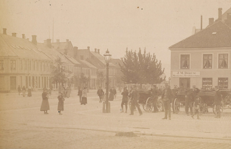
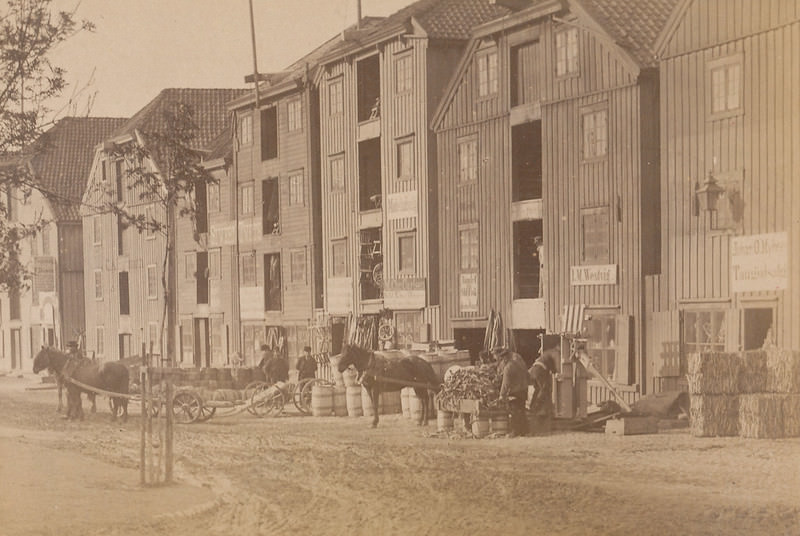
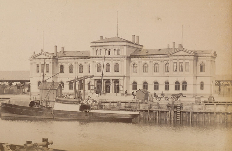
Trondheim Central Station appears in this collection as well, documenting the city’s rail connection that linked it to the broader Norwegian and eventually European rail network. The station’s presence in 1893 reflects how deeply the industrial age had reached into even this historically ancient city. Alongside it, the White Star Line’s emigration office on Carl Johans street tells a starker story — thousands of Norwegians used offices like this one to book passage to America during the great emigration wave of the late 19th century.





Either they mean 19th century or Trondheim has changed a lot recently
I can’t imagine how much worse their dialect sounded back then!
Very cool to see! I am struck at how wide the steets are and how many buildings are still up.
Da disse bildene ble tatt, bodde min farfars farfar, Thomas Bryn (1813-1902), i Munkegt 17 sammen med sine to yngste barn (Marie og Kristian), en leietaker, en kokkepike og en stuepike. Han var stadsfysikus (fylkeslege) i Trondheim 1858-1890. Dette bildet er trolig tatt fra innsiden av Munkegt. 17 på 1890-tallet. Han sitter sammen med sin søster Fredrikke. Bildet bak ham er hans kone Christine Richter, som døde i 1869 etter sin tolvte fødsel.
veldig kult. hvor lå strandgata?