Hey There! Before You Go. 😧
Get the best vintage content straight into your inbox!

Don't worry, we don't spam

What Vancouver looked like in the 1980s Through These Fascinating Photos

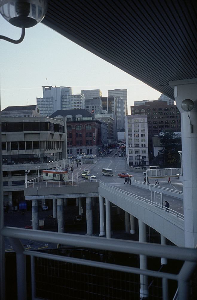
Vancouver in the 1980s was a city in motion. Cranes dotted the skyline, new transit lines were being carved through neighborhoods, and a world-class fair would soon put the city on the global map. These photographs capture everyday life during one of the most transformative decades in the city’s history — from the bridges over False Creek to the grocery stores lining Main Street, and from the quiet paths of Stanley Park to the electric buzz of Expo 86.
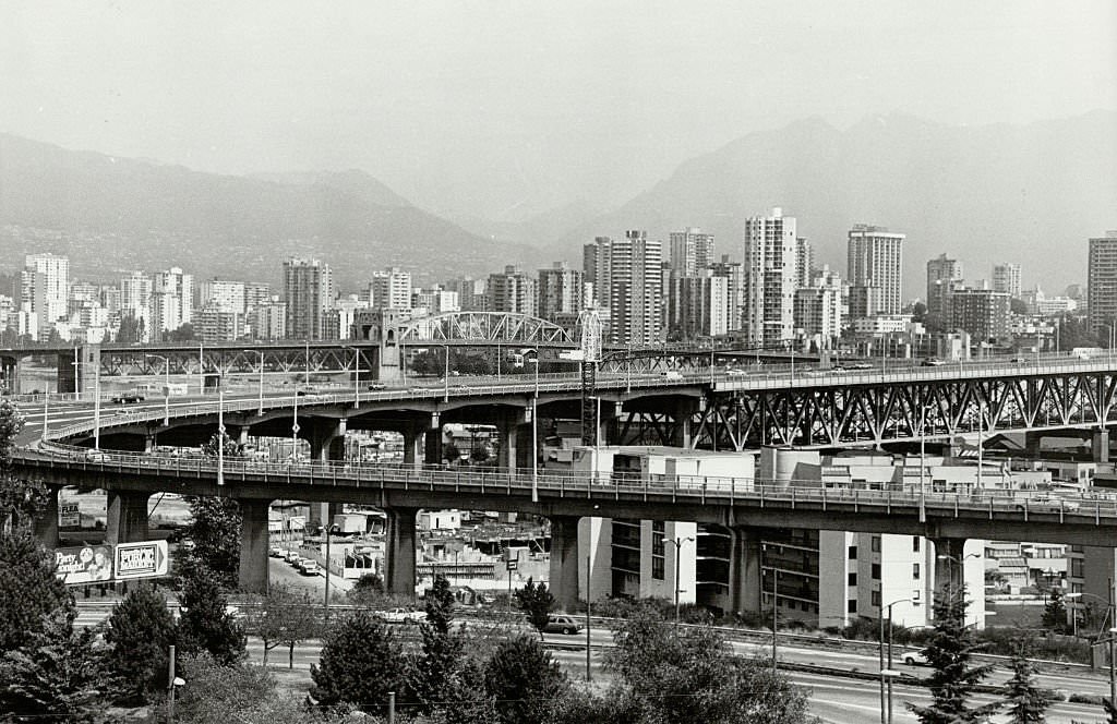
PR railway trestle and the Burrard Street bridge as seen from Granville Street Bridge, Vancouver, 1980

At the start of the decade, Vancouver’s waterways were framed by working infrastructure — railway trestles, bridges, and industrial shorelines that reflected the city’s roots as a port and trade hub. The view from Granville Street Bridge captured that layered landscape perfectly, with rail lines and road bridges stacked against the water.
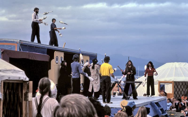
Flying Karamazov Brothers at Vancouver Folk Festival in Jericho Beach Park, Vancouver, 1982

Jericho Beach Park drew crowds for the annual Vancouver Folk Festival, where performers like the Flying Karamazov Brothers brought juggling, comedy, and theater to outdoor audiences. The festival was one of many regular community events that gave Vancouver’s summers a distinct cultural energy.
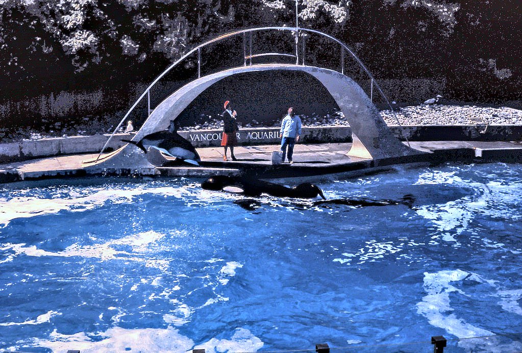
Vancouver Aquarium Orca Pool, 1980

The Vancouver Aquarium in Stanley Park was a major draw throughout the decade. In 1980, the orca pool was a central attraction, drawing visitors from across the region. Stanley Park itself remained one of the city’s most visited landmarks, offering everything from forested trails to formal teahouses.
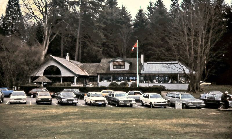
Ferguson Point Teahouse in Stanley Park, Vancouver, 1984

The Ferguson Point Teahouse sat within Stanley Park’s tree canopy, offering a civilized pause for visitors exploring the park’s seawall and gardens. It was one of the park’s most beloved spots — unchanged in atmosphere even as the rest of the city shifted around it.
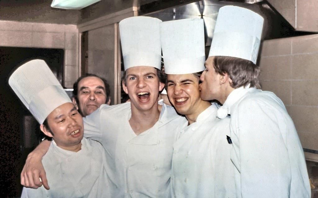
Bayshore Inn Kitchen Staff, Vancouver, 1980

Behind the scenes at some of Vancouver’s finest hotels and restaurants, large kitchen teams kept service running. The Bayshore Inn, positioned along Coal Harbour, was one of the city’s premier hospitality addresses in 1980, and its kitchen staff worked at the level the hotel’s reputation demanded.
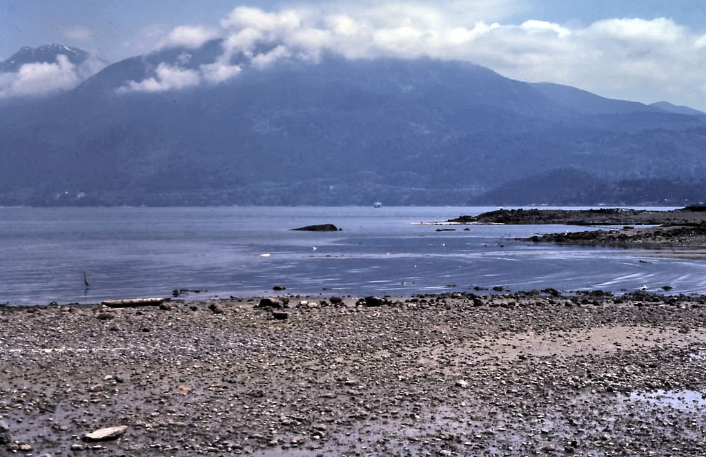
Bowen Island Coast, Howe Sound, 1980

Just a ferry ride from Horseshoe Bay, Bowen Island offered a sharp contrast to downtown Vancouver. In 1980, the shoreline was quiet — a heron fishing at low tide, the ferry crossing Howe Sound, and a clear view back toward the West Vancouver coast. It was the kind of scene that reminded residents how close wilderness sat to the city.
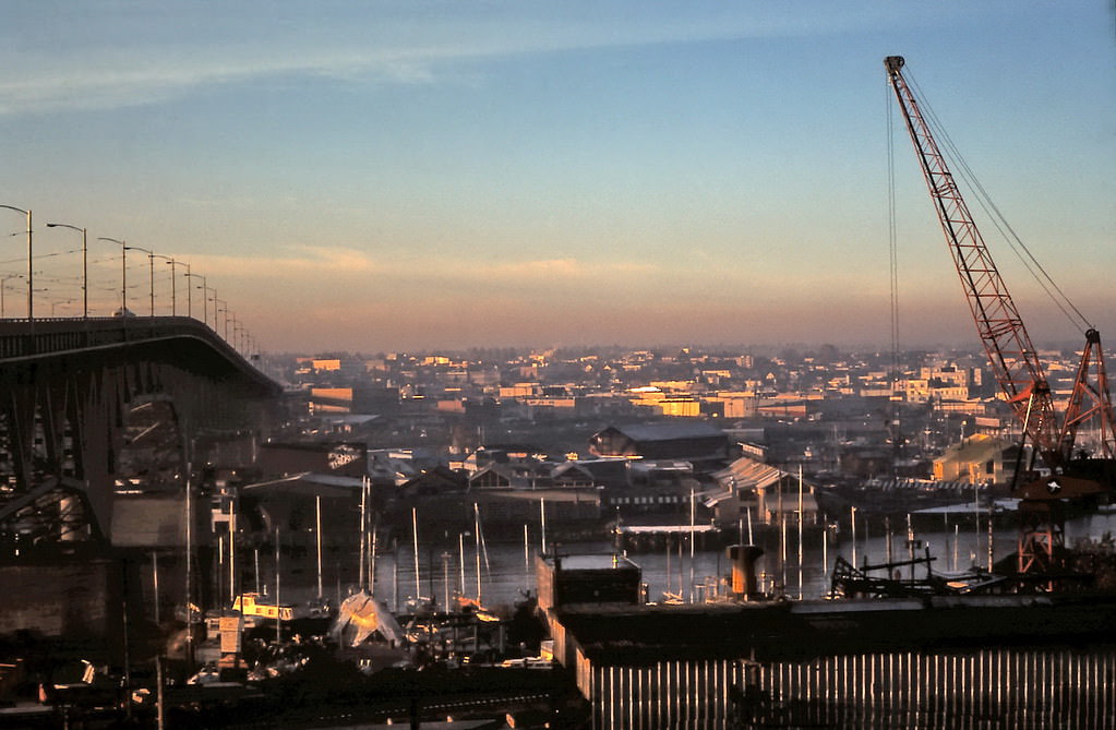
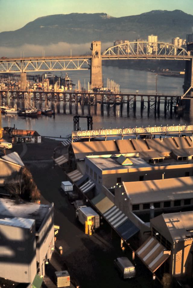
View south from walkway at north end of Granville Street Bridge, looking across False Creek to Granville Island and Kitsilano.

False Creek was a working waterway throughout the early part of the decade, with industrial activity still visible along its shores before redevelopment took hold. Granville Island, tucked beneath the bridge, had only recently been transformed from a heavy industrial site into a public market and arts hub.
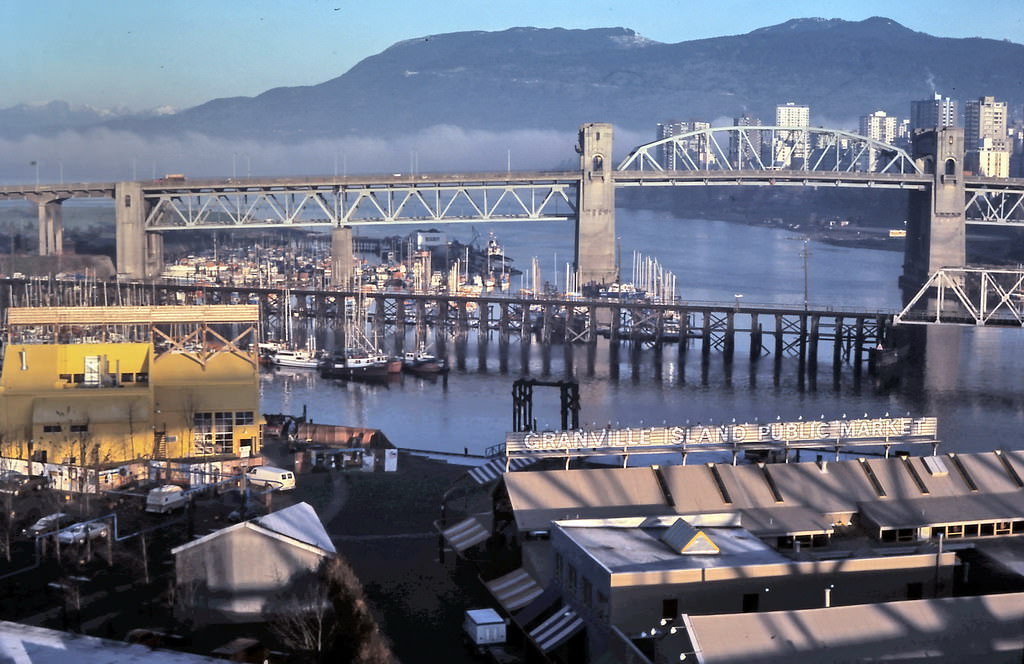
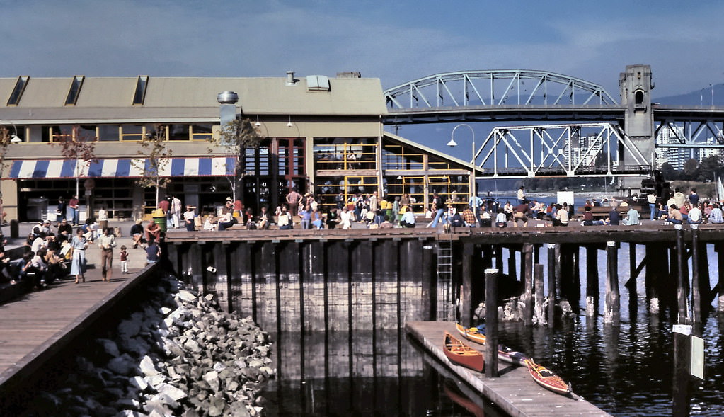
Granville Island Bridges View, Vancouver, 1980.
Granville Island Market & Bridges, Vancouver 1980

By 1980, Granville Island’s public market was already attracting steady foot traffic. Fresh produce, seafood, and local goods filled the market stalls under the shadow of the Granville Street Bridge. The island quickly became one of the most visited destinations in the city.
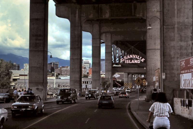
Entrance to Granville Island, under the Granville Street Bridge, Vancouver, 1984

The approach to Granville Island, running beneath the concrete arches of the Granville Street Bridge, gave the market its distinctive character. The narrow entrance tucked under the bridge became one of Vancouver’s most recognizable urban passages.
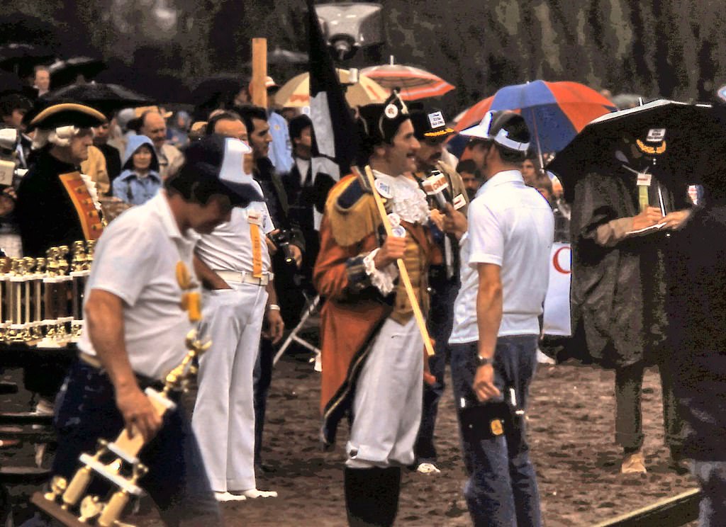
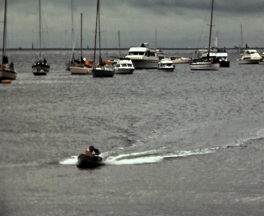
Frank Ney at Vancouver end of Bathtub Race, Kits Beach 1981
Vancouver arrival of Nanaimo Bathtub Race, Kitsilano, 1981

The Nanaimo to Vancouver Bathtub Race was one of the quirkier traditions on the B.C. coast. Competitors raced motorized bathtubs across the Strait of Georgia and arrived at Kitsilano to crowds of spectators. Nanaimo’s mayor Frank Ney was a devoted supporter of the race and a fixture at the finish line.
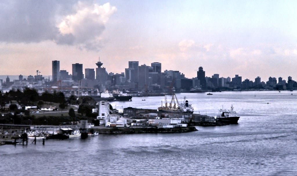
Vancouver from Second Narrows Bridge, 1981.

From the Second Narrows Bridge, the city spread out across the inlet — apartment towers climbing in the West End, industrial yards along the east waterfront, and the mountains framing the entire scene to the north. This vantage point made clear just how dramatically Vancouver’s geography shaped its growth.
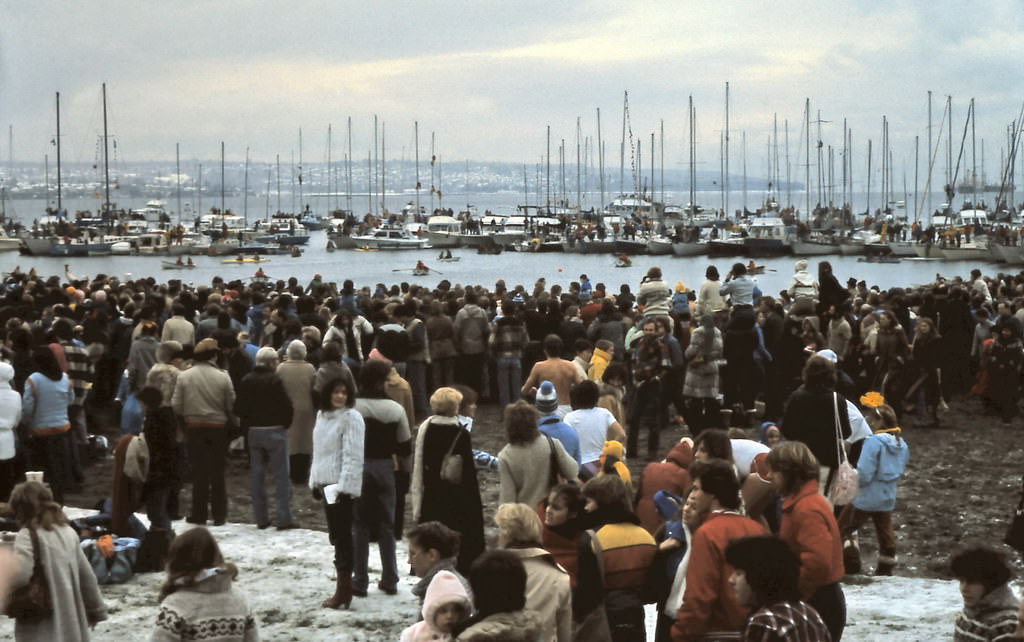
New Years Day annual Polar Bear Swim, Vancouver 1982

Each New Year’s Day, hundreds of Vancouverites charged into the cold waters of English Bay for the annual Polar Bear Swim. The tradition dated back to 1920, and by 1982 it drew thousands of spectators to watch the brave — or foolhardy — plunge into the Pacific in January.
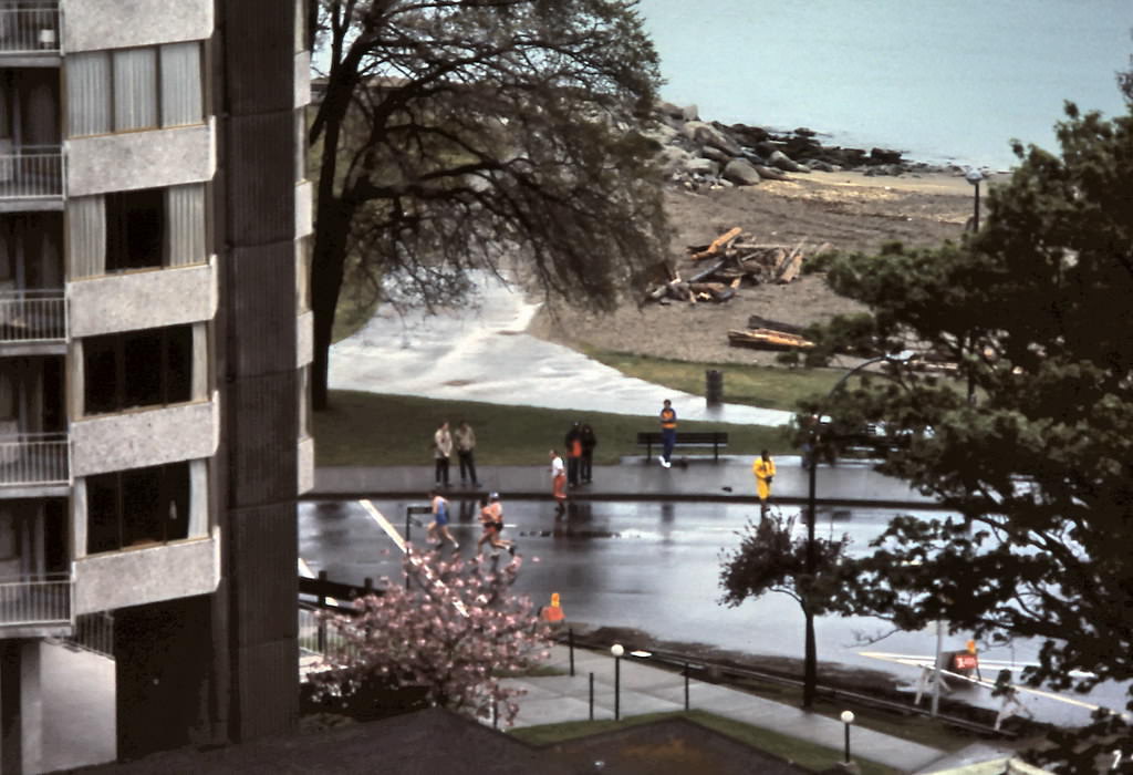
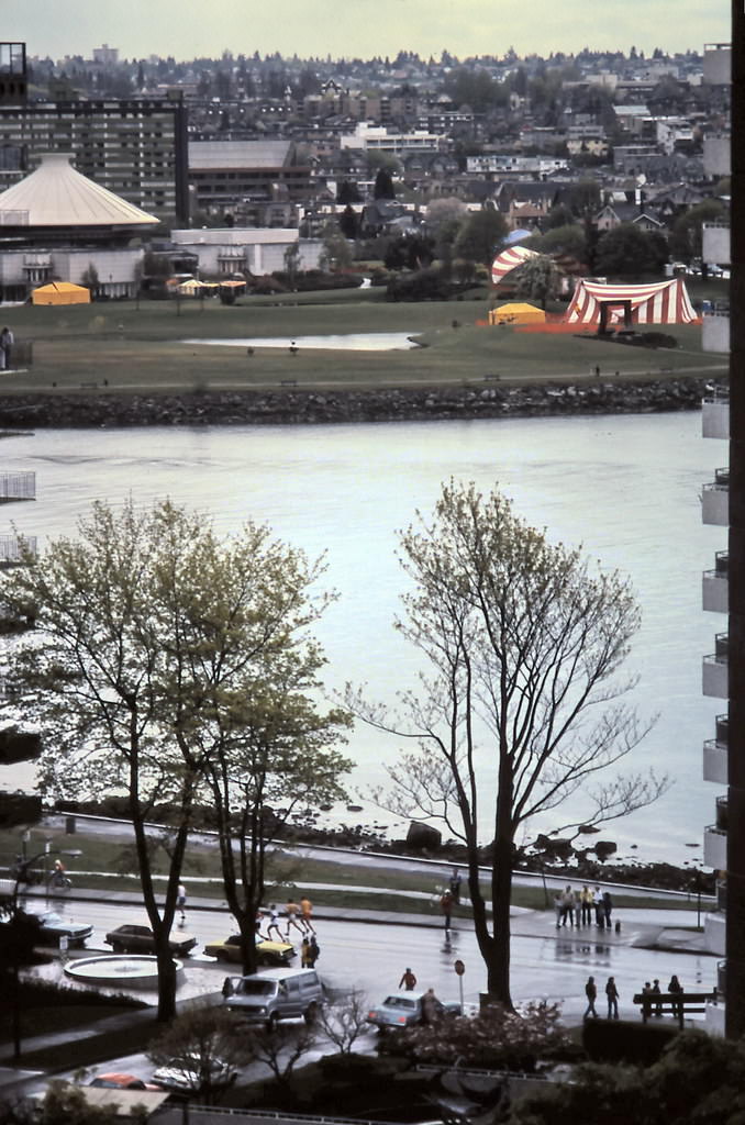
Vancouver marathon on Beach Avenue and the south end of English Bay Beach are seen in this view from a Burnaby Street apartment, Vancouver, 1982.
View of marathon run on Beach Avenue seen from a Burnaby Street apartment, Vancouver 1982.

Beach Avenue along English Bay was a regular route for Vancouver’s marathon runners. From apartment windows on Burnaby Street, residents had front-row views of the race as it wound along the waterfront. The 1985 Sun Run — a 10-kilometer race through downtown streets and Stanley Park — became one of the decade’s signature annual events, drawing thousands of participants.
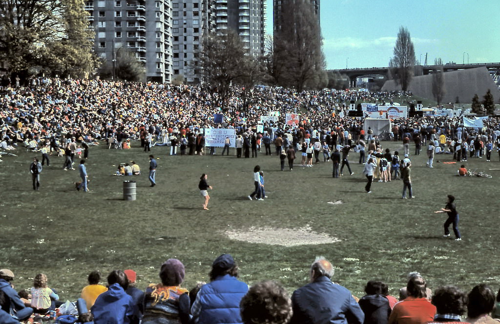
Peace March, Sunset Beach, Vancouver, 1982.

Sunset Beach was a gathering point for the city’s anti-war movement. Peace marches drew large crowds to the waterfront throughout the decade, with Sunset Beach serving as both an assembly point and a finish line for protesters moving through downtown Vancouver.
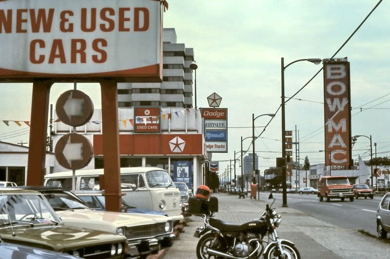
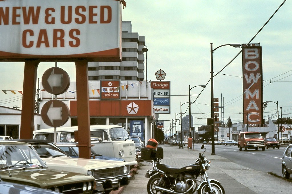
Looking east from 1200 block of West Broadway in Vancouver, 1982
Looking east from 1200 block of West Broadway in Vancouver, 1982.

West Broadway in 1982 was a mix of car dealerships, neon signs, and neighborhood commerce. The BowMac sign — famous as the largest neon sign in Canada — loomed over Plimley Dodge Chrysler Plymouth’s lot. It was a stretch of commercial Vancouver that felt deeply rooted in the postwar era, even as the city around it was changing fast.
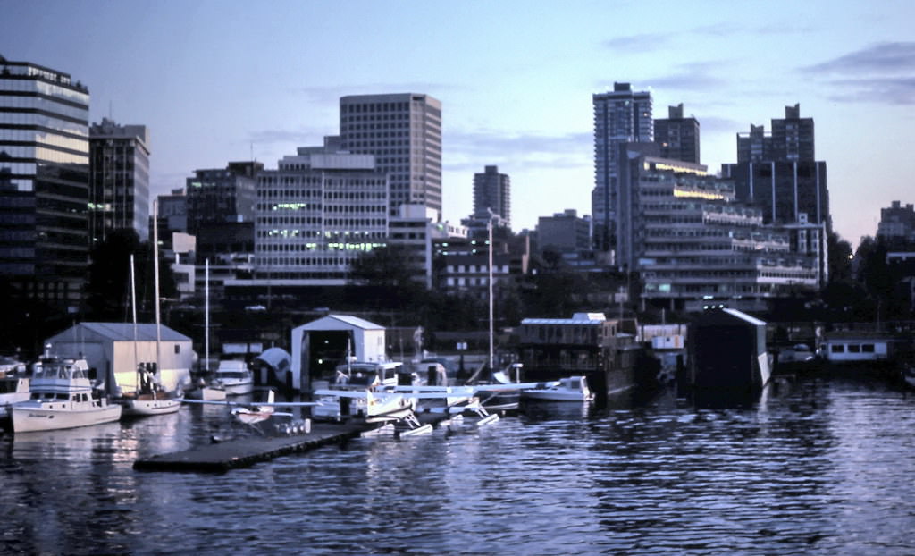
Coal Harbour view of Vancouver's West End 1983.
Coal Harbour view of Vancouver’s West End 1983.

Coal Harbour in 1983 still showed its working-waterfront origins. CPR freight tracks ran all the way to Cardero Street, and the marina shared space with old boat workshops and storage yards. The apartment towers of the West End rose behind it all, creating a striking contrast between industrial infrastructure and residential density.
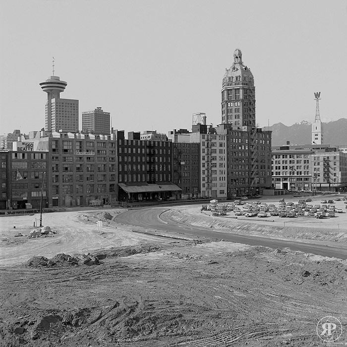
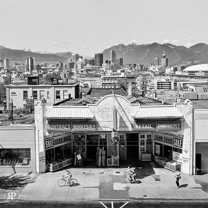
500 Block Beatty Street (rear view), Vancouver, 1983
Broadway & Heather, Vancouver, 1983
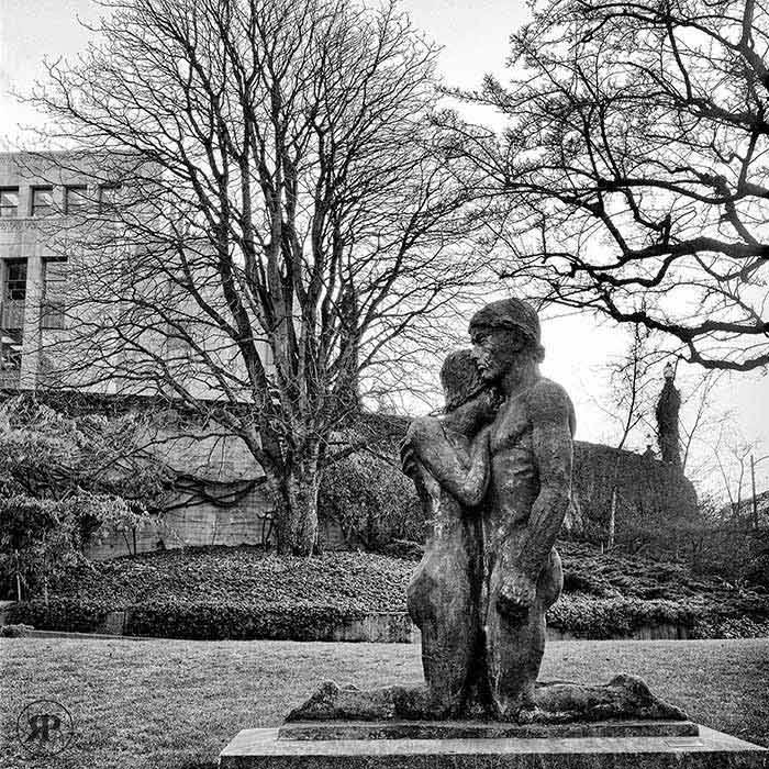
The Lovers, Vancouver City Hall, 1983

Vancouver City Hall, built in 1936, remained a centerpiece of the city’s civic identity in the 1980s. Its grounds featured public sculpture, including the well-known piece photographed here in 1983. The building’s art deco architecture stood as one of the finest examples of Depression-era civic design in Canada.
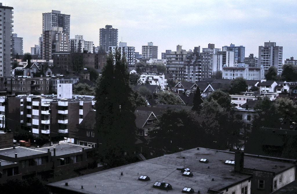
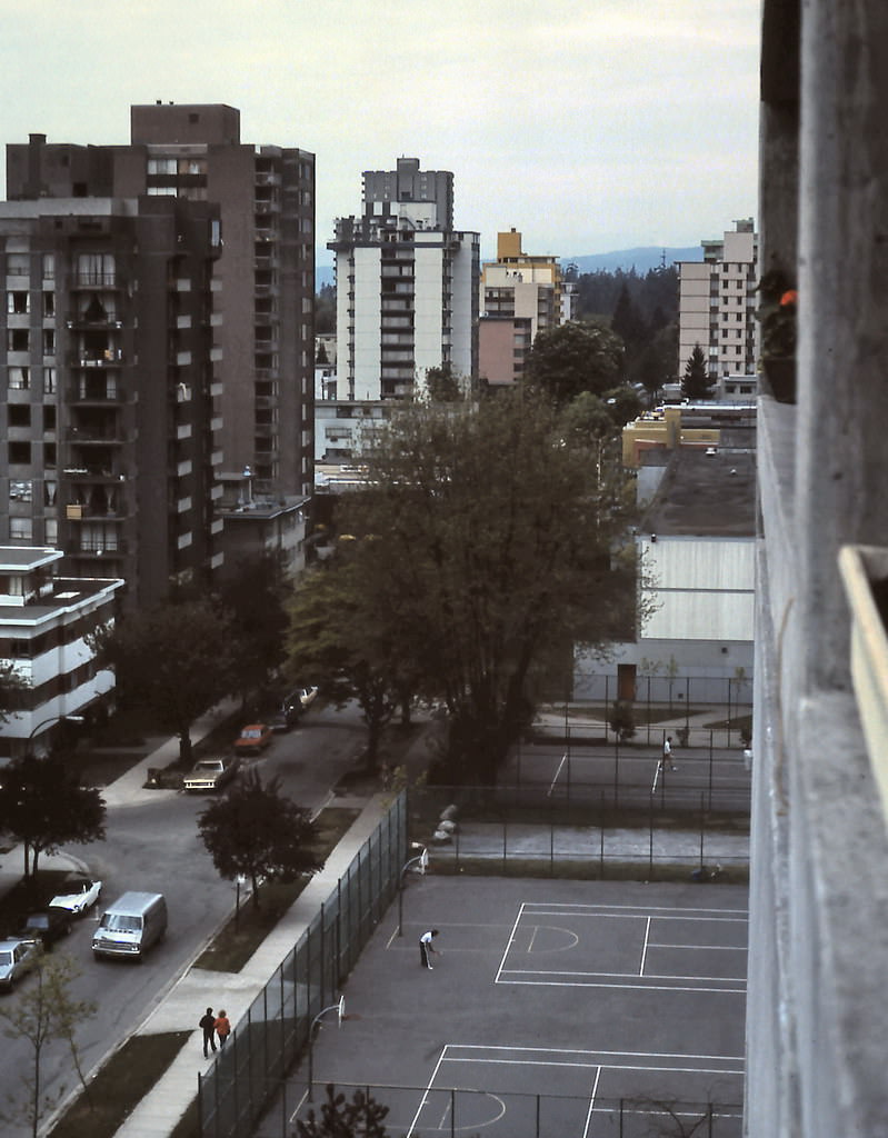
West End from Barclay Street, Vancouver, 1983
Barclay Street View, Vancouver's West End, 1983
Barclay Street View, Vancouver’s West End, 1983

The West End’s Barclay Street retained a residential calm in 1983, lined with older apartment buildings and tree-covered sidewalks. It was one of the denser neighborhoods in North America by this point, packed with low-rise and mid-rise buildings that had replaced many of the area’s original Victorian homes in the 1960s and 70s.
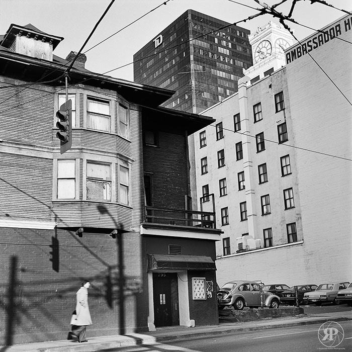
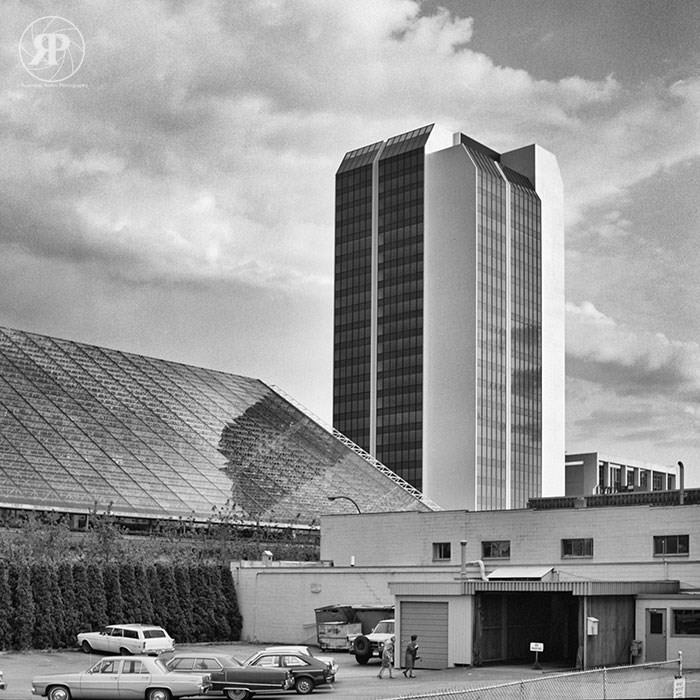
Ambassador Hotel, Robson & Seymour, Vancouver, 1983
Law Courts (rear) & Nelson Square Tower, Vancouver, 1983
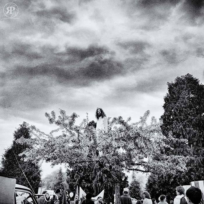
Cherry Tree Jesus, Vancouver, 1983

Downtown Vancouver’s streets in 1983 held a mix of heritage buildings, new towers, and the occasional unexpected detail — like the image of Jesus seen in a cherry tree that drew attention on one city block. Robson Street was evolving quickly, shifting from a German-influenced retail strip into a broader commercial corridor.
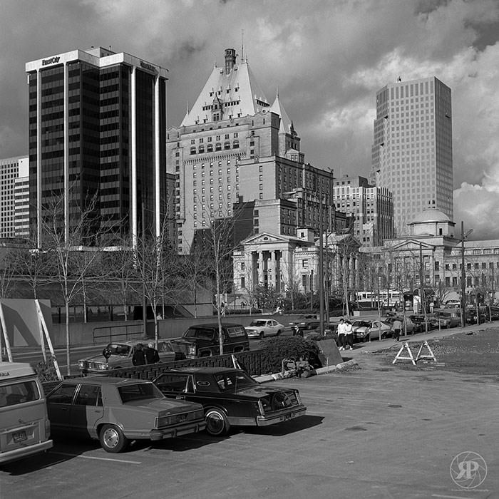
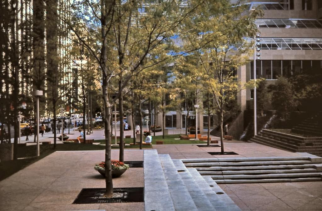
Robson Square, 1984
Robson Square, 1984

Robson Square, designed by architect Arthur Erickson, opened in stages through the early 1980s. The sunken plaza and stepped terraces connected the law courts, provincial government offices, and the Vancouver Art Gallery in a single civic complex. It was a bold piece of urban design that placed pedestrian space at the center of downtown.
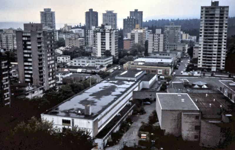
View west from apartment on Barclay Street, Vancouver, 1983
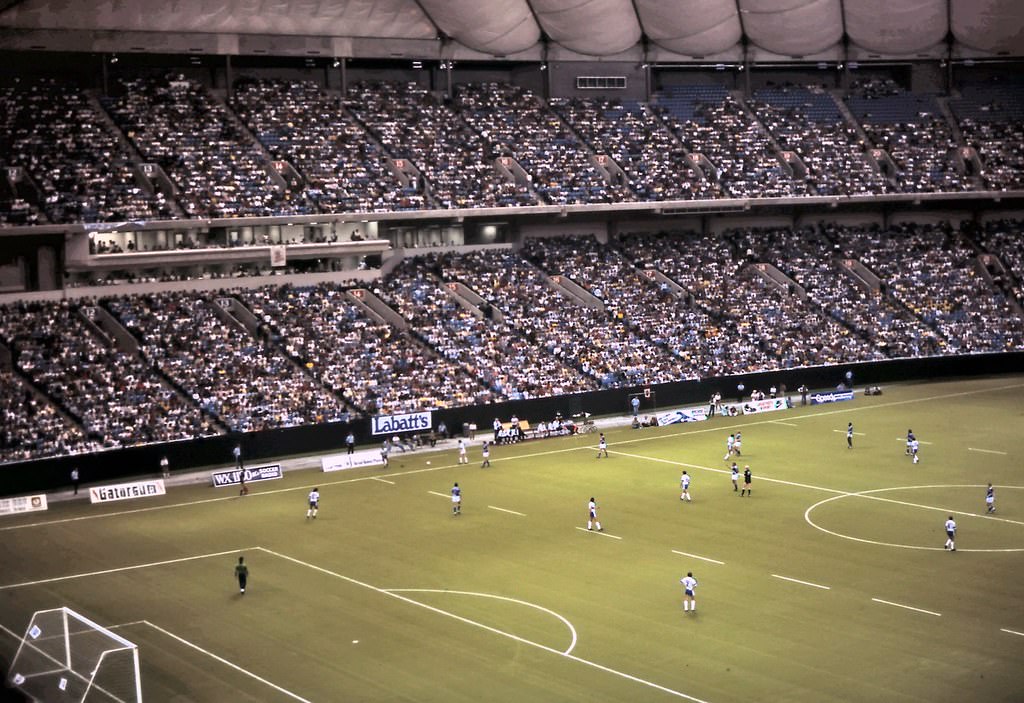
Whitecaps NASL Soccer, BC Place Stadium, Vancouver, 1983

B.C. Place Stadium’s construction began in 1981, and its roof was inflated in 1983, making it the world’s largest air-supported dome at the time. It held 60,000 people and immediately became the home of the Vancouver Whitecaps of the North American Soccer League. The stadium’s giant white dome reshaped the False Creek skyline and gave Vancouver a venue capable of hosting major international events.
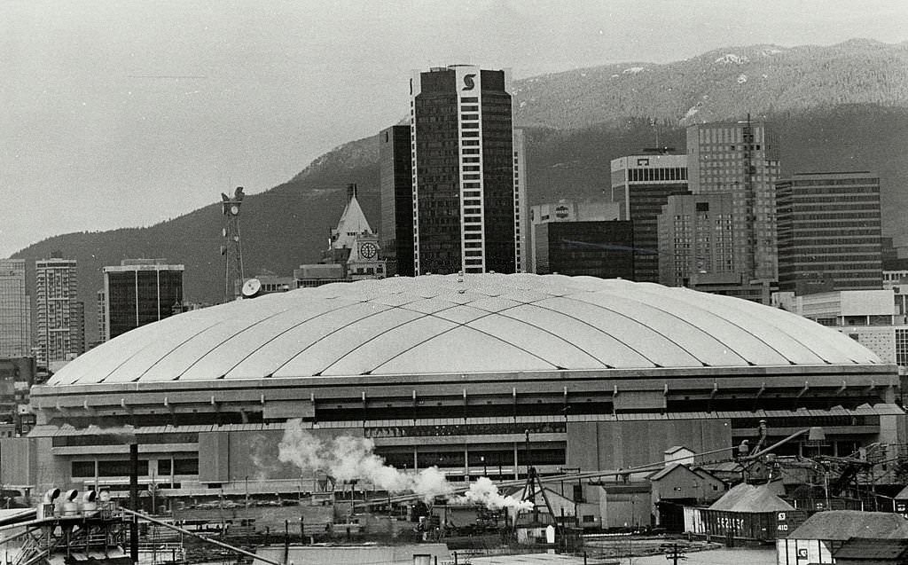
Operation of one of the newest of domed stadia, Vancouver, 1980s

The inflatable dome at B.C. Place was a mechanical feat. Air pressure kept the massive roof aloft around the clock, and the system required constant management. It was the defining image of Vancouver’s ambition in the early 1980s — a structure that announced the city was ready to compete on the world stage.
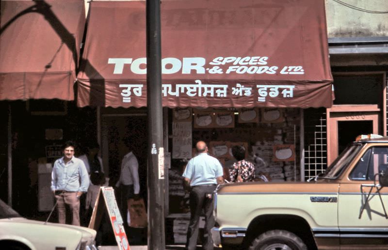
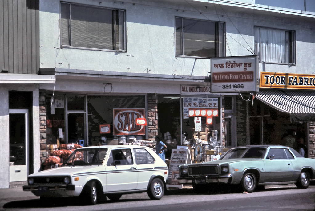
Toor Spices & Foods Ltd., a grocery store on Main Street, Vancouver, 1984

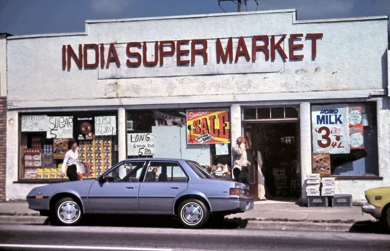
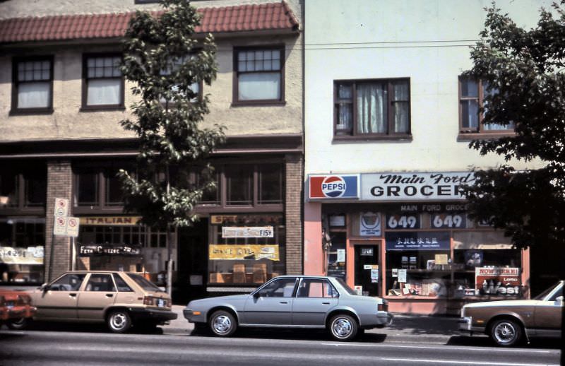
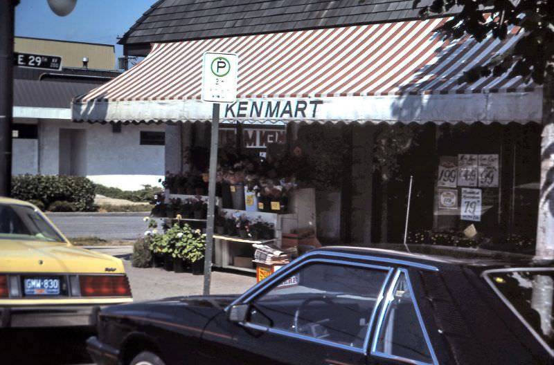
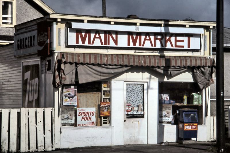
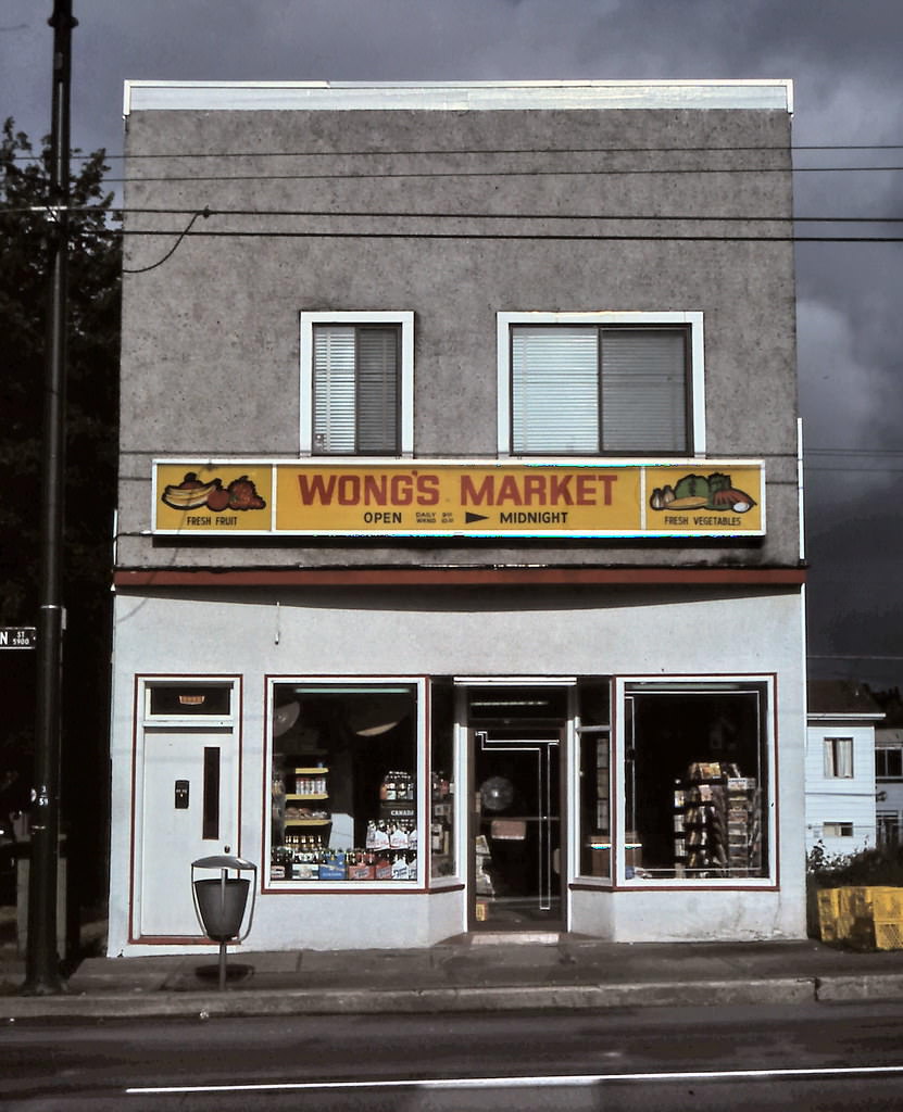
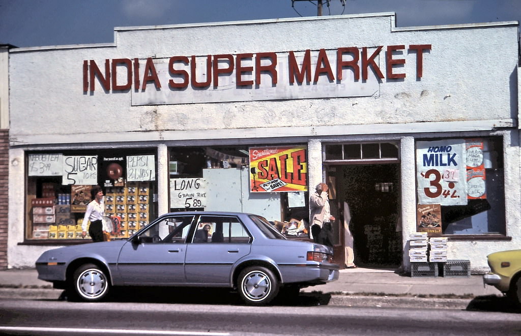
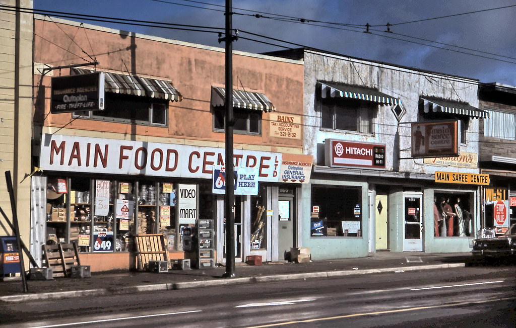
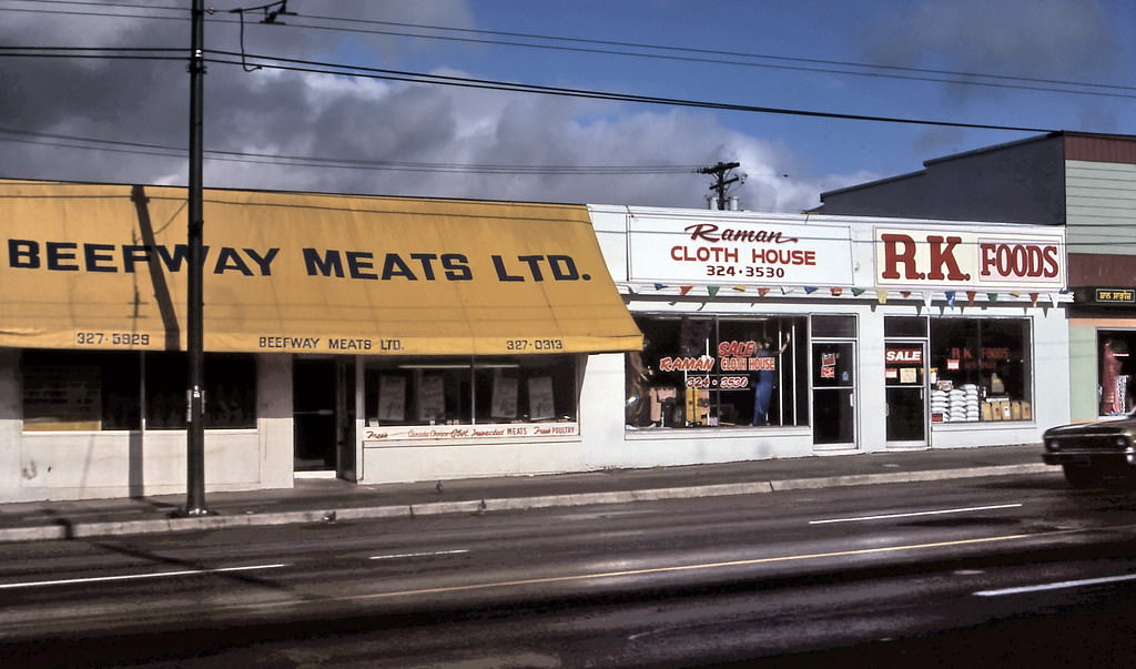
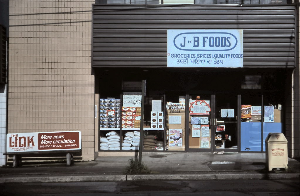
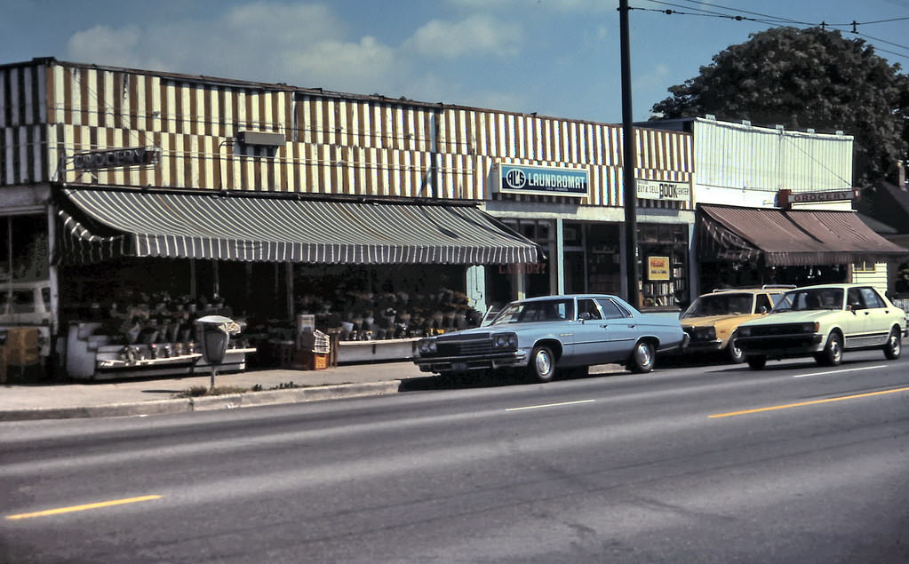
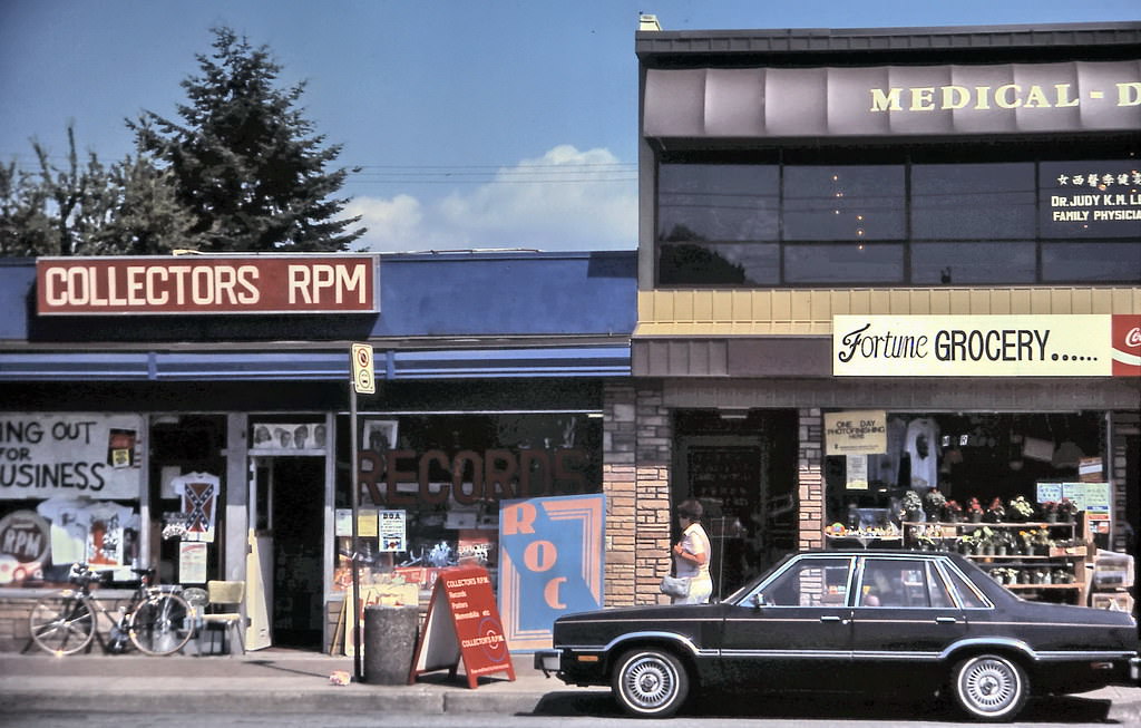
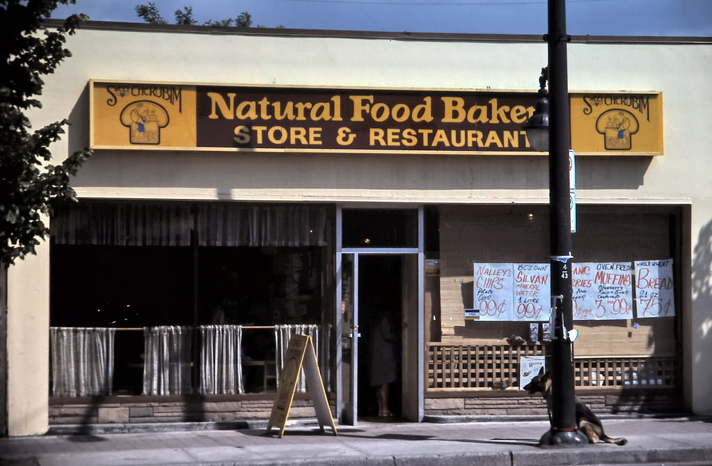
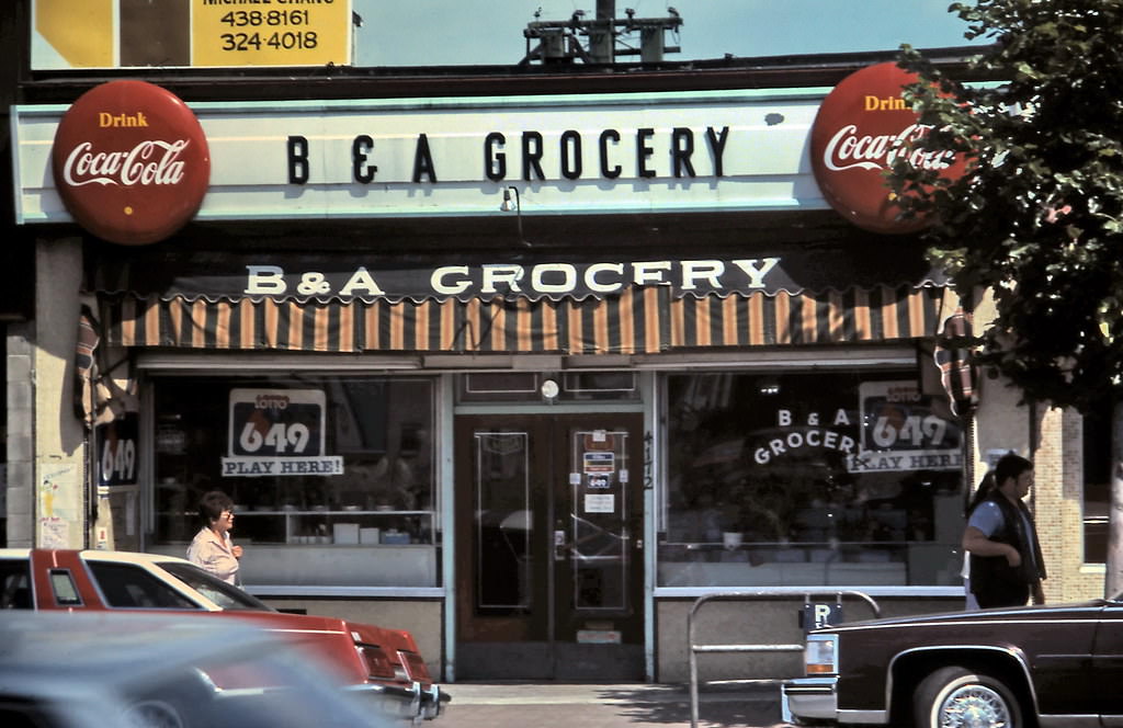
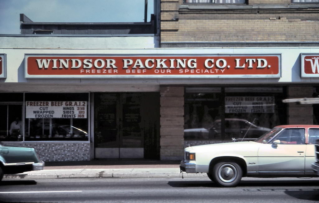
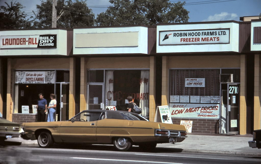
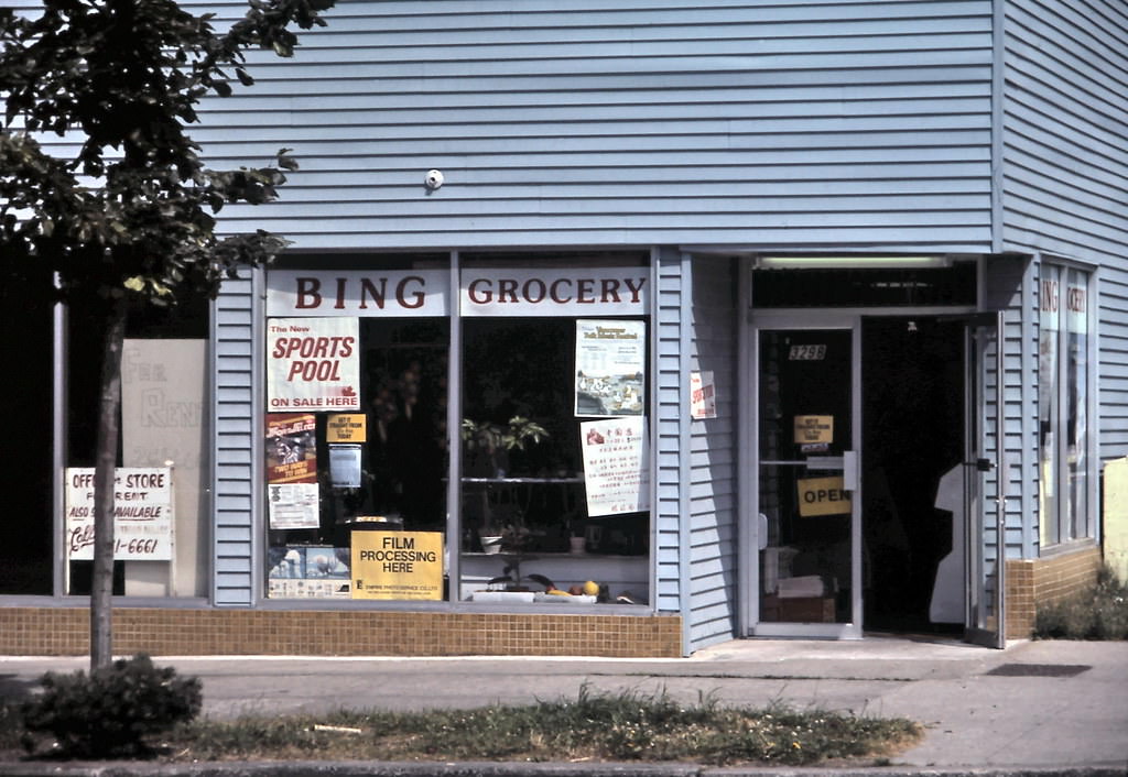
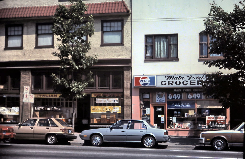
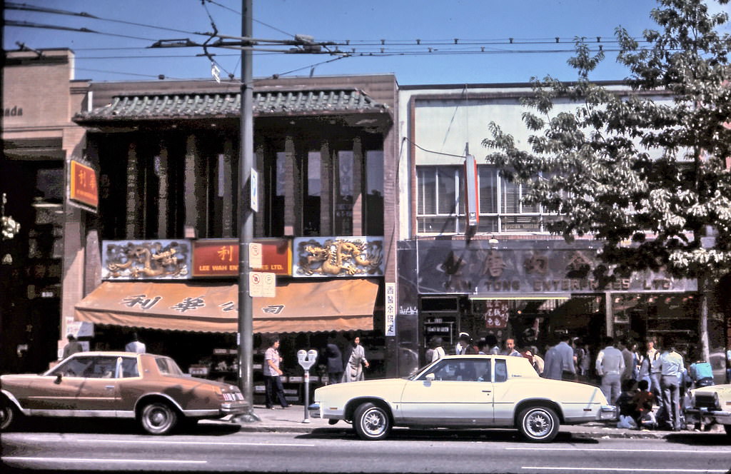
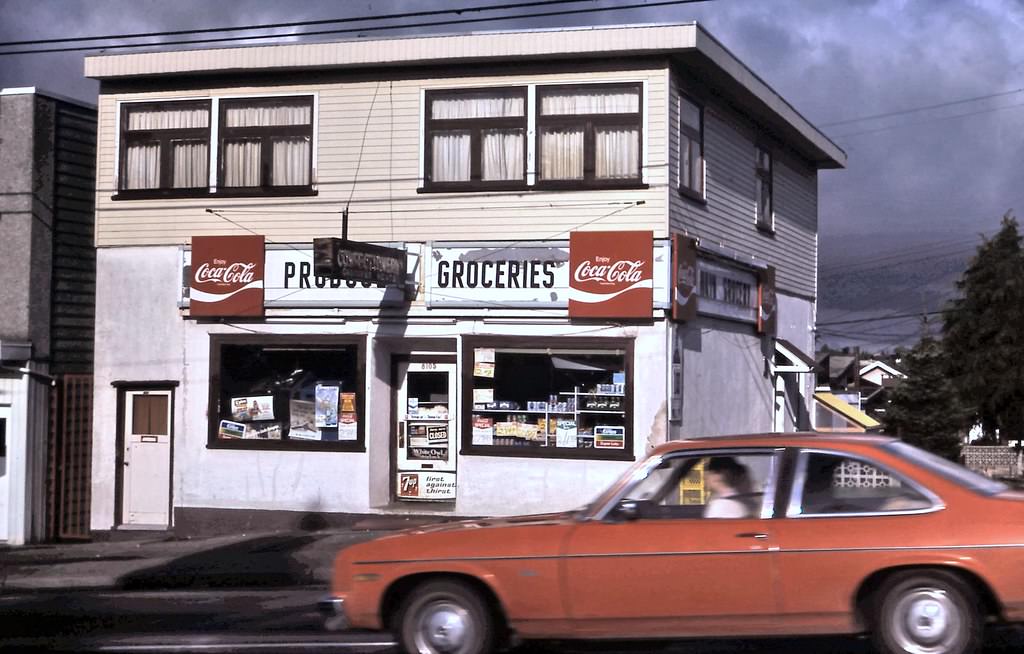
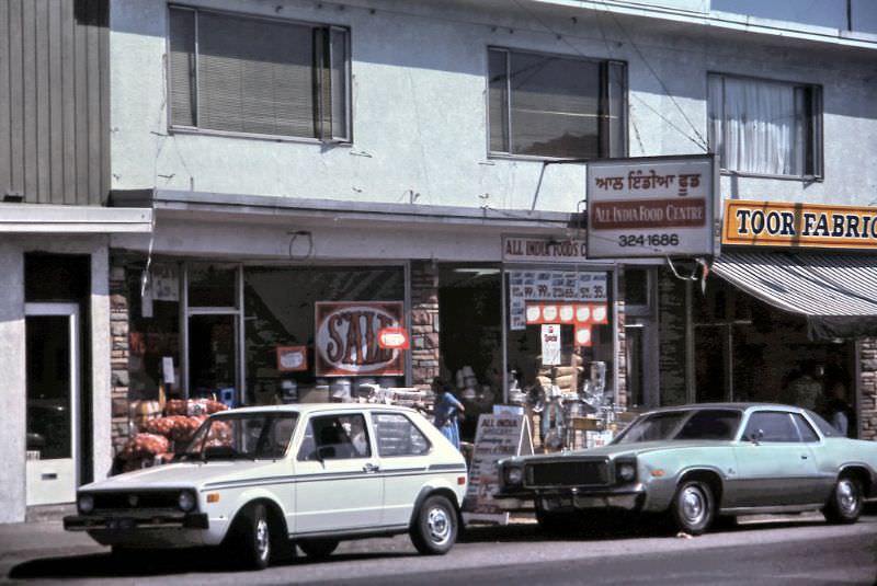
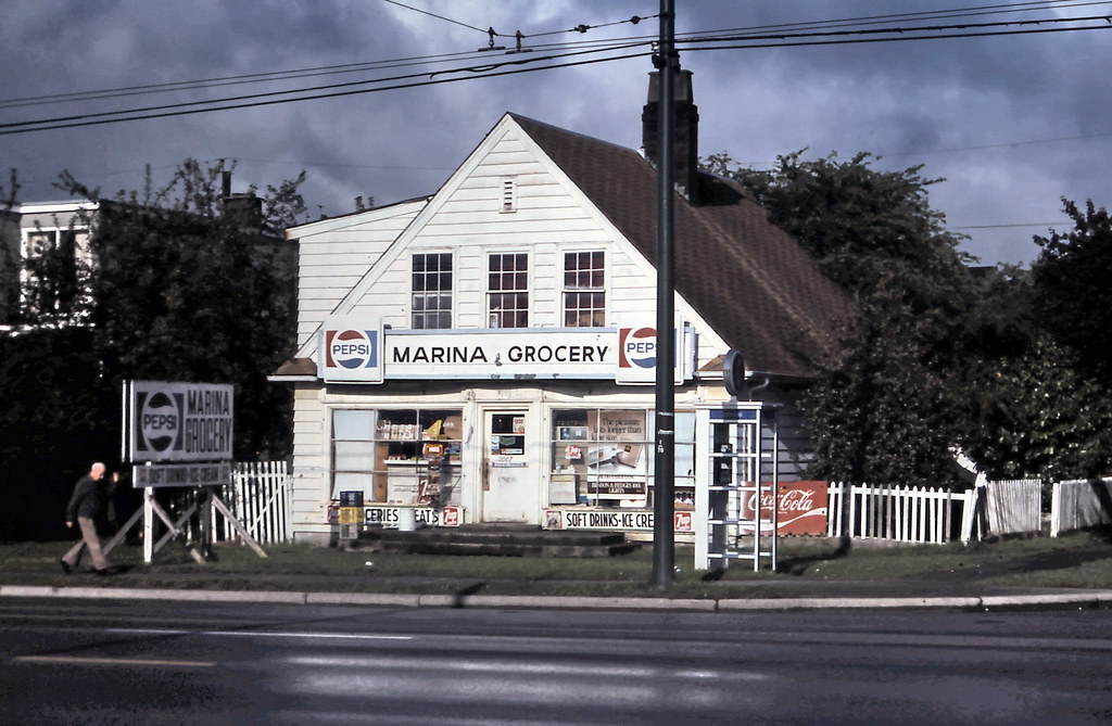
Main Street in 1984 was one of Vancouver’s most diverse commercial strips. From the 2700 block down through the 8000s, the street was lined with independent grocery stores serving Chinese, South Asian, Italian, and broader immigrant communities. A photographer who walked the length of Main Street that year documented dozens of storefronts — a detailed record of the neighborhood’s ethnic and commercial character.
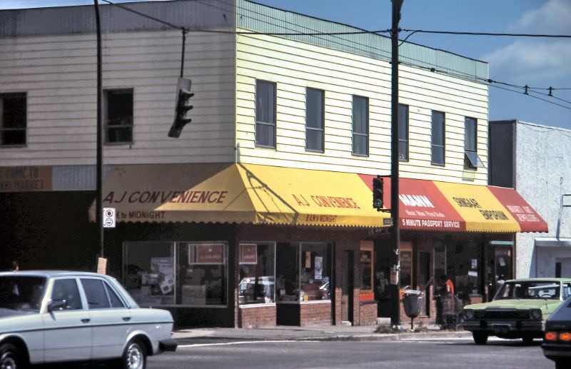
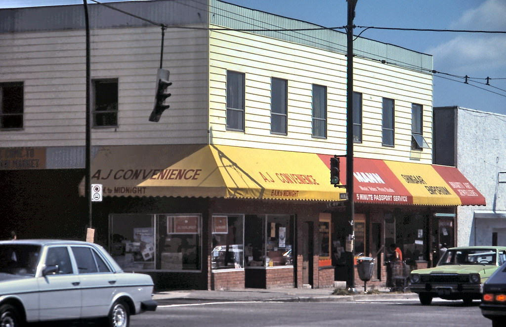
A J Convenience grocery store on southeast corner of Main Street and East 49th Avenue, Vancouver, 1984
All India Food Centre grocery store on 6622 Main Street, Vancouver, 1984
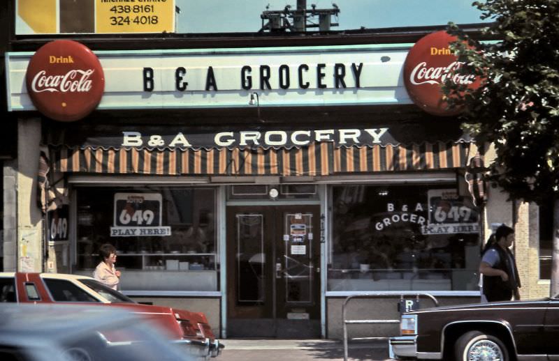
B&A Grocery store at 4172 Main Street, Vancouver, 1984
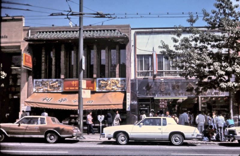
Chinese grocery stores on Main Street (just south of Keefer Street), Vancouver, 1984
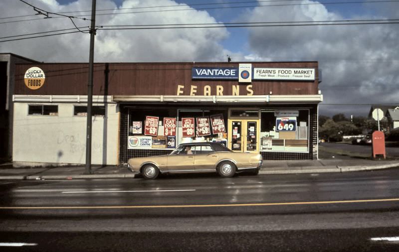
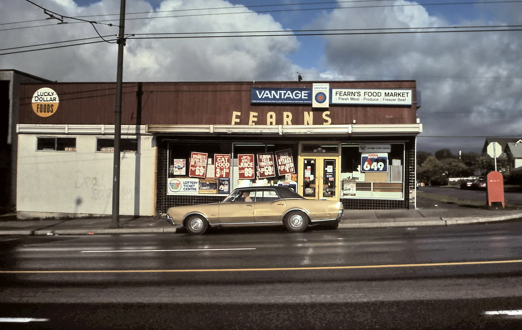
Fearn's Food Market, a Lucky Dollar Foods grocery store on Main Street, Vancouver, 1984
Fearn’s Food Market, a Lucky Dollar Foods grocery store on Main Street, Vancouver, 1984
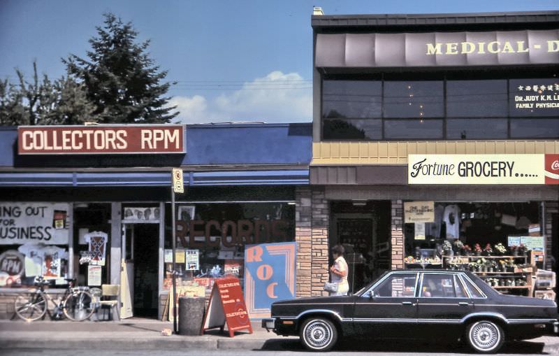
Fortune Grocery store on Main Street near 49th, Vancouver, 1984
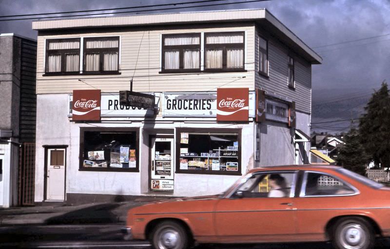
Grocery store at 8105 Main Street, Vancouver, 1984
Grocery stores on Main Street near 33rd Avenue, Vancouver, 1984
India Super Market grocery store on Main Street, Vancouver, 1984
Italian grocery and Main Ford Grocery store on Main Street (just south of Keefer Street), Vancouver, 1984
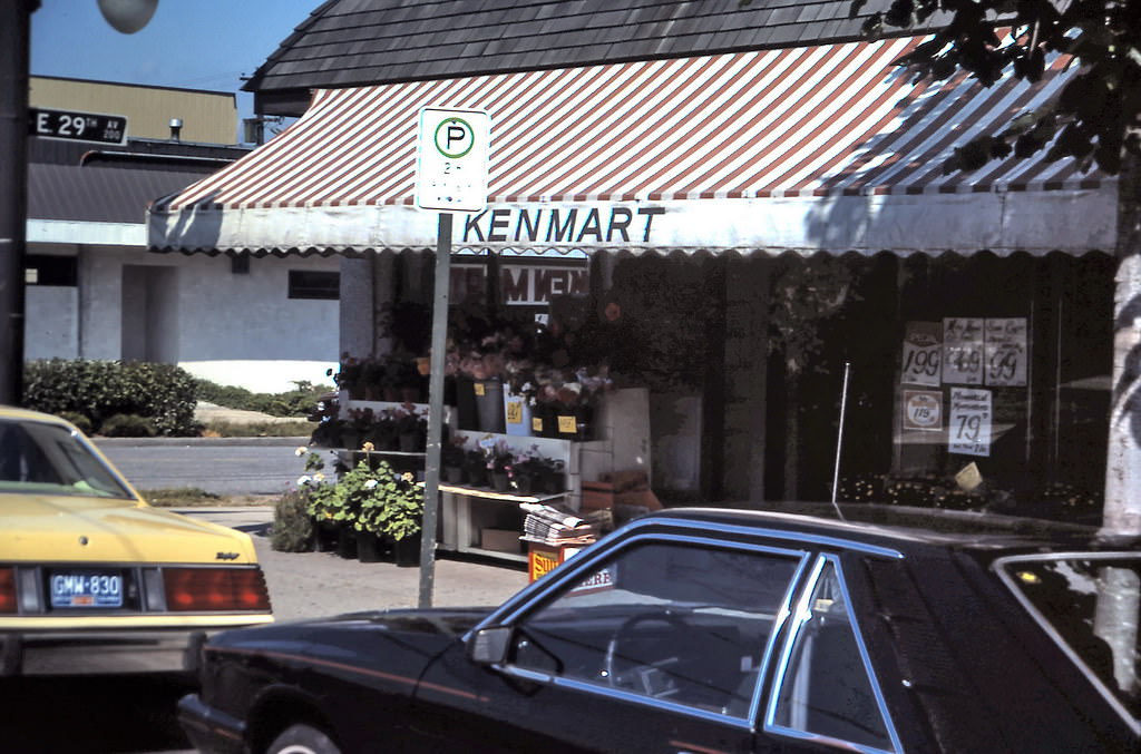
KenMart grocery store on Main Street at 29th Avenue, Vancouver, 1984
Main Market grocery store on Main Street, Vancouver, 1984
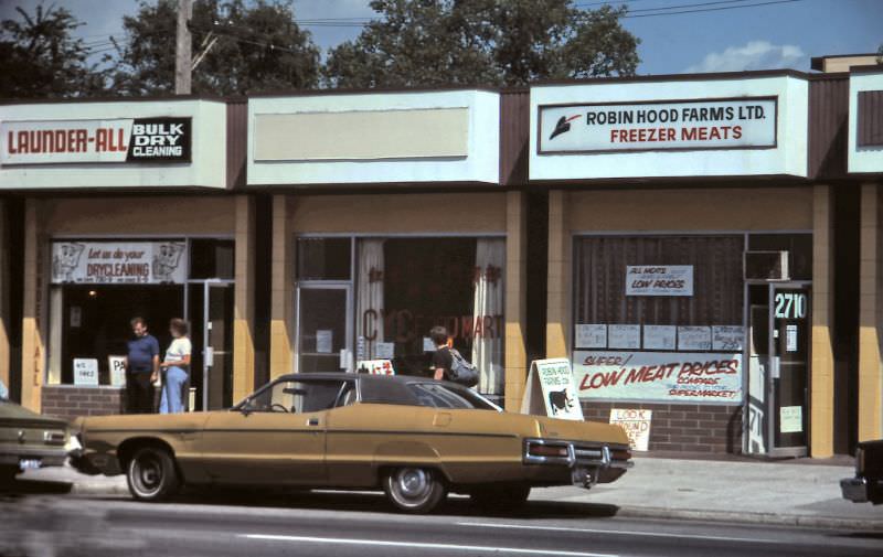
Robin Hood Farms Ltd Freezer Meats store at 2710 Main Street, Vancouver, 1984
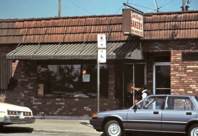
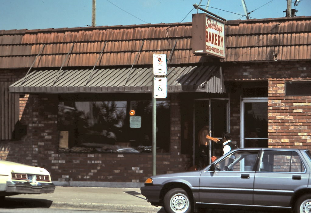
Shirley's Bakery on Main Street about 48th Avenue, Vancouver, 1984
Shirley’s Bakery on Main Street about 48th Avenue, Vancouver, 1984

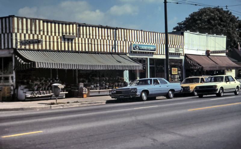
Shirley’s Bakery, KenMart, Robin Hood Farms, the All India Food Centre, and dozens of other shops gave Main Street a texture that no chain-dominated corridor could replicate. Signs advertised Pepsi and Coca-Cola, BC Tel phone booths stood on corners, and after summer rainstorms the wet pavement reflected the storefronts in sharp detail. Many of these businesses would not survive the decade.
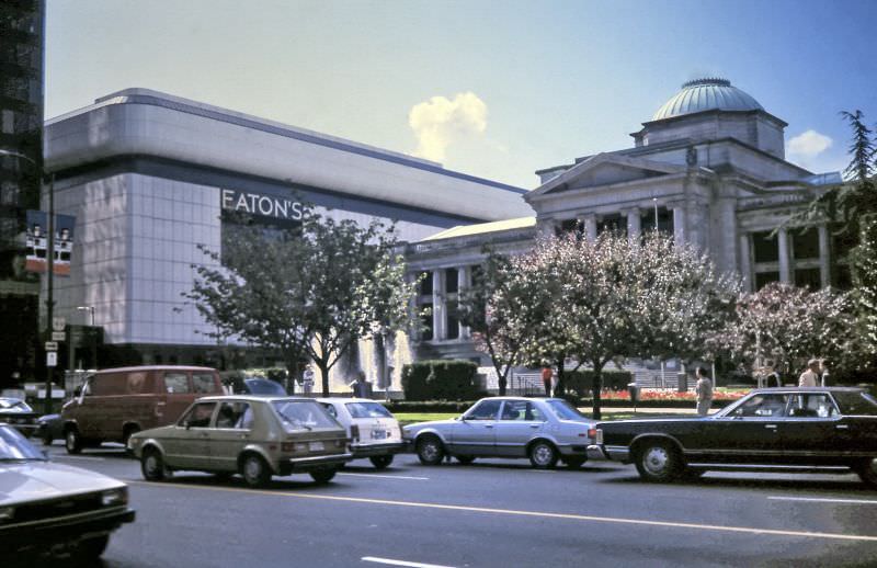
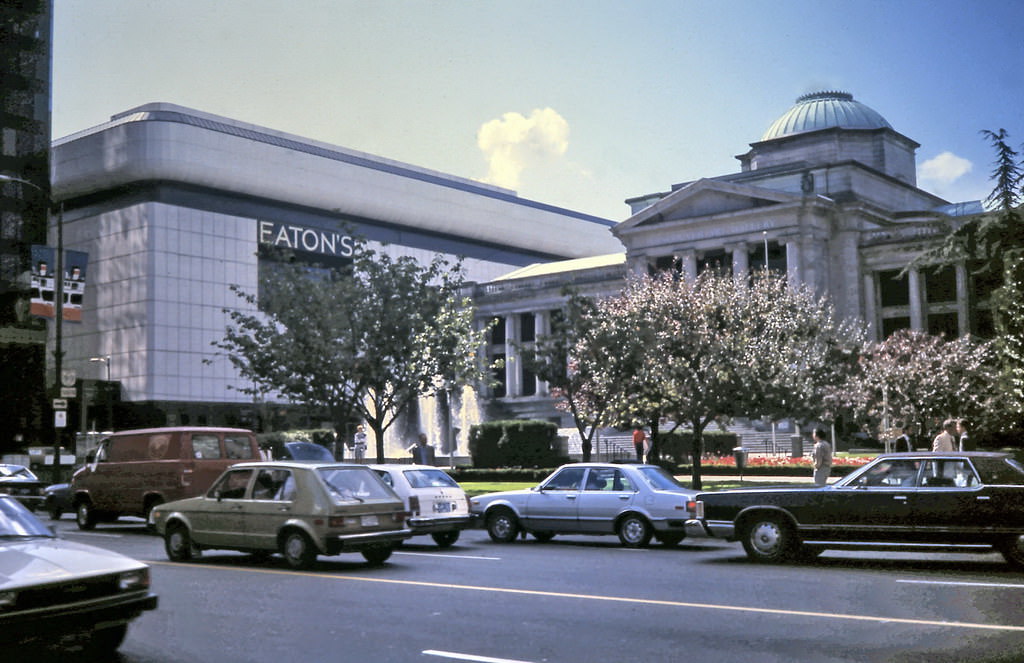
The white wall of Eaton's Department Store is seen behind the Vancouver Art Gallery / Courthouse Plaza from West Georgia Street.
The white wall of Eaton’s Department Store is seen behind the Vancouver Art Gallery / Courthouse Plaza from West Georgia Street.
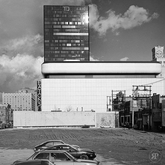
Eaton's "Marshmallow" Building, Vancouver, 1984
Eaton’s “Marshmallow” Building, Vancouver, 1984

Eaton’s department store was a downtown fixture in the 1980s. Its white curved facade — nicknamed the ‘Marshmallow Building’ by locals — stood prominently near the Vancouver Art Gallery. The store was part of a retail downtown that would look unrecognizable to anyone walking those same blocks today.
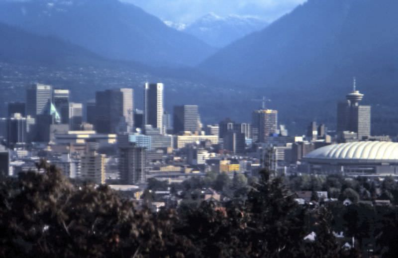
View north from Little Mountain in Queen Elizabeth Park looking toward downtown and the North Shore mountains, Vancouver, 1984

From the summit of Little Mountain in Queen Elizabeth Park, the view north in 1984 took in downtown Vancouver’s growing cluster of towers, with the North Shore mountains rising sharply behind. The park sat on the city’s highest point, and its quarry gardens and arboretum made it one of the most carefully maintained green spaces in Vancouver.
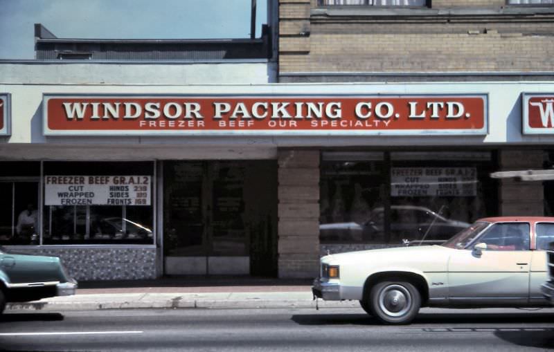
Windsor Packing Company at 4110 Main Street near King Edward, Vancouver, 1984
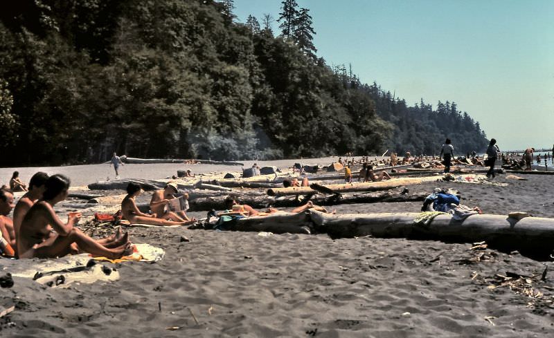
Wreck Beach at mouth of Fraser River in Vancouver, 1984

Wreck Beach, at the base of the cliffs below the University of British Columbia, drew a loyal crowd of visitors who made the steep trek down the trail to reach it. By 1984 it was well established as Vancouver’s clothing-optional beach, a place with its own informal economy and community.
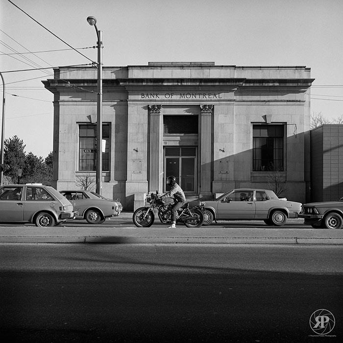
Bank of Montreal Building, Main and Prior, Vancouver, 1984
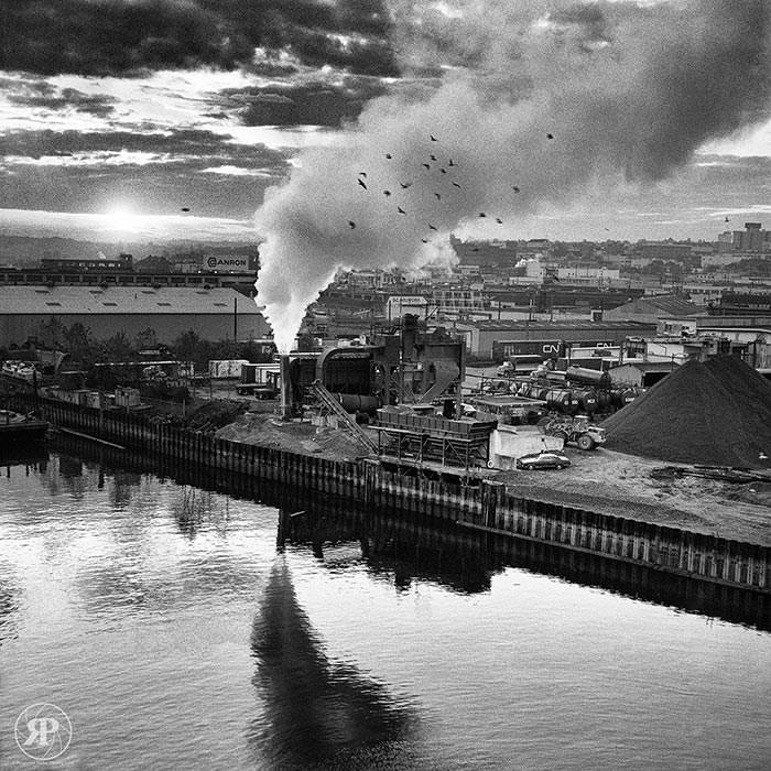
Industry, False Creek, 1984

False Creek’s industrial era was winding down by 1984, but the south shore still held heavy industry — sawmills, machine shops, and rail yards. The transformation of the False Creek basin into the residential and recreational area it became after Expo 86 was still in progress.
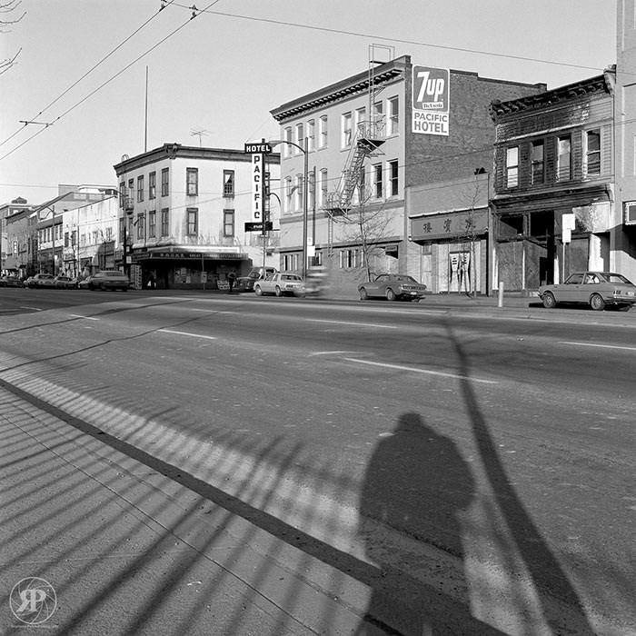
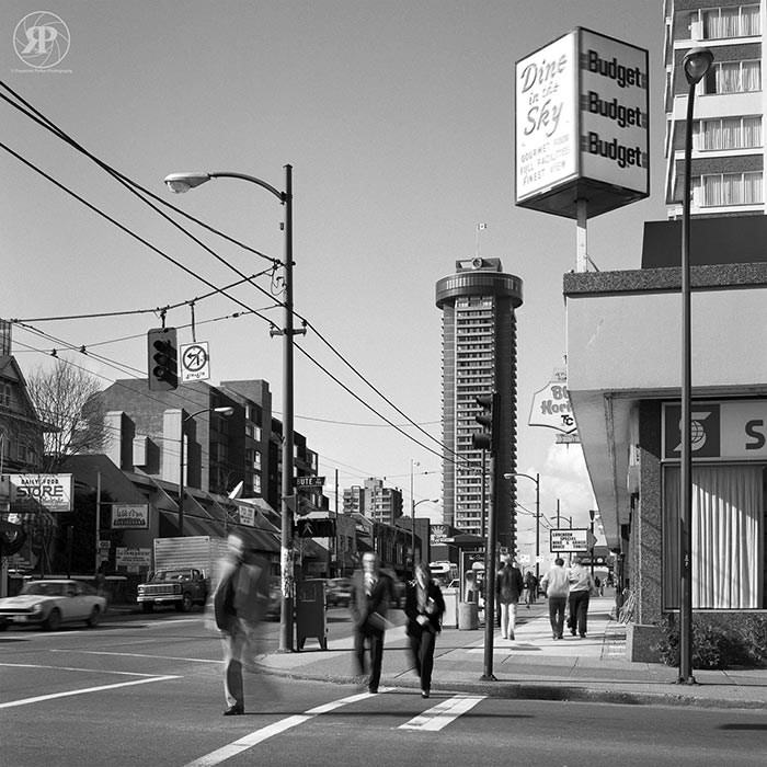
Pacific Hotel, Main Street, Vancouver, 1984
Robson & Bute, Vancouver, 1984
West Georgia Street Gallery Plaza, Downtown Vancouver, 1984.
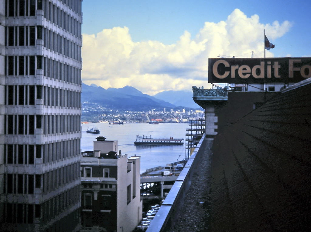
Hornby Street view of Burrard Inlet, Vancouver, 1984.
Park Place Plaza on Burrard Street, Downtown Vancouver, 1984

Downtown Vancouver’s commercial core in 1984 stretched along Burrard, Hornby, and Georgia Streets, where office towers, plazas, and department stores competed for space. Streets like Robson and Bute were beginning to densify with retail and restaurants, setting the stage for the transformation that Expo 86 would accelerate.
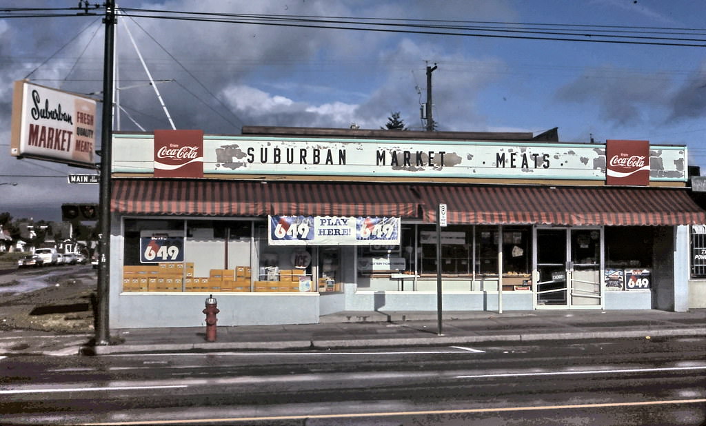
Suburban Market at 7295 Main Street, Vancouver, 1984
Marina Grocery at 7007 Main Street, Vancouver, 1984
Wong's Market on Main Street, Vancouver 1984.
Wong’s Market on Main Street, Vancouver 1984.
All India Food Centre at 6622 Main Street, Vancouver in 1984
AJ Convenience Store on Main Street, Vancouver, 1984
Shirley's Bakery, Vancouver, 48th & Main in 1984.
Shirley’s Bakery, Vancouver, 48th & Main in 1984.
India Super Market, Vancouver, Main Street in 1984
Main Street Food Centre, Hitachi and Sarees, Vancouver, 1984.
Beefway Meats and R.K. Foods on Main Street, Vancouver in 1984.
J&B Foods on Main Street, Vancouver in 1984
Vancouver, Main Street Grocery Stores in 1984.
KenMart Groceries at 29th & Main Street, Vancouver in 1984.
Fortune Grocery and RPM Records on Main Street, Vancouver 1984.
Sweet Cherubim Natural Food Bakery on Main Street, Vancouver in 1984.
B&A Grocery Store on Main Street, Vancouver in 1984
Windsor Packing at 4110 Main Street, Vancouver 1984.
Freezer Meats & Launder-All on Main Street, Vancouver in 1984
Bing Grocery, 17th and Main Street, Vancouver 1984
Vancouver, Main Street Italian and Chinese Grocery Stores 1984.
Chinese Grocery on Main Street near Keefer, Vancouver 1984.
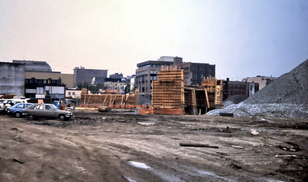
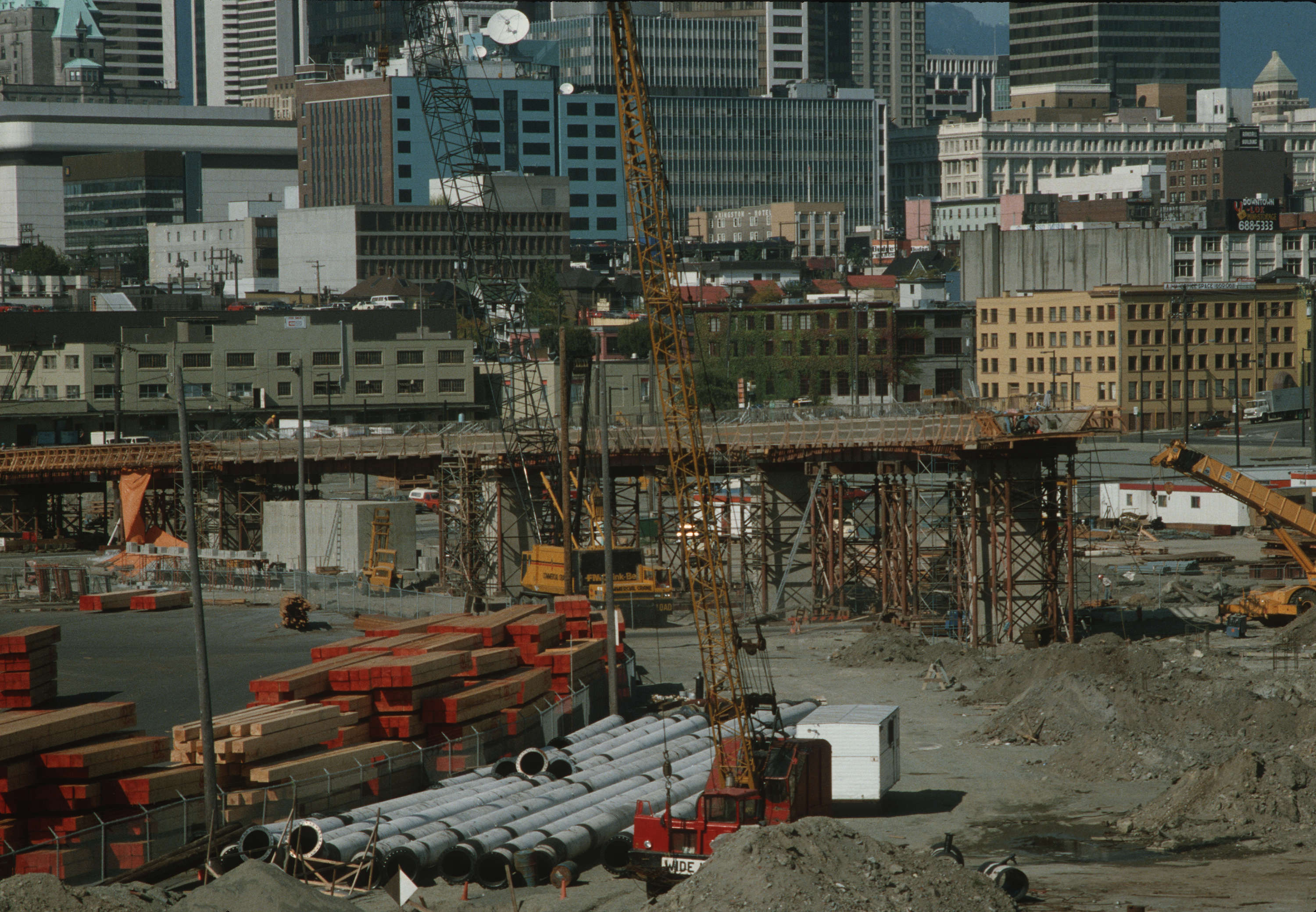
Main Street Overpass Construction, Vancouver 1984.
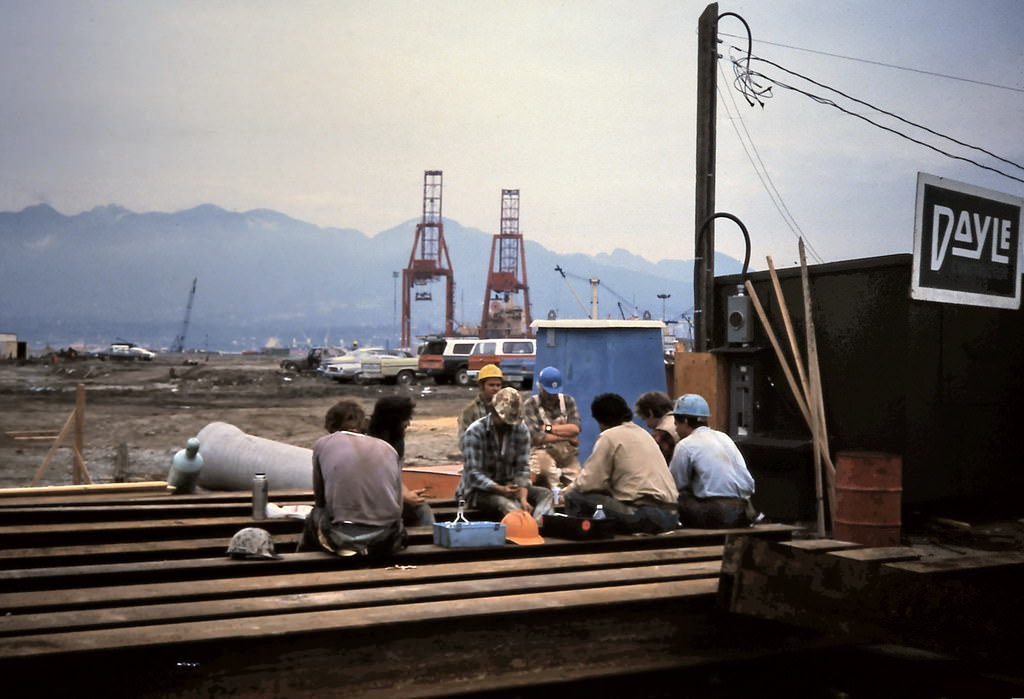
Main Street, Construction Lunch Break, Vancouver 1984

Construction crews working along Main Street in 1984 were building the overpass infrastructure that would support the new SkyTrain line. Workers took lunch breaks in the shadow of heavy equipment, surrounded by the same neighborhood grocers and corner stores that had served the area for decades. The overpass construction was a visible signal that the city’s transit ambitions were becoming reality.
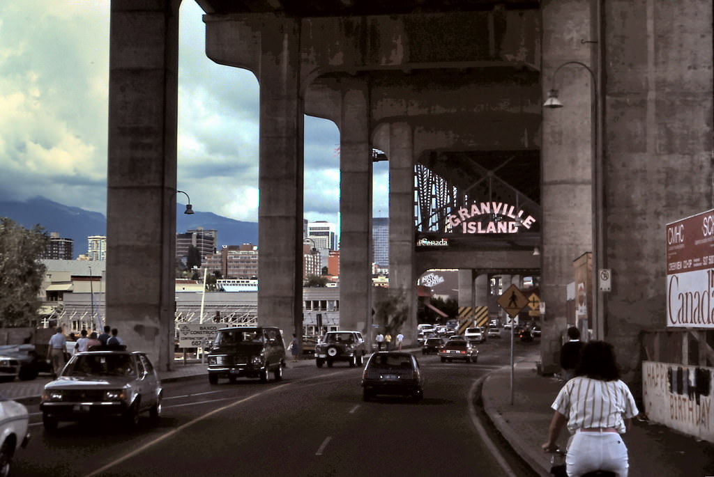
Vancouver entrance to Granville Island 1984
Fearn's Food Market on Main Street, Vancouver, 1984
Fearn’s Food Market on Main Street, Vancouver, 1984
Produce Groceries at 8105 Main Street, Vancouver, 1984.

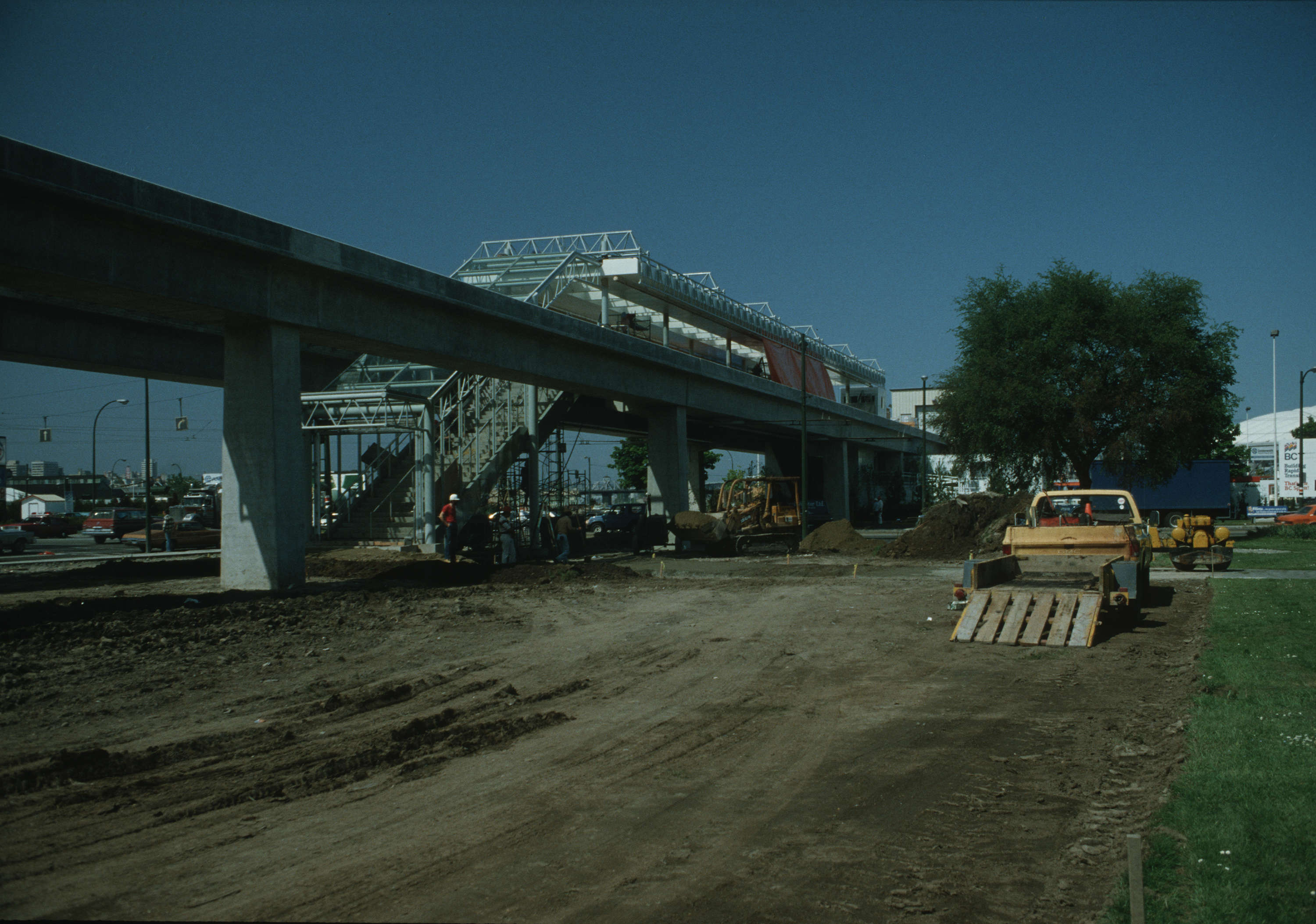
The SkyTrain launched in December 1985, running from downtown Vancouver to New Westminster along a route that followed part of the city’s original interurban rail corridor. It was fully automated from day one — no drivers, no conductors. The system was built in time for Expo 86, and its opening transformed how people moved across the region.
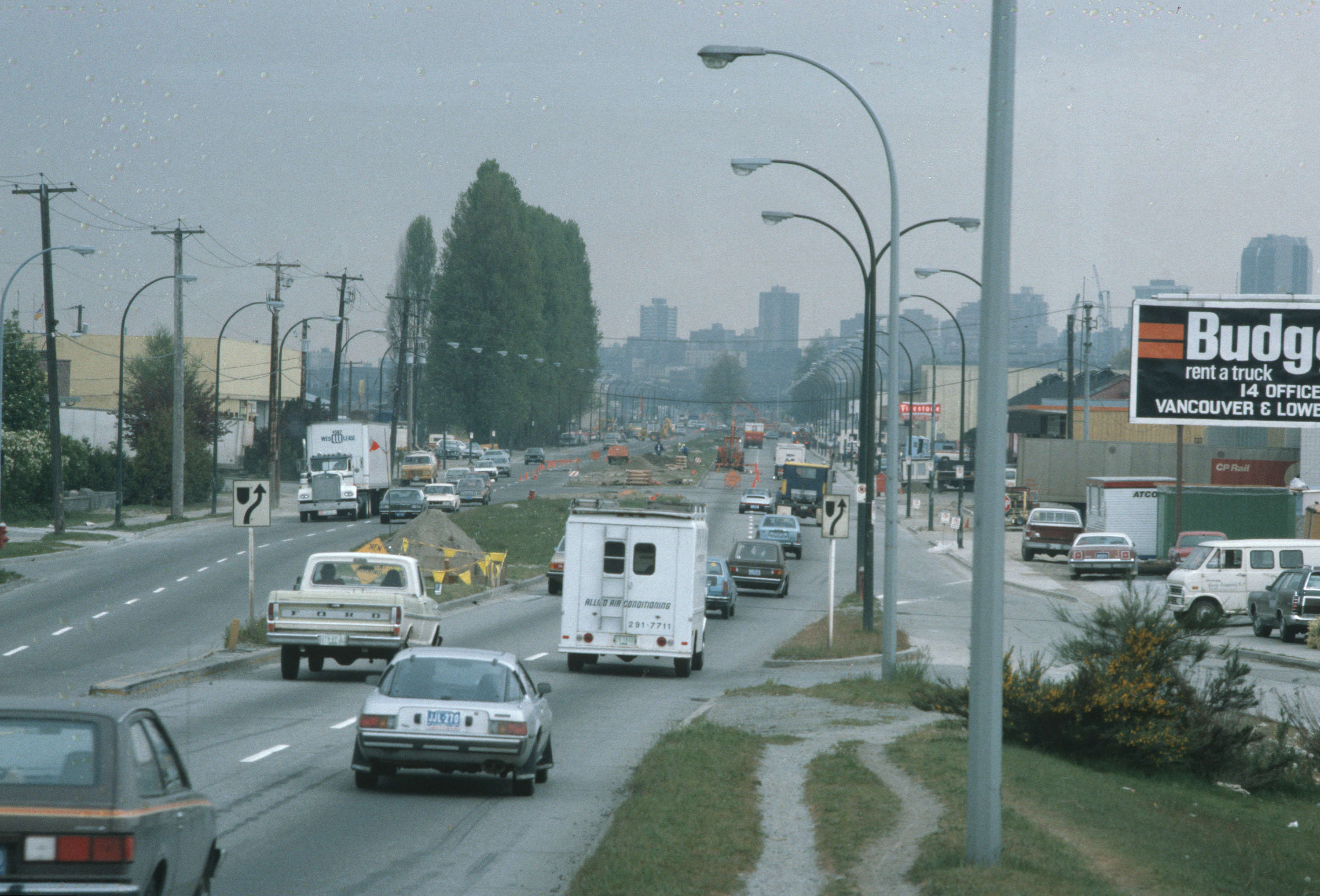
Western view of Terminal Ave, before the SkyTrain line. 3011.
Main Street SkyTrain station under construction.
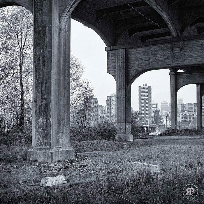
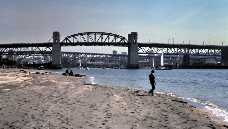
Under Burrard Bridge, Vancouver, 1985

The Burrard Bridge connected downtown Vancouver to Kitsilano and was a constant presence in photographs of the city’s waterways. Below its concrete arches, the waters of False Creek’s western end passed through, and peace demonstrators sometimes gathered on its banks to mark anti-war occasions.
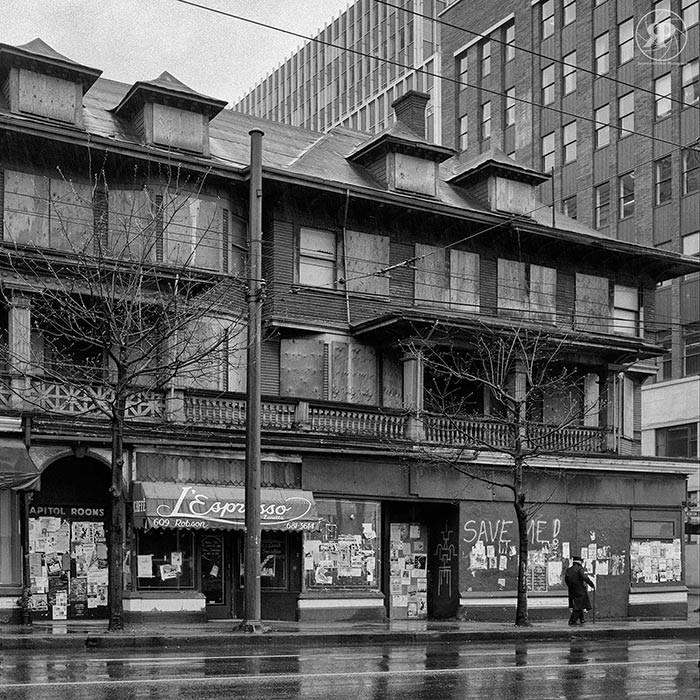
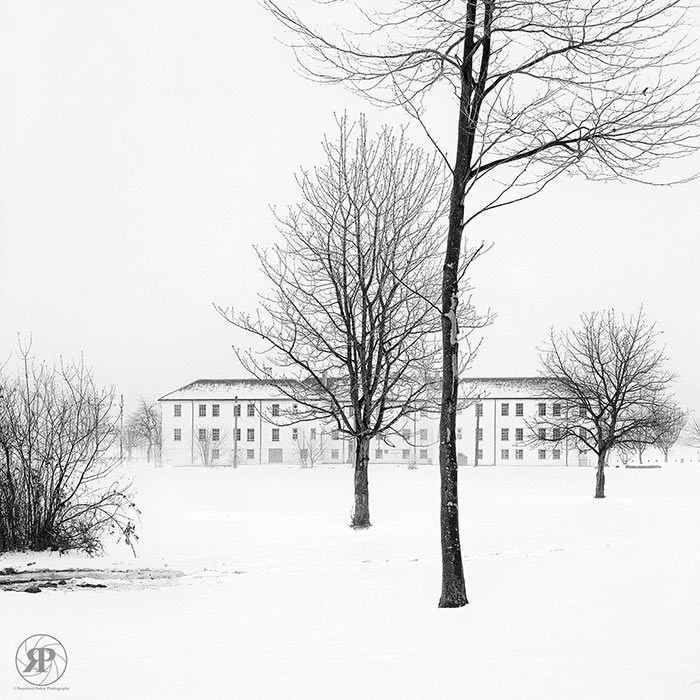
Condemned Orillia Building, Robson & Seymour, 1985
Hostel, Jericho, Vancouver, 1985
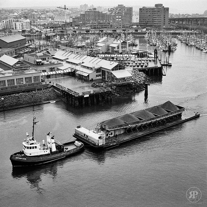
Captain Cook Tug Passes Granville Island, Vancouver, 1985
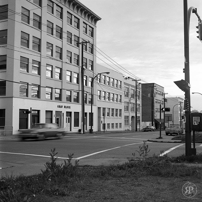
The Gray Block, Homer & Davie, 1985
Passing Trolley Bus, W. 10th Avenue, Vancouver, 1985

Vancouver’s trolley buses were a constant feature of the city’s streets in 1985. Running on overhead wires, they connected neighborhoods across the west side and downtown without diesel fumes. The Jericho Hostel, meanwhile, provided low-cost accommodation for travelers and backpackers making their way up the Pacific Coast.
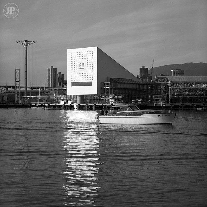
GM Pavilion, Expo 86 Site, Vancouver, 1985

A year before Expo 86 opened, the fairgrounds on the north shore of False Creek were already taking shape. The GM Pavilion was one of the major corporate structures rising on the site in 1985. The exposition would cover 70 hectares and draw more than 22 million visitors over its six-month run — the largest world’s fair ever staged in North America.
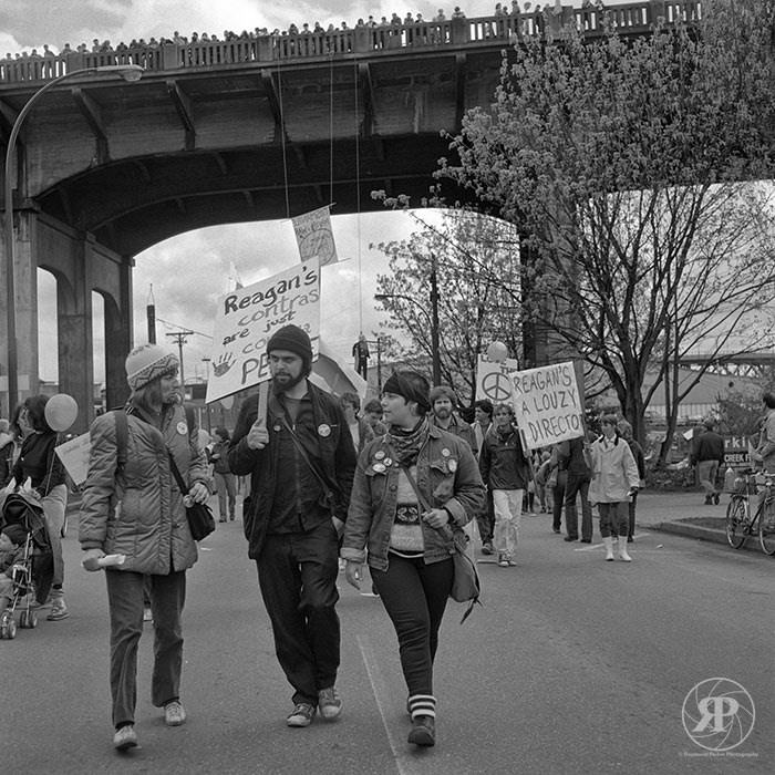
Peace Under Burrard Bridge, Vancouver, 1985
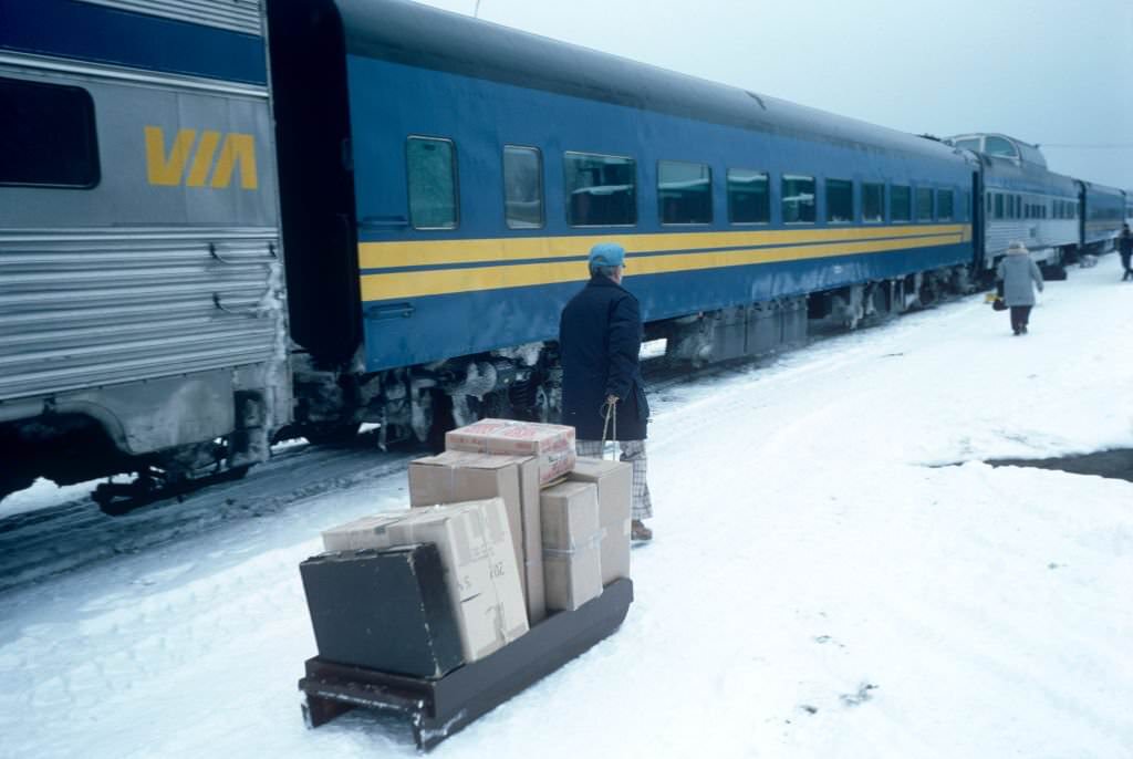
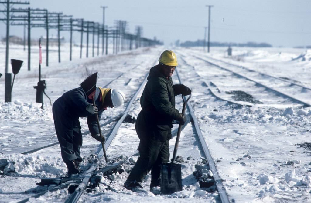
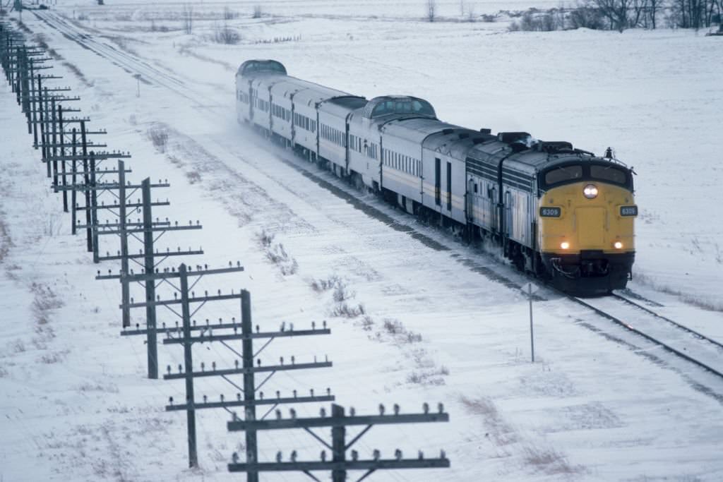
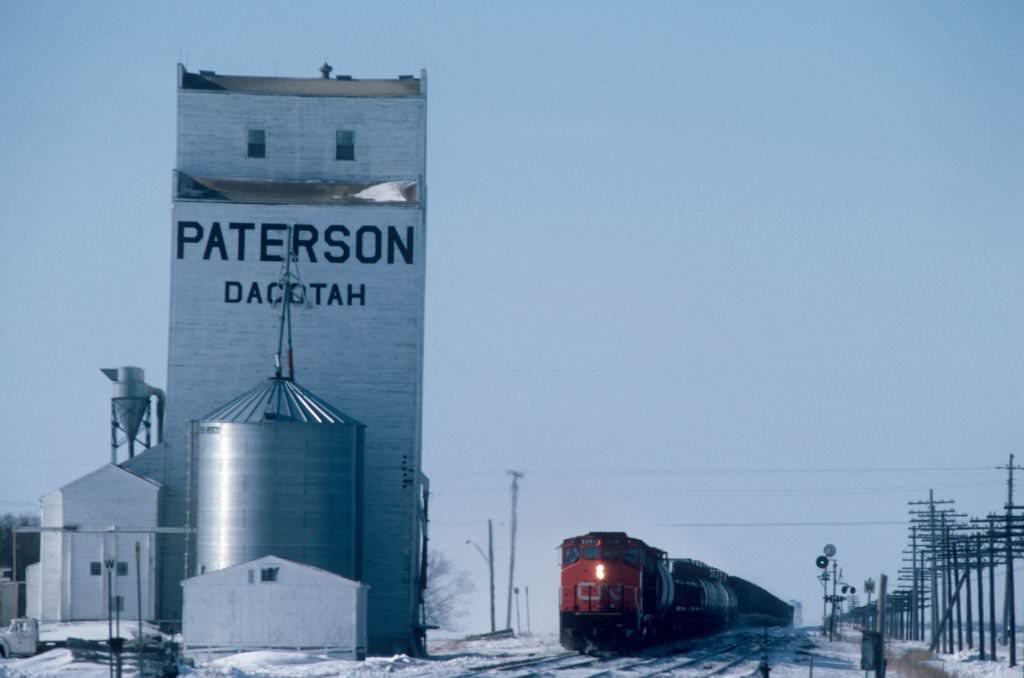
The journey aboard the Canadian transcontinental train which connects Toronto to Vancouver, 1985
Vancouver, 1985
Vancouver, 1985
The journey aboard the Canadian transcontinental train that connects Toronto to Vancouver, 1985
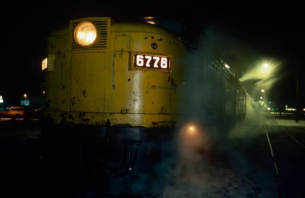
The Last Dream Trains, 1985
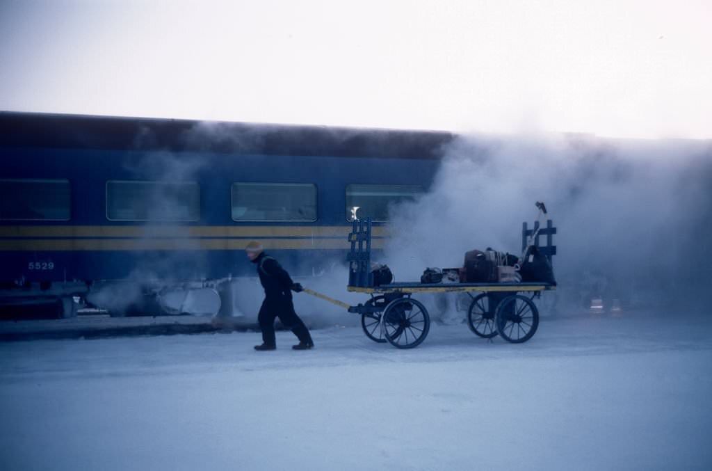
The journey aboard the Canadian transcontinental train which connects Toronto to Vancouver, 1985
The Last Dream Trains, 1985
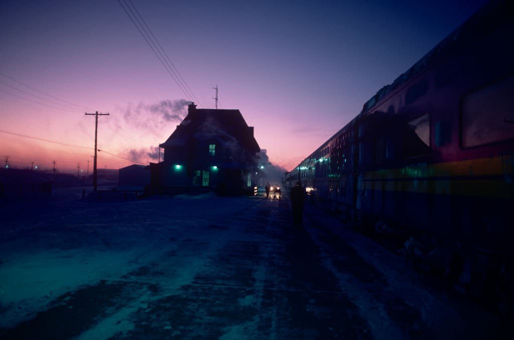
The journey aboard the Canadian transcontinental train which connects Toronto to Vancouver, 1985

The transcontinental train journey from Toronto to Vancouver in 1985 covered thousands of kilometers of Canadian landscape — the Shield, the prairies, and the Rockies — before arriving at Pacific Central Station. For many immigrants and visitors, stepping off that train in Vancouver was their first encounter with the city.
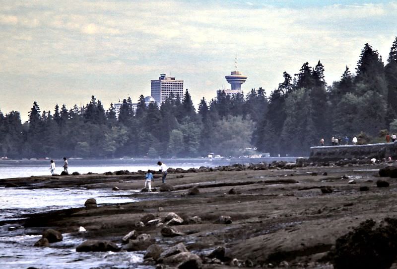
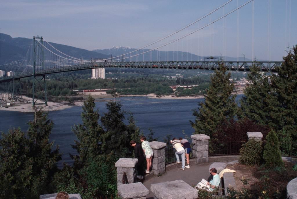
Below the seawall at low-tide east of Lions Gate Bridge in Stanley Park, Vancouver, 1986
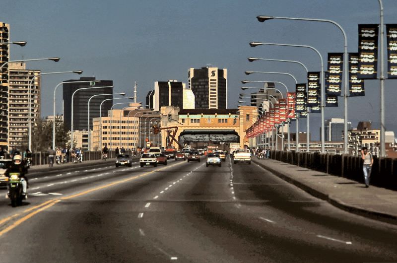
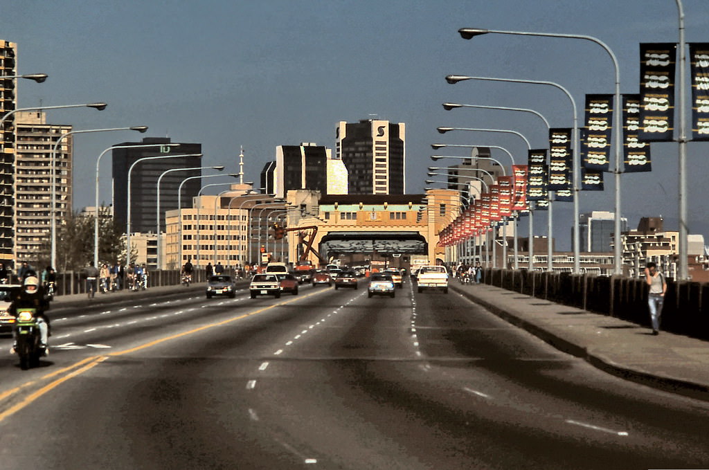
Burrard Street Bridge in Vancouver, 1986

In 1986, Vancouver marked its 100th anniversary as an incorporated city. Workers decorated the Burrard Street Bridge with centennial banners, and the city hosted a year’s worth of commemorative events alongside Expo 86. The two celebrations overlapped to create an extraordinary summer in the city’s history.
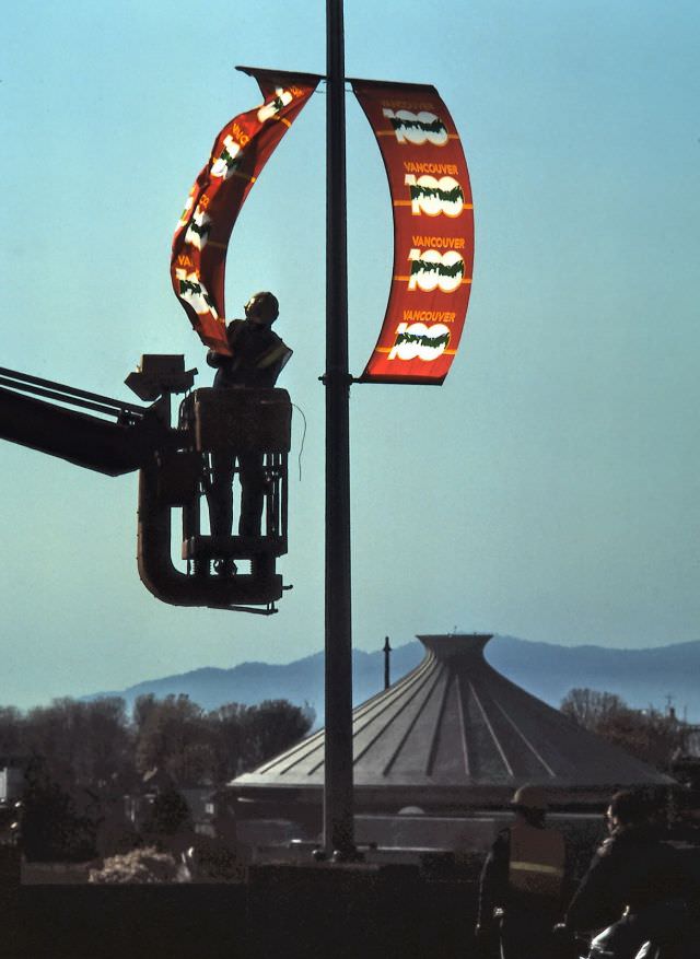
Workman putting up banners on Burrard Street Bridge in Vancouver for the city's 100th Birthday, 1986
Workman putting up banners on Burrard Street Bridge in Vancouver for the city’s 100th Birthday, 1986
Burrard Street Bridge, Vancouver Centennial, 1986.
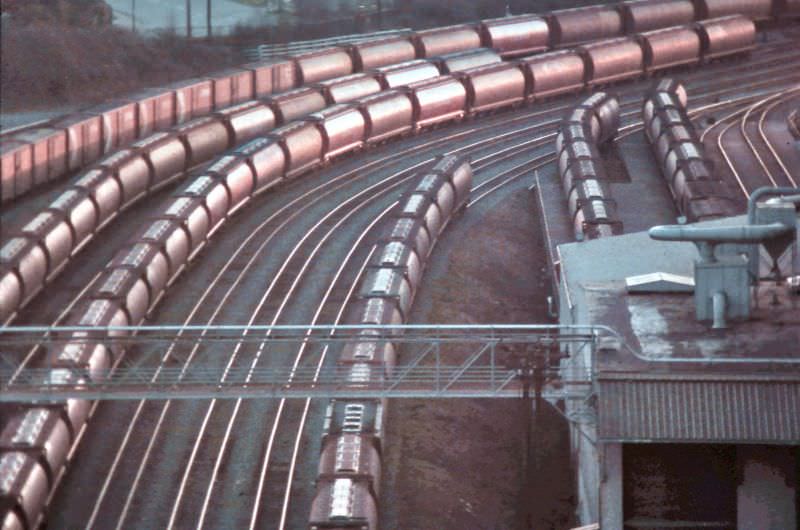
CPR railway grain cars on the waterfront in East Vancouver as seen in early morning from Second Narrows Bridge. They are waiting besides the grain terminals in Vancouver, 1986

While downtown Vancouver prepared for its centennial celebrations and Expo 86, the port’s industrial operations continued without pause. CPR grain cars lined the waterfront in East Vancouver in the early morning light, waiting beside the terminal elevators. Vancouver’s port remained one of the busiest on the Pacific Coast.
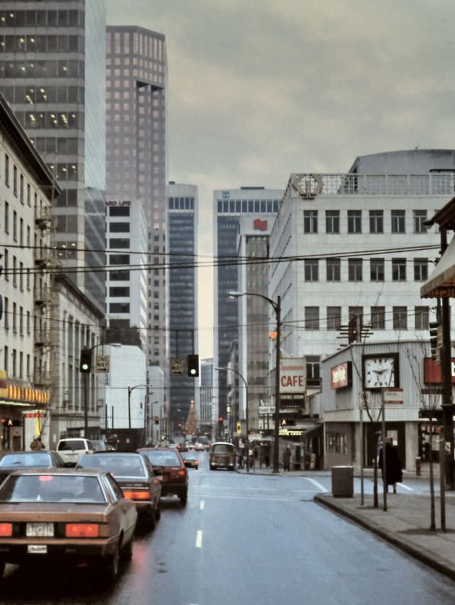
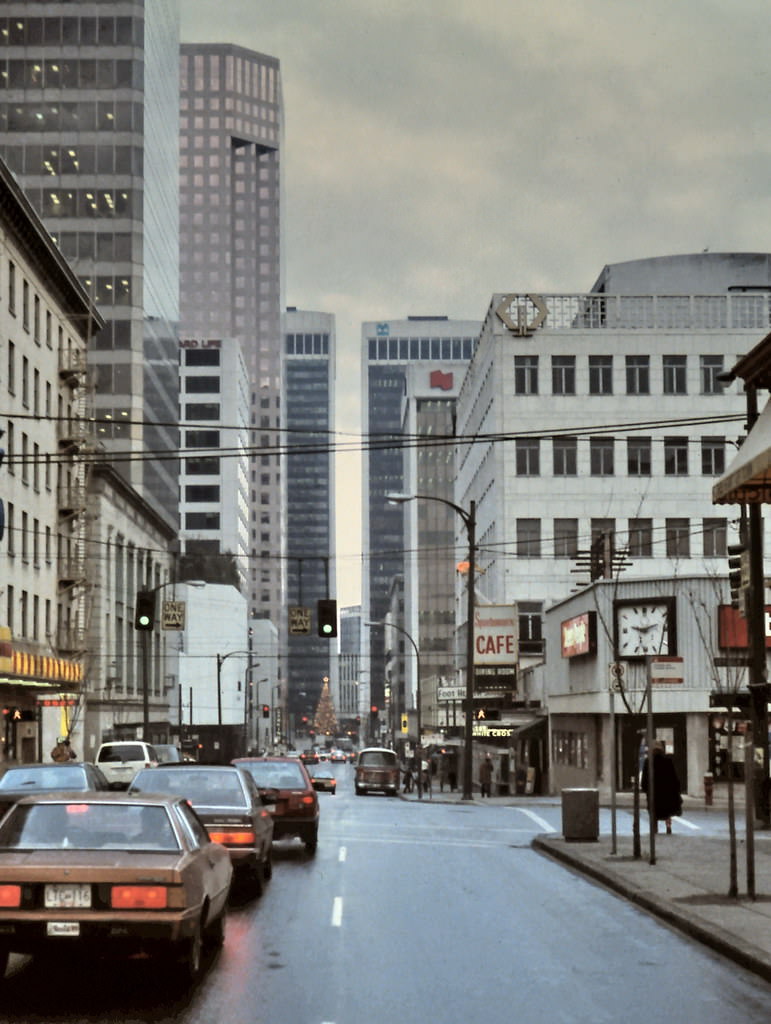
Dunsmuir Street at Seymour Street looking west, Vancouver, 1986
Dunsmuir Street, Vancouver, 1986
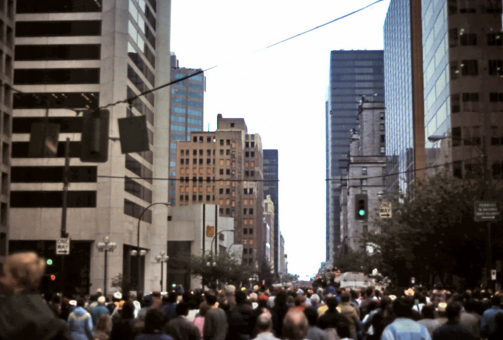
View east on Dunsmuir Street in downtown Vancouver, 1986
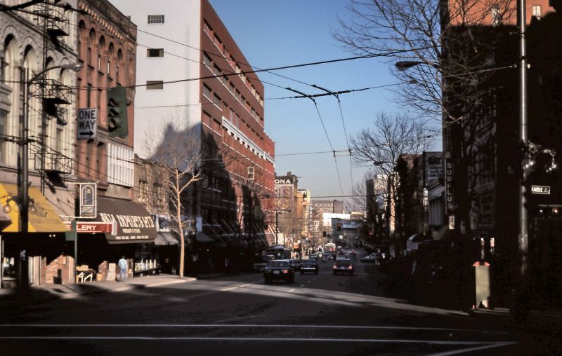
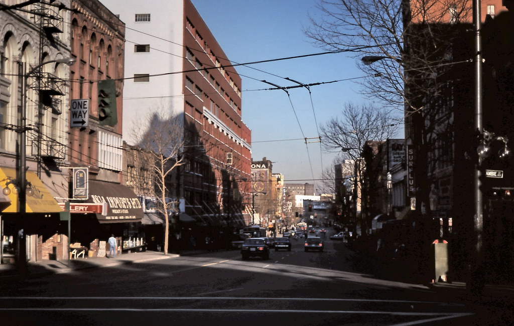
Looking east on Hastings Street at Cambie in downtown Vancouver, 1986
East on Hastings Street, Downtown Vancouver, 1986

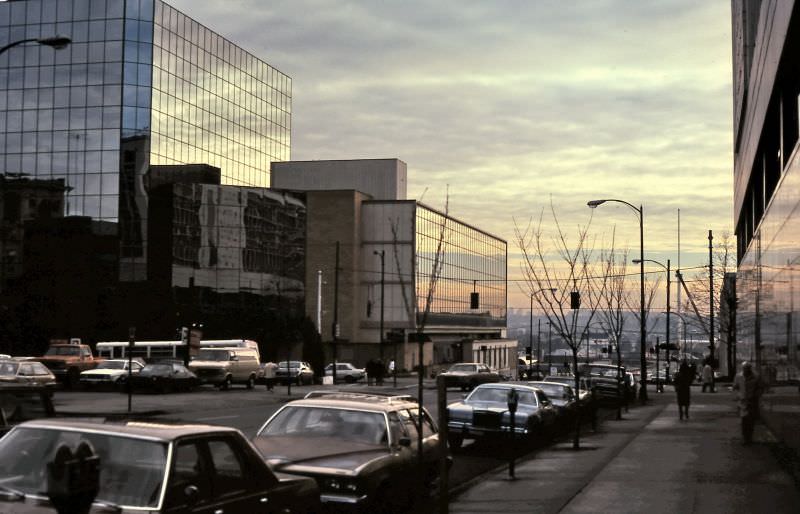
Downtown Vancouver’s street grid in 1986 showed the city at a crossroads. On Hastings Street, heritage buildings sat alongside newer construction, while Dunsmuir Street carried heavy traffic between the bridges and the business core. The streetscapes had a gritty, working quality that would fade significantly in the years following Expo 86.
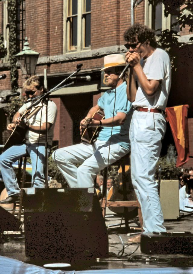
Free Long John Baldry concert on Water Street in Gastown, Vancouver, 1986

Gastown, Vancouver’s oldest neighborhood, hosted free outdoor concerts during the centennial year. British blues and rock vocalist Long John Baldry performed on Water Street, drawing a crowd to one of the city’s most storied blocks. Gastown had been revitalized in the 1970s after years of neglect, and by 1986 it was a regular venue for public events.
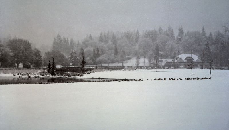
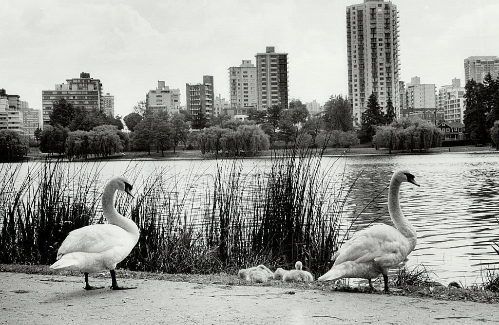
Georgia Street entrance to Stanley Park, Vancouver, 1986
Vancouver's magnificent Stanley Park, 1980s
Vancouver’s magnificent Stanley Park, 1980s
Stanley Park, Vancouver, 1980s

Stanley Park’s Georgia Street entrance was the main gateway for visitors arriving from downtown. The causeway leading into the park passed beneath towering Douglas firs and red cedars, giving immediate shelter from the city. The park’s seawall, forests, and beaches made it Vancouver’s most visited public space throughout the decade.
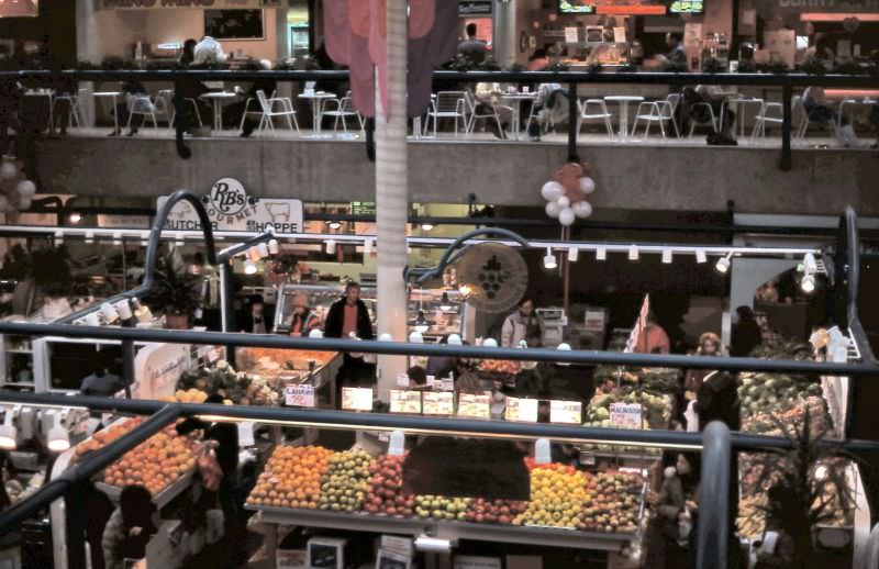
Inside the Robson Public Market on Robson Street in Vancouver, 1986
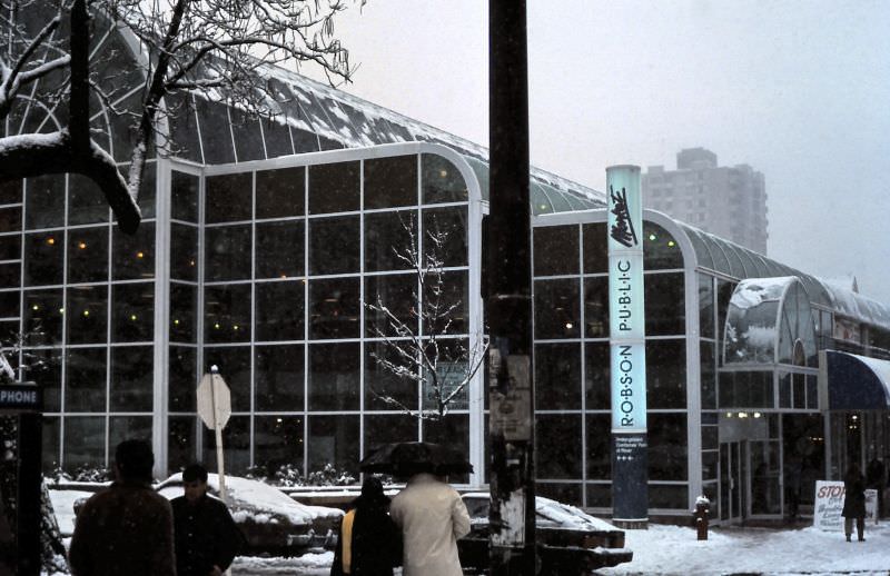
Vancouver's Robson Public Market on Robson Street on snowy day, 1986
Vancouver’s Robson Public Market on Robson Street on snowy day, 1986

The Robson Public Market on Robson Street was a covered marketplace that attracted shoppers year-round. On rare snowy days, the building’s interior offered warm shelter and fresh food while winter weather coated the streets outside. Vancouver’s snowfalls were infrequent enough that they brought a kind of novelty to the city’s familiar streetscapes.
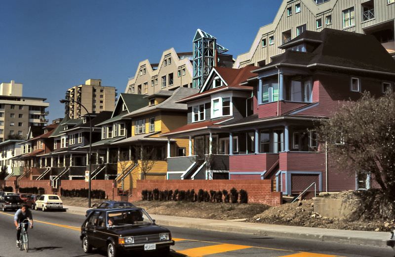
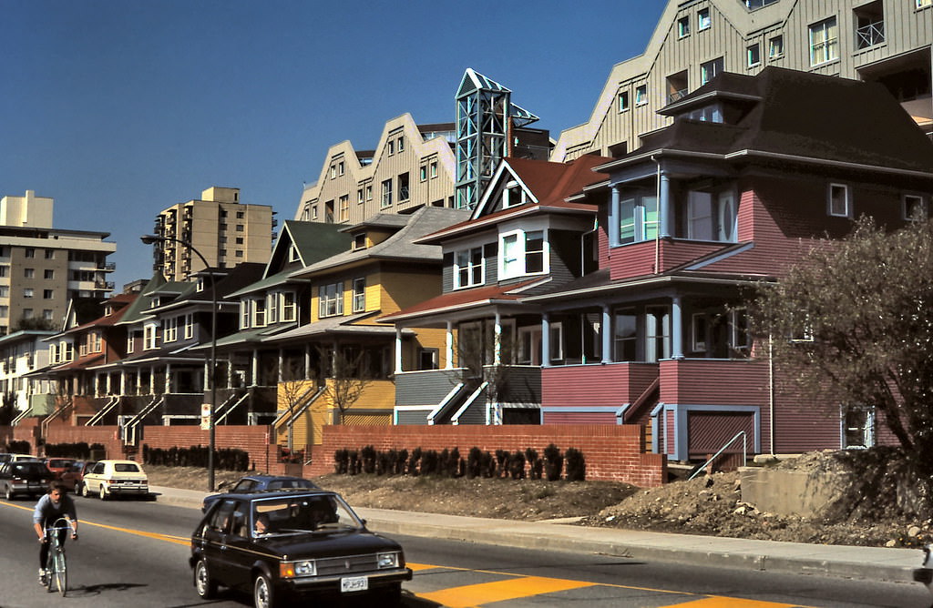
New condos on Pacific Avenue in Vancouver, 1986
Pacific Avenue House Condos, Vancouver, 1986
Sunset Beach and Burrard Street Bridge over False Creek in Vancouver, 1986

New condominium construction along Pacific Avenue in 1986 signaled the beginning of a residential boom that would reshape Vancouver’s waterfront neighborhoods. Sunset Beach, just along the shore, offered views of the Burrard Street Bridge and the mouth of False Creek. The combination of new construction and older parkland gave the area a transitional character unique to that moment in the city’s development.
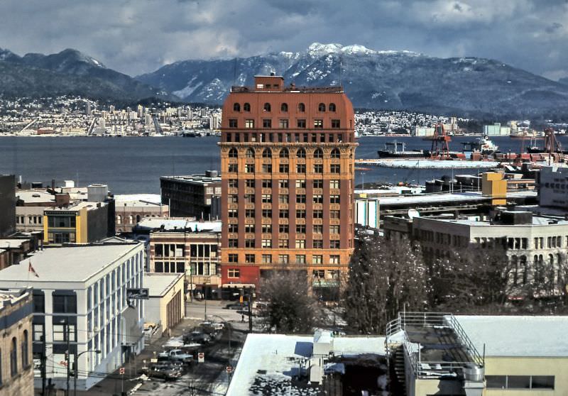
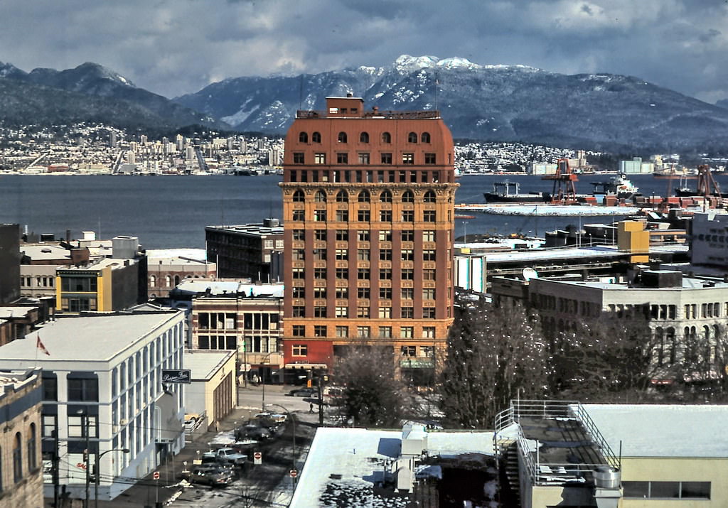
The Dominion Building on east side of downtown Vancouver as seen from VVI/VCC college in early 1986. Victory Square and Hastings Street are in the foreground
Dominion Building and Harbour Snow, Vancouver, 1986

The Dominion Building, completed in 1910 at the corner of Hastings and Cambie, was the tallest building in the British Empire when it was built. By 1986 it was dwarfed by surrounding towers, but its terracotta facade and copper-trimmed dome remained landmarks in the Victory Square area. On winter mornings with snow on the ground, the building’s older architecture stood in sharp relief against the grey harbour sky.
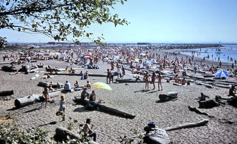
Wreck Beach at mouth of Fraser River in Vancouver, 1986
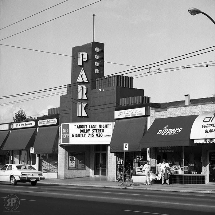
Park Theatre, Cambie Street, Vancouver, 1986
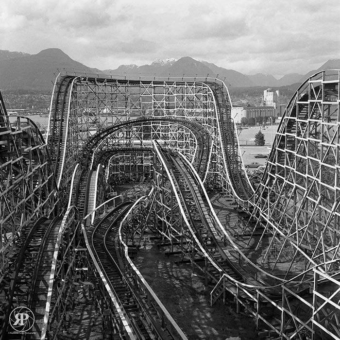
Wooden Roller Coaster, Vancouver, 1986

Expo 86 brought an amusement zone to Vancouver that included a wooden roller coaster — a rare piece of fairground infrastructure for a city that had no permanent amusement park. The six-month fair ran from May to October 1986 on the north shore of False Creek, transforming a former industrial zone into a showcase of transportation and communication technology from nations around the world.
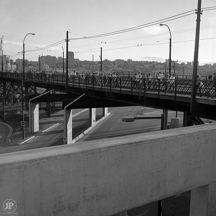
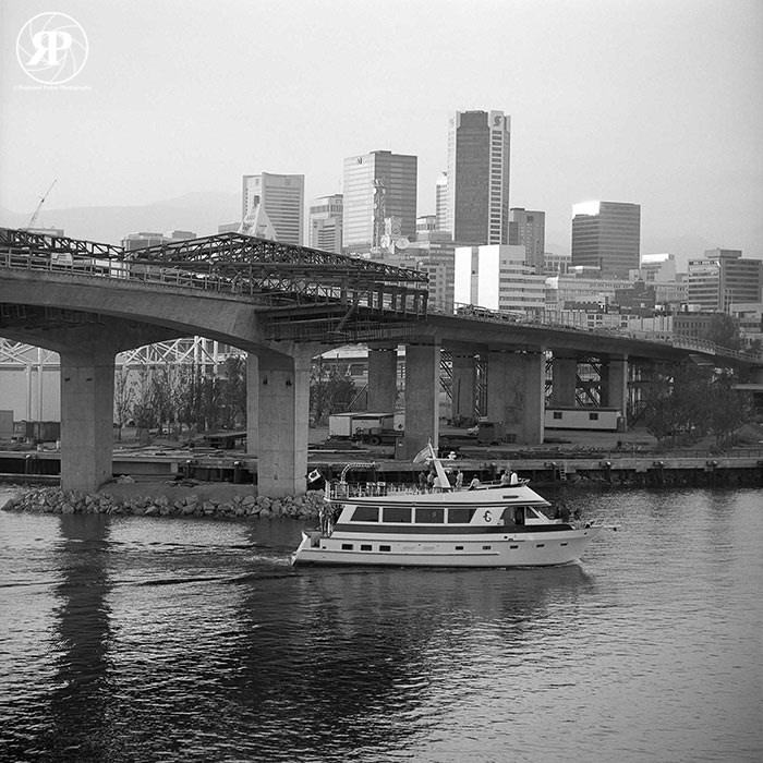
Construction of New Cambie Bridge, Vancouver, 1986
Cambie Bridge under construction.

The new Cambie Bridge was under construction throughout 1986, replacing the older lift bridge that had spanned False Creek since 1954. Its completion gave the city a modern crossing capable of handling the increased traffic that Expo 86 and the new SkyTrain development were bringing to the False Creek area.
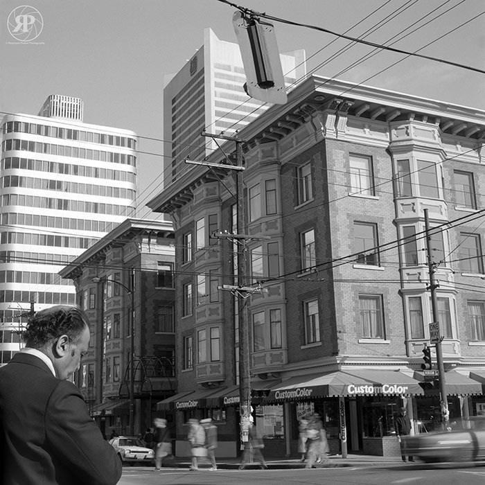
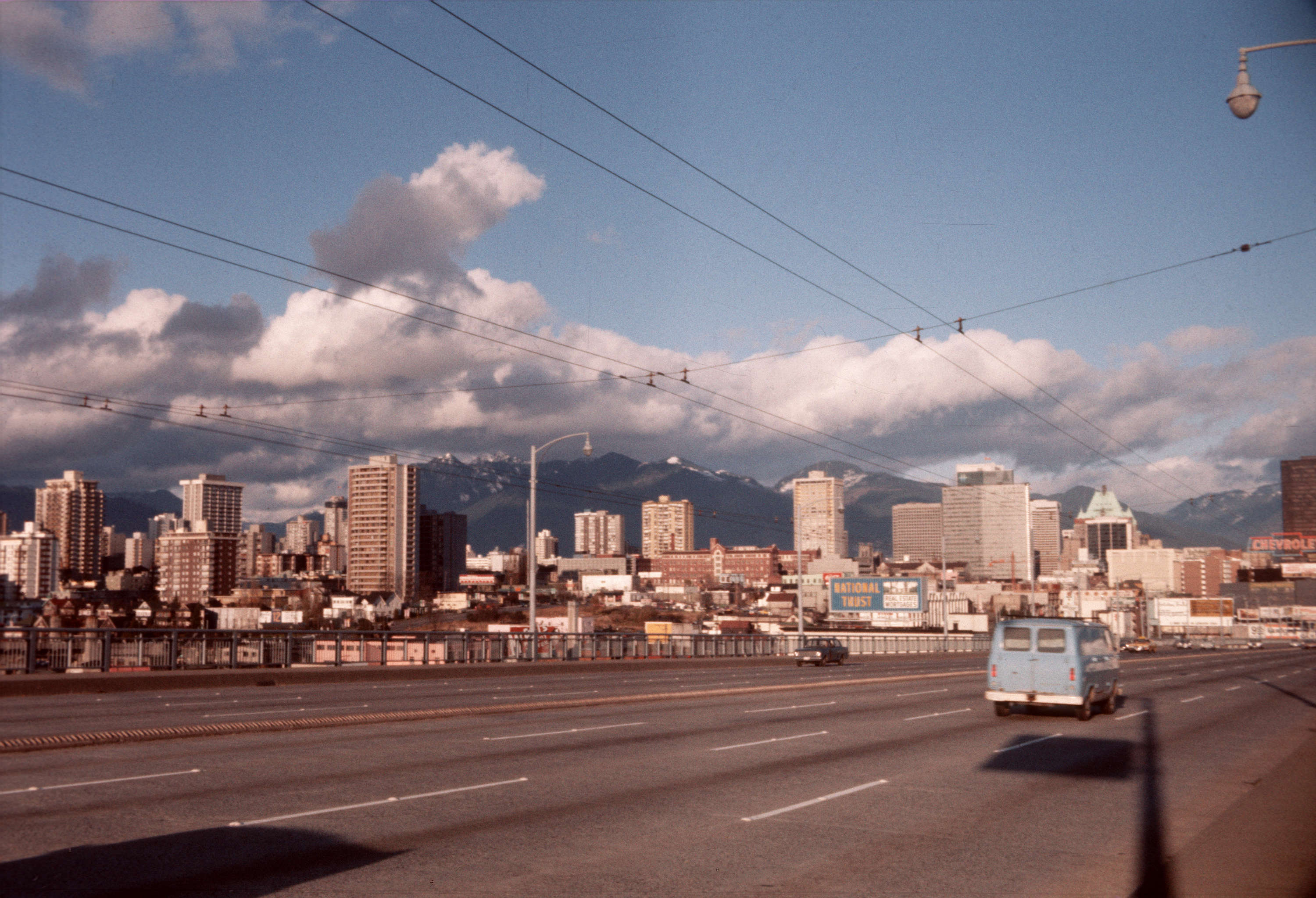
Robson & Thurlow
Robson & Thurlow
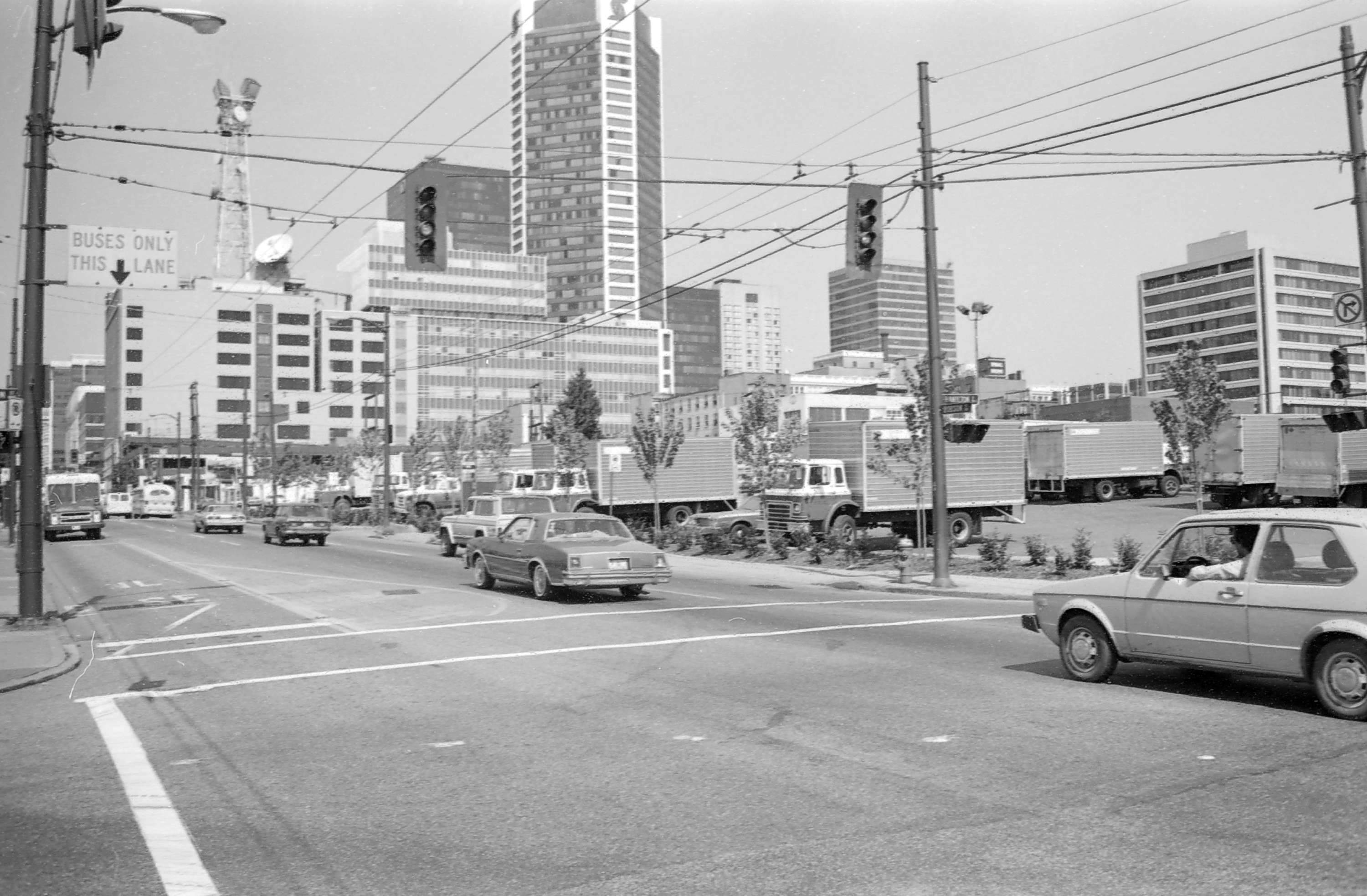
Granville Bridge.
Granville Bridge.
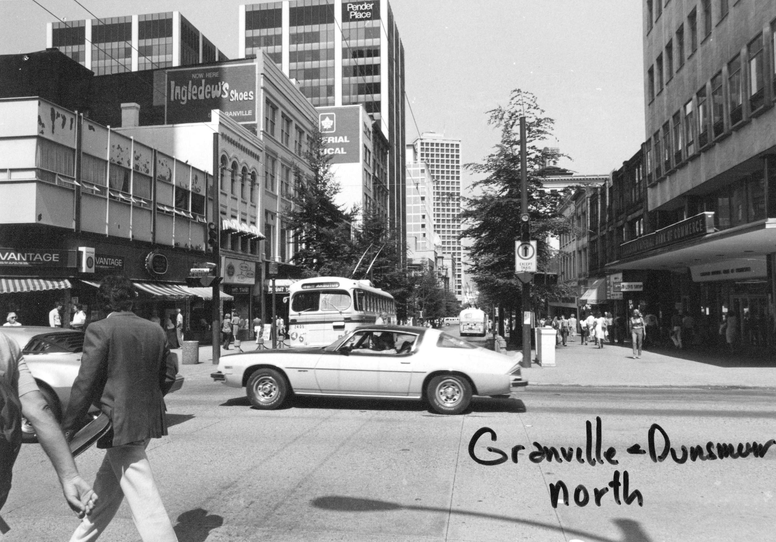
Granville Dunsmuir north
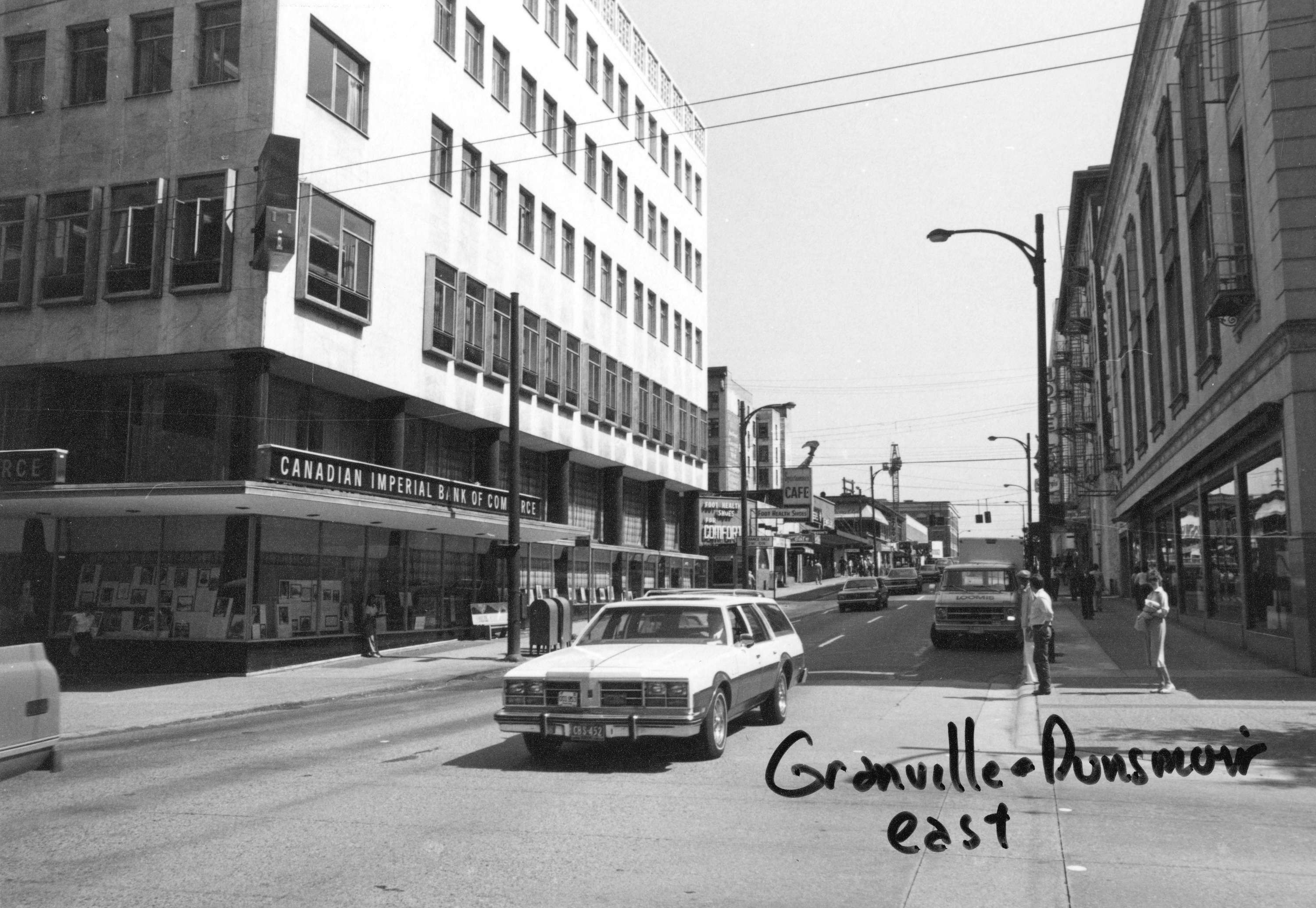
Granville.
Granville.
Robson at Hamilton.
Robson at Hamilton.
Georgia at Granville.
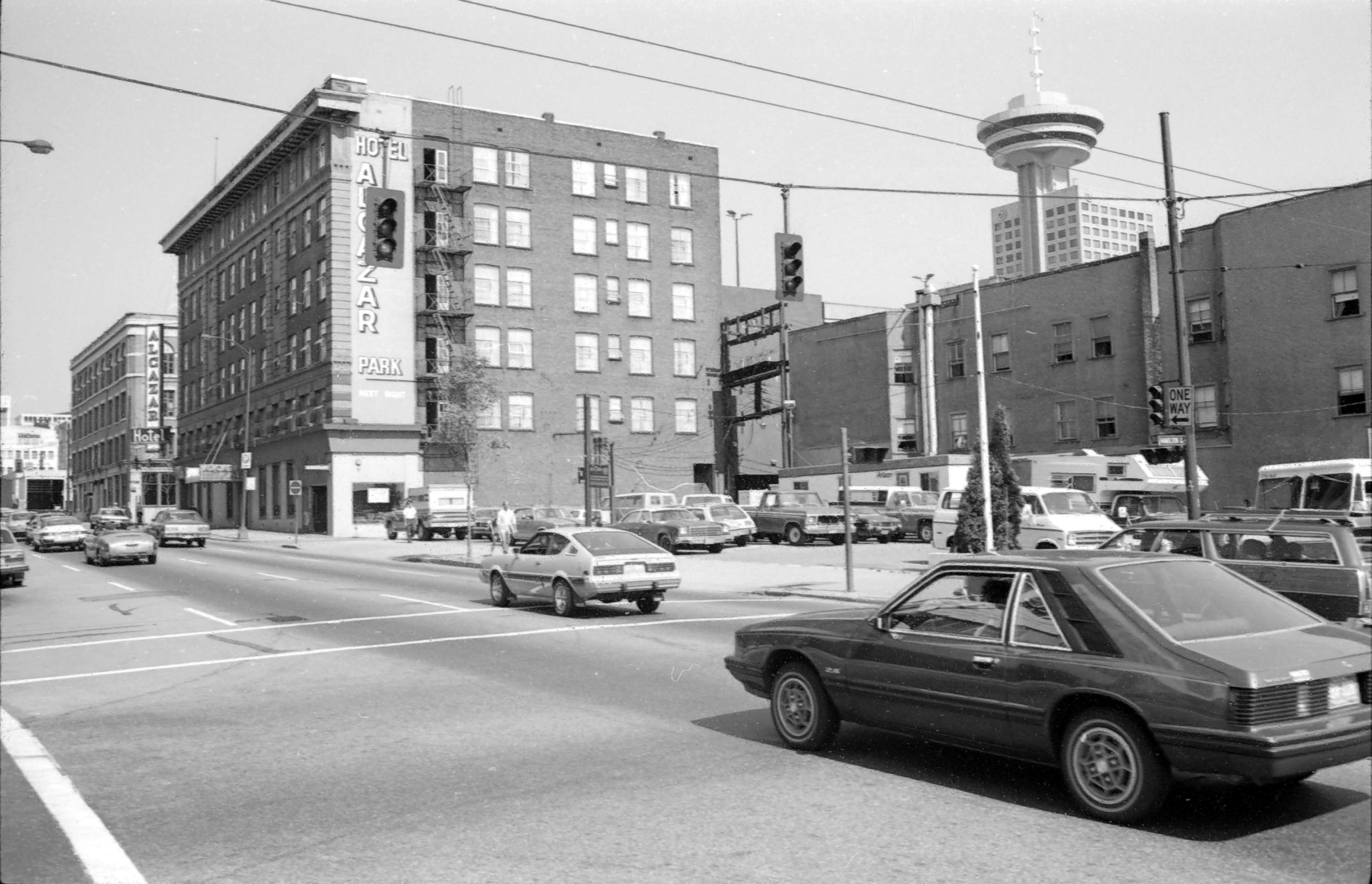
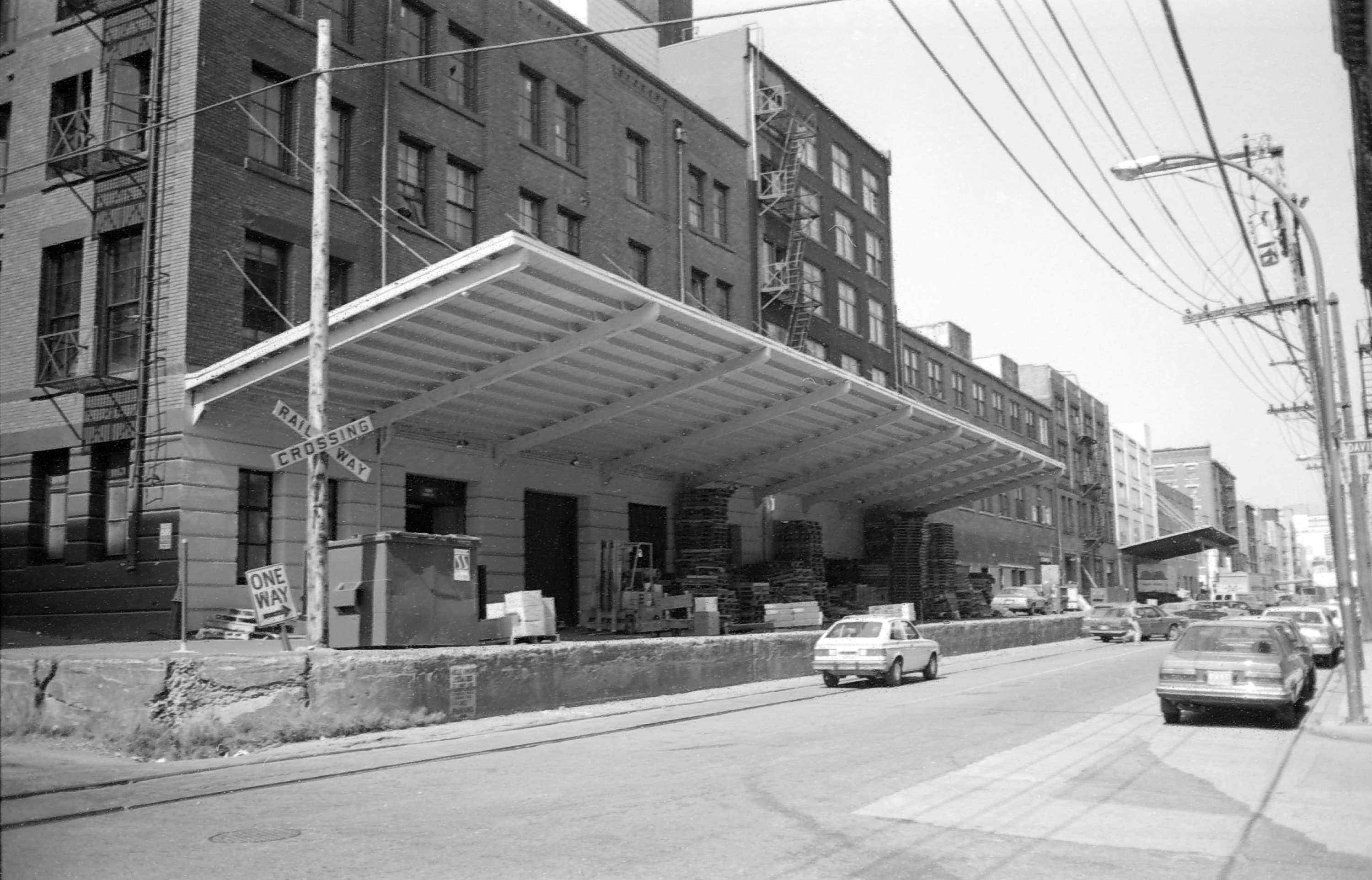
Hamilton at Davie in Yaletown.

Yaletown in the mid-1980s was still a warehouse district — low brick buildings, loading docks, and empty streets after business hours. Hamilton at Davie was nowhere near the restaurant and condo district it would become in the 1990s. These photographs of Granville, Georgia, and Robson Streets capture the city’s commercial heart before the wave of development that followed Expo 86.
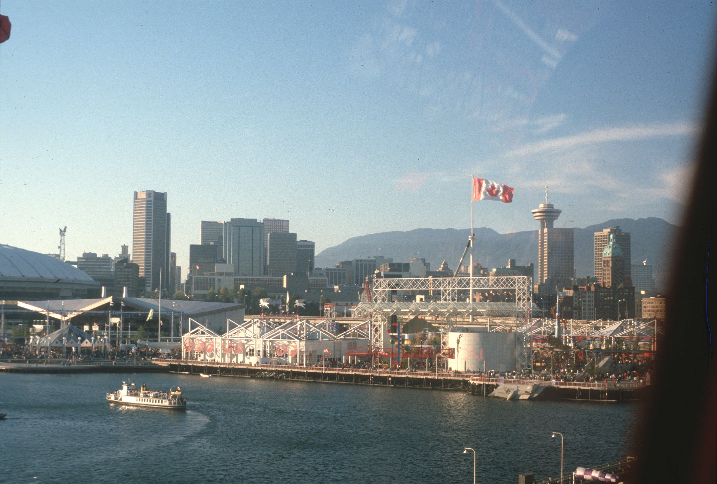
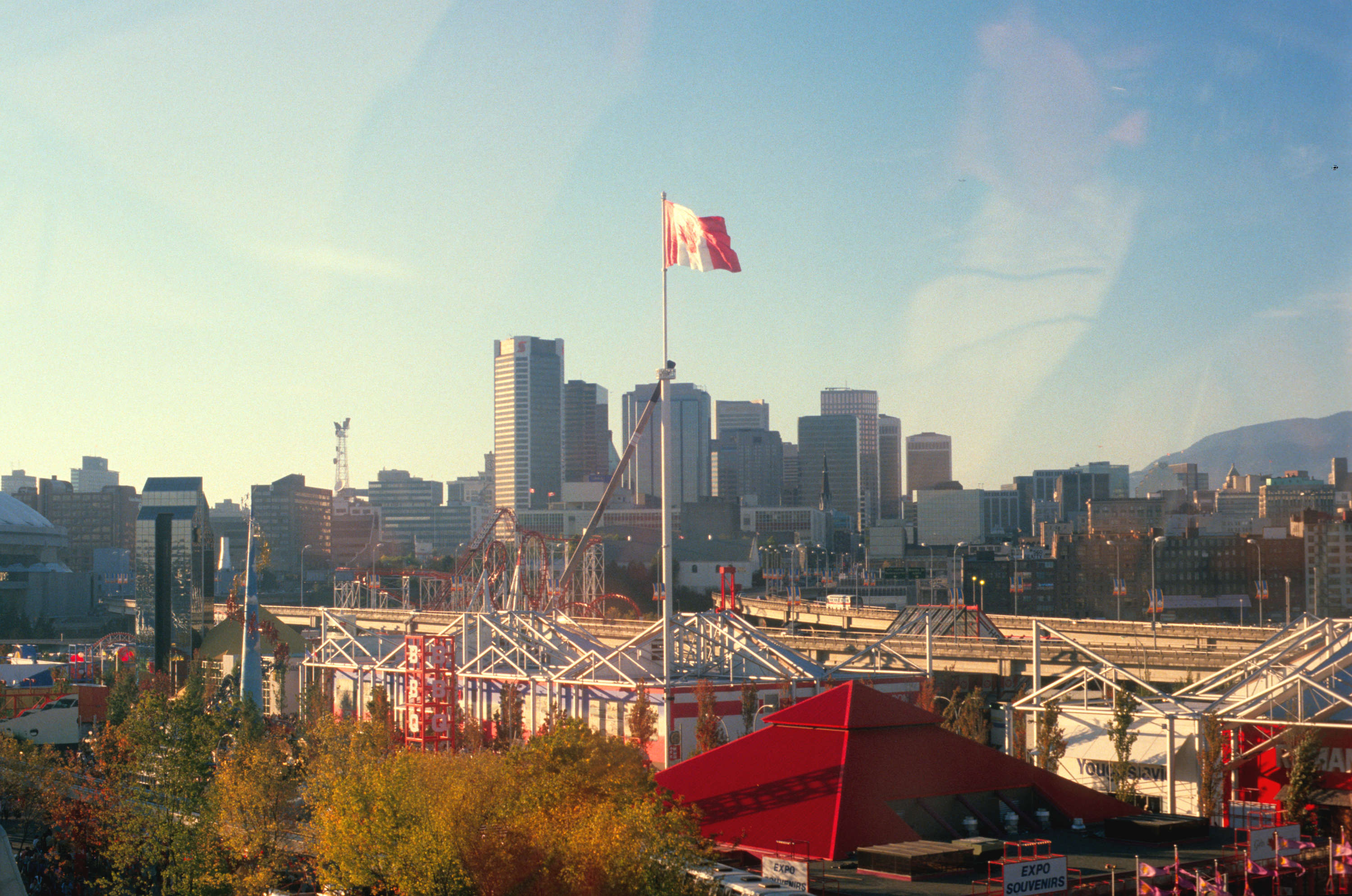
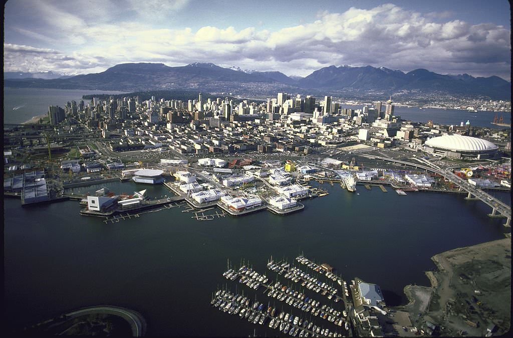
View of downtown Vancouver during Expo86..
Expo in Vancouver, 1986.
Vancouver - Expo 1986.
Vancouver – Expo 1986.
Vancouver - Expo 1986.
Vancouver – Expo 1986.
Vancouver, Expo, 1986.

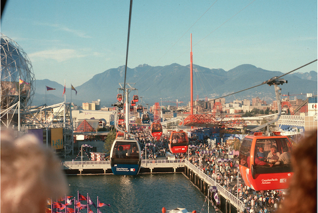
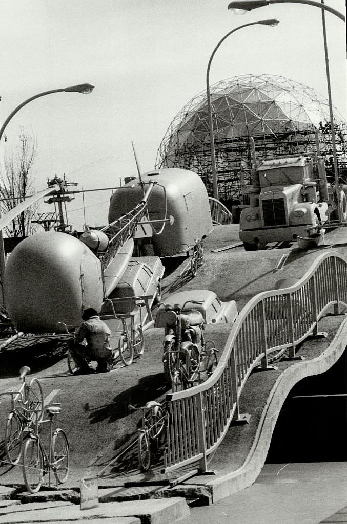
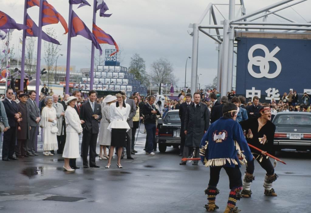
Expo 86 drew 22 million visitors between May and October of that year, making it the largest world’s fair ever held in North America. Pavilions from dozens of countries filled the False Creek site, and the Canadian federal government invested heavily in infrastructure for the event. Prince Charles and Princess Diana attended in May 1986, drawing enormous crowds and international media coverage.
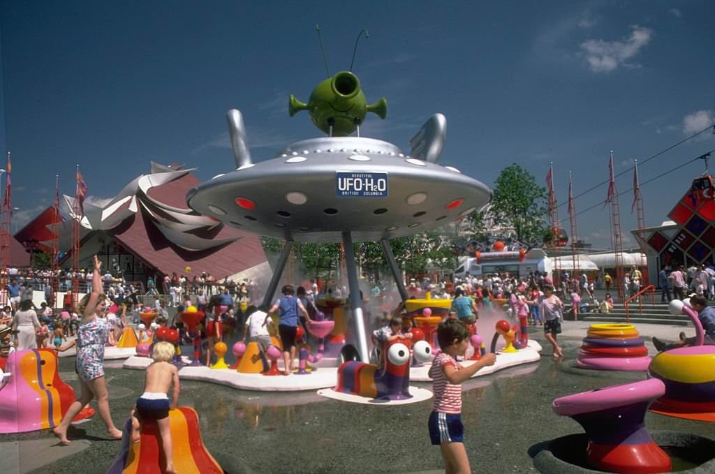
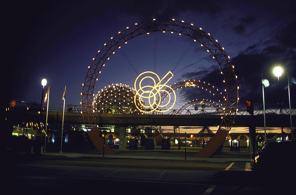
Children play on brightly colored playground equipment that sprays water at the 1986 World's Fair in Vancouver.
Children play on brightly colored playground equipment that sprays water at the 1986 World’s Fair in Vancouver.
Eastern gate of Canadian World's Fair, Expo 1986.
Eastern gate of Canadian World’s Fair, Expo 1986.
Diana, Princess of Wales and Prince Charles visit the Expo 86 World's Fair in Vancouver during a visit to Canada, May 1986.
Diana, Princess of Wales and Prince Charles visit the Expo 86 World’s Fair in Vancouver during a visit to Canada, May 1986.
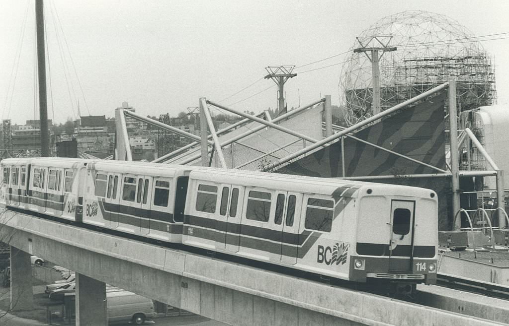
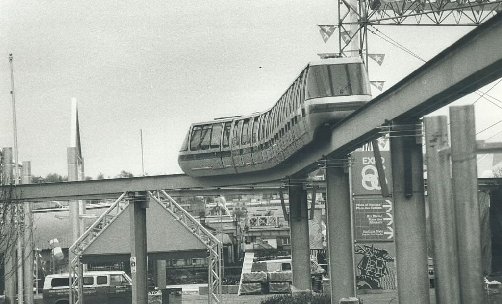
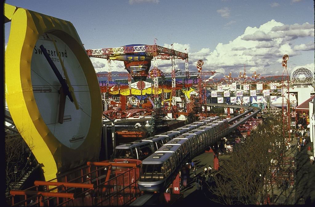
Monorail swooping past Swiss exhibit at Expo 1986 World Fair.
Vancouver, Canada, host of Canadian World, 1986

Inside the fairgrounds, a monorail carried visitors between pavilions, and interactive exhibits covered transportation, communication, and technology. The children’s areas included water-spray playground equipment that drew families on hot summer days. The fair’s theme — Transportation and Communication: World in Motion — World in Touch — reflected the era’s optimism about technology and global connection.
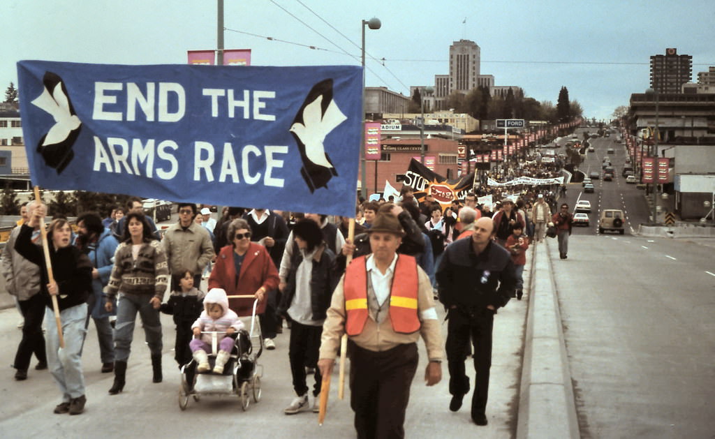
Peace March, Cambie Street Bridge, Vancouver, 1986
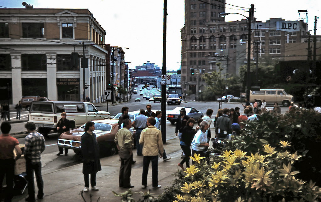
Lindsay Wagner Movie, Pender Street, Vancouver, 1986

Vancouver’s film industry was growing in the 1980s, aided by favorable exchange rates and the city’s varied urban and natural backdrops. Pender Street in 1986 was closed to traffic for a movie production featuring actress Lindsay Wagner. The city’s role as a stand-in for American locations was well established by the mid-decade.
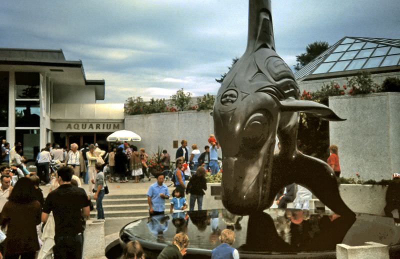
Bill Reid's Haida killer whale bronze statue in front of entrance to the Vancouver Public Aquarium, Vancouver, 1987
Bill Reid’s Haida killer whale bronze statue in front of entrance to the Vancouver Public Aquarium, Vancouver, 1987

Bill Reid’s bronze killer whale sculpture at the entrance to the Vancouver Public Aquarium was one of the city’s most recognized public artworks. Reid, a Haida artist who worked in gold, silver, bronze, and wood, brought Northwest Coast Indigenous art to international prominence. The sculpture stood as both a landmark and a statement about the region’s Indigenous heritage.
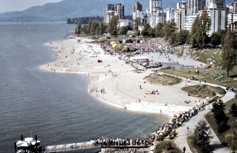
Peace March gathered at Sunset Beach in Vancouver, 1987
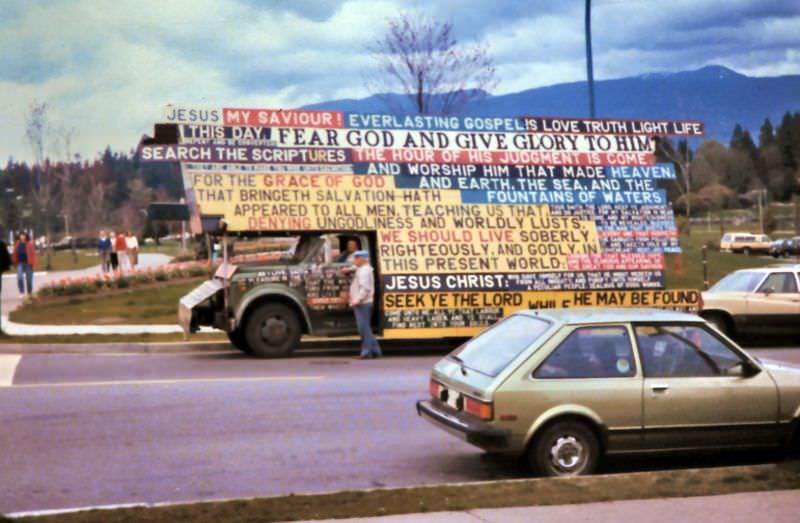
Truck with Christian religious signs parked near the entrance to Stanley Park at Denman and Georgia Streets, Vancouver, 1987
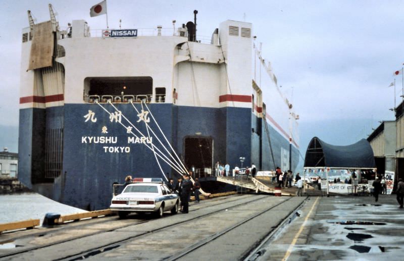
Vancouver Nissan shipload car sale at Ballantyne Pier in Vancouver, 1987

Ballantyne Pier on the East Vancouver waterfront was used in 1987 for a direct ship-to-buyer Nissan car sale — vehicles unloaded straight from the cargo ship and sold on the dock. It was an unusual retail event tied to the volume of Japanese auto imports flowing through Vancouver’s port in the mid-1980s.
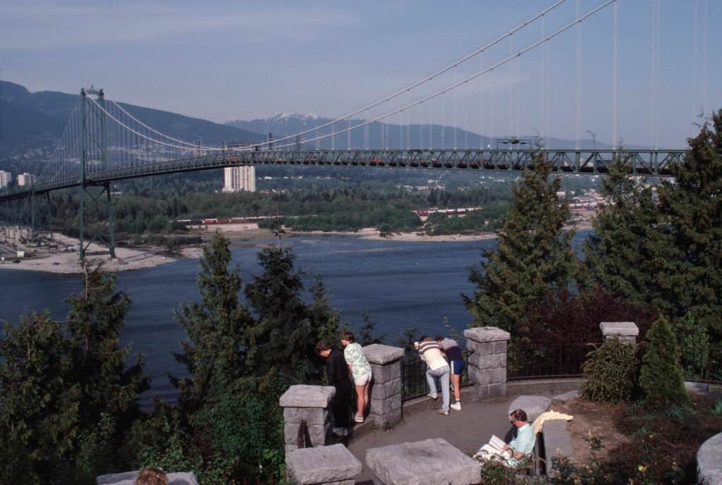
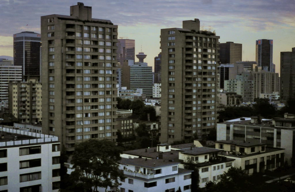
Stanley Park, Vancouver, 1987
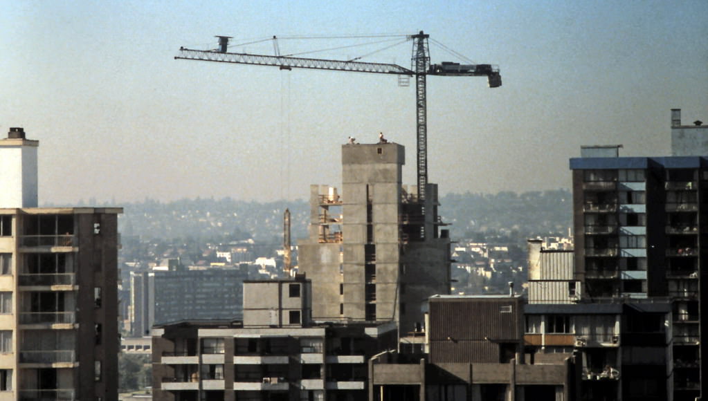
View towards Vancouver Downtown from West End, 1988
Apartments with Construction Crane in Vancouver's West End 1988
Apartments with Construction Crane in Vancouver’s West End 1988
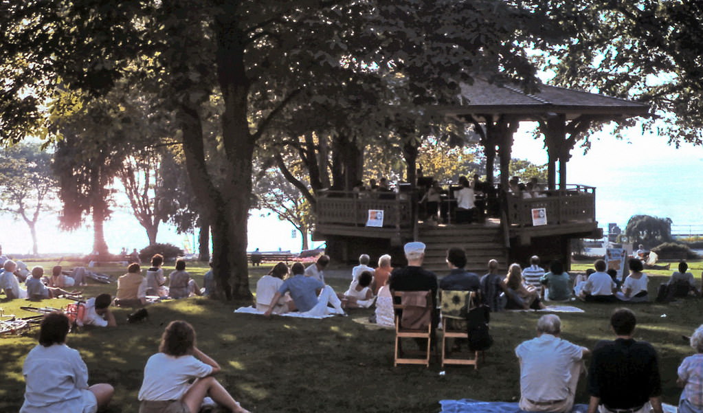
Alexandra Park Bandstand, Vancouver, 1988.

By 1988, Vancouver’s West End skyline had been transformed. Looking northeast from rooftops in the neighborhood, the Bentall Centre, Harbour Centre, and Royal Centre towers were all visible beyond the apartment buildings of the West End. Construction cranes were active across the area, and the post-Expo building boom was pushing residential density higher.
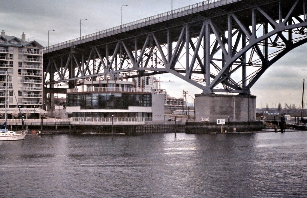
Granville Street Bridge, False Creek, Vancouver, 1989
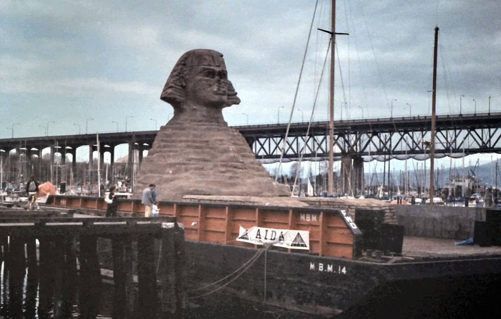
False Creek Barge Sphinx after Expo 86, Vancouver, 1989
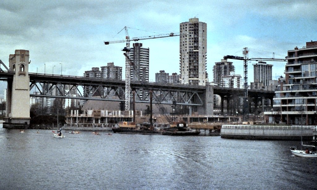
Condo Construction with Burrard Street Bridge, Vancouver, 1989.
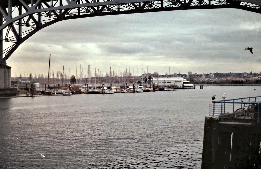
Under Granville St. Bridge to False Creek Marina, Vancouver, 1989

In the years after Expo 86, False Creek’s former fairgrounds were rapidly converted into residential neighborhoods. By 1989, condominium towers were rising along the water’s edge, and the barge Sphinx — left over from the fair — still sat in the creek while redevelopment planning proceeded around it. The transformation of False Creek from an industrial zone to a residential neighborhood was one of the largest urban redevelopment projects in Canadian history.
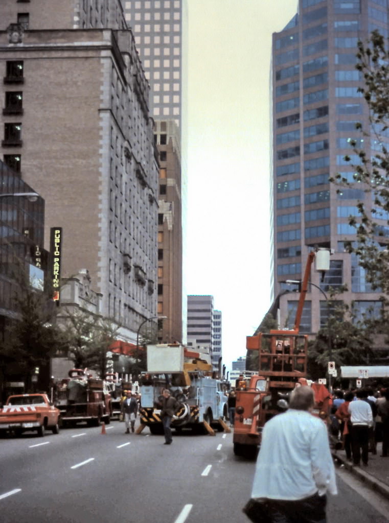
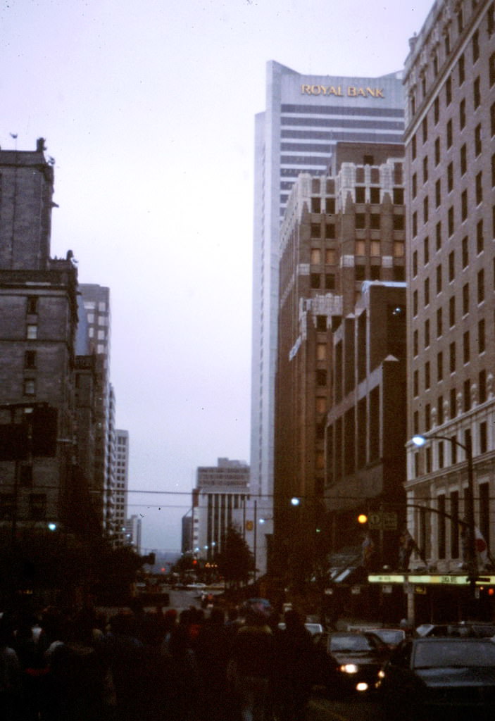
Georgia Medical-Dental Building Demolition Preparation, Vancouver, 1989.
Georgia Medical-Dental Building Demolition, Vancouver, 1989.
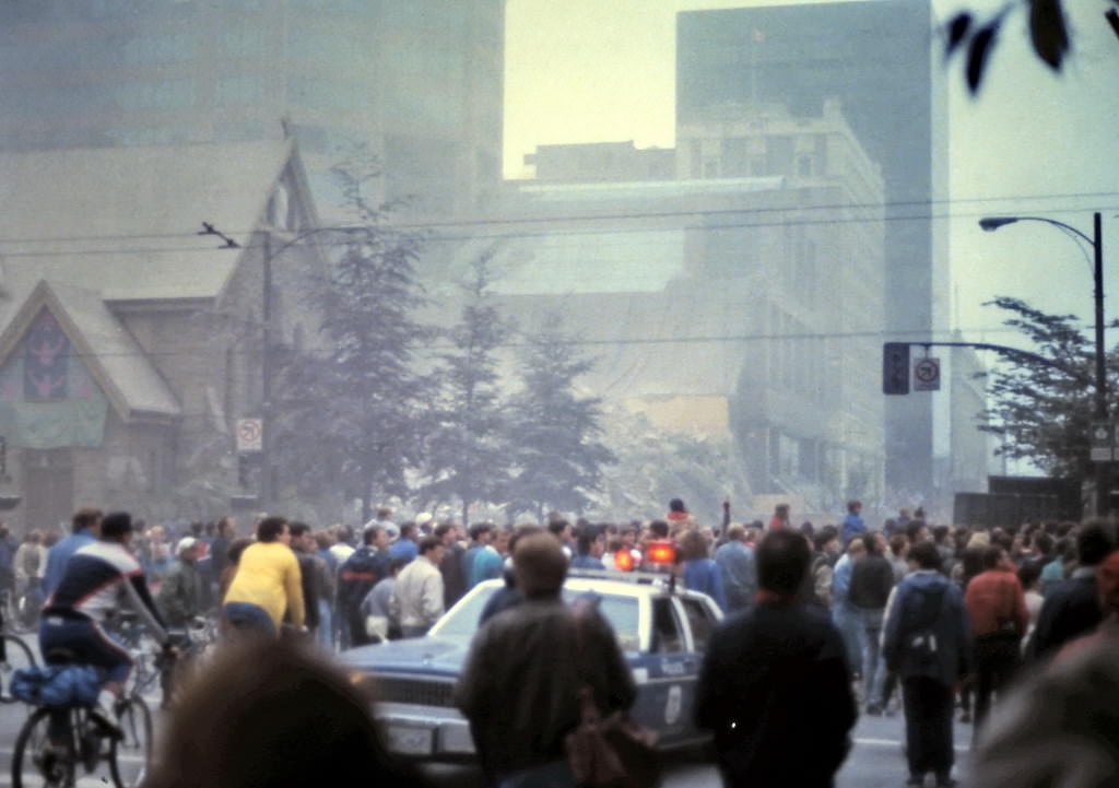
Medical-Dental Controlled Explosion Demolition Crowd, Vancouver, 1989
Georgia Medical-Dental Building Demolition Dust Cloud, Vancouver, 1989.

The Georgia Medical-Dental Building on West Georgia Street was demolished by controlled explosion in 1989. Crowds gathered to watch the blast bring down the structure in a cloud of dust. The demolition cleared the site for new development and marked the end of one of downtown Vancouver’s older professional towers — a fitting symbol for a decade that had rewritten the city’s skyline.
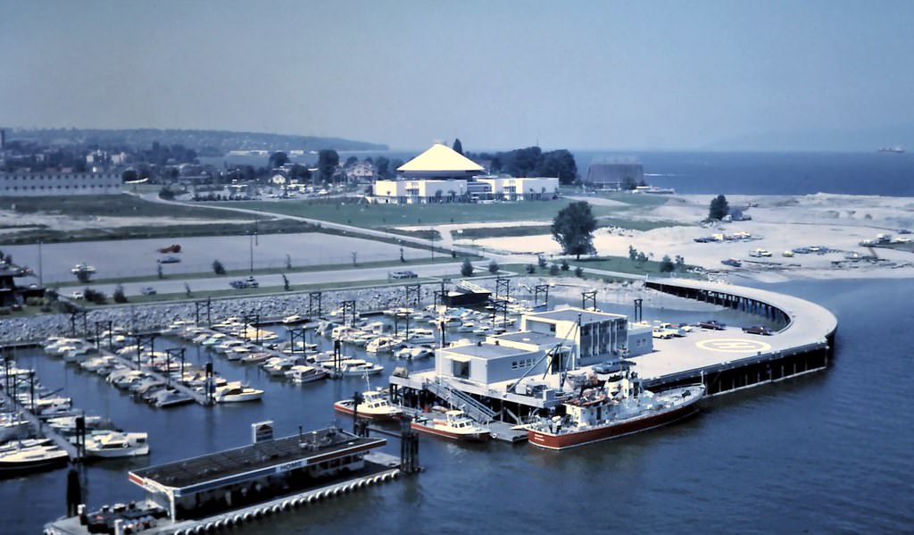
Kits Point Marina, Coast Guard & Park, Vancouver, 1982
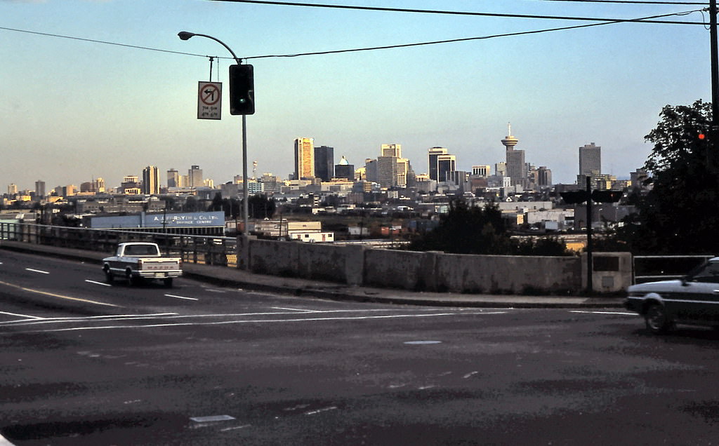
Downtown Vancouver as seen in the morning from First Avenue looking across Clark Drive and Grandview Viaduct in East Vancouver, 1982
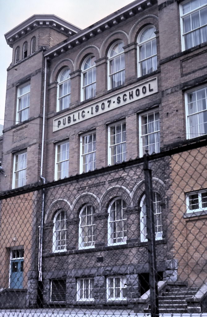
Lord Roberts Elementary school in Vancouver, 1982
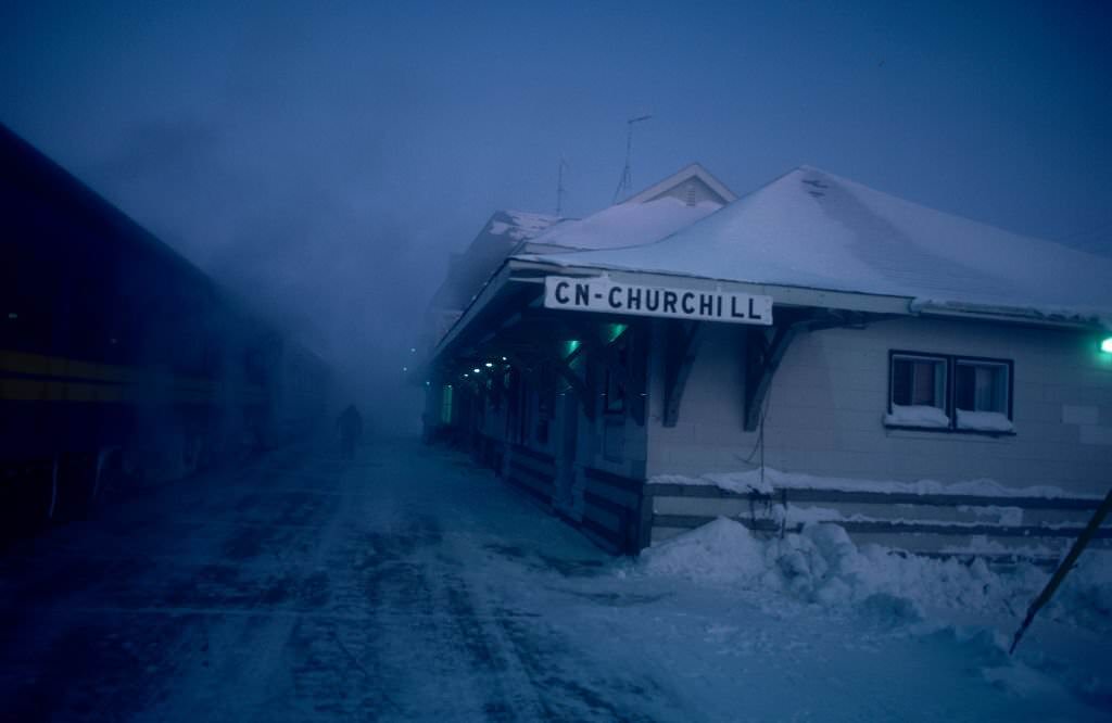
CN, Churchil, 1980s
CN, Churchil, 1980s
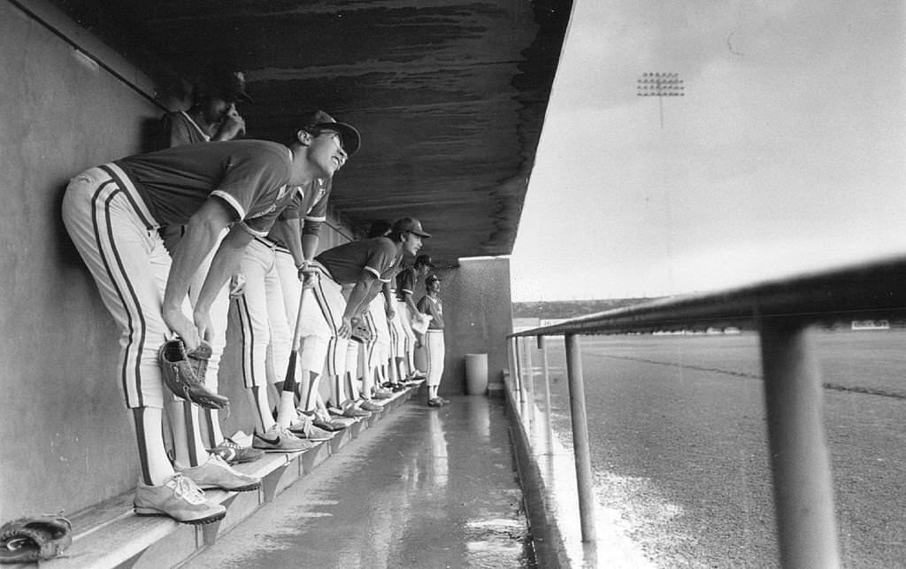
Orel Hirshiser, foreground, looks on anxiously, 1982
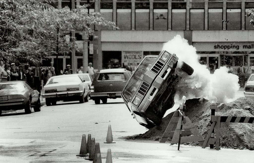
Lombard St. closed to film a car stunt for the third Perry mason tv movie, Vancouver, 1980s
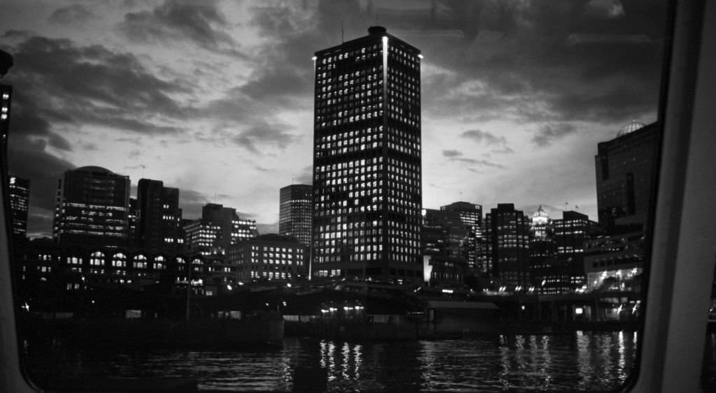
Illuminated buildings at night reflecting off the surface of the Fraser River
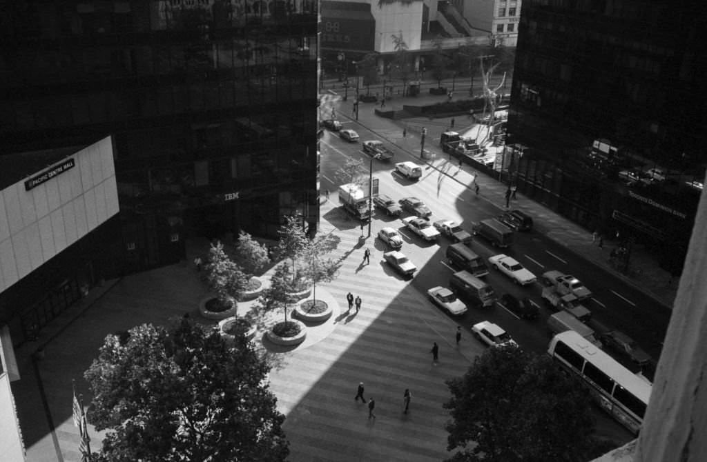
Bird's eye view of a business district
Bird’s eye view of a business district
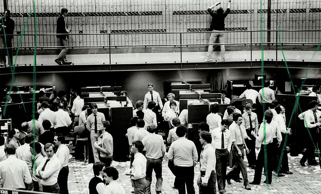
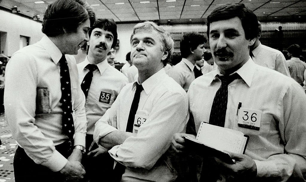
Vancouver traders shuddered a week ago today, 1980s
Vancouver, 1980s
Vancouver, 1980s
Vancouver, 1980s
Vancouver, 1980s
Vancouver, British Columbia, 1980s
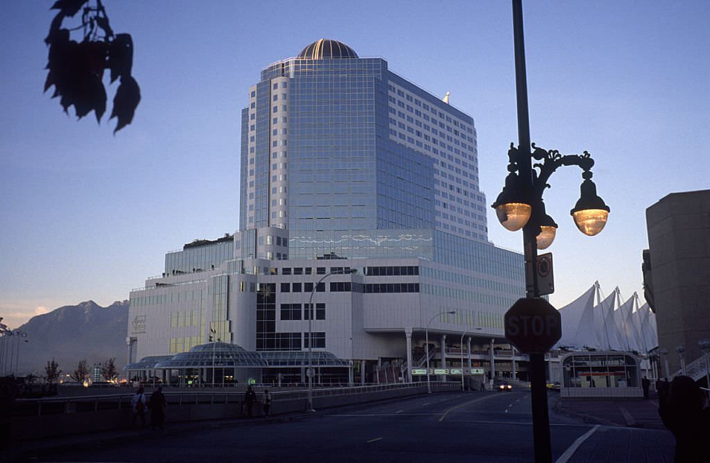
Canada Place, Vancouver, 1980s
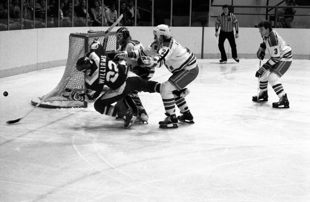
Rangers & Canucks Action

Canada Place, built as the Canadian government’s pavilion for Expo 86, remained after the fair closed as a convention and cruise ship terminal. Its distinctive white sails became one of Vancouver’s most recognized landmarks. The Vancouver Canucks, meanwhile, continued to draw passionate crowds to the Pacific Coliseum through the 1980s, including their memorable battles against the New York Rangers. Taken together, these images form a complete record of a decade when Vancouver stopped being a regional city and became something significantly larger.


Enjoyed this post? Get new ones in your inbox.

2 thoughts on “What Vancouver looked like in the 1980s Through These Fascinating Photos”

  1. Amazing how some places (businesses) look exactly the same. Surprisingly, its not the changes to the buildings that I notice but the changes in nature (trees bigger or gone depending on the photos)

Leave a Comment

Your email address will not be published. Required fields are marked *

Share this Post 🥺

Please take a moment to share this content. Your support is greatly appreciated! 🙌🙏

Share this Post 🥺

Please take a moment to share this content. Your support is greatly appreciated! 🙌🙏
Scroll to Top
 
Hey Friend, Before You Go.. Please like & follow for more interesting content