
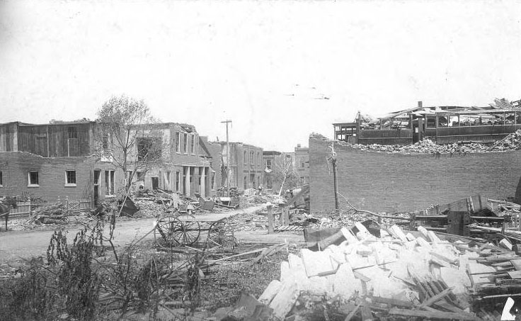
On May 27, 1896, a powerful tornado tore through St. Louis, Missouri, killing at least 255 people and injuring over 1,000 more. Moving at around 60 miles per hour, the storm traveled from the western suburbs through downtown and into the eastern parts of the city, destroying hundreds of homes, businesses, and landmarks. The photographs below document the widespread destruction left in the tornado’s wake, capturing scenes from the hardest-hit neighborhoods including Soulard, Lafayette Square, and Compton Heights.
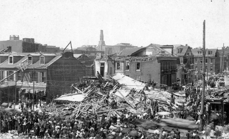
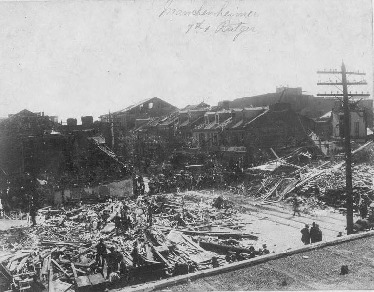
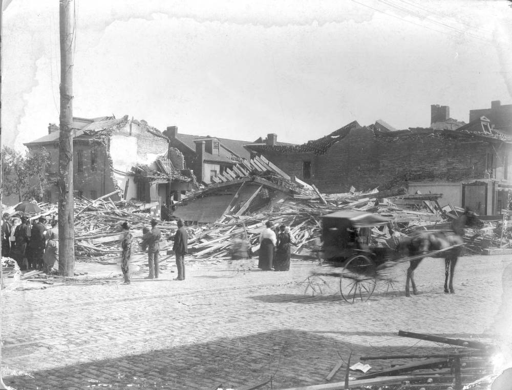
The tornado struck this intersection in Soulard with particular force, causing many deaths at this location. A large crowd gathered at the site of Mauchenheimer’s saloon, whose address had been 1300 South 7th Street. Across the street, Klute’s Grocery, at 1305 South 7th, still stood. In the distance the damaged church of St. Vincent de Paul, at Park Avenue and 9th Street, can be seen.
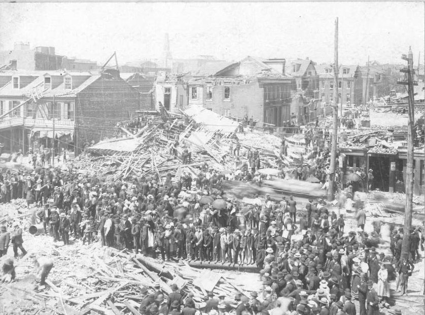
Across the street, Klute’s Grocery, at 1305 South 7th, still stood. In the distance, the damaged church of St. Vincent de Paul, at Park Avenue and 9th Street, can be seen.
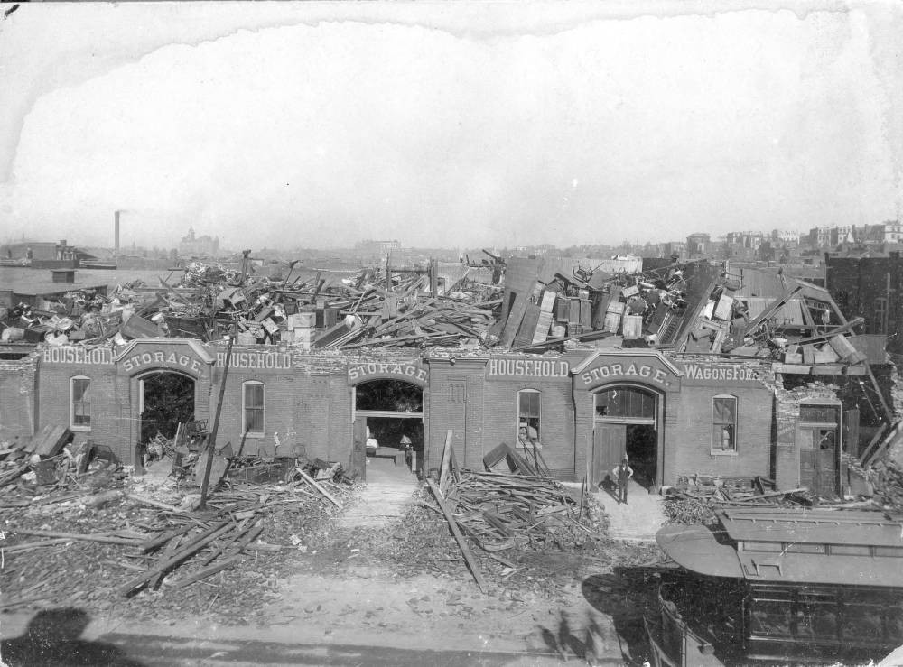
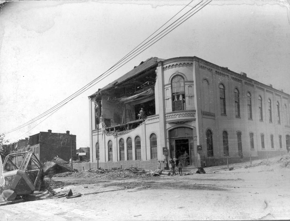
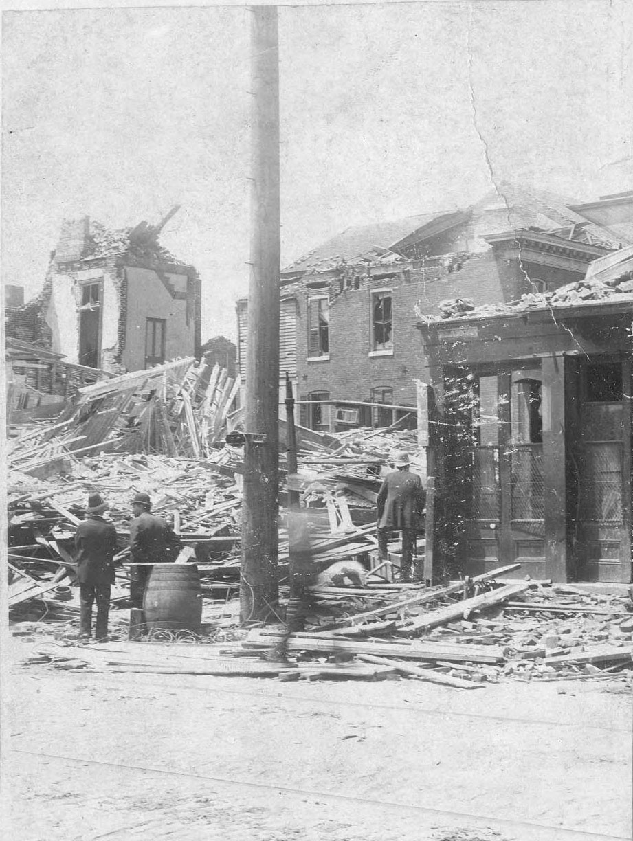
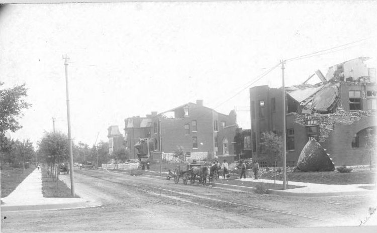
The tornado punched out one wall and blew a heavy iron cupola onto the street. The building was repaired and still stands. It housed the Smile Soft Drink Company in the 1920s and is now known as the Smile Building.
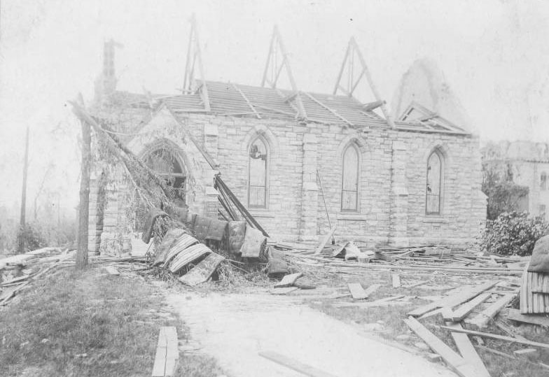
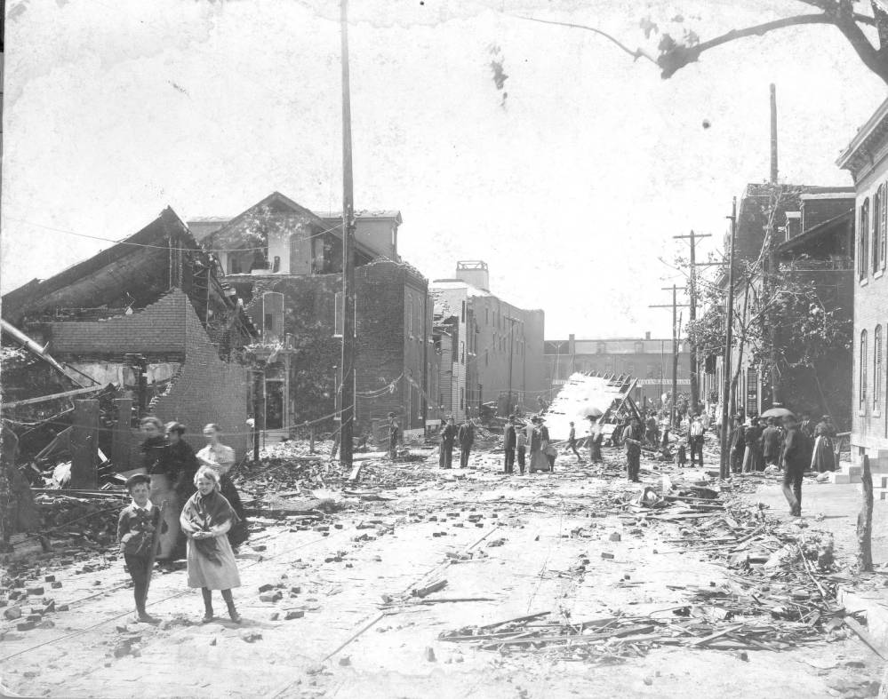
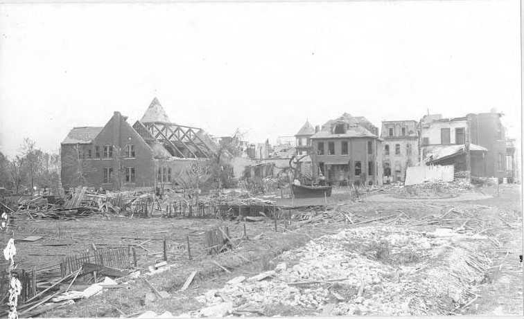
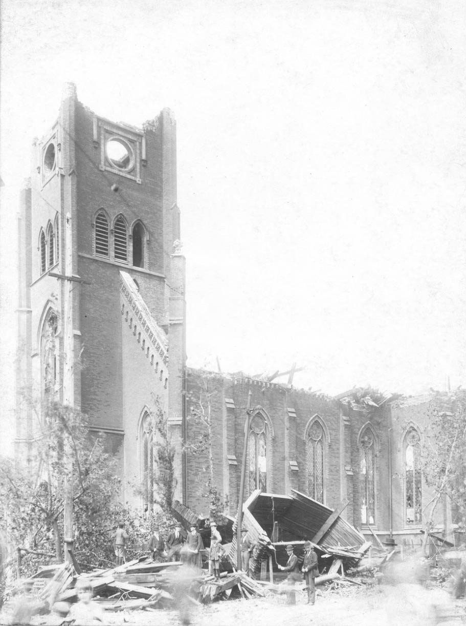
A newspaper reported that a woman who stayed behind after the others had left thought it would provide shelter during the approaching storm, but was forced to flee outside when the roof caved in. Although it lost its entire roof, this church was rebuilt on the same site. Note the dozen or so mattresses draped on a tree. Armstrong Avenue is now named MacKay Place.
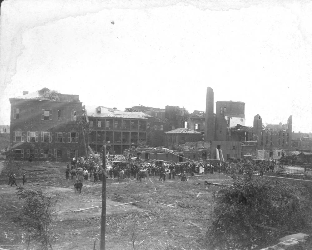
The building that the tornado destroyed, located at Lafayette Avenue and 14th Street, had been built in 1857. Its 450 patients were moved to temporary locations, but replacement structures were not finished on this site until 1905.
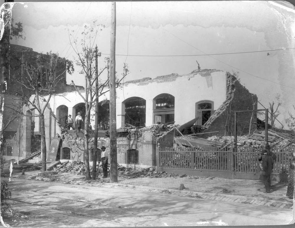
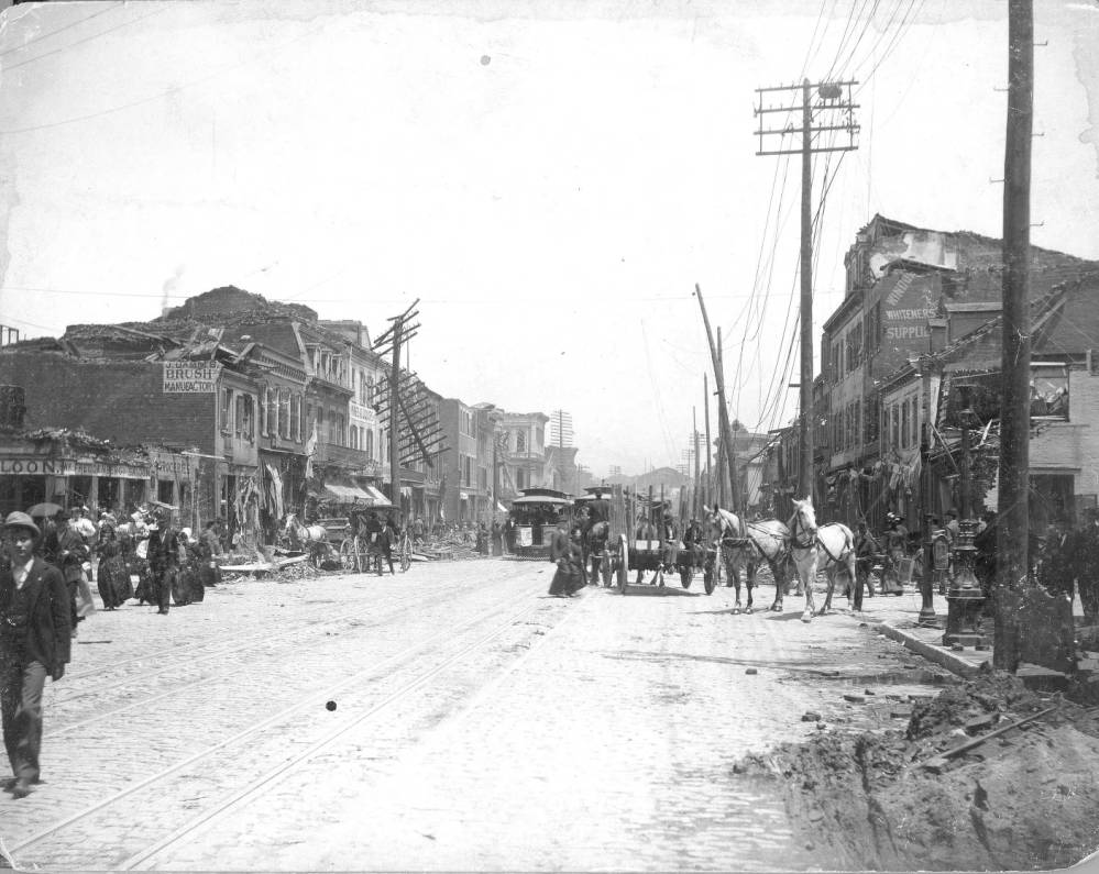
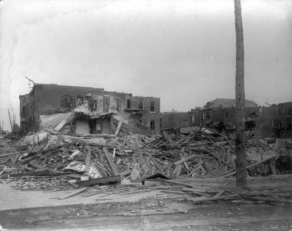
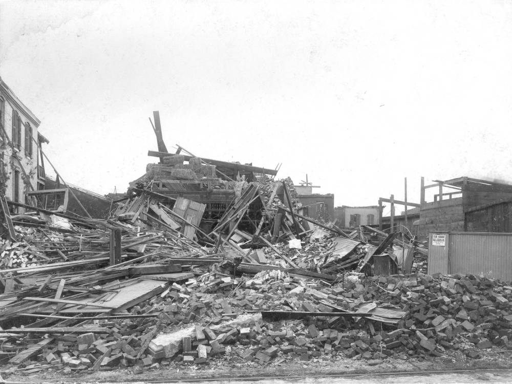
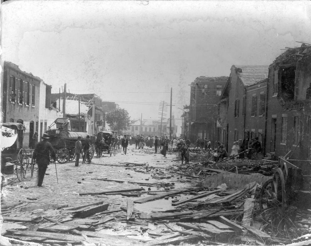
Walls and roofs are missing, broken telephone poles and wagons are heaped in the street, and people are milling around or busy trying to clean up. Freudenberg’s saloon (1437 South Broadway), a brush company, and a liquor store are among the businesses visible in this photograph.
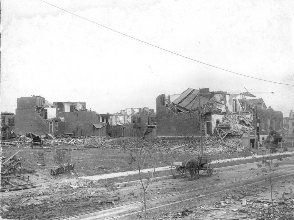
The building on the right is the streetcar shed of the People’s Railway Company, one of over a dozen privately owned rail companies that served St. Louis at the time. One car can be seen on the unroofed 2nd floor. It appears to be car 12, Fourth and Chouteau line. The words “Fourth and Chouteau” can be seen on its side, and some of the words on its roofline appear to be stops on this line, such as the Iron Mtn. Depot, Lafayette Park, and a Garden. The People’s Railway Company’s offices were at 18th Street and Park Avenue, on the east side of Lafayette Park.
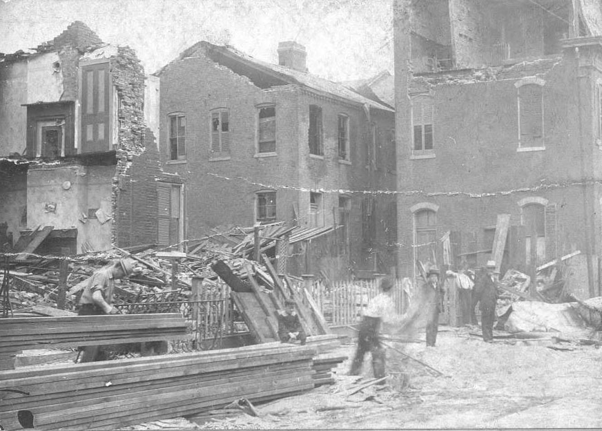
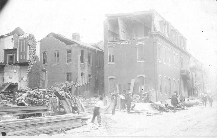
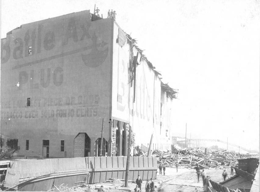
The tall building in the left background is the destroyed People’s Railway Company Power House and offices.
![[Factually Corrected] The tornado devastated this area of Jefferson Avenue just west of Lafayette Park.](https://www.bygonely.com/wp-content/uploads/2023/01/St_Louis_Tornado_1896_20.jpg)
The building on the right is the streetcar shed of the People’s Railway Company, one of over a dozen privately owned rail companies that served St. Louis at the time. One car can be seen on the unroofed 2nd floor. It appears to be car 12, Fourth and Chouteau line. The words “Fourth and Chouteau” can be seen on its side, and some of the words on its roofline appear to be stops on this line, such as the Iron Mtn. Depot, Lafayette Park, and Shaw’s Garden. The People’s Railway Company’s offices were at 18th Street and Park Avenue, on the east side of Lafayette Park.
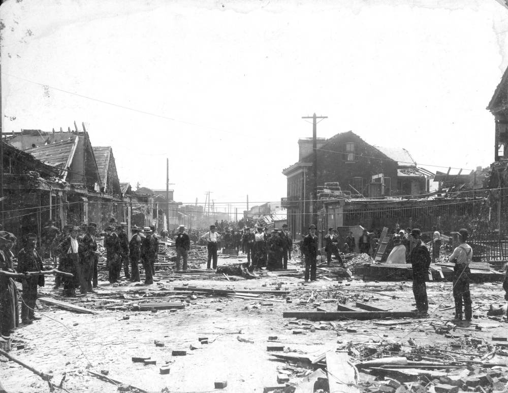
Most buildings were destroyed, and many lives were lost. This view of Rutger looking east from 7th Street shows the large crowd that gathered to view the damage and mourn the next day.
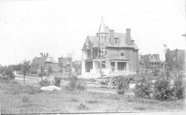
Its streets curve gently around landscaped areas in a deliberate change from the traditional grid pattern, and are named for important literary figures. Many of the upper-class homes built there lost walls and roofs to the tornado. One of these homes is that of Dr. Hugo M. Starkloff, physician and father of St. Louis’ famous Health Commissioner Dr. Max Starkloff.
The tornado hit here after it wreaked havoc in Compton Heights, Lafayette Square, and Soulard, and before it skipped across the river to damage Eads Bridge and East St. Louis.
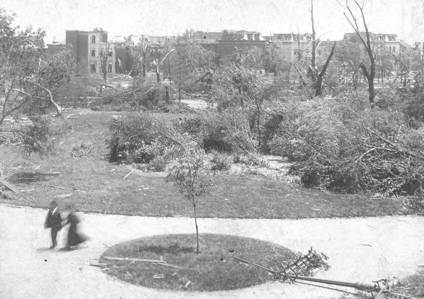
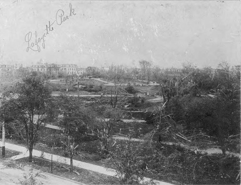
The tornado did some of its worst damage in this neighborhood; the park did not recover for many decades. Damaged houses on the surrounding streets of Lafayette Square are seen in the distance.
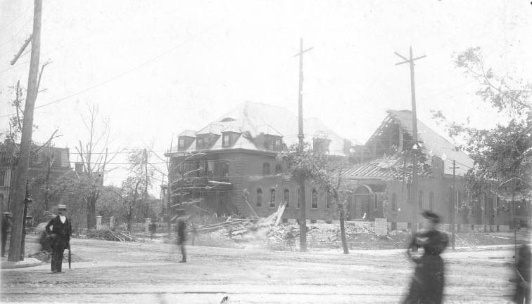
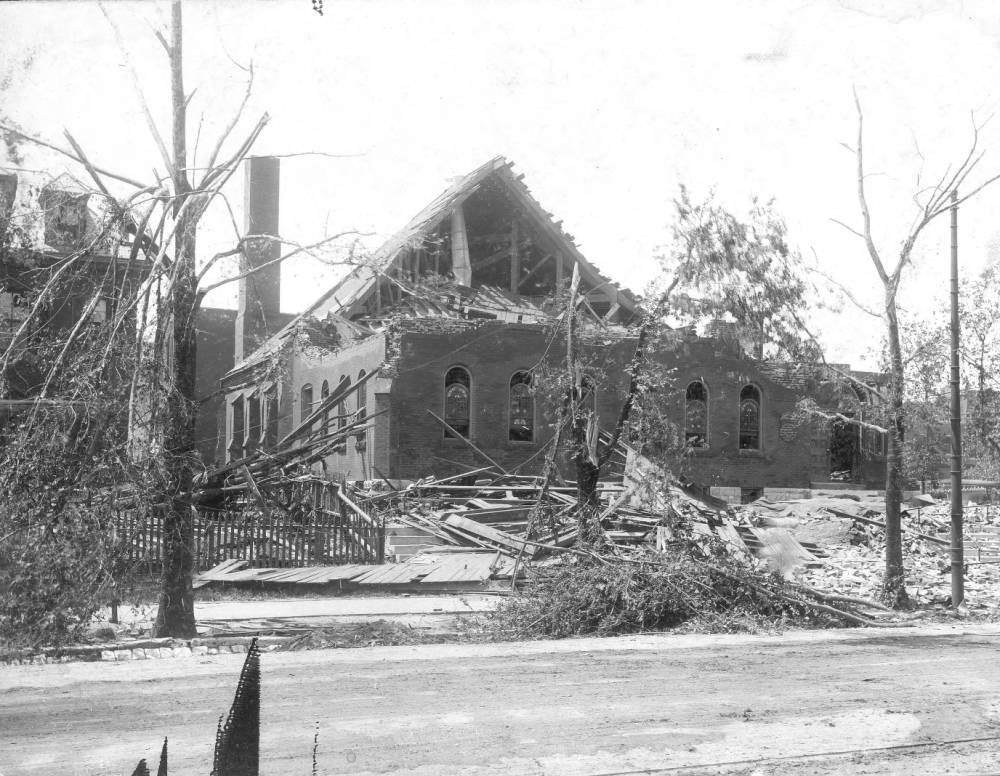
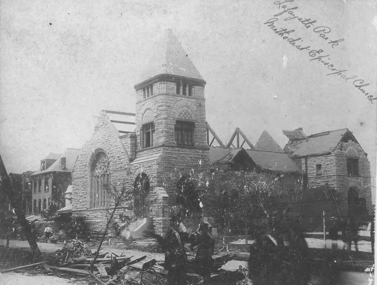
The congregation had built and occupied this stone Romanesque Revival building in 1888. The church’s sanctuary sustained heavy damage and was rebuilt and enlarged to designs by Theodore Link.
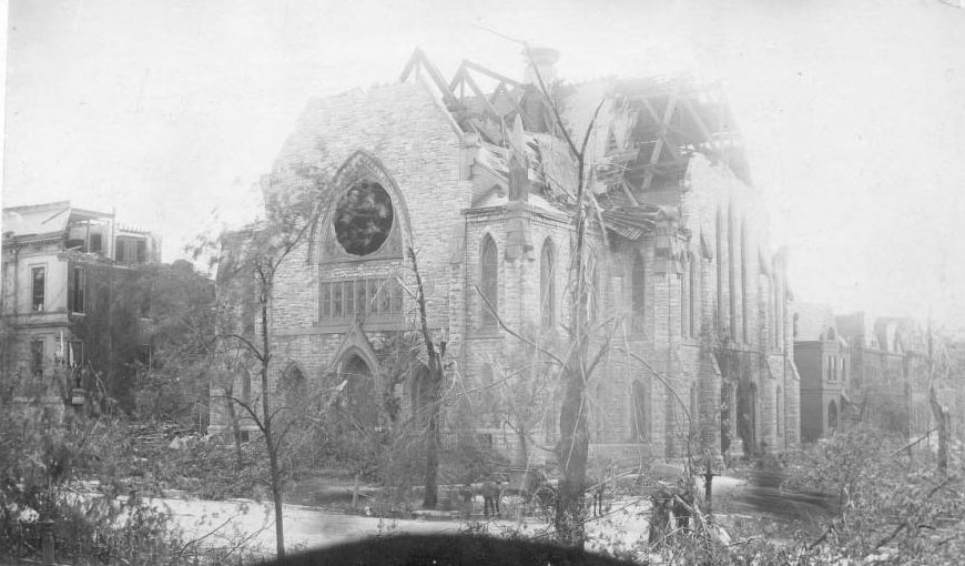
Although devastated by the tornado, its Sunday School room was used to gather and distribute donated clothing after the storm. Services were held in its basement until the building was sufficiently rebuilt to hold a Homecoming Service in the sanctuary in November 1896.
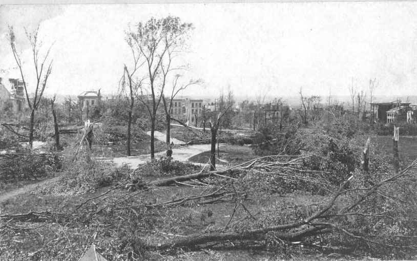
Damaged houses on Missouri Avenue and the Lafayette Park Presbyterian Church can be seen in the background in this west-looking view.
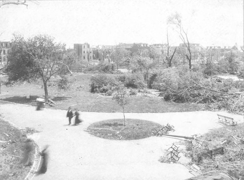
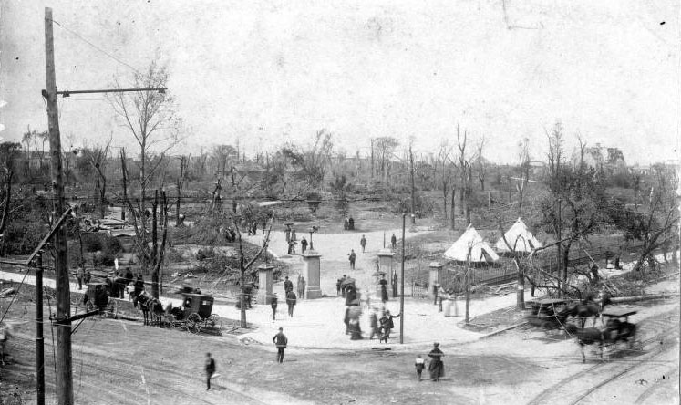
The tornado did its worst damage in this area, destroying most of the trees and structures in the park. The ruins of the Lafayette Park Presbyterian Church can be seen in the distance on the right-hand side of the photograph.
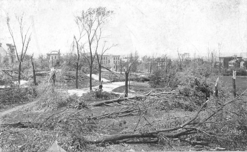
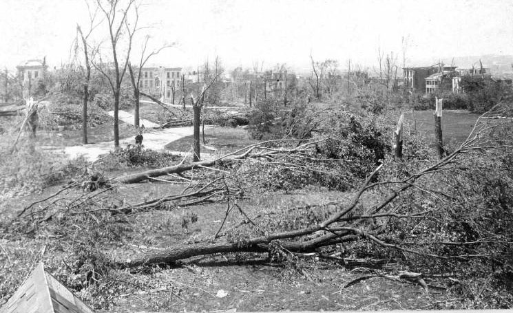
Landowner William Barr donated this lot to the St. Louis Public Library. It is the site of the library’s oldest branch, Barr Branch. Barr Branch was designed by architect Theodore Link.
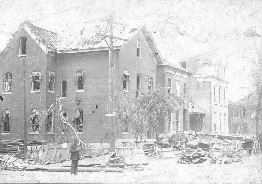
The Union Depot Railroad was one of the largest of the dozen or so privately operated rail and streetcar companies that served St. Louis in the 1890s. Curtains were sucked out of windows of its headquarters, located at the corner of Missouri and Geyer Avenues just south of Lafayette Park.
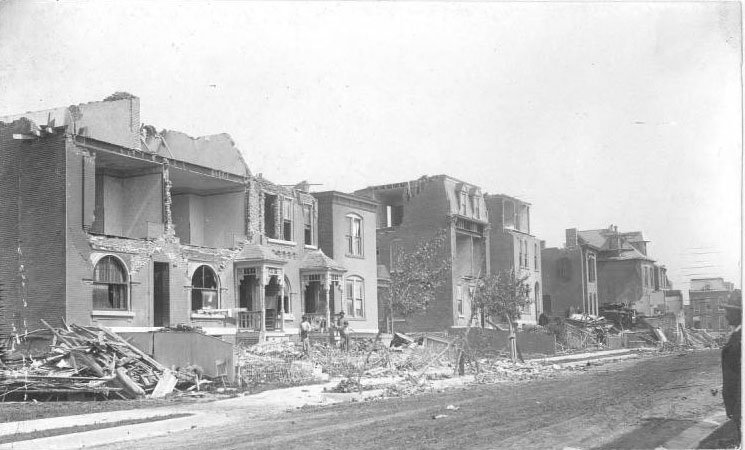
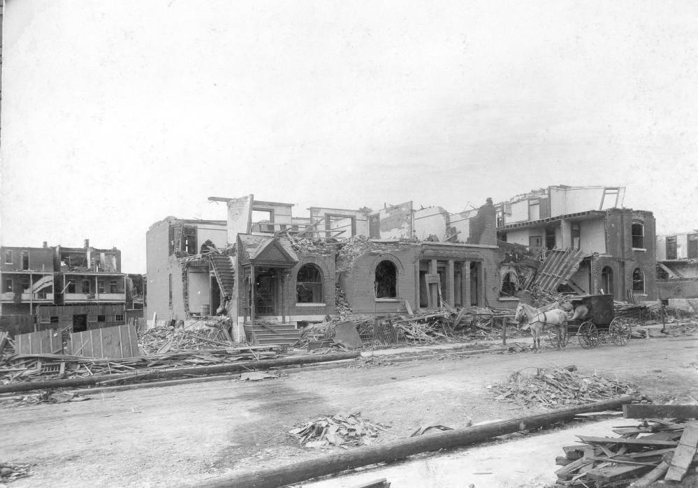
The extensive damage to these homes indicates that they were located on the north end of Oregon Avenue, probably between Compton Heights to the west and Lafayette Square on the east.
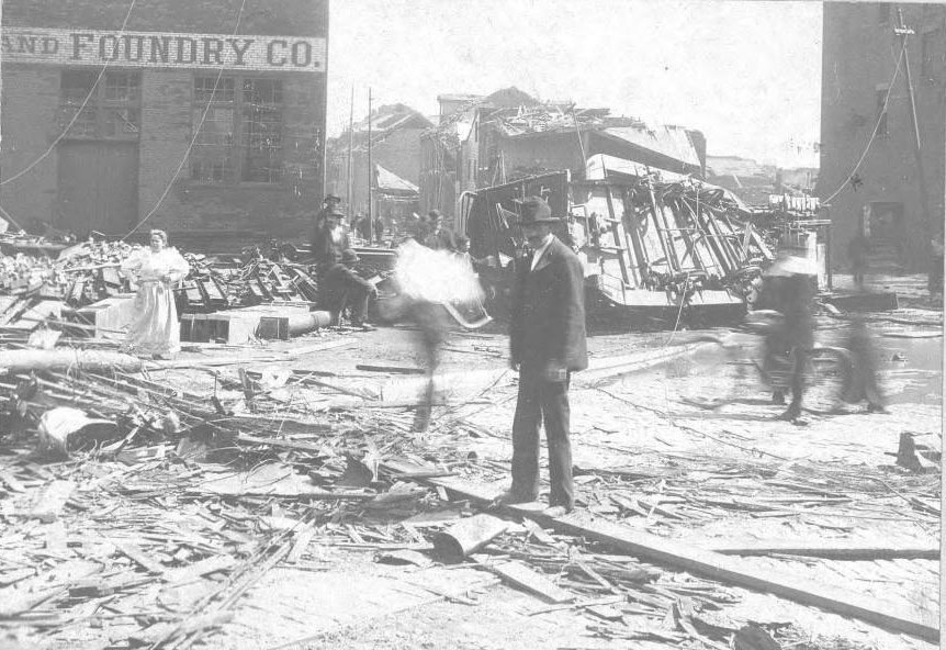
The tornado struck the Christopher & Simpson Architectural Iron and Foundry Company, located on Park Avenue between 8th and 9th streets. An overturned streetcar is seen at center right, and the iron pillars for buildings that this company made can be seen on the ground at left.
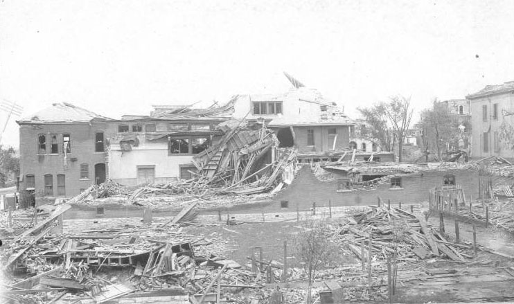
The Union Club, located at Lafayette and Jefferson in the Lafayette Square neighborhood, had been formed in 1891 and was a leading social club for south side residents. The club was rebuilt, although in a different architectural style, on this site.
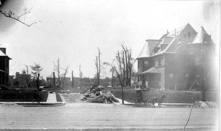
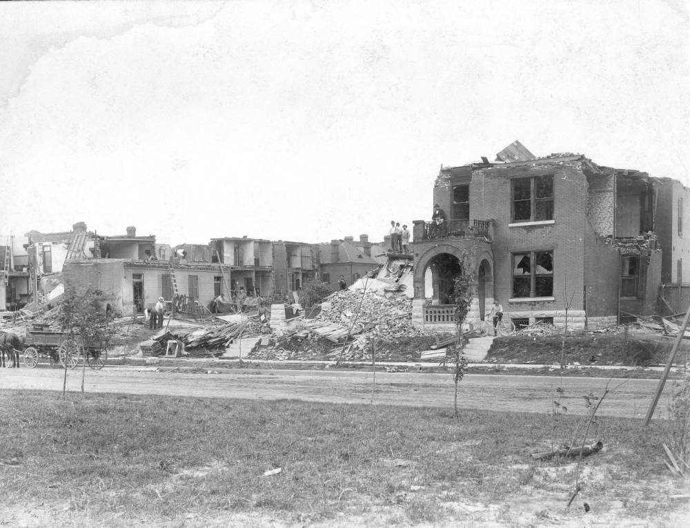
The Compton Heights neighborhood, laid out in 1889, was an early planned residential development. Some of its streets curve gently around landscaped areas in a deliberate change from the traditional grid pattern, and are named for important literary figures. This group of homes was all but destroyed by the tornado. The photograph identifies one of these homes as that of Dr. Hugo M. Starkloff, physician and father of St. Louis’ famous Health Commissioner Dr. Max Starkloff.
![[Factually Corrected] Just two blocks west of Lafayette Park, these homes at Lafayette and Ohio Avenues were in the area that was hardest hit by the tornado, 1896](https://www.bygonely.com/wp-content/uploads/2023/01/St_Louis_Tornado_1896_47.jpg)
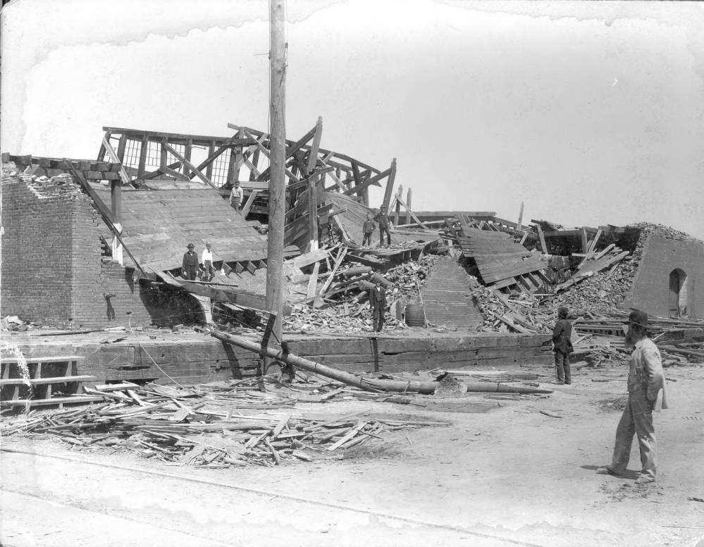
This company was a major cotton compression business — enterprises that compressed cotton into smaller bales for easier transport by rail and river. The company was founded by Christian Peper, the leading St. Louis businessman who also headed the Peper Tobacco Company.
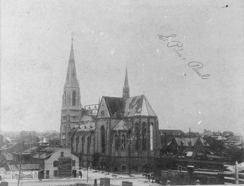
It was located on Allen Street between 7th and 8th streets in the Soulard neighborhood, one of the areas hardest hit by the tornado. It was rebuilt on the same site and still stands today.
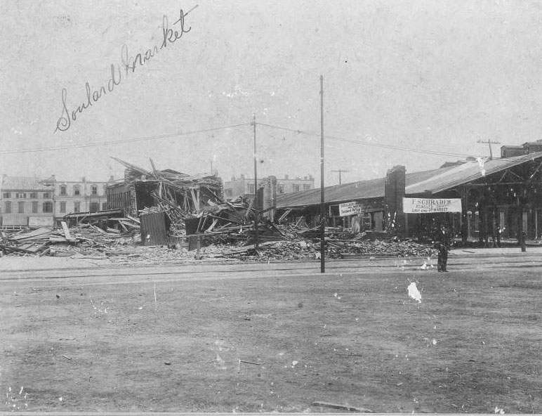
Soulard Market, established in 1841, is one of the oldest surviving open-air farmers’ markets in the country. Still located at South 7th and Carroll Streets, the buildings that were destroyed by the 1896 tornado dated to the late 1840s. Several people lost their lives at this location.
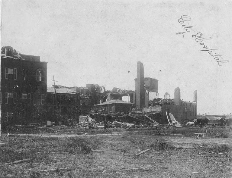
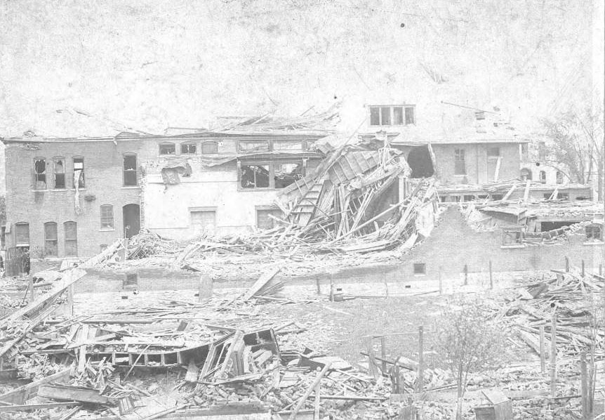
City Hospital was the earliest charitable endeavor of the City of St. Louis, established in 1845 to provide medical care to the indigent. The building that the tornado destroyed, located at Lafayette Avenue and 14th Street, had been built in 1857. Its 450 patients were moved to temporary locations, but replacement structures were not finished on this site until 1905.
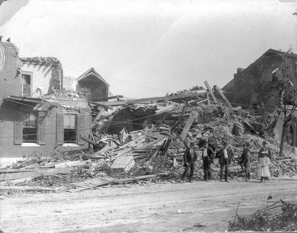
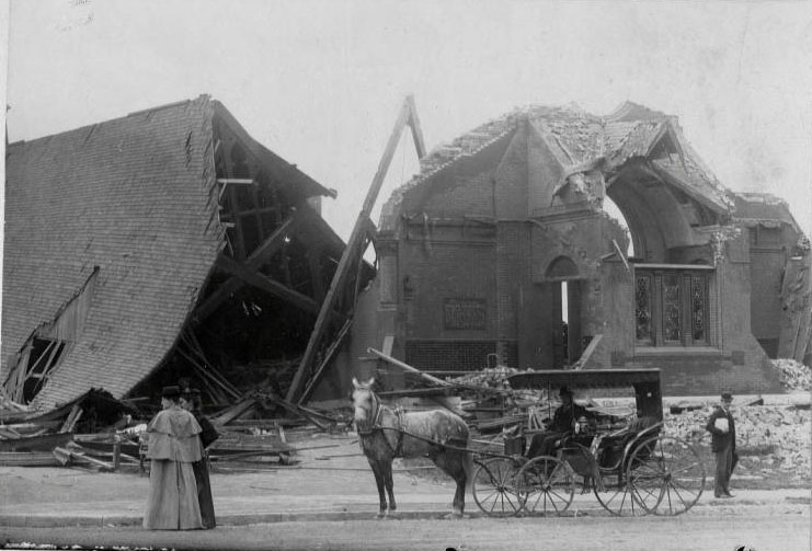
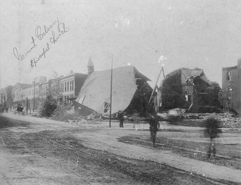
This church, located at Ninth Street and Lafayette Avenue, had been built in 1874. Although the tornado nearly destroyed it, it was rebuilt on the same site.

This church building, located at Ninth Street and Lafayette Avenue, had been built in 1874. Although almost destroyed, it was rebuilt on the same site.
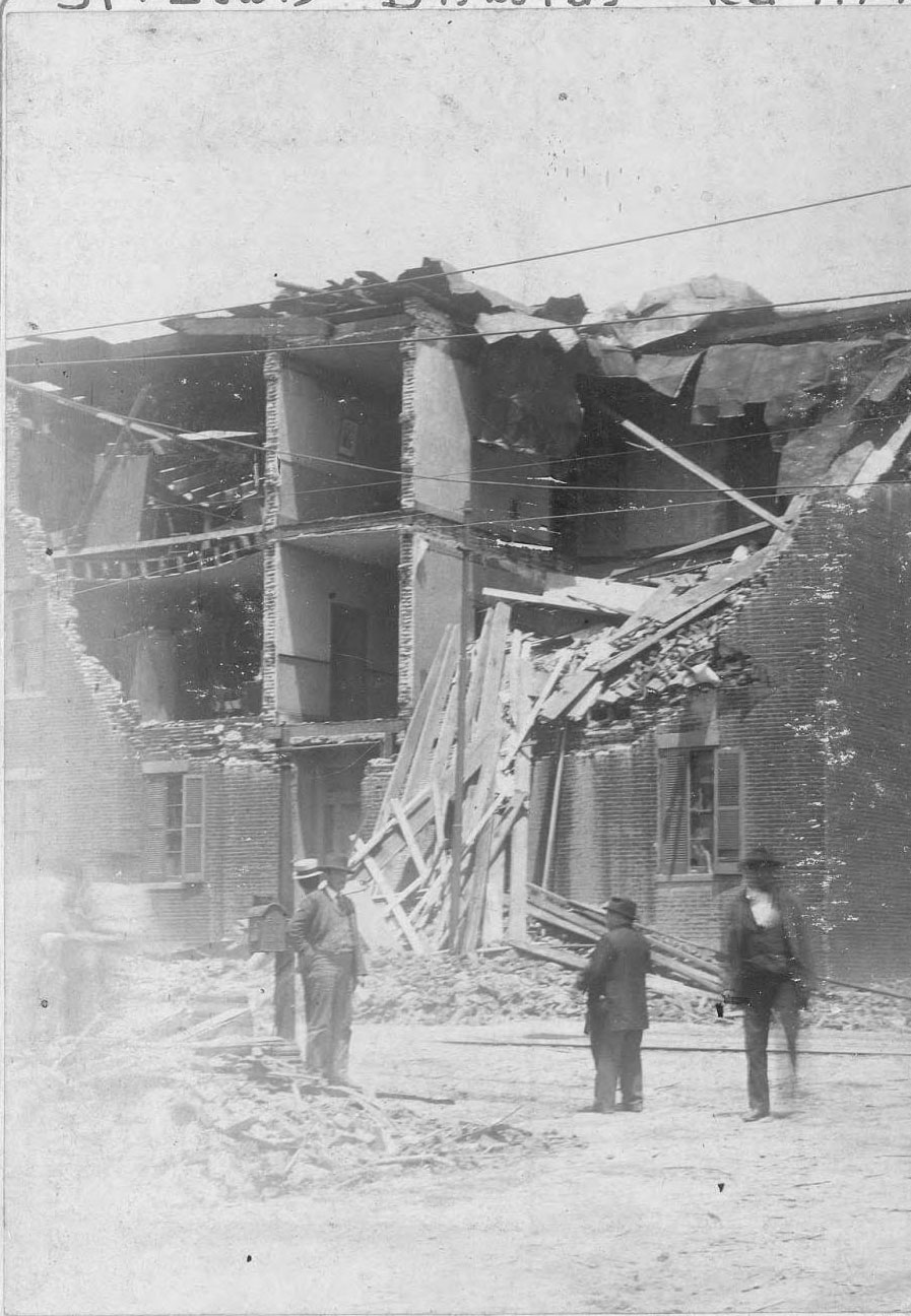
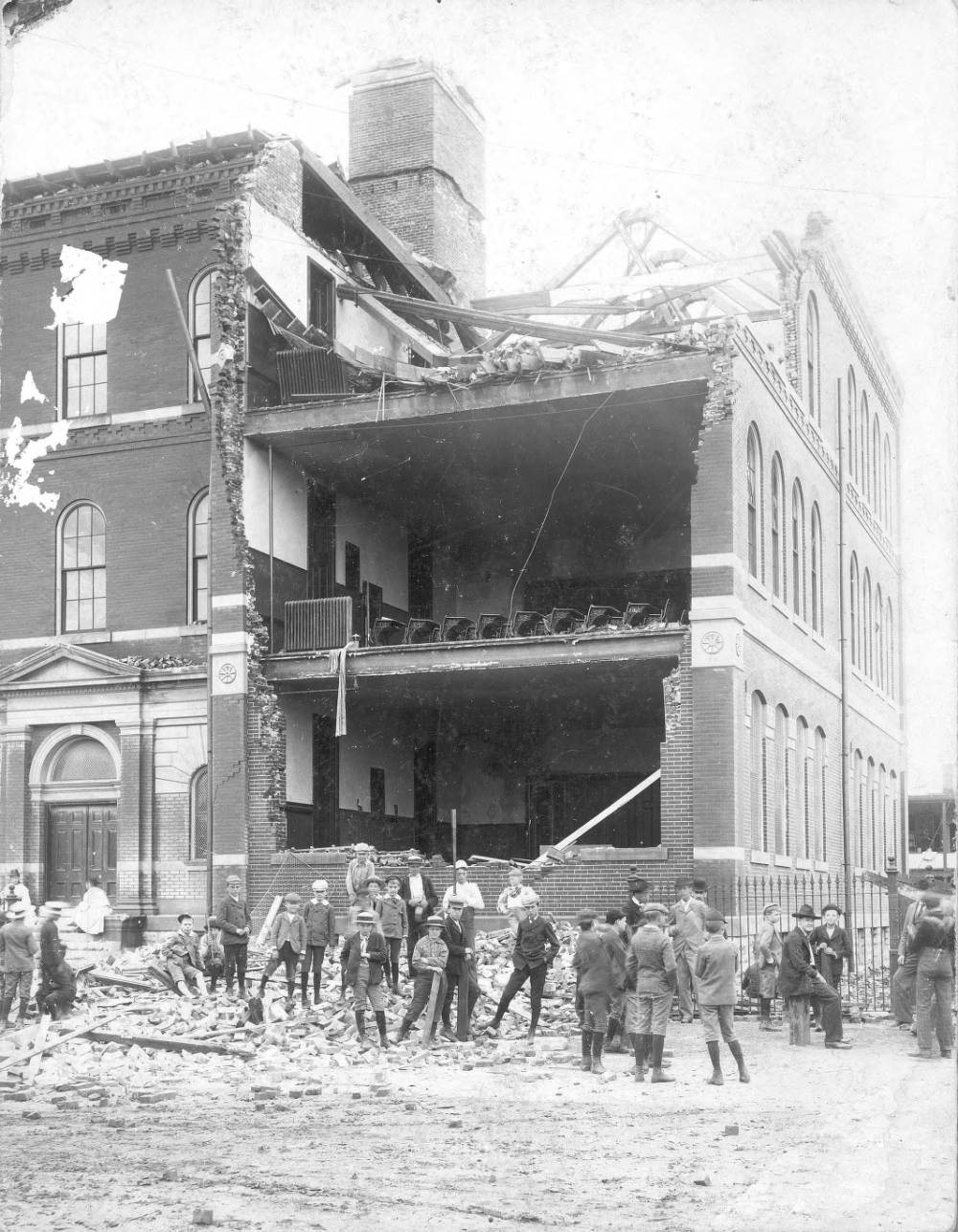
This hospital for the insane, located at 9th and Marion Streets in the Soulard neighborhood, was operated by the Daughters of Charity of St. Vincent de Paul.
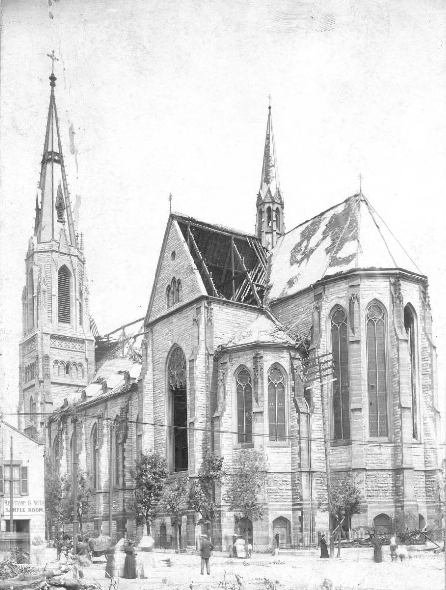
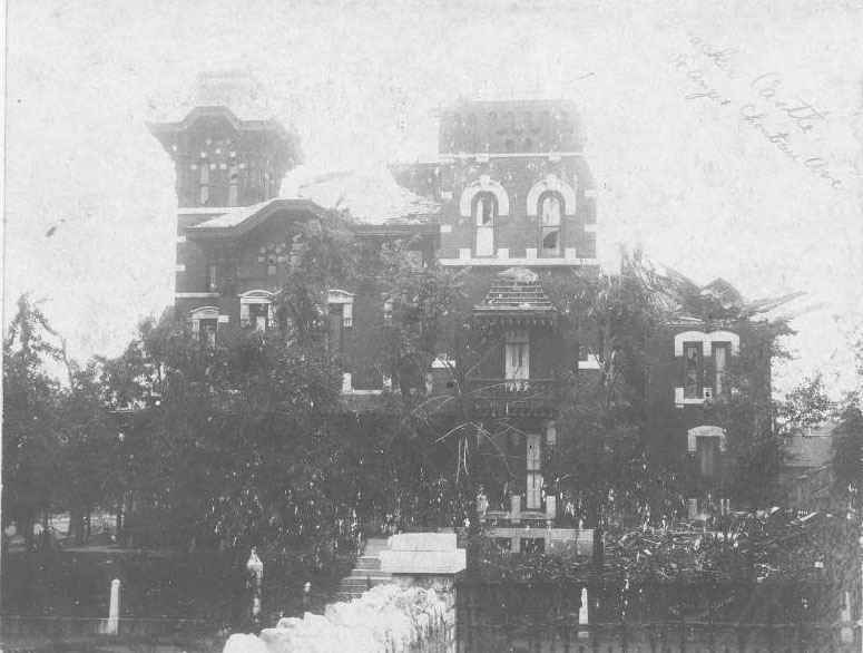
This mansion, built by Jonathan O. Pierce in the 1860s, was nicknamed the Cracker Castle because Pierce’s fortune came from part ownership of a business that supplied crackers and hardtack to soldiers during the Civil War. Located at the corner of Chouteau and St. Ange Avenues, it was struck by lightning and one of its towers was hurled away during the tornado. It was damaged beyond repair and was demolished.
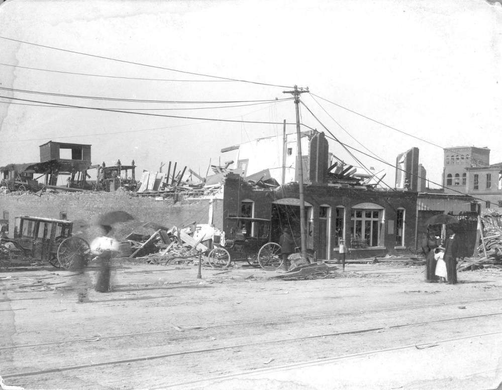
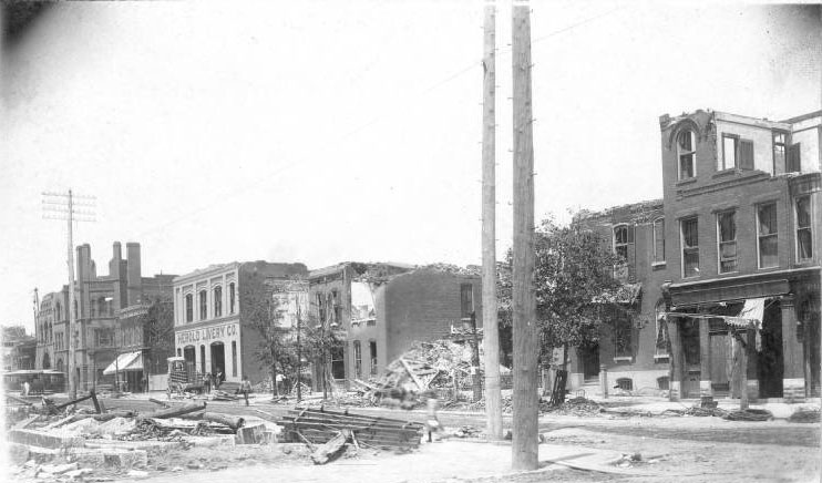
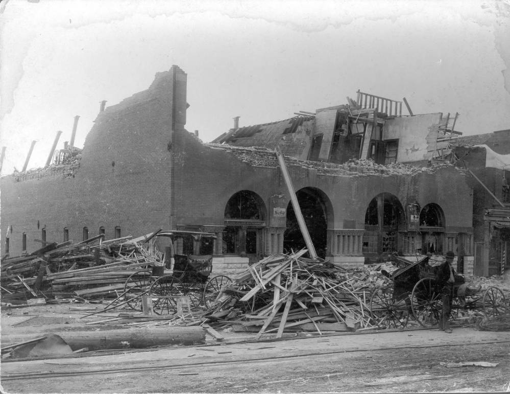
The Heier and Wiebusch Livery business was located at 1615 Lafayette Avenue, just east of Lafayette Square. The tornado blew away the building’s second story and littered the surrounding area with broken carriages.
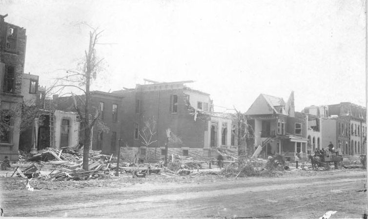
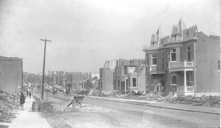
The Lafayette Square area took a direct hit from the powerful tornado, losing most of its homes. This view of Mississippi Avenue, looking south from its intersection with Park Avenue, vividly shows the extent of the devastation.
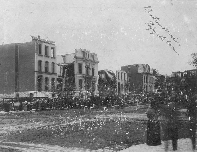
View of the north side of Lafayette, east of Jefferson. It includes 2345 Lafayette, which was the home of the late Louis and Fredericka Duestrow.
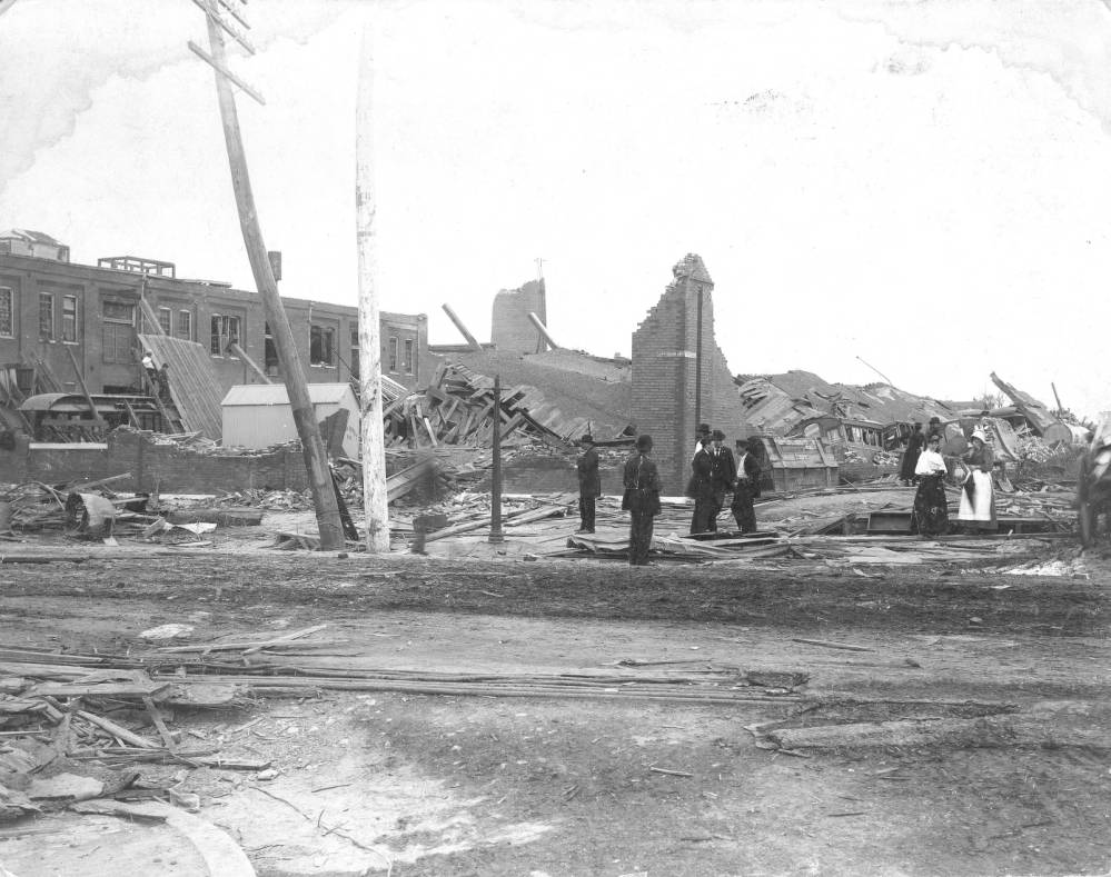
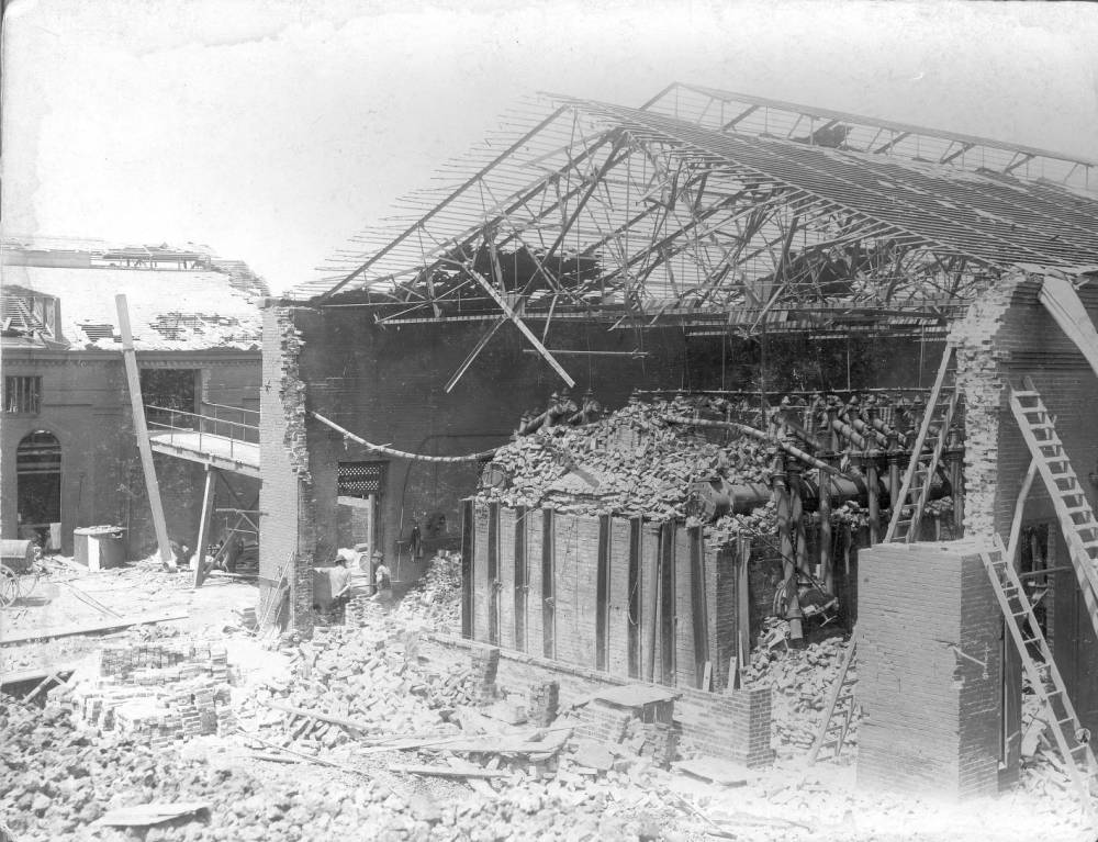
Its large Power House was located at Jefferson between Geyer and Allen Avenues, just southwest of Lafayette Park. The building collapsed onto the railcars that were in the building, killing several people.
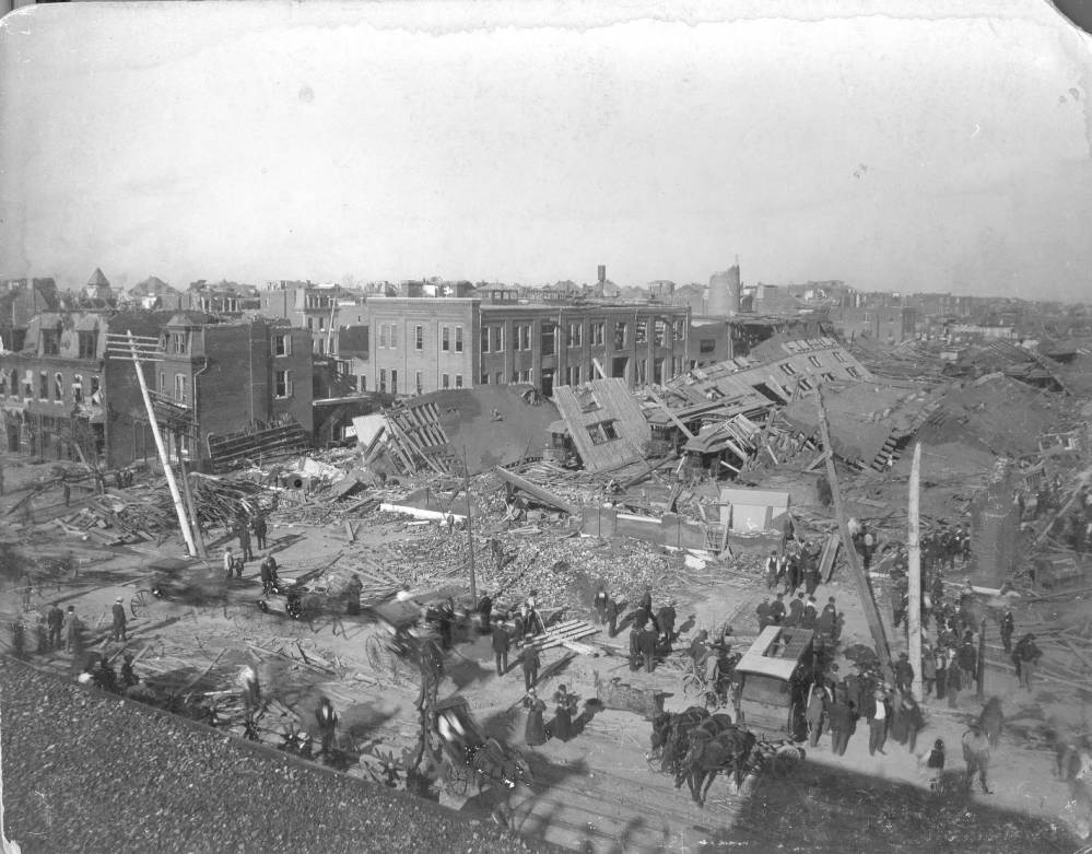
The Union Depot Railroad was one of St. Louis’ largest in the 1890s. Its large Power House was located at Jefferson between Geyer and Allen Avenues, just southwest of Lafayette Park. The building collapsed onto the railcars that were in the building, killing several people.
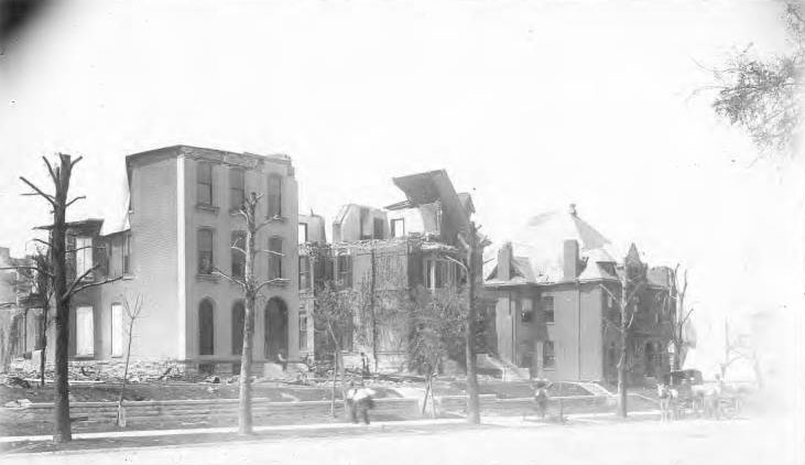
Houses, from left to right, are: 2140 — Mr. & Mrs. James F. How (Eliza Eads), 2146 — Edward Bredell (owned by Edward & Martha Eads Switzer), 2166 — Dr. & Mrs. Joseph Spiegelhalter.





The Graf Engraving Company created a book about the tornado aftermath. I have a copy in English. I have also seen it in German and French. My family’s furniture store, located at the intersection of Broadway and Soulard, was transformed from a three-story structure to a heap of rubble.