In 1910, St. Louis was the fourth-largest city in the United States, with a population of around 687,029. By 1920, that number had grown to 702,905. The city sat at the crossroads of American industry and transportation, drawing workers, businesses, and immigrants — many from Europe — who shaped its neighborhoods, culture, and skyline throughout the decade. Parks, public buildings, schools, and commercial streets all reflected a city that was growing fast and building with confidence.
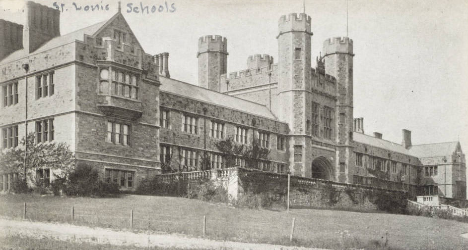
The city’s public spaces were well established by 1910. Forest Park, Shaw’s Garden, and neighborhood greens offered residents a break from the busy streets. The St. Louis Public Library anchored the cultural life of the city alongside institutions like the St. Louis Art Museum and the Jefferson Memorial Building in Forest Park. Washington University’s Brookings Hall and the campuses of St. Louis University added to the city’s reputation as an educational center.
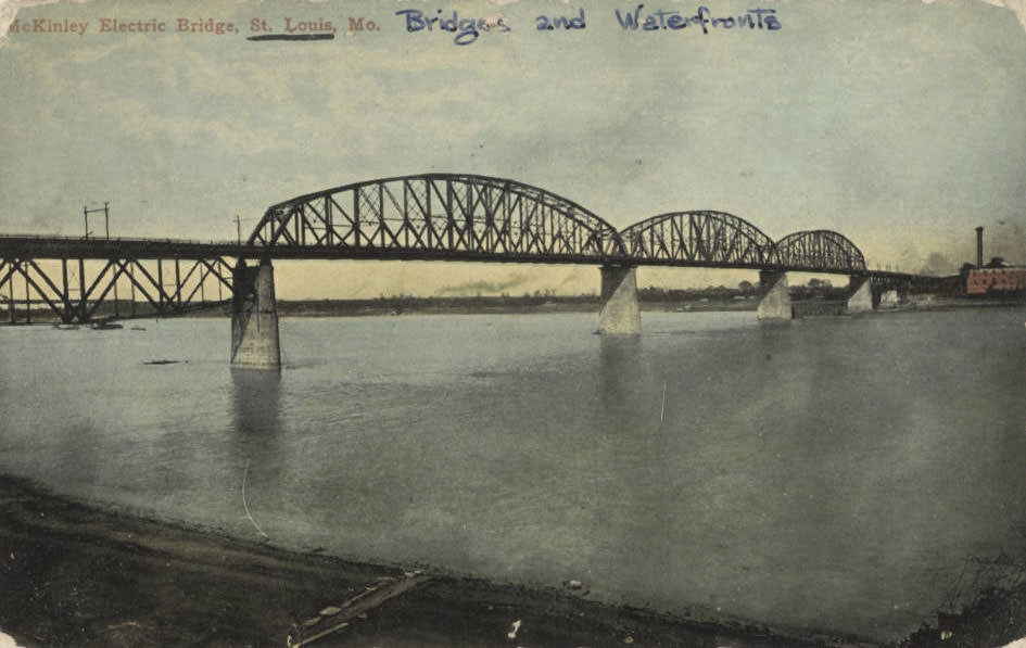
Getting in and out of St. Louis required crossing the Mississippi River, and the city had several bridges serving that purpose. The Free Bridge — later renamed the MacArthur Bridge — connected St. Louis to Illinois and carried both road and rail traffic. In 1910, the McKinley Bridge also opened for business, adding another crossing for the growing volume of vehicles entering the city. These bridges were vital links for commerce and daily commuting alike.
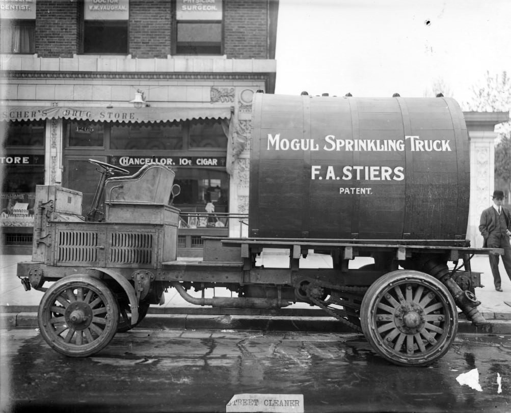
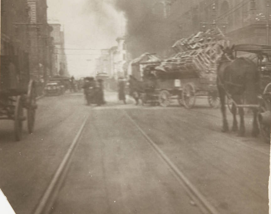
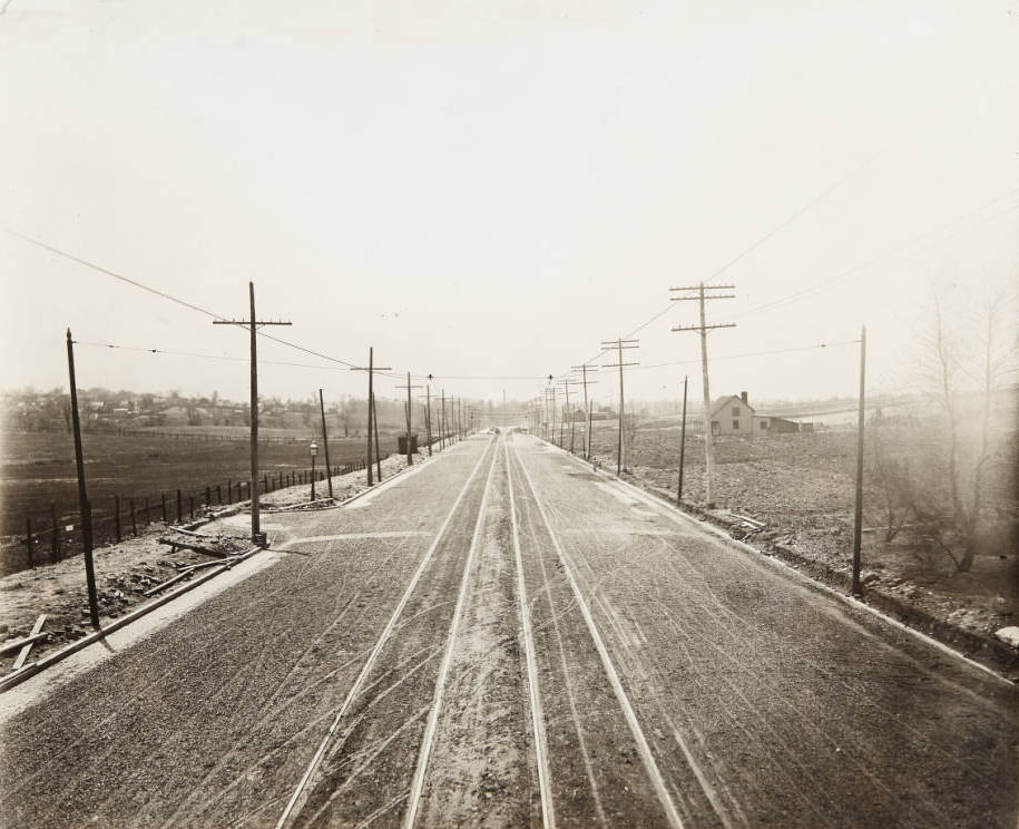
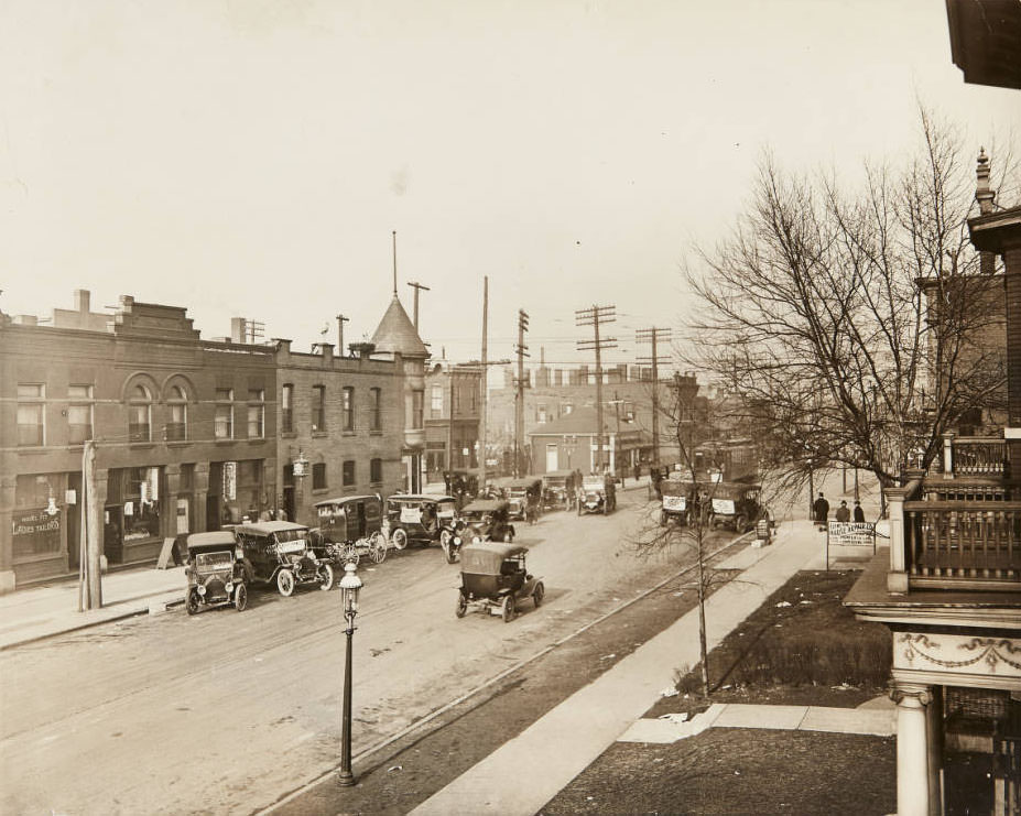
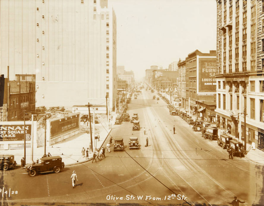
The streets of St. Louis in 1910 were a mix of old and new. Horse-drawn wagons, early automobiles, and streetcars all shared the same roads. The city used sprinkling trucks to keep dust down on unpaved stretches and deployed ash wagons for waste collection. Workers laid new streetcar tracks, repaired sewers, and widened major corridors like Olive Street to handle the growing traffic load.
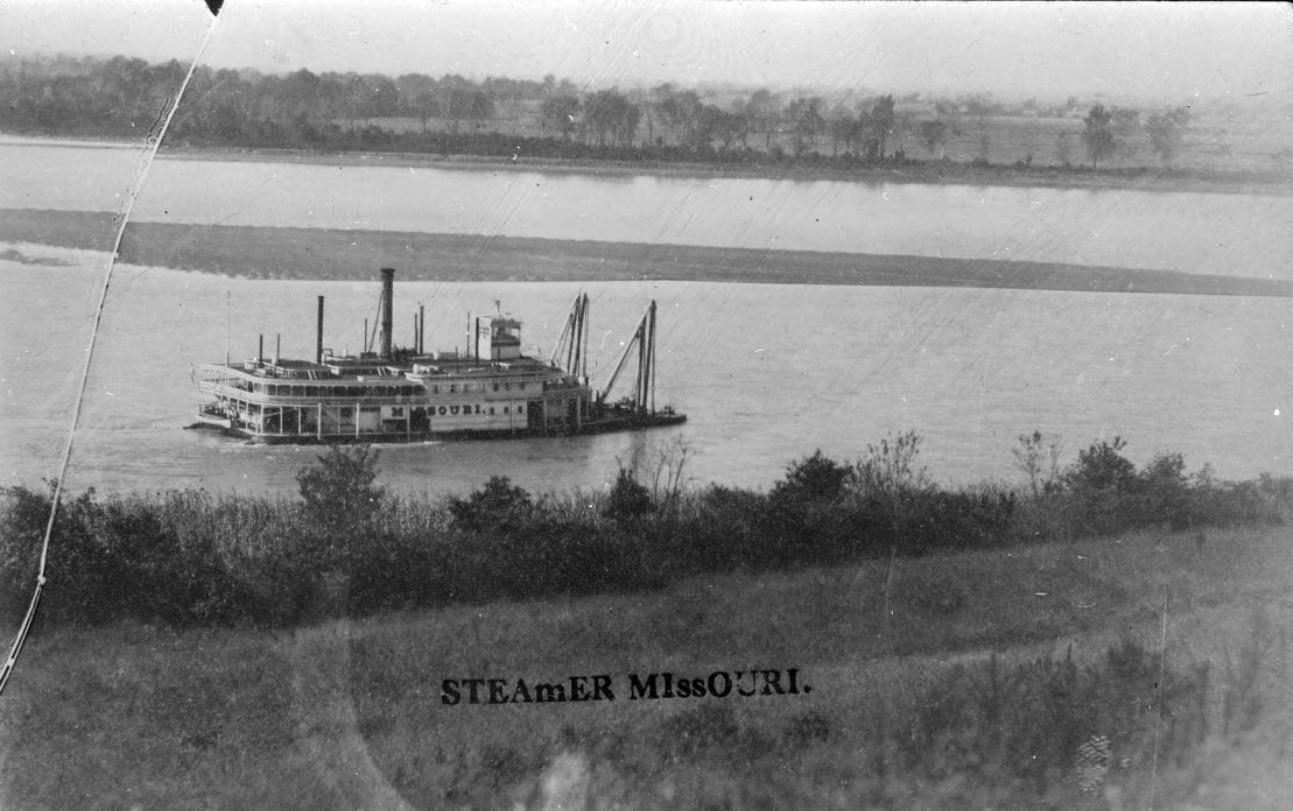
The Mississippi and Missouri rivers were essential to St. Louis’s economy. The U.S. Army Corps of Engineers maintained the waterways, clearing debris and managing the river’s channels to keep shipping lanes open. Snagboats like the Missouri were a regular sight on the water, pulling out submerged logs and other hazards. The St. Louis Arsenal, located along the riverfront, stored weapons and ammunition and played a direct role in the city’s military supply operations during World War I.
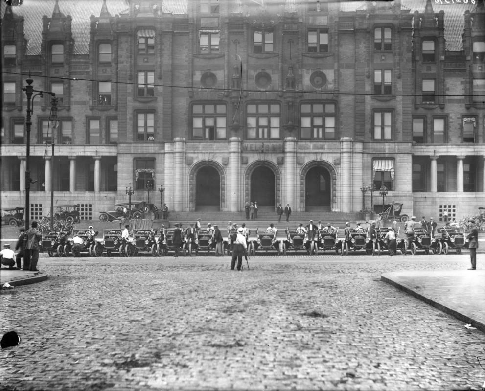
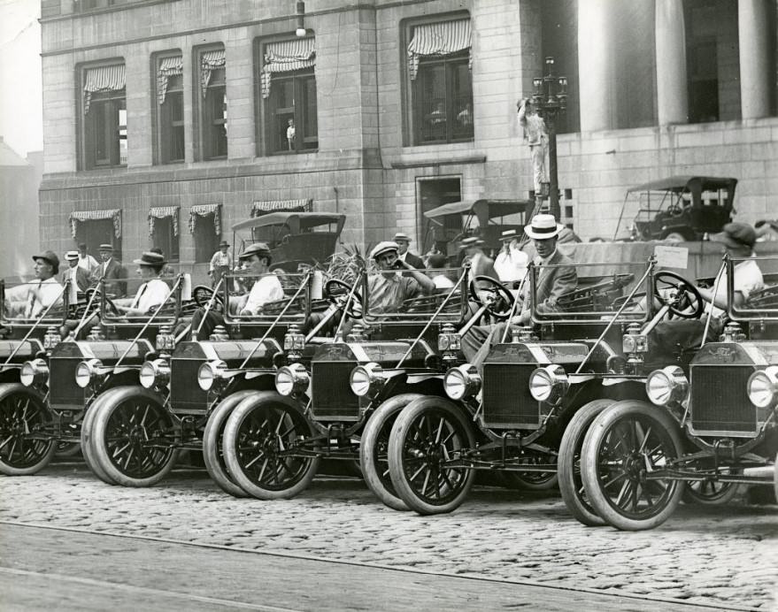
City government in St. Louis was embracing the automobile era early. In 1910, fleets of new Ford vehicles were put on public display at City Hall, signaling a shift away from horse-drawn equipment for municipal services. The city purchased cars for various departments, even as horses remained a common sight hauling coal, cement, and goods across downtown. This overlap of old and new transportation defined everyday life in St. Louis throughout the decade.
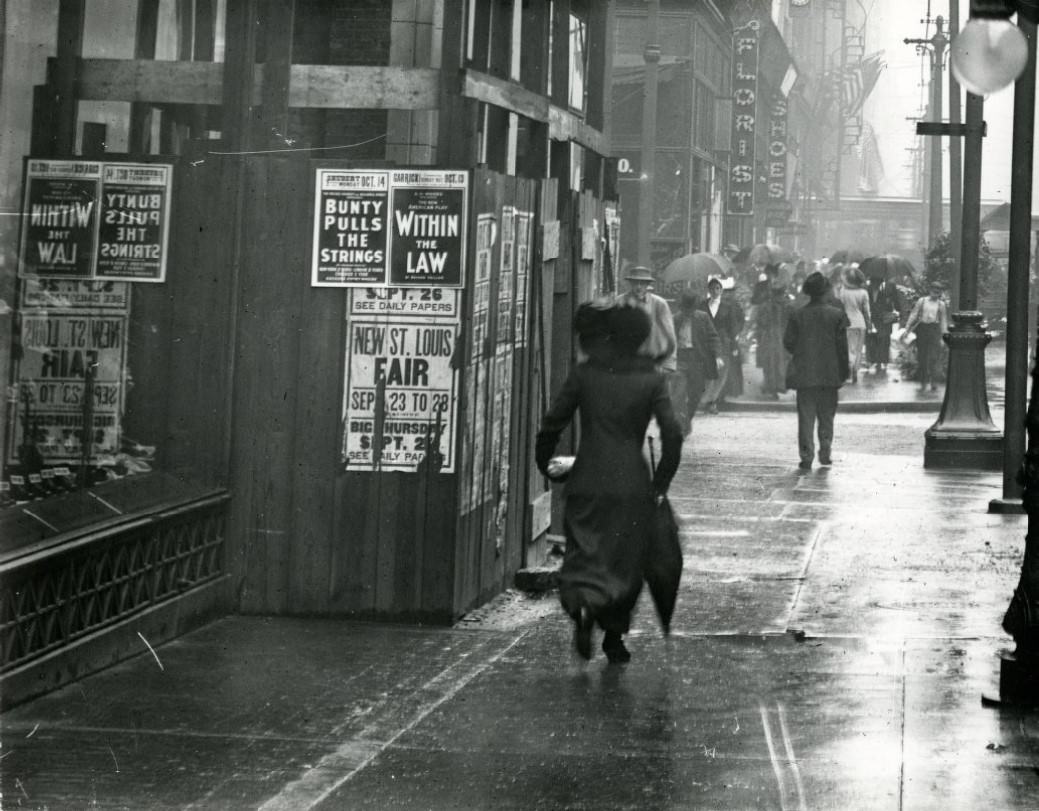
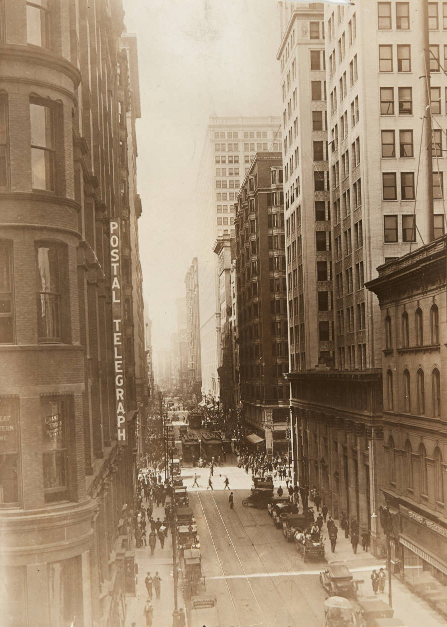
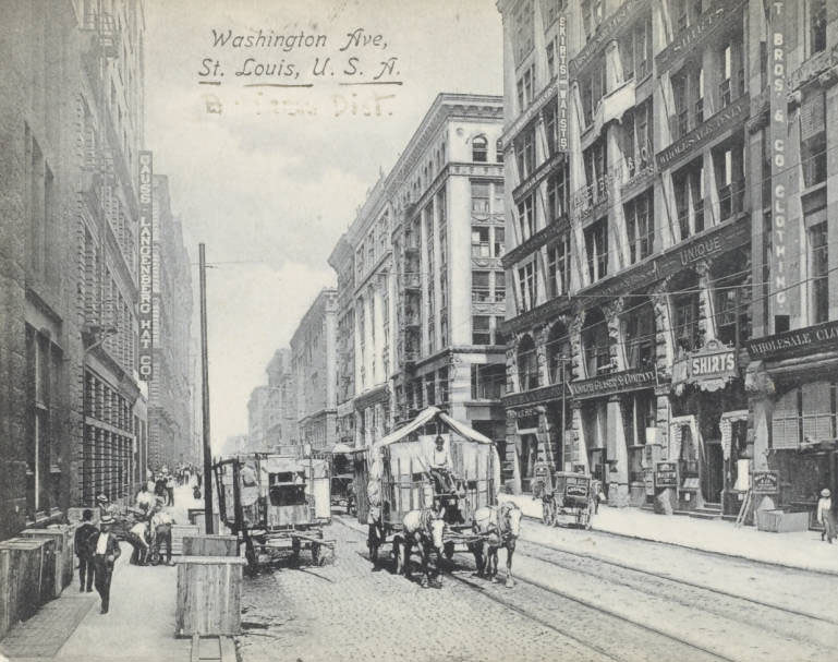
Downtown St. Louis was a lively commercial and entertainment district. Theater marquees advertised current plays, storefronts competed for foot traffic, and pedestrians crowded the sidewalks of Washington Avenue, Olive Street, and Broadway. Department stores like the Grand Leader at 601 Washington Avenue drew shoppers, while hotels, restaurants, and saloons catered to the constant flow of city residents and visitors.
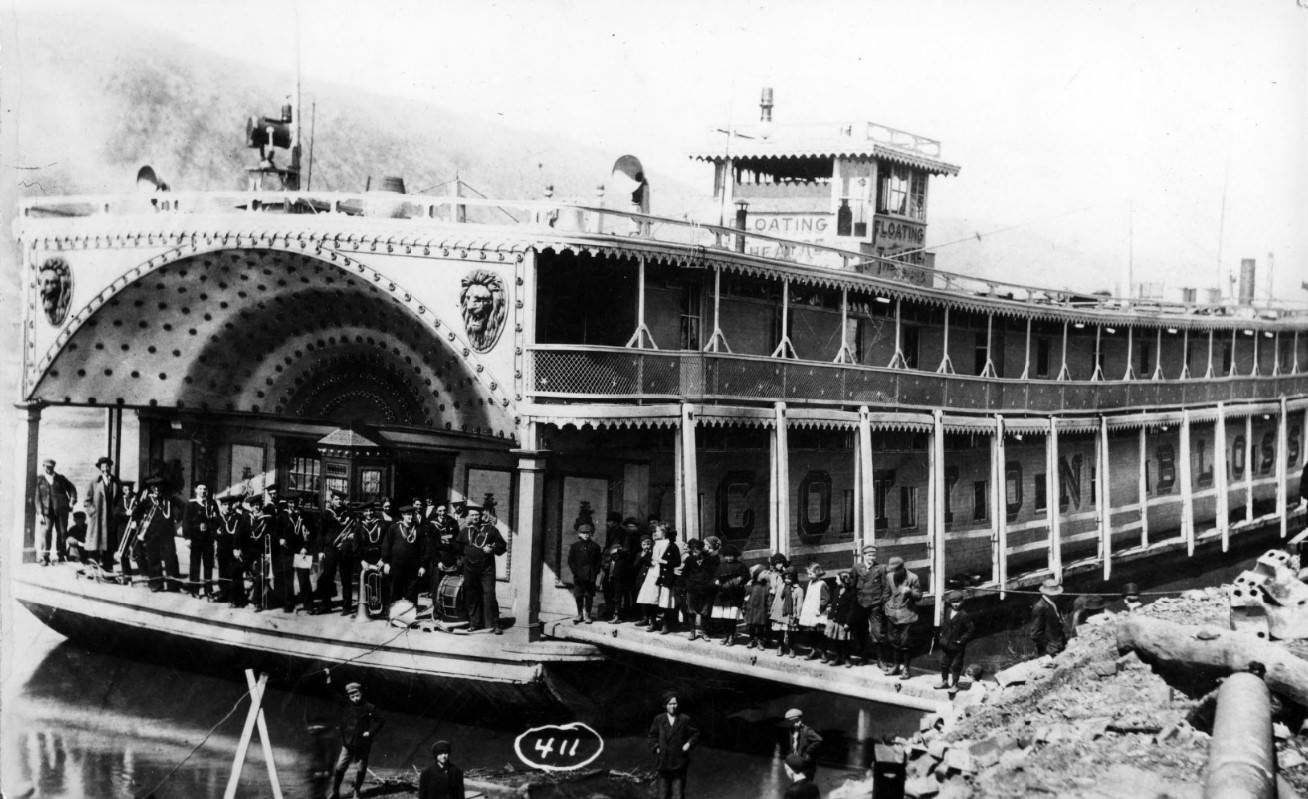
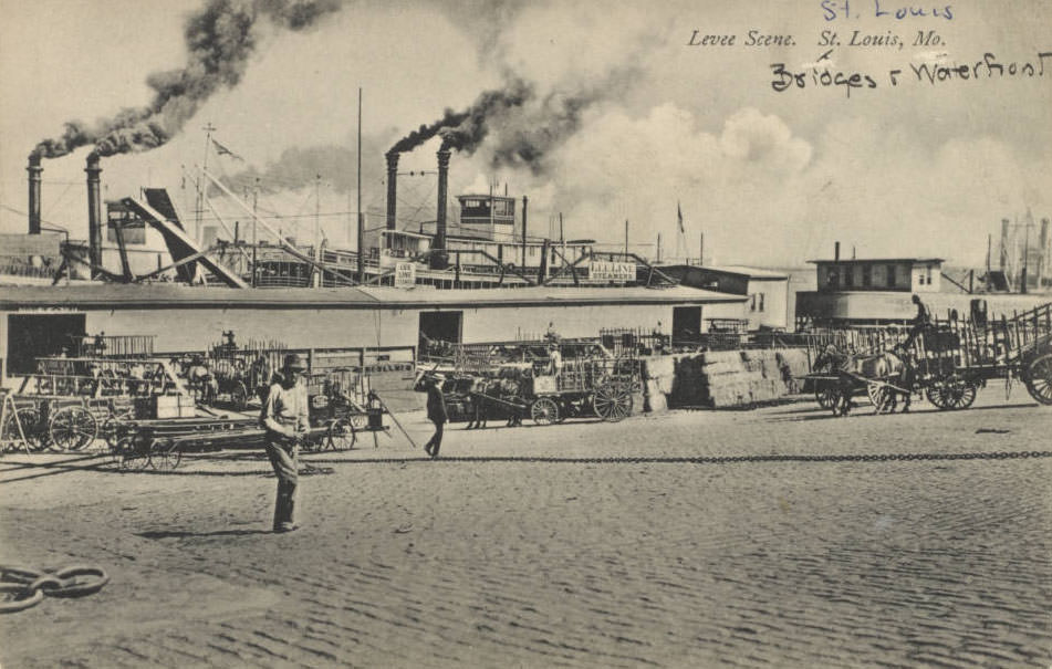
Entertainment extended beyond the theater district. The Cotton Blossom Floating Theatre brought live performances directly to the waterfront, docking along the Mississippi and drawing crowds from across the city. Meanwhile, the river itself remained a working place. Steamboats loaded and unloaded cargo with the help of horses and wagons, while ferries like the Henry Sackman, owned by the Wiggins Ferry Company, transported freight across the river until a wreck in 1918 ended the vessel’s service.
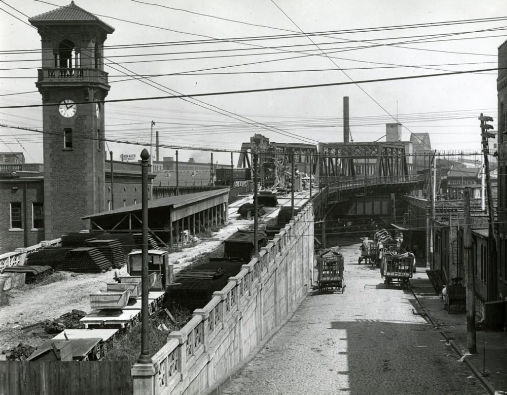
Infrastructure construction was constant throughout the decade. Workers built elevated roadways approaching the Free Bridge, laid streetcar tracks across multiple neighborhoods, and erected steel girders for railway approaches. The Merchant’s Bridge on the elevated west approach saw regular train traffic, while new construction projects along 6th Street and other corridors reflected the city’s ambition to modernize its transportation network.
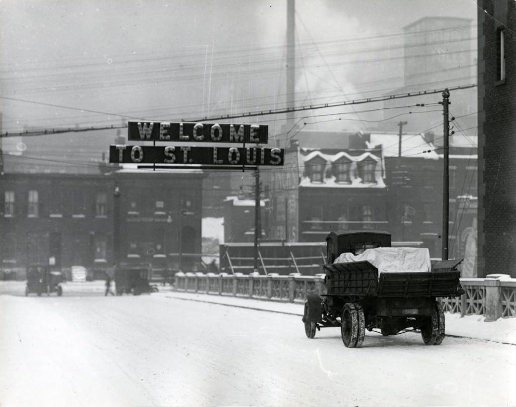
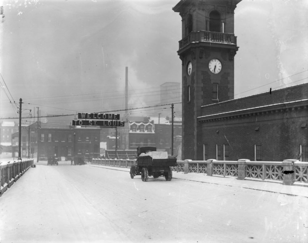
Winter in St. Louis didn’t slow commercial traffic. Trucks and wagons crossed the Free Bridge in snow, delivering goods from Illinois into the city’s warehouses and factories. The bridge’s exit near 6th Street placed arriving vehicles directly into the heart of the downtown commercial zone, where businesses operated year-round regardless of weather.
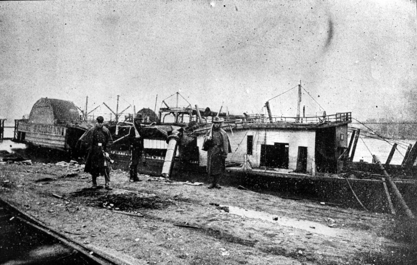
The Henry Sackman’s wreck in 1918 was a notable loss for the Wiggins Ferry Company, which had long operated railroad ferry crossings on the Mississippi. By this point in the decade, rail bridges had largely taken over the work that ferries once handled, and the wreck served as a marker of the end of an era for river ferry operations in St. Louis.
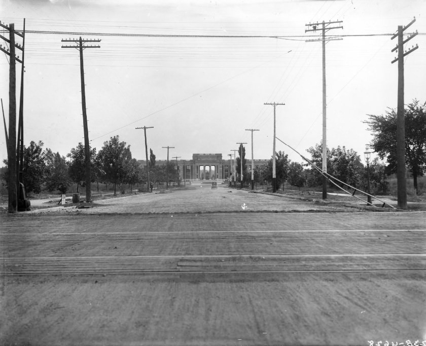
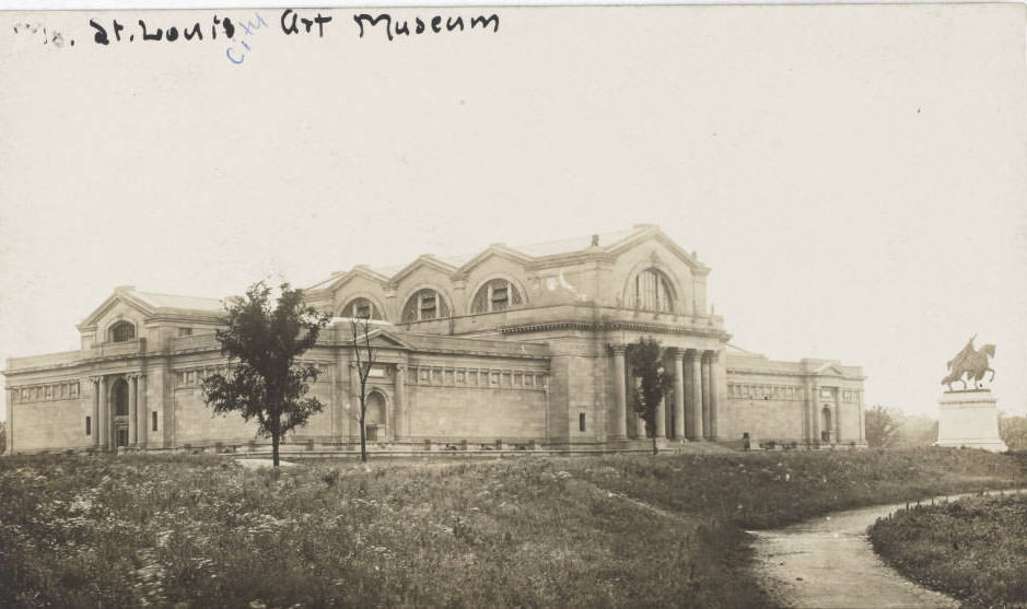
Forest Park was home to several of the city’s most prominent public buildings. The Jefferson Memorial Building stood as a tribute to the Louisiana Purchase Exposition of 1904 and served as a museum and archive during the 1910s. The St. Louis Art Museum, also in Forest Park, opened to the public as a permanent institution after originally serving as the Fine Arts Palace during the 1904 World’s Fair.
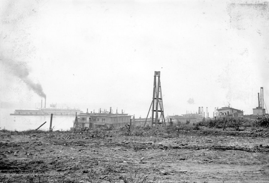
The U.S. Engineer Department maintained a supply depot at the foot of Arsenal Street, where floating equipment was kept ready for river operations. This depot worked alongside the St. Louis Arsenal, which produced and stored weapons and ammunition during World War I. St. Louis factories also turned out artillery, tanks, and aircraft during the war years, with companies like Curtiss-Wright and the St. Louis Aircraft Corporation producing planes for the U.S. military and its allies.
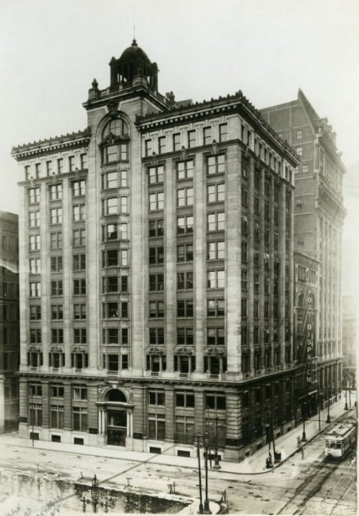
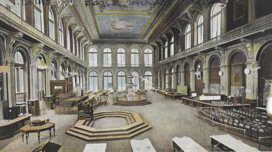
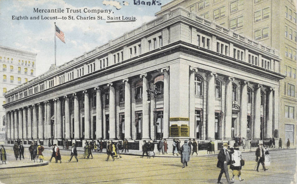
Banking and finance kept pace with the city’s industrial growth. The National Bank of Commerce was one of several major financial institutions operating in downtown St. Louis by 1914. The Mercantile Trust Company building at 8th and Locust and the interior of the Merchants’ Exchange building on 3rd Street were landmarks of St. Louis’s commercial district, where trade deals and financial transactions supported the region’s manufacturing economy.
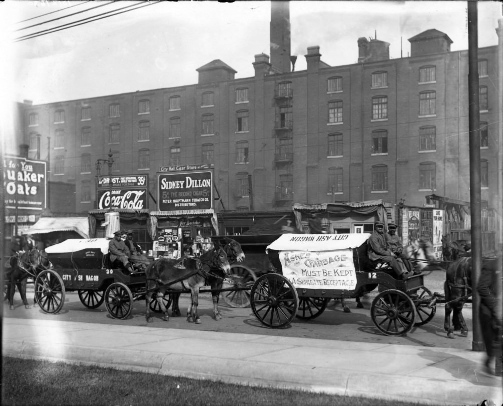
Municipal services in 1910 relied heavily on horse-drawn equipment. The city’s ash wagons collected waste from homes and businesses across every neighborhood, moving in organized parades through the streets. Small businesses lined the blocks behind them — storefronts selling clothing, hardware, food, and dry goods. Washington Avenue and Olive Street were particularly dense with commercial activity, drawing steady foot traffic throughout the day.
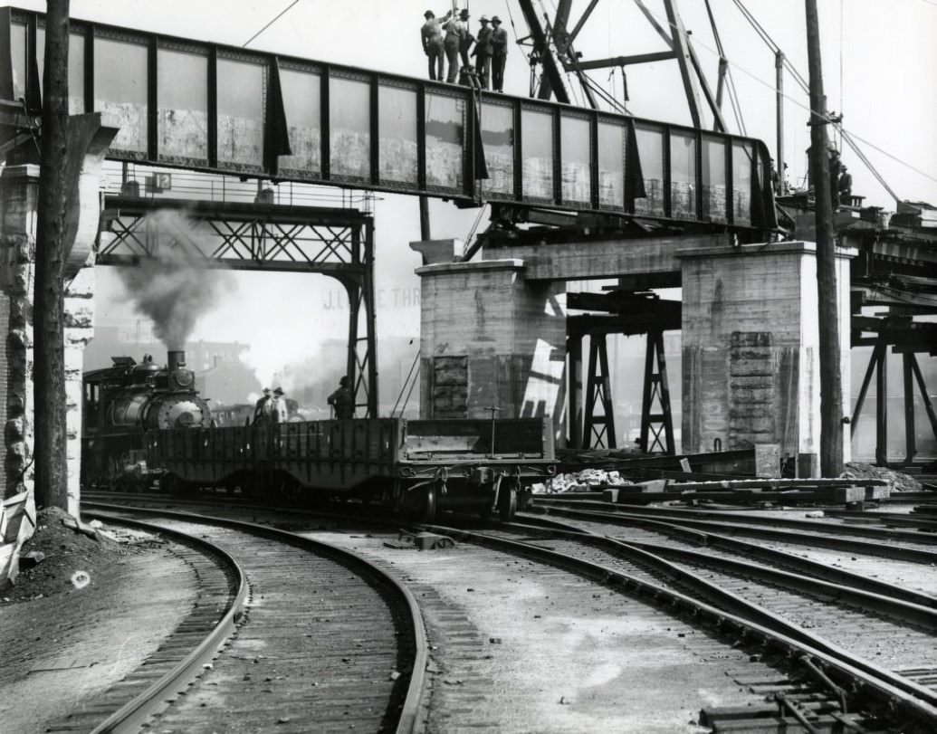
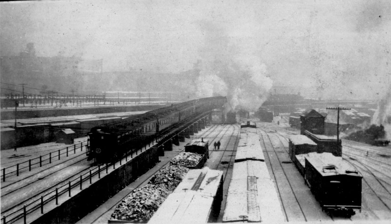
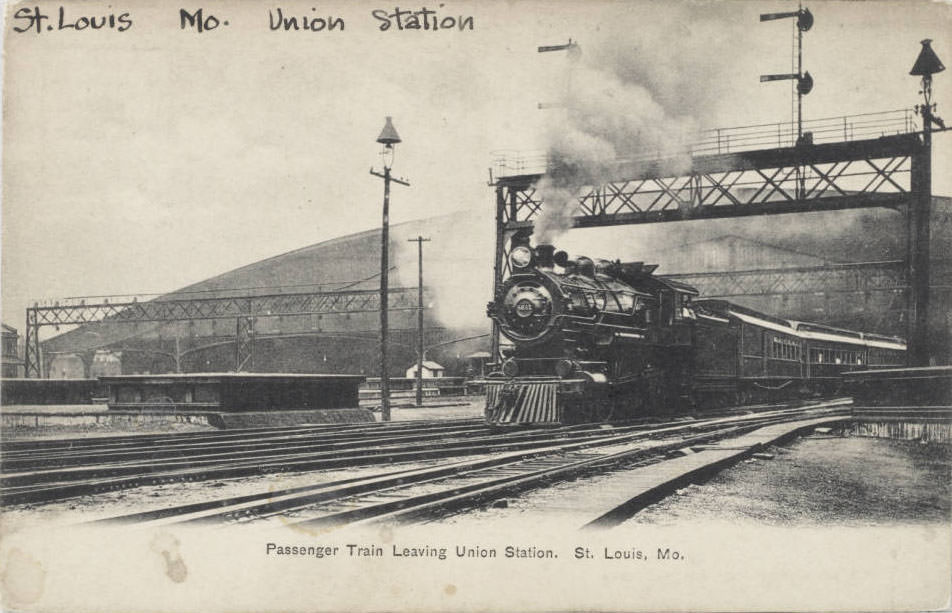
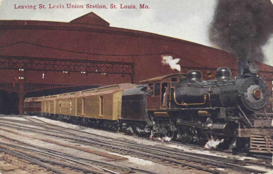
Rail infrastructure in St. Louis was built on multiple levels. While locomotives switched cars at ground level, construction crews overhead set steel girders for elevated rail approaches. Union Station, one of the busiest rail hubs in the country, sent locomotives in and out of its train shed continuously, connecting St. Louis to cities across the nation. The station’s role grew even larger during World War I, when troop movements and war material shipments added to the volume of rail traffic.
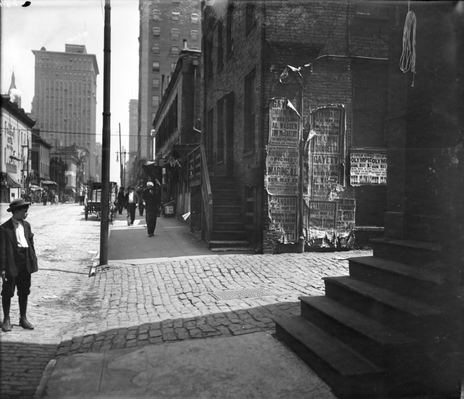
Street-level advertising was everywhere in 1910s St. Louis. Posters pasted to brick walls announced local events — picnics, theater shows, wrestling matches — competing for the attention of passersby on Eighth Street and similar corridors. Cars, wagons, and pedestrians moved constantly through these commercial blocks, making them ideal spots for businesses to post notices and attract customers.
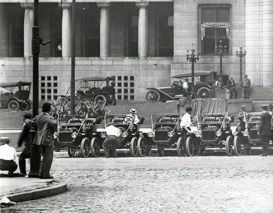
The automobile was quickly becoming a symbol of civic modernity. St. Louis put its new fleet of Ford vehicles on public display at City Hall on the 12th Street side, drawing attention from residents curious about the city’s shift to motorized equipment. The display also reflected national trends — Ford’s mass production model made cars affordable for government fleets and private buyers alike, and St. Louis was keeping up.
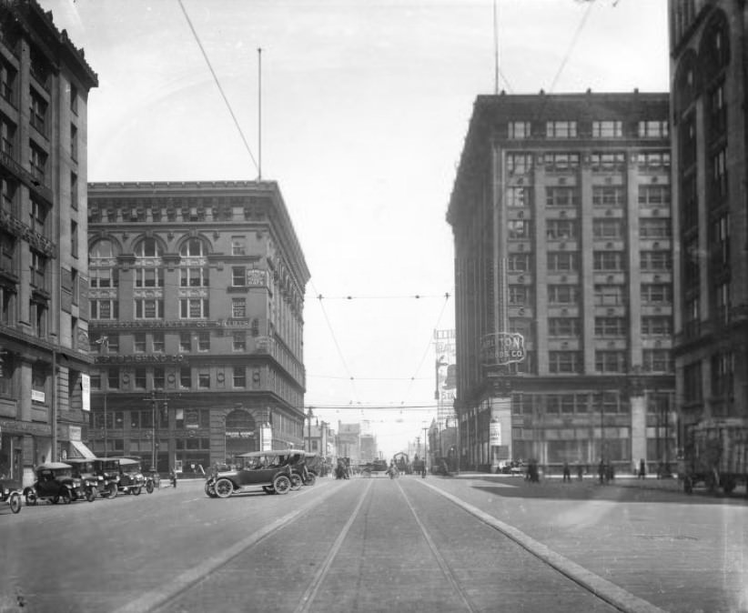
Washington Avenue at North Tucker Boulevard was one of the busiest intersections in the city. Automobiles, horse-drawn wagons, and crowds of pedestrians all competed for space at this downtown crossing. The scene captured the transitional character of the decade — a city still dependent on horse power but rapidly integrating the automobile into daily commerce and transportation.
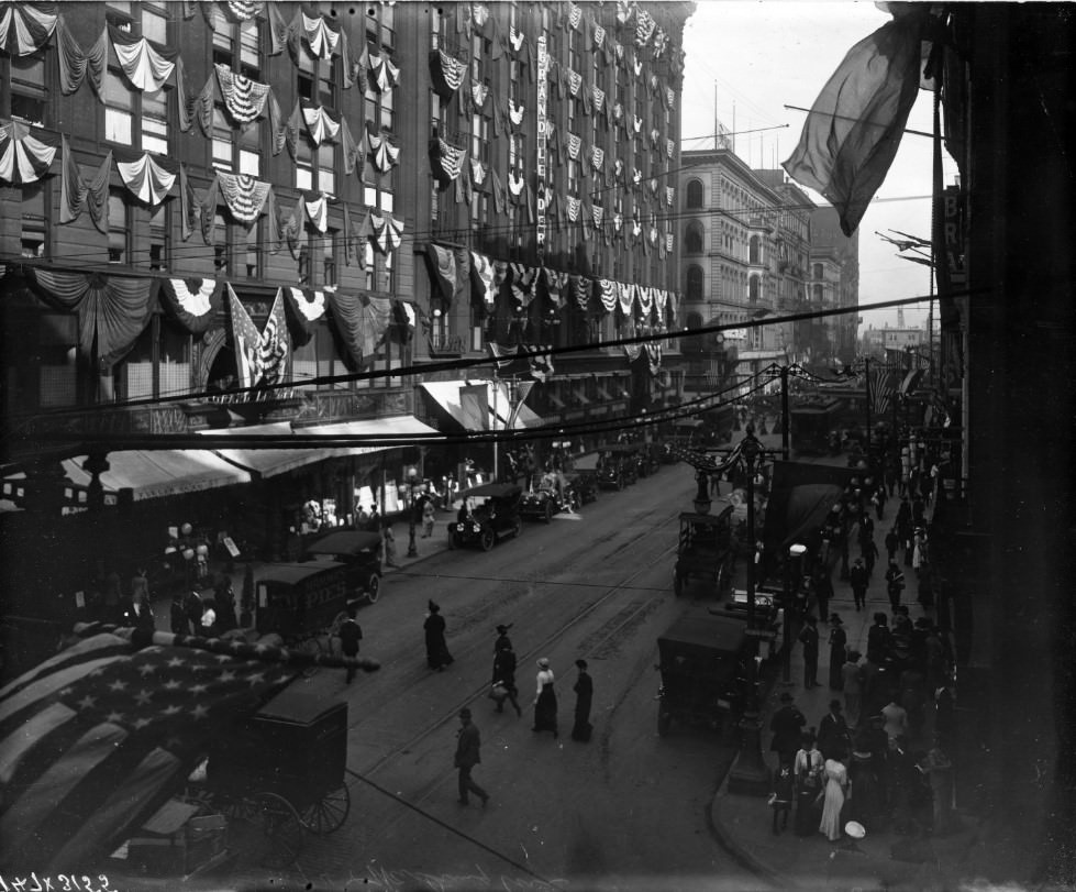
Washington Avenue’s commercial corridor stretched for blocks in both directions from 7th Street. The Grand Leader department store at 601 Washington was a major retail anchor, its facade draped in bunting and American flags on festive occasions. The avenue’s sidewalks stayed crowded throughout the day, with shoppers moving between dry goods stores, hat companies, and shoe retailers that filled nearly every building.
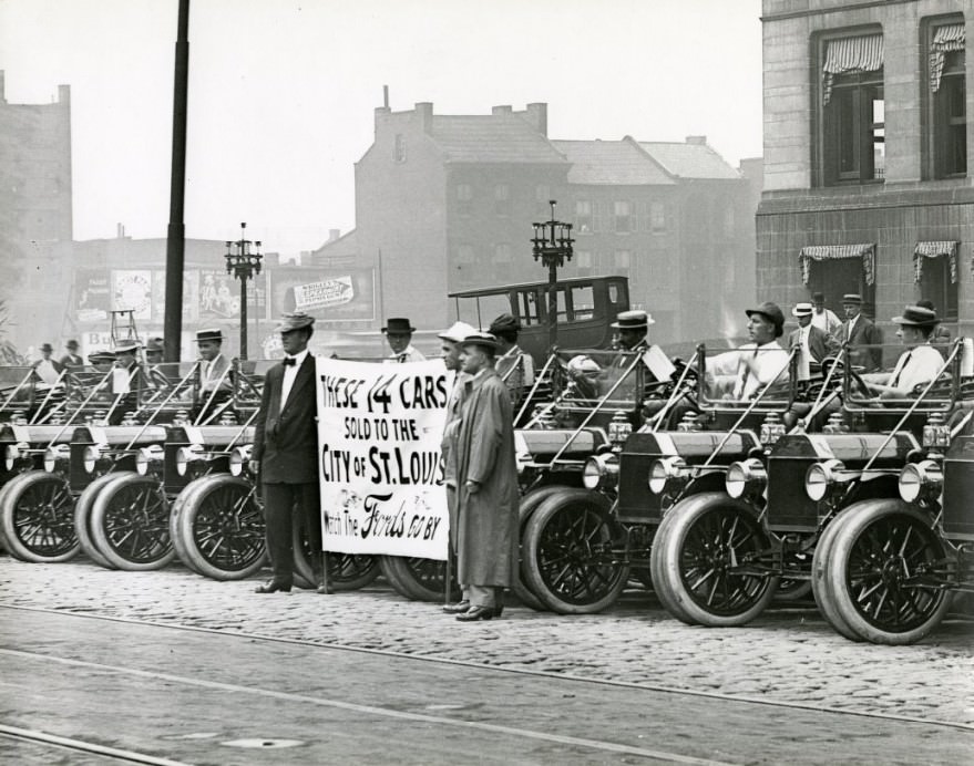
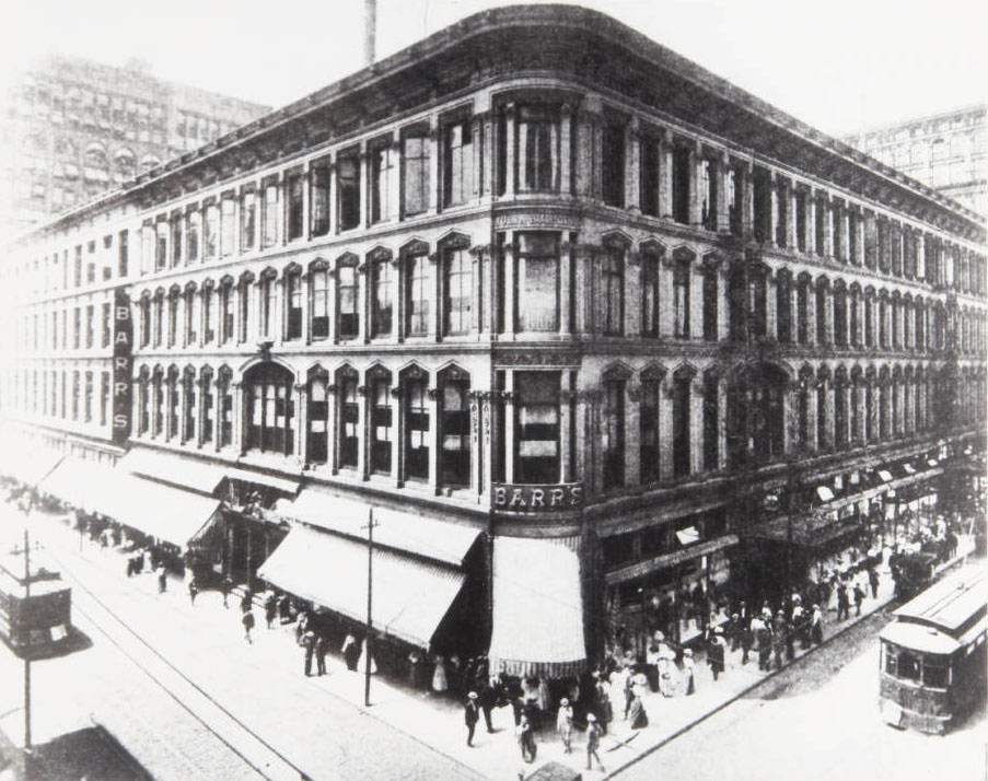
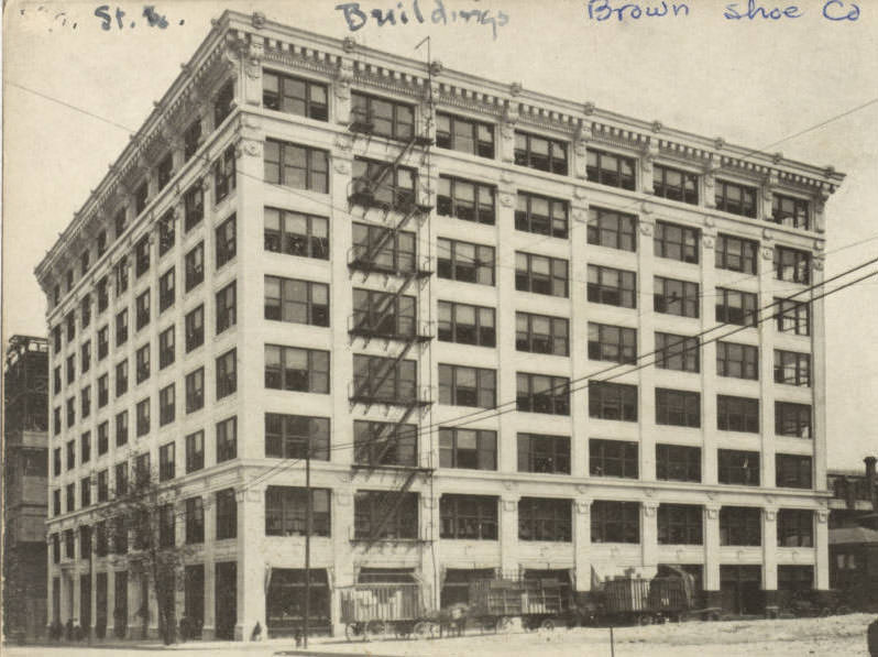
The city’s purchase of automobiles was a significant administrative decision. Replacing horse-drawn vehicles with cars reduced long-term costs and improved the speed of city services. The William Barr Dry Goods Company at 6th and Olive, the Brown Shoe Company on Washington Avenue, and dozens of other large businesses also began incorporating motorized transport into their delivery and logistics operations during this period.
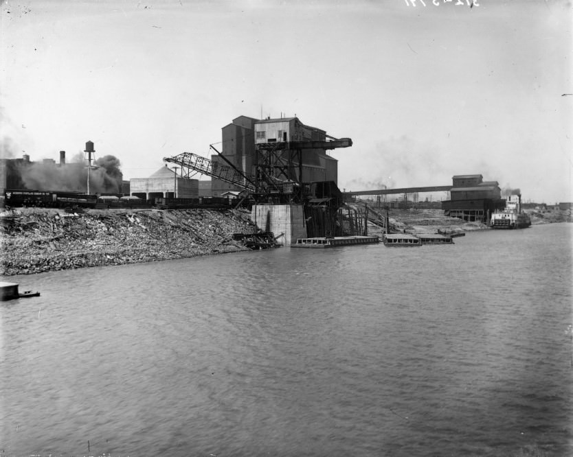
Industry along the Mississippi River remained a defining feature of St. Louis throughout the decade. The Missouri Portland Cement Company operated a large factory and loading docks on the river, where steamboats like the Belle of Calhoun docked to take on cargo. Cement, coal, and other bulk materials moved continuously through the city’s waterfront facilities, feeding the construction boom that was reshaping St. Louis block by block.
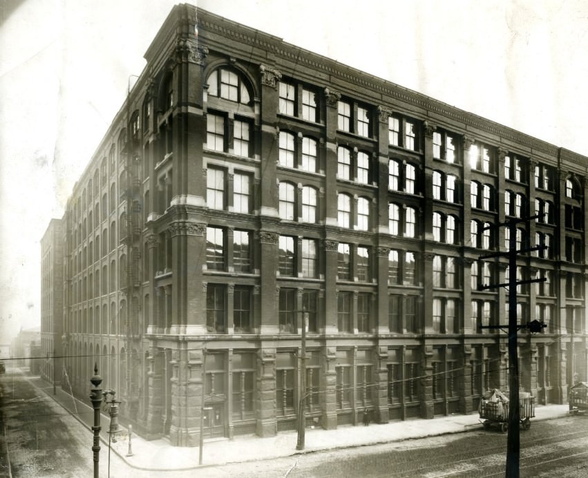
Manufacturing was not limited to heavy industry. Knitting mills, shoe factories, and garment businesses set up operations in buildings like the Drummond Factory at Fourth and Spruce Streets. The city’s working-class neighborhoods surrounded these plants, putting workers within walking distance of their jobs. Residential streets near the factories were lined with row houses, wooden homes, and corner stores that served the daily needs of factory workers and their families.
Rail connections tied the city’s industrial areas together and linked St. Louis to national markets. The Alton Limited made its way up the elevated western approach to the Merchant’s Bridge, one of several rail crossings serving the city. Freight trains brought raw materials in and carried finished goods out, supporting a manufacturing economy that would be pressed into overdrive once the United States entered World War I in 1917.
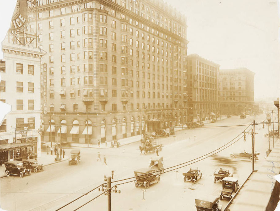
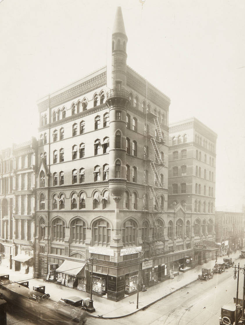
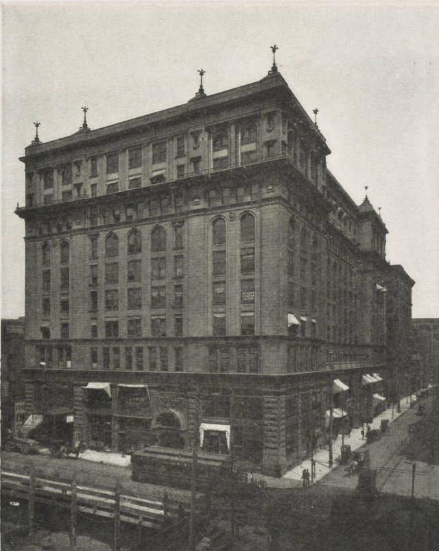
Downtown St. Louis was dense with hotels, office buildings, and financial institutions. The Hotel Jefferson at 12th and Locust was one of the city’s premier lodging destinations, situated next to the Union Electric building. A few blocks away, the ten-story hotel at 4th and Pine offered 400 rooms and elaborate public spaces. The Marion Roe Hotel at 508 Pine Street, a seven-story building, also served guests until it was demolished in the 1960s to make way for Busch Stadium.
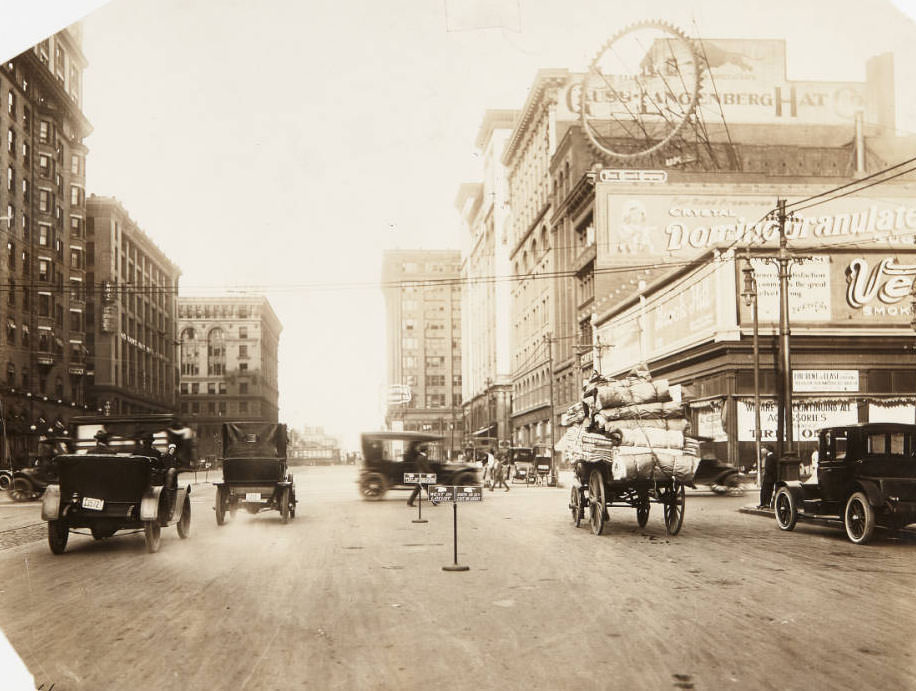
The intersection of 12th and Locust was among the busiest in the city. Automobiles and horse-drawn wagons moved through the crossing constantly, passing storefronts that included the Gauss-Langenberg Hat Company on the east side of the street. Looking north from this corner, the scale of downtown St. Louis became clear — a dense urban grid of commercial buildings, streetcar lines, and pedestrian traffic that extended in every direction.
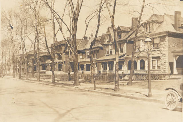
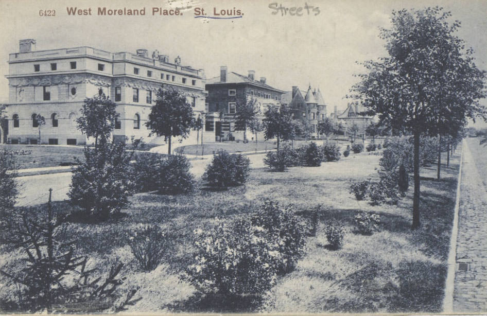
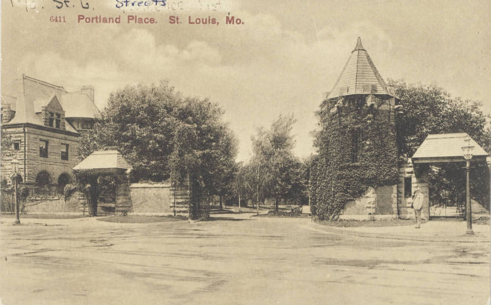
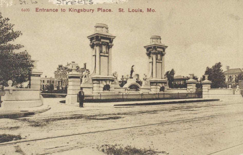
Residential life in 1910s St. Louis varied widely by neighborhood. Forest Park Boulevard was lined with substantial houses, while streets like Gratiot near Boyle featured modest wooden homes — structures that would eventually be removed to make way for what became Interstate 64. Planned private streets like Hortense Place, Kingsbury Place, Portland Place, and Westmoreland Place offered wealthier residents gated enclaves with distinctive stone entrances and landscaped parkways.
Broadway and Washington was one of the city’s busiest freight corridors. Horse teams pulled heavily loaded wagons — stacked with wooden pallets, barrels, and building materials — through intersections shared with early automobiles and pedestrians. The competition for road space reflected a city whose transportation systems were evolving faster than its infrastructure could comfortably accommodate.
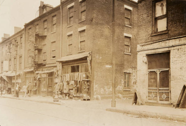
Retail commerce clustered along major arteries throughout the city. Near the intersection of 6th Street and Franklin Avenue, clothing stores displayed their goods directly on the sidewalk, using the street itself as additional retail space. In the midtown area, the 700 block of Franklin Avenue was packed with storefronts serving the surrounding residential neighborhoods. The 800 block of Chestnut Street housed professional offices including the Hill Evans Title Examiner Company at number 822.
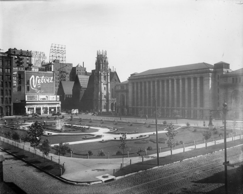
The area around 13th and Olive Streets was earmarked for new development in 1910. Buildings on that corner were slated for demolition to make way for the Central Library, part of a broader effort to improve civic infrastructure across the city. Nearby, on Olive Street between 13th and 14th, businesses like the Wiley Saddlery Company, a Miller loan company, and the Chancellor cigar company occupied storefronts that would soon be razed for a street widening project.
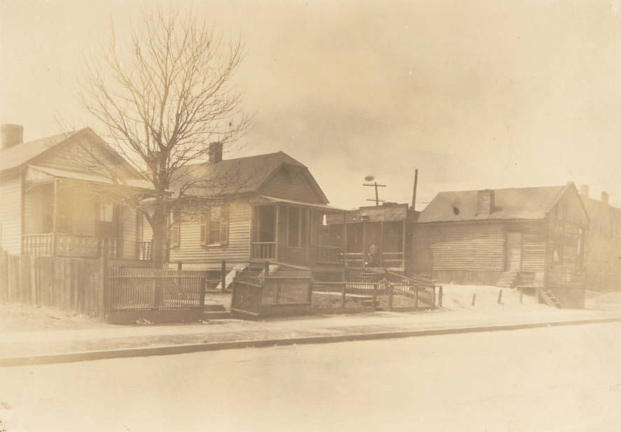
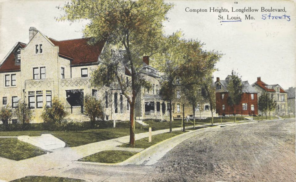
Neighborhoods across St. Louis ranged from densely packed urban blocks to quieter residential streets. Some wooden houses on Gratiot near Boyle sat alongside small yards and corner businesses typical of working-class areas. Meanwhile, Compton Heights along Longfellow Boulevard and the Del-Van building at Delmar and Vandeventer represented the more prosperous developments taking shape on the city’s expanding edges.
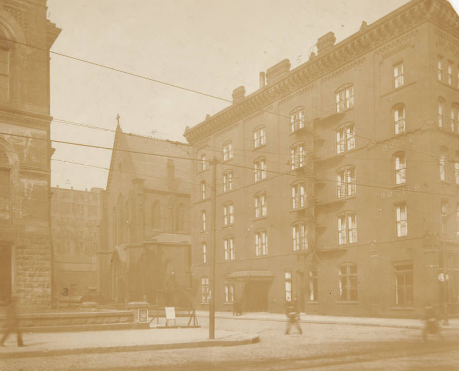
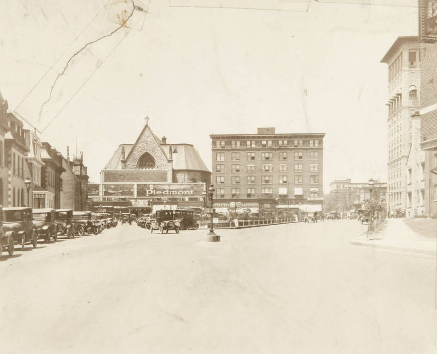
Grand Avenue was one of St. Louis’s major north-south corridors, and its intersection with Olive saw heavy pedestrian and equine traffic throughout the day. Looking north on Grand, the street was lined with a mix of retail, religious, and institutional buildings. St. Francis Xavier College Church at the corner of Grand and Lindell anchored the St. Louis University campus nearby, its spire visible for blocks in multiple directions.
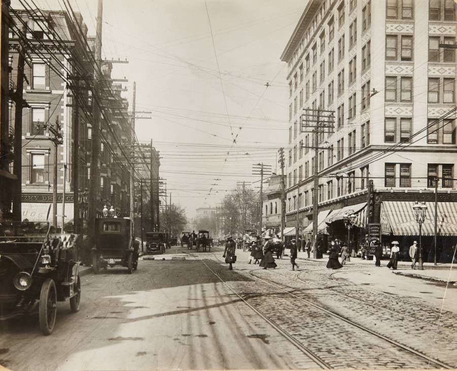
Religious institutions played a central role in the life of St. Louis neighborhoods. St. Francis Xavier College Church at Grand and Lindell served the university community, while St. Anthony of Padua Church at 3200 Meramec in the Mount Pleasant neighborhood served its surrounding parish. St. Leo’s School and other Catholic educational institutions dotted the city map, alongside public schools that ranged from elementary level to large high school campuses.
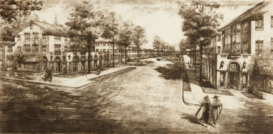
Planned residential developments shaped the city’s growth in new directions. Delmar Boulevard saw proposals for new housing that reflected the decade’s optimism about urban expansion. Nearby, the Del-Van building stood at the intersection of Delmar and Vandeventer, a commercial anchor serving the residential blocks around it. The gate entrance to Washington Terrace off Union Boulevard and the stone gates of Hortense Place off Kingshighway marked the boundaries of the city’s most carefully planned private neighborhoods.
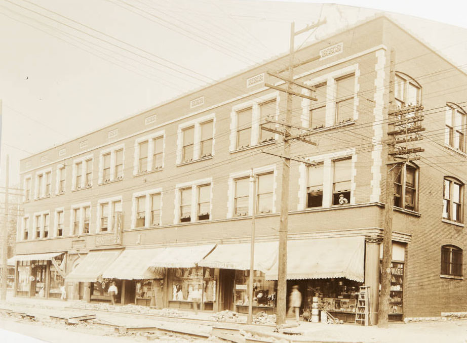
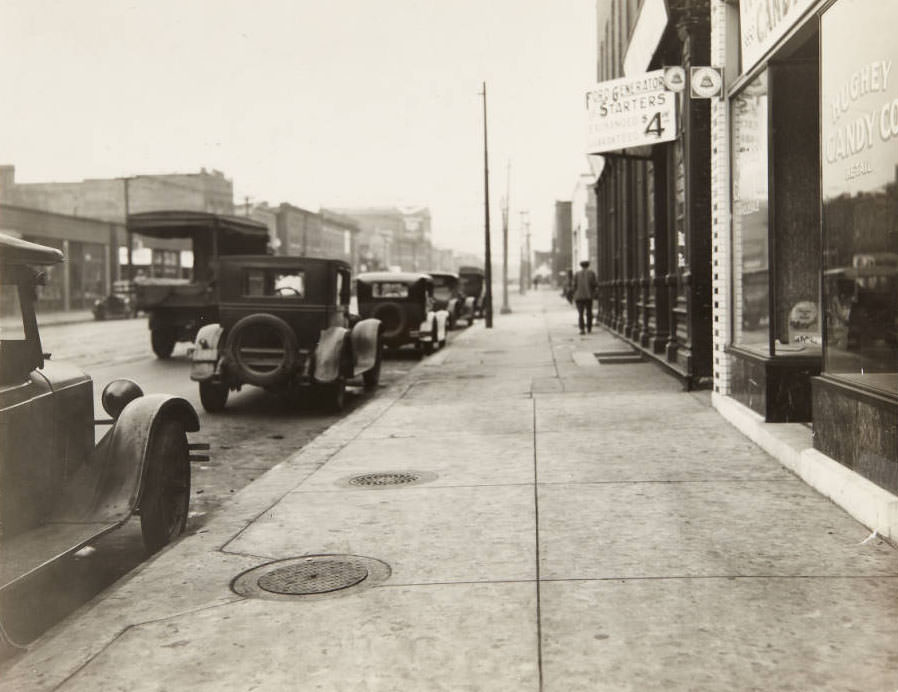
Commercial districts extended well beyond downtown. South Grand near Meramec Street had gas stations for Tower Oil Company and Shell Oil by the end of the decade, a sign of how deeply the automobile had penetrated everyday city life. The Easton Avenue corridor, including the 3800 block where the Hughey Candy Company operated at number 3850, was lined with sidewalk storefronts serving neighborhood shoppers on the north side of the city.
The Marion Roe Hotel at 508 Pine Street was a seven-story building that stood alongside the Rufa Building, the Lyric Theater, and the Globe Hotel in a cluster of downtown structures that defined that part of the city. All of these buildings were eventually demolished in the 1960s to clear the site for the original Busch Stadium, erasing a section of the urban fabric that had been in place since the late 19th century.
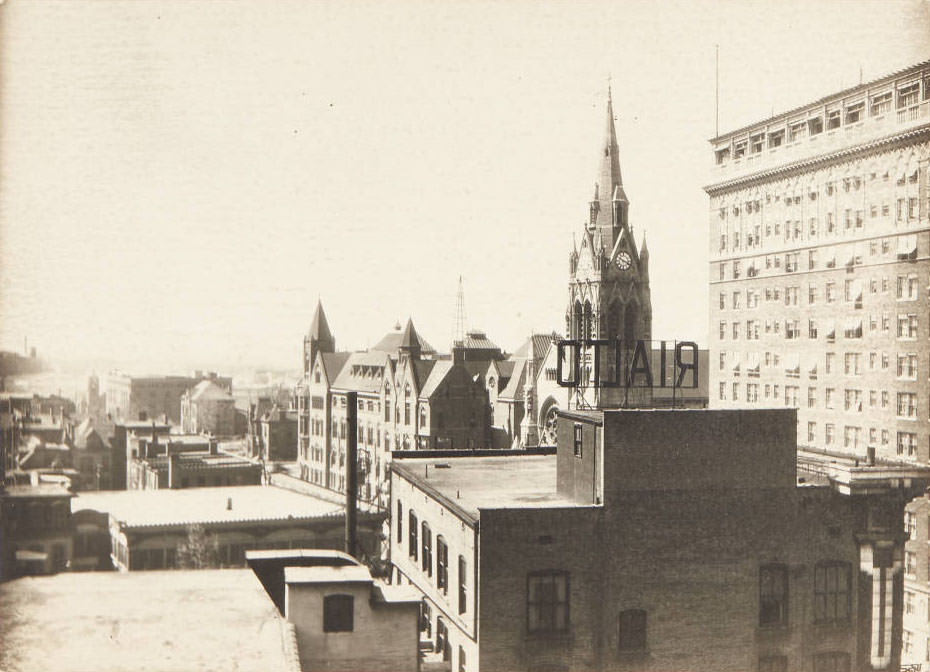
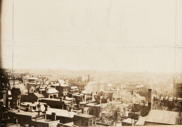
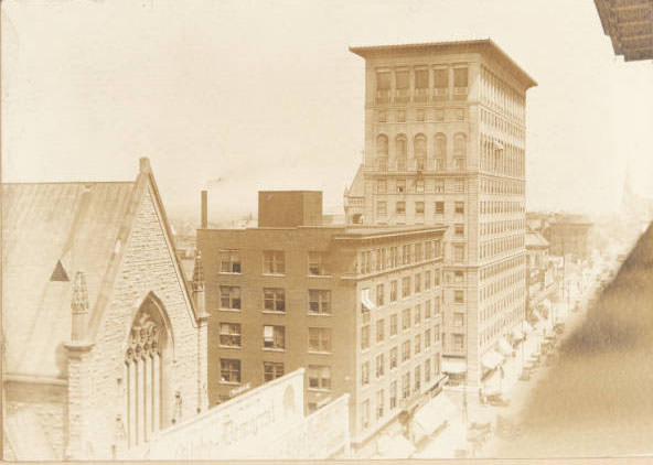
Views from the upper floors of downtown buildings revealed the full scale of St. Louis in 1910. From atop the Metropolitan building, the city’s grid stretched outward in every direction, rooftops and church steeples marking the neighborhoods below. The bird’s-eye perspective showed how thoroughly built out the central city already was, with little open space remaining in the core and development pushing steadily into the surrounding residential areas.
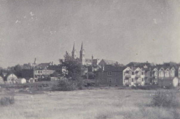
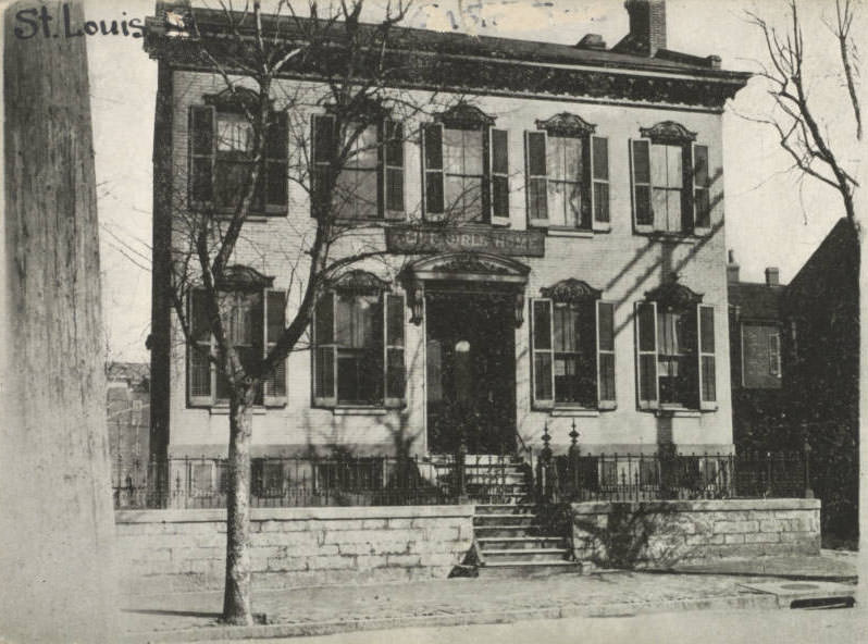
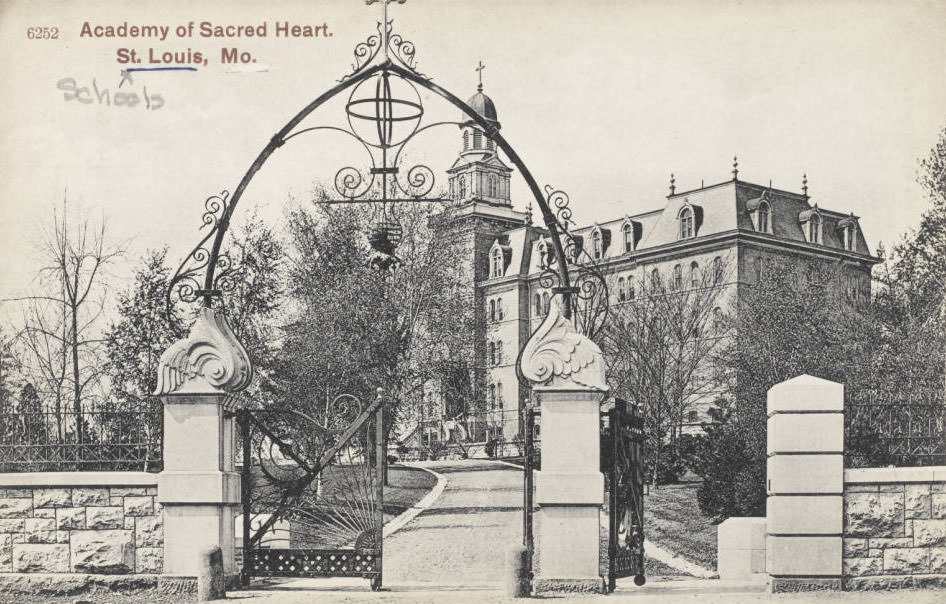
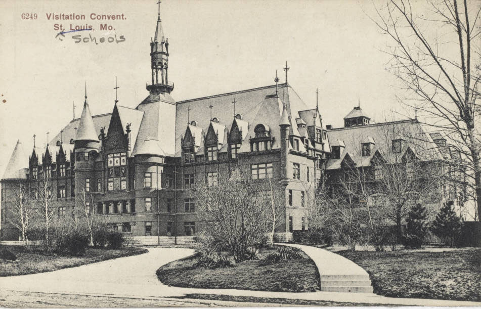
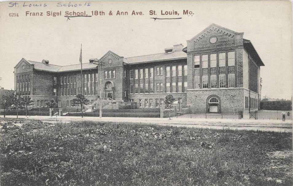
The city’s network of churches, schools, and civic institutions gave each neighborhood its own distinct character. St. Anthony of Padua in Mount Pleasant, the Academy of Sacred Heart, the Visitation Convent, and the Franz Sigel School at 18th and Ann Avenue all served specific communities within the larger city. The Blind Girls’ Home at 1214 North Garrison Avenue represented the city’s social welfare infrastructure, providing housing and care for a vulnerable population.
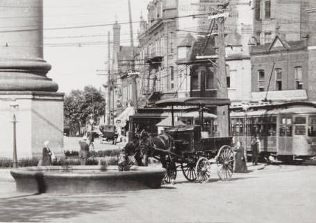
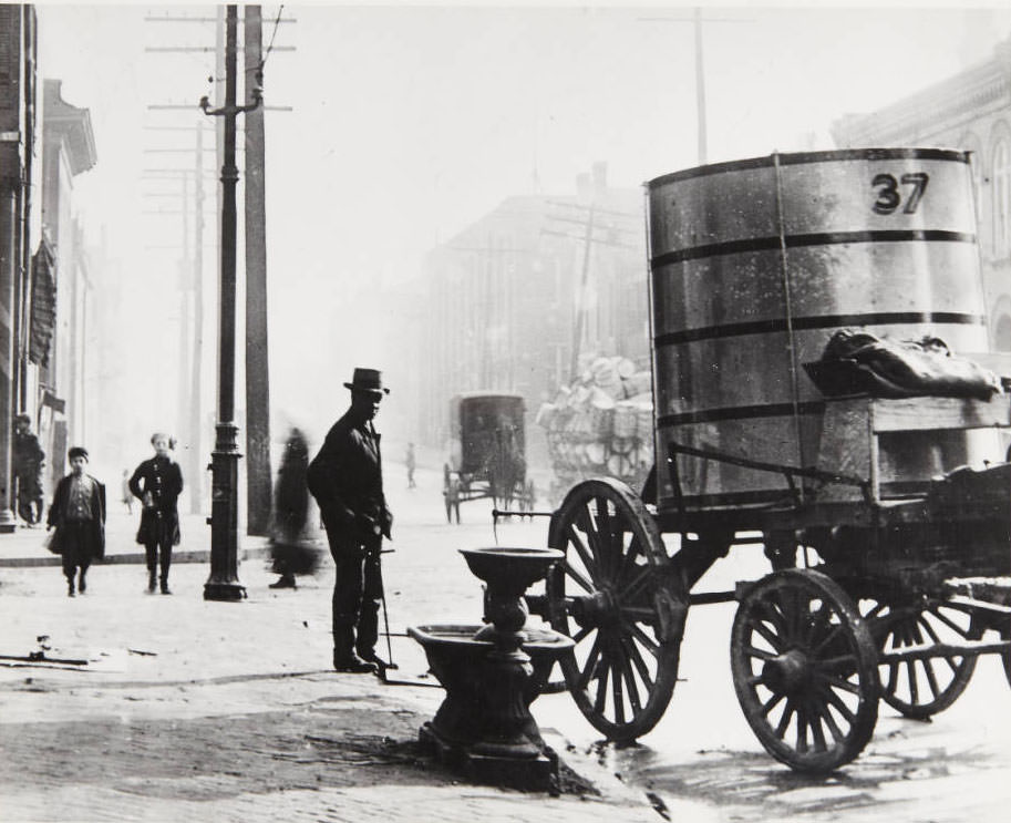
Horses remained essential to daily city operations throughout the decade. At the North Grand Circle, a delivery horse drank from a water trough between runs. Teams of horses pulled coal wagons for the Ice Fuel Company along St. Charles Street, hauled cement for the Portland Cement Company on 20th Street, and powered water wagons that moved through neighborhoods where plumbing was still limited. At 11 North 20th Street, Caushima Killy operated a restaurant alongside the working-class businesses that filled those blocks.
Kingshighway Boulevard ran the length of the city from north to south and served as a major boundary between neighborhoods. Looking south from its intersection with Arsenal Street, the road was lined with residential buildings and institutional structures. Streetcar tracks ran along Kingshighway near Forest Park Avenue, and looking north from Lindell, the boulevard’s tree-lined character gave it a more spacious feel than the denser commercial streets closer to downtown.
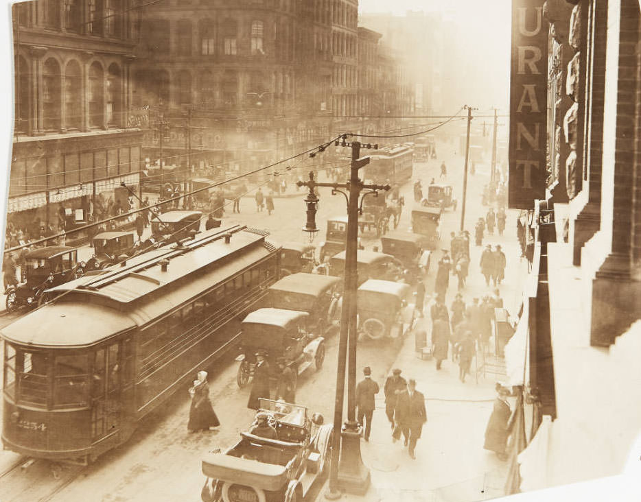
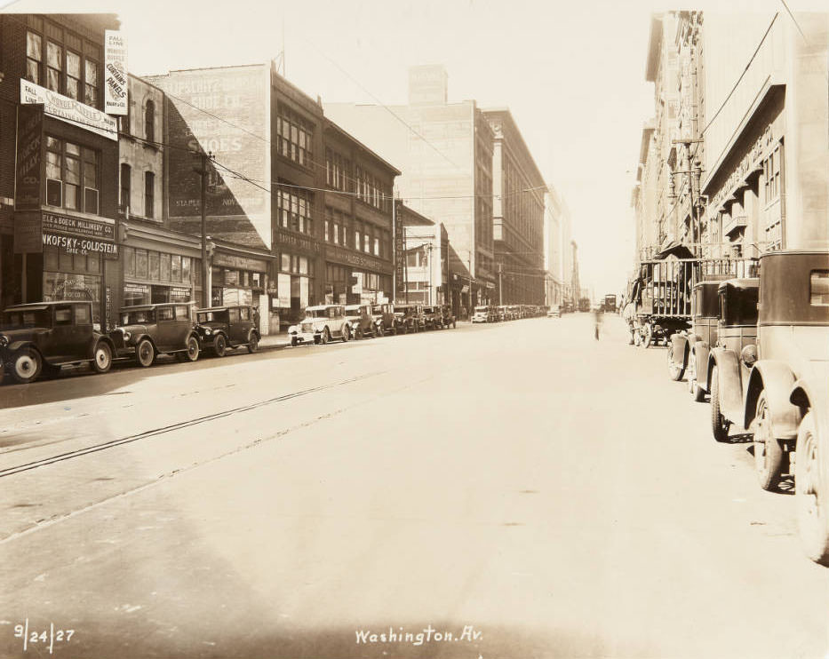
Washington Avenue remained one of the most active commercial streets in the city from start to finish of the decade. Traffic on the avenue was constant — a mix of automobiles, horse-drawn wagons, and streetcars pushing through intersections at 7th Street, 14th Street, and beyond. The Brown Shoe Company building on Washington Avenue was one of several large commercial properties that defined the avenue’s identity as a center of wholesale trade and retail commerce.
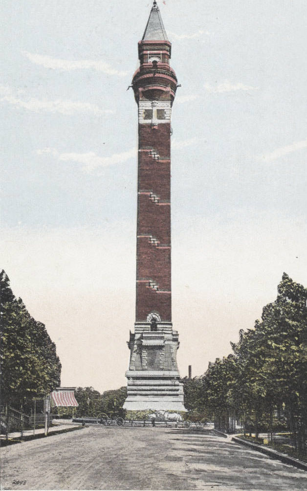
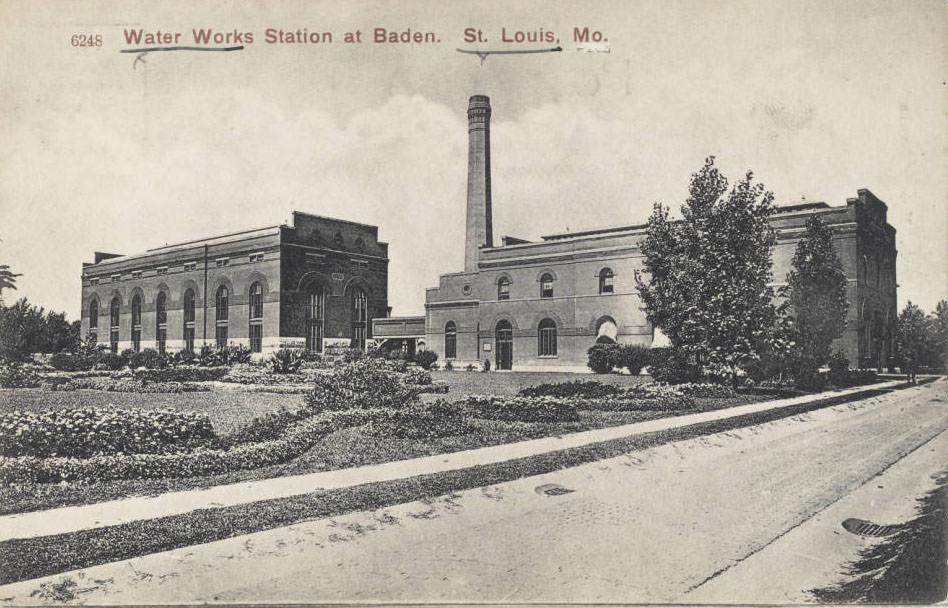
Water supply was a serious civic concern in a city of nearly 700,000 people. St. Louis operated a waterworks at Baden, a pumping station at Chain of Rocks, and a new water tower that served the expanding city grid. Water wagons supplemented the system in areas where infrastructure was still being built, carrying large containers through neighborhoods and delivering water to businesses and residents who needed it.
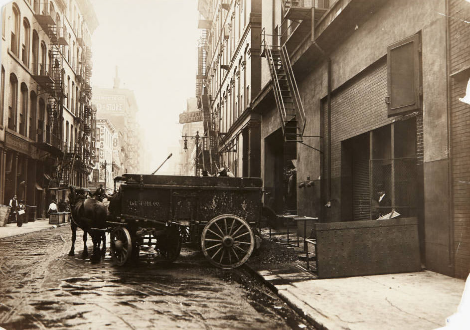
The delivery economy of 1910s St. Louis depended almost entirely on horse power. Coal, ice, dry goods, and building materials all moved through the city on wagons pulled by teams of working horses. The Ice Fuel Company’s deliveries to businesses on St. Charles Street were part of a city-wide logistics network that kept factories running, restaurants supplied, and households heated through the long Missouri winters.
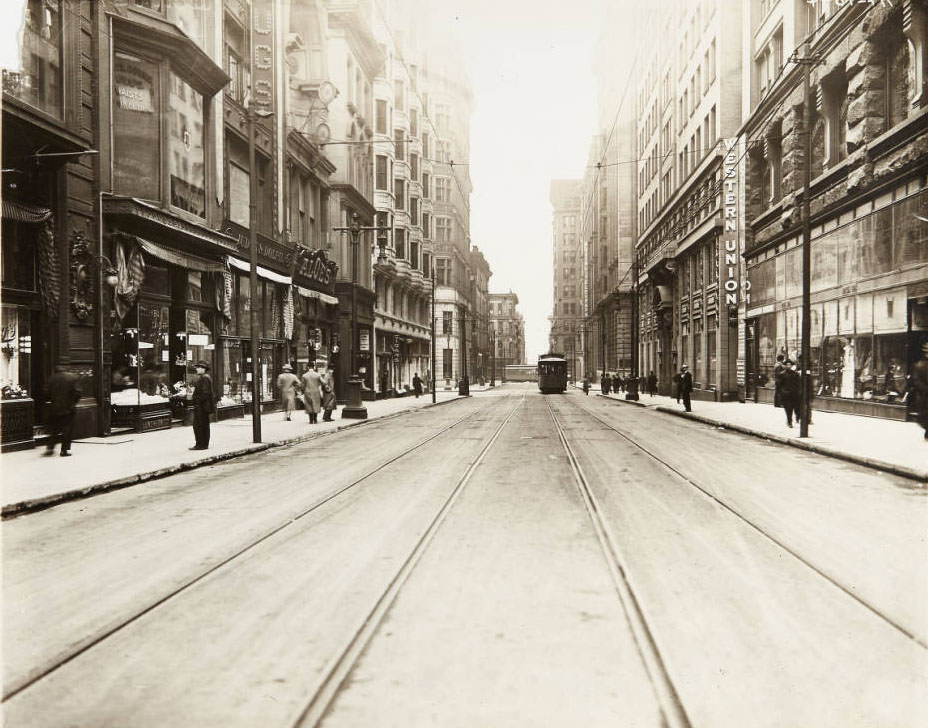
Major retail buildings anchored the downtown commercial core. The William Barr Dry Goods Company at 6th and Olive was a substantial commercial presence in the city, its multi-story building visible on a stretch of Olive Street that also included Western Union Telegraph at 504 Olive, the Judge and Dolph Drug Company at 515 Olive, and Aloe’s optician next door at 513 Olive. Chestnut Street running west from 4th passed the Old Courthouse and the LaSalle Hotel at number 508.
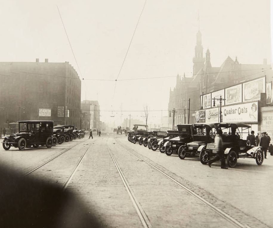
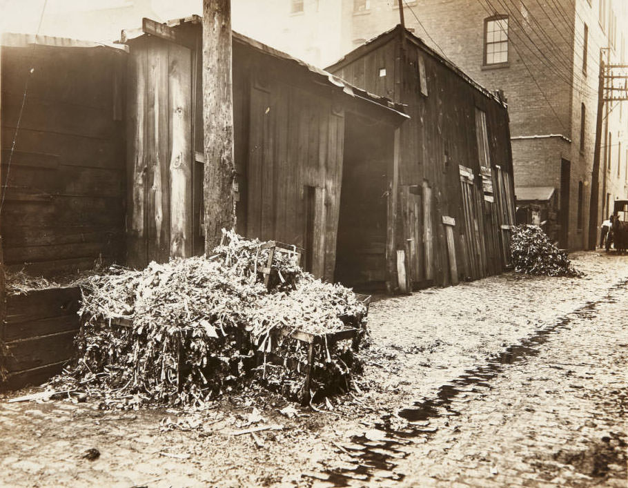
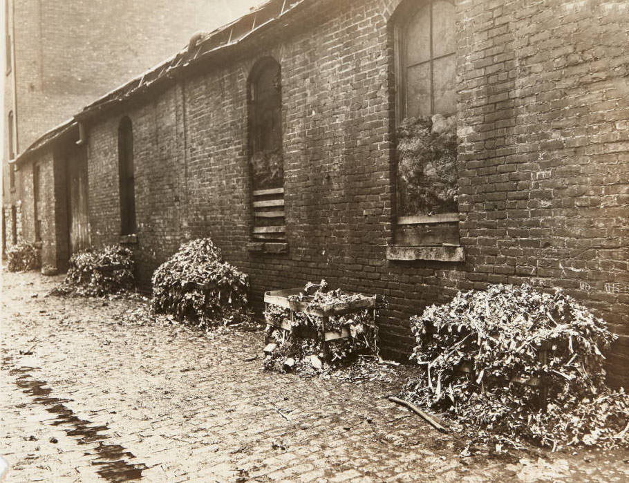
By 1913, automobiles were becoming a regular part of the street scene across all parts of the city. A row of cars parked along 12th Street looking south showed just how quickly the vehicle had taken hold in urban life. Foster Alley in the same year presented a different picture — decaying boxes of plants stacked next to wooden sheds, a neglected back-street corridor far removed from the polished commercial avenues just a few blocks away.
Not all of St. Louis in the 1910s was prosperous or well-maintained. Foster Alley showed the contrast between the city’s commercial showpieces and its neglected back streets, where decaying plant boxes and aging wooden sheds lined the passage. These alley-level views captured a reality that the main street photographs often left out — urban decay coexisting with the growth and development happening just around the corner.
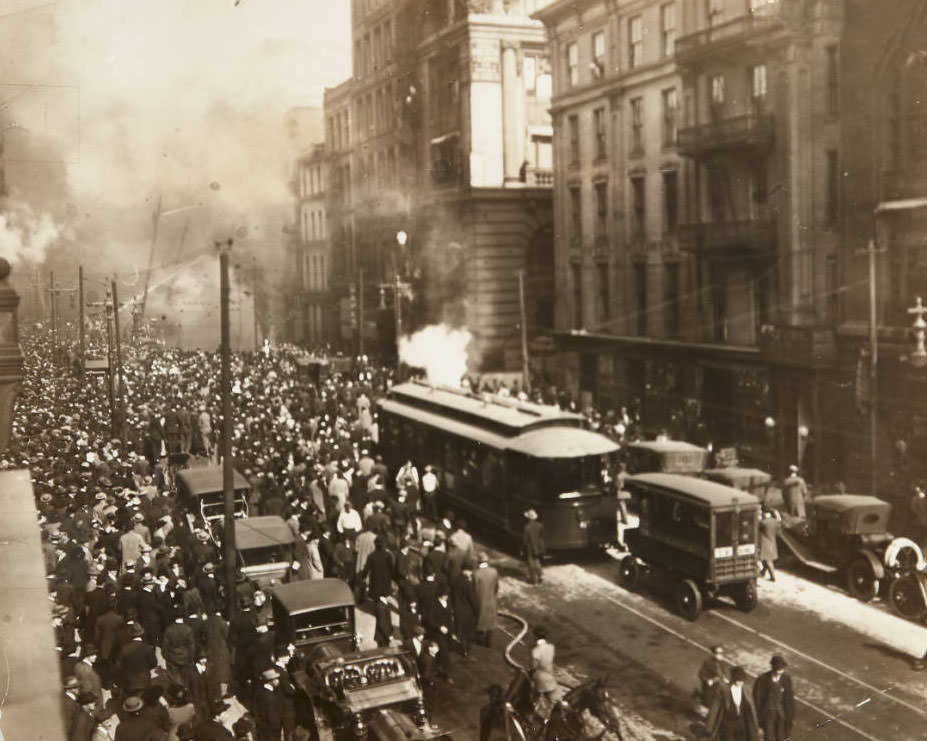
Fires were an ever-present hazard in a city full of wooden structures and densely packed buildings. In 1913, a large crowd gathered near St. Charles Street and Broadway to watch firefighters battle a major blaze. The scene drew onlookers from the surrounding blocks, who filled the street to watch the crews work. Fire equipment at the time was improving but still struggled with large urban fires in tightly built neighborhoods.
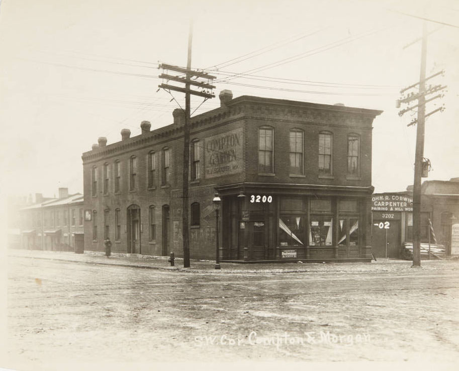
By 1915, the city’s mid-decade character was fully on display. The intersection of Compton Avenue and Morgan Street showed residential and commercial buildings typical of the city’s working neighborhoods. North Grand was lined with storefronts and apartment buildings, pedestrians moving along sidewalks near the intersection with Cook Avenue in a steady rhythm of daily urban life.
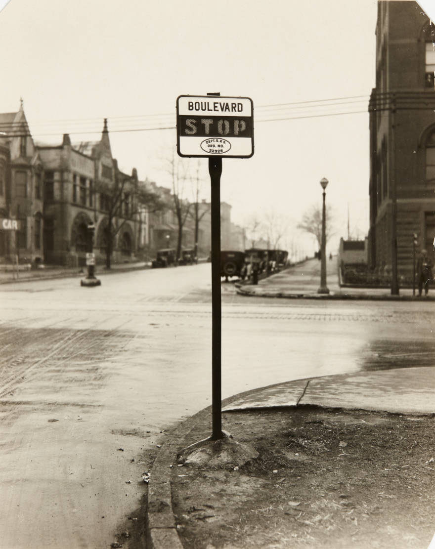
Pedestrian life along North Grand Boulevard in 1915 was active and varied. People walked the sidewalks near the intersection of North Grand and Cook Avenue, passing storefronts, churches, and apartment buildings that lined both sides of the street. Stop signs had begun appearing at major intersections by mid-decade — a new tool for managing traffic at corners like West Pine Boulevard and Grand, where pedestrians and vehicles competed for right of way.
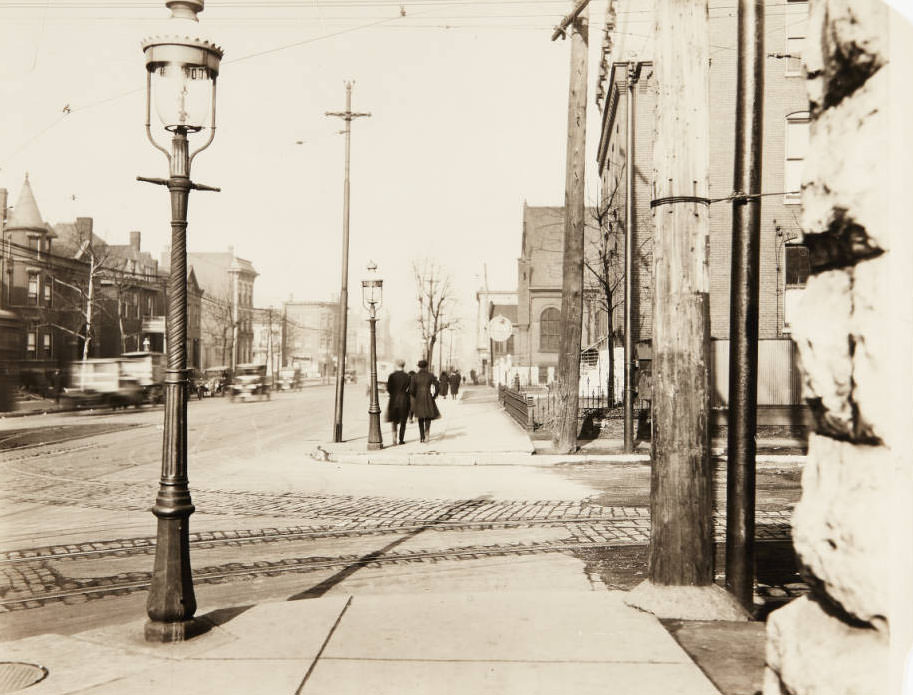
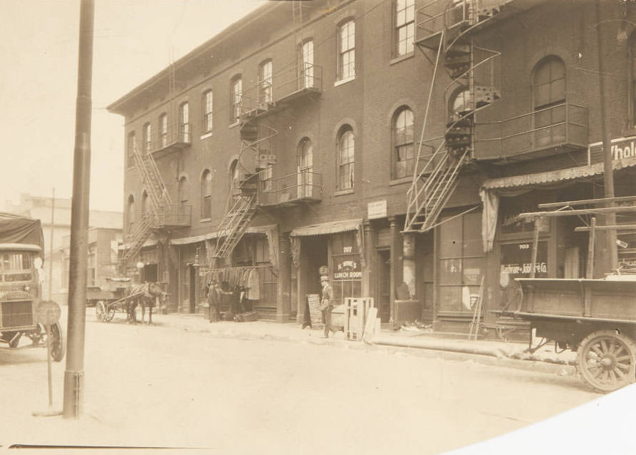
The corner of Grand and Lindell was marked by an ornate streetlight in 1915, a small detail that spoke to the city’s investment in its public infrastructure. The intersection was also notable for the Grand Avenue Presbyterian Church at 527 North Grand, which stood at the site where the Fabulous Fox Theatre would later be built. Lindell Boulevard itself extended westward past St. Louis University and toward the Central West End, lined with residential and institutional buildings of increasing grandeur.
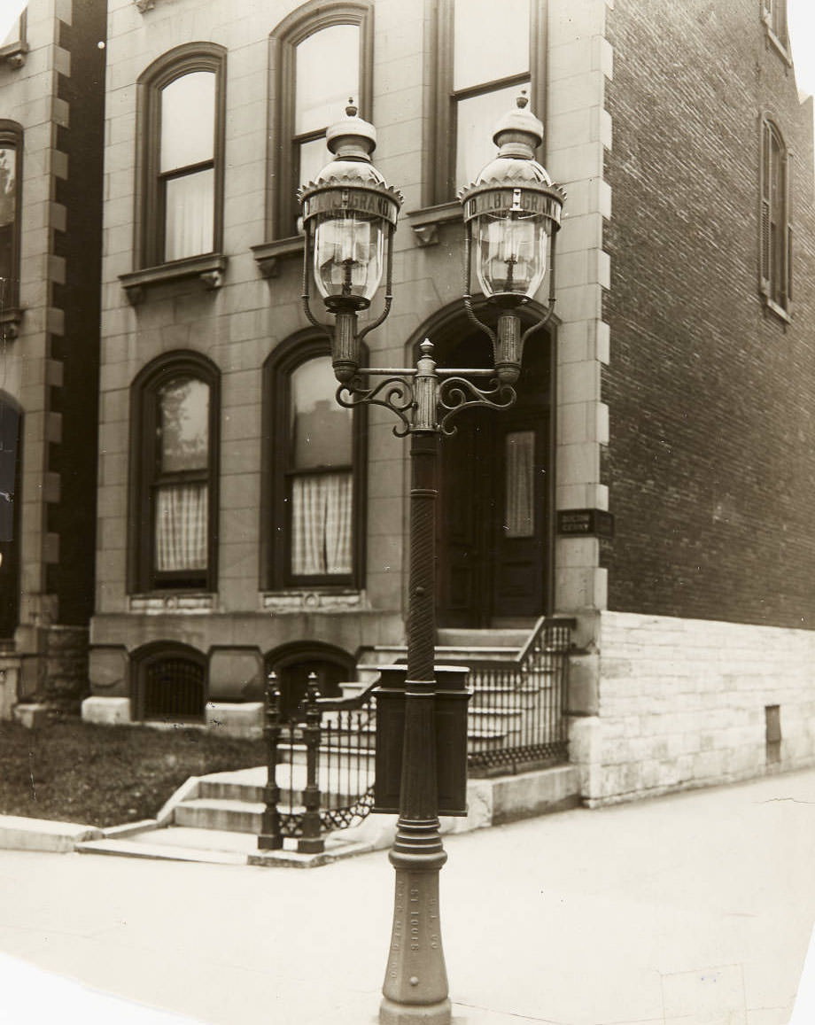
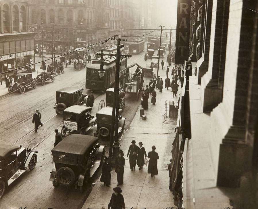
Broadway near Washington Avenue in 1915 was among the city’s busiest freight and commercial corridors. Looking south, the street showed the full mix of transportation that defined St. Louis at mid-decade — automobiles, horse-drawn wagons, and streetcars all moving through the same space. On 20th Street, horses pulling a wagon for the Portland Cement Company rested in front of a row of commercial buildings, including Caushima Killy’s restaurant at number 11.
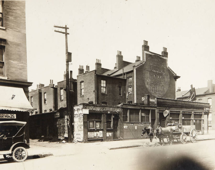
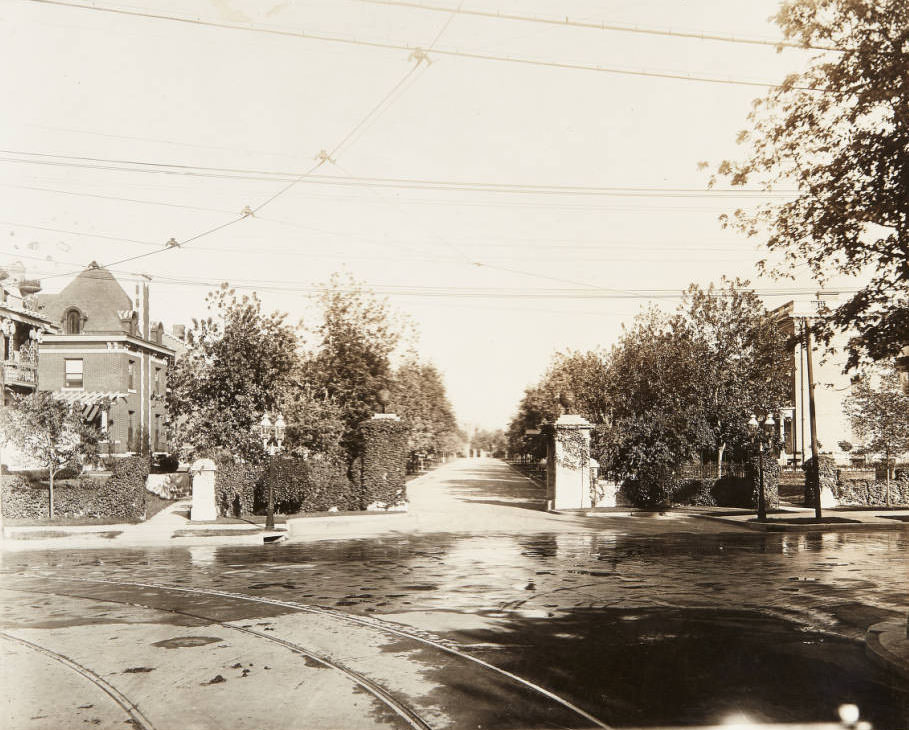
The Central West End’s private streets were among the most distinguished addresses in St. Louis. The stone gate entrance to Hortense Place at its intersection with Kingshighway was an imposing landmark, marking the boundary of a residential enclave developed around 1910. Hortense Place, like Kingsbury Place, Portland Place, and Westmoreland Place, was designed as a self-contained neighborhood with restricted access and uniform architectural standards.
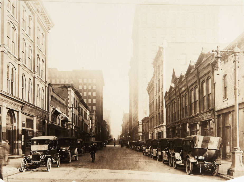
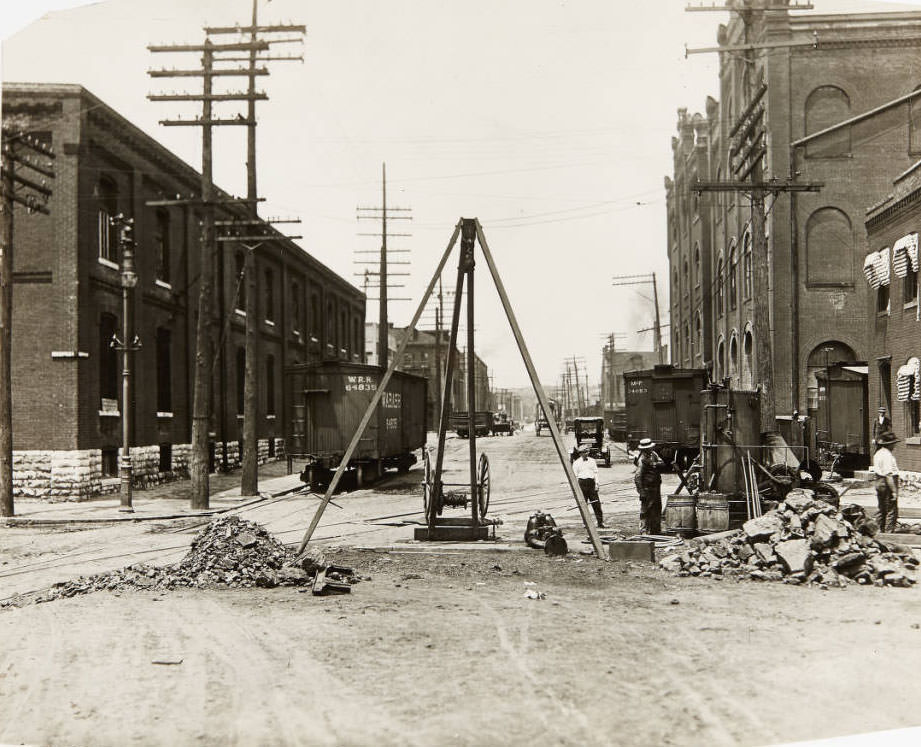
Looking west on Washington from Grand in 1915, the Grand Avenue Presbyterian Church was visible at 527 North Grand on the site where the Fabulous Fox Theatre now stands. The Washington and Grand intersection was a major transfer point for pedestrians, streetcar riders, and vehicle traffic moving between the city’s east-west and north-south corridors. Nearby, Barton Street showed the presence of active railroad lines cutting through residential areas, requiring regular street and sewer maintenance work on the surrounding blocks.
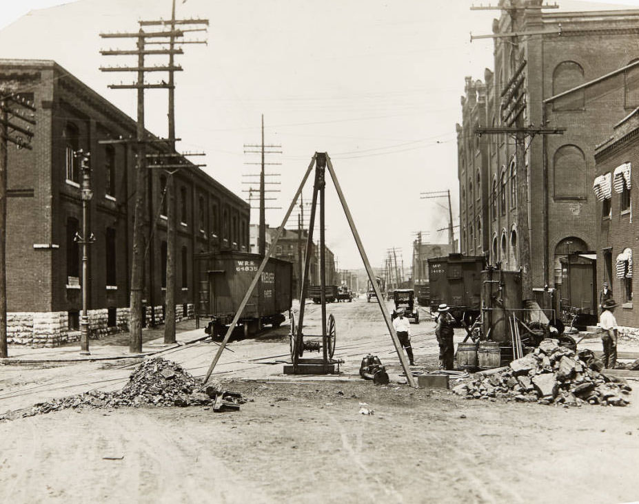
Street and sewer repair work was a constant feature of city life in the 1910s. Workers on Barton Street dug up paving and repaired underground infrastructure, while similar work took place on Washington near Channing Avenue in Midtown. These projects were disruptive but necessary — the city’s underground systems were under growing strain from the expanding population, and surface roads required constant upkeep given the volume of heavy wagon and early automobile traffic they endured daily.
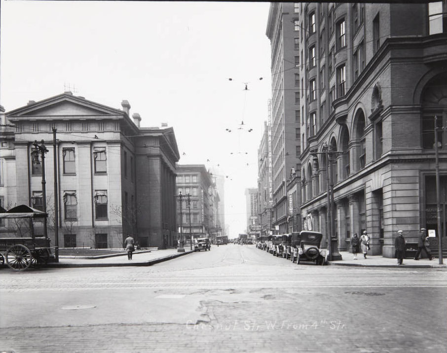
Chestnut Street west from 4th in 1915 was lined with a dense collection of businesses and institutions. The Old Courthouse building was visible on the south side of Chestnut, its dome rising above the surrounding commercial blocks. The 1st National Life building stood at 102 North Broadway, and the LaSalle Hotel occupied 508 Chestnut, while the Powell Hat Company operated at 415 Chestnut. The street represented one of the most commercially layered blocks in the entire downtown grid.
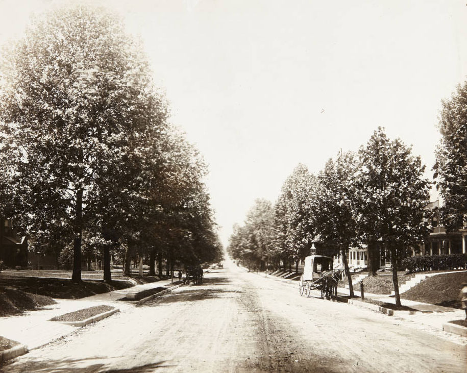
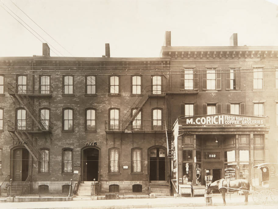
Residential streets away from the commercial core had a quieter character. On the 5300 block of Clara Avenue, a horse-drawn carriage moved through a neighborhood of houses set back from the road. The 1100 block of Chouteau Avenue featured row houses typical of the city’s working-class residential areas, while O’Fallon Street near 20th was lined with buildings strung together by telephone wire poles — visible markers of the city’s expanding communication network.
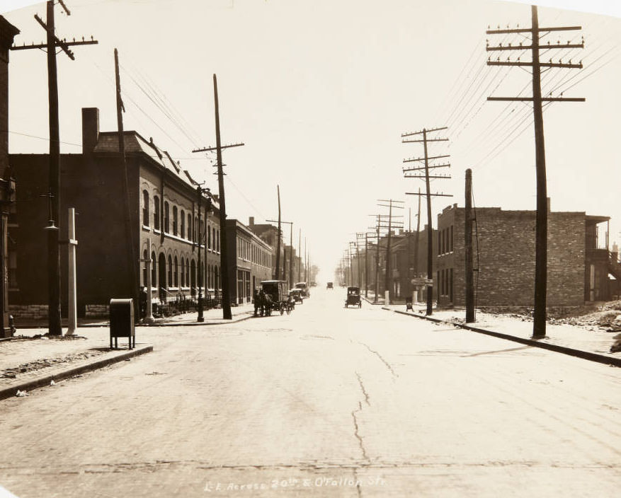
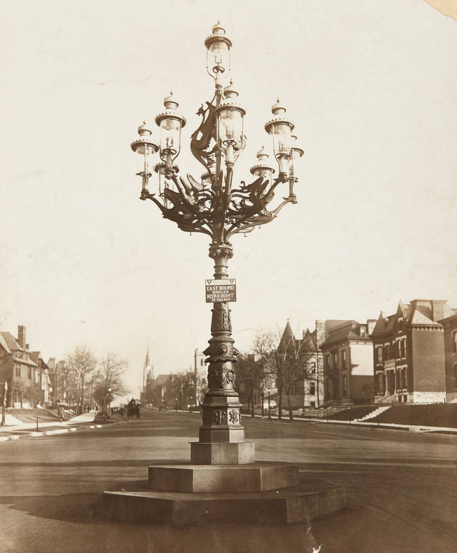
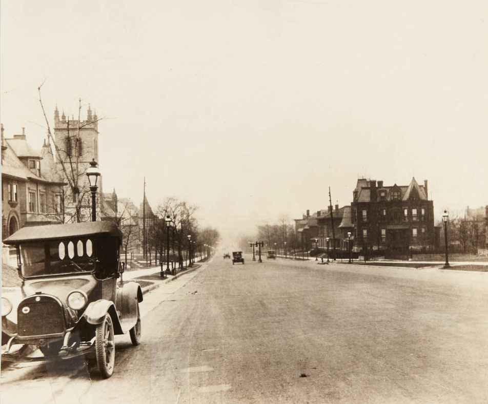
Traffic management was becoming more formalized across the city by 1915. Stop signs appeared at key intersections like West Pine Boulevard at Grand, and ornate lampposts were installed at prominent corners like Lindell and McPherson near the St. Louis University campus. Lindell Boulevard looking west from Spring Avenue was a broad, tree-lined street, its scale befitting one of the city’s most prestigious residential corridors.
Side streets and residential corridors throughout the city showed the same diversity that defined St. Louis as a whole. Miami Street looking east from Ohio Avenue was a quiet residential stretch far removed from the downtown bustle. The intersection of Market and 13th streets had a different character entirely — Cornelius O’Donnell’s harness shop, the Laclede Buffet, and the City Hall Restaurant all operated on that corner, serving the workers and officials who moved through that part of the city daily.
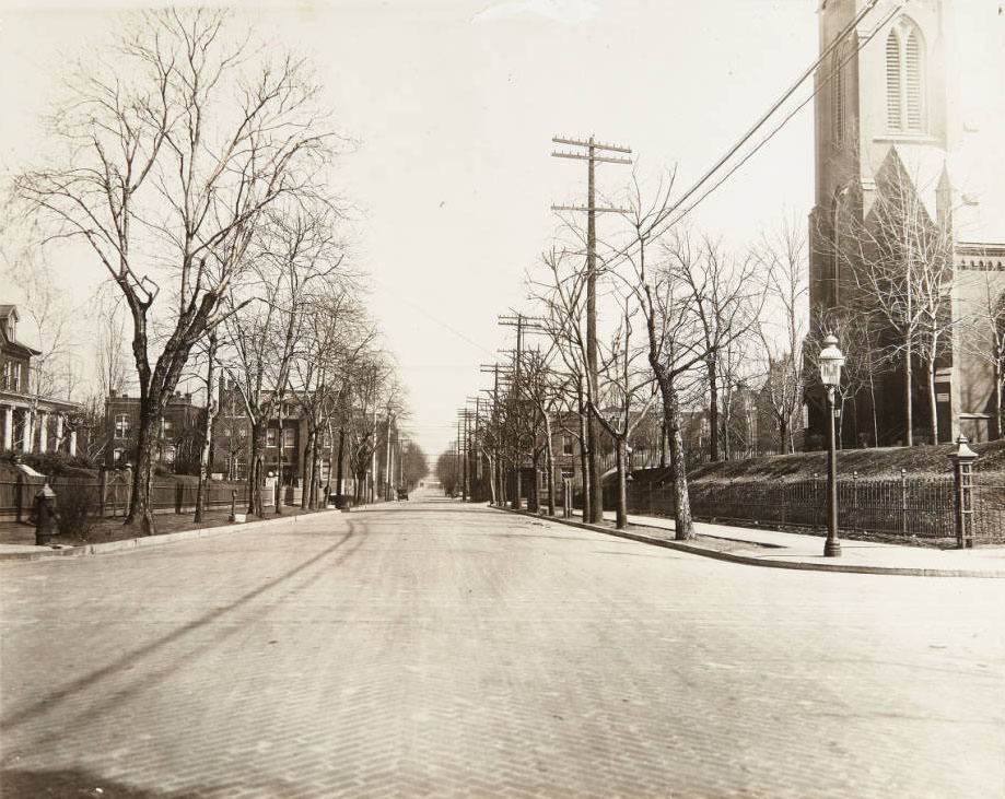
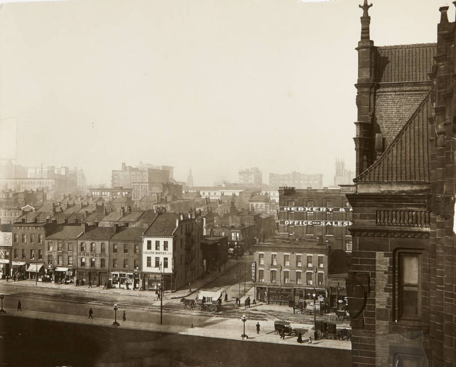
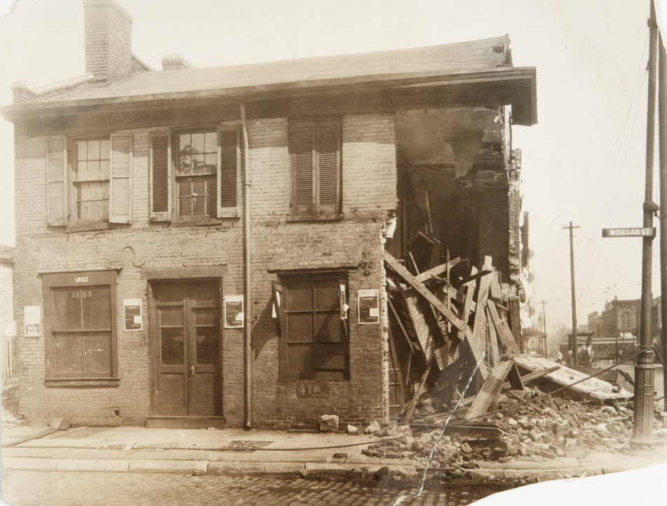
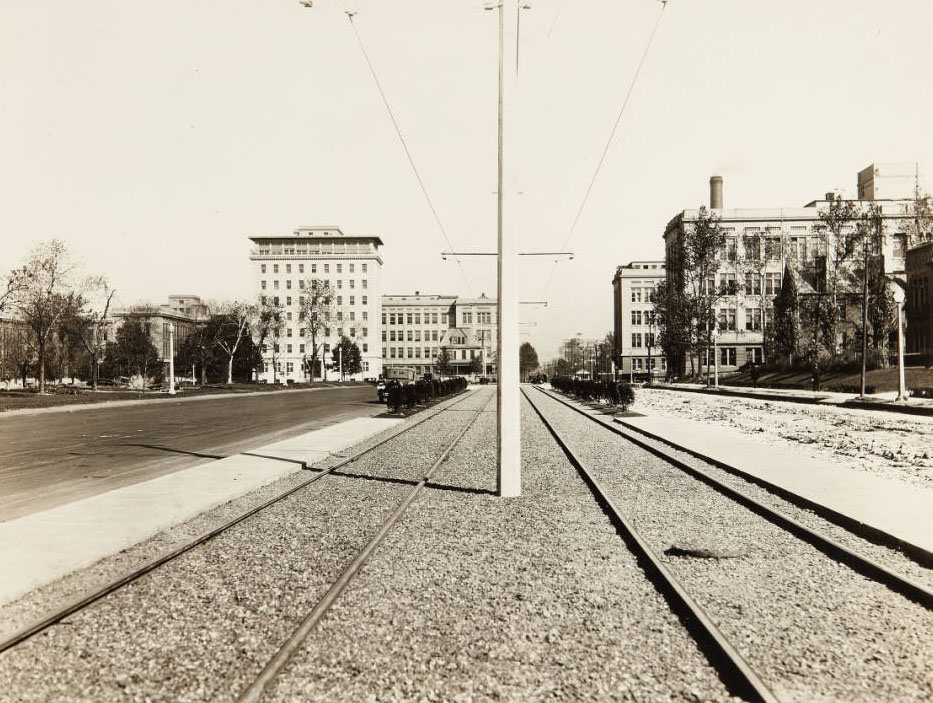
Urban change was constant. A partially demolished building at 1203 Morgan Street in 1915 stood as evidence of ongoing redevelopment across multiple neighborhoods. Streetcar tracks along Kingshighway near Forest Park Avenue carried passengers through an area of the city that was shifting from residential to mixed use, while Kingshighway looking north from Lindell showed the boulevard’s long, unbroken character as a major north-south artery.
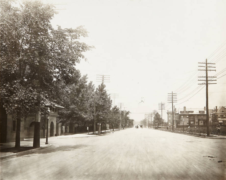
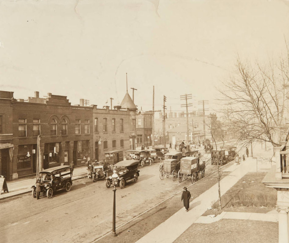
Delmar Boulevard near Taylor Avenue in 1915 was a stretch of mixed commercial and residential development. Automotive and horse-drawn traffic moved through the intersection together, passing buildings that included a saloon at 630 North Taylor operated by Joseph Raffo — its roofline decorated with stork models and a large bird’s nest. Prairie Avenue looking north from 20th Street presented a tree-lined residential alternative, its sidewalks shaded and its houses set back from the curb.
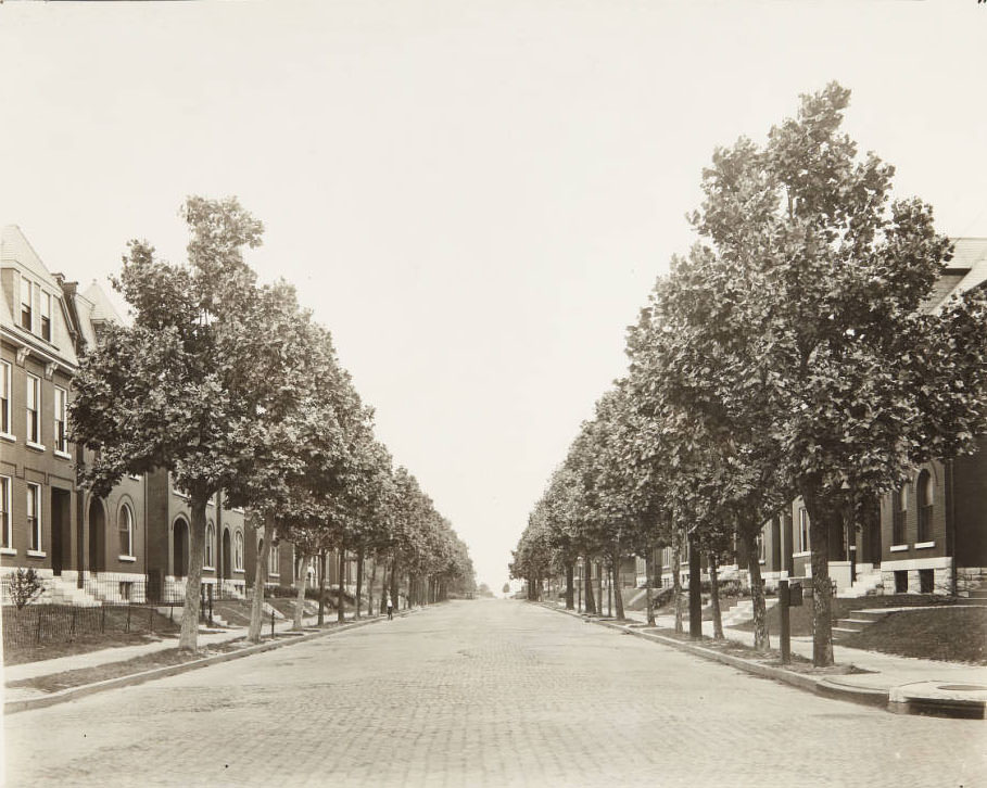
West Pine Boulevard looking east from Sarah Street in 1915 showed a well-maintained residential and institutional corridor. Olive Street from 6th, looking east, brought a much denser commercial scene into view — Western Union Telegraph at 504 Olive, the Judge and Dolph Drug Company at 515, and Aloe’s optician at 513 all clustered within a single block. Looking west on Olive from 4th, the street was busy with vehicles moving in both directions past a continuous wall of commercial storefronts.
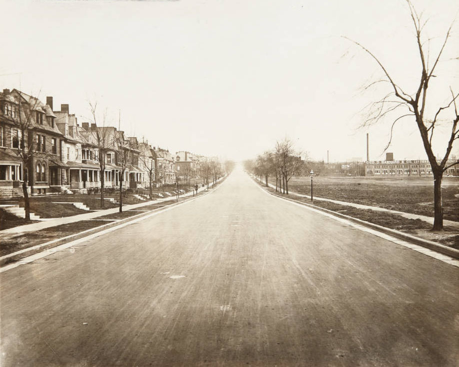
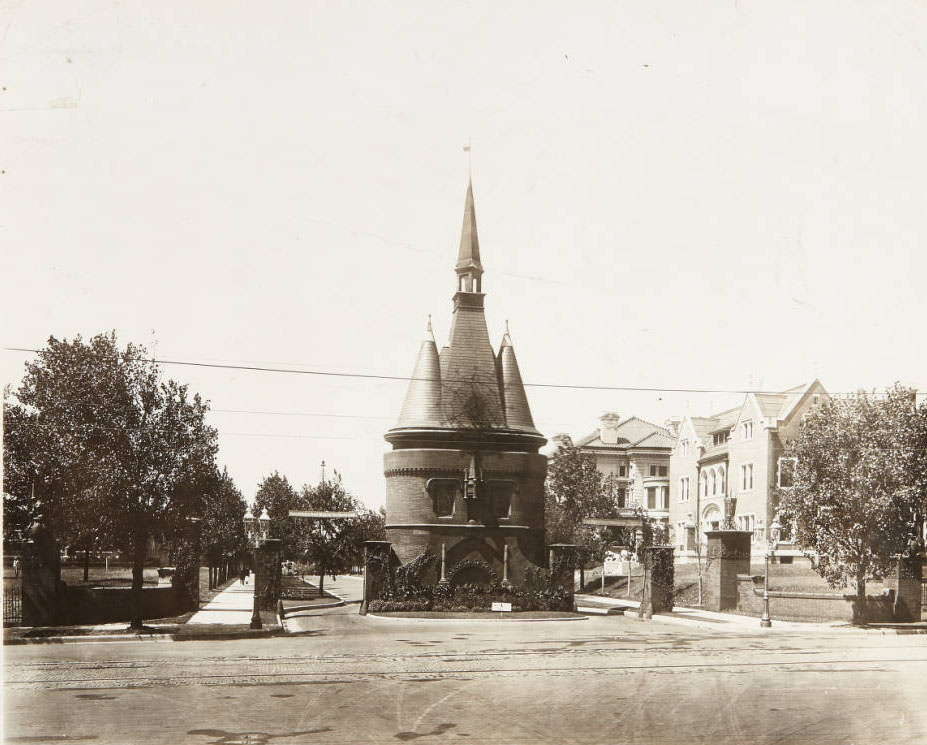
The gate at the entrance to Washington Terrace off Union Boulevard was one of the city’s most recognized neighborhood markers. Like the other private street entrances dotting the Central West End and adjacent areas, it signaled a planned residential enclave with restricted access. Inside, the streets were quieter and the houses larger than what most St. Louis residents could afford, though the gates themselves were visible from the public boulevards and shaped the geography of the surrounding neighborhood.
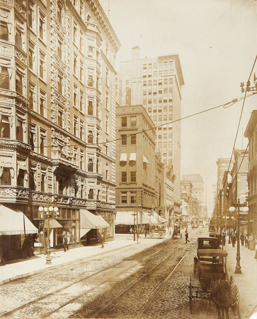
Pine Street running east from 9th and from 12th was among the city’s most active downtown corridors. Looking east on Pine from 9th in 1915, the street was packed with vehicles and pedestrians moving between offices, hotels, and commercial buildings. The Wittels Loan and Mercantile Company at 2001 Market Street represented the city’s pawn and lending economy, serving customers from across the working-class neighborhoods surrounding Midtown.
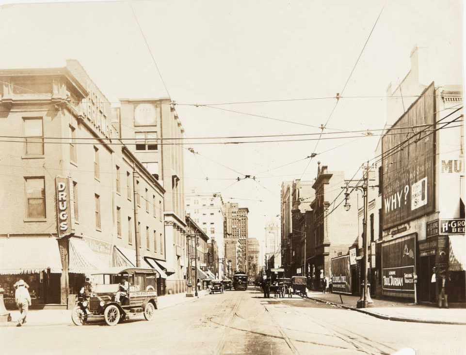
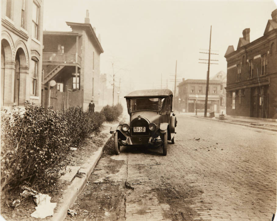
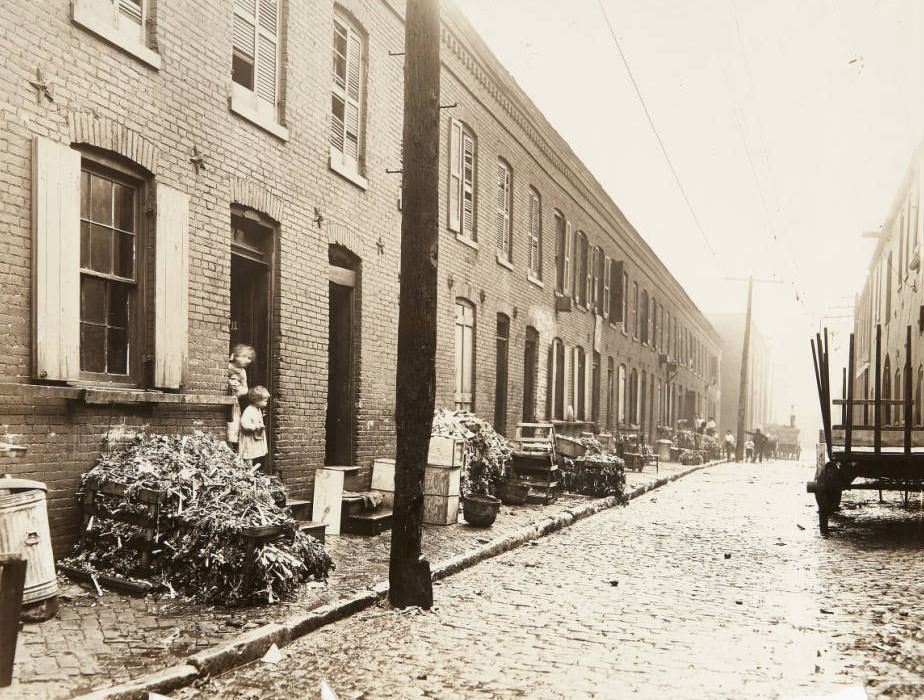
Away from the commercial corridors, residential St. Louis in 1915 showed a full range of conditions. A car sat parked on quiet Pendleton Avenue near Page Boulevard, a sign of the automobile’s spread into residential neighborhoods. On an unidentified cobblestone street, a long rowhouse sheltered residents — three girls visible in one doorway — while large heaps of trash and debris were piled on the sidewalk outside.
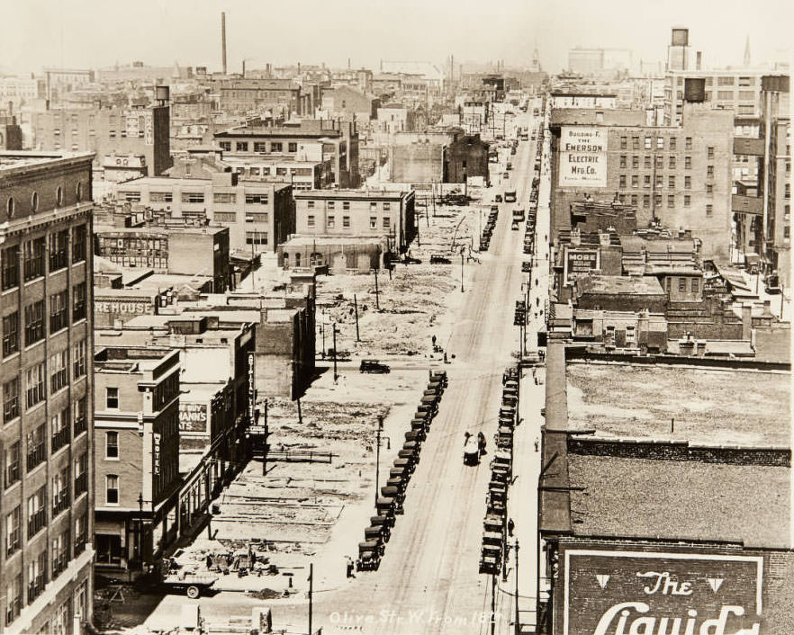
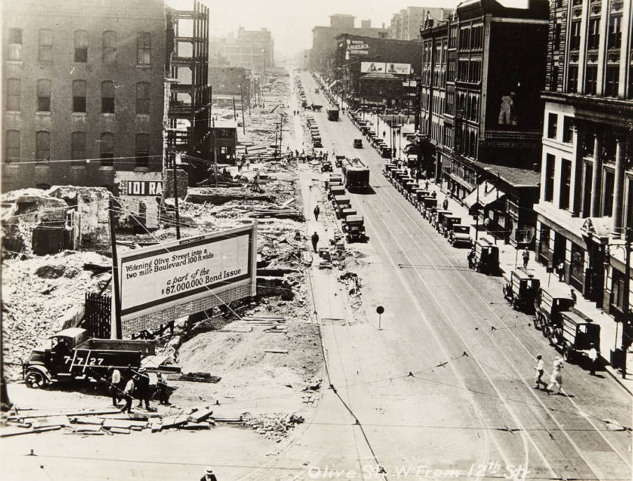
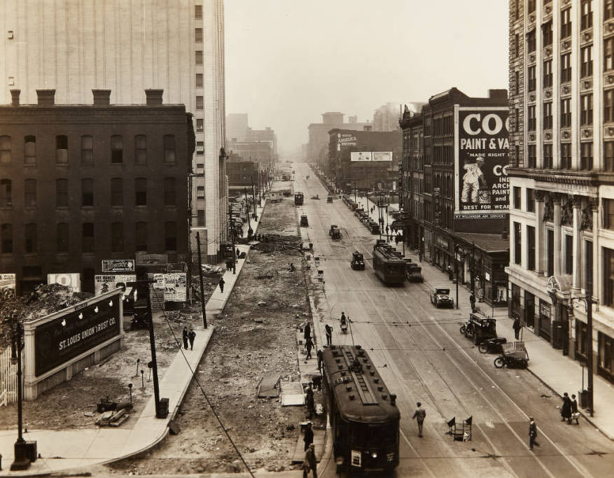
The Olive Street widening project became one of the defining public works efforts of the mid-decade years. Buildings on the south side of Olive between 13th and 14th — including the Wiley Saddlery Company, a Miller loan company, and the Chancellor cigar company — were among the first to be demolished to make way for the wider roadway. The Southwestern Bell Building was visible far in the distance as the project took shape, and the newly constructed Park Pacific Building eventually appeared on the south side of the widened street.
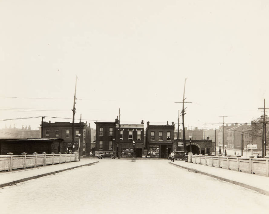
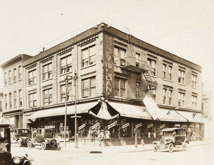
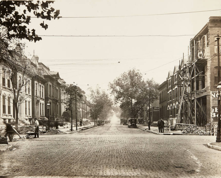
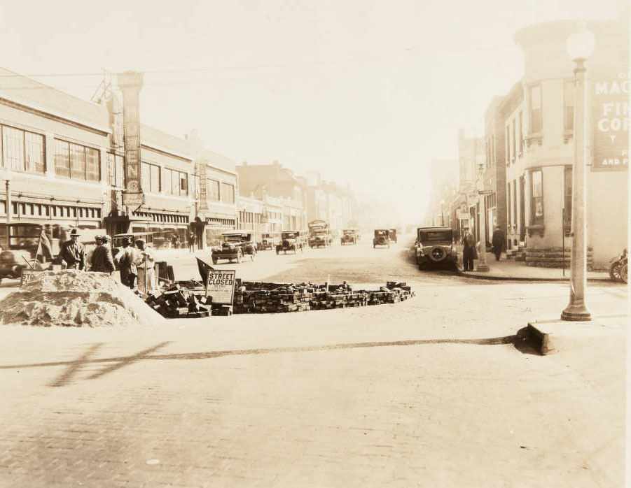
Street repair work in Midtown near Washington and Channing Avenue in 1915 disrupted traffic but reflected the city’s ongoing investment in its road network. Workers tore up pavement and replaced underground infrastructure before relaying the surface. Similar work near 13th Street between Biddle and O’Fallon streets involved building repair alongside roadwork, with scaffolding and construction equipment crowding the sidewalks along the north side of the block.
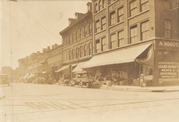
The Douglas Building on the southeast corner of Market and Broadway was home to a range of businesses typical of the era. The McCullough-Crittenden artificial limb company occupied the third floor — a business whose existence reflected the toll of industrial accidents and military service on the working population. The New York Shoe Repairing Company operated on the ground floor, and further down Market Street were the Grace Hotel and the Leader Cafe, establishments serving the city’s daily foot traffic.
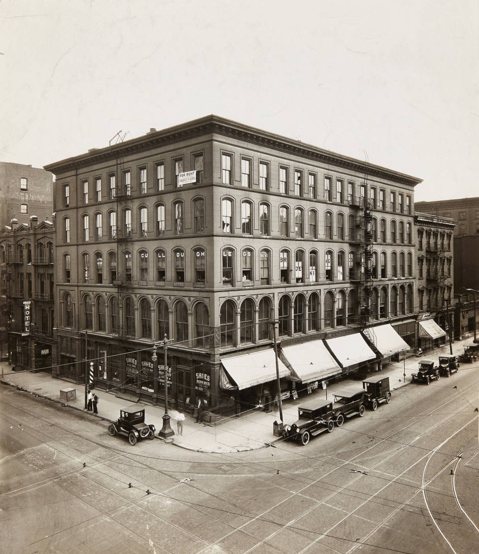
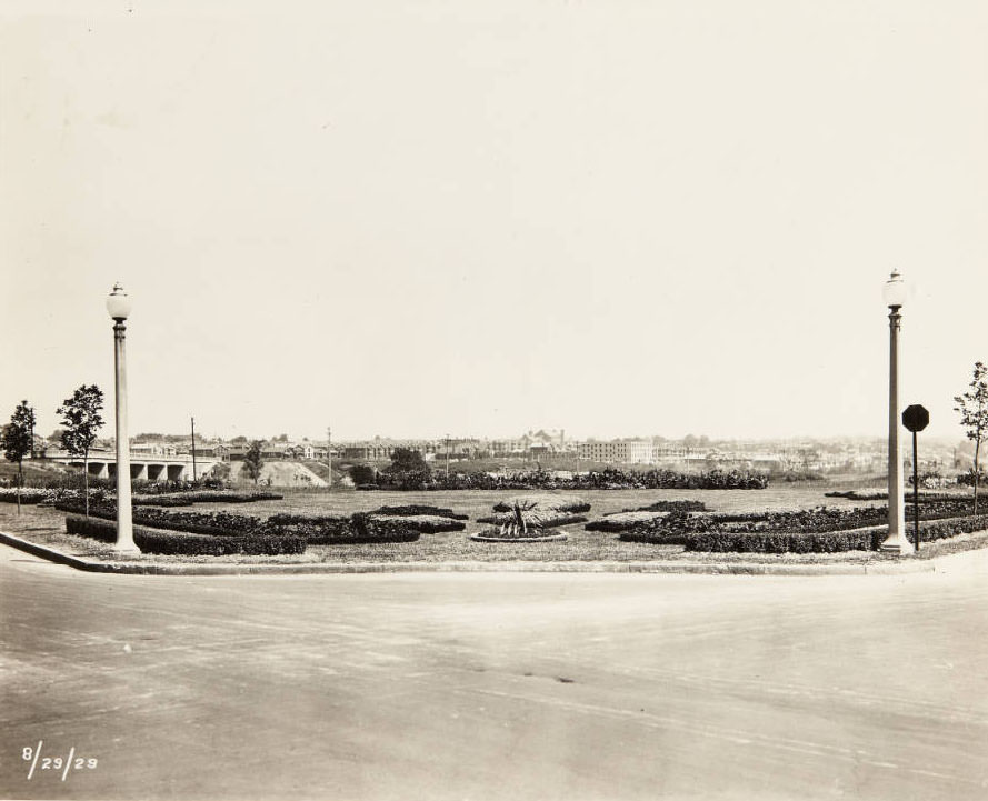
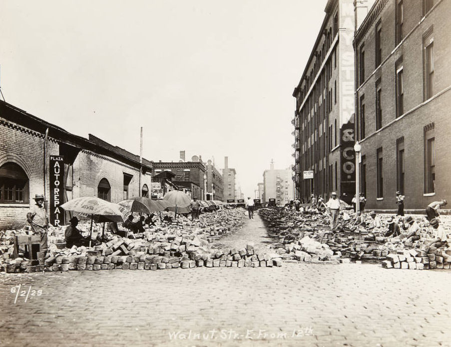
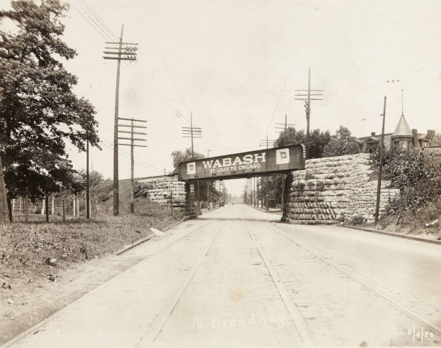
Street repair on Walnut and ongoing maintenance across the downtown grid were part of the continuous effort to keep the city’s road network functional. The Missouri Pacific Building was one of the decade’s prominent commercial structures, its presence reflecting the role that railroad companies played in shaping the physical and economic landscape of St. Louis. A railroad bridge over North Broadway near the Baden neighborhood carried freight lines through one of the city’s northern industrial areas.
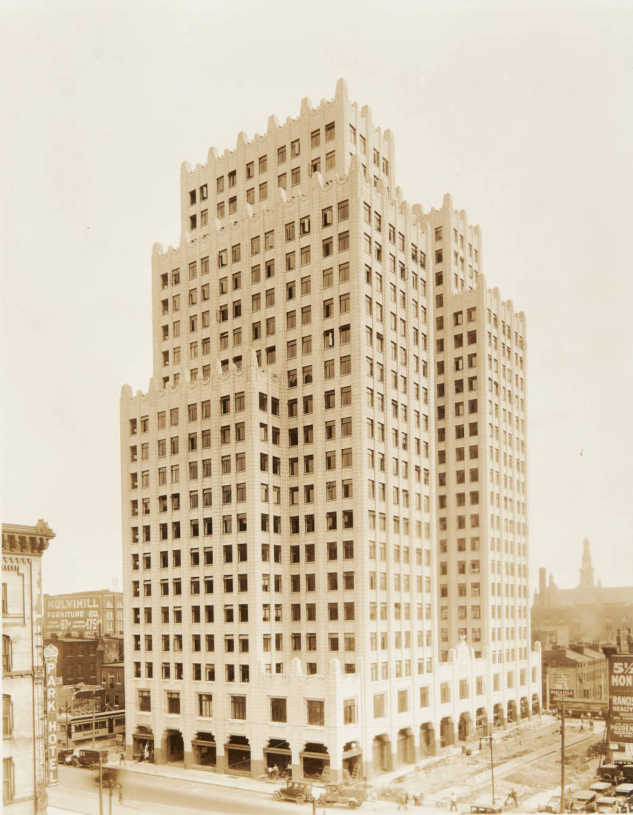
Jennings Studios and the businesses around it represented the kind of small-scale commercial operations that filled the city’s neighborhood corridors outside the downtown core. Along the south side of Olive between 13th and 14th, the early stages of the widening project removed the Wiley Saddlery Company and its neighbors as the city reshaped one of its major east-west arteries. The spire of St. Francis Xavier College Church was visible far in the distance as the demolition got underway.
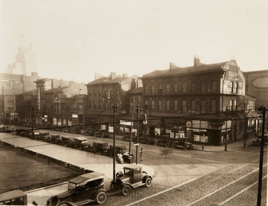
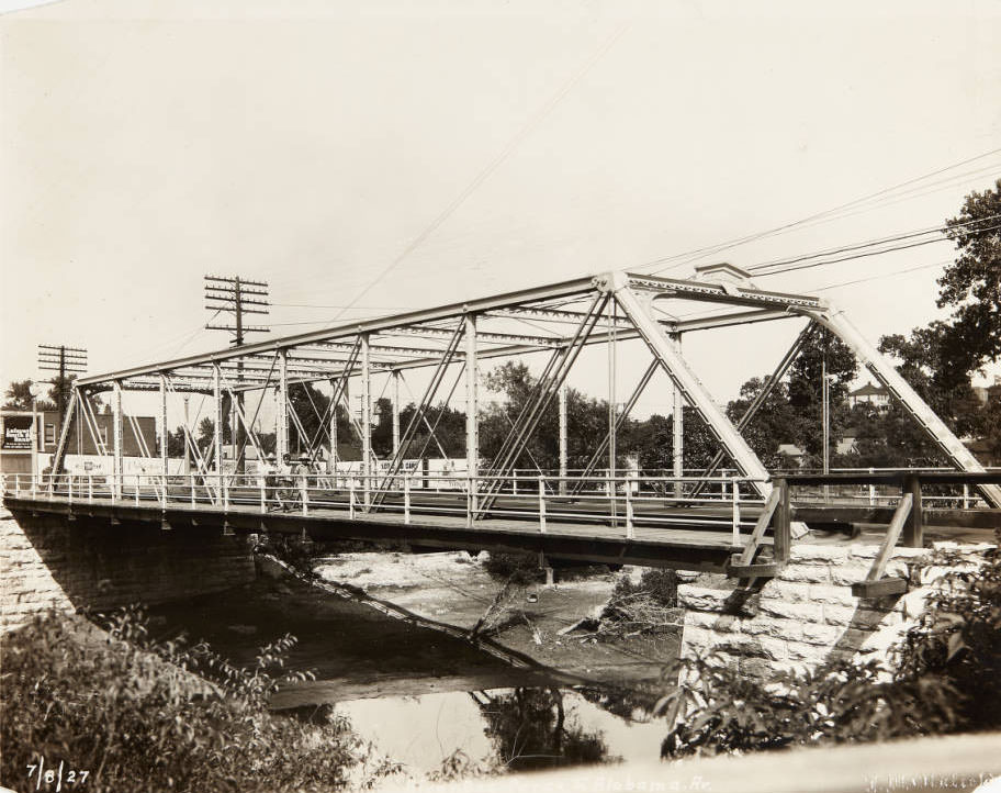
The bridge over the River des Peres connected neighborhoods on the city’s south side and carried both vehicle and pedestrian traffic over the waterway. Washington Avenue looking west from 14th Street showed the avenue’s broad commercial character continuing well into Midtown, its buildings housing wholesale businesses, shoe companies, and warehousing operations that made it one of the city’s most economically productive corridors.
The Olive Street widening project progressed through multiple stages that were documented in photographs. From the initial demolition of buildings on the south side of the street, through the active construction phase when the Park Pacific Building was going up, to the completed roadway — the project transformed one of the city’s most significant commercial corridors and set a precedent for street widening efforts elsewhere in the city.
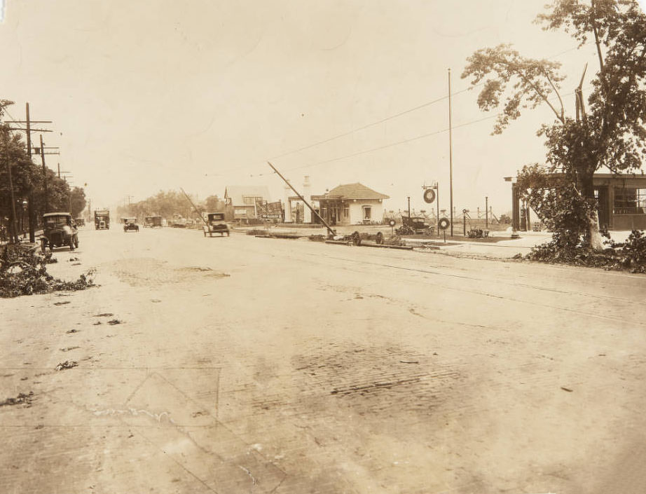
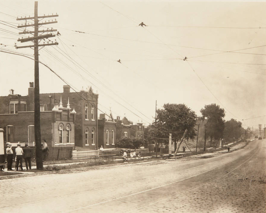
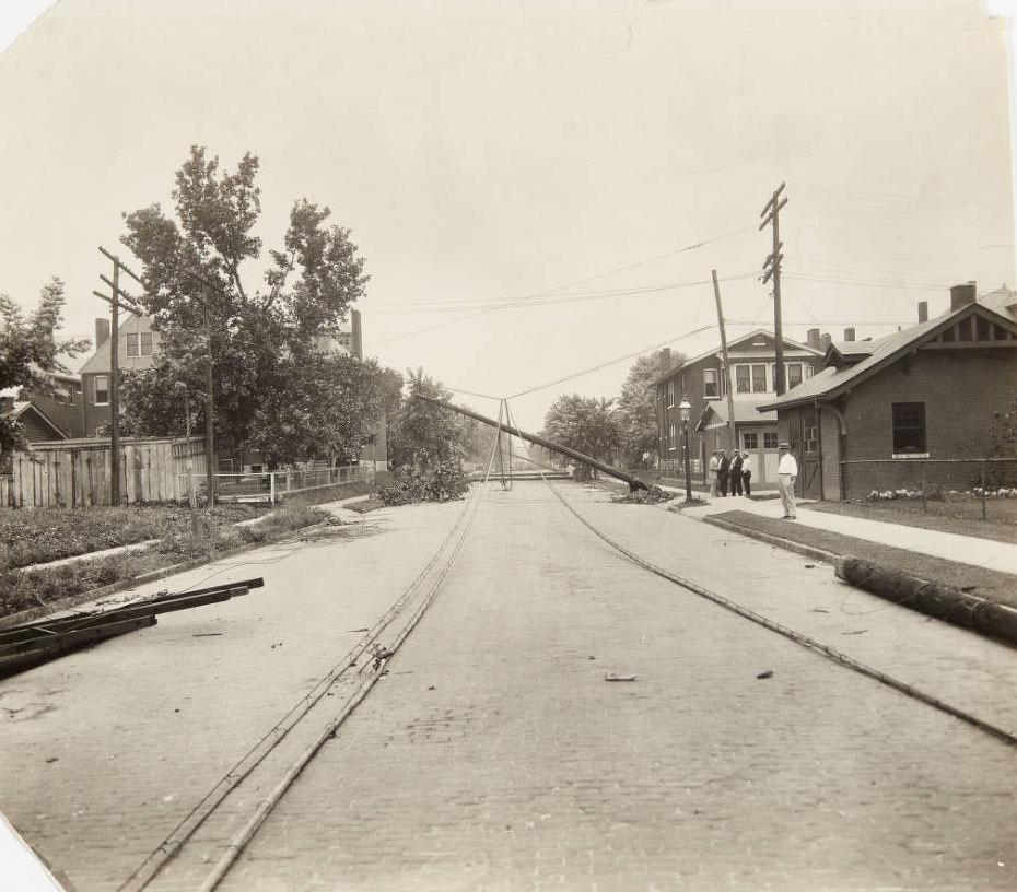
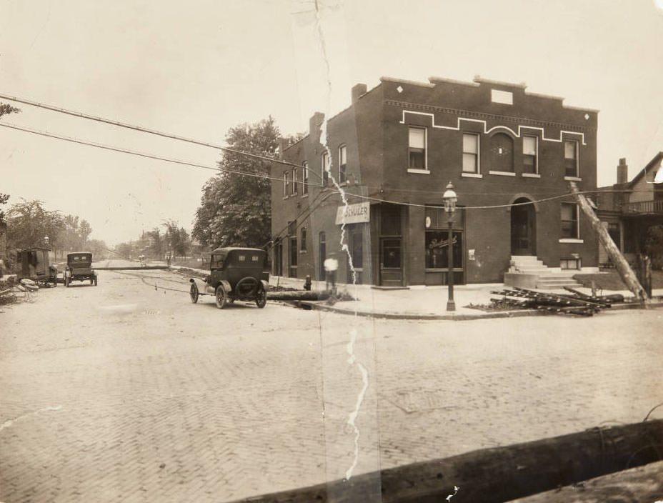
Storm damage was an occasional disruptor of city infrastructure. Downed power lines along Broadway near Osceola Street and along Virginia Avenue required repair crews to restore service to the surrounding neighborhoods. These events exposed how dependent the city had become on its electrical and telephone networks, systems that needed to function without interruption to support businesses, homes, and the city’s wartime industrial operations.
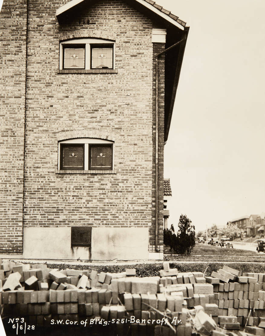
The 3800 block of Easton Avenue on the city’s north side featured a sidewalk lined with storefronts, including the Hughey Candy Company at 3850 Easton. A multi-family residence at 5251 Bancroft Avenue in the Southampton neighborhood represented the city’s expanding residential stock south of Forest Park. Both types of buildings — commercial storefronts on busy avenues and apartment buildings in residential neighborhoods — were central to the texture of daily life in 1910s St. Louis.
The Olive Street widening project moved into its final phases with continuing work visible along the corridor. The Park Pacific Building’s construction on the south side of the street marked a new chapter for a block that had just recently been cleared of older commercial buildings. Once completed, the widened Olive Street offered a significantly broader roadway that could handle the increasing volume of automobile and commercial traffic moving through that part of the city.
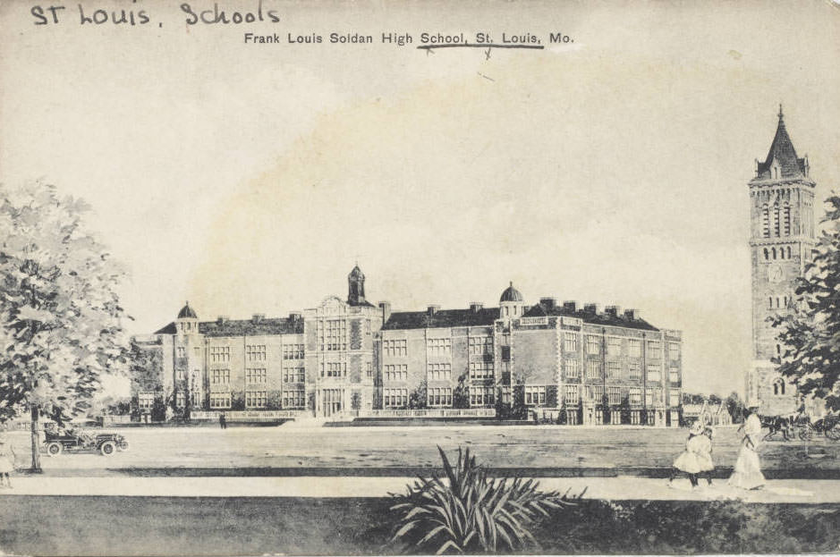
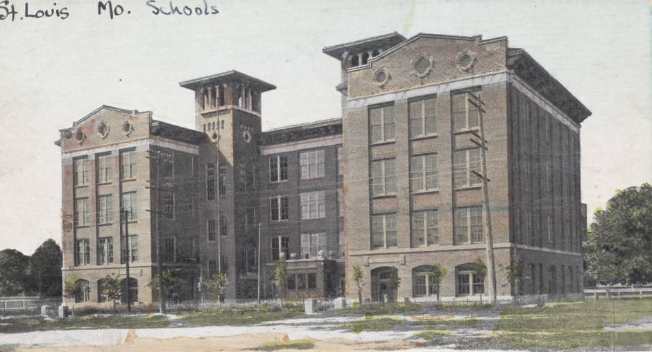
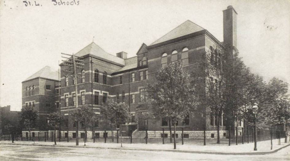
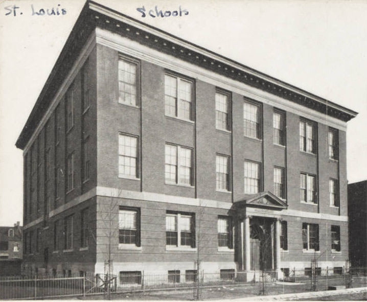
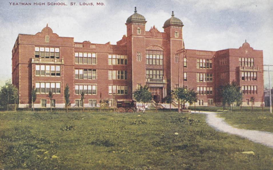
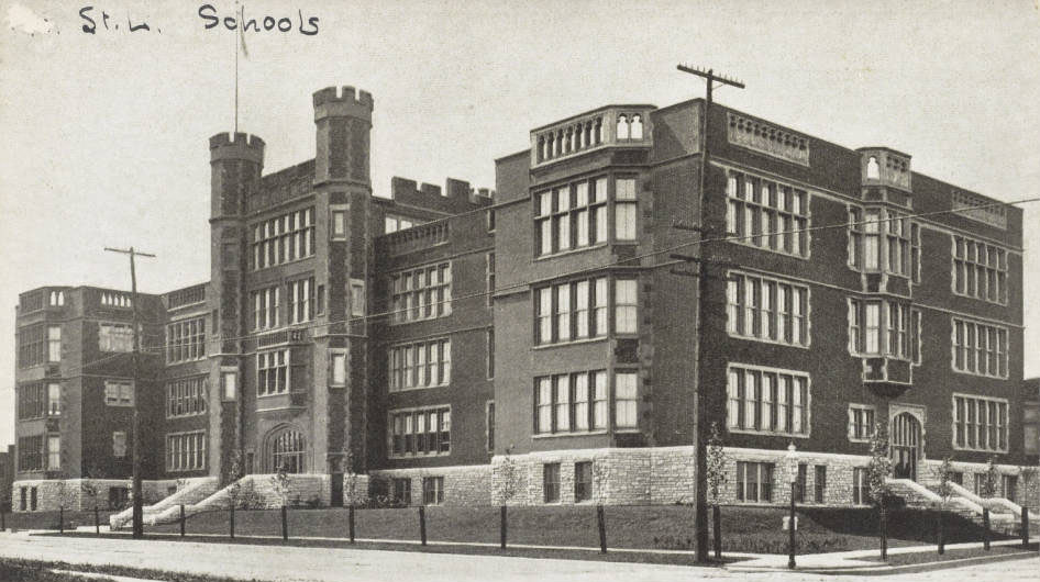
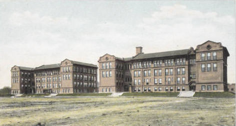
Education was a major civic priority in St. Louis during the 1910s. The city operated dozens of public schools across every neighborhood, from the Eugene Field School at Olive and Taylor to the Hempstead School at Hamilton and Minerva, the Emerson School at Arlington and Page, and the Clay School at 11th and Farrar. Central High School and Frank Louis Soldan High School served older students, while Yeatman and McKinley high schools at 2156 Russell Avenue rounded out the secondary education network.
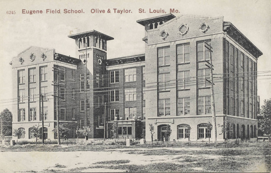
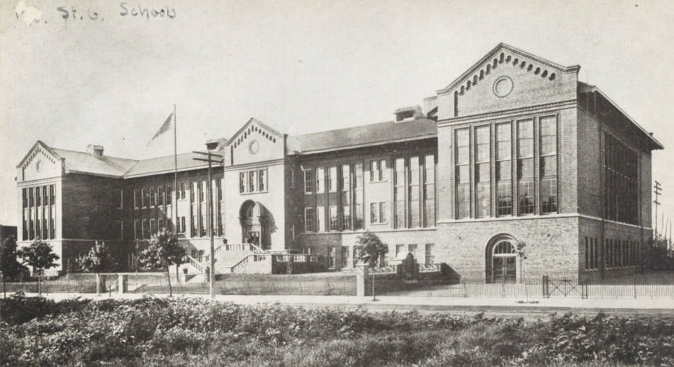
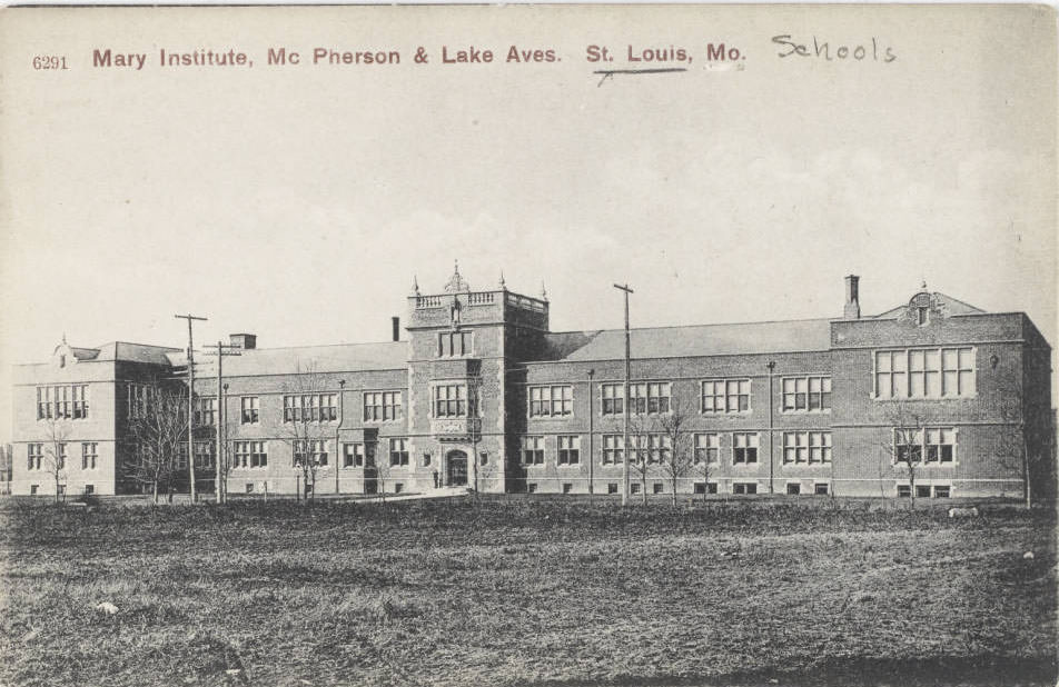
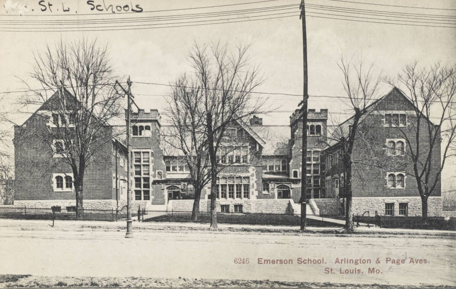
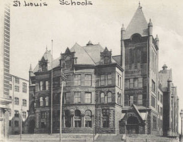
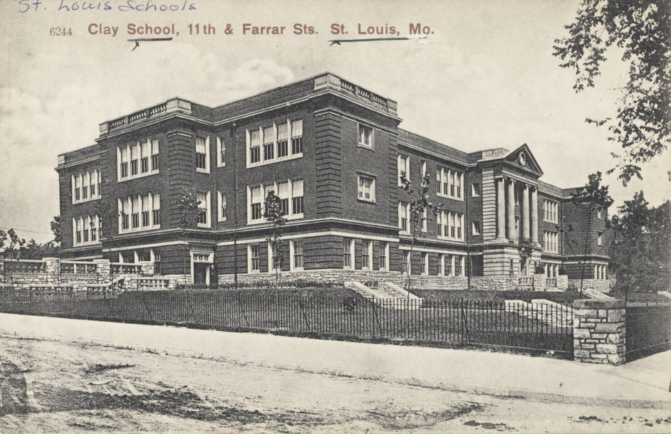
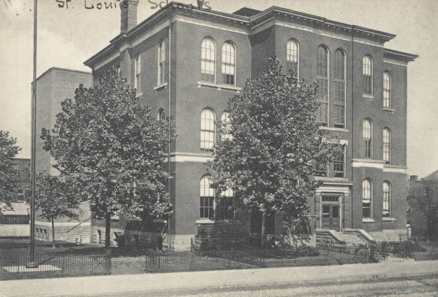
Cultural and social institutions completed the picture of a city investing broadly in public life. The St. Louis Art Museum in Forest Park had been a fixture since the 1904 World’s Fair. The Blind Girls’ Home at 1214 North Garrison Avenue provided care for residents who needed specialized support. Mary Institute at McPherson and Lake operated as one of the city’s distinguished private schools for girls, while the Academy of Sacred Heart and the Smith Academy and Manual Training School offered additional educational options for families across the city.
The waterfront remained a center of commerce and labor throughout the decade. Workmen used horses and wagons to load and unload steamboats along the St. Louis riverfront, hauling cargo between boats and the city’s warehouses and factories. The McKinley Bridge, which opened in 1910, added a new crossing for both vehicle traffic and rail freight, giving the city another artery for goods moving in and out of the river port.
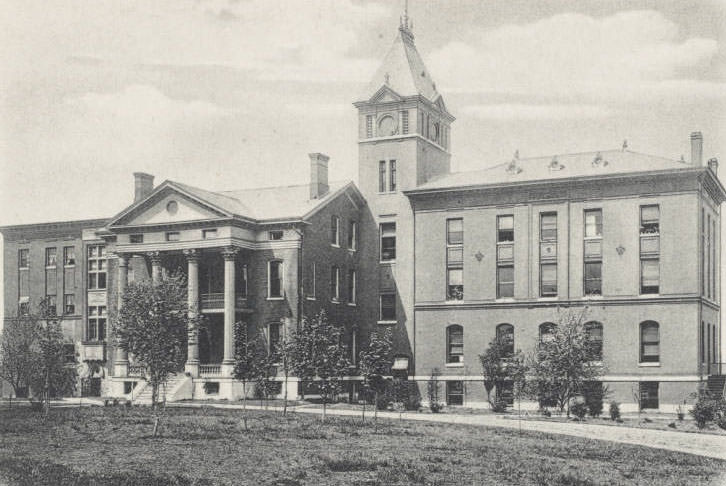
Public schools across every neighborhood served the city’s diverse and growing population. The Riddick School at Evans and Whittier, St. Leo’s School, and the Franz Sigel School at 18th and Ann Avenue all served specific communities within the larger city. The Clinton Public School was another node in the extensive public education network that St. Louis operated during this period, ensuring that children across all neighborhoods had access to schooling.
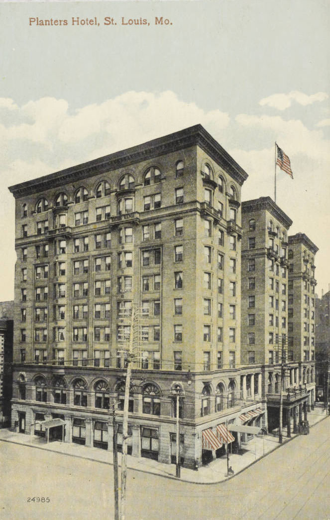
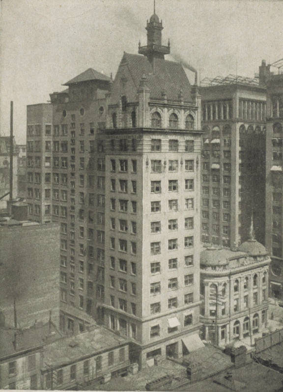
Hotels anchored the city’s downtown hospitality sector. At 4th and Pine Streets, a ten-story hotel with 400 rooms and elegant public spaces served business travelers and visitors arriving at Union Station. The Century Building in downtown St. Louis and the Holland Building at 215 North 7th Street were among the decade’s prominent commercial addresses, their multi-story facades defining the street-level experience of walking through the city’s central business district.
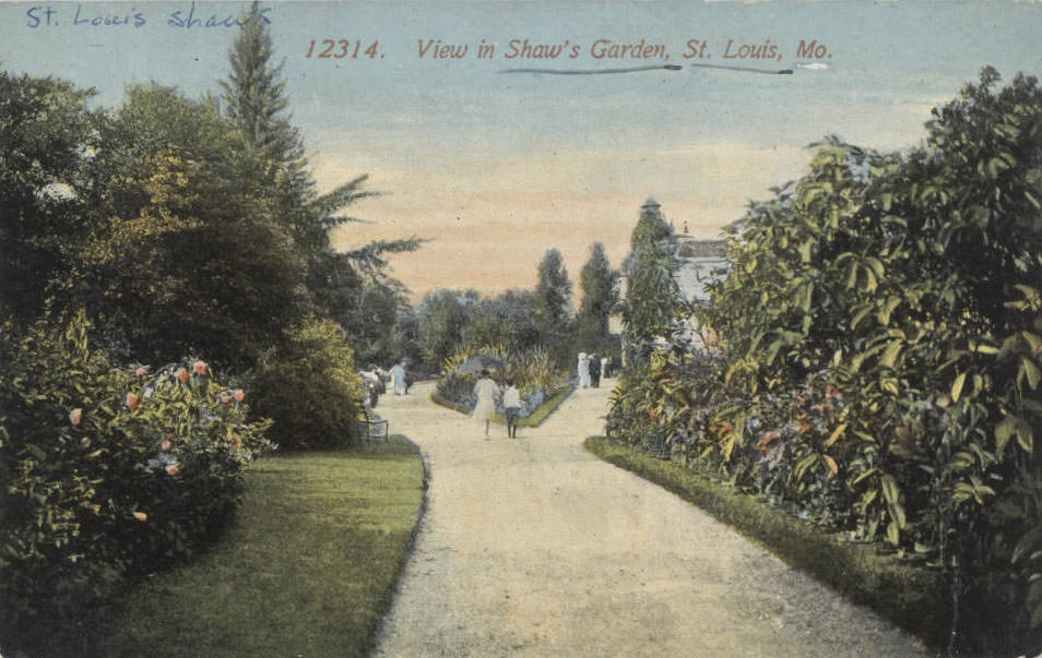
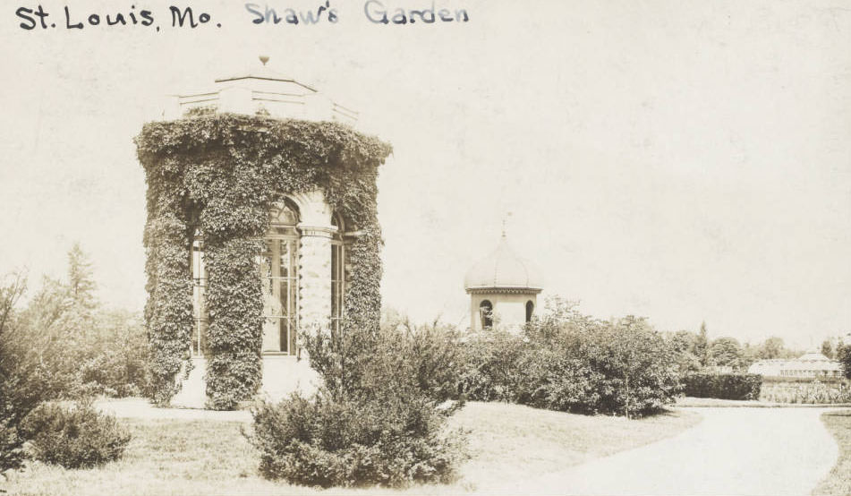
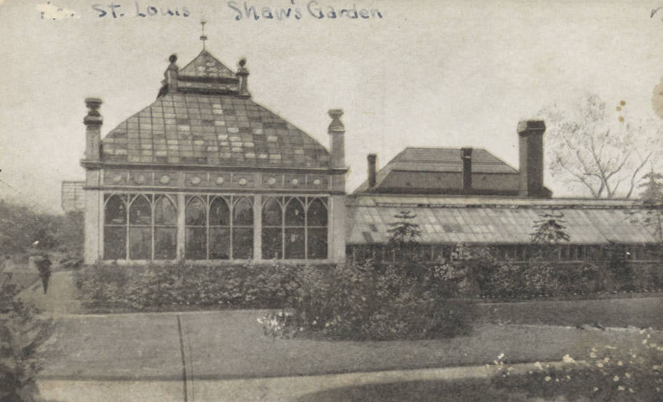
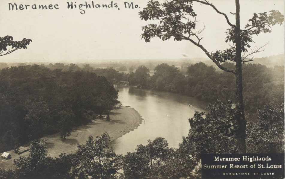
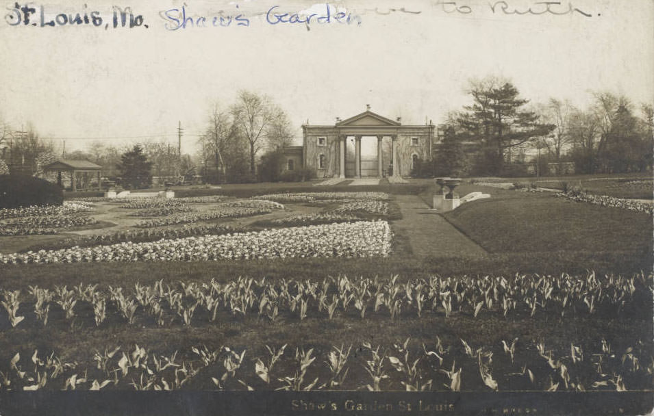
Shaw’s Garden — now known as the Missouri Botanical Garden — was a major attraction in 1910s St. Louis. The garden’s grounds included flower beds, an orchid house, and the mausoleum originally built by founder Henry Shaw but never used by him. Meramec Highlands served as a summer resort destination for St. Louis residents seeking relief from the city’s heat, while Forest Park and neighborhood green spaces provided everyday recreational options.
The city’s most prestigious residential streets maintained a quiet grandeur throughout the decade. Westmoreland Place, Portland Place, and Kingsbury Place were gated private streets whose gates and entry monuments served as physical markers of wealth and exclusivity. Hortense Place, developed around 1910, joined this collection of exclusive residential enclaves, offering residents on the street’s single block a level of seclusion and architectural consistency that the surrounding public streets could not provide.
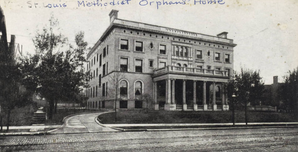
Religious and educational institutions defined the physical and social character of neighborhoods throughout the city. The Academy of Sacred Heart and the Visitation Convent provided Catholic education and community life for their surrounding areas. The Smith Academy and Manual Training School offered both academic and vocational preparation. The Methodist Orphan Home at 4385 Maryland Avenue cared for children without families, operating as part of the city’s broader network of social welfare institutions.
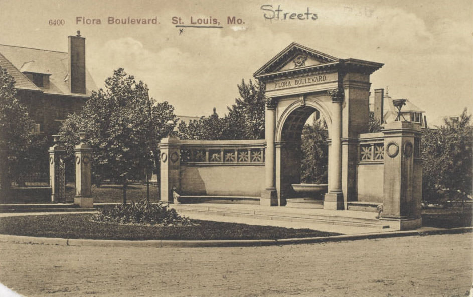
Compton Heights along Longfellow Boulevard was one of the city’s desirable residential areas, its streets lined with substantial houses on generous lots. Flora Boulevard in another part of the city offered a similarly spacious residential character. These neighborhoods stood in deliberate contrast to the dense row house blocks and working-class streets closer to the downtown factories and rail yards, reflecting the sharp economic divisions that shaped where different St. Louis residents lived and how they experienced the city.
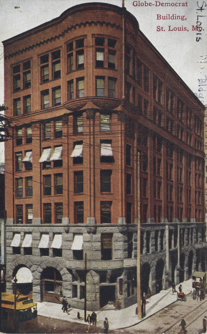
Commerce, trade, and finance came together inside institutions like the Merchants’ Exchange building on 3rd Street between Chestnut and Pine. The exchange’s interior was an elaborate space where commodity traders and merchants conducted the business that made St. Louis a regional economic center. The Mercantile Trust Company at 8th and Locust provided the banking services that supported this trade, while the St. Louis Globe-Democrat building at 6th and Pine kept residents informed about the city’s affairs and the progress of World War I abroad.
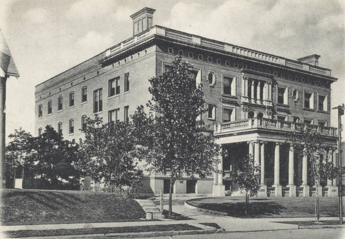
Social welfare institutions filled an important gap in a city where industrial labor was hard and social safety nets were minimal. The Methodist Orphan Home at 4385 Maryland Avenue provided housing and care for orphaned children, operating in a substantial building on one of the city’s residential avenues. The Memorial House at 2609 South Grand, originally built as a private home by René Beauvais in 1867, became the Memorial Home for elderly men and women in 1882, continuing in that role through the 1910s.
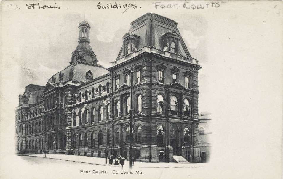
Civic government in St. Louis operated from several major buildings concentrated in the downtown core. The Four Courts municipal building on Clark Avenue between 11th and 12th streets handled the city’s judicial and administrative functions. City Hall on 12th Street served as the seat of municipal government, its steps and side streets the site of public displays like the Ford automobile exhibition. These buildings gave physical form to the administrative machinery that kept the fourth-largest city in the United States running.
Union Station was one of the city’s most active and architecturally impressive structures. Locomotives left its train shed continuously, connecting St. Louis to the national rail network. During World War I, the station handled an enormous volume of troop movements and war material shipments in addition to its normal passenger and freight traffic, making it a critical node in the national military logistics system.
The private streets of the Central West End were among St. Louis’s most carefully designed residential environments. Kingsbury Place’s entrance and Hortense Place’s development around 1910 added to the cluster of exclusive streets that defined the area’s upper-class character. A bird’s-eye view of St. Louis from 1910 captured the full extent of the urban landscape — a dense city core surrounded by expanding residential neighborhoods and industrial districts reaching outward toward the Missouri and Mississippi rivers.
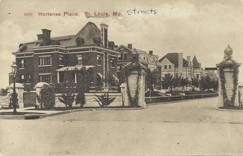
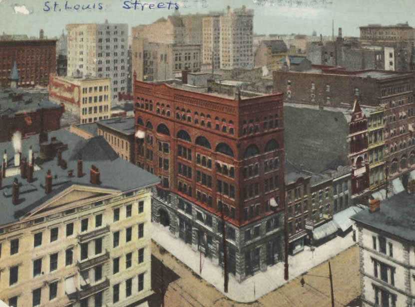
Looking north from Olive on 12th Street in 1910, the city’s density was evident — buildings packed tightly along the street, signs competing for attention at every level. The new water tower served the expanding city, complementing the waterworks station at Baden and the Chain of Rocks pumping facility. Water infrastructure was as essential to the city’s function as its rail network or its industrial factories, quietly sustaining a population of nearly 700,000 residents.
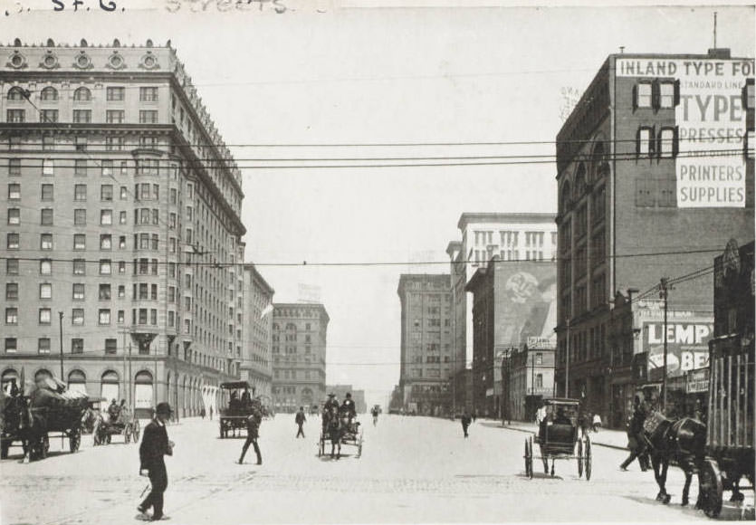
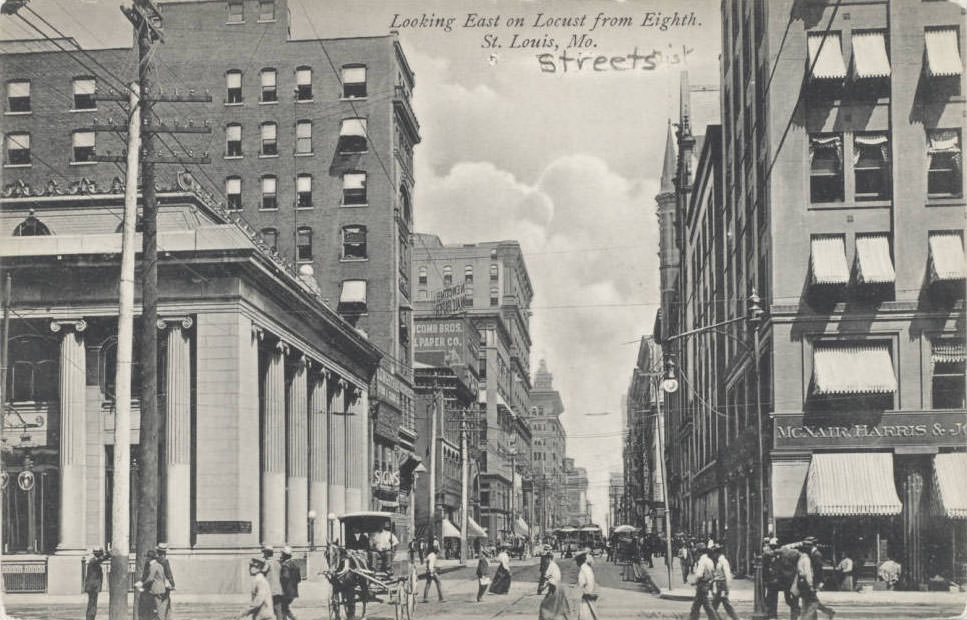
Looking east on Locust from 8th Street in 1910, the commercial character of this central corridor was unmistakable — multi-story buildings on both sides of the street, ground-floor storefronts busy with customers, and upper floors housing offices and professional firms. Flora Boulevard, Meramec Highlands, and Shaw’s Garden, captured in the same period, offered visual counterpoints — green, spacious environments that existed alongside the dense urban fabric of downtown and the working neighborhoods in between.
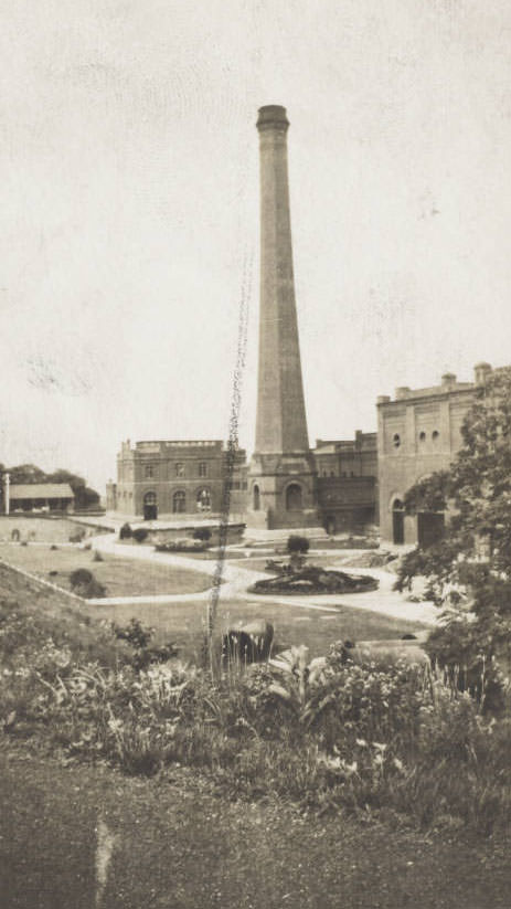
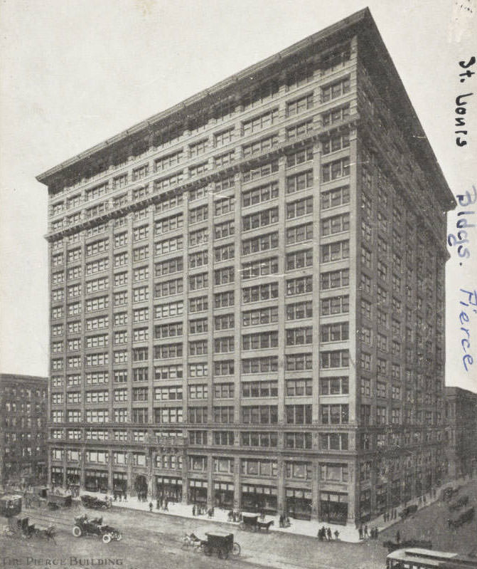
By 1915, the Low Service Pumping Station at the Chain of Rocks waterworks was a key facility keeping the city’s water supply stable. The Pierce Building, photographed the same year, was another commercial landmark in a downtown district full of substantial office and retail structures. Shaw’s Garden continued to attract visitors to its plant collections, including the Materna section of the grounds, offering St. Louis residents a cultivated natural space in the midst of one of the country’s most active industrial cities.
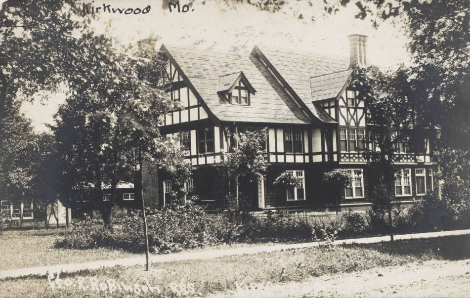
Outside the city limits, communities like Kirkwood maintained their own distinct residential character. The R. Robinson residence in Kirkwood in 1912 represented the kind of substantial private home that anchored the suburban towns surrounding St. Louis, places that were connected to the city by rail but maintained a quieter, less dense way of life. Together, the city and its surrounding communities formed a metropolitan region that was growing, changing, and preparing for the demands that World War I would soon place on every part of its economy and infrastructure.