
Cape Town in the 1930s was a city in motion. Buildings were rising, roads were being cut through mountain slopes, and the harbour was being reshaped to handle more trade. At the same time, the Great Depression was grinding down working-class families, racial segregation was tightening its grip, and political organisations were beginning to find their voices. These photographs offer a rare, close look at a city caught between growth and hardship.
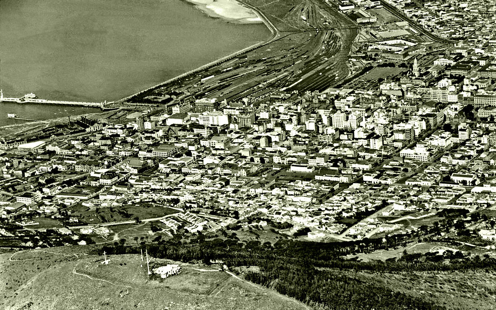
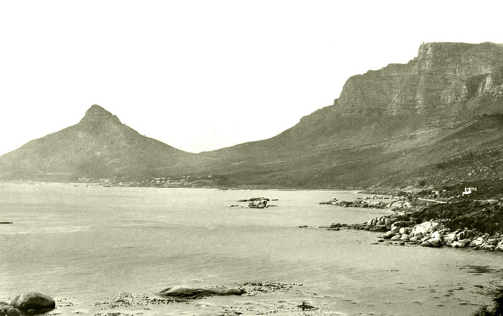
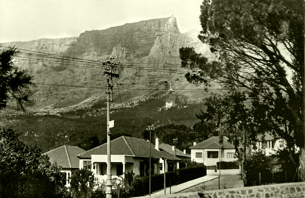
The natural landscape remained one of Cape Town’s defining features. Signal Hill overlooked the city and the sea, while the slopes of Table Mountain and Lion’s Head shaped the city’s edges in ways that no planner could alter. Roads and suburbs had to bend around these formations, giving Cape Town its distinctive geography.
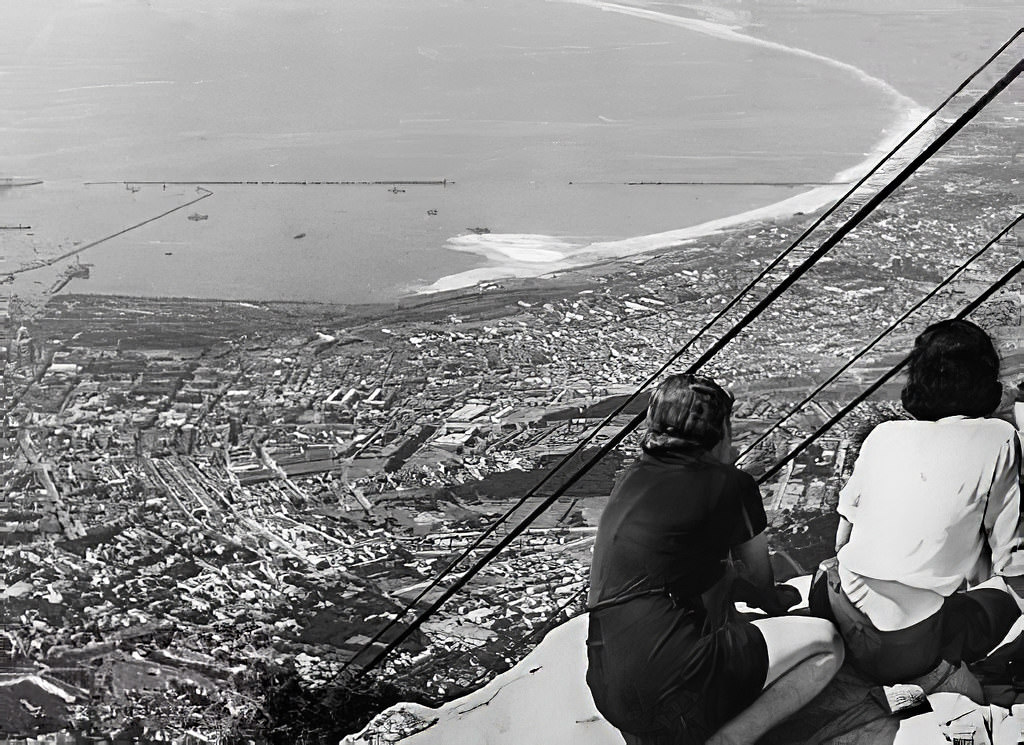
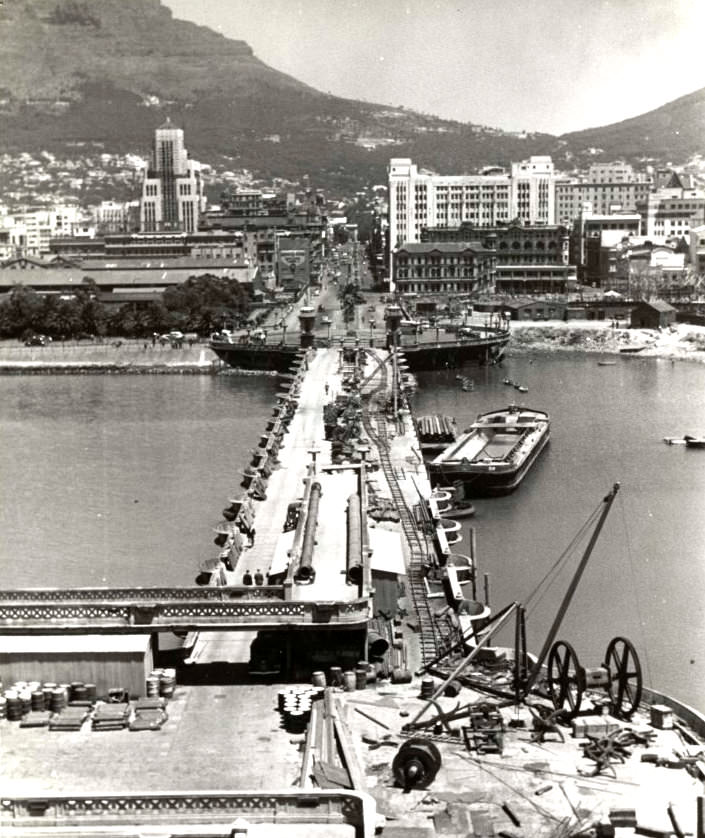
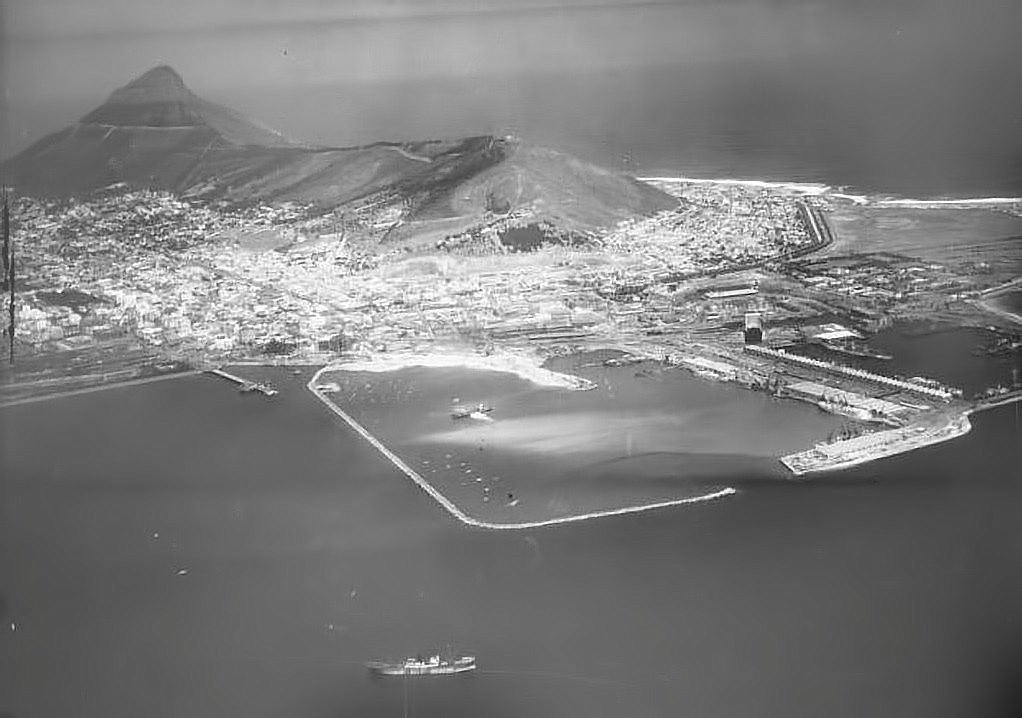
The harbour was one of the decade’s biggest construction stories. Work on the Duncan Dock began in the late 1930s, expanding the port to handle the growing volume of shipping traffic passing through the Cape. The foreshore itself was being reclaimed from the sea, land that would eventually become some of Cape Town’s most-used commercial space.
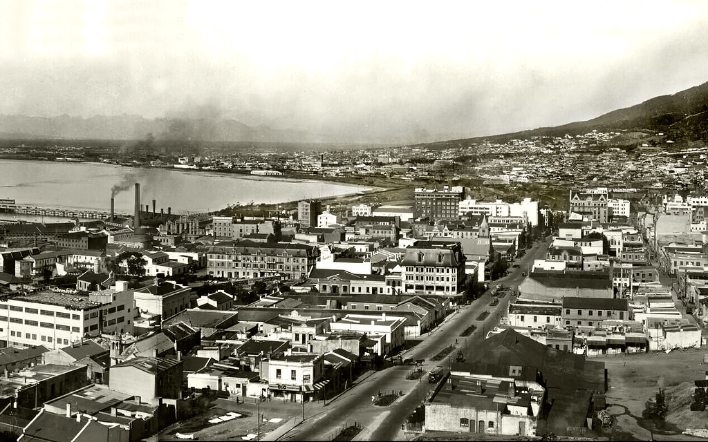
City streets like Strand Street were busy and well-established by the early part of the decade. Motor vehicles and pedestrians shared the road, and the architecture lining these streets reflected both colonial-era construction and newer commercial buildings going up to meet the demands of a growing urban population.
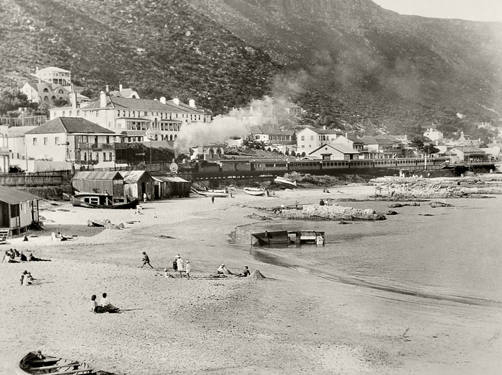
Outside the city centre, coastal communities like Kalk Bay retained a quieter, working character. Fishing was the backbone of Kalk Bay’s economy, and the harbour there was a daily hub of activity. The community was made up of predominantly Cape Malay and coloured fishing families who had lived along that stretch of False Bay for generations.
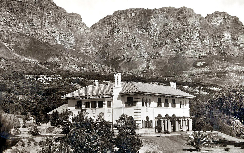
On the Atlantic Seaboard, Camps Bay was developing as a destination for the wealthier end of Cape Town’s population. Hotels like the Camps Bay Retreat catered to visitors seeking sea views and mountain scenery away from the bustle of the city centre.
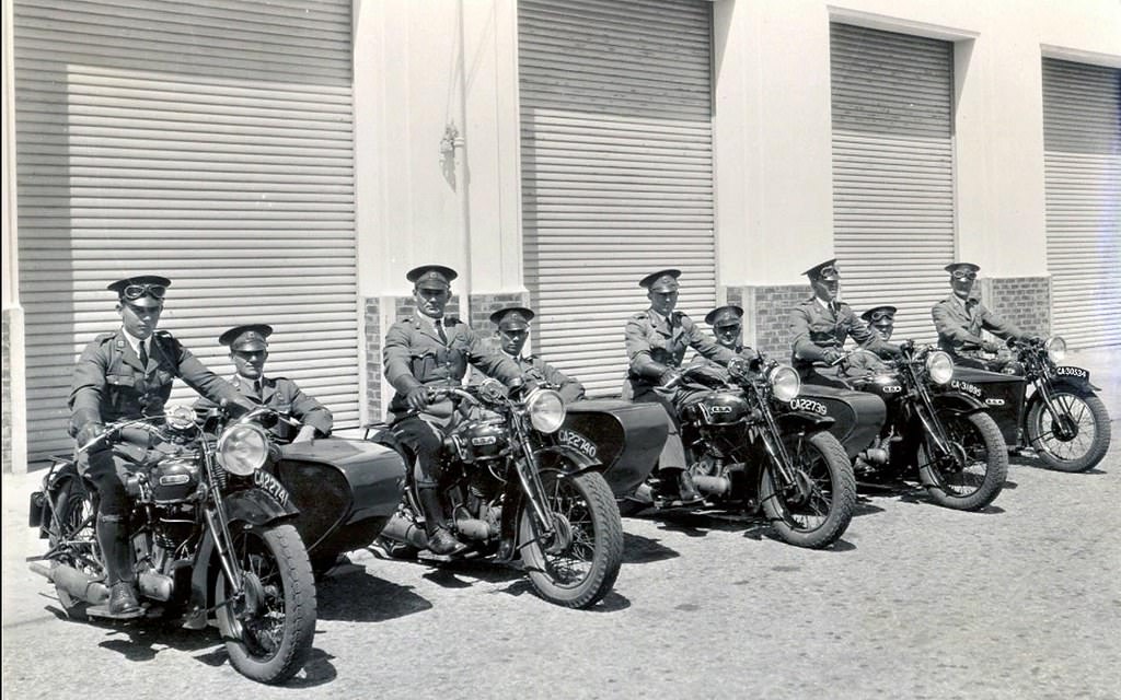
As the number of motor vehicles on Cape Town’s streets increased through the 1930s, traffic management became a serious concern. The Traffic Police were a visible presence on key intersections, directing the flow of cars, buses, and pedestrians. Road infrastructure was being expanded to keep pace, but the city’s older street layout was not always well-suited to the volume of vehicles.
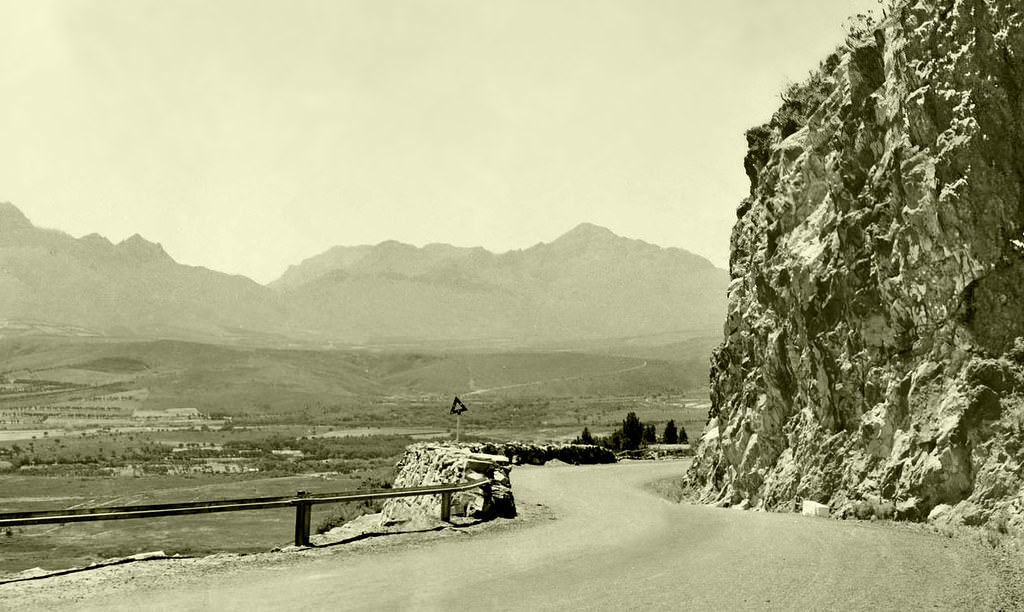
Beyond the city limits, the roads connecting Cape Town to the rest of the country were narrow and demanding. Sir Lowry’s Pass, which climbs out of the Hottentots Holland mountains, was a critical route linking the Cape Peninsula to the interior. Travelling it by car in the 1930s required care, and road improvements were ongoing throughout the decade.
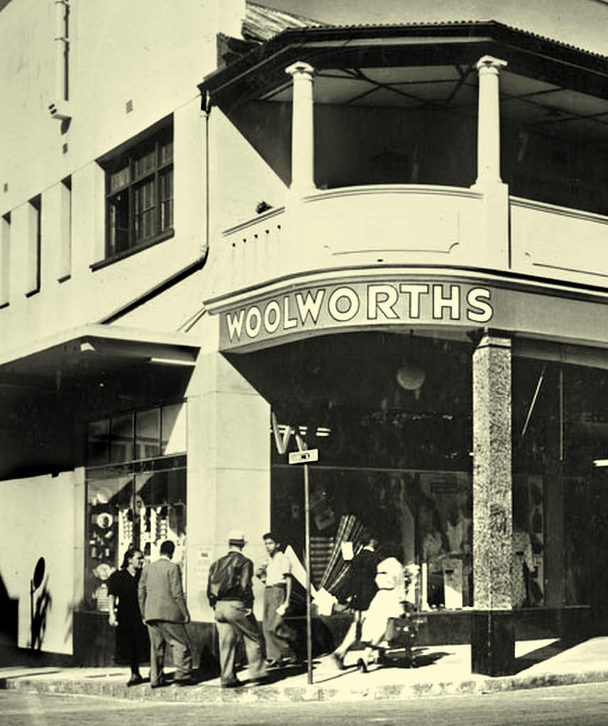
October 1931 marked a notable retail moment for South Africa. The first Woolworths store in the country opened on Plein Street in Cape Town, operating from the old Royal Hotel building. The store introduced a new style of retail to South African shoppers at a time when the Depression was making everyday purchases harder for many families.
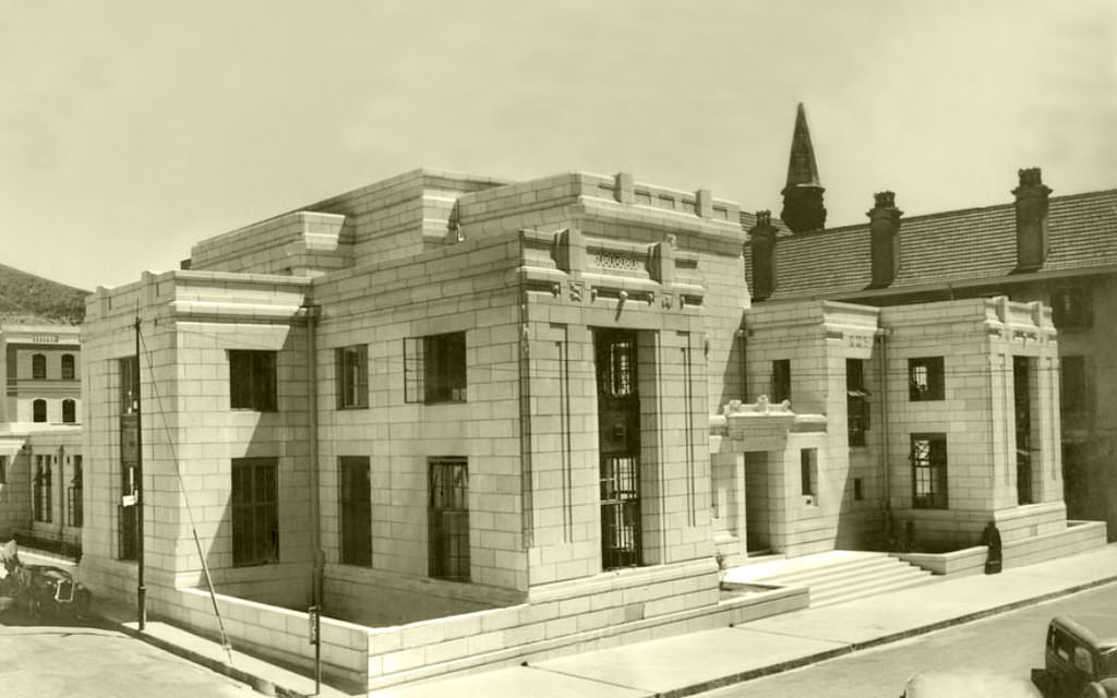
Civic and financial institutions were investing in permanent, substantial buildings across the city. The Land Bank building on Queen Victoria Street in the Gardens suburb, designed by architect Brian Mansergh, was a solid example of institutional architecture from the late 1930s. These buildings were built to project stability and authority, even as the economy around them remained fragile.
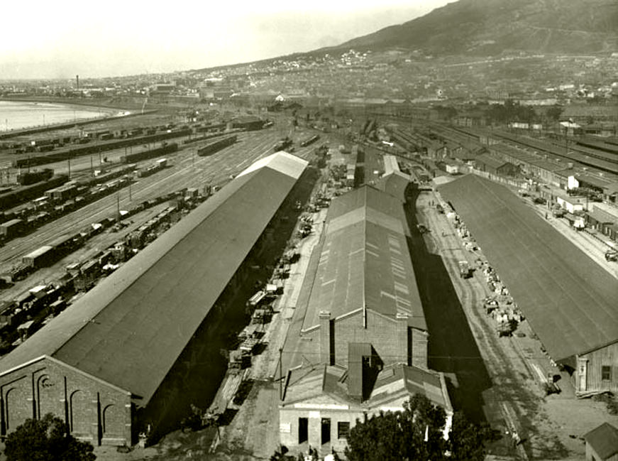
The railway was central to Cape Town’s economy. The goods yard at Cape Town Station was a constant hive of activity, moving freight between the harbour and destinations across the country. South Africa’s rail network was one of the most extensive on the continent, and Cape Town Station was one of its busiest nodes.
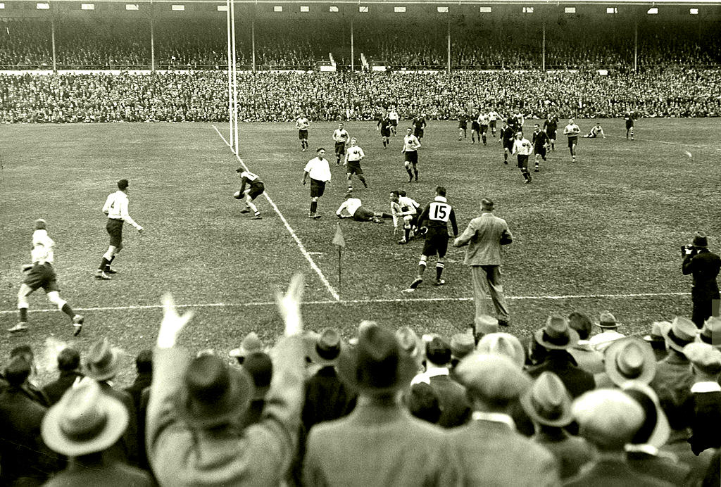
Rugby was already a deeply embedded part of white South African culture by the 1930s. Test matches between the Springboks and sides like the Australian Wallabies drew large crowds. The 1933 series between South Africa and Australia was a major sporting event, and Cape Town was one of the host cities.
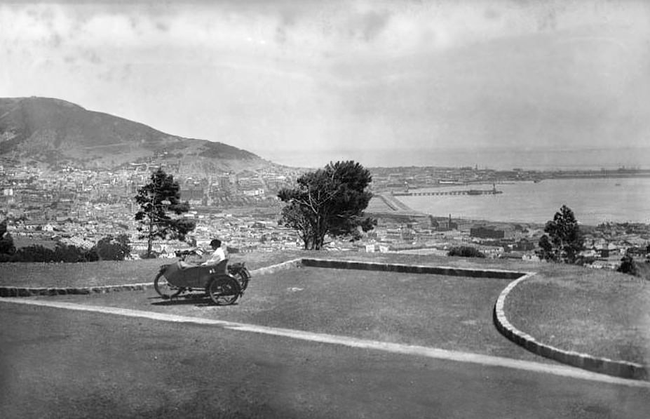
De Waal Drive, which curves along the lower slopes of Table Mountain above the city bowl, was already in use by the early 1930s. The road offered dramatic views over Cape Town and the harbour and was part of the expanding road network that connected different parts of the city as suburban development spread outward.
By 1939, the world was on the edge of another global war. South Africa would enter World War II on the side of the Allies, and Cape Town’s harbour would once again become strategically vital, serving as a resupply and transit point for Allied shipping. The late 1930s photographs from Cape Town carry that particular weight of a world about to change violently.
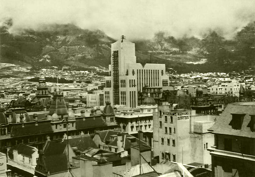
One of the decade’s most significant architectural achievements was the Mutual Building on Darling Street. Nearing completion in 1939, the building featured an elaborate Art Deco façade with Egyptian-influenced motifs, elaborate decorative details, and a strong vertical presence. It became one of the defining landmarks of Cape Town’s city centre.
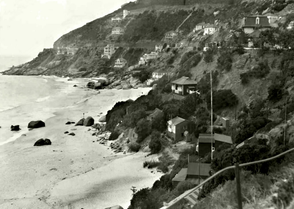
The Atlantic coastline drew residents and visitors to its beaches throughout the decade. Clifton’s beaches, sheltered from the south-easter wind by the rocky slopes above, were popular gathering spots in summer. The sea and mountain scenery remained constant, even as the suburbs around them were slowly filling in.
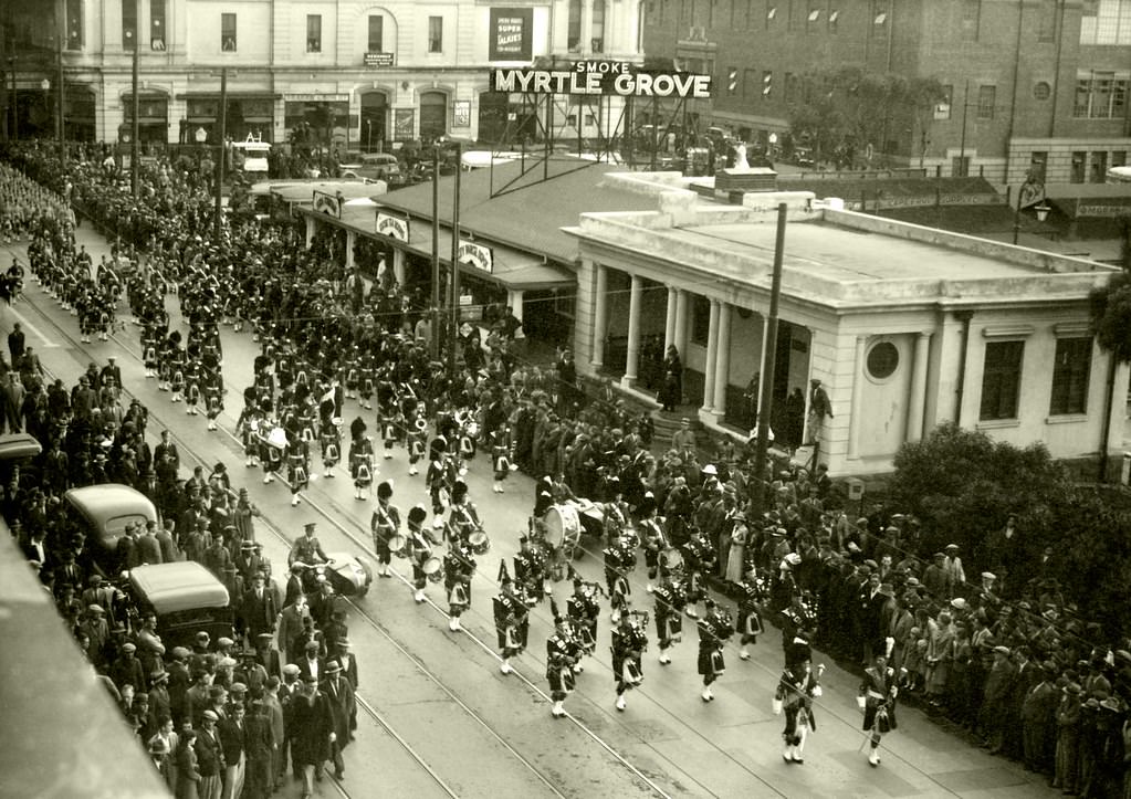
Cape Town maintained strong ties to Britain throughout the 1930s. When the Gordon Highlanders — a Scottish infantry regiment — visited in 1936 and marched down Darling Street, it was a public display of that imperial connection. Such visits were treated as significant events and drew large crowds of spectators.
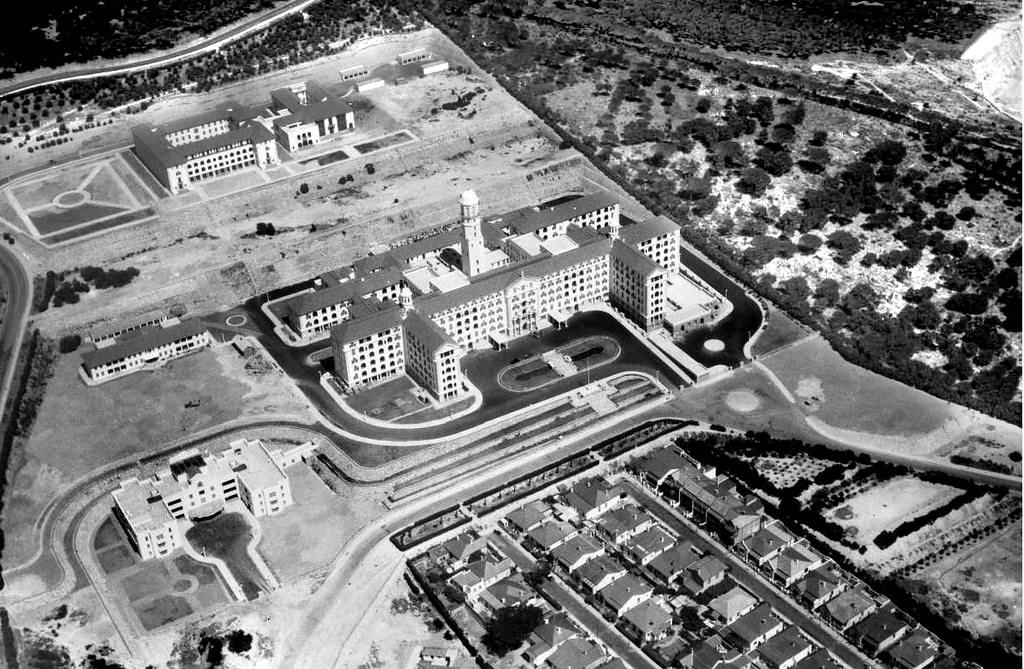
Groote Schuur Hospital, seen here in 1938, was one of the major public medical facilities serving Cape Town. Built on the slopes of Devil’s Peak, the hospital served a large and diverse population. It would later become world-famous in 1967 as the site of the first successful human heart transplant, but in the 1930s it was already a cornerstone of public health in the Western Cape.
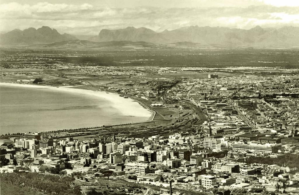
Aerial and elevated views of Cape Town from the 1930s show a city that still had room to breathe. The dense commercial core was concentrated around Adderley Street and the surrounding blocks, while residential suburbs spread gradually up the mountain slopes and along the coast in both directions.
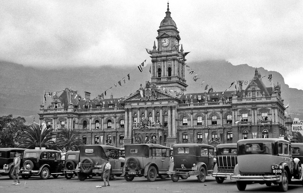
Royal visits were major public occasions in colonial-era South Africa. When Prince George visited in 1934, Cape Town’s City Hall was decorated to mark the occasion. The City Hall, completed in 1905 and built in the Italian Renaissance style, was the natural setting for such official ceremonies and remained the civic heart of the city.
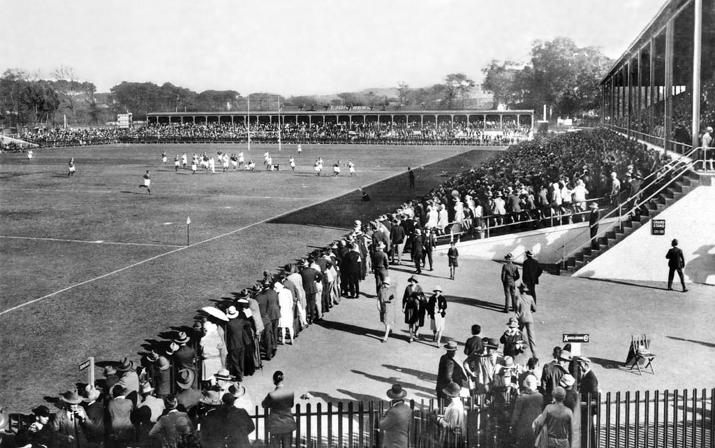
Newlands Rugby Ground was already well-established by 1930, hosting top-level provincial and international matches. The ground sat in the leafy southern suburbs, surrounded by the oak trees and mountain backdrop that made it one of the most visually striking sports venues in the country.
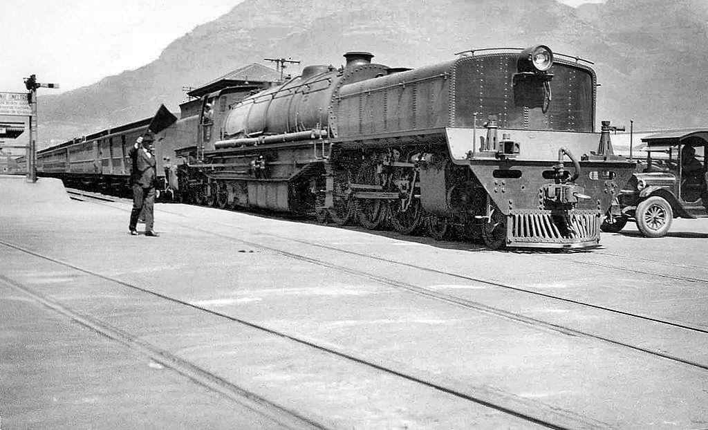
The image of a train crossing Adderley Street in 1932 captures the way rail infrastructure was woven directly into the city’s street layout. Cape Town’s rail system carried thousands of commuters daily, linking the city centre to the suburbs and to the industrial areas along the foreshore.
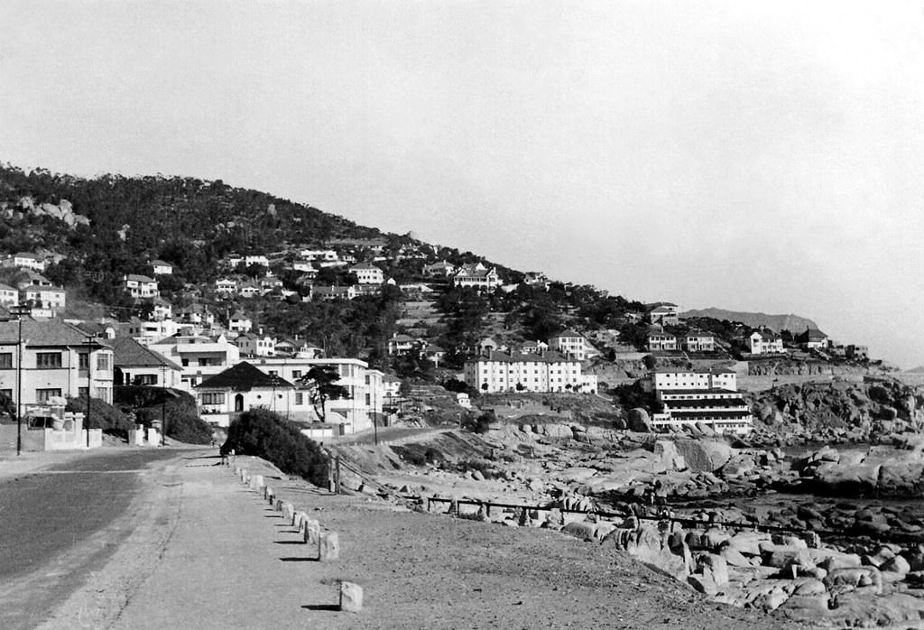
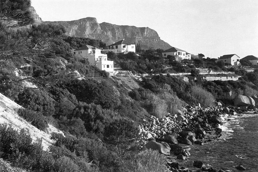
Victoria Road along the Camps Bay coastline was lined with some of the city’s more affluent residences by the late 1930s. The stretch near what was locally known as Balie Bay — named for the sewerage pipes running nearby — shows how even the most scenic addresses had their practical, unglamorous side.
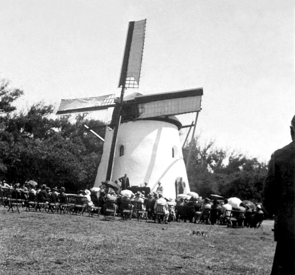
Mostert’s Mill, one of the oldest surviving windmills in South Africa, was restored in 1936. Located near the University of Cape Town on the slopes of Devil’s Peak, the mill dates back to 1796. Its restoration in the 1930s was part of a broader effort to preserve Cape Town’s older Dutch-colonial heritage amid rapid urban development.

Development left visible marks on the mountain. Quarrying and road-cutting operations created scars on the slopes of Table Mountain that were plain to see from the city below. These marks on the landscape were a direct result of the raw material needed to build Cape Town’s expanding road network and construction projects.
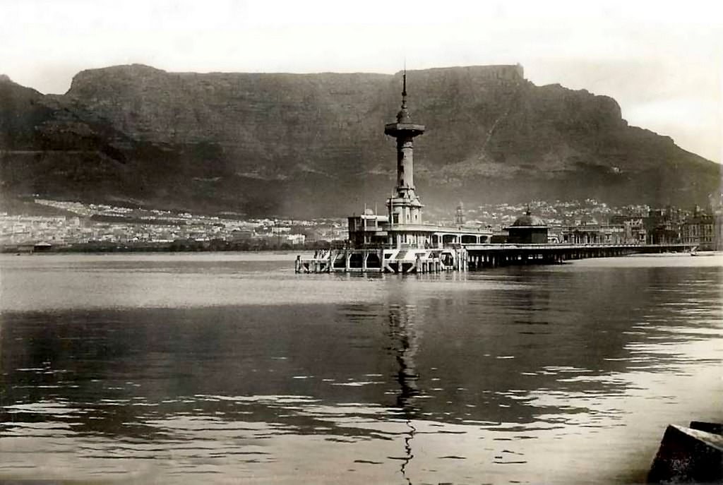
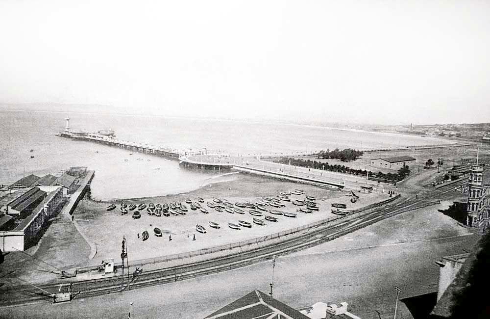
The old pier at Cape Town’s waterfront was a busy place at the start of the decade. Passengers arriving by sea disembarked here, and the pier was also used for recreational purposes. As the harbour underwent major expansion with the construction of the Duncan Dock later in the decade, the older pier infrastructure was gradually phased out.
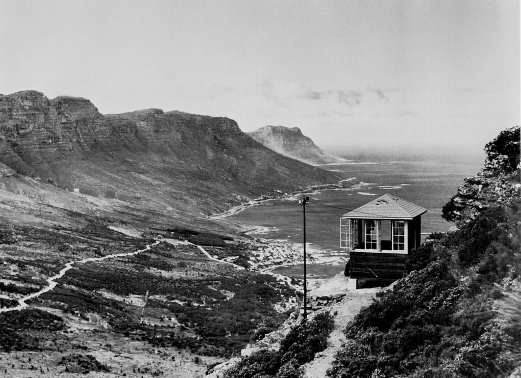
A fire lookout station on Lion’s Head served as an early warning system for fires breaking out on the mountain slopes or in the surrounding areas. The fynbos vegetation covering the Cape Peninsula was — and remains — highly flammable, and fires could spread rapidly. The lookout station allowed observers to spot smoke early and direct firefighting efforts.
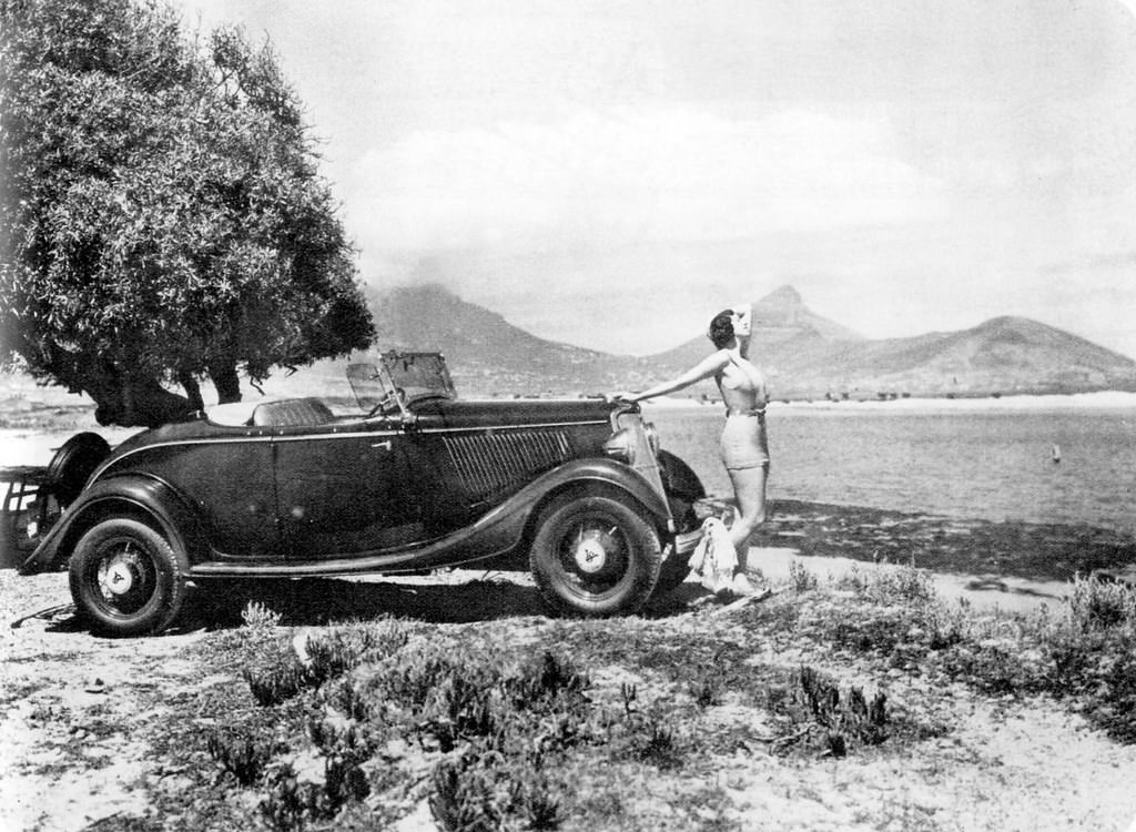
Motor vehicles were becoming more common on Cape Town’s roads through the 1930s, though they remained a mark of relative wealth. A 1934 Ford V8 De Luxe Roadster photographed at Milnerton represents the era’s growing love of the automobile. Ford’s V8 engine, introduced in 1932, was a significant technological step that made faster, more powerful cars more accessible.
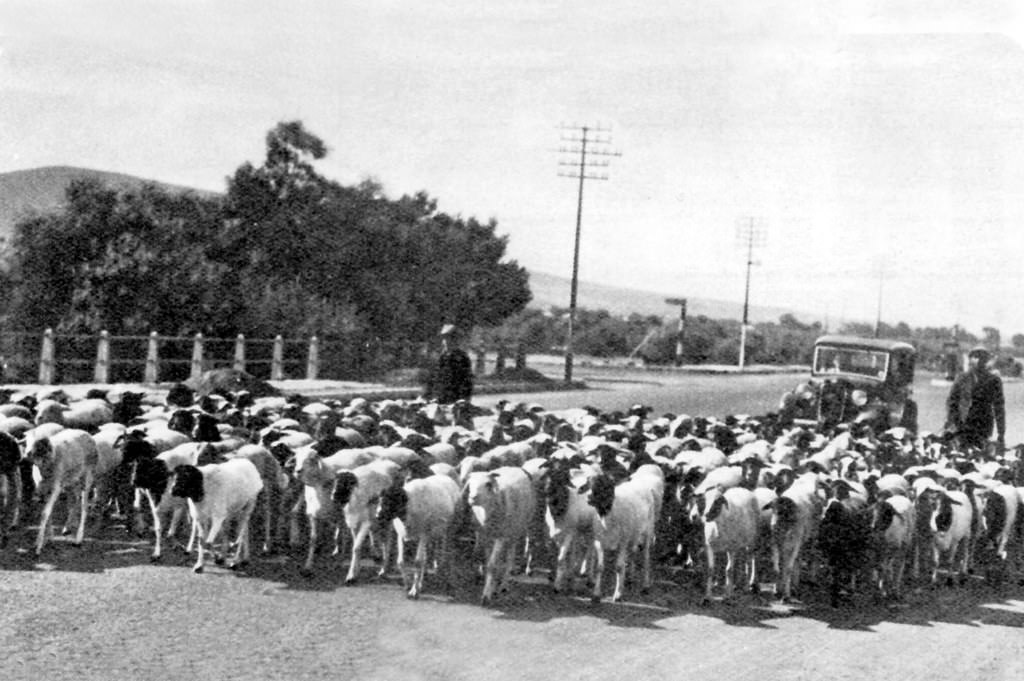
Bellville, to the northeast of Cape Town, was a separate, predominantly Afrikaans-speaking town in the 1930s. Voortrekker Road was its main commercial artery. The town reflected a very different social and cultural environment from the cosmopolitan city centre, and Afrikaner nationalist sentiment was strong in communities like these throughout the decade.
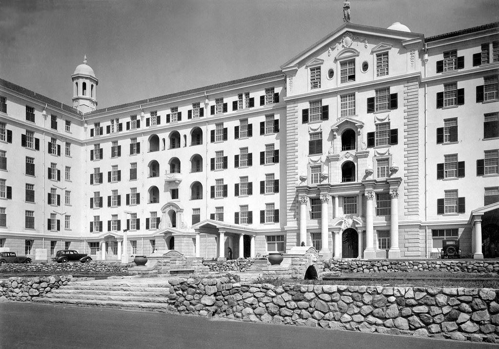
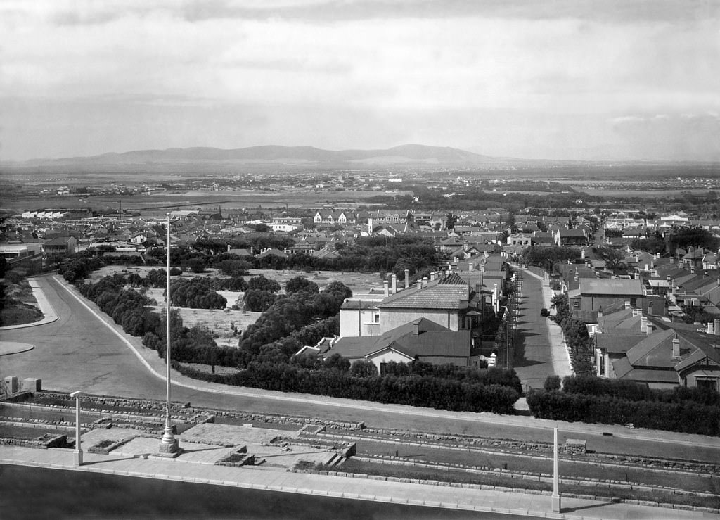
The view from the newly completed Groote Schuur Hospital in 1938 looked out over the southern suburbs and toward the Cape Flats. From that elevated position on Devil’s Peak, the scale of Cape Town’s spread was clear — a patchwork of residential streets, open land, and the distant shimmer of False Bay.
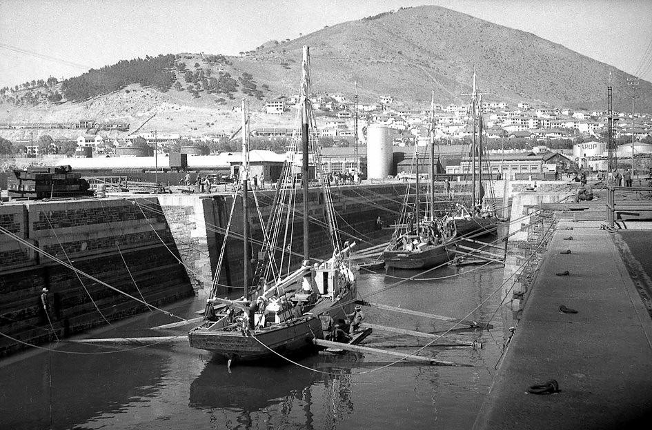
The Robinson Dry Dock was an essential part of Cape Town’s port operations. Ships requiring maintenance and repair were brought into the dry dock, which allowed workers to access the hull below the waterline. As shipping traffic through the Cape increased, facilities like the Robinson Dry Dock were in constant demand.
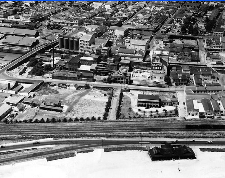
Woodstock Beach in 1935 sat near the Castle Brewery, which was located in lower Woodstock before relocating to Newlands in 1955. Lower Church Street, visible crossing the railway lines in the photograph, still exists today. Woodstock was a working-class neighbourhood with a mix of residents, and its beach and bathing facilities were part of everyday life for those who lived nearby.
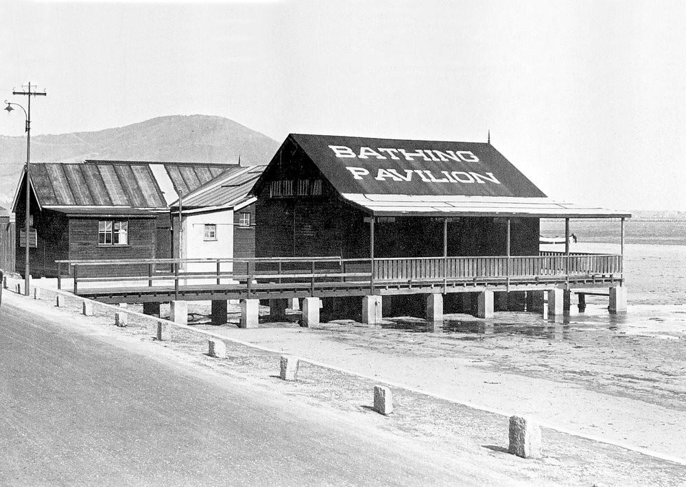
The Woodstock Bathing Pavilion, situated near what is today the Royal Cape Yacht Club, was a popular seaside facility for Cape Town residents in the 1930s. Public bathing pavilions provided changing rooms and social space along the coast at a time when organised beach facilities were a standard feature of urban seaside life.
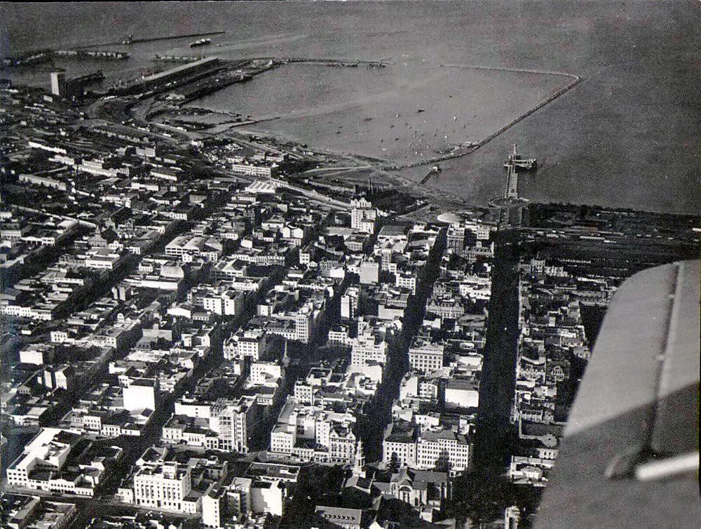
The Victoria Basin, as seen in this 1934 photograph, was the working heart of Cape Town’s docks at the time — but it was only about a third of the size that the Duncan Dock would eventually reach. The scale of the dock expansion planned for the late 1930s and beyond would fundamentally reshape both the harbour and the foreshore.
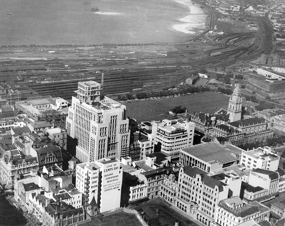
By 1937, Cape Town’s skyline was being reshaped by two major construction projects running simultaneously. The Old Mutual Building was nearing completion while the General Post Office behind it was beginning to take shape. Both buildings would become permanent fixtures of the city centre.
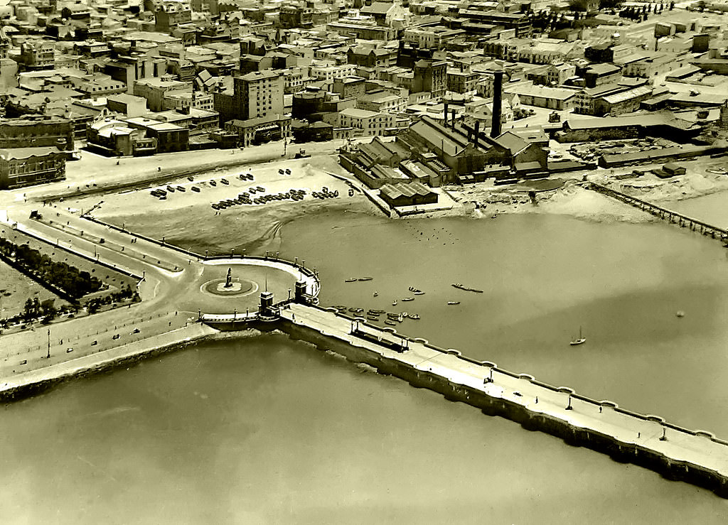
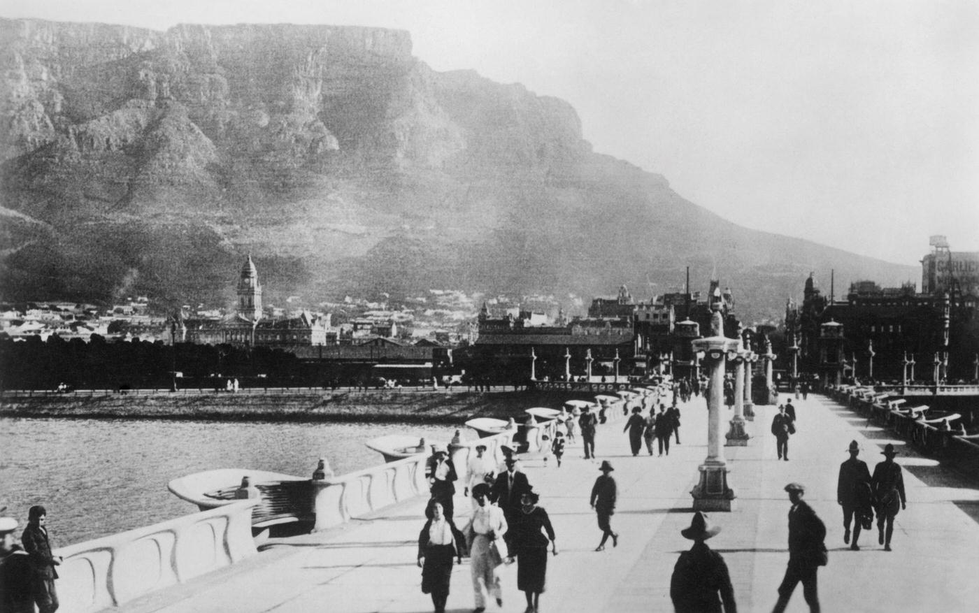
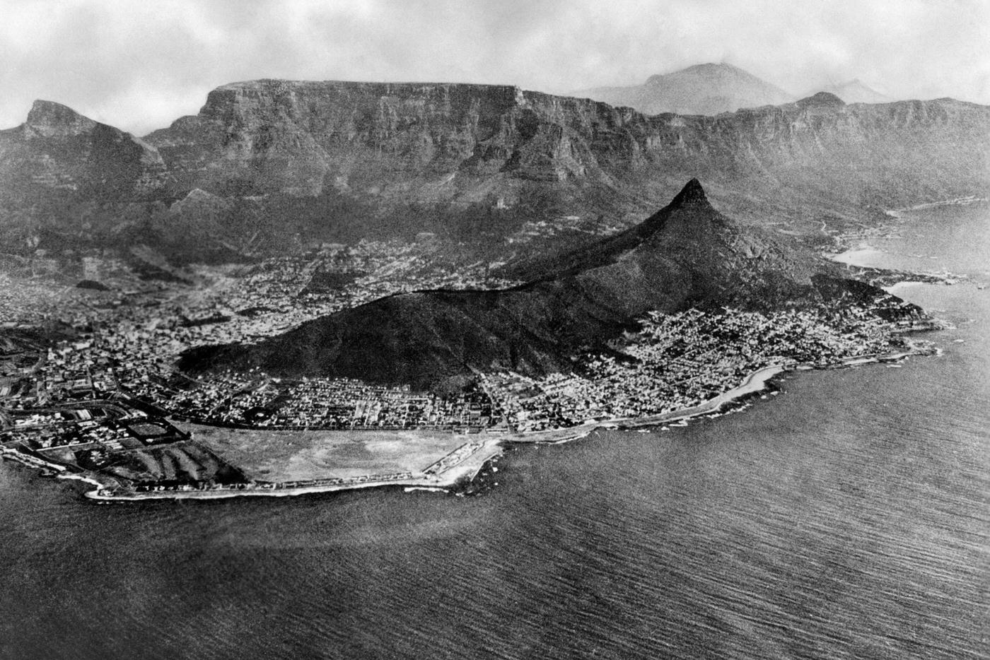
These wider views of Cape Town across the decade show the city at different stages of its growth. The mountain always dominates the background, a fixed reference point against which the changing urban landscape below can be measured. Streets, buildings, and harbour infrastructure shift from photograph to photograph, but Table Mountain remains unchanged.
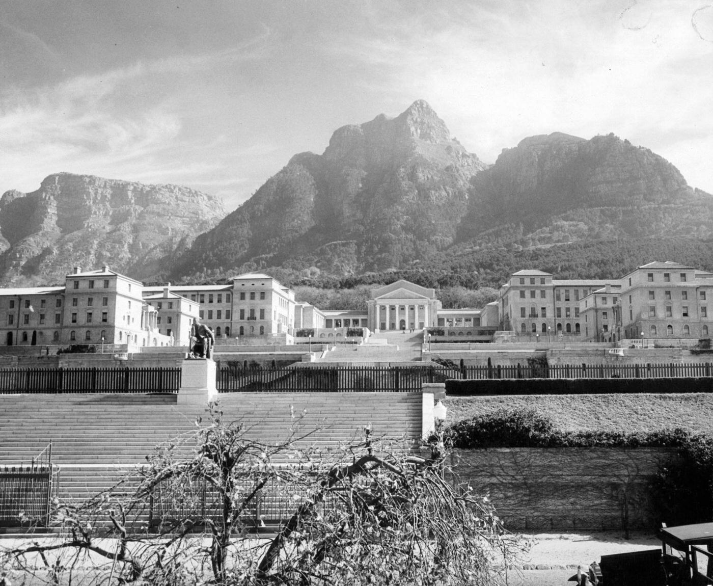
The University of Cape Town had moved to its current location on the slopes of Devil’s Peak in 1928, and by 1930 its grand Jameson Hall and surrounding buildings were firmly established on the mountainside. UCT was one of the country’s leading academic institutions, though access was heavily shaped by race and class throughout the 1930s.
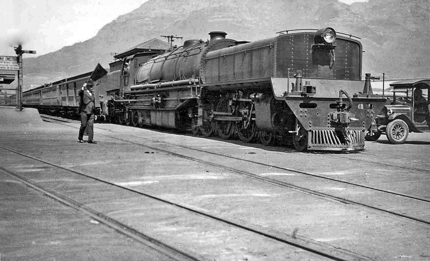
Cape Town’s rail infrastructure in 1932 was already decades old in places, with some lines dating back to the nineteenth century. The railway connected the city to the winelands, the southern suburbs, and the Cape Flats, and was the primary mode of long-distance travel for most residents who could not afford a motor vehicle.
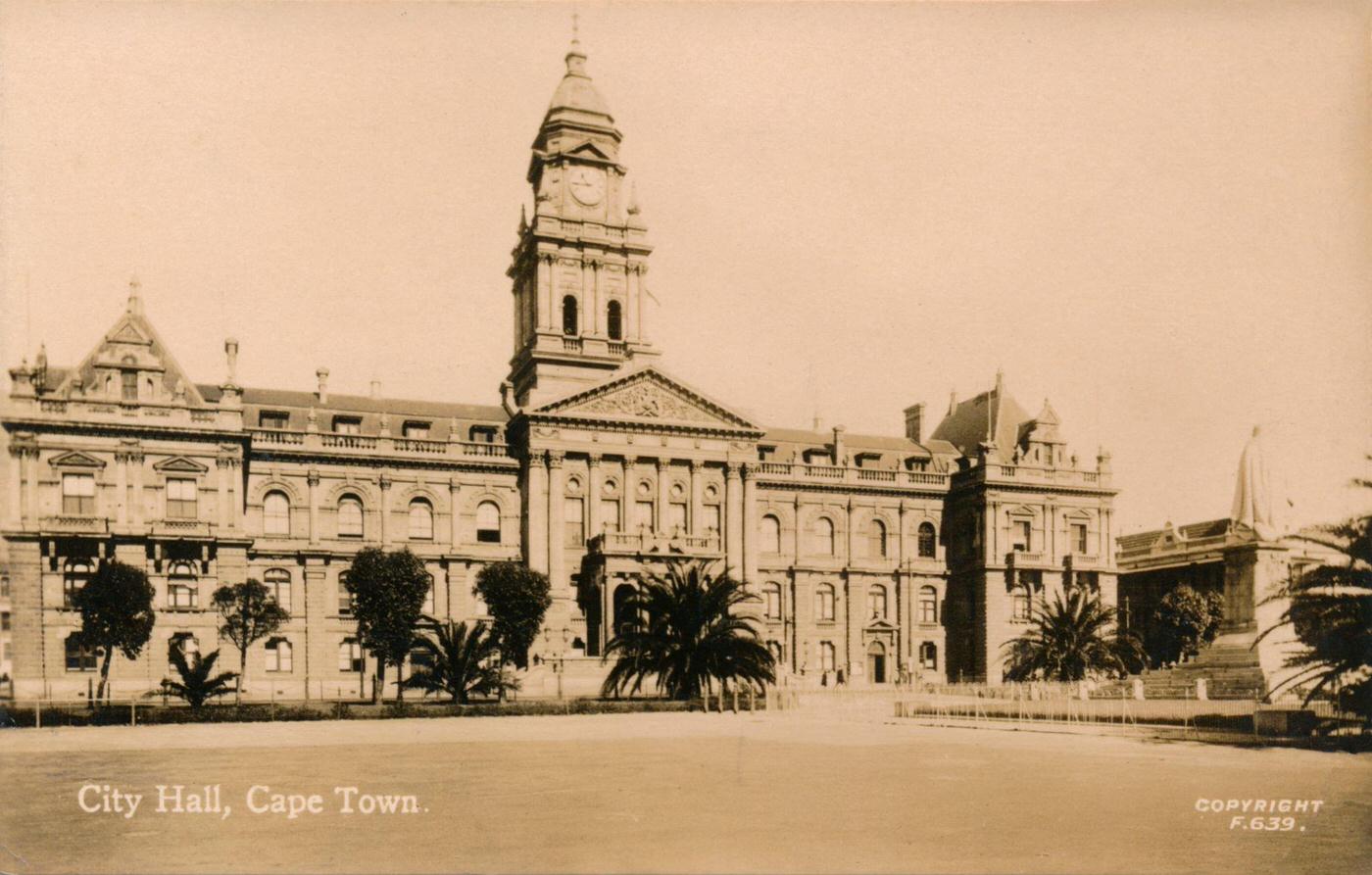
Cape Town’s City Hall on Darling Street was the city’s main civic building. Built in pale Bath stone in the Italian Renaissance style and completed in 1905, it faced the Grand Parade — the city’s largest open public space. Public gatherings, markets, and official ceremonies all took place in and around these buildings regularly through the 1930s.
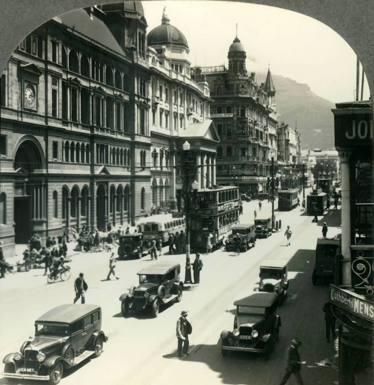
Adderley Street’s flower market was one of the city’s most distinctive street-level features. Vendors, largely from the Cape Malay community, sold flowers from the pavement near the Post Office. The market was a daily fixture that drew shoppers and passersby and added colour and commerce to one of Cape Town’s most-travelled streets.
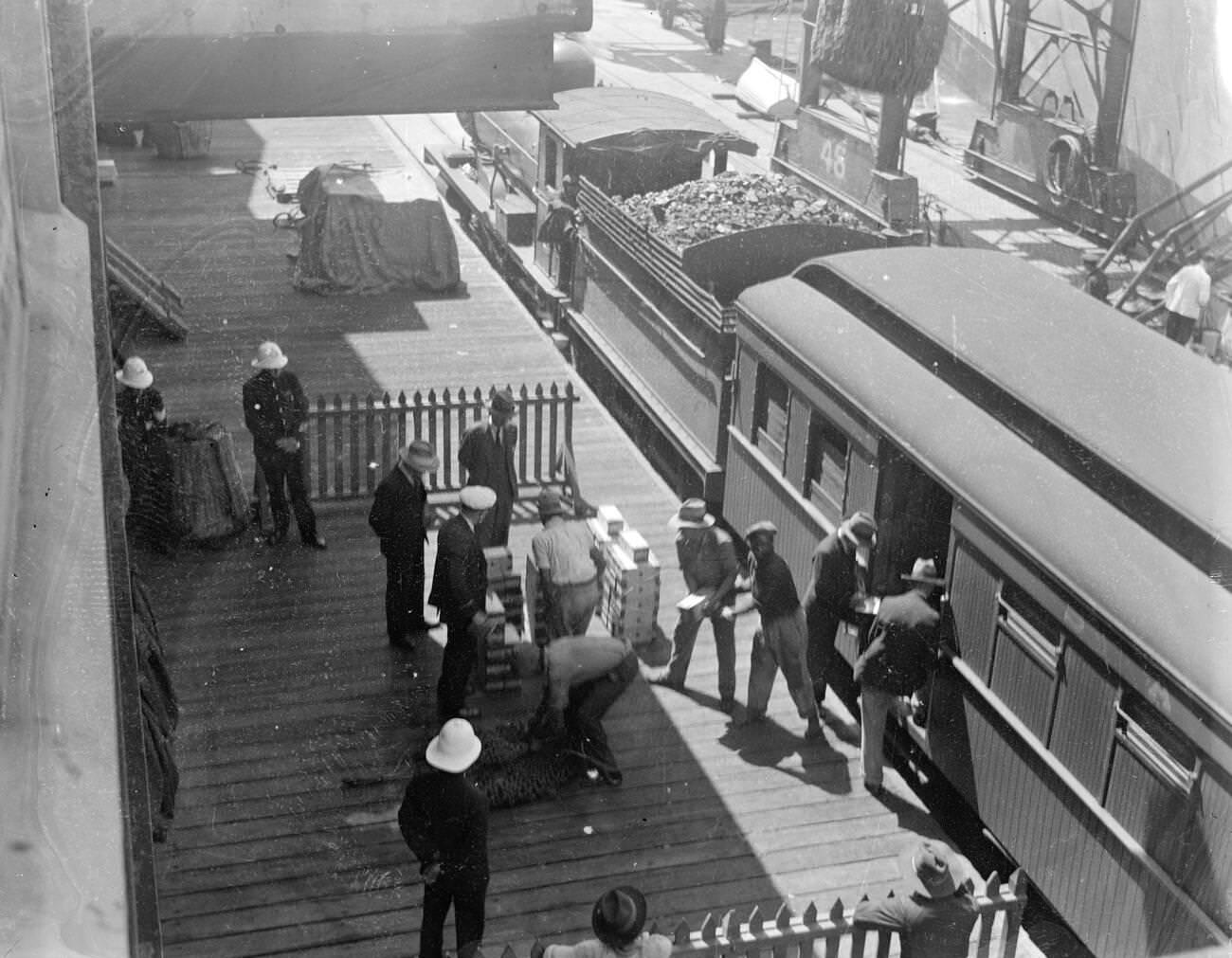
Gold mined on the Witwatersrand in Johannesburg was transported by rail to Cape Town and loaded onto ships for export. The sight of gold being handled at the docks was a reminder of the enormous wealth flowing through South Africa — wealth that was generated largely by black labour under harsh and exploitative conditions, and from which most of the country’s black and coloured population saw almost no benefit.




