
Switzerland in the 1950s was a country finding its footing in a rapidly changing world. While much of Europe was still rebuilding from the destruction of World War II, Switzerland had emerged largely unscathed. Its economy was stable, unemployment was low, and the country was growing at roughly 5 percent per year throughout the 1950s and 1960s. That prosperity showed in its streets, its towns, and its carefully maintained architecture — a country that looked, in many ways, like it had always been untouched by the chaos around it.
Swiss foreign policy during this period was deliberately cautious. Leaders resisted joining multilateral organizations that they felt could threaten the country’s sovereignty. When European nations began pushing for deeper economic integration — what would eventually become the European Union — Switzerland declined to join. Instead, it became a founding member of the European Free Trade Association (EFTA), a looser arrangement that allowed trade cooperation without the political entanglements. Switzerland did eventually engage with international bodies on its own terms, joining the General Agreement on Tariffs and Trade in 1966, the International Monetary Fund in 1992, and the World Trade Organization in 1995.
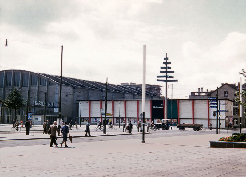
Basel was one of Switzerland’s most important cities — a hub of commerce, culture, and trade sitting right at the point where Switzerland, Germany, and France meet. The Basler Halle, shown here in the 1950s, once stood on the site where the Congress Center now operates. Even then, Basel was a city that balanced its medieval heritage with modern economic activity.
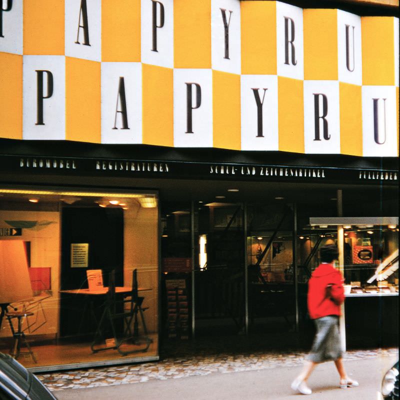
Freie Strasse, one of Basel’s main shopping streets, gave a clear picture of everyday Swiss commercial life in 1956. Storefronts were tidy and well-kept, reflecting the general prosperity of the era. Switzerland’s rapid economic development didn’t just benefit its banks and industries — it filtered down into its high streets and neighborhoods.
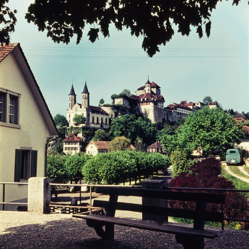
Away from the big cities, Swiss towns like Aarburg preserved centuries of history in plain sight. The Fortress Aarburg sits high above the town on a rocky promontory above the Aare River, and the Reformed Church below it dates back to the medieval period. In the 1950s, both structures remained central to the identity of the small town.
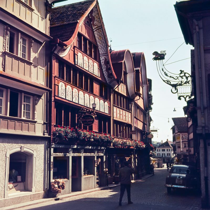
Appenzell, in northeastern Switzerland, was one of the country’s most visually distinctive towns. Its Hauptgasse — the main street — was lined with brightly painted facades and ornate window boxes. The town was also famous as one of the last places in Switzerland to hold open-air democratic assemblies, known as Landsgemeinden, where eligible citizens voted by a show of hands.
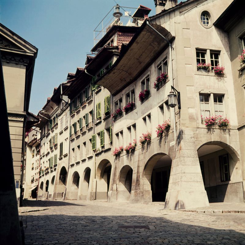
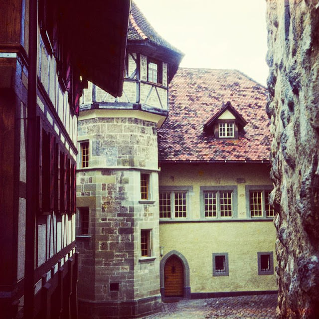
Bern, the federal capital, appears in several of these photographs, and for good reason. The city’s medieval old town — with its sandstone arcades, fountains, and cobblestone streets — was one of the most complete examples of medieval urban planning in Europe. Walking through it in the 1950s, as these images show, meant walking through streets that had looked largely the same for five centuries.
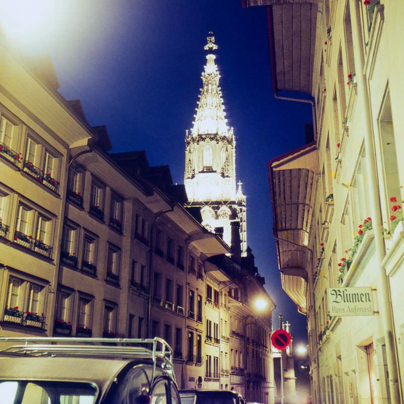
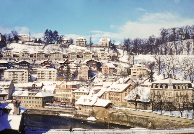
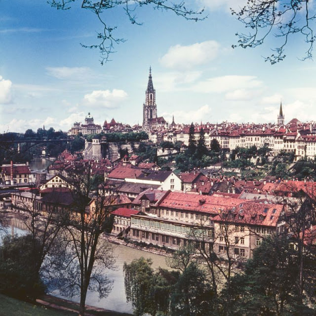
The Nydeggbrücke bridge offered one of the finest views in Bern — looking north along the Aare River, with the city’s distinctive red-roofed buildings rising on both sides. Bern was founded in 1191, and by the 1950s it had grown into a modern capital while preserving almost all of its old-town character. That balance between the old and the new was something Switzerland managed better than almost anywhere else in Europe.
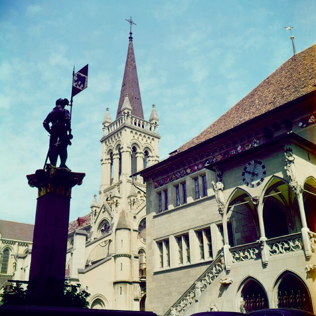
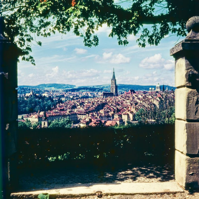
The Rosengarten — the Rose Garden — sits on a hill north of the old town and provides a panoramic view across the city and the looping Aare River below. The garden itself contains over 200 varieties of roses and rhododendrons, and the view from it has been one of Bern’s most visited spots for generations.
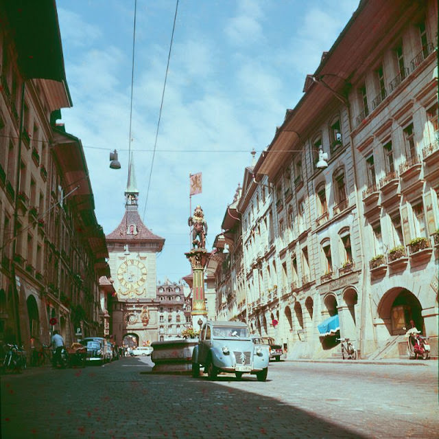
The Zytglogge — Bern’s medieval clock tower — is one of the city’s most recognizable landmarks. Built in the early 13th century, it originally served as a watchtower and city gate. By the 1950s, it had long become the symbol of Bern, with its astronomical clock drawing visitors from across Europe. Albert Einstein, who lived in Bern in the early 1900s, reportedly drew inspiration from the tower’s clock for his thoughts on the nature of time.
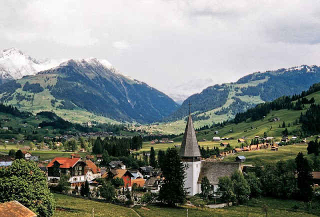
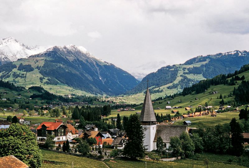
Gstaad, in the Bernese Oberland region, was already beginning its transformation into one of Switzerland’s most exclusive resort destinations by the late 1950s. The Eglise de Saanen — a Protestant church dating back to the 15th century — stood quietly in the valley, a reminder of the village’s older, simpler roots before the ski industry and international wealthy visitors reshaped its character.
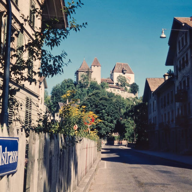
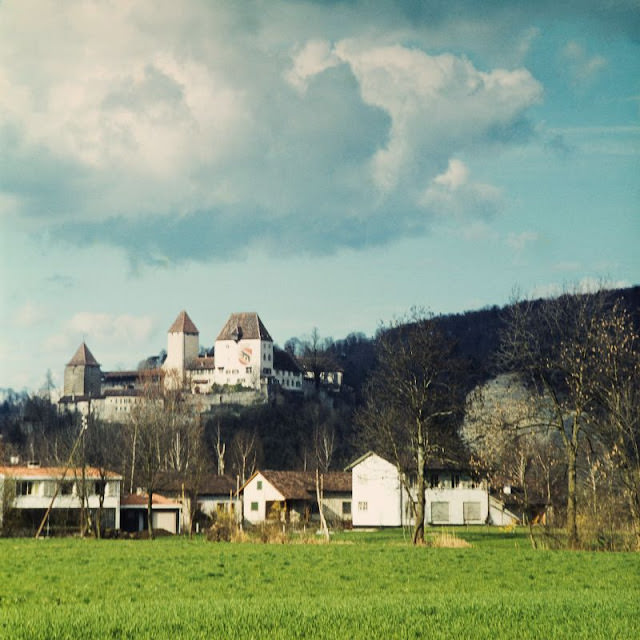
Schloss Burgdorf is one of the best-preserved Zähringen castles in Switzerland. Built in the 12th century, it dominates the town from its hilltop position. By the 1950s, the castle housed a regional history museum, making it both a monument and a working cultural institution. These two photographs taken from different vantage points show just how dramatically the structure sits above the surrounding landscape.
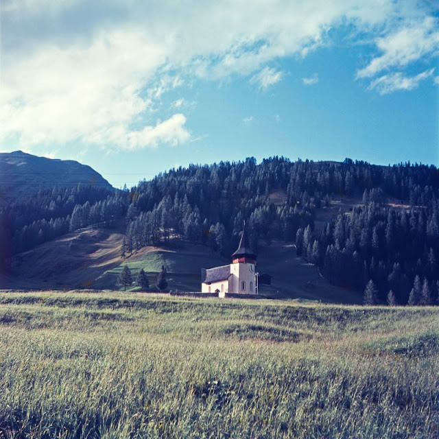
Davos in the 1950s was already internationally known — first as a tuberculosis sanatorium destination in the 19th century, and later as a ski resort. In 1971, the World Economic Forum was founded there, and Davos became synonymous with globalization and high-level international dialogue by the early 21st century. But in this photograph from the 1950s, Frauenkirch — a quiet village suburb of Davos — still looked much as it had for decades, with its church spire rising above the alpine valley floor.
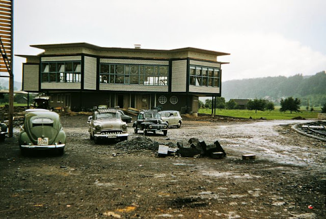
This photograph from 1956 captures something different — not a church or a castle, but the welfare building of the Schindler Elevators factory in Ebikon, still under construction. Schindler, founded in Lucerne in 1874, was one of Switzerland’s great industrial success stories. By the mid-20th century it was a global company, and the construction of a dedicated staff canteen at its factory reflected the era’s broader investment in worker facilities.
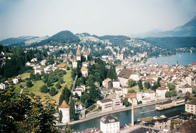
Lucerne was — and remains — one of Switzerland’s most visited cities. This aerial view, taken from near the Château Gütsch hotel in July 1955, shows the city spread along its lake and river with the Alps rising in the background. The funicular railway up to Gütsch had been operating since 1888, and by the 1950s it was a well-established part of the tourist experience in the city.
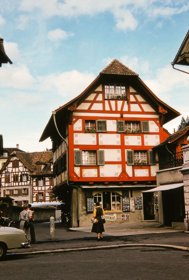
Half-timbered houses like this one at Stiftstrasse 10 were scattered throughout Lucerne’s older neighborhoods. These structures, with their exposed wooden frames filled with plaster or brick, were characteristic of central European architecture from the medieval period onward. By the early 1950s, they were increasingly rare survivors in a city that was modernizing quickly.
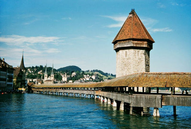
The Kapellbrücke — the Chapel Bridge — is one of the most photographed structures in all of Switzerland. Built in 1333 as part of Lucerne’s fortifications, the covered wooden footbridge crosses the Reuss River diagonally and is decorated inside with 17th-century painted panels depicting scenes from Swiss history. In 1993, a fire destroyed much of the bridge, but it was rebuilt. In the 1950s photograph shown here, it stands fully intact and busy with foot traffic.
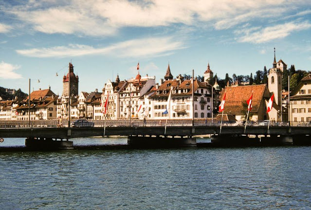
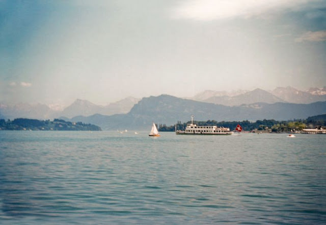
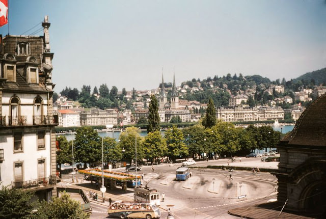
Lake Lucerne, photographed here from near the Grand Casino in July 1955, shows the stunning natural backdrop that made the city a magnet for tourists throughout the 19th and 20th centuries. The lake’s irregular shape — created by the convergence of several alpine valleys — means that views from its shores almost always include dramatic mountain scenery.
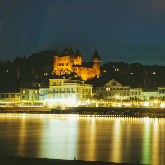
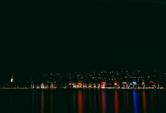
Nyon, on the northern shore of Lake Geneva, was home to one of Switzerland’s oldest Roman settlements. The castle visible here was built in the 12th century by the Dukes of Savoy and later rebuilt in the 13th. Photographed at night in the 1950s, its illuminated towers reflected off the calm lake surface — one of the more striking images in this collection.
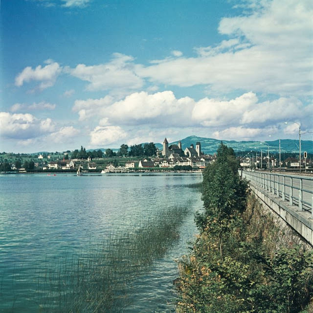
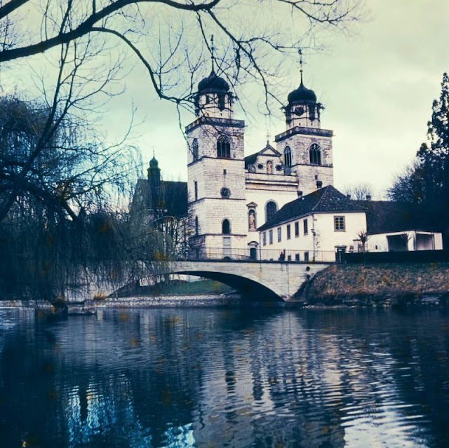
The Klosterkirche in Rheinau sits on a small island in the Rhine River, connected to the mainland by a single bridge. The monastery on this site dates back to the 8th century, and the current Baroque church was completed in 1712. By the 1950s, the monastery was still an active Benedictine community, and the island setting gave it an almost otherworldly isolation from the surrounding Swiss countryside.
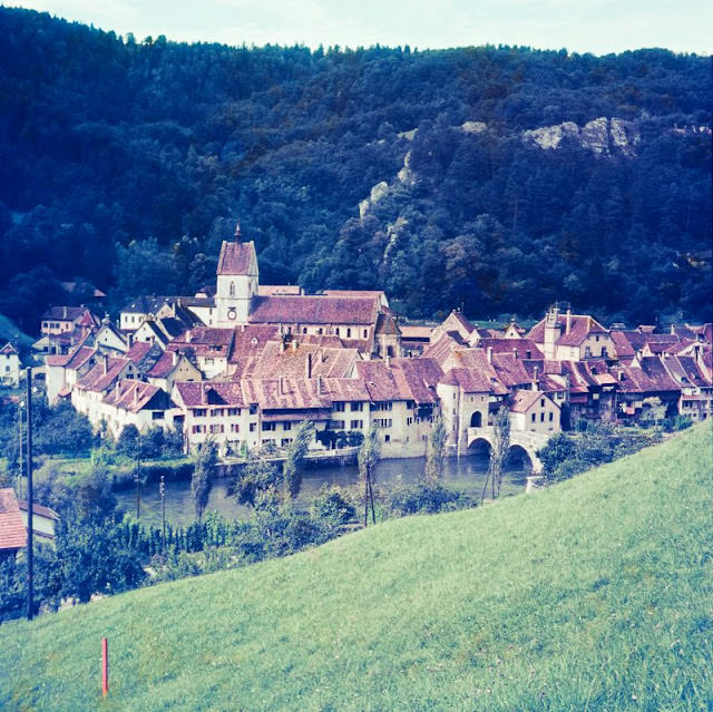
Saint-Ursanne is one of Switzerland’s most remarkably preserved medieval villages, tucked into a tight loop of the Doubs River in the canton of Jura. The St. Jean Bridge crossing the river was built in the 17th century. Even in the 1950s, the village had changed little from its medieval layout — narrow streets, stone buildings, and a collegiate church dating back to the 12th century.
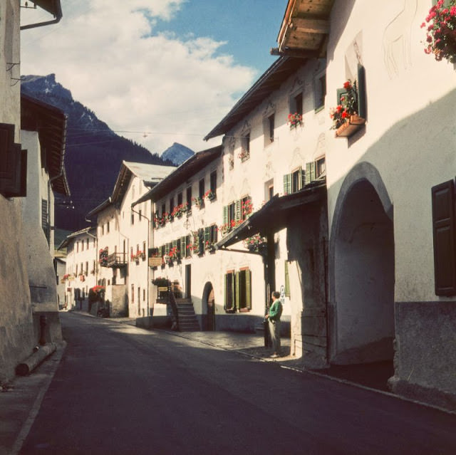
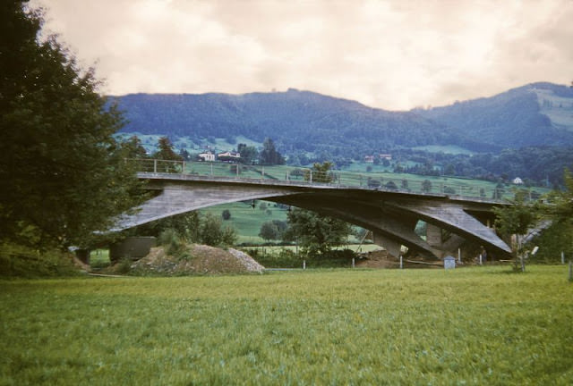
The canton of Schwyz holds a special place in Swiss history — it is one of the three founding cantons of the Swiss Confederation, and it gave the country its name. The Churerstrasse Bridge in Altendorf, photographed in the early 1950s, is a small but telling example of the infrastructure that connected these mountain communities.
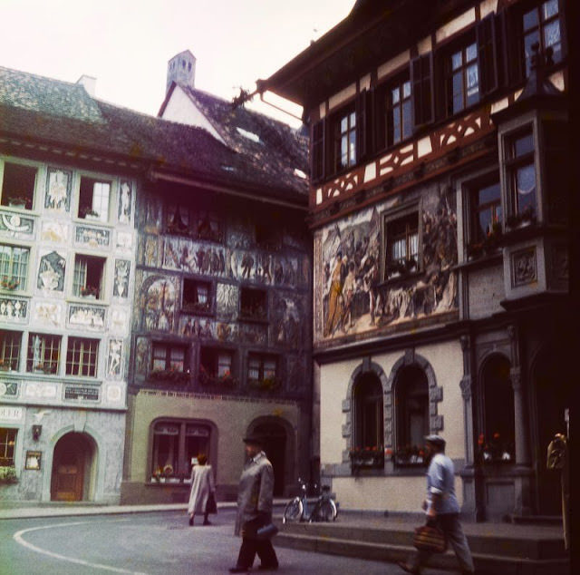
Stein am Rhein earned its nickname “Märlistadt” — fairy-tale town — from its extraordinarily well-preserved medieval center. The main square is lined with half-timbered buildings covered in detailed frescoes depicting historical scenes, coats of arms, and allegorical figures. The town sits at the point where the Rhine flows out of Lake Constance, and it remained one of the most visually complete medieval town centers in the German-speaking world.
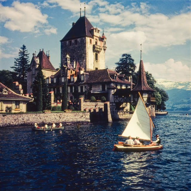
Schloss Oberhofen rises directly from the shore of Lake Thun — one of Switzerland’s most dramatically positioned castles. The structure dates back to the 12th century and was expanded and modified numerous times over the following centuries. By the 1950s it had been opened as a museum, with its rooms furnished to reflect different periods of Swiss domestic life from the Middle Ages to the early 20th century.
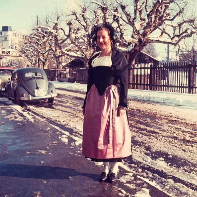
This photograph captures a person wearing a traditional Simmental costume — the regional dress of the Simmental valley in the Bernese Oberland. Traditional Swiss regional costumes were still worn at festivals and ceremonies in the 1950s, and documenting them was part of a broader Swiss cultural effort to preserve local identity even as the country modernized rapidly.
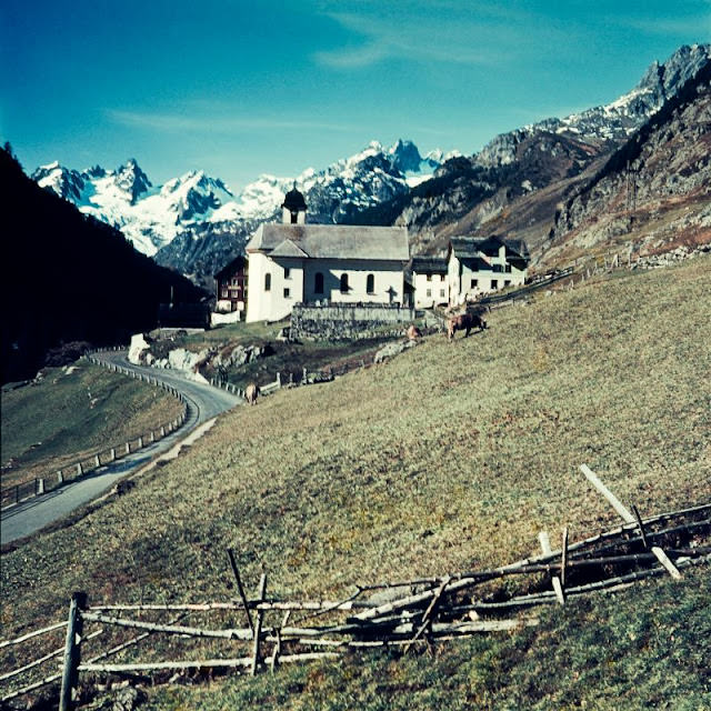
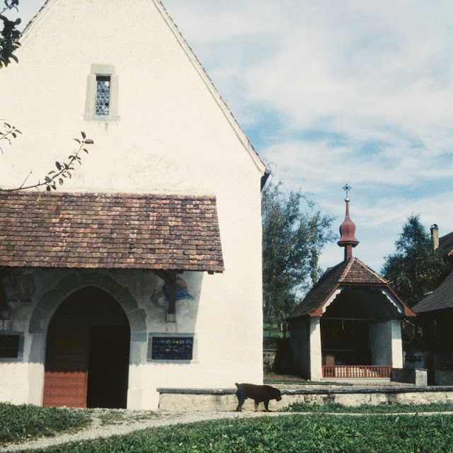
Small roadside chapels like this one near Wassen were a common feature of Swiss alpine roads. The Sustenstrasse runs through the Reuss valley and connects the canton of Uri with the Bernese Oberland over the Susten Pass. In the 1950s, road travel through the Alps was still an adventure — tunnels were few, and passes closed for months every winter.
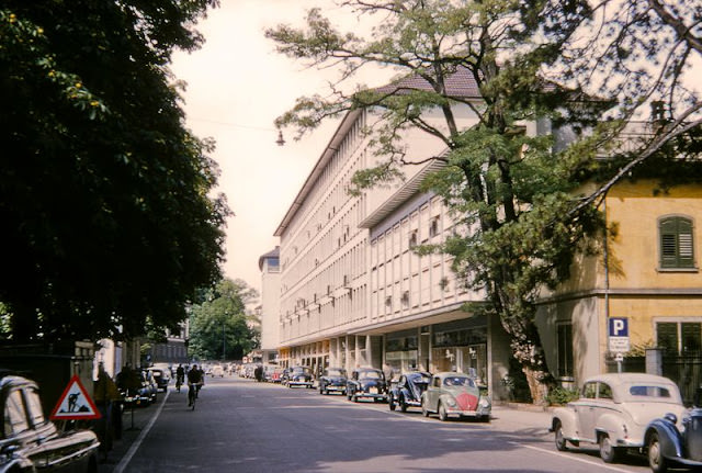
Zurich, Switzerland’s largest city and its financial center, was growing fast in the 1950s. While Bern served as the political capital, Zurich was the economic engine. Its banking sector, established over centuries, was reinforced by Switzerland’s neutrality during World War II, which made it a safe haven for international capital. By the 1950s, Zurich’s position as one of Europe’s leading financial centers was firmly established.
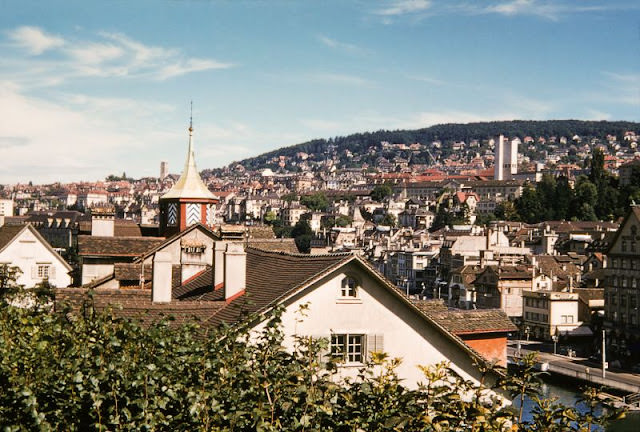
The Lindenhof is a small elevated park in the heart of Zurich’s old town, sitting on the site of a Roman fort and later a Carolingian imperial palace. By the 1950s it was a peaceful public space offering one of the best views across the Limmat River to the opposite bank. The north-easterly view shown here takes in the old town’s mix of church towers and tightly packed rooftops.
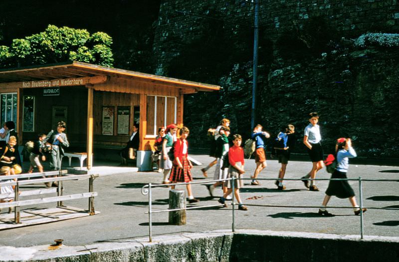
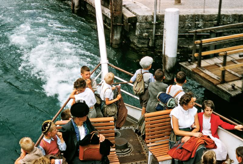
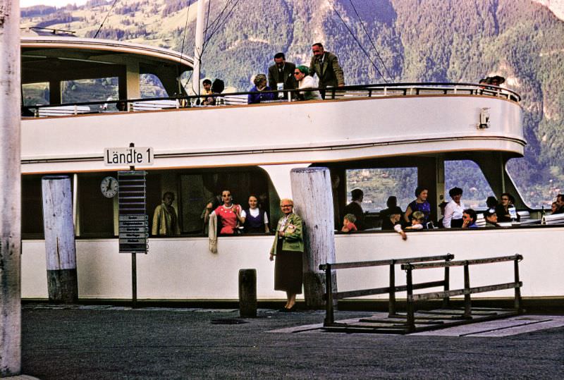
Lake Thun and its surrounding villages provided a very different kind of Swiss scene — one of everyday life rather than grand architecture. These photographs of schoolchildren at the waterfront and aboard ferries capture the way lake transport was woven into the daily routine of communities around Thunersee. For villages on the lake, the ferry was not just a tourist attraction but a practical way to get around.
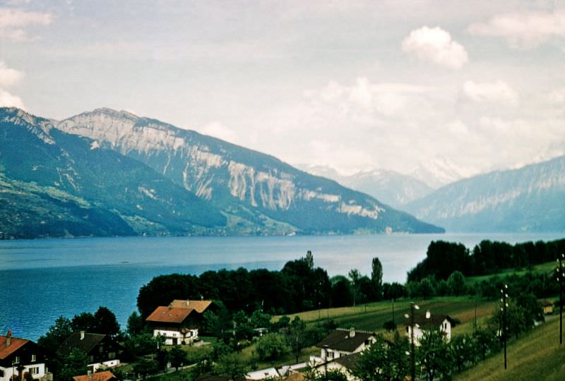
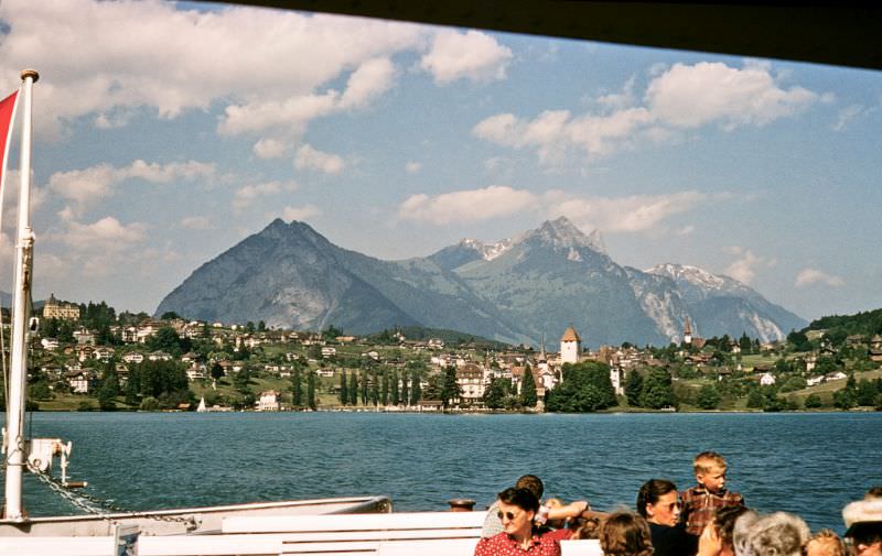
The view from Spiez across Lake Thun toward Merligen and the Niederhorn mountain captures the scale of the Bernese Oberland landscape. Spiez itself sits on a small peninsula jutting into Lake Thun, crowned by its medieval castle, and the views from town extend across the full breadth of the lake to the mountains beyond.
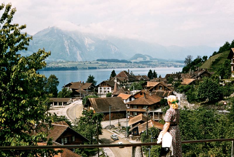
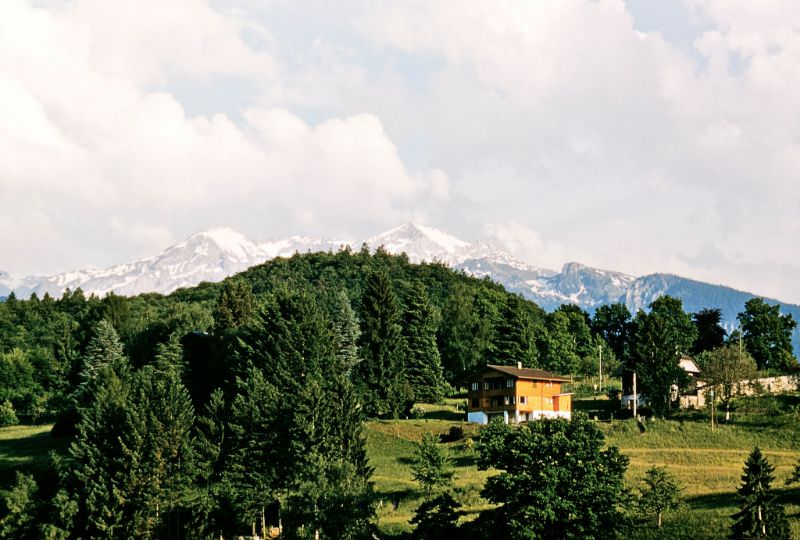
The Jungfrau, rising to 4,158 meters, dominates the skyline southeast of Spiez and is one of the most recognizable peaks in the Alps. The Jungfraujoch railway station — the highest in Europe at 3,454 meters — had been operating since 1912, and by the 1950s the mountain was well established on Switzerland’s tourist circuit.
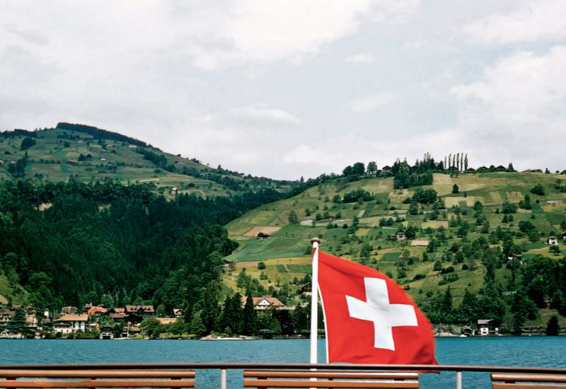
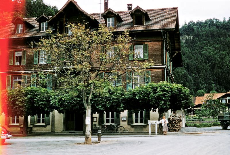
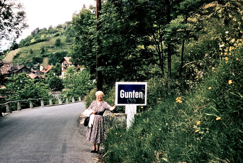
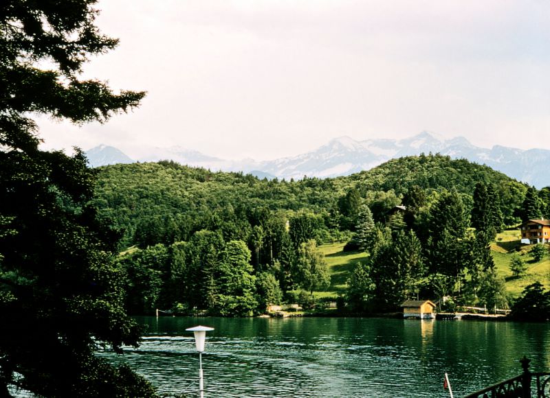
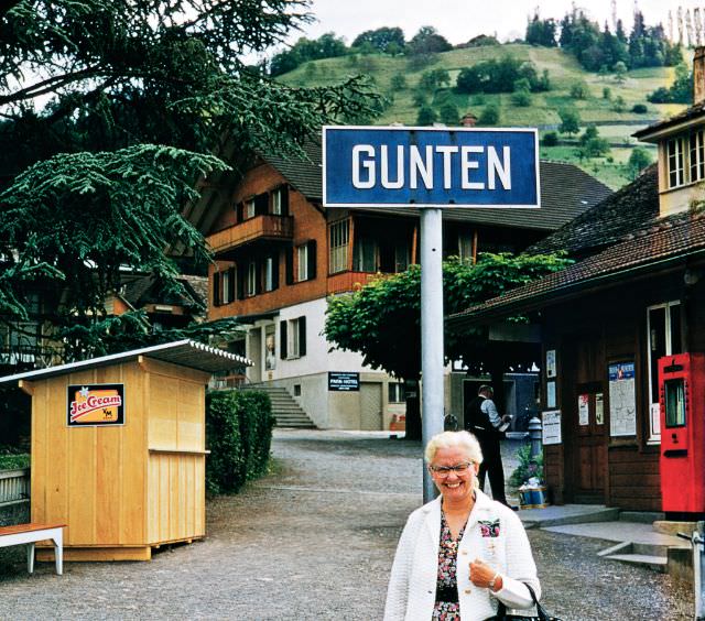
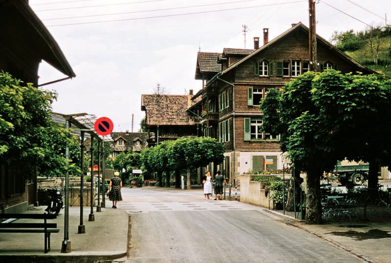
Gunten was a small lakeside village on the southern shore of Lake Thun. Its position — sheltered from northern winds by the hills above — gave it a relatively mild climate by Swiss alpine standards. Several photographs in this collection were taken in and around Gunten, suggesting a photographer who spent considerable time exploring this quiet corner of the Bernese Oberland.
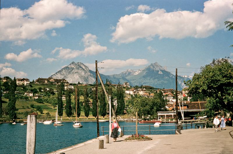
This photograph of a real estate business in Gunten is a pointed reminder of just how much Switzerland’s economic boom was reshaping even its smallest villages. As prosperity grew through the 1950s, demand for property — particularly in scenic lake and mountain locations — increased sharply. Real estate offices in tiny villages like Gunten were part of a broader pattern of development that was beginning to change the Swiss landscape.
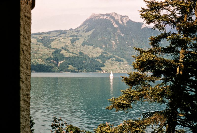
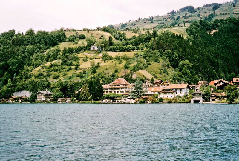
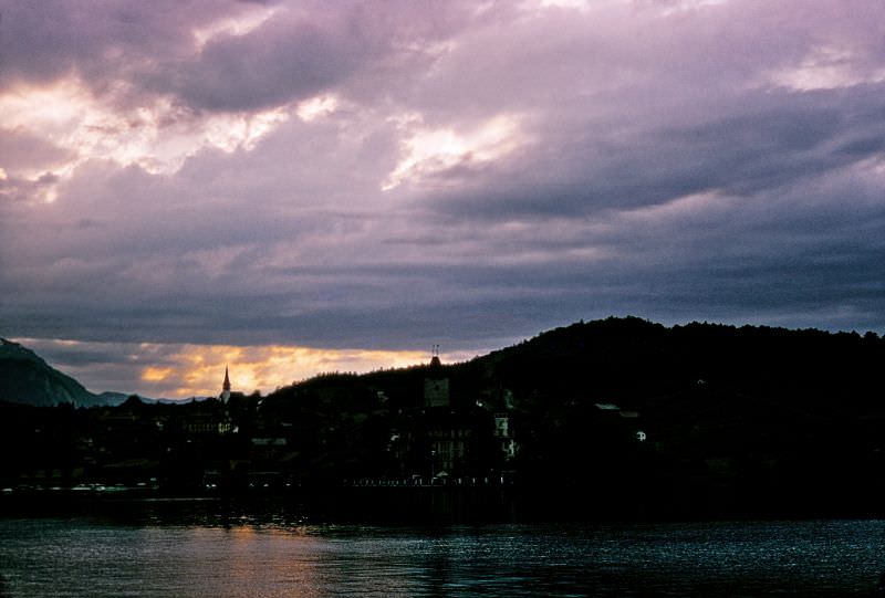
Seen from the water, Gunten appears as a tight cluster of houses and gardens pressed between the lakeshore and the steep hillside above. The Thunersee ferry services connected Gunten with Spiez, Thun, and the other lakeside towns, making the lake itself the main road for much of the community’s daily movement.
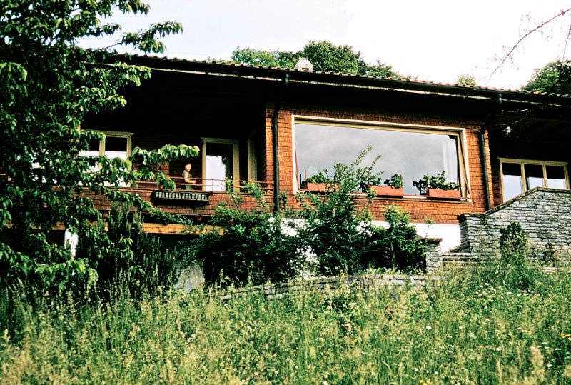
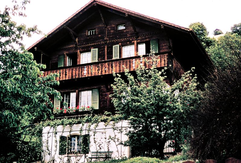
The caption on this photograph — “The $70,000 House” — tells its own story. In the 1950s, $70,000 was a significant sum, equivalent to well over half a million dollars today. The fact that someone noted the price suggests the house was considered remarkable in its value even then, pointing to the premium that lakefront Swiss property commanded even in smaller villages like Gunten.
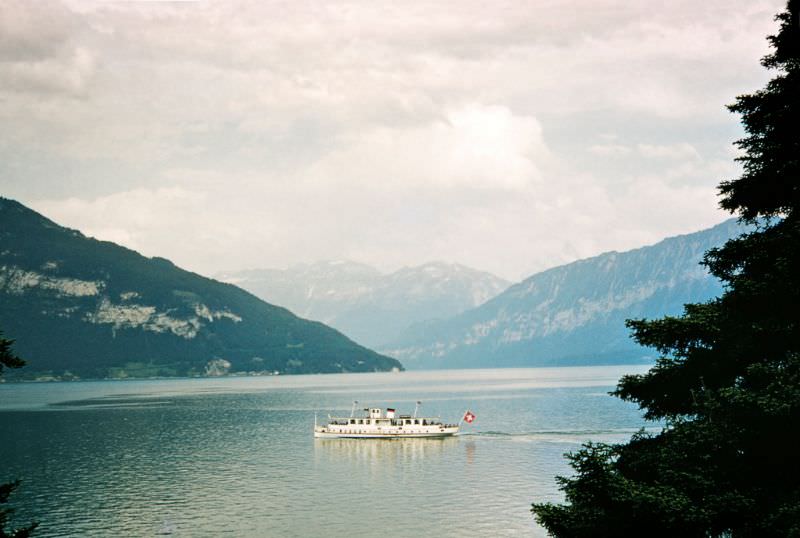
Spiez, with its castle, its harbor, and its position at the heart of Lake Thun, brings this visual journey through 1950s Switzerland to a close. The town’s medieval castle — Schloss Spiez — had been inhabited continuously for over 3,000 years before becoming a museum in the early 20th century. In the 1950s, Spiez was both a working Swiss town and a destination, sitting at the crossroads of routes heading south toward the Lötschberg tunnel and east toward Interlaken and the high Alps. These photographs, taken across Switzerland in the course of a single decade, show a country that was simultaneously proud of what it had preserved and confident about where it was going.





It’s still the same haha
I mean, you can take a picture of a cathedral or typical 19th century building now or in 50 years, and there won’t be any difference.
In essence, it is the same as now, but with older vehicles. Yes, maybe don’t show the historic center of Bern, because… you know… not much has changed in 500 years.
Back then, Geneva didn’t exist
Is this supposed to be funny?
Can you prove that it existed then? These images show nothing of an existence in the 1950s.
I’m not sure whether these are old photos or actual photos with some washed-out colors and grain. Overall, it still looks similar.
There were no cars everywhere, which I thought was nice.
Many of those places today have fewer cars than on those pictures (albeit more people). Check out the old cities of Bern and Luzern…