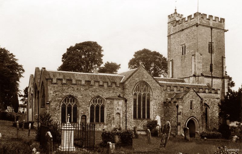
Devon is one of England’s most varied counties. It stretches from the rugged cliffs of the north coast to the sheltered harbours of the south, with sweeping moorland cutting through the middle. Its main urban centres — Plymouth, Exeter, and Torbay — served as the beating heart of trade, retail, and services for the surrounding communities. While tourism was a major part of the economy even then, fishing, farming, mining, and agriculture all played important roles in daily life. The photographs collected here were taken between roughly 1900 and 1929, capturing Devon at a moment when horse-drawn carts still shared the road with the first motor vehicles, and village life moved at a steady, unhurried pace.
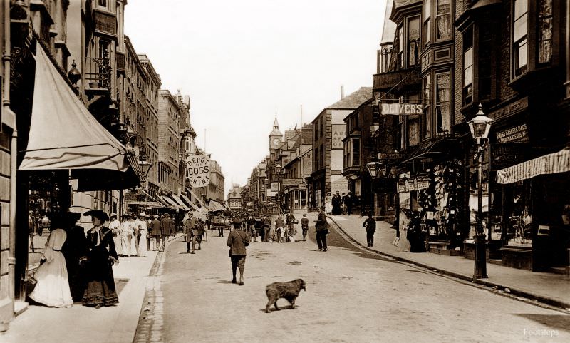
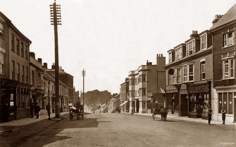
Ilfracombe, perched on Devon’s dramatic north coast, was already a well-known seaside resort by the early 1900s. Its High Street buzzed with shopkeepers, visitors, and locals going about their day. The buildings that lined the street reflected the town’s Victorian prosperity, built to serve the waves of tourists who arrived by rail.
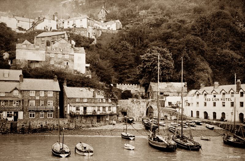
Few villages in all of England are as visually striking as Clovelly. Built on a hillside so steep that wheeled vehicles could not use its main street, goods were carried by donkeys and sleds well into the 20th century. The whitewashed cottages and flower-lined lanes made it a favourite subject for photographers and painters alike.
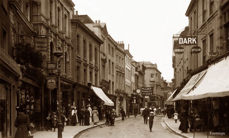
Barnstaple is one of the oldest boroughs in England, and by the turn of the century its High Street was a thriving commercial corridor. Shops, banks, and market traders filled the street, serving not just the town’s residents but the farming communities spread across the surrounding countryside of North Devon.
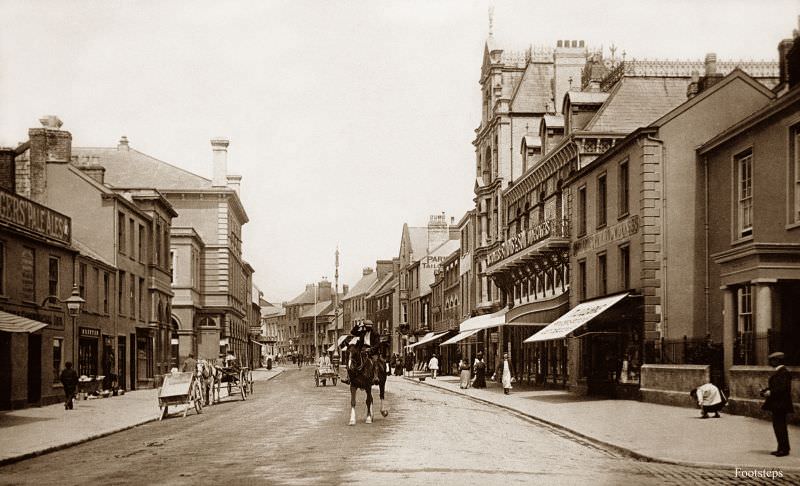
Honiton, in east Devon, was famous for its lace-making tradition stretching back centuries. Its wide High Street was designed that way deliberately — the town was a regular stopping point on the coaching route between London and Exeter. By the time this photograph was taken, motor cars were beginning to appear on those same roads.
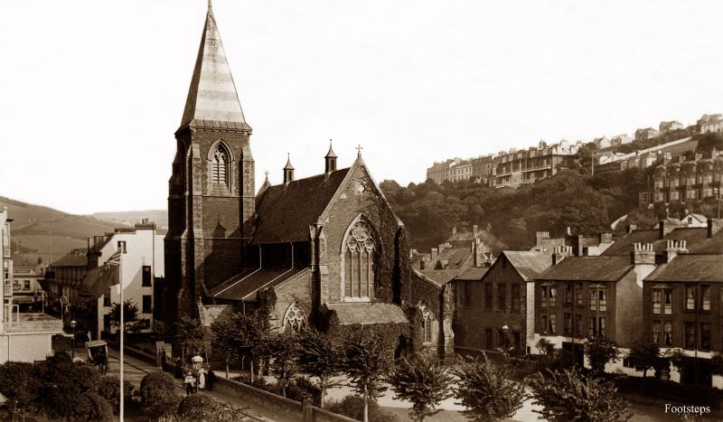
The Church of St Philip and St James in Ilfracombe stood as a central fixture of community life. Built in the Victorian era to accommodate the town’s growing population, it served the spiritual needs of both permanent residents and the seasonal visitors who flooded into Ilfracombe each summer.
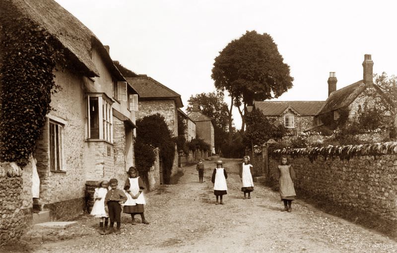
Stockland, in the far east of Devon near the Somerset border, was the kind of quiet agricultural village that defined rural England at the time. Farming families made up most of the population, and the rhythms of planting and harvest shaped the calendar more than anything else.
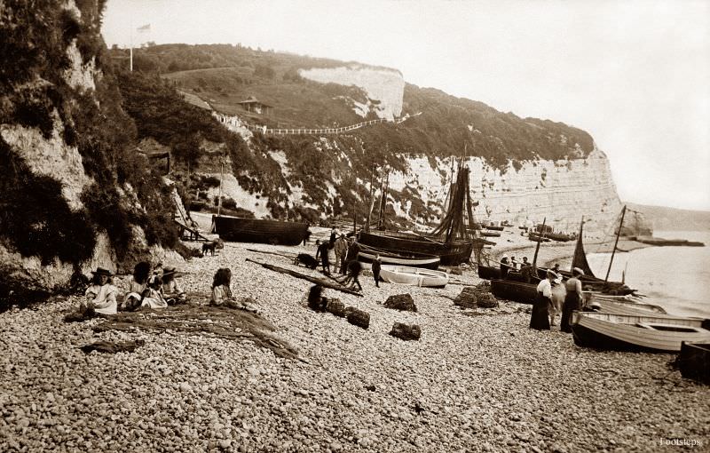
The village of Beer sits in a sheltered cove on Devon’s Jurassic Coast. Its beach was a working beach — fishing boats were hauled up onto the shingle, and the local fishing trade was central to the village economy. The distinctive white cliffs on either side of the cove, made of chalk, set it apart from much of the surrounding coastline.
North Tawton was a small market town on the edge of Dartmoor. Its economy relied heavily on agriculture and, historically, on the wool trade. By the 1910s it retained its modest, self-contained character, with local businesses serving the farming families spread across the surrounding parishes.
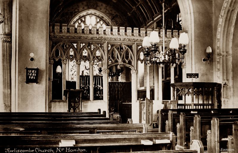
The interior of Awliscombe church offers a glimpse into the religious life of a typical Devon village in the 1910s. These parish churches were not merely places of worship — they were community anchors, hosting baptisms, weddings, and funerals that marked every stage of village life.
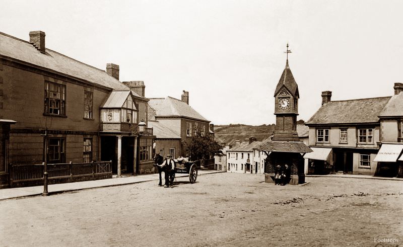
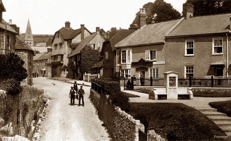
A broader view of Beer in the 1910s shows the village itself climbing the hillside above the cove. Stone and cob cottages, many of them occupied by fishing families, clustered around the narrow lanes leading down to the beach. The local Beer stone — a creamy limestone — was quarried here for centuries and used in buildings as far away as Exeter Cathedral.
Bishopsteignton sits on a hillside above the Teign estuary, looking out across the water toward Teignmouth. The village had strong agricultural roots, and its elevated position gave residents commanding views of the estuary and the farmland stretching inland.
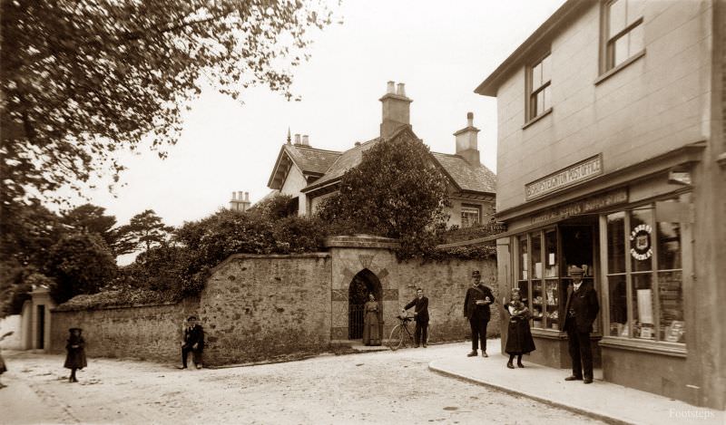
Boutport Street in Barnstaple ran parallel to the river Taw and was one of the town’s key thoroughfares. By the 1910s it was lined with a mix of Victorian commercial buildings, and the street would have seen a constant flow of pedestrians, horse-drawn carts, and early motor vehicles.
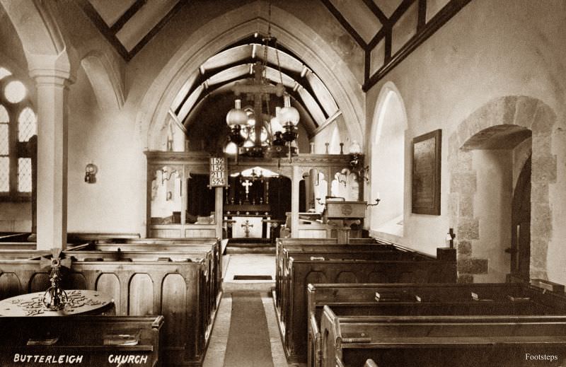
Butterleigh is a tiny parish tucked into the rolling hills of mid-Devon. Its small church, like many others across the county, contained features dating back several centuries. The interior photographed here shows the plain, modest style typical of rural Devon churches — unadorned stonework, simple wooden pews, and clear-glass windows letting in the Devon light.
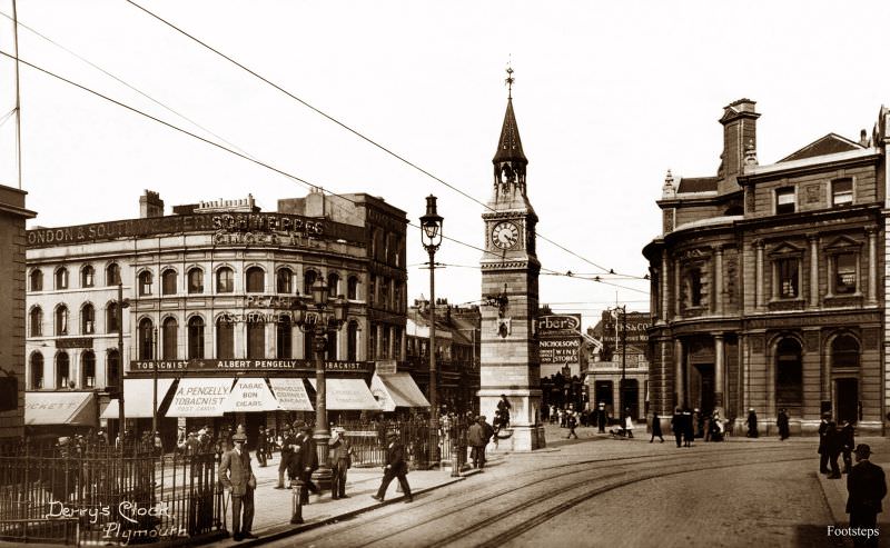
Plymouth was Devon’s largest city, and Derry’s Clock was one of its most recognisable landmarks. Standing at the junction of several major streets in the city centre, the clock was built in 1862 and quickly became a popular meeting point for Plymouth residents. The surrounding streets were filled with shops, hotels, and the steady hum of a busy port city.
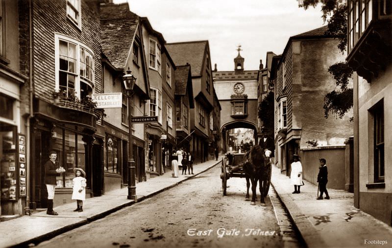
Totnes is one of Devon’s oldest towns, and the East Gate was one of the surviving medieval structures that still defined its character in the 1910s. The gate straddled the High Street, and all traffic moving through the town centre had to pass beneath it. It served as a powerful reminder of the town’s medieval origins.
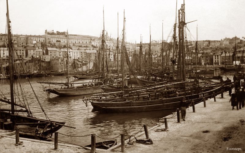
Brixham harbour was home to one of the most important fishing fleets in England. The distinctive red-sailed Brixham trawlers were famous across the country, and the fishing industry employed a large portion of the town’s population. The harbour scene in the 1910s would have been one of constant activity — boats arriving with catches, fish being sorted and sold, and nets spread out on the quay for repair.
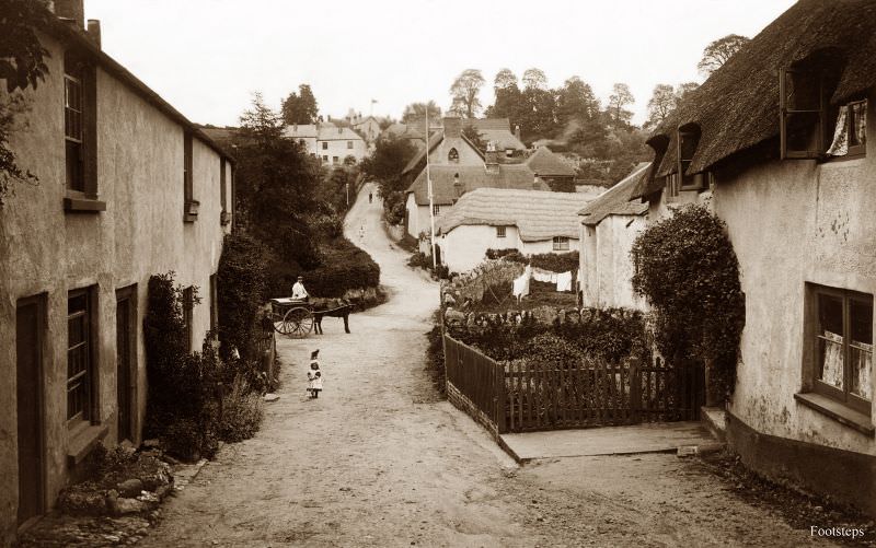
Holcombe is a small coastal hamlet between Dawlish and Teignmouth. Its setting — a narrow strip of land between red sandstone cliffs and the sea — made it a striking but exposed place to live. The railway line running along the base of the cliffs, built by Brunel in the 1840s, was already a defining feature of the local landscape by this time.
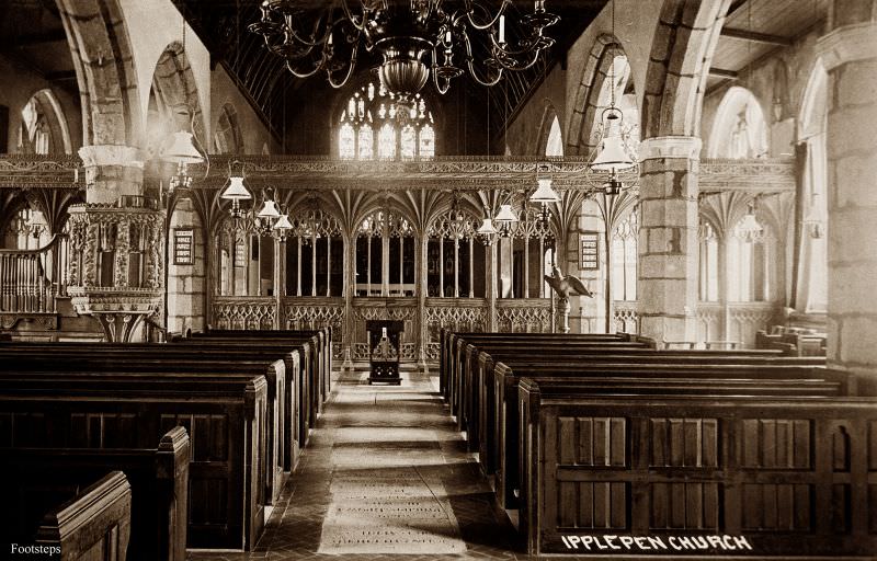
The interior of Ipplepen church, photographed around 1910, shows a well-maintained Devon parish church with its characteristic rood screen — a carved wooden partition separating the nave from the chancel. Ipplepen’s screen is considered one of the finest examples of medieval woodcarving in Devon, and it survived the centuries largely intact.
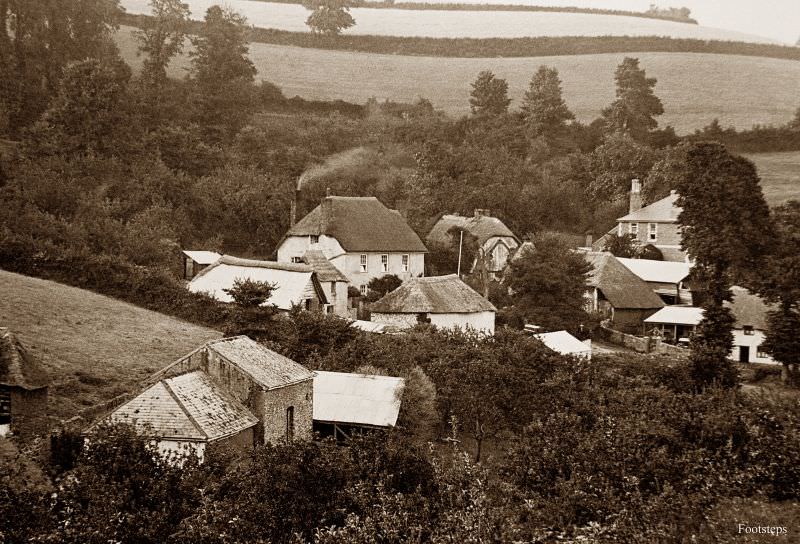
Maidencombe is a secluded cove village just north of Torquay. By the 1910s its thatched cottages and sheltered beach had made it a quiet retreat, largely untouched by the rapid development transforming Torquay and Paignton nearby. It remained the kind of place that visitors sought out precisely because it had been left alone.
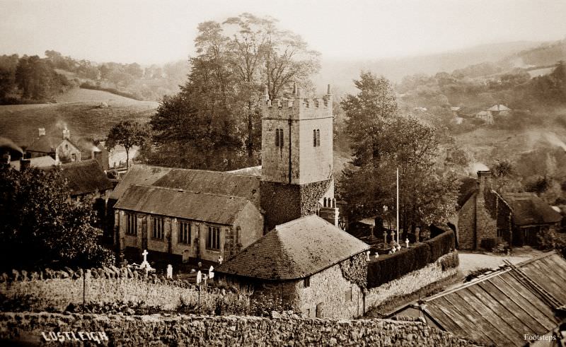
St John’s Church in Lustleigh sits at the heart of a village on the eastern edge of Dartmoor. Lustleigh was — and remains — a picture-book Devon village, with thatched cottages grouped around the church. The churchyard and the surrounding granite walls were typical of the Dartmoor building style that evolved to suit the local stone.
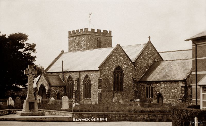
St Mary’s Church in Hemyock stands in the Culm Valley in east Devon. The village of Hemyock also contained the remains of a medieval castle adjacent to the church, making the area around the churchyard particularly rich in history. The church itself served a scattered farming community spread across the surrounding hills.
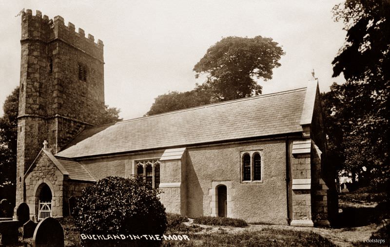
Buckland-in-the-Moor is one of the most photographed villages on Dartmoor. St Peter’s Church sits among oak trees above the village, and the surrounding landscape of moorland and wooded valleys made it stand out even among Devon’s many beautiful parishes. The church clock face, where the numbers are replaced with the letters “MY DEAR MOTHER,” was added in the 1930s — just after this photograph was taken.
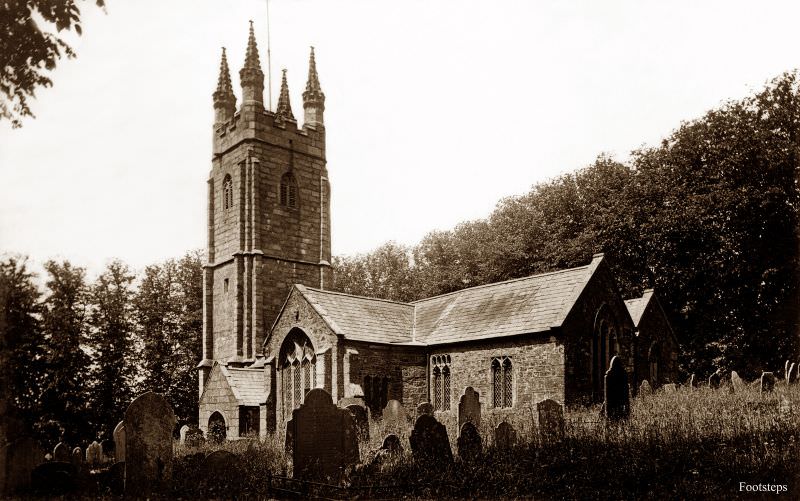
Peter Tavy is a small village on the western edge of Dartmoor, just north of Tavistock. Its church of St Peter dates back to the 15th century and is built in the local granite that characterises moorland architecture across this part of Devon. The village itself was small — a handful of farms, the church, and little else.
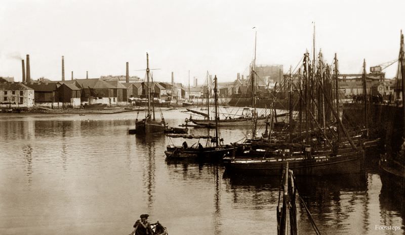
Sutton Harbour in Plymouth was the city’s original harbour, used continuously since medieval times. By the 1910s it was still a working harbour, surrounded by fish markets, warehouses, and the Barbican district — one of the oldest parts of Plymouth. It was from near this harbour that the Mayflower departed for America in 1620.
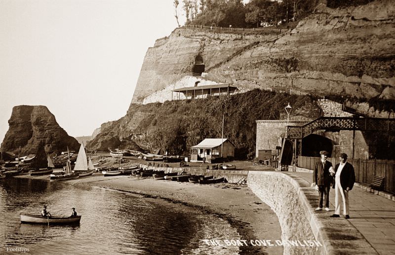
Dawlish was a popular seaside resort by the 1910s, known for its black swans on the stream running through the town centre and its red sandstone cliffs. The Boat Cove area gave visitors a sheltered spot along the shoreline, separate from the main beach, where smaller boats could be moored or launched.
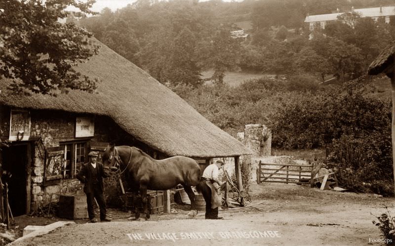
The village smithy at Branscombe captures a trade that was still absolutely essential in rural Devon in the 1910s. Before tractors replaced horses on the farm, the blacksmith kept the agricultural economy moving — shoeing horses, repairing iron tools, and making the hardware that farms depended on every day. Branscombe, in east Devon, was largely self-sufficient in this way.
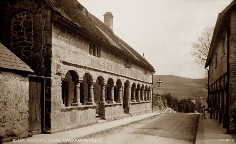
The Almshouses at Moretonhampstead are among the most distinctive buildings in Devon. Built in 1637 in a granite colonnade style, they stand on the edge of the town and were originally built to house the poor of the parish. By the 1920s they had become one of the most photographed architectural features on Dartmoor.
Bantham is a small coastal hamlet at the mouth of the River Avon in south Devon. Its beach faced the open sea at Bigbury Bay, and the area was known for strong tidal currents that made local knowledge essential for anyone working on the water. The surrounding dunes and coastal farmland gave it a wild, open character.
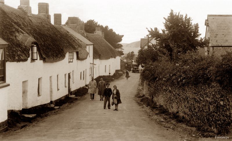
Brixham’s harbour front in the 1920s was dominated by the statue of William of Orange, who landed at Brixham in 1688 at the start of what became known as the Glorious Revolution. The statue, erected in 1888 to mark the 200th anniversary of the landing, stood at the harbourside as a constant reminder of the town’s place in English history.

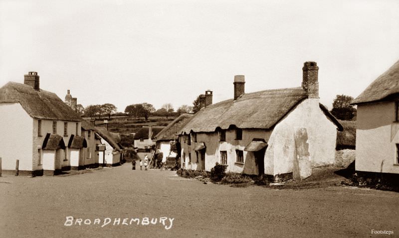
Broadhembury is a picture-perfect estate village in east Devon, largely owned by the Drewe family for generations. Its thatched, colour-washed cottages lining the village lane made it one of the most visually preserved villages in the county. Little about its appearance had changed since the 18th century, and by the 1920s that consistency was itself part of its character.
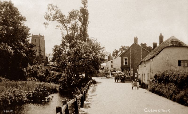
Culmstock sits in the Culm Valley in east Devon, a quiet agricultural parish with a church featuring an unusual yew tree growing from its tower. The village was surrounded by dairy farms, and the Culm Valley Light Railway, opened in 1876, connected communities like Culmstock to the wider rail network and the markets beyond.
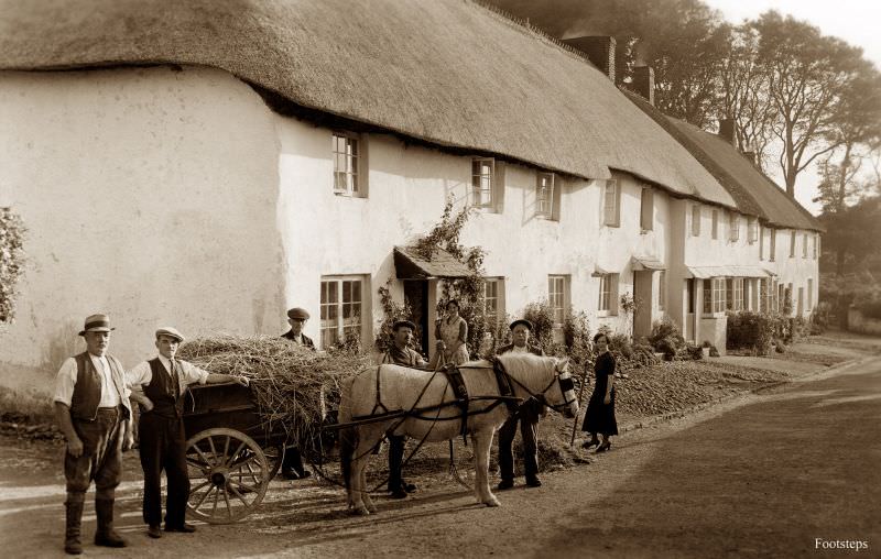
Prixford is a tiny hamlet in North Devon, near Barnstaple. Places like Prixford were the smallest units of Devon’s rural landscape — a cluster of farms, perhaps a handful of houses, and little formal infrastructure. Photographs of such places are rare, making images like this one especially valuable as historical records.
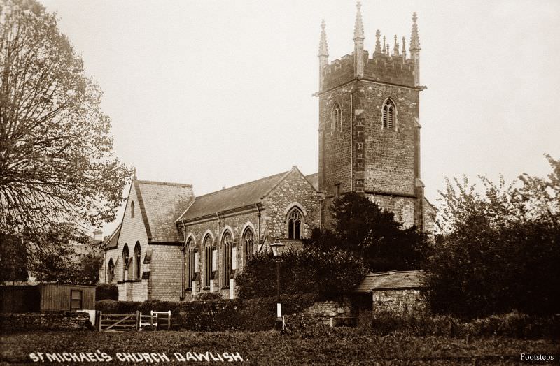
St Michael’s Church in Dawlish served the growing resort town through the Victorian era and into the 20th century. As Dawlish expanded to accommodate more tourists and permanent residents, the church remained a fixed point in the town’s identity. Its tower was visible from much of the surrounding area.
St Michael’s Church in Honiton served as the parish church for this east Devon market town. Honiton’s church history is complex — the original medieval church burned down in one of the town’s several devastating fires, and the current building dates largely from the 18th and 19th centuries. By the 1920s it stood as a solid, well-established presence in a town that had rebuilt itself more than once.