
Sitting about 65 kilometers west of Sydney, the Blue Mountains of New South Wales have drawn visitors for well over a century. The range stretches across roughly 800 square kilometers of eucalyptus forests, deep valleys, and dramatic sandstone cliffs. Today it holds UNESCO World Heritage status, but these photographs take us back to 1900 — when the mountains were just beginning to open up to tourism and the camera was still a rare tool in the field.
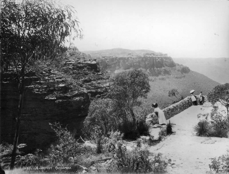
Katoomba was the beating heart of early Blue Mountains tourism. Perched on the escarpment edge, its lookouts gave visitors their first real sense of the scale below. The Jamison Valley drops sharply from the plateau, and photographs from these vantage points capture that sense of depth in a way few places in Australia can match.
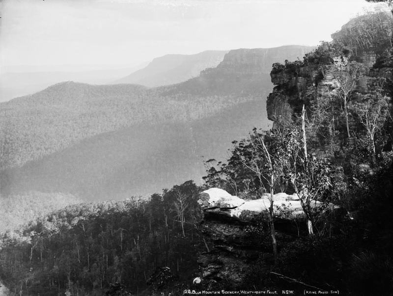
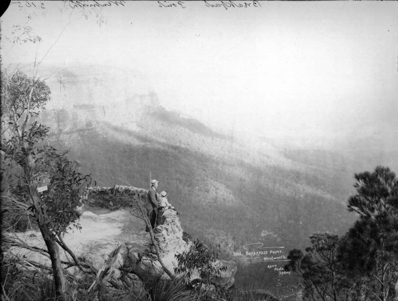
Wentworth Falls was another popular stop along the Great Western Railway line. Breakfast Point offered sweeping views across the valleys, and the walking tracks nearby wound through bush that had seen European boots for fewer than a hundred years. Indigenous Australians, however, had lived across this landscape for thousands of years before any railway was laid.
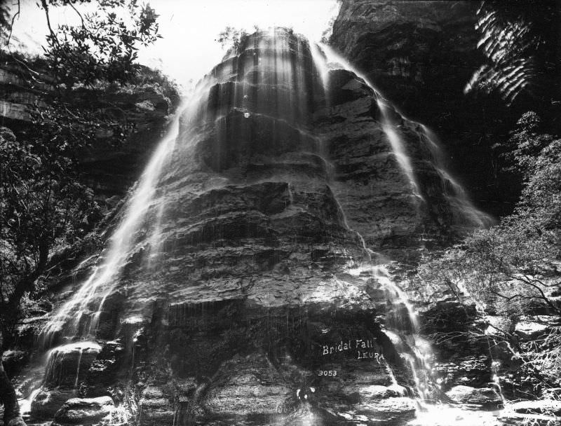
Leura’s waterfalls were a major draw for early visitors. Bridal Falls and Sylvia Falls both cascade down the cliffline into the valley below, fed by the plateau’s reliable rainfall. The town of Leura itself became known as one of the more refined stops on the mountain circuit, with well-kept gardens and guesthouses catering to Sydney day-trippers.
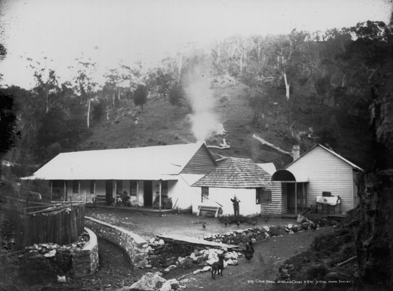
West of Katoomba, the Jenolan Caves system was one of the most remarkable natural attractions in colonial New South Wales. Caves House served as the accommodation base for visitors making the journey to explore the limestone caverns. The caves had been known to European settlers since the 1830s, and by 1900 guided tours were already a well-established part of the experience.
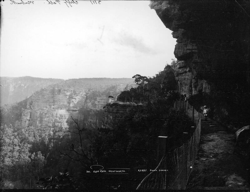
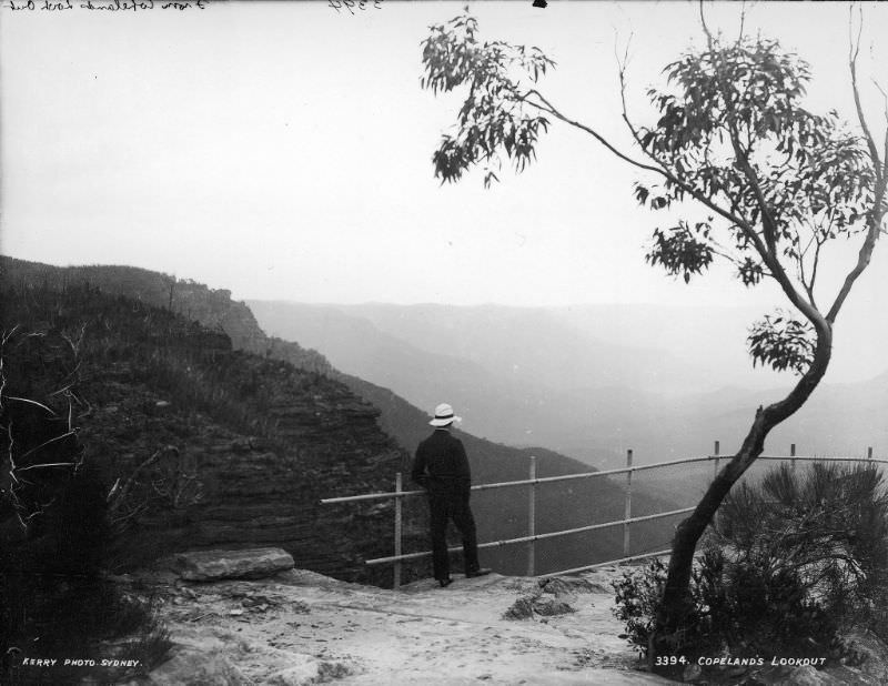
The cliff paths that edged the escarpment were both a thrill and a test of nerve for Victorian-era walkers. Dressed in the full attire of the day — long skirts, boots, and coats — visitors navigated narrow tracks cut into sandstone ledges high above the valley floor. Lookouts like Copeland’s rewarded the effort with panoramas that stretched for miles.
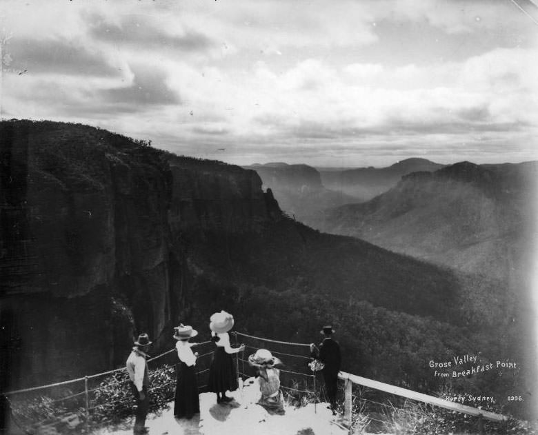
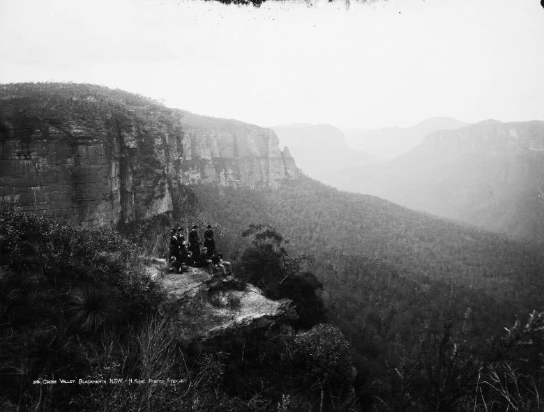
North of Katoomba, the Grose Valley cuts a vast gorge into the plateau. Viewed from Blackheath — the highest town in the mountains — the valley appears almost impossibly wide and green. The township of Blackheath sits at around 1,000 meters above sea level, and the views from its rim lookouts were considered among the finest in the entire range.
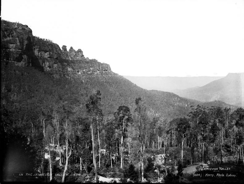
The Jamison Valley spreads out below Katoomba’s southern cliffs. In 1900, the valley floor was largely untouched bushland. The Katoomba Scenic Railway, which descends into this valley, was already in operation — built originally to transport coal and shale, then repurposed as the world’s steepest passenger railway to carry tourists down the near-vertical cliff face.
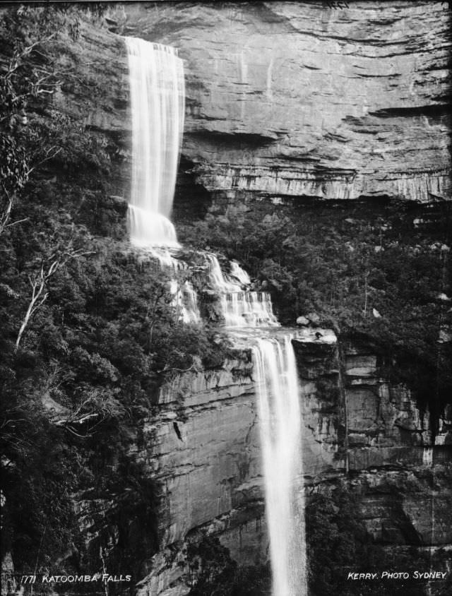
Katoomba Falls drops in stages over the cliff edge, feeding streams that wind through the valley below. The falls were easily accessible from the town and became one of the first natural landmarks that new arrivals sought out. Early photographers found them a reliable subject — long exposures gave the water a silky, dramatic appearance that printed well on glass plates.
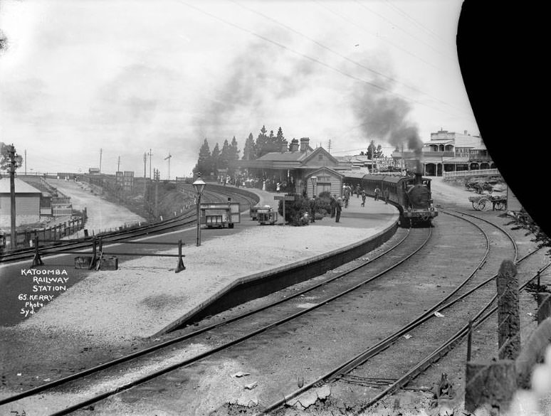
Katoomba Railway Station was the gateway to the mountains for most visitors. The Great Western Railway line had connected Sydney to Katoomba since 1874, making the town accessible for a day trip or a longer stay. By 1900 the station was busy with weekend travelers, and the surrounding streets were filling with hotels and guesthouses to meet the demand.
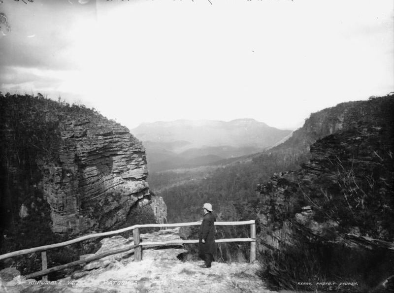
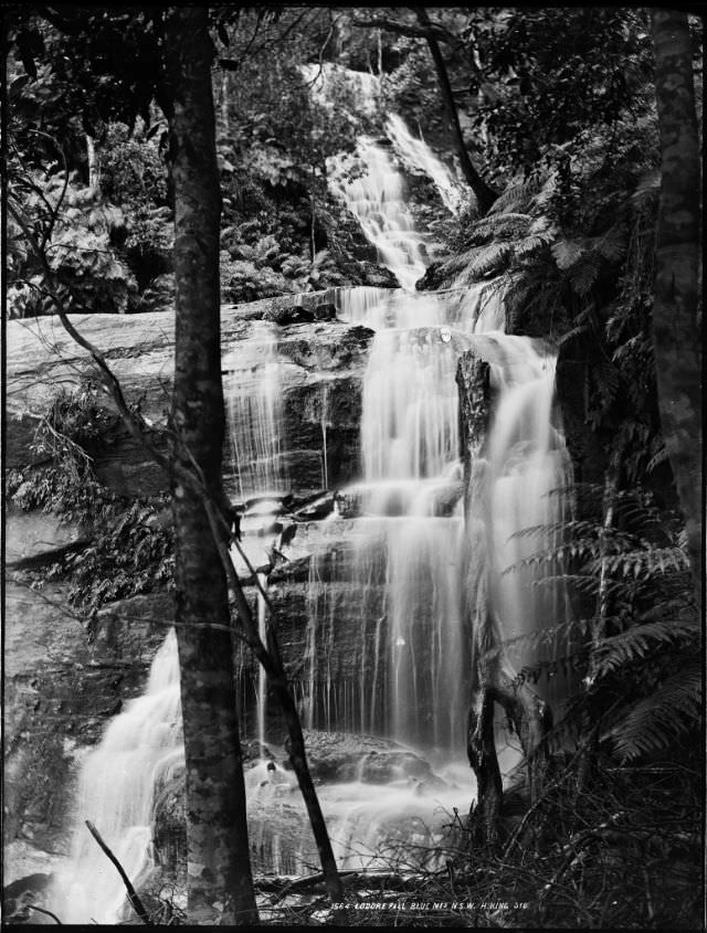
The valleys visible from Katoomba’s rim each carried their own character. Lodore Fall was one of several lesser-known cascades that rewarded visitors willing to venture beyond the main tourist circuits. Many of these falls were only reachable on foot, and the bush tracks leading to them were rough by any standard.
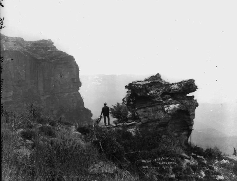
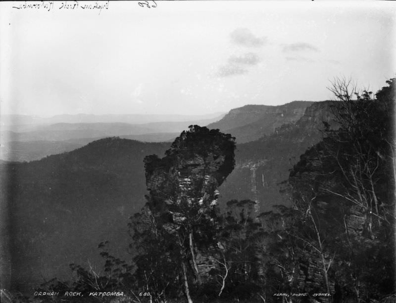
Narrow Neck is a long sandstone plateau that juts south from Katoomba like a peninsula, with deep valleys on either side. Walking its length gave visitors a genuine sense of isolation — the cliffs fell away sharply on both sides, and on clear days the visibility stretched deep into the Blue Mountains wilderness. Orphan Rock, nearby, stood as one of the area’s most photographed sandstone columns.
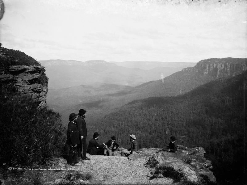

Perry’s Lookdown at Blackheath offered one of the most direct views into the Grose Valley. The descent from the lookout into the valley was steep and used by only the most serious bushwalkers. Prince Regent’s Glen near Wentworth Falls was a quieter, more sheltered spot — a glen of tree ferns and moss-covered rock that offered a very different mood from the open cliff-top vistas.
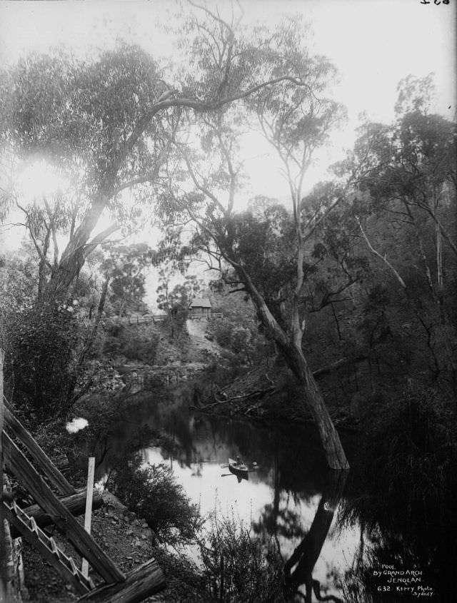
The Grand Arch at Jenolan is one of the largest natural tunnel arches in the world. A dark pool sits inside it, reflecting the rock ceiling above. In 1900 visitors reached Jenolan by horse-drawn coach after a long journey from Katoomba. The caves themselves were lit with candles and kerosene lamps, which cast long shadows across the formations inside.
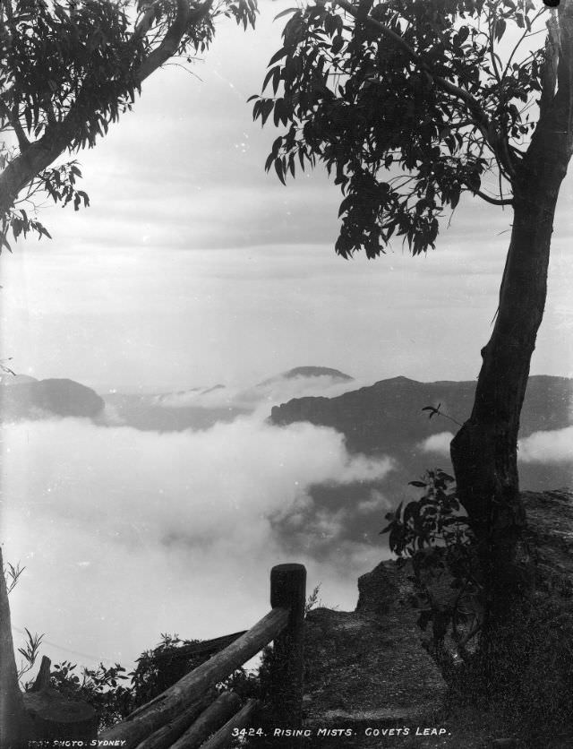
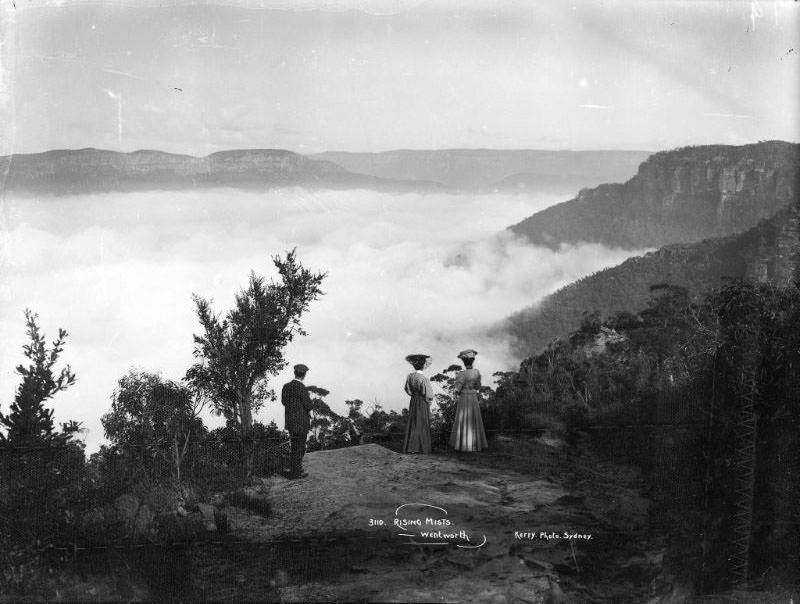
Morning mist was a defining feature of the Blue Mountains at the turn of the century, just as it is today. At Govetts Leap in Blackheath, the mist rises from the Grose Valley in great rolling waves after rain. Photographers in 1900 captured this effect with remarkable clarity, and these images stand as some of the most atmospheric records of the landscape from that era.
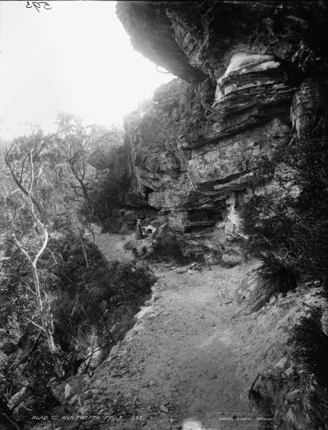
The roads connecting the mountain towns in 1900 were mostly unsealed tracks carved through the bush. Horse-drawn vehicles were the standard mode of travel between townships, and the roads reflected the engineering limitations of the time. This photograph of the road to Wentworth Falls gives a rare ground-level view of what daily travel through the mountains actually looked like.
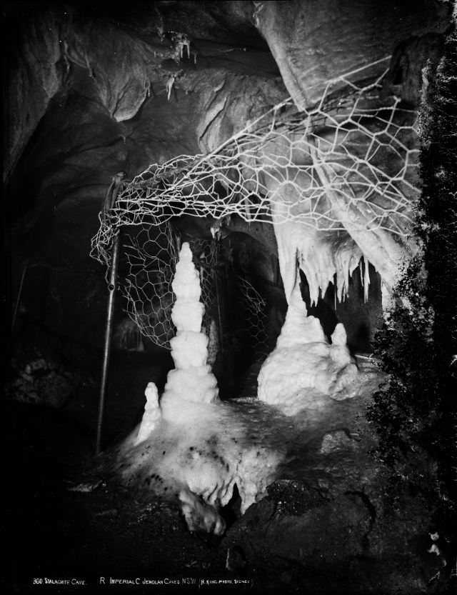
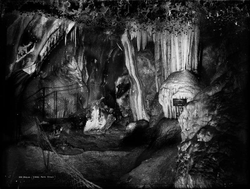
Inside the Jenolan cave system, formations like those in the Imperial Cave had been building for millions of years. Stalactites hung from the ceilings and stalagmites rose from the floors, some meeting in the middle to form columns. Early visitors were guided through these chambers with handheld lamps, and the photographs taken inside — given the technology of the time — are technically impressive achievements.
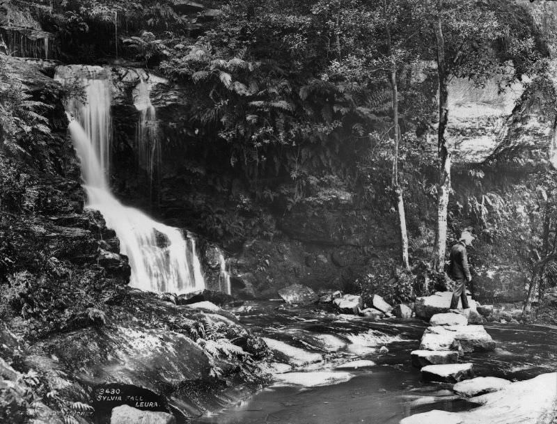
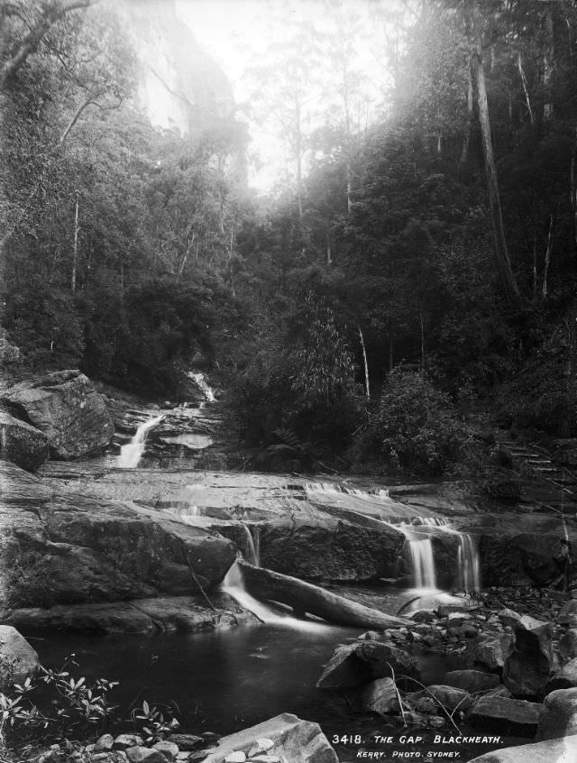
The Gap at Blackheath is a narrow pass through the cliff line that funnels views directly into the Grose Valley. At Leura, Sylvia Falls drops in a clean single plunge into a fern-filled grotto below. Both locations were accessible from well-worn walking tracks and featured regularly in the tourist guides and postcards of the early 1900s.
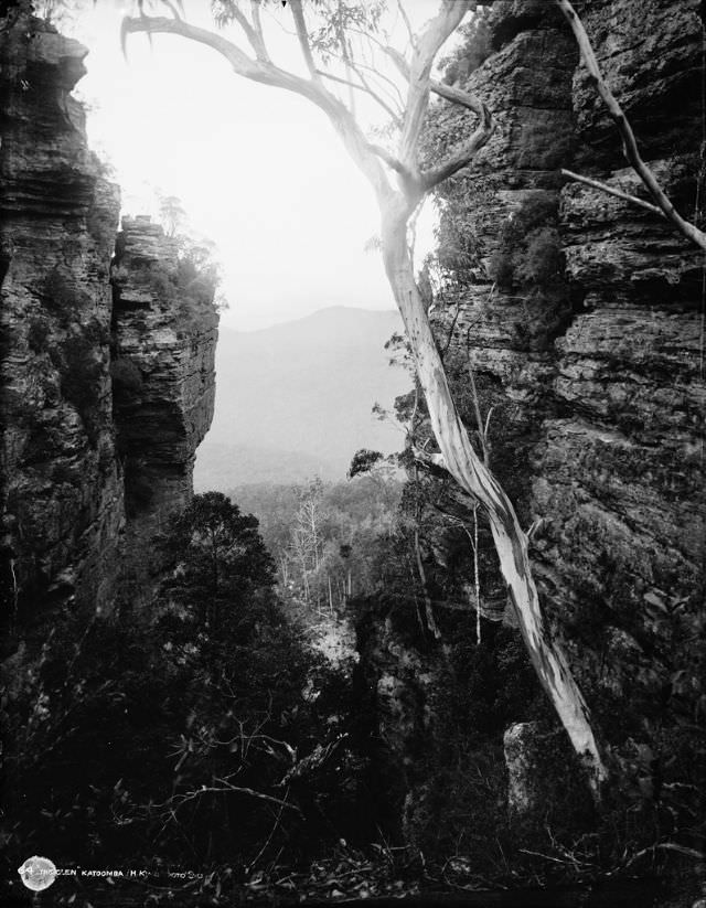
The Glen near Katoomba was a sheltered bush retreat close to the town center. Ferns, mosses, and creek stones lined the path through it, offering a cooler and more enclosed experience than the open cliff edges. For visitors not inclined toward strenuous walking, spots like The Glen provided a gentler connection to the natural environment.
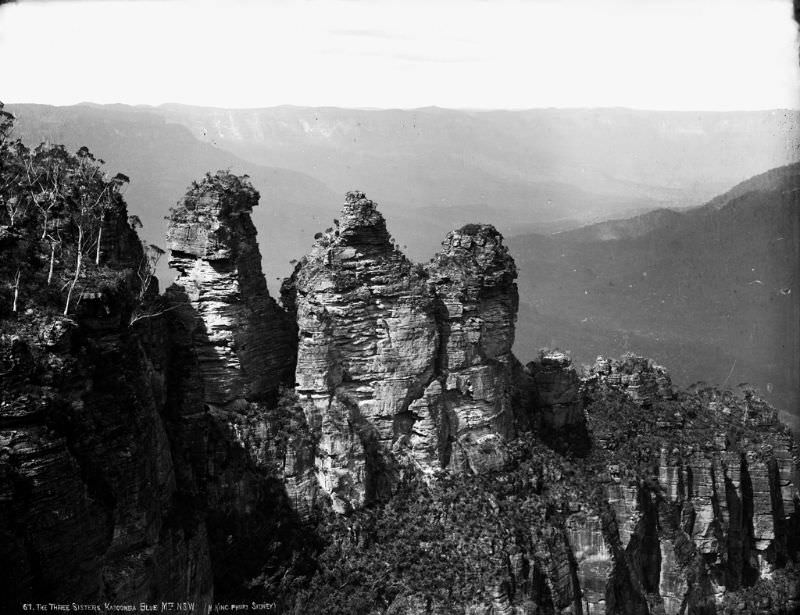
The Three Sisters are three sandstone pillars rising from the escarpment edge at Echo Point, Katoomba. They stand at heights of 922, 918, and 906 meters above sea level. By 1900 they were already the most photographed feature in the Blue Mountains, and this image captures them in their full form — stark, angular, and surrounded by the valley that defines the entire region.
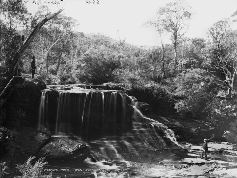
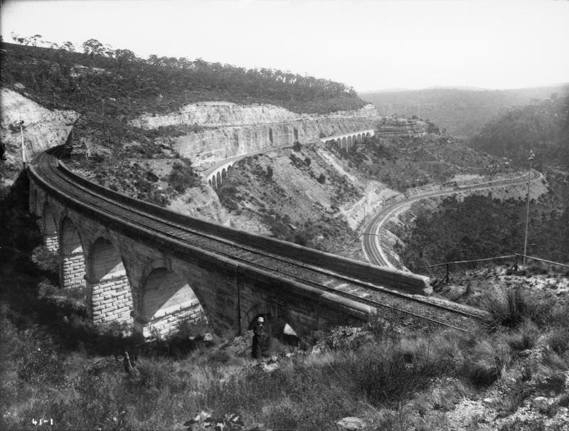
Weeping Rock at Wentworth Falls was named for the constant seepage of water through its sandstone face, creating a thin veil of moisture across the rock surface year-round. The Zig Zag Railway, photographed here in 1900, was an engineering solution to the steep descent of the Blue Mountains escarpment. Built in the 1860s, it used a series of reversing passes to bring trains down the cliff face before a tunnel replaced it in 1910.




