Hey There! Before You Go. 😧
Get the best vintage content straight into your inbox!

Don't worry, we don't spam

1970s Manchester: Fascinating Pictures That Give A Complete Snapshot of Old Manchester

The 1970s were a turbulent decade for Manchester. Heavy industry was shrinking fast, thousands of workers lost their jobs, and the city’s leaders found themselves stripped of many of the powers they had held for generations. Control over key services shifted to broader regional authorities. The airport was taken out of Manchester’s direct hands. Even the city’s iconic red buses — a symbol Mancunians had known for decades — were repainted in a jarring orange and brown under a new regional transport authority.
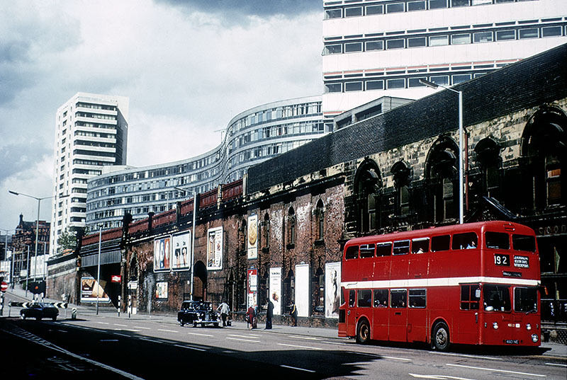
Manchester's famous red buses became grotesque pop orange and brown (London Road, 1975)
Manchester’s famous red buses became grotesque pop orange and brown (London Road, 1975)
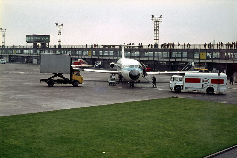
The airport was taken out of Manchester's hands
The airport was taken out of Manchester’s hands

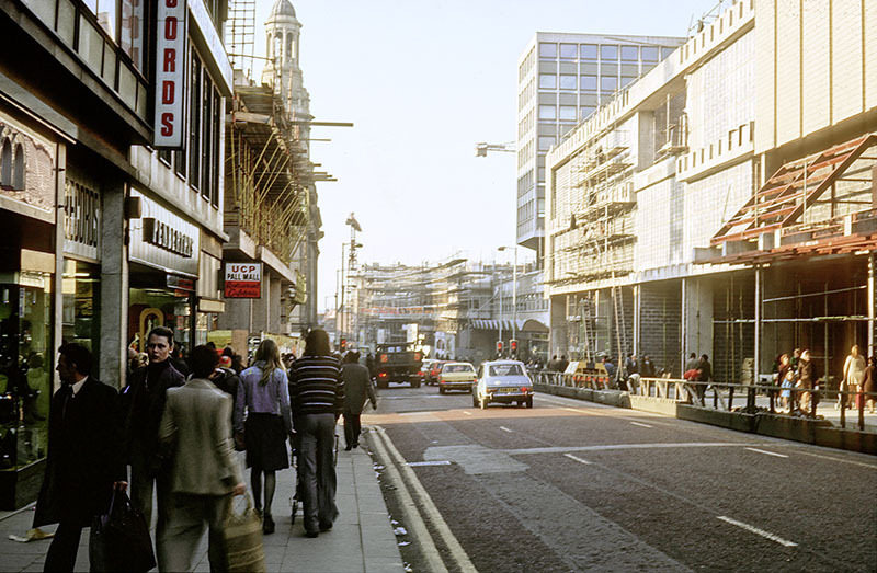
The single biggest physical change to hit the city centre during this decade was the Manchester Arndale Centre. Construction tore through Market Street and the surrounding area for years, with scaffolding and hoardings becoming a permanent feature of the streetscape throughout much of the 1970s. When the Arndale finally opened, it was one of the largest city-centre shopping centres in Europe — and one of the most criticised for its appearance.
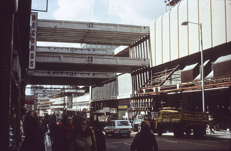
View along Market Street during construction of the Arndale Centre

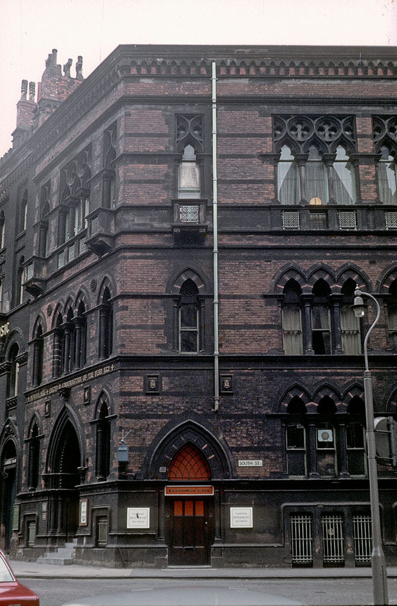
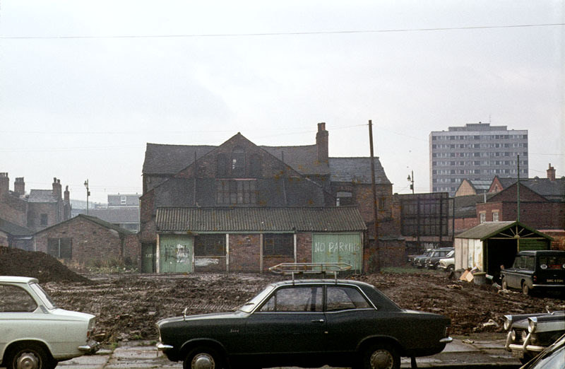
As new developments rose across Manchester, older buildings were cleared to make way. The Oxford Pub, known for its ornate Victorian design, was demolished during this period. The site did not become something grander — it was turned into a car park.
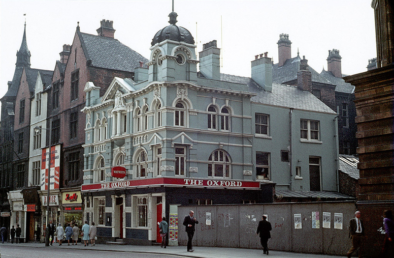
The opulent Oxford Pub was demolished and later became a car park

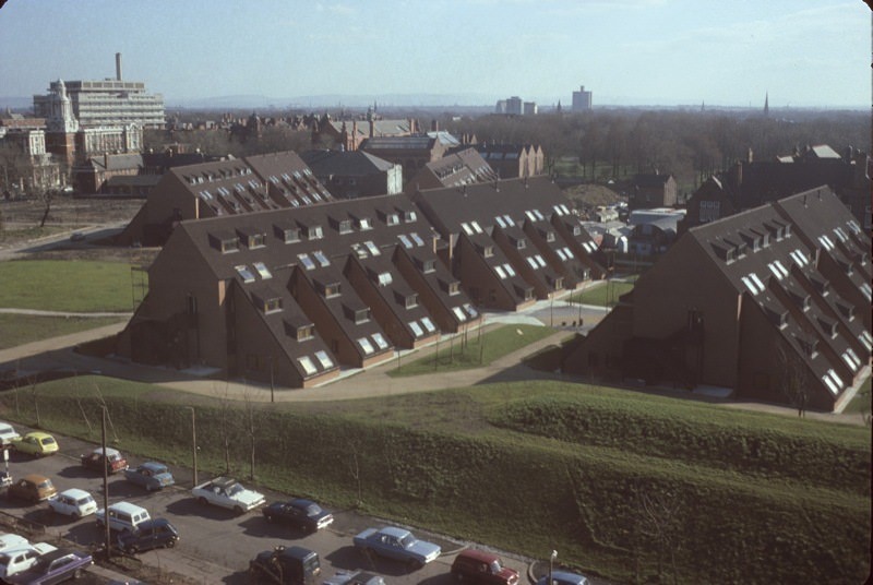
Hulme was one of the most dramatic examples of 1970s planning in action. The area had been almost entirely redeveloped in the late 1960s and early 1970s, replacing traditional terraced streets with a network of deck-access crescents, elevated walkways, and tower blocks. The design was bold on paper — residents could walk between buildings without ever touching the ground. In practice, the estate quickly became known for serious social problems.
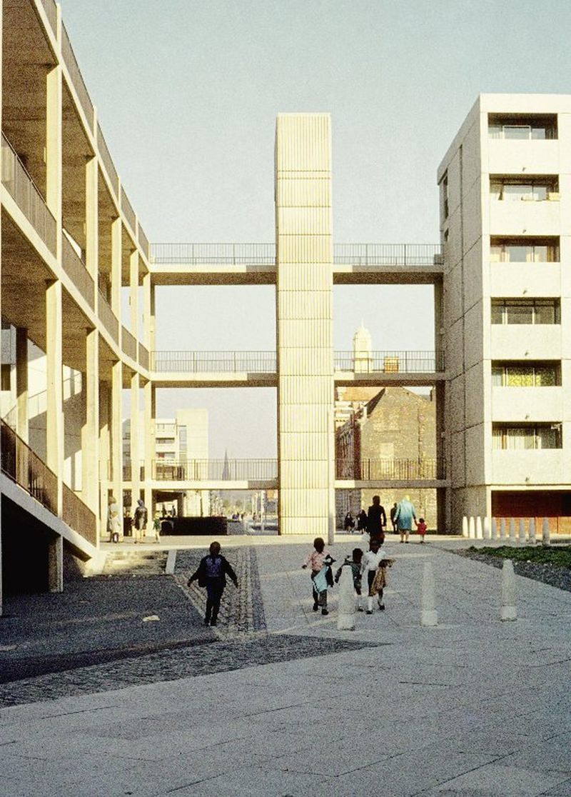
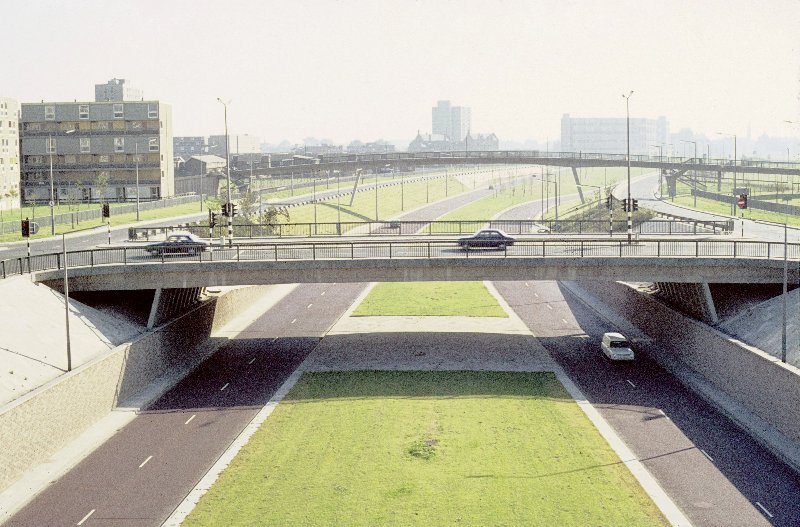
View along Hulme Walk in 1972, showing lift tower and walkways linking Charles Barry Crescent, Robert Adam Crescent and Hawksmoor Close.
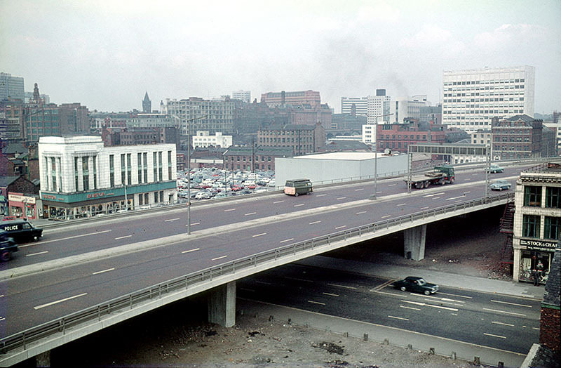
The elevated section of the Mancunian Way, crossing Oxford Road. Taken from the Cavendish School at All Saints, c. 1970.

Oxford Road ran like a spine through the changing city, connecting the university quarter to the centre. Along its length, you could see old and new Manchester side by side — Victorian brick buildings standing next to modernist concrete blocks, boarded-up shops beside newly opened institutions.
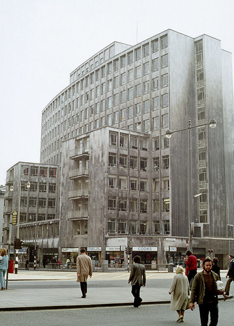
Peter House on Oxford Street/St Peter's Square in 1972
Peter House on Oxford Street/St Peter’s Square in 1972
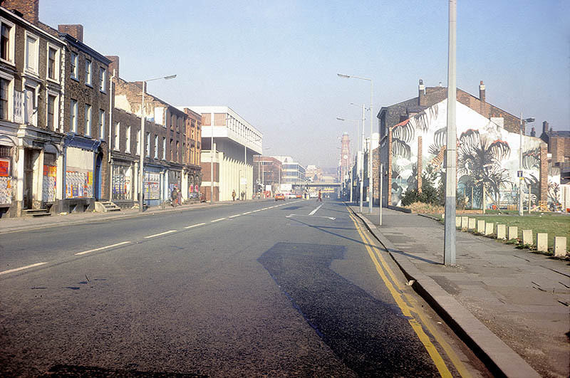
View from Hulme Walk footbridge looking south along Princess Road, 1972
View across Oxford Road at All Saints, looking east from the Chatham Building, November 1970.

Manchester Polytechnic was a growing force in the city’s cultural life during the 1970s. Its Faculty of Art and Design produced students who were already working at a professional level while still studying. Annual fashion shows at the Polytechnic drew attention, and degree shows displayed work that reflected both the creativity and the political mood of the era.
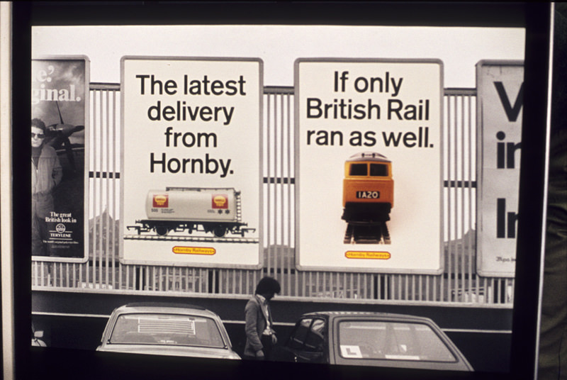
Advertisement by a Graphic Design student displayed in the degree show at Manchester Polytechnic's Faculty of Art and Design in 1978.
Advertisement by a Graphic Design student displayed in the degree show at Manchester Polytechnic’s Faculty of Art and Design in 1978.
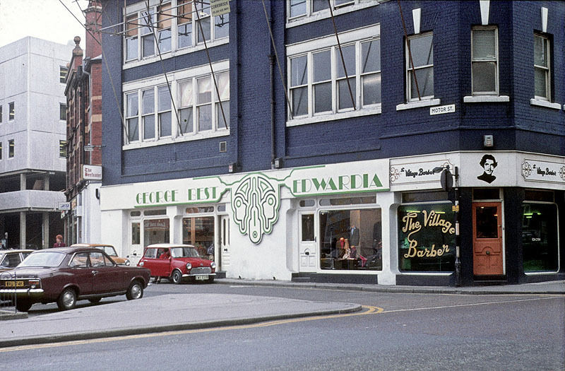
George Best's 'Edwardia' boutique on Motor Street, about 1972.
George Best’s ‘Edwardia’ boutique on Motor Street, about 1972.
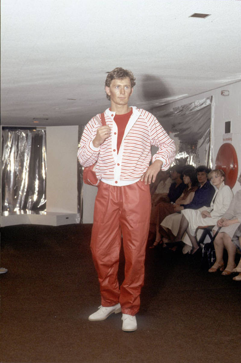
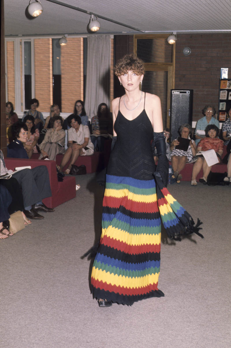
Model wearing clothes designed by a student at Manchester Polytechnic Faculty of Art and Design's fashion show, 1979
Model wearing clothes designed by a student at Manchester Polytechnic Faculty of Art and Design’s fashion show, 1979

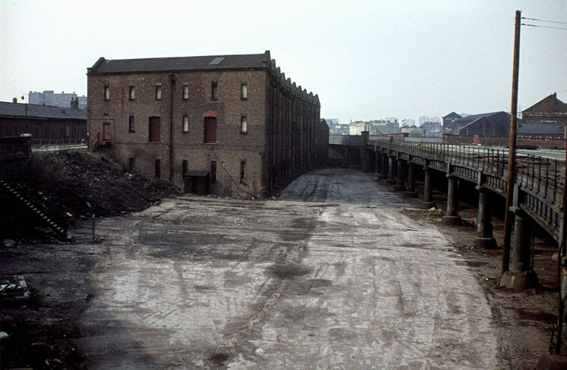
Manchester Central Station closed to passengers in 1969, and by the mid-1970s its vast iron-and-brick train shed stood empty on Windmill Street. The future of the building was uncertain for years. Meanwhile, the railway heritage of Liverpool Road — the world’s oldest surviving passenger railway station — also came to an end, with that site closing in 1975.
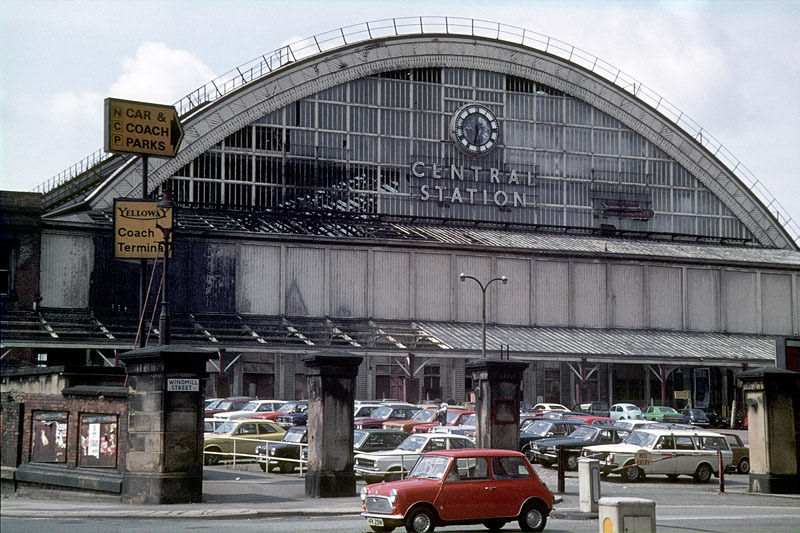
Manchester Central Station from Windmill Street, around 1975.
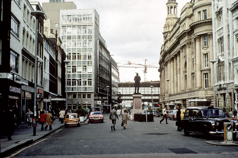
View of St Ann's Square, from the church towards St Mary's Gate in 1976.
View of St Ann’s Square, from the church towards St Mary’s Gate in 1976.
View north along Deansgate in June 1976.

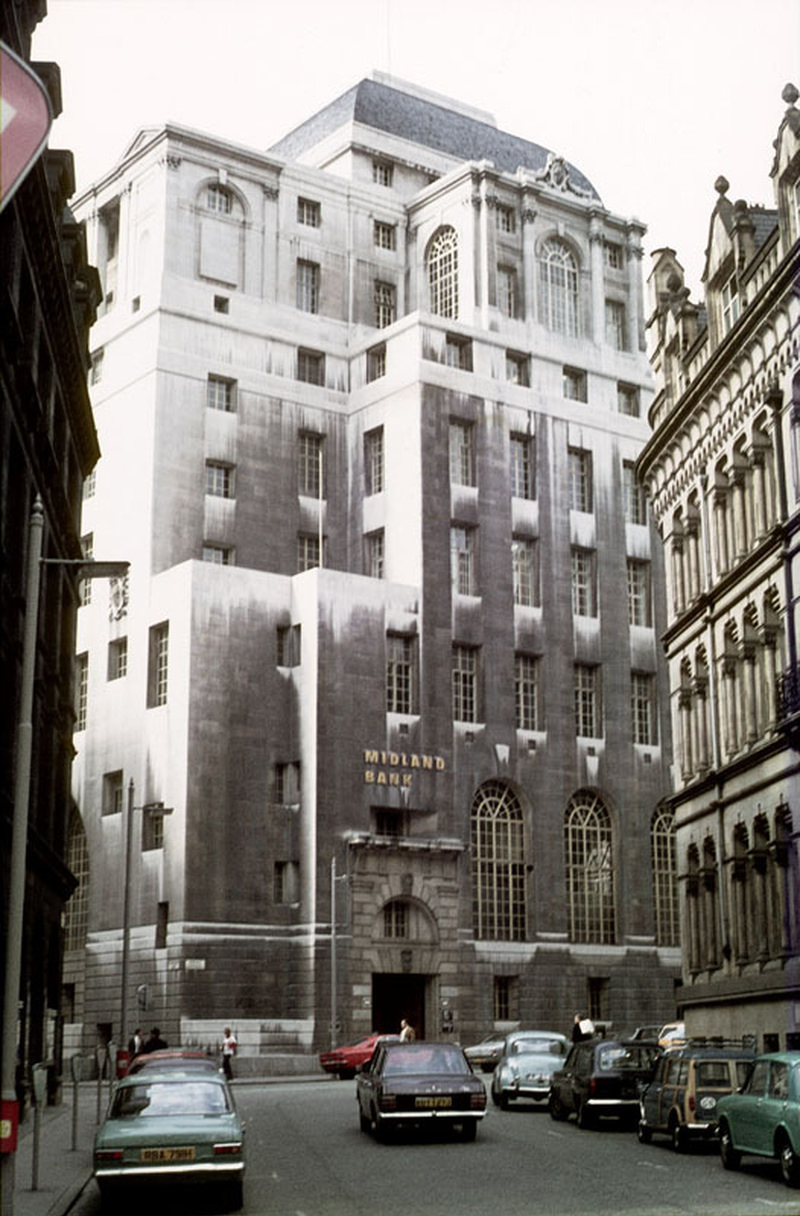
Deansgate and its surroundings saw their share of change. The Grosvenor Hotel at the northern end of the street was demolished around 1970. Northcliffe House stood at its junction with Hardman Street, and the Midland Bank building continued to anchor the financial district from Spring Gardens — a part of the city that still wore its Edwardian confidence proudly.
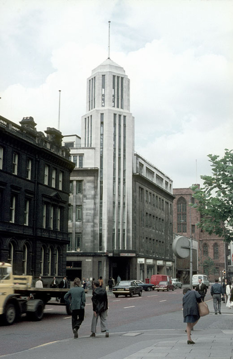
Northcliffe House at the junction of Deansgate and Hardman Street, around 1971.
The Midland Bank building from Spring Gardens, around 1971.
View north along Oxford Road, towards St Peter's Square in 1976.
View north along Oxford Road, towards St Peter’s Square in 1976.

By the end of the decade, the Arndale Centre had fully taken shape. From Cateaton Street you could see the completed exterior — a vast tiled façade that drew fierce criticism from architects and the public alike. Inside, the centre was busy and bright, a very different environment from the traditional street markets and independent shops it had displaced.
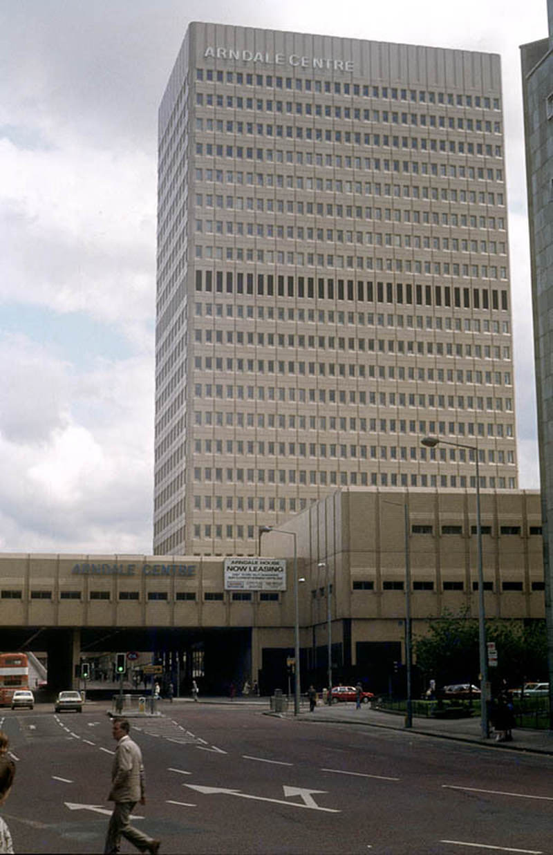
The Arndale Centre from Cateaton Street, around 1979.
Exterior of the former Bridgewater Theatre, a small Victorian music hall that occupied a site between Cambridge Street and Cowcill Street c.1973
The vault in the Lloyds Arms pub on Higher Ormond Street, All Saints, Manchester, around 1974.

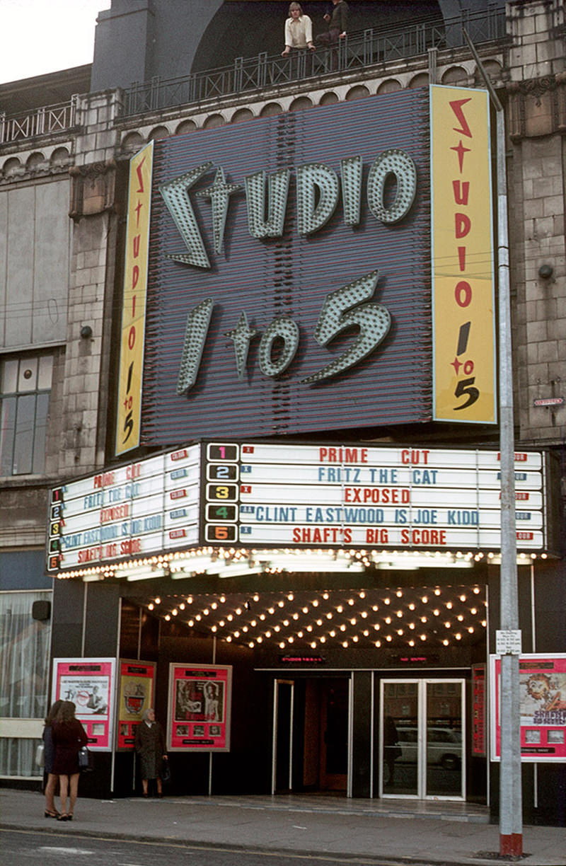
The cinema scene in Manchester was still active in the early 1970s, with several screens operating along Oxford Road and Oxford Street. The Tatler, the Studio 1 to 5, the Gaumont, the Odeon, and the Oxford cinema all drew audiences. The Tatler would later become part of the Cornerhouse arts venue, but in 1974 it was still running on its original corner site at Whitworth Street and Oxford Road Station Approach.
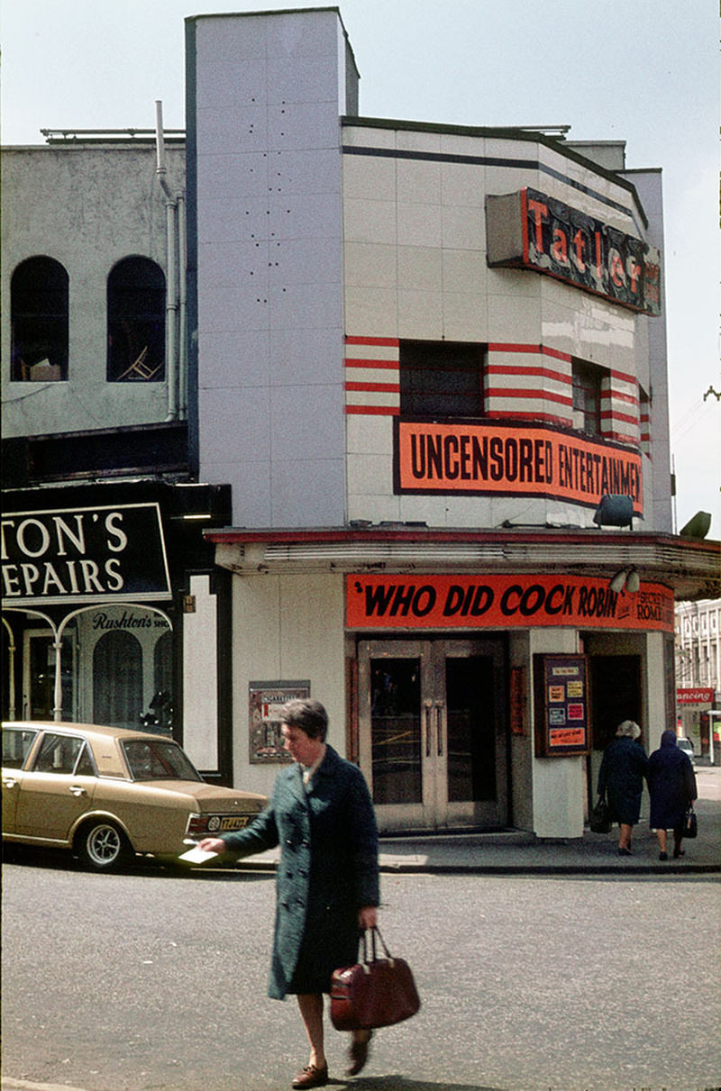
The Tatler cinema on the corner of Whitworth Street and Oxford Road Station Approach in 1974 – later became part of the Cornerhouse arts venue
The Studio 1 to 5 cinema on Oxford Road in September 1972
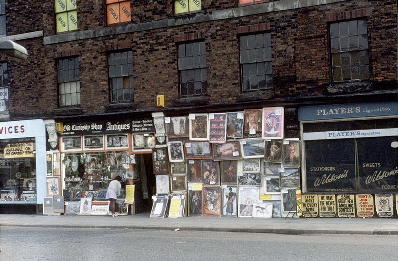
Display of posters and reproduction paintings outside the Old Curiosity Shop on Chapel Street, Salford, September 1973.

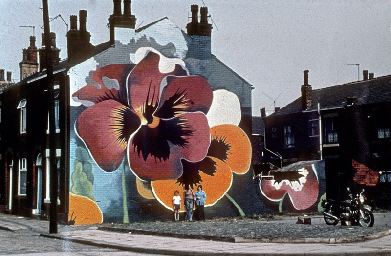
Pop culture left its mark on the physical landscape of Greater Manchester in unexpected ways. In Heywood, a large mural of Alvin Stardust was painted on the gable end of a terrace of houses. In Rochdale, artist Walter Kershaw painted a striking pansy mural on a similar end wall — part of a broader public mural movement that used blank brickwork as a canvas in working-class neighbourhoods.
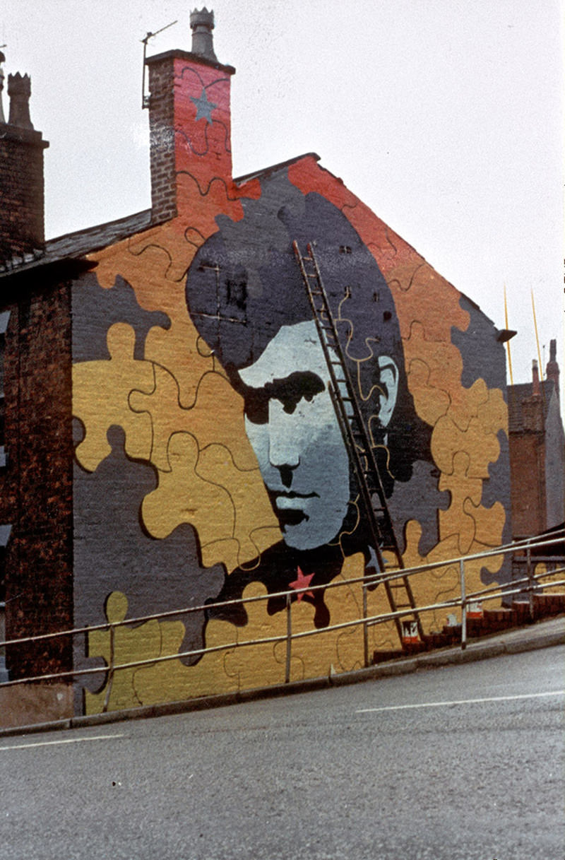
Mural depicting Alvin Stardust on the gable-end of terraced houses in Heywood, in the early 1970s.
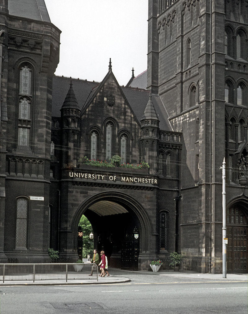
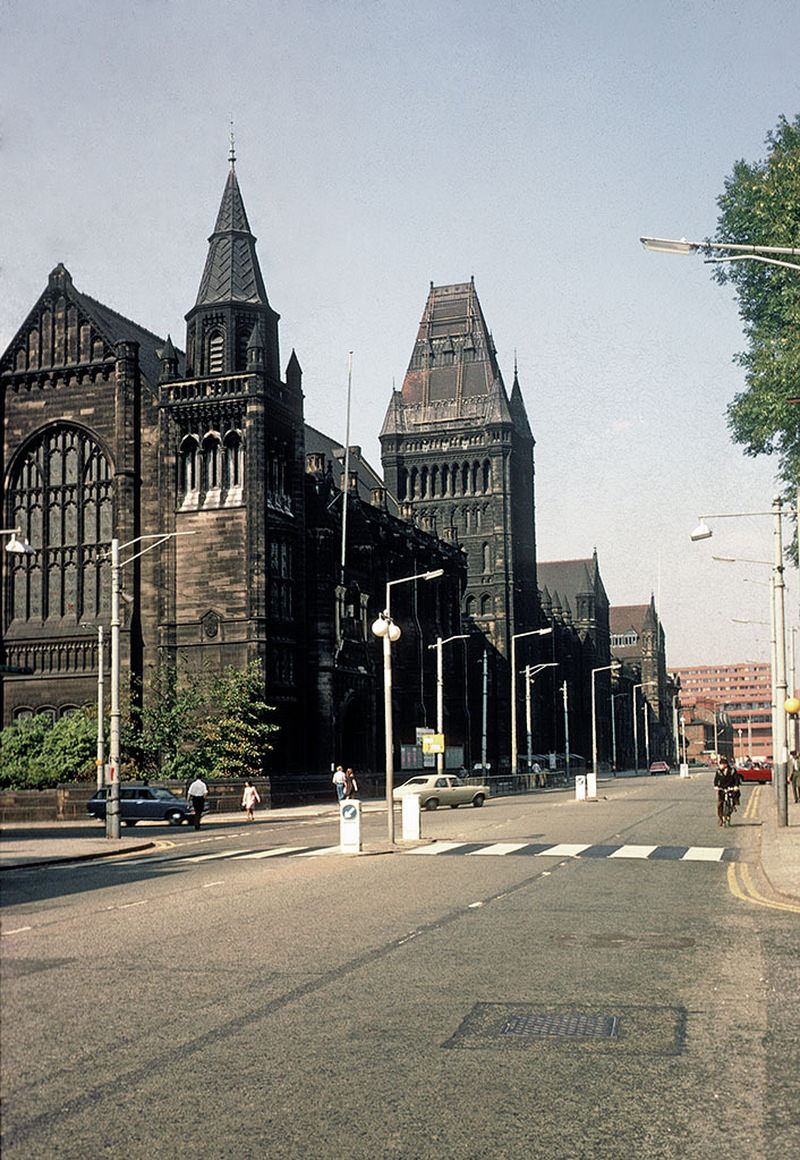
The Victorian buildings of the University of Manchester on Oxford Road, looking north towards the city centre. Photographed in September 1971.
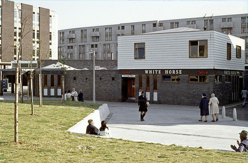
The White Horse pub on Hulme Walk, Hulme, around 1972

Not every business in 1970s Manchester was struggling. The On the Eighth Day shop at 111 Oxford Road opened as a worker-owned cooperative selling vegetarian food and wholefood products — one of the earliest of its kind in the city. On a very different note, George Best had already opened his Edwardia boutique on Motor Street around 1972, capitalising on his fame and the fashion appetite of the era.
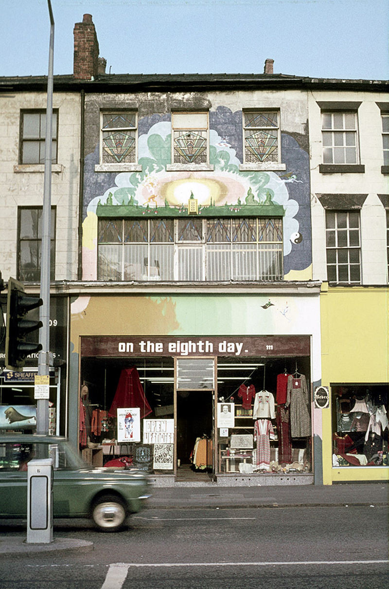
The On the Eighth Day shop at 111 Oxford Road, photographed around 1973.
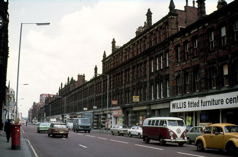
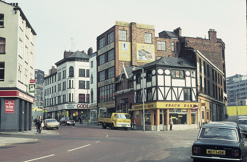
Withy Grove, Manchester, looking towards Shude Hill, around 1972.
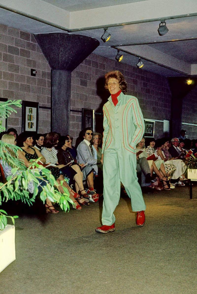
The work of a Manchester Polytechnic fashion student modelled at the Fashion Show in the Undercroft Gallery, June 1976.

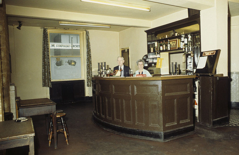
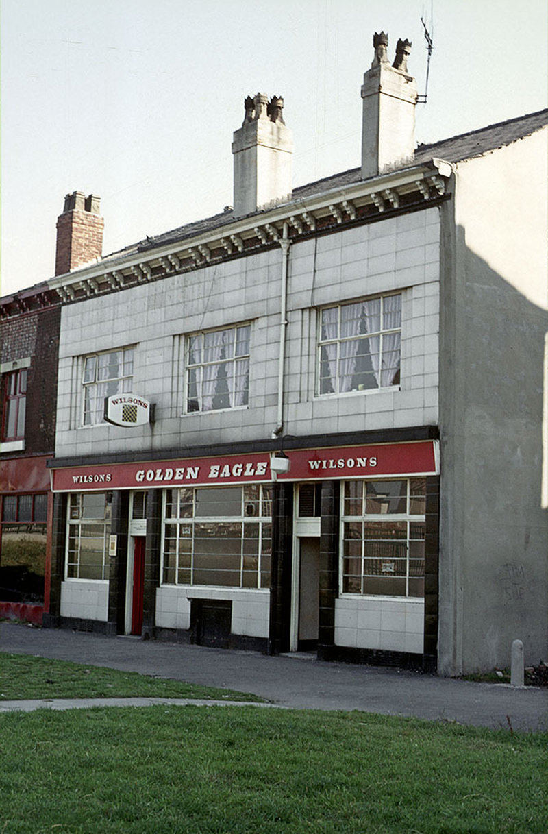
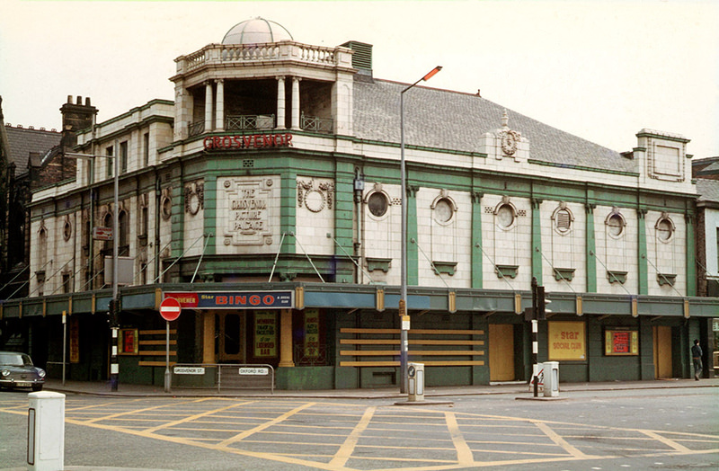
The All Saints area around Oxford Road was one of the most densely packed parts of the city for pubs, small hotels, and local institutions. The Cavendish Hotel, the Church Inn on Cambridge Street, and the Eagle and White Horse pubs in Hulme all served the communities that lived and worked nearby. The Grosvenor Picture Palace at All Saints had already converted to bingo by the early 1970s, operating as the Star Bingo and Social Club.
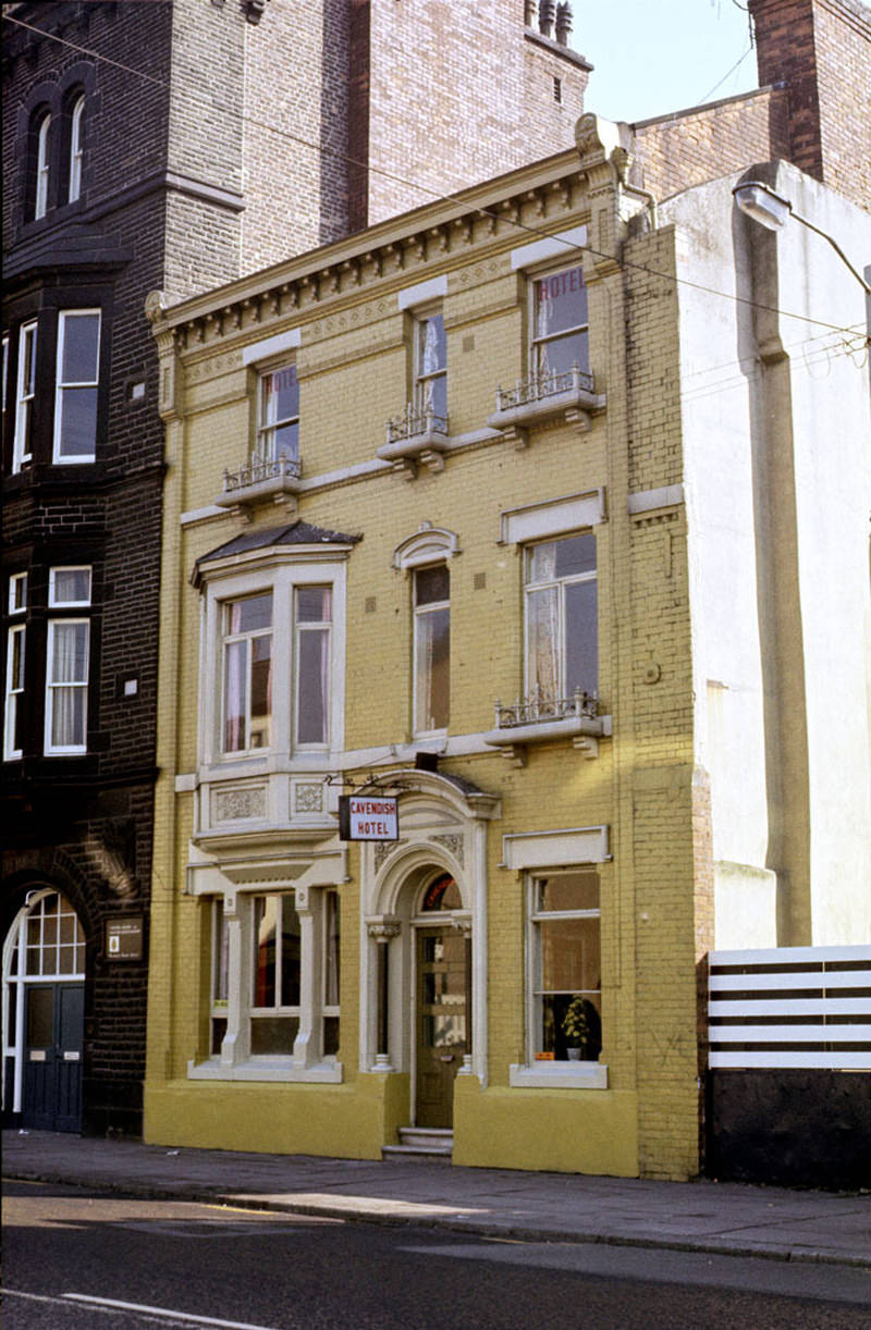
The Cavendish Hotel on Cavendish Street, All Saints, around 1972.
The Grosvenor Picture Palace at All Saints photographed when occupied by the Star Bingo and Social Club, circa 1971. The building is now The Footage pub.
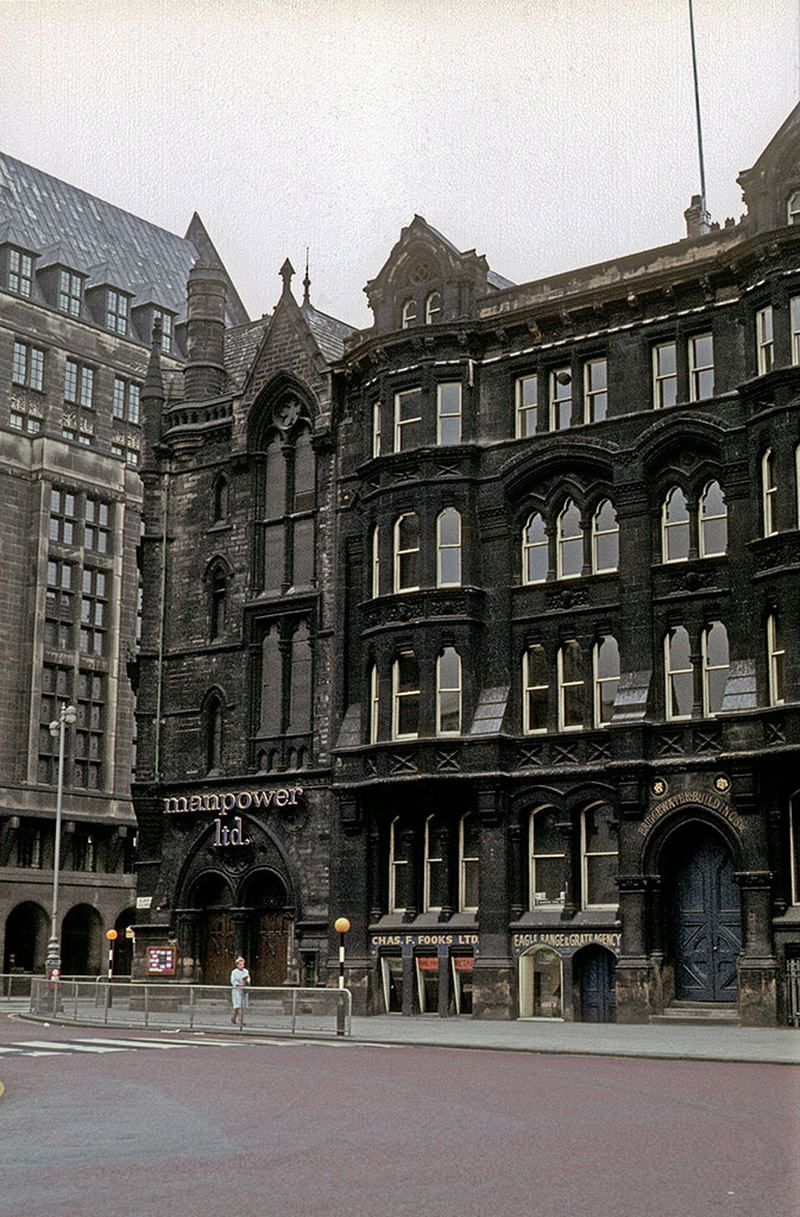
St Andrew's Chambers and Bridgewater Buildings on Lloyd Street, on the south side of Albert Square, photographed around 1970.
St Andrew’s Chambers and Bridgewater Buildings on Lloyd Street, on the south side of Albert Square, photographed around 1970.

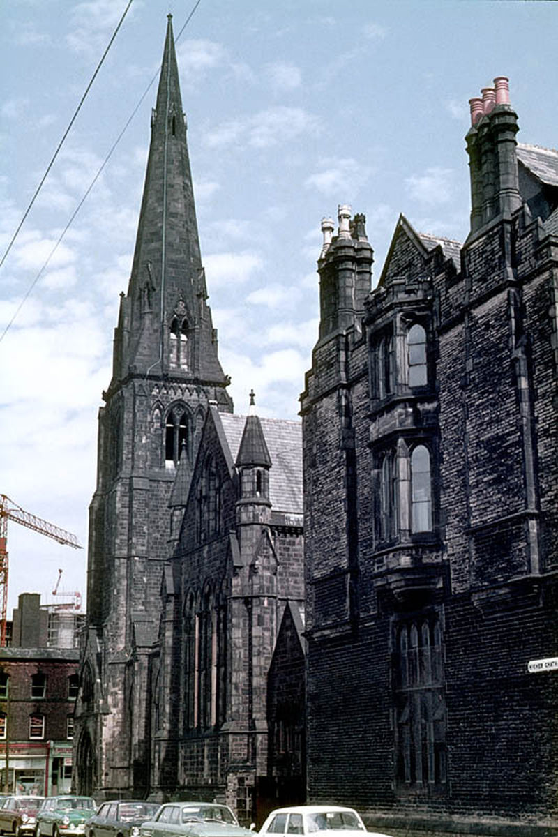
Religious buildings that had anchored communities for over a century were also disappearing. St George’s Church on Chester Road in Hulme still stood at the start of the decade, but the area around it had been fundamentally transformed by the new housing estates. The Cavendish Street Chapel and School on Higher Chatham Street were demolished in 1974 to make way for the Cavendish Building for Manchester Polytechnic.
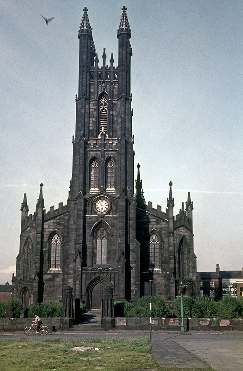
The west front of St George's church on Chester Road, Hulme, around 1970
The west front of St George’s church on Chester Road, Hulme, around 1970
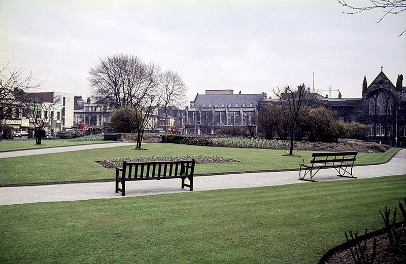
Grosvenor Square (All Saints Park), looking east towards Oxford Road, about 1970.
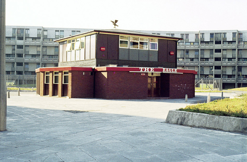
The Eagle pub on Hulme Walk, Hulme, around 1972

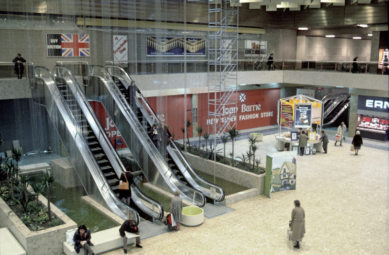
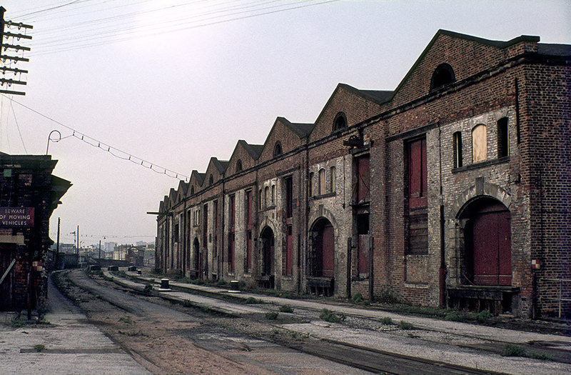
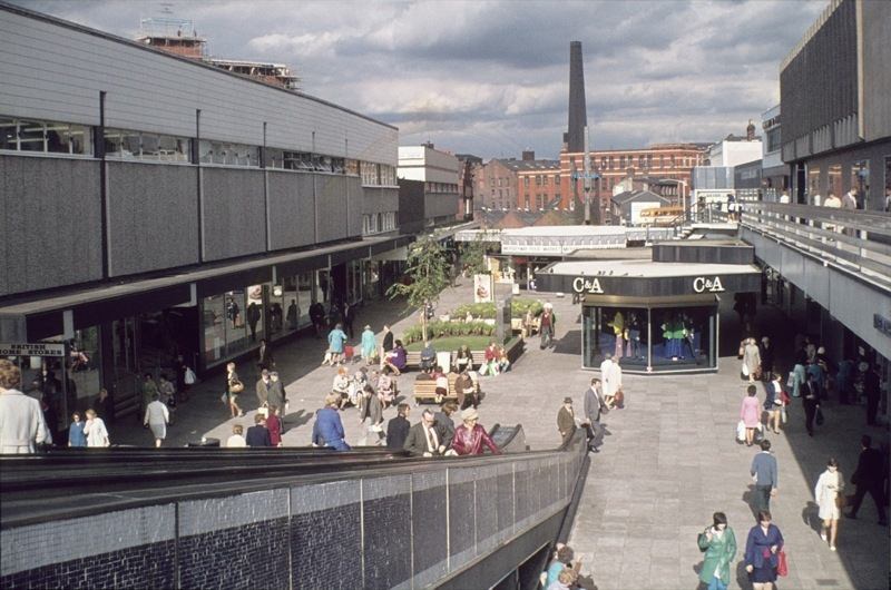
Inside the completed Arndale Centre in 1979, shoppers moved through wide concourses under artificial light, surrounded by chain stores and tiled surfaces. It was a deliberately inward-looking environment, sealed off from the streets outside. The Liverpool Road railway station, which closed in 1975, offered a sharp contrast — a relic of the industrial age sitting quietly on the edge of the city.
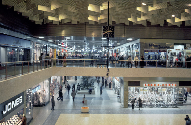
Interior of the Manchester Arndale Centre in 1979
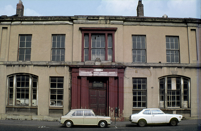
View of the Liverpool Road railway station site in Manchester, shortly after its closure in 1975.
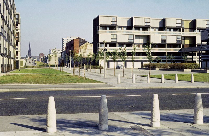
View along Hulme Walk towards All Saints, with Royce Road in the foreground and Ribchester Walk beyond

Not all of Greater Manchester’s architectural history was being lost. In Middleton, Williams and Glyn’s Bank occupied a building designed by Edgar Wood for the Manchester and Salford Bank in 1892 — a structure that stood as a reminder of the confident, ornate banking architecture of the Victorian era. In Stockport, the Merseyway shopping precinct showed that the trend toward covered retail environments was not unique to the city centre.
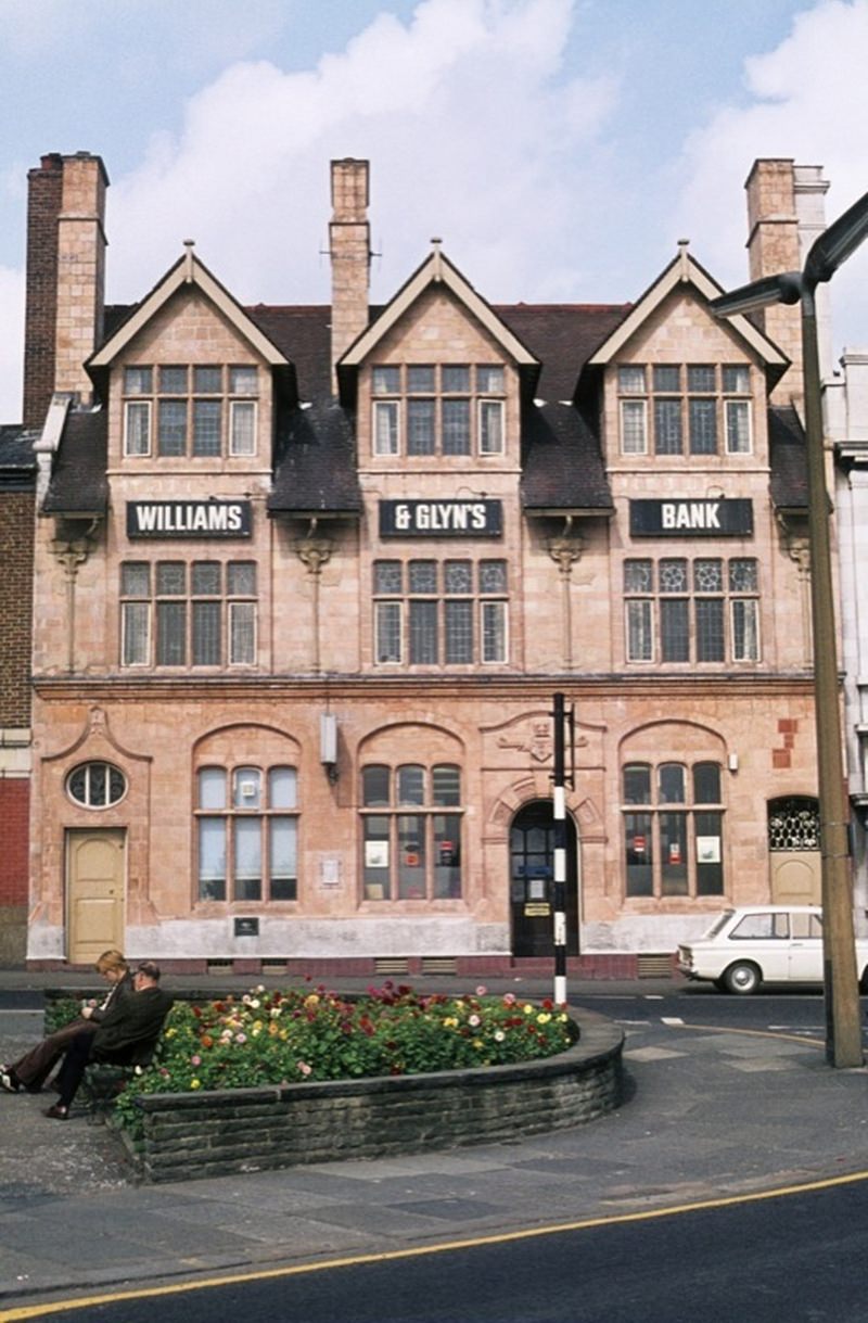
Williams and Glyn's Bank, Market Place, Middleton, early 1970s. Designed by Edgar Wood for the Manchester and Salford Bank and built in 1892.
Williams and Glyn’s Bank, Market Place, Middleton, early 1970s. Designed by Edgar Wood for the Manchester and Salford Bank and built in 1892.
The Merseyway shopping precinct, Stockport, 1973
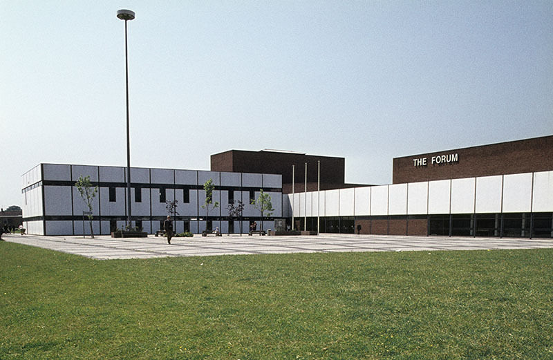
The Forum at Wythenshawe civic centre in 1975

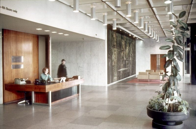
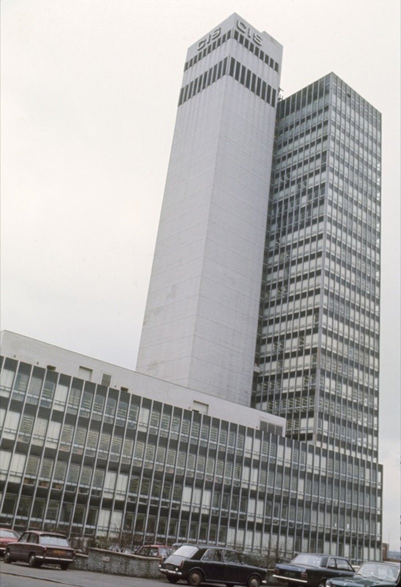
Back in the city centre, Piccadilly remained a busy focal point. The Hotel Piccadilly rose above Piccadilly Gardens, and the BBC’s Broadcasting House at Piccadilly continued to operate as the corporation’s regional base. The CIS Building on Miller Street, completed in 1962, was still one of the most recognisable modern landmarks on the skyline — its entrance hall a showcase of mid-century design.
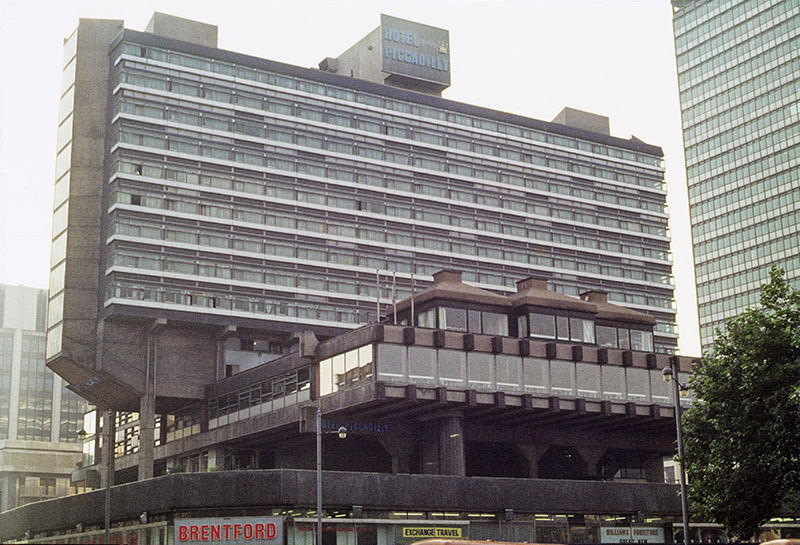
The Hotel Piccadilly from Piccadilly Gardens in 1972
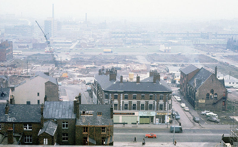
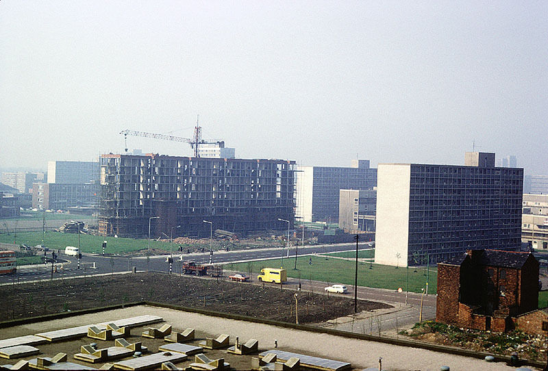
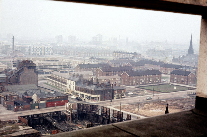
View across the northern part of Hulme from the top of the Chatham Building in November 1970
Model displaying student work at the dress show at Manchester Polytechnic's Faculty of Art and Design in 1975.
Model displaying student work at the dress show at Manchester Polytechnic’s Faculty of Art and Design in 1975.
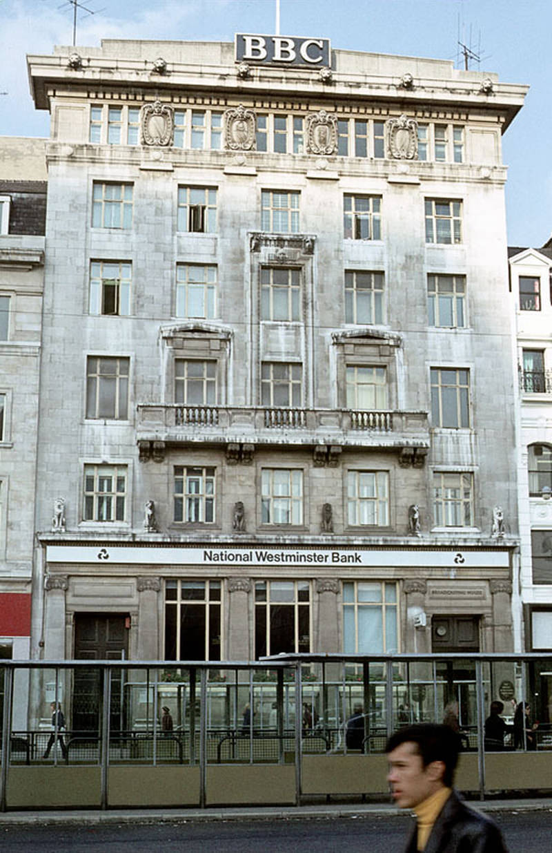
The BBC's Broadcasting House at Piccadilly, Manchester, photographed about 1970.
The BBC’s Broadcasting House at Piccadilly, Manchester, photographed about 1970.

Shudehill, Withy Grove, and the streets running between them still had the character of older Manchester in the early 1970s — low-rise buildings, market traders, and a mix of shops that predated the age of chain retail. Further south, the deck-access flats on Coverdale Crescent in Ardwick — built using the Bison wall frame system and known locally as ‘Fort Ardwick’ — represented the harder edge of 1970s housing policy.
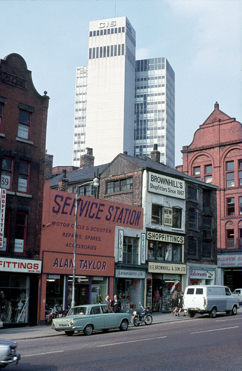
Shudehill near the junction with Nicholas Croft, around 1972.
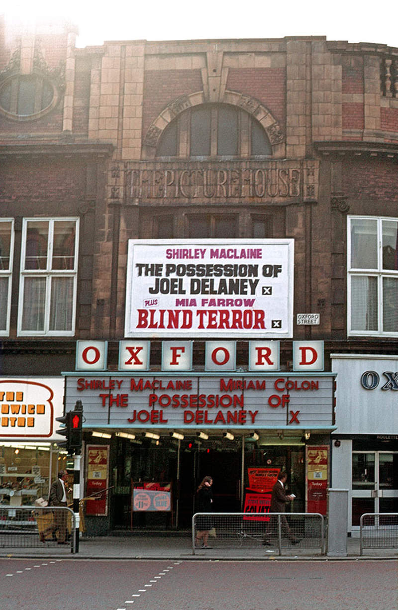
The Oxford cinema (also called the New Oxford) on Oxford Street, formerly The Picture House, in September 1972.
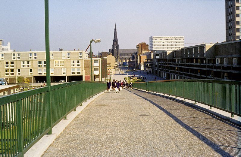
Hulme Walk footbridge, 1972

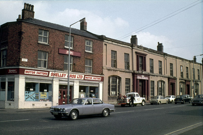
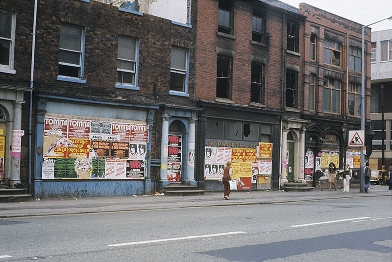
Medical facilities were also being reorganised across the city. The Manchester Ear Hospital on Lower Ormond Street was photographed in 1972–73, shortly before its services were transferred to Manchester Royal Infirmary. On Oxford Road, Georgian houses that had been converted to shops stood boarded up in 1976, waiting for decisions about their future.
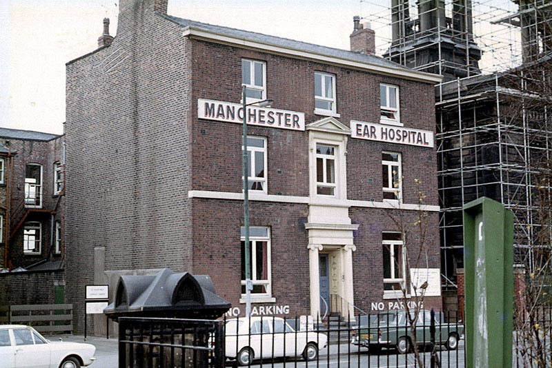
The Manchester Ear Hospital on Lower Ormond Street, photographed in 1972-3, shortly before being transferrred to Manchester Royal Infirmary
Boarded-up shops (once Georgian houses) on the west side of Oxford Road at All Saints, Manchester, 1976
The Cooper House block of flats under construction, 1973

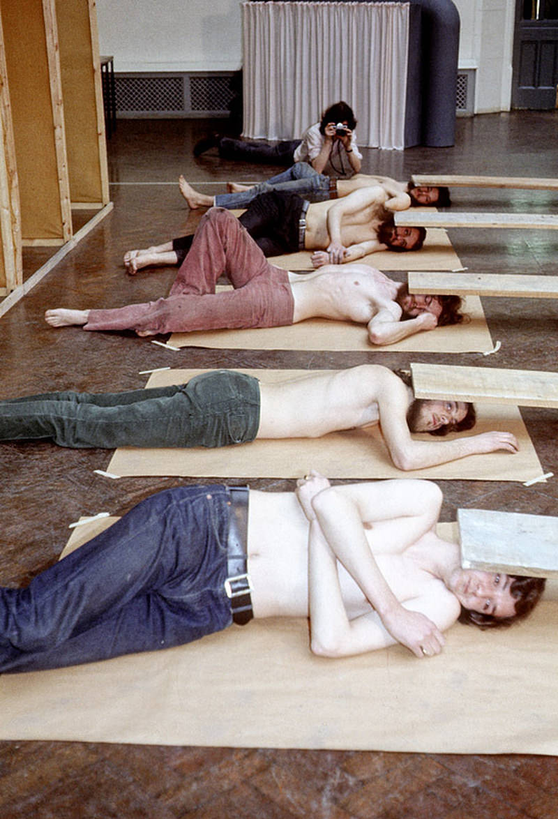
Manchester Polytechnic was expanding physically as well as academically. Loxford Tower was completed in 1974 as the first purpose-built structure for the Polytechnic, occupying part of what would later become the site of the MMU Business School. The theatre school on Cavendish Street continued to operate in older premises adjoining the Righton Building. Post-graduate sculpture students staged performances in the Faculty gallery as early as March 1971, pointing toward the experimental arts scene that would grow through the decade.
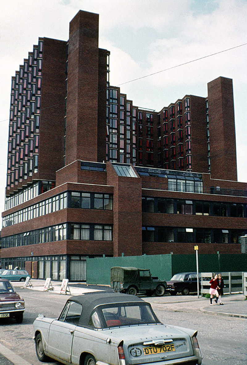
Loxford Tower, shortly after completion in 1974. This was the first newly-constructed building for Manchester Polytechnic and occupied part of the site of the new MMU Business School.
View along HIgher Chatham Street showing the Cavendish Street Chapel and School, which were demolished in 1974 to make way for the Cavendish Building.
View north along Oxford Road at All Saints, looking towards Manchester City Centre, 1976.

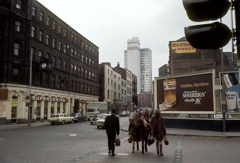
The street-level view along London Road and Piccadilly Station Approach in 1976 showed a city that had changed enormously in just a few years but still carried the traces of earlier eras. The Victorian buildings of the University of Manchester on Oxford Road remained largely intact, their stone facades unchanged even as the streets around them were widened, rerouted, or cleared.
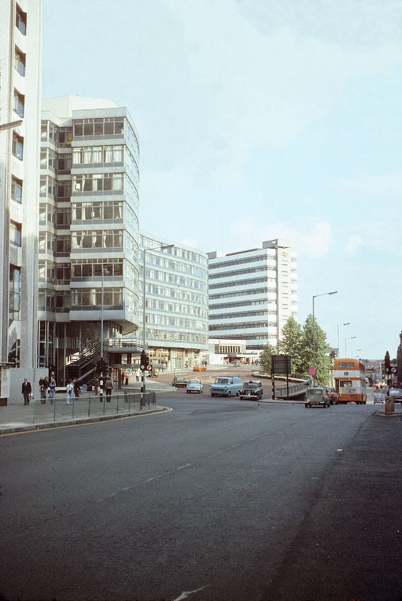
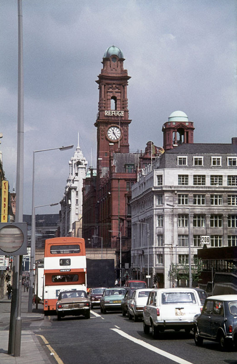
View along London Road and Piccadilly Station Approach, 1976
The CIS Building on Miller Street in 1970
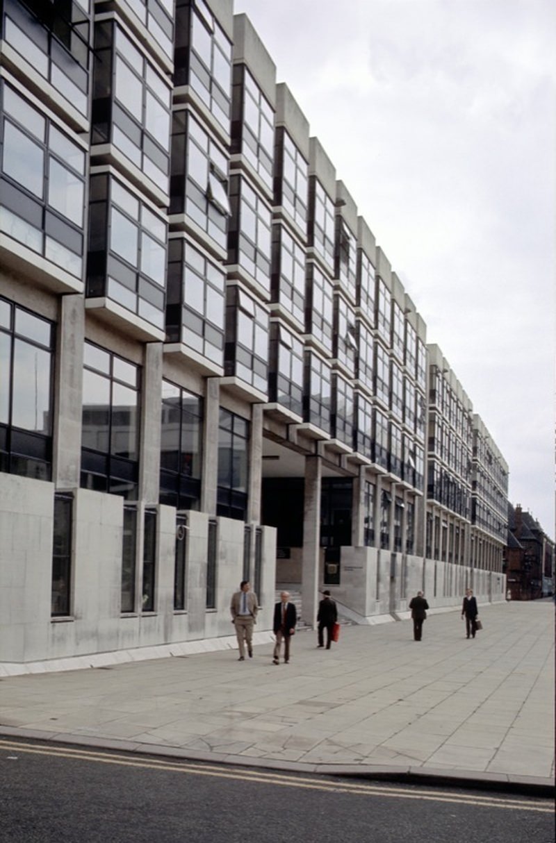
Deans Court and Cumberland House (the offices of the Manchester Education Committee) on Crown Square, 1976

Hulme’s new residential landscape, photographed repeatedly throughout the early 1970s, told a story of ambitious planning colliding with everyday life. The pedestrian ramps leading up to the access decks of Charles Barry Crescent included children’s play areas underneath — an attempt to maintain street-level activity in an elevated environment. By the end of the decade, views north from the Chatham Tower toward the city centre showed the full scale of what had been built.
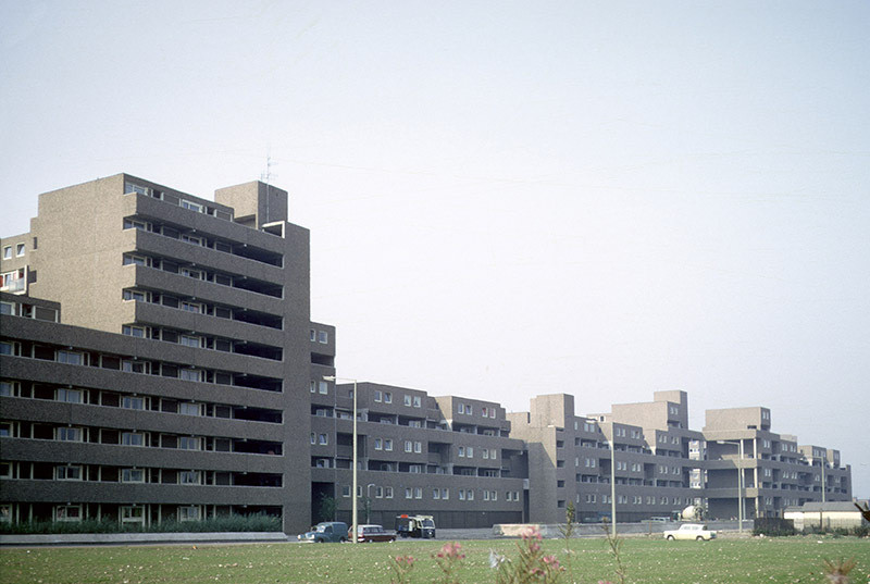
Deck access flats and maisonettes built using the Bison wall frame system, on Coverdale Crescent, Ardwick, 1970. Known locally as 'Fort Ardwick'.
Deck access flats and maisonettes built using the Bison wall frame system, on Coverdale Crescent, Ardwick, 1970. Known locally as ‘Fort Ardwick’.
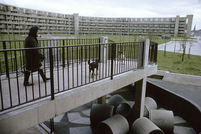
Pedestrian ramp to the access decks of Charles Barry Crescent, with children's play area beneath.
Pedestrian ramp to the access decks of Charles Barry Crescent, with children’s play area beneath.
View along Market Street towards St Mary's Gate and Deansgate in 1975, during construction of the Arndale Centre (right).
View along Market Street towards St Mary’s Gate and Deansgate in 1975, during construction of the Arndale Centre (right).

Around Albert Square, some of Manchester’s most cherished Victorian civic architecture still stood. The Memorial Hall, designed by Thomas Worthington and built between 1863 and 1866, occupied the south-west corner of the square. St Andrew’s Chambers and the Bridgewater Buildings on Lloyd Street completed the southern edge. These buildings had survived the slum clearances and the postwar reconstruction, but their future was never entirely certain in a decade defined by demolition.
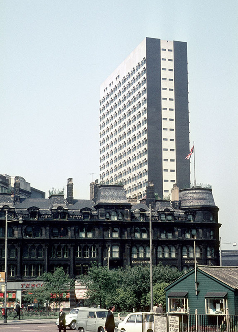
View of Highland House on Victoria Bridge Street, designed by Leach Rhodes Walker and built in 1966. In the foreground is the Grosvenor Hotel at the northern end of Deansgate, demolished c. 1970.
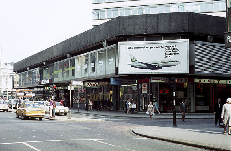
View of Mosley Street at its junction with York Street in 1972, showing shops in the podium element of the Piccadilly Plaza development.
The University of Manchester's Whitworth Park student residences in 1976
The University of Manchester’s Whitworth Park student residences in 1976
Entrance Hall of the CIS Building in 1970

The Royal Northern College of Music opened on Oxford Road in 1973, giving Manchester a new world-class music facility. The University of Manchester’s Mathematics Building offered elevated views up and down Oxford Road — a corridor that, by the mid-1970s, had become one of the most architecturally layered streets in the north of England, with buildings spanning more than a century of design standing in close proximity.
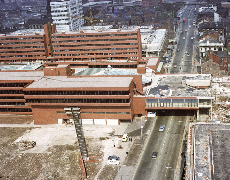
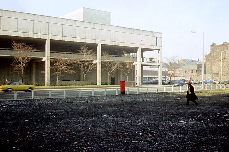
View across Oxford Road to the Royal Northern College of Music in 1976
View up Oxford Road towards the city centre from the tower of the University of Manchester's Mathematics Building in 1972
View up Oxford Road towards the city centre from the tower of the University of Manchester’s Mathematics Building in 1972
Post-graduate sculpture students take part in a performance entitled 'Murphy' in the gallery of Manchester Polytechnic's Faculty of Art and Design in March 1971.
Post-graduate sculpture students take part in a performance entitled ‘Murphy’ in the gallery of Manchester Polytechnic’s Faculty of Art and Design in March 1971.

Street-level photographs from across the city centre capture the texture of 1970s Manchester in vivid detail. George Street in 1972, Brazennose Street looking toward Albert Square, High Street from Church Street in March 1970, Wakefield Street approaching Oxford Road Station — each of these images shows a city in motion, neither fully demolished nor fully rebuilt, caught between what it had been and what it was becoming.
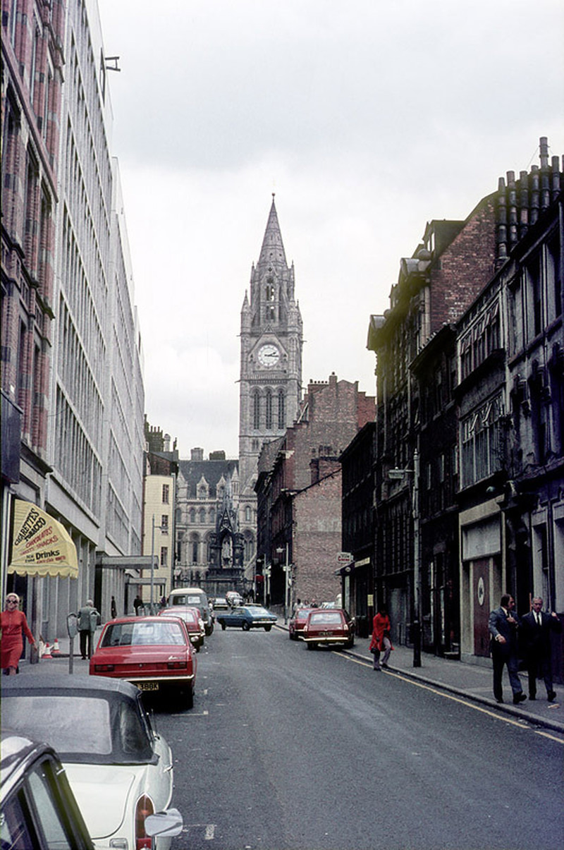
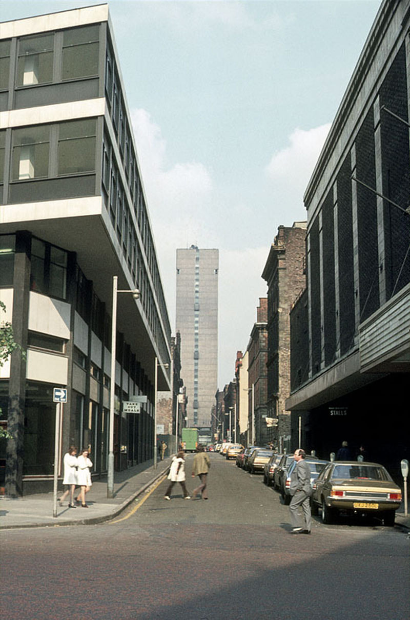
View along George Street from Oxford Street towards Piccadilly in 1972
iew along Brazennose Street from Deansgate to Albert Square, 1972.
View north along High Street from the junction with Church Street in March 1970.
Liverpool Road at the junction with Water Street, around 1975.
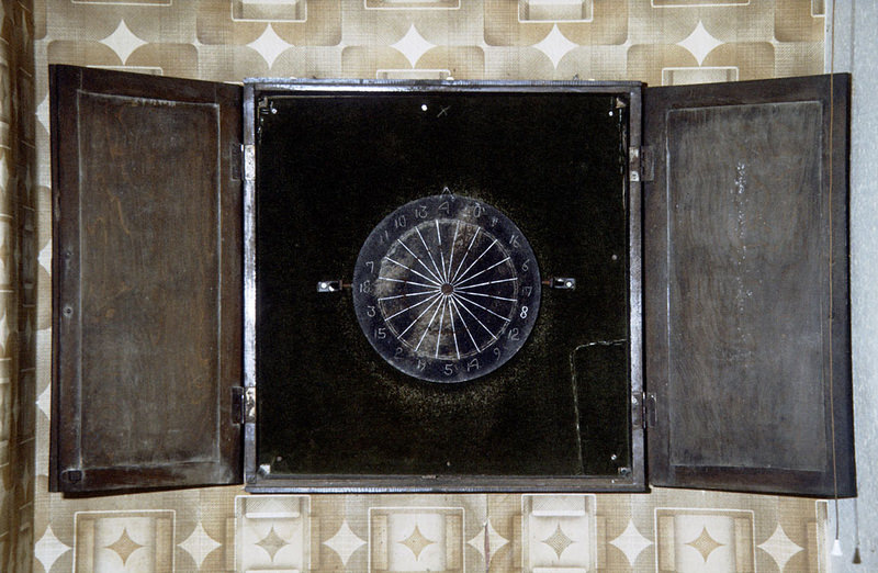
A well used Manchester dartboard in the vault of the Lloyds Arms on Higher Ormond Street around 1974.
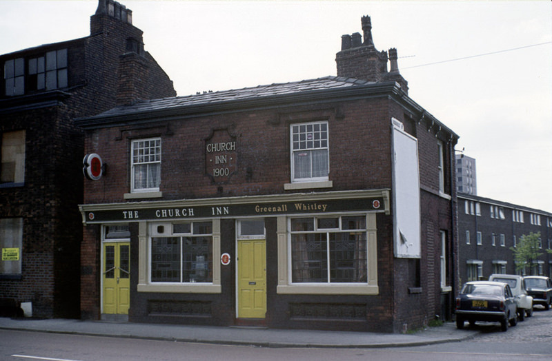
The Church Inn on Cambridge Street, All Saints, around 1972.
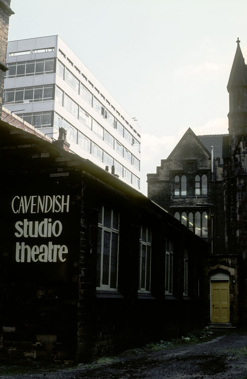
Manchester Polytechnic's theatre school adjoining the Righton Building on Cavendish Street c.1973
Manchester Polytechnic’s theatre school adjoining the Righton Building on Cavendish Street c.1973
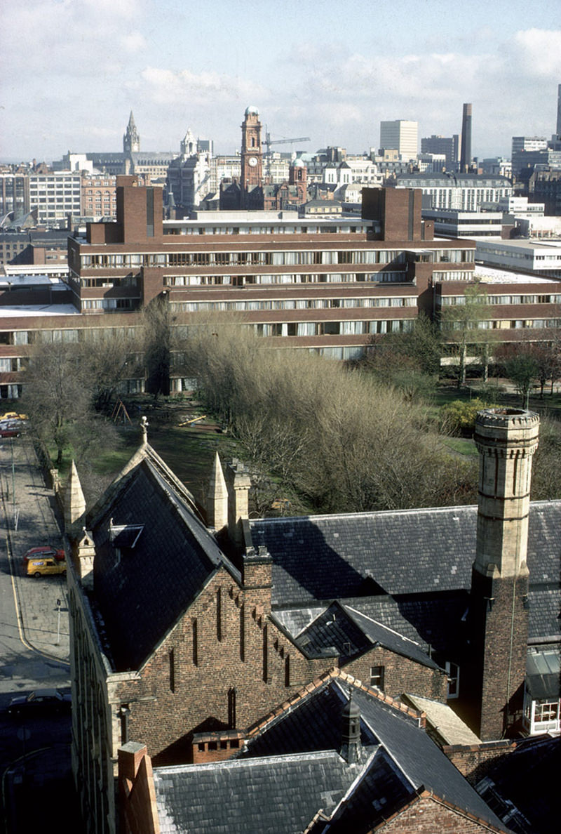
View north towards Manchester city centre from the Chatham tower in March 1979.
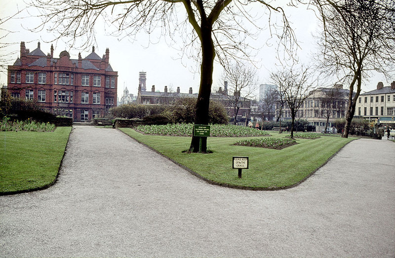
Grosvenor Square (All Saints Park), looking north towards the Cavendish School (the site of the current All Saints Building), about 1970.
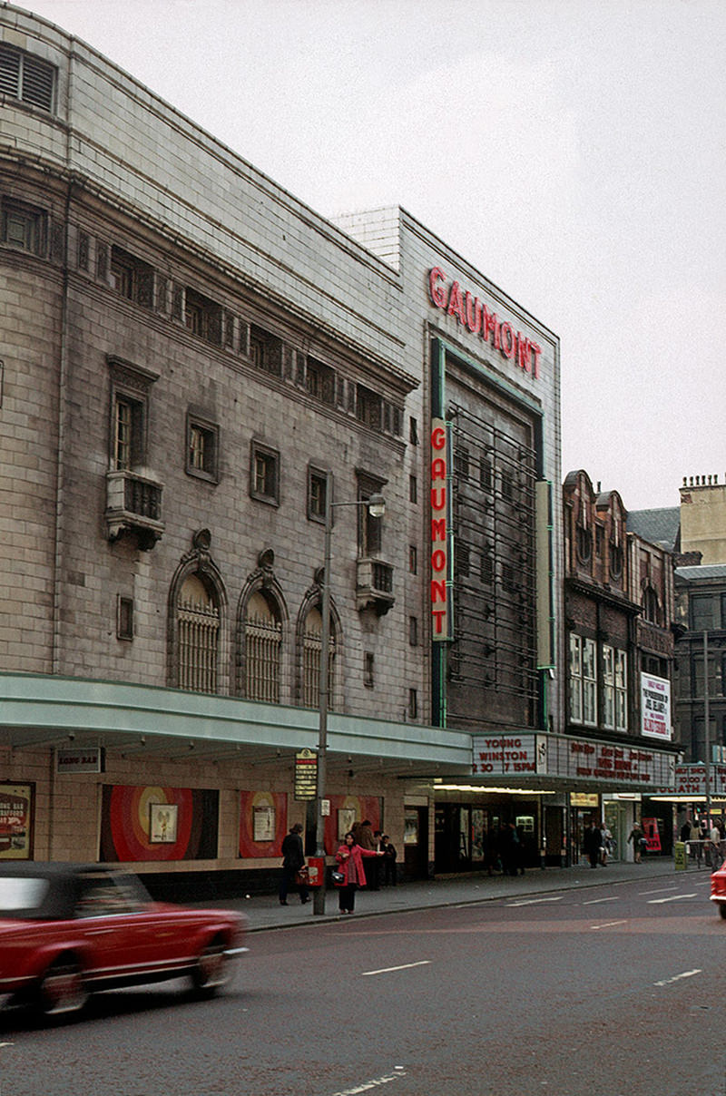
The Gaumont Cinema on Oxford Street in September 1972.
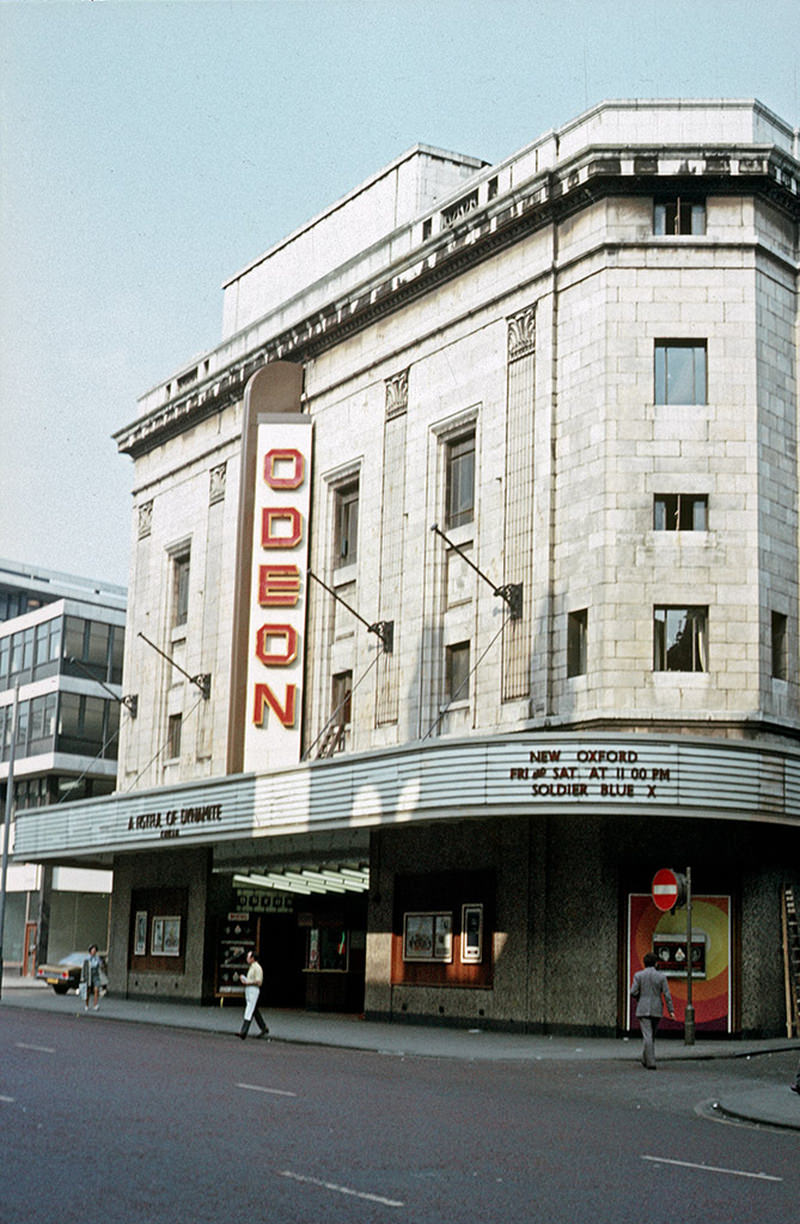
The Odeon cinema on Oxford Street, photographed September 1972
Mural depicting pansies on the gable-end wall of terraced houses in Rochdale. Painted by Walter Kershaw in the early 1970s.
The Oxford Road entrance to the quadrangle at the University of Manchester, around 1970.
The Memorial Hall, on the south west corner of Albert Square. Designed by Thomas Worthington and built in 1863-66. This photo was taken, around 1970
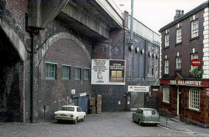
View of Wakefield Street towards Oxford Road Station and The Salisbury pub, around 1974.
Mural depicting pansies on the gable-end wall of terraced houses in Rochdale. Painted by Walter Kershaw in the early 1970s.
Interior of the Manchester Arndale Centre in 1979
View of the Liverpool Road railway station site in Manchester, shortly after its closure in 1975.
Enjoyed this post? Get new ones in your inbox.

19 thoughts on “1970s Manchester: Fascinating Pictures That Give A Complete Snapshot of Old Manchester”

    1. I remember going with scouts to see planes take off on a trip with our uncle sometimes. Many of us had never flown before, so it was an entirely new experience. When I was 15, flying was still considered a novelty.

  1. had no idea eighth day was so old! unless it’s a different shop now

    the brutalism in hulme looked really nice back then, shame it’s not aged particularly well

    all the buildings are so dirty with pollution D:

  2. Love how the approach to Piccadilly has hardly changed at all, then other areas are completely unrecognisable now. Had no idea The Salisbury pub was so old too.

  3. I lived in Whitworth halls of residence when I went to uni in 2006. Absolutely hated them! Think they were some of the only halls left where it was a shared bathroom still and the kitchen didn’t have a window. Each flat was gender segregated also as the bathrooms were shared.

Leave a Comment

Your email address will not be published. Required fields are marked *

Share this Post 🥺

Please take a moment to share this content. Your support is greatly appreciated! 🙌🙏

Share this Post 🥺

Please take a moment to share this content. Your support is greatly appreciated! 🙌🙏
Scroll to Top
 
Hey Friend, Before You Go.. Please like & follow for more interesting content